Black Park (3), Callander, Perthshire

Cairn:  OS Grid Reference – NN 66885 07447

Getting Here
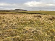
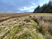
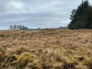
Low-lying Black Park (3)

From Callander head east along the main A84 road and nearly 300 yards past the entrance to the Keltie Bridge caravan park, take the tiny road on your left (north) and barely 100 yards along turn right and go up here for exactly 1 mile.  Walk up the track from here and follow the directions to find the Black Park (1) cairn; and then the nearby small Black Park (2) cairn.  From here you need to walk north-east round the small rounded hillock in front of you, and cross a small burn (stream) up to the next small grassy rise.  Altogether this is about 200 yards from the Black Park (2) cairn.  On this grassy rise lives the Black Park (3) cairn!

Archaeology & History

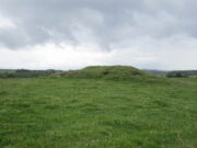
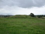
As with its compatriot Black Park (2) cairn 200 yards southwest, this can be hard to see.  It’s an overgrown small singular cairn (it looks like a tumulus now) of no great note to look at: probably the resting spot of an individual or just a small family.  Measuring some 5-6 yards across and less than a yard high at the most, its easily missed unless you’re really mean to find it. More impressive are the ones on the hill immediately above you to the east.  Head there next!

References:

  1. Royal Commission Ancient & Historical Monuments, Scotland, Braes of Doune: An Archaeological Survey, RCAHMS: Edinburgh 1994.

© Paul BennettThe Northern Antiquarian

The map could not be loaded. Please contact the site owner.
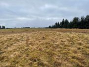
Black Park (2), Callander, Perthshire

Cairn:  OS Grid Reference – NN 6672 0735

Getting Here

Black Park (2) cairn

Take the same directions as if you’re going to visit the large Black Park (1) cairn, and from here look down the slight boggy slope to your right (east) and, across the other side of a small burn (stream) you’ll see a slightly raised grassy knoll.  A curved dyke is to its left (west) side.  You’re there!

Archaeology & History

This small cairn, barely two feet high at the most, and five yards across, is deemed as a possible Bronze Age cairn on Canmore and in the Royal Commission (1994) report of the area.  There is certainly a pile of small stones here, but it may be a clearance cairn (I hope I’m wrong).  Only an excavation will tell us for sure.

References:

  1. Royal Commission Ancient & Historical Monuments, Scotland, Braes of Doune: An Archaeological Survey, RCAHMS: Edinburgh 1994.

© Paul BennettThe Northern Antiquarian

The map could not be loaded. Please contact the site owner.
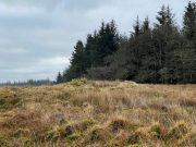
Black Park (1), Callander, Perthshire

Cairn:  OS Grid Reference – NN 66612 07349

Also Known as:

  1. Black Wood
  2. Sruth Geal

Getting Here

Black Park (1) cairn, looking south

Less than a mile east of Callander on the main A84 road, nearly 300 yards past the entrance to the Keltie Bridge caravan park, take the tiny road on your left (north) and barely 100 yards along turn right and go up here for excatly 1 mile (give or take a few yeards) where  track goes into the forest on your left and you can park-up here.  Walk up the track into the silence for just under a mile where, as the track splits and you kink to the right, a gate appears.  On the other side of the gate, turn immediately left, almost walking back on yourself, just above the curving waters of a burn, through boggy reeds, keeping to the fence-line until, less than 300 yards along, you’ll reach what you’re looking for.

Archaeology & History

Black Park (1), looking W

This reasonably large cairn and its neighbours (Black Park [2], [3], [4] and [5]) would appear to be relatively new discoveries as I can find nothing about it prior to the Royal Commission’s 1994 survey.  They are even absent from Moray MacKay’s (1953) excellent work on the area!  Hence, descriptions of it are scant and visitors to the place are few indeed (we did meet a local who knew about the old tomb, but said that nothing was known about it); but it is, nonetheless, a fine, albeit denuded and very overgrown cairn, living today amidst a quiet mass of reeds and surrounded by boggy ground—so make sure you’ve got your boots on!

Internal line of stonework
Black Park (1), looking SE

At its height, today, it stands less than four feet tall and measures roughly 16 yards across at its widest.  Through one section of the tomb there runs a raised line of stonework that almost looks like internal walling, which may have been where a chamber once existed.  It’s been hollowed out by someone in the not-too-distant past but, as I said, there are no records of such a thing, so whether or not that was a chamber or merely a fortuituous collapse of stone in a straight line, we can’t really say.  Along its more northern edges there seems to be a small raised wall of stone defining its edge, although once again it requires a more discerning examination to work out whether this is part of its original facade, or is a result of some of the stone mass falling to the edges.

Visit the old place and sit with its silence for a while…

References:

  1. Royal Commission Ancient & Historical Monuments, Scotland, Braes of Doune: An Archaeological Survey, RCAHMS: Edinburgh 1994.

© Paul BennettThe Northern Antiquarian

The map could not be loaded. Please contact the site owner.
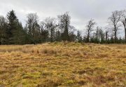
Easter Coillechat, Kilmadock, Stirlingshire

Cairn:  OS Grid Reference – NN 68830 04347

Getting Here

The cairn, looking NW

From Doune, take the A84 road to Callander.  As you pass through the hamlet of Buchany, keep your eyes peeled a few hundred yards on as the road dips down and swerves gently right, for the road sign of Drumloist (or Moist as some locals keep amending!) which goes up to the right.  It’s a small single track road that zigs and zags slowly uphill.  After exact one mile you reach a small track on your right (there one left too).  Carefully park hereby (don’t block the gate!).  Across the road, go through the gate on your right and walk along the edge of the field until you reach the burn.  Go across it, and then across the field, through the gate and you’ll see it ahead of you.  In the tick season (summer) treat the brackens as possessed by a plague and avoid it!

Archaeology & History

Looking at its stony face

A curiously forgotten place, hidden from sight, this large rounded grass-covered mound with small upright stones around one side, seems timeless amidst the open fields.  It seems alone, but the denuded chambered tomb of Ballachraggan is just visible 1.4 miles to the northwest on the near-horizon; and there’s a hidden cairnfield just a half-mile away.  This cairn measures 18 yards (N-S) by 16 yards (E-W) and stands 7-8 feet high when you look at it from its southern side.  The top of the mound is a mix of stone and grass with a slight dip in the middle, perhaps by someone in ages past digging, albeit only slightly—perhaps scared away by the old folk buried herein.

One of the most notable aspects of this site is the complete silence.  On my last two visits hereby, a fusion of mists from the low cloud above and the breathing Earth below gave an atmosphere the likes of which lived when this tomb was first built.  On one occasion hereby, no vehicles for several hours gave the silence a curious atmosphere (those of you who like sitting in the rain with the wilderness will know what I mean).  To me this is a gorgeous site…

© Paul BennettThe Northern Antiquarian

The map could not be loaded. Please contact the site owner.