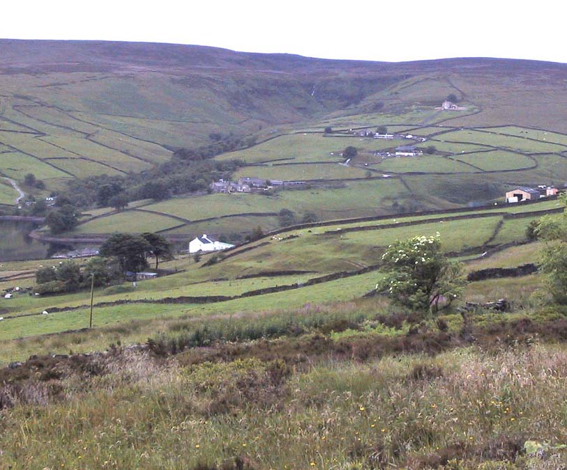
Ponden Kirk, Stanbury Moor, West Yorkshire

Legendary Rocks:  OS Grid Reference – SD 97969 36483

Also known as:

  1. Penistone Crags
  2. Wuthering Heights
View towards Ponden Kirk, at end of the valley in the distance

Getting Here

Go west through Stanbury village towards Lancashire for a mile till you reach the end of Ponden Reservoir.  Where the water ends, follow the small track up to, and past, Whitestone Farm, till you reach the stream.  Follow the valley up…

Archaeology & History

As the great Yorkshire historian J. Horsfall Turner (1879) told, “Ponden Kirk consists of a ledge of high rocks, dry in summer, but forming a stupendous cataract after heavy rain.  It was here that Mrs Nicholls (Currer Bell) caught a severe cold shortly before her death.”  The site is a fine one – not to be attempted from the base by unfit doods, unless you’re really serious about your climbing!  But to those of us who like clambering up rocks and wholesome scenery, walk to the site via the stream (Ponden Clough Beck) and get to the cleft in the rock face.  Tis a truly fine place!
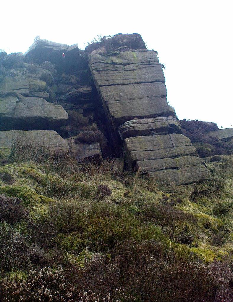
Ponden Kirk, from below

In 1913, one writer posited the notion that the opening in the rocks through which local folk crawl (see Folklore, below) “is seemingly artificial” – which aint quite true, sadly.

Once on the tops above the Kirk, you’ve one helluva decent view, be it raining or sunny.  On the far northeastern horizon arises the great omphalos of Almscliffe Crags; and next to that is the elongated top of Baildon Hill; and a little further northeast is Otley Chevin.  It would be good to visit here on a few of the old heathen days and watch the sunrise, just to see if there are any intriguing solar observations to be made! (take a tent though – or p’raps, if you’re like us, don’t bother, but you’ll be bloody cold for the night!)  The only potential sunrises of heathen significance appear to be midsummer and Beltane….
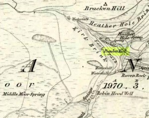
Ponden Kirk on 1851 map

For me at least, one of the things which gives this site an intriguing form of sanctity is the fact that the Kirk itself forms the head at the end of the valley.  It is a very fine ritual site and would obviously have had much more to be said of it than just the heathen marriage rites which are left today.  The forces of wind and rain scream from its height, and in the valley beneath the chime of the gentlest echoes resonate, giving an altogether different ‘spirit’ amidst the same land.  Those old cherubs of ‘male’ and ‘female’ spirit commune potently here – no doubt being the ingredients which gave form to the marriage customs… Those of you into feng-shui (the real stuff, not the modern bollox) and genius loci should spend time with the water and rocks here and you’ll see what I mean.  Archaeologists amongst you, if you dare, should amble aimlessly here for sometime…for many hours, a few times, and give yourselves a notion of the ‘ritual landscapes’ you like to write about from the safety of your textbooks, to get a bittova better notion of what ‘experiencing the land’ is actually about.

This rocky outcrop was also said to be the place that Emily Bronte used in her Wuthering Heights novel as the place called Penistone Crags.  A couple of other local writers have also added this legendary place in their tales aswell.
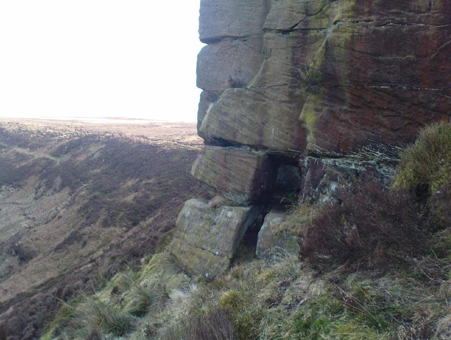
Ponden Kirks ceremonial passage

Folklore

Alleged by Elizabeth Southwart (1923) “to be of druidical origin,” the first literary note of this great rock outcrop appears to come from the reverend James Whalley (1869) of Todmorden, who in his romantic amblings over the moorlands here, told that if any gentleman wants to get married,

“he must by all means pay a visit to Ponden Kirk… Here ‘they marry single ones!’  Any lady or gentleman who can successfully ‘go through one part of the rock’ (which is quite possible) is declared to all intents and purposes duly married according to the forms and ceremonies of Ponden Kirk.”

His wording here seems to imply that the event of passing through the rocky opening, is in itself a confirmation of the ceremony of marriage, not needing the blessing of some strange christian rites.  If so, this tradition would be a very ancient one indeed, making the stone the witness to the marriage event.  This would be a rite witnessed by the stones themselves: a universal heathen attribute found in most of the ancient traditional cultures.  But this curious unwritten history was to be echoed a decade later by that great Yorkshire historian, J. Horsfall Turner (1879), who told us that,

“at Ponden Kirk, as at Ripon Minster, a curious wedding ceremony is frequently observed.  It consists in dragging one’s-self through a crevice in the rock, the successful performance of which betokens a speedy nuptial… The place is now frequently called ‘Wuthering Heights.  Apart from the association of such names as Crimlesworth and Oakden (see the Alcomden Stones), fancy easily ascribes a druidical settlement at the Kirk.”

A not unreasonable assumption – though nothing of this nature, of yet, has been found.
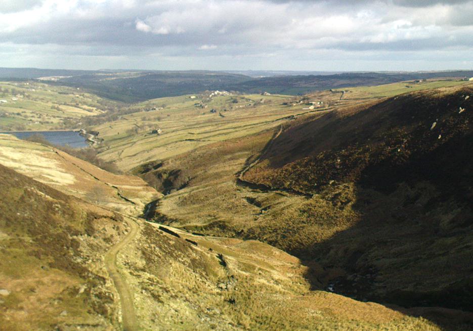
...and the view from the top!
…and the view from the top!

That other great Yorkshire writer, Harry Speight — aka Johnnie Gray (1891) — echoed the same folklore telling how,

“The natives of these parts have a saying, ‘Let’s go to Ponden Kirk where they wed odd ‘uns,’ which has its origin in an old custom of passing through an enormous boulder… The belief is that if you pass through it, you will never die single.  No one knows how the rock acquired its name, but the Saxon kirk suggests a temple of worship, possibly extending back to the druidical times.”
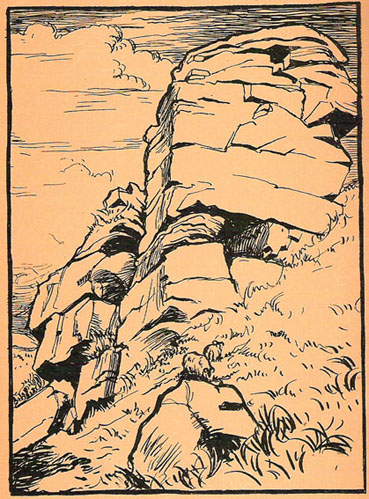
Old drawing of Ponden Kirk by T. MacKenzie, c.1923
Ponden Kirk – by T. MacKenzie, c.1923

A few years later, Mr Whiteley Turner came here and he too affirmed the old wedding rites, also telling that “according to tradition, maidens (some say bachelors too) who successfully creep through the aperture will be married within the year.”  This bit of info also shows that the rocks also had oracular properties – a function known at countless other sites.

The proximity of Robin’s Hood Well, just a couple of hundred yards away, beckons for association with the Ponden Kirk – which it obviously had… But that’s a tale to be told elsewhere…

References:

  1. Bennett, Paul, The Old Stones of Elmet, Capall Bann: Milverton 2001.
  2. Craven, Joseph, A Bronte Moorland Village and its People: A History of Stanbury, Rydal: Keighley 1907.
  3. Crawley, Ernest, The Mystic Rose: A Study of Primitive Marriage, Watts & Co: London 1932.
  4. Gray, Johnnie, Through Airedale from Goole to Malham, Walker & Laycock Leeds 1891.
  5. Southwart, Elizabeth, Bronte Moors and Villages, Bodley Head: London 1923.
  6. Turner, J. Horsfall, Haworth, Past and Present, J.S. Jowett: Brighouse 1879.
  7. Turner, Whiteley, A Spring-time Saunter Round and about Bronte Land, Halifax Courier 1913.
  8. Whalley, James, The Wild Moor, Edward Baines: Leeds 1869.

Acknowledgements:  Many thanks to Judith Spolander for her correction on my Bronte glitch.

© Paul Bennett, The Northern Antiquarian 
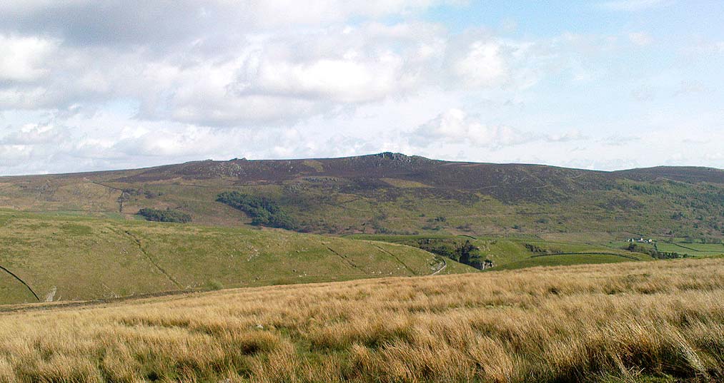

Simon’s Seat, Skyreholme, North Yorkshire

Sacred Hill:  OS Grid Reference – SE 0788 5981

Getting Here

Simon’s Seat in the centre & the Lord’s Seat immediately east

Tons of ways here.   To those who drive, take the Grassington-Pateley Bridge (B6265) road and a couple of miles past the village of Hebden, you’ll see the high rocks climbing on your southern horizon, with another group of rocks a few hundred yards along the same ridge.  That’s it!

Archaeology & History

This is an awesome site, full of raw power. It commands a brilliant view all round, but it is the north which truly draws the eye’s attention. Beneath the great drop of this huge outcrop is the haunted and legendary Troller’s Ghyll. The scent of as yet undisclosed neolithic and Bronze Age sites purrs from the moors all round you and there can be little doubt that this was a place of important magick in ancient days.

What seems to be several cup-markings on one of the topmost rocks are, to me, authentic. Harry Speight mentioned them in his 1892 work on the Craven and Northwest Yorkshire Highlands – but there are a number of other rocks in this giant outcrop with “possibles” on them.

Folklore

The name of this great rock outcrop has long been a puzzle to historians and place-name experts.  One tale that was told of Simon’s Seat to the travelling pen of one Frederic Montagu in 1838, told that,

“It was upon the top of this mountain that an infant was found by a shepherd, who took it to his home, and after feeding and clothing it, he had the child named Simon; being himself but a poor man, he was unable to maintain the foundling, when it was ultimately agreed to by the shepherds, that the child should be kept “amang ’em.”  The child was called Simon Amangham and the descendants of this child are now living in Wharfedale.”

The usually sober pen of Mr Speight thinks this to have been one the high places of druidic worship, named after the legendary Simon Druid. “It is however, hardly likely,” he wrote, “that he ever sat there himself, but was probably represented by some druidical soothsayer on whom his mystic gifts descended.”

I’ve gotta say, I think there’s something distinctly true about those lines. Visit this place a few times, alone, during the week, or at night – when there’s no tourists about – and tell me it isn’t…

References:

  1. Bogg, Edmund, Higher Wharfeland, James Miles: Leeds 1904.
  2. Montagu, Frederic, Gleanings in Craven, Simpkin Marshall: London 1838.
  3. Speight, Harry, The Craven and Northwest Yorkshire Highlands, Elliott Stock: London 1892.

© Paul Bennett, The Northern Antiquarian

Rocking Stone, Rishworth Moor, West Yorkshire

Legendary Rock:  OS Grid Reference – SD 990 150

Archaeology & History

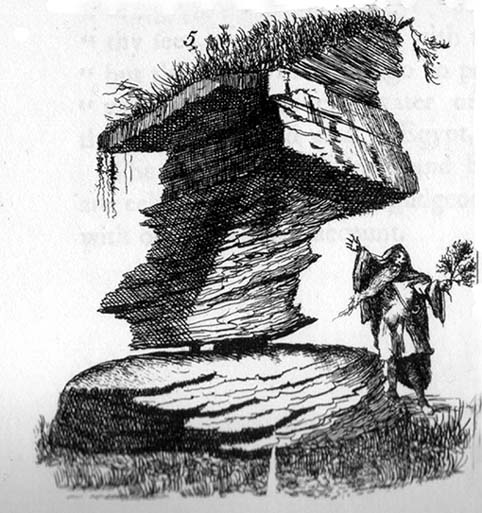
Rishworth Moor Rocking Stone, 1775

The reverend John Watson (1775) first wrote about this place, describing it as, “a group of stones, laid, seemingly, one above another, to the height of several yards, and called the Rocking stone.”  Very little archaeological remains have been described hereabouts, save the odd flint scatters here and there.  Anything which might have been here in the past was likely destroyed when the M62 was built right next to the site.

Folklore

The rocking stone was long ascribed in local tradition to be a  site used by the druids.  It was said that in bygone days the great boulder would rock, but this must have been a long time ago as even when Mr Watson described it, he told how “that quality is lost.”

Close by is the sometimes dried-up spring known as the Booth Dean Spa, which Watson thought might have been related to whatever ancient rituals occurred here.

References:

  1. Watson, John, The History and Antiquities of the Parish of Halifax, T.Lowndes: London 1775.

© Paul Bennett, The Northern Antiquarian

Hitching Stone, Keighley Moor, West Yorkshire

Legendary Rock:  OS Grid Reference – SD 98665 41698

Getting Here

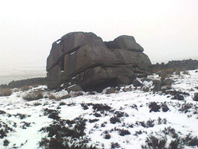
Hitching Stone through fog and snow
Hitching Stone through fog & snow

The easiest way to get here is via Cowling – though you can approach the place via moorland roads from Sutton-in-Craven, Oakworth and Keighley, but Cowling’s the closest place (so we’ll take it from there).  Turn east off the A6068 up Old Lane at the Ickornshaw side of town and go up the steep and winding road until you hit the moors.  Just as the road levels out with walling on either side of the road, there’s some rough ground to your left.  You can park here.  You’ll blatantly see our Hitching Stone on the moorland a few hundred yards above you on the other side of the road.  Walk up the usually boggy footpath straight to it!

Archaeology & History

For me, this is a superb place! Each time I come here the place becomes even more and more attractive — it’s like it’s calling me with greater strength with each visit.  But that aside…

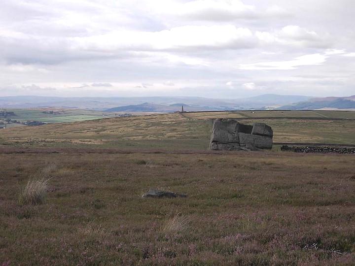
Supposedly the largest single boulder in Yorkshire, it possesses several legends, aligns with the sacred Pendle Hill in Lancashire, is an omphalos (centre of the universe spot) and has other good points too! My first visit here was near the end of the Great Drought of 1995.  All of the streams and springs had dried up on the moors but, on the very top of this huge rock, measuring at least 8 feet by 4 feet across (and 3 feet deep) was a large pool of water, not unlike a bath, in which a couple of you could easily bathe (and do more besides, if the fancy takes you!).  It was surreal!  Water-boatmen and other insects were living in this curious pool on top of the rock.  Yet all other water supplies for miles around had long since dried-up.  It didn’t really seem to make sense.

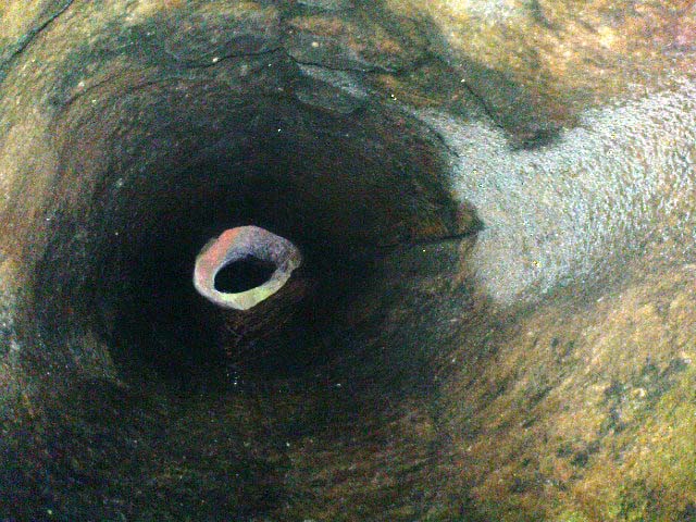
Crystalline tunnel in the Hitching Stone

On the west-facing side of the boulder, about 8 feet up, is a curious deep recess known as the Druid’s or Priest’s Chair, into which initiates were sat (facing Pendle Hill, down which it seems the equinox sun “rolls”) and is believed, said Harry Speight, “to have some connection with Druidical worship, to which tradition assigns a place on these moors.” If you climb up and inside the Priest’s Chair section you’ll notice a curious “tunnel” that runs down through the boulder, about 12 feet long, emerging near the northern base of the rock and out onto the moor itself.  This curious tunnel through the rock is due to the softer rock of a fossilised tree (Lepidodendron) crumbling away — and not, as Will Keighley (1858) believed, “the mould or matrix of a great fish.” When we visited the stone the other day in the snow, we noticed how the inner surface of this tunnel was shimmering throughout its length as if coated in a beautiful crystalline lattice (you can sort-of make this out in the image here, where the numerous bright spots on the photo are where the rock was lit up). Twas gorgeous!

The Hitching Stone, looking north

The boulder lies at the meeting of five boundaries, and was the starting point for horse-racing event until the end of the 19th century.  A short distance away “are two smaller stones, the one on the east called ‘Kidstone’, the other ‘Navaxstone’, which stands at the terminus of the race-course.” (Keighley 1858)  Lammas fairs were also held here, though were stopped in 1870.

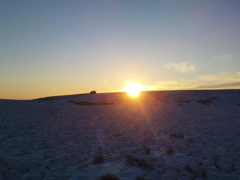
The cup-marked Winter Hill Stone a few hundred yards to the northeast, which I previously thought aligned with this site around winter solstice, but which happens to be a few degrees of arc off-line, would have indicated a very early mythic relationship, but this thought may now have to be put to bed.  I’ve not checked whether the winter solstice alignment shown in the photo below (with the Hitching Stone being shown on the near-horizon as the sun rose on winter solstice, 2010, from Winter Hill Stone) would have been closer in neolithic times or not.  Summat to check out sometime in the future maybe…

This aside, there is little doubt that this was an important sacred site to our ancestors.

Folklore

Winter Solstice sunrise, 2010 (from Winter Hill Stone)

Legend has it that the Hitching Stone used to sit on Ilkley Moor. But it was outside the rocky house of a great witch who, fed up by the constant intrusion the boulder made to her life, tried all sorts of ways to move it, but without success. So one day, using magick, she stuck her wand (or broomstick) into the very rock itself and threw it several miles from one side of the valley to the other until it landed where it still sits, on Keighley Moor.

A variation on the same tale tells that she pushed it up the hill from the Aire valley bottom. The “hole” running through the stone is supposed to be where our old witch shoved her broomstick!

References:

  1. Bennett, Paul, The Old Stones of Elmet, Capall Bann: Milverton 2001.
  2. Gray, Johnnie, Through Airedale form Goole to Malham, G.F. Sewell: Bradford 1891.
  3. Keighley, William, Keighley, Past and Present, R. Aked: Keighley 1858.
  4. Wood, Eric, Cowling: A Moorland Parish, Cowling Local History Society 1980.

© Paul Bennett, The Northern Antiquarian

Gull Stones, Great Yarmouth, Norfolk

Stone Circle (destroyed):  OS Grid Reference – TG 524 035

Archaeology & History

Several local history records describe there being a circle of ten standing stones in a field called ‘Stone-field’ or ‘Stone-piece’ – now covered by a housing estate at Gorleston-on-Sea, south of Yarmouth.  In 1875, C. J. Palmer said that,

“there is a tradition that the Druids had a temple at Gorleston, some remains of which existed down to a comparatively recent period. It is supposed to have stood on a field next to the road to Lowestoft, upon what is called Great Stone Close; and it has been asserted that some huge stones remained standing until 1768, when they were destroyed by digging round their base and dragging them down by ropes. There are also two fields called Further Stone Close and Middle Stone Close, so that it is possible the Druidical circle, if it ever existed, may have had a wide extent”.

A painting of the site was reported to have been viewed by members of the Norfolk & Norwich Archaeological Society in 1888, but I’ve been unable to find out where this has gone.  Anyone out there got a copy?  Or know where it hangs?  An image of this lost stone circle would be hugely welcome!

References:

  1. Burgess, Michael W., The Standing Stones of Norfolk and Suffolk, ESNA 1: Lowestoft 1978.
  2. Palmer, C.J., The Perlustration of Great Yarmouth – volume 3, George Nall: Gt Yarmouth 1875.

Links:

  1. Hidden East Anglia: Ancient Sites & Legends

© Paul Bennett, The Northern Antiquarian

Druid’s Stone, Bungay, Suffolk

Legendary Rock:  OS Grid Reference – TM 337 898

Folklore

Described in 1926 by local antiquarian and early ley-hunter, W.A.  (1926), as “a fallen monolith” — this old stone is probably just a glacial erratic.  Found in the churchyard of St. Mary’s, tradition tells that in ages past young girls danced twelve times around this old stone, then placed their ears upon it to hear the answers to their questions and wishes. A similar legend tells how children danced around the stone seven times on a certain day of the year to conjure up the devil.  Mr Dutt thought the great rock may have been “a ley or direction stone.”

References:

  1. Dutt, W.A., The Ancient Mark-Stones of East Anglia, Flood & Sons: Lowestoft 1926.

© Paul Bennett, The Northern Antiquarian


Druid’s Altar, Bingley, West Yorkshire

Legendary Rocks: OS Grid Reference – SE 0924 3994

Getting There

Druid’s Altar, sitting with mist

Pretty easy to get to. Best thing to do really, is ask a local and they’ll send you in the right direction. From Bingley, take the Harden road (B6429) across the river. As it bends sharply left, note there’s a track going up into the woods to the right. Walk up it! Keep going and, unless you take a detour, you’ll end up at the rock outcrop eventually (where the woods come to an end, Druid’s Altar appears before you with the track running along its top-side).

Archaeology & History

Mentioned in the Tithe Awards of 1849, this lovely outcrop of rocks looking down the Aire Valley on the southern edge of Bingley has “an immemorial tradition” of druidic worship, said Harry Speight in 1898 – though quite when it first acquired such repute is outside of any literary record.  In Sidney Greenbank’s (1929) rare book on this place, he could find little by way of archaeological data to affirm the old tradition, save the odd prehistoric find of flints here and there; though it is said that Beltane fires were burned upon the crags here in bygone centuries.

1894 photo of Druid's Altar (courtesy Clive Hardy)
1894 photo of Druid’s Altar (courtesy Clive Hardy)

There was a 19th century account from the Ilkley Scientific Club where a member described there being a cup-and-ring carving “near the so-called Druid’s Altar, at Bingley,” but I’m unaware of the whereabouts of this carving and Boughey & Vickerman’s (2003) said nothing about it in their survey; though a possible cup-marking can be seen on one rock less than 100 yards west, which might account for the report. (a bit dodgy though!)

Folklore

Harry Speight (1898) makes what sounds like a rare flight of fancy when he described faerie being seen atop of the many oaks beneath the Druid’s Altar.  In Clive Hardy’s (2002) work (from whence the old photo of the Altar is taken), he tells how “local antiquarians say that the cobbled way running from the Brown Cow Inn towards the site, is an old processional route walked by the druids.”

One, possibly two wells, each beneath the Altar rocks, are also reputed to have been associated with the old pagan priests, as their names tell: the Altar Well and the Druid’s Well – though the Altar Well has seemingly fallen back to Earth in recent years.

References:

  1. Greenbank, Sidney, The Druid’s Altar, Bingley, R.G. Preston: Bingley 1929.
  2. Hardy, Clive, Around Bradford, Frith Book Ltd: Salisbury 2002.
  3. Moores, Les, Ancient Monuments and Stone Circles, Francis Frith Collection: Salisbury 2005.
  4. Speight, Harry, Chronicles and Stories of Bingley and District, Elliott Stock: London 1898.
  5. Turner, J. Horsfall, Ancient Bingley, Thomas Harrison: Bingley 1897.

© Paul Bennett, The Northern Antiquarian
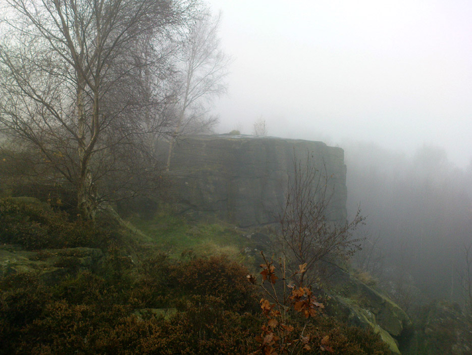

Cleatop, Settle, North Yorkshire

Stone Circle (destroyed):  OS grid-reference – SD 821 613

Also known as:

  1. Druid’s Hill Circle
  2. Druid’s Circle

Archaeology & History

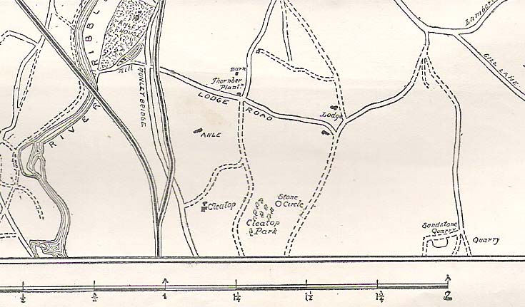
Speight's 1895 map - showing position of circle
Speight’s 1895 map – showing position of circle

Not included in any previous archaeological surveys of megalithic rings, this circle of stones was apparently visible from quite a distance away, sitting on the hillside where now there is woodland.  It was described by the great Yorkshire historian Harry Speight (1892, 1895), though today it seems that all remains of it have vanished.

An early description of it came after an excursion to the site by local antiquarians, who told that “at Cleatop, about a mile to the south of Settle, are the remains of an ancient stone circle.” (Horsfall-Turner 1888) A few years later, Mr Speight gave us more details of the place, saying:

“A little above Cleatop Farm (near Rathmell)…is Cleatop Wood.  Cleatop derives its name from the A.S. cleof, a rocky aclivity; Latin clivus, a bank or slope. Near the northeast side of the wood there was once a very noticeable Druid’s Circle, about 60 feet in diameter; indeed, Mr Thomas Brayshaw of Settle, informs me that within the memory of persons still living, it was so regular and well-defined that one or two gaps caused by the removal of stones could be easily distinguished. The eminence at the rear of the site has, from time immemorial, been known as Druid’s Hill.”

Some years later, that very same local historian Tom Brayshaw (1932) wrote:

“The Ordnance map marks, on the steep slope to the north of Cleatop Wood, ‘site of Stone Circle’.  It needs a very keen eye to identify the few stumps that remain today, and it is deplorable that this most interesting monument, after enduring for so many centuries, has been destroyed during the last eighty years.  In 1847 a description of the circle, as it then was, was sent to Captain Yolland of the Ordnance Survey.

“”I suppose the circle of stones in Cleatop High Park to be aboriginal British or Druidical remains from the following appearances: the circle is complete and the large stones are set on end, some of them several tons weight.  The stones are twelve in number now standing, beside several others that seem to be rolled a short distance, as it is placed on the ascent of a steep hill and commands a beautiful and extensive prospect (more so than any given point of the same altitude in the vicinity).  The circle is 36 feet in diameter.”

“A few stones were still standing in 1883.  The hill above long bore the name Druids Hill.  The Enclosure Acts passed towards the end of the 18th century greatly increased the number of drystone walls in the parish, and it is probable that many old stone monuments were destroyed in making them and in their subsequent repair”.

We have no references of burials or other excavations here to give us any idea of whether human remains had ever been found.  It’s an intriguing place in the landscape though…and worthy of further explorations…

References:

  1. Brayshaw, Thomas, A History of the Ancient Parish of Giggleswick, Halton & Co.: London 1932.
  2. Horsfall-Turner, J. (ed.), ‘Antiquarian Excursion to Giggleswick and Settle,’ in Yorkshire Folklore Journal, vol.1, T. Harrison: Bingley 1888.
  3. Speight, Harry, The Craven and Northwest Yorkshire Highlands, Elliott Stock: London 1892.
  4. Speight, Harry, Tramps and Drives in the Craven Highlands, Elliot Stock: London 1895.

© Paul Bennett, The Northern Antiquarian


Clach na h-ealea, Clachan, Lismore, Argyll

Legendary Stone:  OS Grid Reference – NM 8609 4342

Also Known as:

  1. Canmore ID 23090
  2. Clach na h-eala
  3. Stone of the Swan
  4. Swan Stone

Archaeology & History

Although the lads at the Scottish Royal Commission (1974) initially described this site as a ‘Standing Stone’, it is in fact,

“an erratic boulder of granite roughly shaped in the form of a cross… It measures 0.8m in height, 0.6m in width at base, and 0.4m in width at the top…(and) the stone is supposed to have marked a boundary.”

The site was evidently of some mythic importance, as the great Cathedral of St. Moluag was built next to the stone — unless the giant cairn of Cnoc Aingil, 500 yards away, was to blame. A holy well of this saint’s name (an obvious heathen site beforehand) is also nearby.

Folklore

Although this stone was dedicated to swans, I’ve not found the story behind the name.  There were no buried swans here, but local tradition told that this old boulder could give sanctuary to anyone who touched it, or ran round it sunwise.  The Hebridean folklorist Otta Swire (1964) told that,

“anyone who claimed such sanctuary had his case considered by ‘the Elders.’ If they considered his plea justified, they ‘came out and walked sun-wise round the Swan Stone.’ If they did not approve of his right to sanctuary, they walked round it anti-clockwise and the man was then given over, not to his enemies, but ‘to Authority’ to be tried.”

This old tradition derives from well known pre-christian rites. Swire also reported that even in the 1960s here, “at funerals the coffin is always carried round the grave sun-wise before being laid in it.” An old cross placed in the Field of the Cross next to the stone was an attempt to tease folk away from heathen rites of the stone, but failed.

References:

  1. Royal Commission on the Ancient & Historical Monuments of Scotland, Argyll – volume 2: Lorn, RCAHMS: Edinburgh 1974.
  2. Swire, O.F., The Inner Hebrides and their Legends, Collins: London 1964.

© Paul Bennett, The Northern Antiquarian

Busky Dike Druidical Altar, Fewston, North Yorkshire

Legendary Rocks (destroyed):  OS Grid Reference – SE 187 545

Archaeology & History

The original position and nature of this site was difficult to ascertain and left us wondering whether the place was once a monolith, stone circle or legendary rock outcrop, as seemed that there were no remains left of the place.  Aswell as that, the only reference we had that describing this place is from William Grainge’s History of Knaresborough (1871), where he wrote:

“At Busky Dike, a place between Cragg Hall and Fewston, according to the report of tradition, there once existed a Druidical altar; and that same venerable authority declares that the same place is the haunt of a Bharguest; and many of the country people yet tremble as they pass that place in the dark, for fear they should meet that strange and terrible beast.”

The latter remark would indicate that something decidely pre-christian was once of renown here.  But it seems that an old rock outcrop was the place in question here, found in the now wooded area on the south side of the Busky Dike Road, just northwest a half-mile outside of Fewston itself.  It would be good to hear more about this place…if anyone knows owt…

References:

  1. Grainge, William, The History of Harrogate and the Forest of Knaresborough, 1871.
  2. Grainge, William, The History and Topography of Little Timble, Great Timble and the Hamlet of Snowden, William Walker: Otley 1895.

© Paul BennettThe Northern Antiquarian