Brimham Rocks, Hartwith, North Yorkshire

Legendary Rocks:  OS Grid Reference – SE 210 649

Also Known as:

  1. Brimham Crags

Getting Here

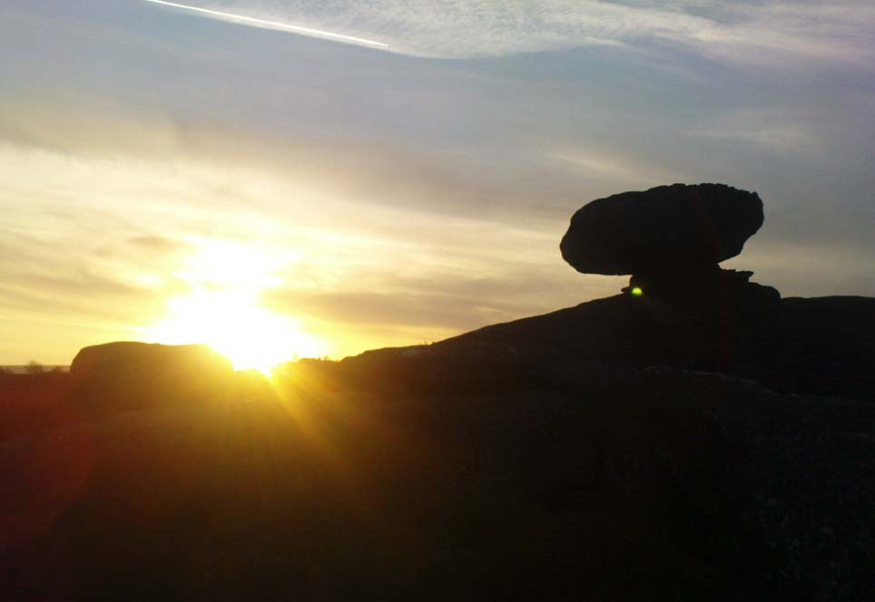
Sunfall behind Mushroom Rock

From the lovely village of Summerbridge (near Pateley Bridge), go up the steep Hartwith Bank road, going straight across at the crossroads for another few hundred yards, passing the old tombs of Graffa Plain on your right…and they’ll start appearing on your left-hand side (west).  Do not go into the expensive National Trust car-park.  Instead (if you’ve already gone too far), about 100 yards before the Car Park you’ll find a small dirt-track on your left a short distance away.  But if you drive past the rip-off car park, another 100 yards on there’s another spot where you can easily park up on the right-hand side of the road.  Then cross the road and follow y’ nose…

Archaeology & History

The OS grid reference given above is an approximation — for obvious reasons.  This is a huge area that’s covered by Britain’s finest natural megalithic features, obviously sculptured by Nature Herself — though many are the historians who sought to give Druids the credit here.   God knows how!  The area over which these magnificent rock sentinels live covers some 60 acres and is some 1000 feet above sea level.  The view from the hill around which the encircling parade of rocks guards is excellent, allowing our eyes to catch focus on the distant lands of Whernside, Simon’s Seat, York Minster, the Cleveland Hills and Kilburn’s white horse.  It’s quite a view.
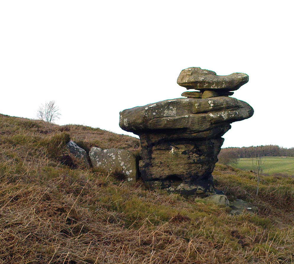
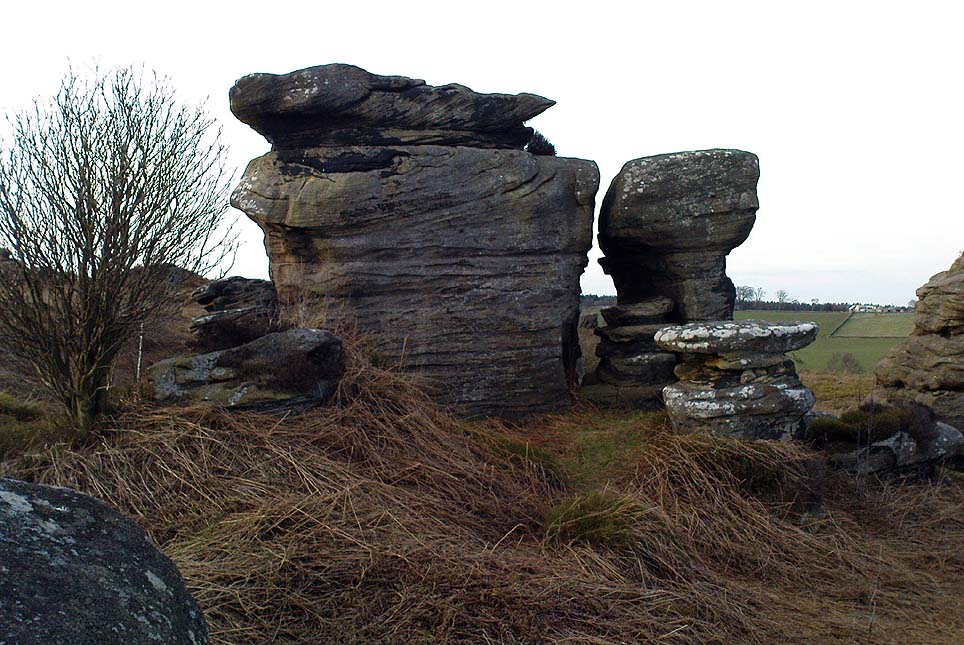
Easternmost Rocking Stone
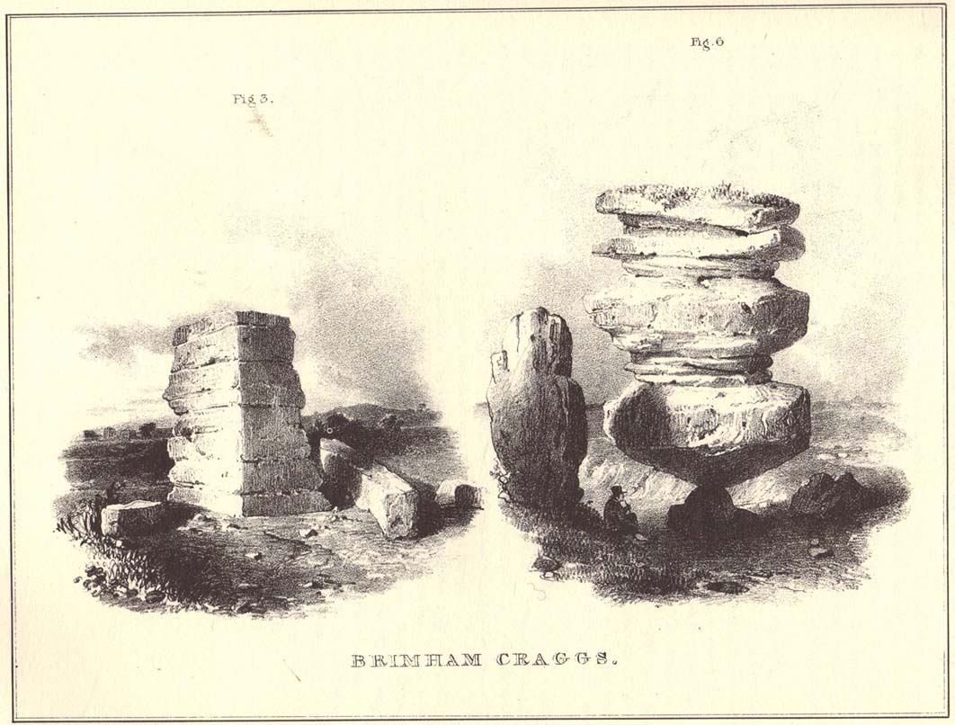
Idol Stone (Godfrey Higgins 1826)

But this tends to be overlooked when you first visit the place, as the rocks which surround and walk alongside you overwhelm with impressions not encountered before.  To those with spirit, you’ll be bouncing and running all day here, clambering upon rocking stones, jumping between dodgy gorges that await falls, and just aching to climb pinnacles that deny you.  But then, if you need the selfishness of silence, this arena will only grant such solace when the rains are about, or dense fog and low cloud keeps others from this haunting amphitheatre.  And it’s not surprising…  The mass of rocks contort into the most beautiful and curious simulacra, which would not have gone unnoticed, nor deemed unimportant in the sacred landscape of our ancestors…

Brimham Rocks have been written about since the 17th century, though they didn’t receive the serious attention of outsiders until the 19th, when numerous Victorian writers — from antiquarians and geologists, to archaeologists and Druids — got to hear about the place.  And by the beginning of the 20th century, a veritable mass of articles had been written in journals and travelogues of all persuasions!  These quiet Yorkshire Rocks had become truly famous!
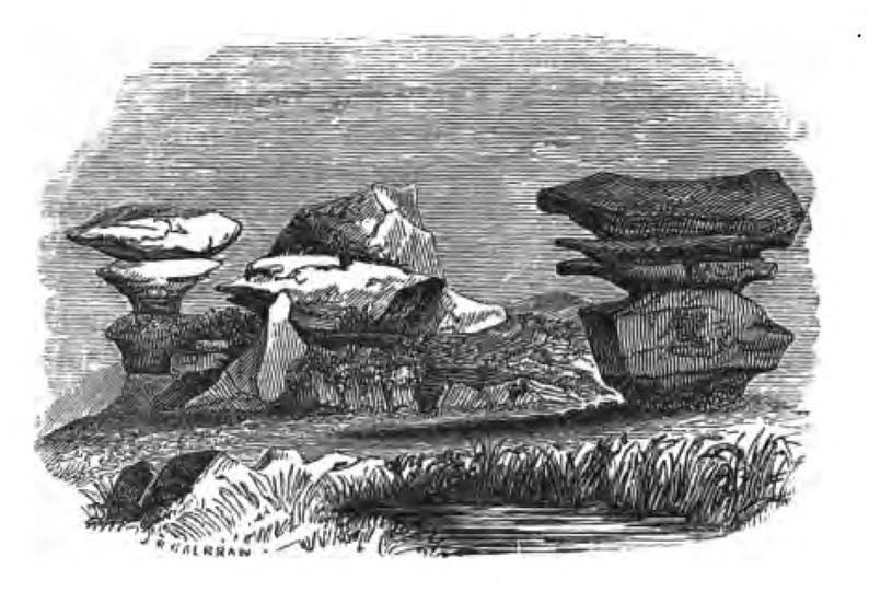
Brimham Rocks (Walbran 1856)
Old Woman and her consort

A lengthy essay was written in the distinguished archaeology journal of its time, Archaeologia, by northern historian Hayman Rooke (1787), who thought that some of the rocks here had been tampered with by the druids; with the legendary Cannon Rock in particular possessing oracular properties.  The site as a whole was, he posited, a temple for Druids in ancient days.  Certainly the place would have been deemed as sacred, whether by the druids or our more remote neolithic and Bronze Age ancestors.
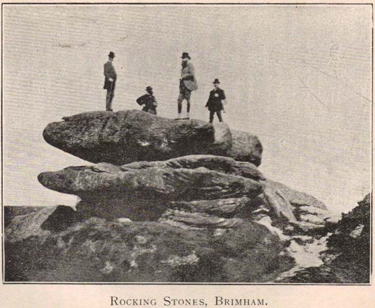
Harry Speight & his mates, c.1890

In Harry Speight’s magnum opus, Nidderdale (1894), he described these rocky giants as best as he could, admitting as others before and since, that no mere words can convey the impression that only a personal encounter liberates, saying:

“The Brimham Rocks are among the greatest natural wonders of Yorkshire, and many have been the theories from time to time advanced as to the cause of their extraordinary aspects… The resemblances to natural and artificial objects are most striking.  There we have the Elephant Rock, the Porpoise Head, the Dancing Bear (a very singular, naturally-shaped specimen), the Boat Rock, showing the bow and stern completely, etc.  Then there is the great Idol Rock, a most mysterious-looking object, of almost incredible size and form.  It is a perfectly detached block, fully twenty feet high, weathered along face joints into three roughly circular pieces, each from 40 to 50 feet in circumference, piled one above the other; the whole mass, weighing by estimation over 200 tons, being poised on a pyramid 3½ feet in diameter; the pivot itself supporting this immense column having a diameter of barely 12 inches.

“East of the guide’s house are the famous Rocking Stones, consisting of a group of four rocks, which were discovered to be movable in the year 1786.  The two on the west side weighing approximately 50 and 25 tons, require but little force to vibrate, while those on the east side, though much smaller are not so well poised and do not move readily.  Each of the larger stones has a basin-like cavity on the top, and a kind of knee-hole open to the north, said to be the work of Druids.  Close to the Rocking Stones are the appropriately-named Oyster-shell Rock, and the Hippopotamus’ Head.  Turning now some thirty yards north of the Idol Rock we ascend Mount Delectable, where is the agreeable Courting or Kissing Chair, happily at not too close quarters with the above Hippopotamus’ Head and Boar’s Snout.  The Chair consists of a single seat, but why it should be so called, I had better leave the amorous lover to solve.  West of these is the more sober Druid’s Reading Desk, with its church-like lectern on a stout stone base.  The we come to the Lover’s Leap, a gigantic and abrupt face of beetling crag, weathered to the west, and rising to a height of 60 to 70 feet, with three immense fragments balanced in a very remarkable manner at the summit.  The rock is in tow principal sections, and an iron hand-rail has been fixed across the chasm to enable visitors to look down from the top.  Further south are the Frog and Tortoise Rocks, the latter presenting from one point of view a capital resemblance to a tortoise creeping up the face of the crag towards the imaged frog.  A little below this is a good imitation of a cannon, projecting from the edge of the cliff.  In addition to these singular resemblances there are many others which the guide points out, such as the Yoke of Oxen, Mushroom Rocks, Druid’s Oven, Dog’s Head, Telescope, and the curiously perforated Cannon Rock, etc.”

In a later work, Speight (1906) also mentioned the existence of a Druid’s Circle some 300 yards west of the main natural temples, but this site appears to have been destroyed.  Thankfully the large standing stone on Hartwith Moor, a mile to the south, can still be found upright…

Folklore
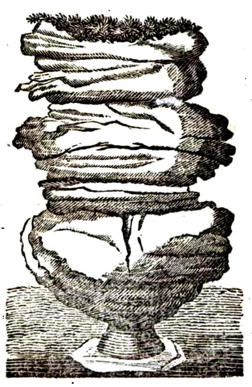
Idol Stone (Hargrove 1809)

In folklore, there’s little surprise this place was held by just about every 18th and 19th century historian as a ‘druidic site.’ But more interesting – in the light of Paul Devereux’s (2001) work on acoustic archaeology – is what Edmund Bogg (c.1895) said of these huge contorted stones:

“In bygone days these immense stones were supposed to be the habitation of spirits. The echo given from the rocks was said to be the voice of the spirit who dwelt there, and which the people named the Son of the Rocks. From a conversation we had with the peasantry not far from here, it seems the ancient superstition had not yet fully disappeared.”

This is precisely the notion of spirit given to rocky places elsewhere in the world, where the very echo was perceived as the ‘voice of the rocks’.  Meditate on it a bit, in situ. (a fine summary of this notion and its implications — which has crept into archaeology of late — can be found in Paul Devereux’s work, Stone Age Soundtracks)

One of Brimham’s southwestern rocks was known as the Noon Stone when Mr Rooke (1787) came here.  There are many stones with this name scattering Yorkshire and other northern counties, each with the same mythic background: that the sun casts a shadow from it at midday to indicate the time of day.  Of this Noon Stone Mr Hooke also told us that,

“On Midsummer Eve fires are lighted on the side.  Its situation is apposite for this purpose, being on the edge of a hill, commanding an extensive view.   This custom is of the most remote antiquity.”

On the very southern edge of Brimham’s Rocks (some might say beyond their real border) is the Beacon Rock — and it is aptly named: as in the year 1887 on the day of Queen Victoria’s Jubilee, a great beacon fire was lit here, signalling to others in the distance.  Its title however, pre-dates Victoria’s Jubilee, though we don’t know how far back in time it goes…

…to be continued…

References:

  1. Bogg, Edmund, From Eden Vale to the Plains of York, James Miles: Leeds c.1895.
  2. Devereux, Paul, Stone Age Soundtracks: The Acoustic Archaeology of Ancient Sites, Vega: London 2001.
  3. Grainge, William, The History and Topography of Harrogate and the Forest of Knaresborough, John Russell Smith: London 1871.
  4. Harrison, William, A Descriptive Account of Brimham Rocks in the West Riding of Yorkshire, A. Johnson: Ripon 1846.
  5. Michell, John, The Earth Spirit: Its Ways, Shrines and Mysteries, Thames & Hudson: London 1975.
  6. Michell, John, Simulacra, Thames & Hudson: London 1979.
  7. Rooke, Hayman, “Some Account of the Brimham Rocks in Yorkshire,” in Archaeologia journal, volume 8, 1787.
  8. Speight, Harry, Nidderdale and the Garden of the Nidd, Elliot Stock: London 1894.
  9. Speight, Harry, Upper Nidderdale, with the Forest of Knaresborough, Elliot Stock: London 1906.
  10. Walbran, John Richard, A Guide to Ripon, Fountains Abbey, Harrogate, Bolton Abbey, etc, Johnson: Ripon 1856.

© Paul Bennett, The Northern Antiquarian


Rocking Stone, Golcar, West Yorkshire

Legendary Rock (destroyed):  OS Grid Reference – SE 076 163

Also Known as:

  1. Holed Stone
  2. Holy Stone
  3. Whole Stone

Archaeology & History

Golcar rocking stone in 1799

Like many old rocking stones, this was destroyed due to quarrying operations many years ago and sadly, I believe, we have no illustrations of the place to show the site.  This legendary site—also known as the ‘Holed’ or ‘Holy Stone’—is preserved in the place-name of Rocking Stone Hill and, unlike many other alleged rocking stones, actually swayed to and fro if the old records are owt to go by.  Not far away (and also destroyed some 200 years back) were two stone circles which probably had some mythic relationship to this legendary rock.

The stone was first described by John Watson in his monumental History of Halifax (1775), where he told that is was,

“so situated as to be a boundary mark, dividing the two townships of Golcar and Slaightwait in the Parish of Huddersfield, adjoining to the Parish of Halifax on Wholestone Moor.  The stone as measured by the late Thomas Perceval, or Royton…is 10½ feet long, 9ft 4in or 5in broad, and 5ft 3in thick.  Its weight…is 18 tons, 190lbs.  It rests on so small a centre, that at one particular point, a man may cause it to rock; though some years ago it was damaged a little, in this respect, by some masons, who endeavoured, but in vain, to throw it off its centre, in order to discover the principle on which so large a weight was made to move.”

Mr John Crabtree (1836) included it in his survey, and it was illustrated on the very first Ordnance Survey map in the 1840s where it was described as ‘Supposed Druidical’.  But the old stone sadly didn’t last much longer.  Once the self-righteous Industrialists got here, round about the year 1886, the Rocking Stone was destroyed by quarrying operations.  All that remains of the place today is a small cluster of place-names..

Folklore

Thought by Watson (1775) and his contemporaries to have had druidic associations (without evidence), when Philip Ahier (1942) came exploring this area in 1936, he came upon “an old resident (who) informed me that he had sat upon the stone when a youth and had caused it to rock.”

References:

  1. Ahier, Philip, The Legends and Traditions of Huddersfield and District, Advertiser Press: Huddersfield 1942.
  2. Bennett, Paul, The Old Stones of Elmet, Capall Bann: Milverton 2001.
  3. Crabtree, John, Concise History of the Parish & Vicarage of Halifax, Hartley & Walker: Halifax 1836.
  4. Watson, John, The History and Antiquities of the Parish of Halifax, T. Lowndes: London 1775.

© Paul Bennett, The Northern Antiquarian 

Temple of Anaitis, Lusta, Waternish, Skye

‘Stone Circle’: OS Grid Reference – NG 2725 5273

Also Known as:

  1. Annait
  2. Temple of Annait

Getting Here

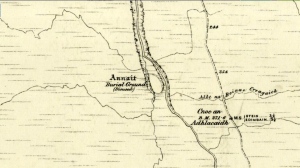
1880 map of Anaitis
1880 map of Anaitis

Otta Swire (1961) told how to find this place, thus: “The Waternish road turns off to the north at Fairy Bridge, whence it runs along the valley of the Bay river. On the left of the road, though at some little distance from it, where the river cleaves its way through a gorge to the sea, stands the mound which is now all that remains of the ‘Temple of Anaitis’ (so called).”

Archaeology & History

This is a curious place, full of archaeological potential if the folklore and history records are owt to go by, yet little of any substance remains to substantiate what may have been an important stone circle or other heathen site in earlier times. It seems to have been described first of all in the famous Hebridean journeys of Boswell and Johnson in the late 18th century.  Amidst his insulting description of both the landscape and local people, on Friday 17th September 1773, James Boswell visited the site and told:

“The weather this day was rather better than any that we had since we came to Dunvegan. Mr M’Queen had often mentioned a curious piece of antiquity near this which he called a temple of the goddess Anaitis.  Having often talked of going to see it, he and I set out after breakfast, attended by his servant, a fellow quite like a savage.  I must observe here, that in Skye there seems to be much idleness; for men and boys follow you, as colts follow passengers upon a road. The usual figure of a Sky boy, is a lown with bare legs and feet, a dirty kilt, ragged coat and waistcoat, a bare head, and a stick in his hand, which, I suppose, is partly to help the lazy rogue to walk, partly to serve as a kind of a defensive weapon. We walked what is called two miles, but is probably four, from the castle, till we came to the sacred place. The country around is a black dreary moor on all sides, except to the sea-coast, towards which there is a view through a valley, and the farm of Bay shews some good land. The place itself is green ground, being well drained, by means of a deep glen on each side, in both of which there runs a rivulet with a good quantity of water, forming several cascades, which make a considerable appearance and sound.  The first thing we came to was an earthen mound, or dyke, extending from the one precipice to the other.  A little farther on, was a strong stone-wall, not high, but very thick, extending in the same manner.  On the outside of it were the ruins of two houses, one on each side of the entry or gate to it. The wall is built all along of uncemented stones, but of so large a size as to make a very firm and durable rampart. It has been built all about the consecrated ground, except where the precipice is deep enough to form an enclosure of itself. The sacred spot contains more than two acres. There are within it the ruins of many houses, none of them large, a cairn, and many graves marked by clusters of stones. Mr M’Queen insisted that the ruin of a small building, standing east and west, was actually the temple of the goddess Anaitis, where her statue was kept, and from whence processions were made to wash it in one of the brooks. There is, it must be owned, a hollow road visible for a good way from the entrance; but Mr M’Queen, with the keen eye of an antiquary, traced it much farther than I could perceive it. There is not above a foot and a half in height of the walls now remaining; and the whole extent of the building was never, I imagine, greater than an ordinary Highland house. Mr M’Queen has collected a great deal of learning on the subject of the temple of Anaitis; and I had endeavoured, in my journal, to state such particulars as might give some idea of it, and of the surrounding scenery” —

But in all honesty it seems Mr Johnson was either too lazy to write about the place, or simply didn’t actually get there, in spite of what he alleged!  But later that evening, Boswell dined with the same Mr MacQueen, who told him more of this site.  In the typically pedantic tone of english supremacy (which still prevails in some idiots who visit these lands), he continued by saying:

“Mr Macqueen had laid stress on the name given to the place by the country people, Ainnit; and added, ” I knew not what to make of this piece of antiquity, till I met with the Anaitidis delubrum in Lydia, mentioned by Pausanias and the elder Pliny.”  Dr. Johnson, with his usual acuteness, examined Mr Macqueen as to the meaning of the word Ainnit, in Erse, and it proved to be a water-place, or a place near water, “which,” said Mr. Macqueen, “agrees with all the descriptions of the temples of that goddess, which were situated near rivers, that there might be water to wash the statue.”

There ensued a discussion between Mr MacQueen and Samuel Johnson about the etymology of Anaitis, with one thinking it was of a goddess, and another that it represented an early christian site.  To this day it is difficult to say what the word means with any certainty.  In W.J. Watson’s (1993) fine work he tells us,

Andoit, now annaid, has been already explained as a patron saint’s church, or a church that contains the relics of the founder.  This is the meaning in Ireland and it is all we have to go upon.  How far it is held with regard to Scotland is hard to say… They are often in places  that are now, and must always have been, rather remote and out of the way.  It is very rarely indeed that an Annat can be associated with any particular saint, nor have I met any traditions connected with them.  But wherever there is an Annat there are traces of an ancient chapel or cemetery, or both; very often, too, the Annat adjoins a fine well or stream…”

The great Skye historian and folklorist Otta Swire (1961) also wrote about this mysterious site, mainly echoing what’s said above, but also adding:

“This name of Annait or Annat is found all over Scotland. It has been interpreted as meaning the ‘Water-place’ from Celtic ‘An’ = water, because many are near water. Others suggest ‘Ann’ = a circle (Celtic) and claim that most Annats are near standing stones. The most-favoured derivation seems to be from Ann, the Irish mother of the Gods, and those who hold this view claim that the Annats are always near a revered spot, where either a mother-church or the cell of a patron saint once stood. Probably Annat does, in fact, come from an older, pre-Celtic tongue, and belongs to an older people whose ancient worship it may well commemorate. The curious shape of the Waternish Temple of Anaitis and its survival make it seem likely that it was something of importance in its day, built with more than usual care and skill. Perhaps the Temple tradition is correct – but whose, if so, and to what gods? One cannot help wondering if cats played any part in its ritual, and if so, if any faint memory remains, for the nickname of the people of this wing was ‘Na Caits’ = The Cats, and not far off, by one of the tributary burns on the right of the roadway, there stands a small cairn, crowned by a long, sharp stone somewhat resembling a huge claw. This is the ‘Cats’ Cairn’.”

The Cats’ Cairn (NG271526) is said to mark the grave of a young boy from the 18th century, who was buried where he died and its story is told elsewhere on TNA.  Another example of the Annait place-name can be found elsewhere on Skye at the megalithic site, Clach na h’annait.

References:

  1. Boswell, James, The Journal of a Tour to the Hebrides with Samuel Johnson, National Illustrated Library: London 1899.
  2. Swire, Otta F., Skye: The Island and its Legends, Blackie: Glasgow 1961.
  3. Watson, W.J., The History of the Celtic Place-Names of Scotland, Birlinn: Edinburgh 1993.

© Paul Bennett, The Northern Antiquarian
Weeping Stone, Fladaigh Chuain, Skye

Legendary Rock: OS Grid Reference – NG 3638 8091

Getting Here

Unless you’ve got your own boat, forget it!  This one’s miles out on the isolated uninhabited island of Fladda-chuain about 5 miles off the northwest tip from Duntulm, Trotternish.  I wouldn’t mind a coupla weeks alone on the isle though – if anyone can get me there!

Archaeology & History

The little rocky island itself was allegedly another of the many visiting places of St. Columba in his many ventures to sell his religion to the peasants and displace the druids, who were alleged to practice pre-christian rites here and deemed it as sacred.  St. Columba’s chapel on this island was built to displace the heathen traditions.

Folklore

In Otta Swire’s (1961) excellent work on the folklore and history of the Isle of Skye, she wrote:

“In Duntulm Bay lies Tulm Island and beyond it, in clear weather, Fladdachuan, Fladda of the Ocean, can be seen. In olden times this was a sacred spot, held by many to be Tir-nan-Og, the Isle of Perpetual Youth, which lay in the west; here it is always summer and the sun never sets. The puffins recognized its sacred nature and never began any venture until they had circled the island three times sunwise; this they did also on arriving in Skye and before leaving it. It was held by some to be the reason why in Skye people used to turn three times sunwise before starting a new enterprise. The Druids held it in veneration and St. Columba caused a chapel to be built there. On its altar lay a black stone which some say was the original altar stone of the Druids and which was known as the Weeping Stone because it was always wet. Until fairly recently fishermen used to land on the island and pour three handfuls of seawater on the stone to procure favourable winds or to stop bad floods. The Weeping Stone no longer exists, or at least is no longer to be found where the altar once stood.”

I can’t find anything more about this place.  Does anyone know owt more about it?

References:

  1. Swire, Otta F., Skye: The Island and its Legends, Blackie & Son: Glasgow 1961.

© Paul Bennett, The Northern Antiquarian
High Close Pasture, Grassington, North Yorkshire

Settlement:   OS Grid Reference – SE 003 652

Also known as:

  1. The Circus
  2. Druid’s Altar
  3. Druid’s Circle

Getting Here

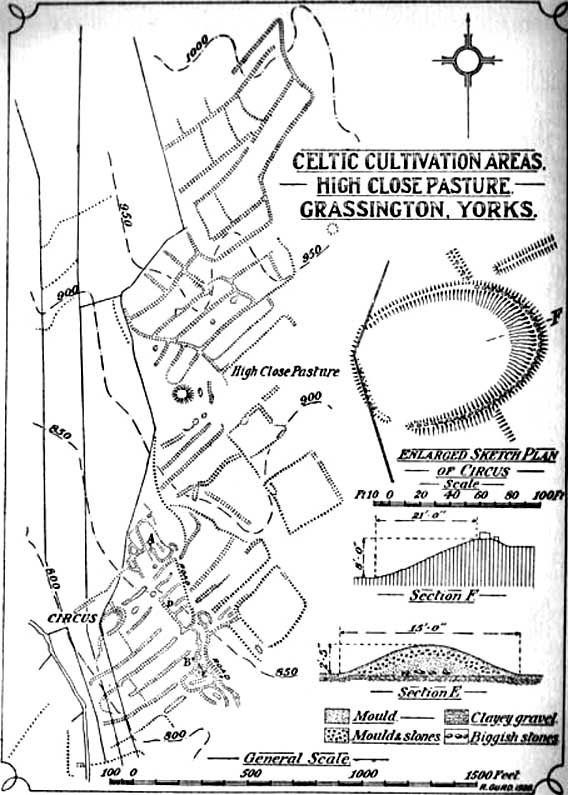
Curwen’s 1928 plan

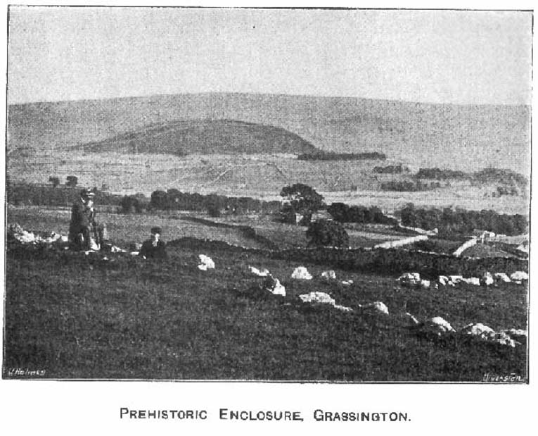
Easy enough to locate.  In Grassington go up the main street a coupla hundred yards, turning left up past the small church, taking the footpath on your right heading up to the fields that stretch to the north.  Don’t mistake the remains of the medieval village that you’ll pass for the Iron Age and Romano-British site that we’re heading for, another coupla hundred yards up.  You’ll notice a lot of old low walling structures on the slopes heading up above you.  That’s the stuff!

Archaeology & History

Despite the industrial devastation of the landscape on the hills around here, this entire area still teems with prehistoric archaeological remains, making you wonder just how much more once existed in this region.  In bygone days Prof Anne Ross thought this region to be the capital of northern England in Iron Age days.  She could be right: in just about every nook and cranny of small valleys and rivulets we find evidence of ancient people everywhere for miles around, settlement upon settlement in every direction you take.  The remains found here at High Close Pasture typifying the examples any ardent antiquarian will come across in this region of upper Wharfedale.

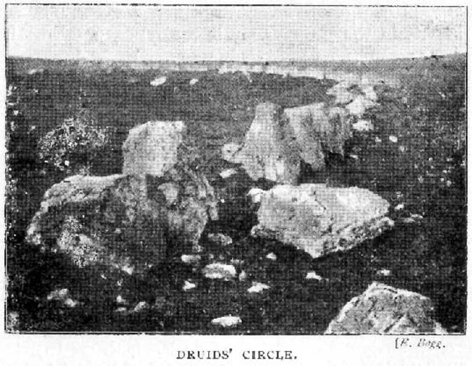
Druid’s Circle (Bogg 1904)
Earliest known photo in 1899

The settlement remains and ancient cultivations at High Close have been described by various writers over the last hundred years, with Edmund Bogg (1902) calling the most notable of the remains here the ‘Druid’s Altar’ (not to be confused with the other Druid’s Altar at nearby Bordley); a title that was similarly described as “The Druid’s Circle” when Eliot Curwen surveyed the area.  It is also locally known as ‘The Circus’, after it being a place where celebrated events once took place. This Druid’s Circle section is,

“an oval area 150 feet long by 75 feet wide. It consists of a bank surmounted by a single or double-row of flat-topped stones about one-and-half feet high by 2 feet wide… This may have been a communal meeting place of the Iron Age folk, who cultivated these fields, and who lived in isolated huts.” (Elgee & Elgee 1933)

The notion of the circle being a communal meeting place was echoed by Mr Curwen (1928) in his slightly more detailed description of this place.  He told that the interior of the Druid’s Circle had been levelled:

“It lies eight feet below the surrounding banks to the northeast and east, to which it rises with a gradient of 8 in 21.  The bank to the north is less high, while to the south and west  the arena, while seperated from it by the bank, is above the level of the sloping hillside.  The encircling bank is surmounted by a single (and) double row of stones for three-fourths of its extent.  These are apparent to the east and south, but are less so to the west, as along this side a stone wall has been built actually along the bank of the Circus; the stones belonging to this bank are, however, quite clear below the footings of the wall.  From northeast round by south to southwest the row of stones is double.  Those in the inner row, forty-six in number, stand some eighteen inches high; they are about two feet wide and are flat-topped, the line is almost continuous, and in parts the stones are placed edge to edge.  A second row of smaller stones backs the larger ones.  Entrance is obtained to the central level area by a gap to the southwest.  No fosse surrounds this earthwork.  To the southeast, a lynchet four feet high runs off it, while to the north a low stoney bank runs off in a NW direction, and one of the larger stony banks approaches to within a few feet of the northwest.”

In the fields above, particularly on the east and north of this notable ruined stone ring, the extensive “cultivation pastures” as they’ve been called, are evident all over the place.  Hut circles and copious other antiquities can all be found within a square mile of this spot.  If you like your Iron Age archaeology, this area will knock yer socks off!

…to be continued…

References:

  1. Bogg, Edmund, Higher Wharfeland, James Miles: Leeds 1904.
  2. Charlesworth, Miss D., ‘Iron Age Settlements and Field Systems,’ in Archaeological Journal, volume 125, 1968.
  3. Curwen, Eliot, ‘Ancient Cultivations at Grassington,’ in Antiquity, June 1928.
  4. Elgee, Frank & Harriett, The Archaeology of Yorkshire, Methuen: London 1933.
  5. Raistrick, Arthur & Chapman, S.E., ‘The Lynchet Groups of Upper Wharfedale, Yorkshire,’ in Antiquity, June 1929.
  6. Speight, Harry, Upper Wharfedale, Elliott Stock: London 1900.

© Paul Bennett, The Northern Antiquarian

Tigh Stallar, Boreray, St. Kilda

Stone circle:  OS Grid Reference – NA 153 050

Archaeology & History

The isle of Boreray is four miles northeast of Hirta and here once lived, according to legend, a christian hermit.  However in the reverend Kenneth Macaulay History of St. Kilda (1764), he told us that the character was actually a druid.   Take your pick!  The druid lived at Stallir House, adjacent to which, said Macaulay, was

“a large circle of huge stones fixed perpendicularly in the ground, at equal distances from one and other, with one more remarkable regular in the centre which is flat in the top and one would think sacred in a more eminent degree.”

In a later article by F.L.W. Thomas (1867) he also mentioned this ‘stone circle’, though indicated its decline.  Additional information on this little known stone is sparse due to its somewhat remote position on one of the uninhabited isles of St. Kilda.  I wouldn’t mind spending a month or two there, roughing it, to see what’s what!

References:

  1. Macaulay, Kenneth, The History of St. Kilda. Containing a Description of This Remarkable Island; the Manners and Customs of the Inhabitants; the Religious and Pagan Antiquities There Found, T. Becket: London 1764.
  2. Thomas, F.L.W., “On the Primitive Dwellings and Hypogea of the Outer Hebrides,” in Proceedings of the Society of Antiquaries of Scotland, volume 7, 1867.

© Paul Bennett, The Northern Antiquarian

Alcomden Stones, Stanbury Moor, West Yorkshire

Legendary Rocks: OS Grid Reference – SD 97313 35737

Also Known as:

  1. Oakenden Stones

Getting Here

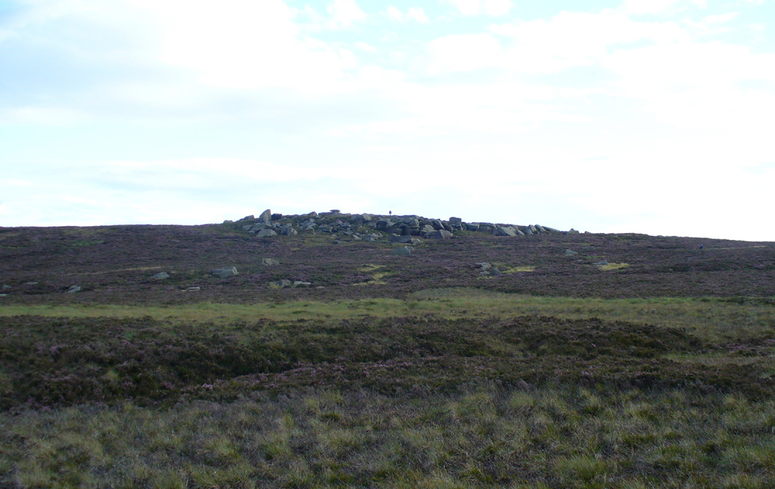
The ‘druidic’ Alcomden Stones

Takes a bitta getting to this spot, but it’s worth the effort!  Make a day of it and walk up here via the little-known Cuckoo Stones monoliths.  From here the walk gets steeper!  Follow the footpath from the standing stones, uphill, to the legendary Wuthering Heights building of Bronte-fame a half-mile ahead of you.  Then walk immediately up the slope at the side of the derelict house higher onto the moor (there’s no real footpath to follow) until the moorland levels out.  From here, look west and walk that way for a few hundred yards where you’ll be seeing a large rock outcrop ahead of you.  That’s where you’re heading! (if you reach the triangulation pillar, take the small path from there along the top of the moor towards this large rock outcrop)

Archaeology & History

Alcomden’s Altar Stone

To those of you who like a bitta wilderness, or healthy normal people I suppose, this is a stunning place!  Even though there’s little by way of archaeology here — save the usual expectations of a few flints and arrowheads — its geomancy, its position in the landscape, makes it excel as a once important ritual site for our ancestors in not-so-distant centuries.  Although local tradition gave these great rocks a prehistoric pedigree, the archaeological record doesn’t say as much — but that doesn’t really mean much up here.  We’ve found a singular Bronze Age cairn on the level at Middle Moor Flat 400 yards northwest (not in the record books), some prehistoric walling on the flat east of here (not in the record books), so a lot more attention is needed hereby to see what more may be hiding in this rocky heathland area.

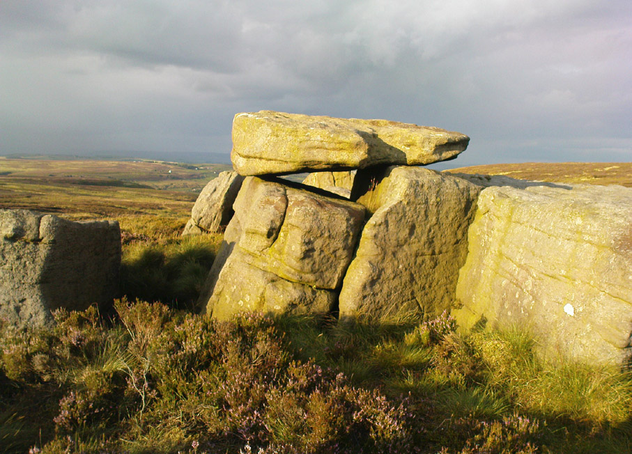
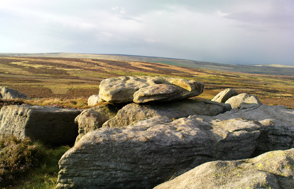
The main feature amidst this extensive scattering of rocks is the large rocking stone, said to weigh six- or seven-tons, resting upon other glacial deposits.  The rock itself can be made to rock very slightly.  It was described in Lewis’ Topographical Dictionary as a

“cromlech, an evident druidical remain, (which) consists of one flat stone, weight about six tons, placed horizontally upon two huge upright blocks.”

But the placement here was done by Nature and not humans — making it much more important to our ancestors.  This was a site for solace, for ritual and to commune with the gods themselves.  A few visits to this place show this quite clearly — unless you’re unable to relax that is! It’s a place I wanna spend more time working with, as the mythic history around these stones feels strong, despite their absence from written records.

The ‘altar’ resting on rocks
Alcomden’s “altar”

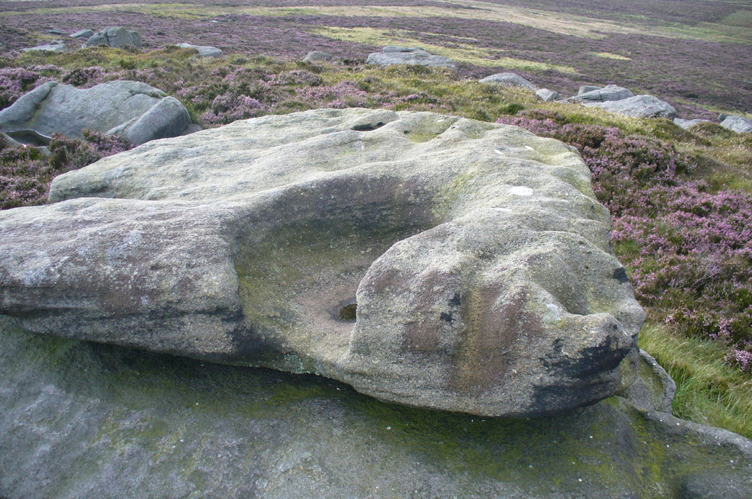
The druidic sentiments espoused by Lewis were all but echoed by our otherwise sober historian, J. Horsfall Turner, in his history of Haworth (1879), where he describes the Alcomden Stones as “the remains of a Druid’s Altar.”  On top of the main ‘altar stone’ are what could be ascribed as worn cup-markings, but it seems they’re Nature’s handiwork once again; though this wouldn’t deny them as having some significance to our ancestors.  A number of other boulders amidst this mass of rocks also have what seem like cup-markings, but none of them can be said with any certainty to have been carved by people.  Indeed, the entirety of this legendary rock outcrop seems to have been created solely by the spirits of Nature.

One view of Earth, from Alcomden
View of Earth, from Alcomden

It was first described as ‘Alconley’ in 1371, then in the 1379 Poll Tax returns as ‘Halcom’, the etymology of which is difficult.  Al- is a cliff or rock, many of which occur here; den is certainly a valley, over which we look to the northeast (to Ponden Kirk, 500 yards away); but the central element of ‘com‘ is the greatest puzzle.  Blakeborough (1911) tells of the old Yorkshire word ‘con’ — found in the 1371 spelling — meaning “to scan, or observe critically,” which one can certainly apply here in a topographical sense, i.e., “observation stones above a valley.”  It’s simple, succinct, and makes sense!

Folklore

As Elizabeth Southwart (1923) rightly said,

“Our forefathers, instinct and imagination more highly developed than knowledge, peopled their woods with fairies and their valleys with ghosts.  On the high, wind-swept spaces they built their altars to Unknown Gods.”

Turner's 1913 drawing
Turner’s 1913 drawing

And such she thought was done at this “heap of rocks called Oakenden Stones.”  It seems likely, as this place is superb for ritual magick and meditative systems.  But all we have are the repeats of numerous old historians, from Whiteley Turner (1913) and his namesake J. Horsfall, to James Whalley, J.W. Parker and more, who recorded what the old locals said: that is was a place of the druids.  There may be a grain of truth in it somewhere…

References:

  1. Bennett, Paul, The Old Stones of Elmet, Capall Bann: Milverton 2001.
  2. Blakeborough, Richard, Wit, Character, Folklore and Customs of the North Riding of Yorkshire, W. Rapp: Saltburn 1911.
  3. Parker, J.W., Guide to the Bronte Country, J.W. Parker: Haworth n.d. (c.1971)
  4. Southwart, Elizabeth, Bronte Moors and Villages: From Thornton to Haworth, John Lane Bodley Head: London 1923.
  5. Turner, J. Horsfall, Haworth, Past and Present, Hendon Mill: Nelson 1879.
  6. Turner, Whiteley, A Spring-Time Saunter round and about Bronte Lane, Halifax Courier 1913.

© Paul Bennett, The Northern Antiquarian

Dun Bhuirg, Iona, Argyll

Hillfort:  OS Grid Reference – NM 2649 2462

Also known as:

  1. Canmore ID 21638
  2. Dun Cul Bhuirg

Getting Here

Take the road that cuts across the island, west, until you reach the stupid golf-course.  Walk across it, heading for the coast (not the building at Culbuirg), then follow the little footpath up until you reach the large rocky rise about 500 hundred yards north.  That’s it!

Folklore

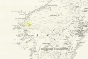
Dun Bhuirg on 1881 map

Shown on the 1881 OS map of the region, the small remains of this Iron Age hillfort was said to be the place where St. Columba saw a rain-cloud which he predicted would bring a plague of ulcers to the people of Ireland. To prevent such a plague, Columba thence dispatched a monk called Silnan to Ireland, armed with some bread which he’d blessed. This bread was then dipped in consecrated water and given to those afflicted with the plague, who were thereafter cured.

Wee-ird……

Another tradition told that this old fort was once an important meeting place for the druids, though Geoff Holder (2007) writes that this is little more than a “spurious nineteenth century tradition” which he dismisses as without foundation. Though a short distance from here, he also told how one “Fiona MacLeod” (real name, William Sharp) one night watched the ghost of the Culdee, Oran, a couple of hundred yards away, “and so he never went that way again at night.”  In truth, traditions of druidism tend to be animistic traits: legends remembered from pre-christian days, and blanket dismissals of such folklore are themselves untrustworthy—especially on this Isle of the Druids.

References:

  1. Holder, Geoff,The Guide to Mysterious Iona and Staffa, Tempus: Stroud 2007.
  2. MacLeod, Fiona, Iona, Floris: Edinburgh 1982.

© Paul Bennett, The Northern Antiquarian

Druid’s Oak, Caton, Lancashire

Legendary Tree:  OS Grid Reference — SD 5297 6467

Also Known as:

  1. Caton Oak
  2. Fish Stones Oak

Getting Here

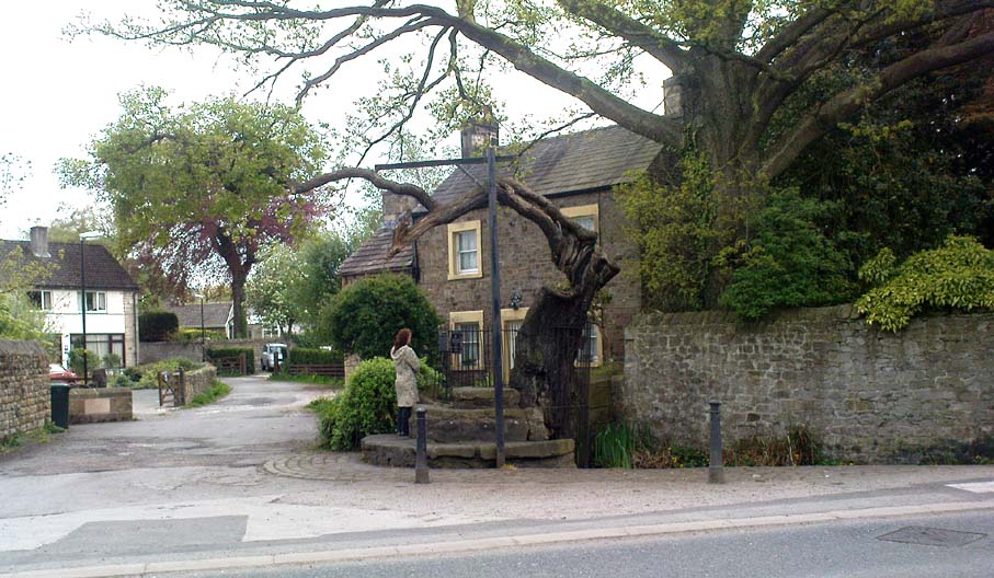
The Druid's or Caton Oak
The Druid’s or Caton Oak

Dead easy! Near the western end of Caton village, right on the edge of the main road (A683) running through the village (south-side of the road), enclosed by railings, you’ll see the remains of this ancient tree, just by the side of the stream.  Keep your eyes peeled!

Archaeology & History

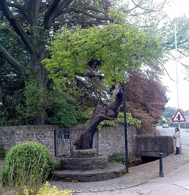
The small scruffy-looking remnant of an oak standing here by the roadside in Caton village, surrounded by protective railings, is the dying remnants of the old tree, standing upon the sandstone steps which were known as the Fish Stones: a curious monument that has been listed as a protected monument by the Dept of National Heritage.  A small plaque on the side tells:

“The three semi-circular sandstone steps, shaded by the oak tree, were used in medieval times by the monks of Cockersand Abbey to display and sell fish caught from the River Lune.  The ancient oak tree, reputed to date back to the time of the druids, and the Fish Stones, have become a landmark and Symbol of Caton.”

Druid's Oak, Caton
Druid’s Oak, Caton

This was probably the local moot spot for villagers and those living in outlying farms and hills in medieval times.  No doubt a market of some sort was also once here; perhaps even an old cross, as the Fish Stones have all the appearance of some village cross steps.  I’ve found little else about this old tree, nor any folklore (but aint looked too hard if truth be had!).  There’s surely more to be said about this once sacred tree.

More sites related in folklore to druids can be found not too far away at the collapsed cairn near Bordley; the Druid’s Altar and nearby Druid’s Well on the outskirts of Bingley; the Druid’s Stone of Bungay in Suffolk and many more…

© Paul Bennett, The Northern Antiquarian 

Druid’s Altar, Bordley, North Yorkshire

Ring Cairn:  OS Grid Reference – SD 94945 65270

Also Known as:

  1. Bordley Circle

Getting Here

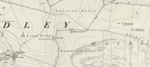
Druids Altar on 1852 map

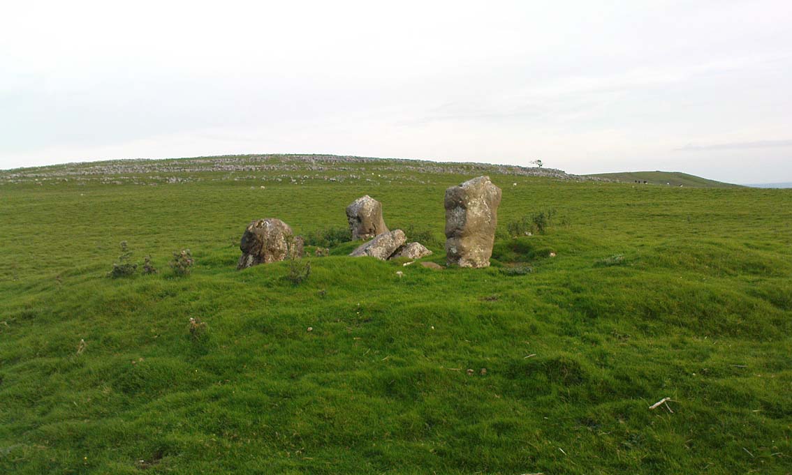
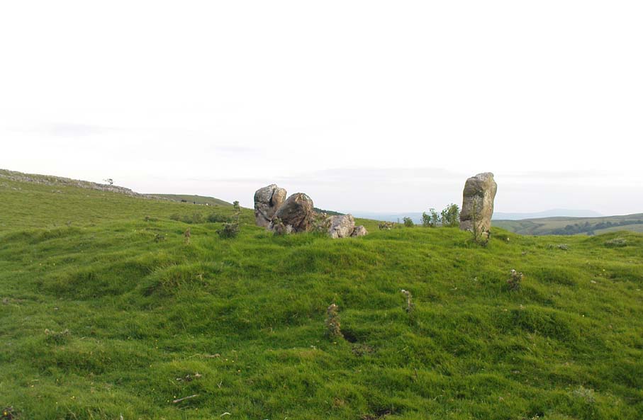
From Threshfield, go up Skirethorns Lane for about 1/2 mile, where the lane takes a sharp right. Continue uphill for nearly 2 miles to a metal gate. Go through the gate, where you’ll see a pair of curious standing stones ahead of you, but instead walk about 250 yards along the line of the old field wall running to the west.  You’ll see on the modern OS-map that a ‘cairn’ is shown: this is where you’re heading!

Archaeology & History

First highlighted on the 1852 OS-map of Bordley and district, this is a lovely site in a beautiful setting, surrounded by a veritable mass of other prehistoric remains at all quarters, including the large settlement of Hammond Close immediately south, the little-known settlement at Kealcup to the west, the Lantern Holes settlement up the hill immediately north, some standing stones due east, and much more.  Although it was described in Aubrey Burl’s Four Posters (1988) as just such a type of megalithic relic (a “four-poster stone circle”), an earlier description of the site from the mighty pen of Harry Speight (1892) told of a much more complete ring of stones, with trilithon to boot. He wrote:

“This prehistoric relic consists of a round stone and earthen mound, about 150 feet in circumference and 3 feet high, and was formerly surrounded by a circle of upright stones, only three of which are now left standing. On one side was a large flat stone resting upon two others, and known as the Druid’s Altar. On the adjoining land an ancient iron spear-head was found some years ago, and fragments of rudely-fashioned pottery have also from time to time turned up in the same neighbourhood.”

Edmund Bogg’s (1904) description following his own visit a few years later described this “remains of Druidical sacrifice” as consisting of,

“a mound some four feet high, and fifty yards round the outer rim. In the centre are two upright stones about four feet in length; and others nearly buried in the mound. Numerous stones from this circle have been used in building the adjoining walls.”

Bordley Circle, looking SE
Bordley Hill, looking south to Pendle Hill

A decade later another writer (Lewis 1914) merely copied what Speight and Bogg had recited previously. And whatever the modern books might tell of its status, I think we can safely assert that this was originally a much more substantial monument than the humble four-poster stone circle that meets our eye nowadays.  Our megalithic magus Aubrey Burl (1988) wrote the following on Bordley’s druidical stones:

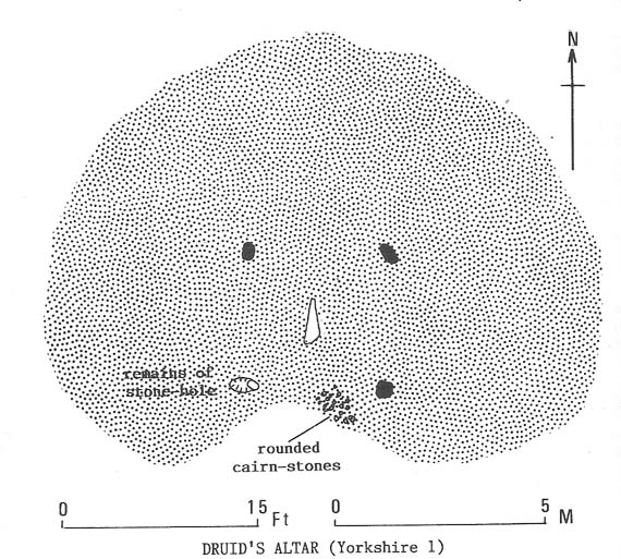
“On a circular mound 41ft (12.5m) across and 3ft (1m) high, three stones of local limestone form the corners of a rectangle 11ft 6in (3.5m) square, from which the SW stone is missing.  At its corner is ‘a stump, possibly the base of a prostrate stone,’ 5ft 10in (1.8m) long, now lying near the centre.  The tallest stone, 3ft 7in (1.1m) high is at the south-east.  The sides of the square are close to the cardinal points.  Between the SW and SE stones is a scatter of round cairnstones… Characteristically, the 4-Poster stands at the edge of a terrace from which the lands falls steeply to the west.”

Plan of the Druid's Altar (after Burl, 1988)
Plan of the Druid’s Altar (after Burl, 1988)

The Druid’s Altar seems to have originally been a large prehistoric tomb, perhaps even a chambered cairn.  Its situation in the landscape where it holds a circle of many outlying hills to attention, almost in the centre of them all, was evidently of some importance.  The only geographical ‘opening’ from here is to the south, where a long open valley widens to capture the grandeur of Pendle Hill, many miles away.  This would not have been insignificant.

We must also draw attention to what may be a secondary tumulus of similar size and form to the mound that the Druid’s Altar sits upon only some 25 yards to the west of the “circle”.  The shape and form of this second mound is similar to that of our Druid’s Circle — though to date, it seems that no archaeologist has paid attention to this secondary feature.  It measures some 21 yards (east-west) x 19 yards (north-south) in diameter and has the appearance of a tumulus or buried cairn.  The mound may be of a purely geological nature, but this cannot safely be asserted until the attention of the spade has been brought here.

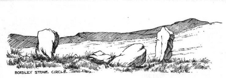
Druid's Altar, Bordley (drawing by Neil Wingate, 1976)
Druid’s Altar, Bordley (drawing by Neil Wingate, 1976)

Folklore

Although we have nothing directly associated with the circle, the surrounding hills here have long been known as the abode of faerie-folk.  Threshfield — in whose parish this circle lies — is renowned for it.  There have been accounts of curious light phenomena here too.  Modern alignment lore tells the site to be related to the peaked tomb above Seaty Hill, equinox west of here.

References:

  1. Bogg, Edmund, Higher Wharfeland, James Miles: Otley 1904.
  2. Burl, Aubrey, Four Posters: Bronze Age Stone Circles of Western Europe, BAR 195: Oxford 1988.
  3. Feather, S.W. & Manby, T.G., ‘Prehistoric Chambered Tombs of the Pennines,’ in Yorkshire Archaeological Journal, Vol 42, 1970.
  4. Lewis, A.L., ‘Standing Stones and Stone Circles in Yorkshire,’ in Man, no.83, 1914.
  5. Raistrick, Arthur, ‘The Bronze Age in West Yorkshire,’ in Yorkshire Archaeological Journal, Vol 29, 1929.
  6. Speight, Harry, The Craven and Northwest Yorkshire Highlands, Elliott Stock: London 1892.
  7. Wingate, Neil, Grassington and Wharfedale, Grassington 1977.

© Paul Bennett, The Northern Antiquarian