Glesart Stanes, Glassford, Lanarkshire

Standing Stones:  OS Grid Reference – NS 73609 46916

Also Known as:

  1. Avonholm
  2. Canmore ID 45595
  3. Glesart Stones
  4. Struthers Burial Ground
  5. Three Stones

Getting Here

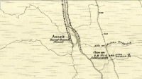
Glesart Stones on 1864 map

From the roundabout in Glassford village, head west down Jackson Street along the country lane of Hunterlees Road.  About 600 yards on, turn right at the small crossroads (passing the cemetery on yer left) for about half-a-mile, before turning left along a small track that head to some trees 400 yards along.  Once you’ve reached the trees, walk uphill and follow the footpath to the right, keeping to the tree-line.  It eventually runs to a small private graveyard. You’re there!

Archaeology & History

Glesart Stones,
looking west

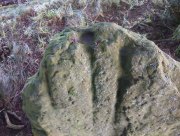
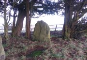
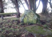
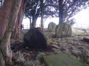
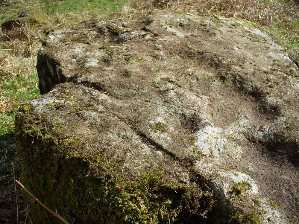
In the little-known private graveyard of the Struthers family on the crest of the ridge overlooking the River Avon and gazing across landscape stretching for miles into the distance, nearly a mile east of Glassford village, several hundred yards away from the Commonwealth graveyard, a cluster of yew trees hides, not only the 19th century tombstones, but remnants of some thing much more archaic.  Three small standing stones, between 2½ and 4 feet in height, hide unseen under cover of the yews, at the end of a much overgrown ancient trackway which terminates at the site.  They’re odd, inasmuch as they don’t seem to be in their original position.  Yet some form of archaic veracity seems confirmed by the weathered fluting: eroded lines stretching down the faces of two of the taller stones and, more importantly, what seem to be cup-markings on each of the monoliths.

Cup-mark atop of east stone

Easternmost stone

The tallest stone at the eastern end of the graveyard has a deep cup on its crown.  This may be the result of weathering; but we must exercise caution with our scepticism here.  Certainly the eroded lines that run down this stone are due to weathering – and many centuries of it; but the peculiarity is that the weathering occurs only on one side.  This implies that only one side of the stone was open to the elements.

Central cup-marked stone

‘X’ carved atop of central stone

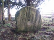
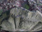
The second, central stone of the three, is slightly smaller than the first.  Unlike the eastern stone, its crown has been snapped off at some time in the past century or so, as evidenced in the flat smooth top.  But along the top are a series of small incised marks, one of which includes a notable ‘X’, which may have been surrounded by a circle.  A second fainter ‘X’ can be seen to its side, and small metal-cut lines are at each side of these figures.  Another small section of this stone on its southern edge has also been snapped off at some time in the past.  The most notable element on this monolith is the reasonably large cup-mark on its central west-face.  It is distinctly eroded, measuring 2-3 inches across and an inch or more deep.  Its nature and form is just like the one in the middle of the tallest of the standing stones at Tuilyies, nearly 31 miles to the northeast.

Western smallest stone

The Three Stones

The smallest of the three stones is just a few feet away from the central stone.  To me, it seemed oddly-placed (not sure why) and had seen the attention of a fire at its base not too long ago.  On its vertical face near the top-centre of the stone, another cup-marking seems in evidence, some 2 inches across and half-an-inch deep—but this may be natural.  The Glasgow archaeologist Kenneth Brophy reported that on a recent visit, computer photogrammetry was undertaken here, so we’ll hopefully see what they found soon enough.

There is some degree of caution amongst some archaeologists regarding the prehistoric authenticity of the Glesart Stanes – and not without good cause.  Yet despite this, the seeming cup-marks and, particularly, the positioning of the stones in the landscape suggest something ancient this way stood.  The stones here are more likely to be the remains of a once-larger monument: perhaps a cairn; perhaps a ring of stones; or perhaps even an early christian site.  At the bottom of the hill for example, just 350 yards below, is a large curve in the River Avon on the other side of which we find the remains of an early church dedicated to that heathen figure of St. Ninian (his holy well close by); and 300 yards north is the wooded Priest’s Burn, whose history and folklore seem lost.

The Glesart Stanes were the subject of an extended article by M.T. M’Whirter in the Hamilton Advertiser in 1929 (for which I must thank Ewan Allinson for putting it on-line).  He wrote:

“Situated on the highest hill-top on the estate of Avonholm, north to the house of that name, is the private burial ground of James Young Struthers… Situated within the burial ground are three upright flagstones of a dark brown colour, rough and unhewn,  Each stone is facing the east, and placed one behind the other, though not in a straight line, and the space between the eastern and the middle stone is eight feet, and the space between the middle and the western stone is seven feet.  The stone flags vary in measurement, the eastern stone being the greater, standing four feet three inches high, three feet eight inches broad, and one foot thick.  The middle stone is three feet high, three feet ten inches broad, and nine inches thick; and the western stone is three feet high, four feet broad and ten inches thick.  The two outer stones bear no letters, figures or marks, but the centre stone has rudely sculptured on the top-edge the Roman numerals IX, and on the western side of the stone there is a cup-shaped indentation about two inches in diameter.  A groove 26 inches in length extends from the top of the stone to below the level of the cup indentation.  The groove is deeper at the top, but gradually loses in depth towards the bottom end.  I have seen grooves similar to above by the friction of a wire rope passing over a rocky surface.  The numerals, cup indentation and groove do not appear to be part of the original placing of the stones and, if a cromlech, then in the centuries that have gone, the stones becoming exposed to view by the removal of the mound, would invariably have led to a search for stone coffins or urns, yet no discovery of either has ever been recorded.”

Indeed, Mr M’Whirter was sceptical of them being part of a prehistoric burial site, preferring instead to think that a megalithic ring once stood here.  He continued:

“From an examination of the three stones, I am convinced that they form a segment of a circle, and assuming that nine additional stones complete the circle, it would enclose a space of roughly one hundred feet in circumference, with each stone facing an easterly direction.”

But we might never know for certain…. The only other literary source I have come across which describes the site is that by the local vicar, William Stewart (1988), who told us that:

“The stones stand erect, six feet apart, three rough slabs of coarse-grained sandstone, three feet high, three feet broad and six inches thick, free of any chisel marks.  Two have their back to the east, the third, oblique to the others, has its back to the south-east, thus there is no suggestion of a stone circle.  There are vertical grooves on two of the stones, while the centre stone has a cupmark, below which is a faint circle, one foot in diameter.  They stand at the end of a long narrow strip of land with low earthen walls on either side, perhaps an old agricultural field division, and they gave their name ‘Three Stanes’, to a now partly-lost road which eventually reached The Craggs and ended as Threestanes Road in Strathaven…”

The Three Stones

The “faint circle” described by Mr Stewart is barely visible now.  And the idea that these “three stones” gave their name to the farmhouse and road of the same name at the other side of Strathaven, three miles west, seems to be stretching credulity to the limits.  Surely?

Folklore

In 1845, Gavin Laing in the New Statistical Account for Lanarkshire told that:

“These stones are known simply as the “Three Stones”. There is a tradition in the neighbourhood that three Lords were buried here, after being killed while looking on at a Battle. The stones are about 3½ feet high and about as thick as flag stones. They stand upright being firmly fixed in the ground.”

The stones and their traditional origin were also mentioned in Francis Groome’s Ordnance Gazetteer (1884), where he echoed the 1845 NSA account, but also added:

“Three tall upright stones are here, and have been variously regarded as Caledonian remains, as monuments of ancient noblemen, and as monuments of martyrs.”

Then at the end of the 1850s, when the Ordnance Survey lads came here, they reported,

“Three high stones stand upright on a small eminence upon the lands of Avonholm, respecting their origin there are various opinions. They are probably the remnants of Druidical superstition.”

References:

  1. Groome, Francis H., Ordnance Gazetteer of Scotland – volume 1, Thomas C. Jack: Edinburgh 1884.
  2. M’Whirter, M.T., “The Standing Stones at Glassford,” in Hamilton Advertiser, 1929.
  3. Stewart, William T., Glasford – The Kirk and the Kingdom, Mainsprint: Hamilton 1988.
  4. Wilson, James Alexander, A Contribution to the History of Lanarkshire – volume 2, J. Wylie: Glasgow 1937.

© Paul BennettThe Northern Antiquarian


Weeping Stone, Fladaigh Chuain, Skye

Legendary Rock: OS Grid Reference – NG 3638 8091

Getting Here

Unless you’ve got your own boat, forget it!  This one’s miles out on the isolated uninhabited island of Fladda-chuain about 5 miles off the northwest tip from Duntulm, Trotternish.  I wouldn’t mind a coupla weeks alone on the isle though – if anyone can get me there!

Archaeology & History

This little rocky island was allegedly another one of the many visiting places that St. Columba frequented in his copious ventures, trying to sell his new religion to local people wherever he went.  Here he came to the legendary clach known as the Weeping Stone: a place of reverence to the druids and indigenous people.  But St Columba came here to christianize the rituals that were had at the site; and, eventually, he was allowed to build a  small stone chapel close by.

Folklore

In Otta Swire’s (1961) excellent work on the folklore and history of the Isle of Skye, she wrote:

“In Duntulm Bay lies Tulm Island and beyond it, in clear weather, Fladdachuan, Fladda of the Ocean, can be seen. In olden times this was a sacred spot, held by many to be Tir-nan-Og, the Isle of Perpetual Youth, which lay in the west; here it is always summer and the sun never sets. The puffins recognized its sacred nature and never began any venture until they had circled the island three times sunwise; this they did also on arriving in Skye and before leaving it. It was held by some to be the reason why in Skye people used to turn three times sunwise before starting a new enterprise. The Druids held it in veneration and St. Columba caused a chapel to be built there. On its altar lay a black stone which some say was the original altar stone of the Druids and which was known as the Weeping Stone because it was always wet. Until fairly recently fishermen used to land on the island and pour three handfuls of seawater on the stone to procure favourable winds or to stop bad floods. The Weeping Stone no longer exists, or at least is no longer to be found where the altar once stood.”

I can’t find anything more about this place.  Does anyone know owt more about it?

References:

  1. Swire, Otta F., Skye: The Island and its Legends, Blackie & Son: Glasgow 1961.

© Paul BennettThe Northern Antiquarian


Temple of Anaitis, Lusta, Waternish, Skye

‘Stone Circle’: OS Grid Reference – NG 2725 5273

Also Known as:

  1. Annait
  2. Temple of Annait

Getting Here

1880 map of Anaitis

1880 map of Anaitis

Otta Swire (1961) told how to find this place, thus: “The Waternish road turns off to the north at Fairy Bridge, whence it runs along the valley of the Bay river. On the left of the road, though at some little distance from it, where the river cleaves its way through a gorge to the sea, stands the mound which is now all that remains of the ‘Temple of Anaitis’ (so called).”

Archaeology & History

This is a curious place, full of archaeological potential if the folklore and history records are owt to go by, yet little of any substance remains to substantiate what may have been an important stone circle or other heathen site in earlier times. It seems to have been described first of all in the famous Hebridean journeys of Boswell and Johnson in the late 18th century.  Amidst his insulting description of both the landscape and local people, on Friday 17th September 1773, James Boswell visited the site and told:

“The weather this day was rather better than any that we had since we came to Dunvegan. Mr M’Queen had often mentioned a curious piece of antiquity near this which he called a temple of the goddess Anaitis.  Having often talked of going to see it, he and I set out after breakfast, attended by his servant, a fellow quite like a savage.  I must observe here, that in Skye there seems to be much idleness; for men and boys follow you, as colts follow passengers upon a road. The usual figure of a Sky boy, is a lown with bare legs and feet, a dirty kilt, ragged coat and waistcoat, a bare head, and a stick in his hand, which, I suppose, is partly to help the lazy rogue to walk, partly to serve as a kind of a defensive weapon. We walked what is called two miles, but is probably four, from the castle, till we came to the sacred place. The country around is a black dreary moor on all sides, except to the sea-coast, towards which there is a view through a valley, and the farm of Bay shews some good land. The place itself is green ground, being well drained, by means of a deep glen on each side, in both of which there runs a rivulet with a good quantity of water, forming several cascades, which make a considerable appearance and sound.  The first thing we came to was an earthen mound, or dyke, extending from the one precipice to the other.  A little farther on, was a strong stone-wall, not high, but very thick, extending in the same manner.  On the outside of it were the ruins of two houses, one on each side of the entry or gate to it. The wall is built all along of uncemented stones, but of so large a size as to make a very firm and durable rampart. It has been built all about the consecrated ground, except where the precipice is deep enough to form an enclosure of itself. The sacred spot contains more than two acres. There are within it the ruins of many houses, none of them large, a cairn, and many graves marked by clusters of stones. Mr M’Queen insisted that the ruin of a small building, standing east and west, was actually the temple of the goddess Anaitis, where her statue was kept, and from whence processions were made to wash it in one of the brooks. There is, it must be owned, a hollow road visible for a good way from the entrance; but Mr M’Queen, with the keen eye of an antiquary, traced it much farther than I could perceive it. There is not above a foot and a half in height of the walls now remaining; and the whole extent of the building was never, I imagine, greater than an ordinary Highland house. Mr M’Queen has collected a great deal of learning on the subject of the temple of Anaitis; and I had endeavoured, in my journal, to state such particulars as might give some idea of it, and of the surrounding scenery” —

But in all honesty it seems Mr Johnson was either too lazy to write about the place, or simply didn’t actually get there, in spite of what he alleged!  But later that evening, Boswell dined with the same Mr MacQueen, who told him more of this site.  In the typically pedantic tone of english supremacy (which still prevails in some idiots who visit these lands), he continued by saying:

“Mr Macqueen had laid stress on the name given to the place by the country people, Ainnit; and added, ” I knew not what to make of this piece of antiquity, till I met with the Anaitidis delubrum in Lydia, mentioned by Pausanias and the elder Pliny.”  Dr. Johnson, with his usual acuteness, examined Mr Macqueen as to the meaning of the word Ainnit, in Erse, and it proved to be a water-place, or a place near water, “which,” said Mr. Macqueen, “agrees with all the descriptions of the temples of that goddess, which were situated near rivers, that there might be water to wash the statue.”

There ensued a discussion between Mr MacQueen and Samuel Johnson about the etymology of ‘Anaitis’, with one thinking it was of a goddess, and another that it represented an early christian site.  To this day it is difficult to say what the word means with any certainty.  In W.J. Watson’s (1993) fine work he tells us,

Andoit, now annaid, has been already explained as a patron saint’s church, or a church that contains the relics of the founder.  This is the meaning in Ireland and it is all we have to go upon.  How far it is held with regard to Scotland is hard to say… They are often in places  that are now, and must always have been, rather remote and out of the way.  It is very rarely indeed that an Annat can be associated with any particular saint, nor have I met any traditions connected with them.  But wherever there is an Annat there are traces of an ancient chapel or cemetery, or both; very often, too, the Annat adjoins a fine well or stream…”

The great Skye historian and folklorist Otta Swire (1961) also wrote about this mysterious site, mainly echoing what’s said above, but also adding:

“This name of Annait or Annat is found all over Scotland. It has been interpreted as meaning the ‘Water-place’ from Celtic ‘An’ = water, because many are near water. Others suggest ‘Ann’ = a circle (Celtic) and claim that most Annats are near standing stones. The most-favoured derivation seems to be from Ann, the Irish mother of the Gods, and those who hold this view claim that the Annats are always near a revered spot, where either a mother-church or the cell of a patron saint once stood. Probably Annat does, in fact, come from an older, pre-Celtic tongue, and belongs to an older people whose ancient worship it may well commemorate. The curious shape of the Waternish Temple of Anaitis and its survival make it seem likely that it was something of importance in its day, built with more than usual care and skill. Perhaps the Temple tradition is correct – but whose, if so, and to what gods? One cannot help wondering if cats played any part in its ritual, and if so, if any faint memory remains, for the nickname of the people of this wing was ‘Na Caits’ = The Cats, and not far off, by one of the tributary burns on the right of the roadway, there stands a small cairn, crowned by a long, sharp stone somewhat resembling a huge claw. This is the ‘Cats’ Cairn’.”

The Cats’ Cairn (NG271526) is said to mark the grave of a young boy from the 18th century, who was buried where he died and its story is told elsewhere on TNA.  Another example of the Annait place-name can be found elsewhere on Skye at the megalithic site, Clach na h’annait.

References:

  1. Boswell, James, The Journal of a Tour to the Hebrides with Samuel Johnson, National Illustrated Library: London 1899.
  2. Swire, Otta F., Skye: The Island and its Legends, Blackie: Glasgow 1961.
  3. Watson, W.J., The History of the Celtic Place-Names of Scotland, Birlinn: Edinburgh 1993.

© Paul BennettThe Northern Antiquarian


Clach na h-ealea, Clachan, Lismore, Argyll

Legendary Stone:  OS Grid Reference – NM 861 435

Also Known as:

  1. Clach na h-eala
  2. Stone of the Swan
  3. Swan Stone

Archaeology & History

Although the lads at the Scottish Royal Commission (1974) initially described this site as a ‘Standing Stone’, it is in fact,

“an erratic boulder of granite roughly shaped in the form of a cross… It measures 0.8m in height, 0.6m in width at base, and 0.4m in width at the top…(and) the stone is supposed to have marked a boundary.”

The site was evidently of some mythic importance, as the great Cathedral of St. Moluag was built next to the stone — unless the giant cairn of Cnoc Aingil, 500 yards away, was to blame. A holy well of this saint’s name (an obvious heathen site beforehand) is also nearby.

Folklore

Although this stone was dedicated to swans, I’ve not found the story behind the name.  There were no buried swans here, but local tradition told that this old boulder could give sanctuary to anyone who touched it, or ran round it sunwise.  The Hebridean folklorist Otta Swire (1964) told that,

“anyone who claimed such sanctuary had his case considered by ‘the Elders.’ If they considered his plea justified, they ‘came out and walked sun-wise round the Swan Stone.’ If they did not approve of his right to sanctuary, they walked round it anti-clockwise and the man was then given over, not to his enemies, but ‘to Authority’ to be tried.”

This old tradition derives from well known pre-christian rites. Swire also reported that even in the 1960s here, “at funerals the coffin is always carried round the grave sun-wise before being laid in it.” An old cross placed in the Field of the Cross next to the stone was an attempt to tease folk away from heathen rites of the stone, but failed.

References:

  1. Royal Commission on the Ancient & Historical Monuments of Scotland, Argyll – volume 2: Lorn, RCAHMS: Edinburgh 1974.
  2. Swire, O.F., The Inner Hebrides and their Legends, Collins: London 1964.

© Paul BennettThe Northern Antiquarian

St. Peter’s Well, York Minster, North Yorkshire

Holy Well:  OS Grid Reference – SE 6038 5219

Also Known as:

  1. Holy Well, York Minster

Archaeology & History

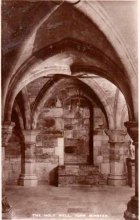
Old photo of the well

For people who like to visit the sacred sites that determined a cross-over from Earth-based animism to one which ceased sanctifying the Earth, this ancient water source in the cellars beneath York Minster would be a good example.  Sadly, the church has closed off access to this ancient heritage and you can no longer see it.  Yet despite the fact that the modern-day christians have closed off your encounter with this important heritage site (York Minster’s website doesn’t even mention its existence!), we should not forget its mythic history…

As you walk into the building (at some great expense, it has to be said), the location of the holy well is said to be at its more western end, albeit in the crypt underground—although there does seems to be some confusion with some authors about exactly where the well is positioned.

1850 sketch of well

The earliest account we hear of the place relates to when the northern tribal King Edwin, along with his sons Osfrid and Esfrid, came here to be “baptized” in the waters of this clear spring “on Easter day, April 12, 627” CE.  Immediately thereafter a small wooden chapel was constructed next to or above the well.  From then on, as the centuries passed, the renown of the well grew and eventually the magnificent ritual temple of York Minster was eventually built.  The waters eventually became dedicated to St. Peter and an annual festival occurred here soon after the Midsummer solstice on what became known as St. Peter’s Day (June 29).  After the year 1462, a secondary festival date was also given to the site by the Church and another annual celebration occurred here on October 1 too.  Its waters remained accessible to people for drinking, healing and rites throughout the centuries.  It is only now, in the 21st century, that its sacrality and spirit has been closed-off.  This is a situation that must be remedied!


In Mr Goole’s (1850) survey of York Minster, his architectural illustration of the building showed that the water from the well had been brought up onto the ground floor, on the southeast side of the inner cathedral building in the easternmost vestry, and named as St Peter’s Pump.  This is illustrated in the 1850 drawing above-left.

A whole series of early writers mention the well in earlier centuries—of whom a brief sample is given here.  When Celia Feinnes came here in the 17th century, she said that,

“In the vestry of York Minster there is a well of sweet spring water called St Peter’s Well ye saint of ye Church, so it is called St Peter’s Cathedral.” (Smith 1923)

Mr Torre (1719) gave it equal brevity, saying simply that,

“at the south-west corner thereof is a draw-well (called St. Peter’s Well) of very wholesome clear water much drunk by the common people.”

In R.C. Hope’s (1893) national survey of sacred wells, he told that

“There is a draw well with a stone cistern in the eastern part of the crypt of York Minster… The Crypt is about 40 feet by 35 feet.”

The well was even included in Murray’s Handbook to Yorkshire (1892) as being “in the southwest corner of the Minster.” William Smith (1923) included the site in his fine survey, telling his readers that,

“The water is excellent in quality, which in measure, so chemists say, is due to the lime washed into it by the rain from the walls of the Minster.  The water has for centuries been used for baptisms, and is so used today.  The well has now for some years been covered with a pump.”

Folklore

In Geoffrey of Monmouth’s famous early History, we find that King Arthur visited here. …And one final note, about which we know not for certain whether it was relevant to the holy well hiding in the crypt, but a fascinating heathen custom was enacted here in bygone days, almost above the spring.  Mistletoe, as Christina Hole (1950) told,

“was ceremonially carried to the cathedral on Christmas Eve and laid upon the high altar, after which a universal pardon and liberty for all was proclaimed at the four gates of the city for as long as the branch lay upon the altar.”

Mistletoe is one element that is known to have been sacred to the druids (not the present-day druids!) and was sacred to the ancient Scandinavians (who came here), and also possessed the powers of life and death in its prodigious folklore and phytochemistry.  Fascinating…

…to be continued…

References:

  1. Bord, Janet, Cures and Curses: Ritual and Cult at Holy Wells, HOAP: Wymeswold 2006.
  2. Gutch, Mrs, County Folk-lore volume 2 – North Riding of Yorkshire, York and the Ainsty, David Nutt: London 1901.
  3. Hole, Christina, English Custom and Usage, Batsford: London 1950.
  4. Hole, Christina, English Shrines and Sanctuaries, Batsford: London 1954.
  5. Hope, Robert Charles, Legendary Lore of the Holy Wells of England, Elliott Stock: London 1893.
  6. Murray, John, Handbook for Travellers in Yorkshire, J.Murray: London 1874.
  7. Parkinson, Thomas, Yorkshire Legends and Traditions, Elliot Stock: London 1888.
  8. Poole, G.A., An Historical and Descriptive Guide to York Cathedral and its Antiquities, R. Sunter: York 1850.
  9. Purey-Cust, A.P., York Minster, Isbister: London 1898.
  10. Rattue, James, The Living Stream: Holy Wells in Historical Context, Boydell: Woodbridge 1995.
  11. Smith, William, Ancient Springs and Streams of the East Riding of Yorkshire, A. Brown: Hull 1923.
  12. Torre, James, The Antiquities of York, York 1719.
  13. Whelan, Edna, “Holy Wells in Yorkshire – part 1,” in Source, No.3, November 1985.
  14. Whelan, Edna, The Magic and Mystery of Holy Wells, Capall Bann: Chieveley 2001.
  15. Whelan, Edna & Taylor, Ian, Yorkshire Holy Wells and Sacred Springs, Northern Lights: Dunnington 1989.

© Paul Bennett, The Northern Antiquarian
Lund Well, Bingley, West Yorkshire

Sacred Well (destroyed):  OS Grid Reference – SE 0973 4091

Archaeology & History

Lund Well on 1852 map

Lund Well on 1852 map

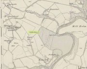
Once found in a cluster of three little wells all very close to each other near the top of the field where the Crossflatts roundabout joins up with the Aire-Valley trunk road, this is an intriguing site if you happen to be a pagan, or have an interest in druidism — and for one main reason: its name.  When I first came across a reference to the place about 25 years ago, the only piece of information I could find about it came from the arduous detailed researches of the Victorian industrial historian J. Horsfall Turner who, unfortunately, neglected to record much of the fading folklore in the region at his time.  Marked on the 1852 6-inch Ordnance Survey map, ‘Lund’ was a bit of an etymological curiosity, and Mr Turner (1897) thought the well’s name was little other than that of a local mill owner, whose nickname was ‘Lund’ Thompson.  He was guessing of course…and I thought little more about it…

Years later when looking through A.H. Smith’s (1961-63) magnum opus on the place-names of West Yorkshire, I found that he didn’t include the Lund Well in his survey.  However, an eventual perusal of Kenneth Cameron’s (1996) work told that in Old Norse place-names (and there is a preponderance of such places scattering Yorkshire and Lancashire), lund or lundr was a “‘small wood, grove,’ also had a meaning, ‘sacred grove’.” The word is echoed in old French, launde, meaning ‘forest glade’.  In A.H. Smith’s (1954) earlier etymological magnum opus he said that the word derives from a “small wood, grove, also a sacred grove, one offering sanctuary.”  However, Margaret Gelling (2000) urged caution on the origin of lund as a sacred grove and erred more to the usual English tendency of depersonalizing everything, taking any animistic attribution away from its root meaning; but we must urge caution upon her caution here!  Neither Joseph Wright (English Dialect Dictionary, vol.3 1905) nor William Grant (Scottish National Dictionary, vol.6, 1963) have entries for this word, so we must assume the Scandinavian root word origin to be correct.

One vitally important ingredient with the Lund Well is its geographical position.  For across the adjacent River Aire the land climbs uphill—and a few hundred yards above we reach the well-known and legendary Druid’s Altar, with its Druid’s Well just below.  This association is what suggests our Lund Well may have had a real association with a “sacred grove of trees”, as—despite us knowing very little about them—we do at least know that druids performed rites in sacred groves.  In Greenbank’s (1929) historical analysis of the Druid’s Altar, he was left perplexed as to the origin of its name as all early accounts and popular culture assigned it this title, and so he opted for the probability that the druids did indeed once perform rites here.  If this was true, then our seemingly innocuous Lund Well once had a much more sacred history than anyone might have thought.  Sadly, through their usual ignorance of such matters, the industrialists destroyed it….

References:

  1. Cameron, Kenneth, English Place-Names, Batsford: London 1996. 
  2. Gelling, Margaret, Place-Names in the Landscape, Phoenix: London 2000.
  3. Greenbank, Sydney, The Druid’s Altar, Bingley, R.G. Preston: Bingley 1929.
  4. Smith, A.H., English Place-Name Elements – volume 2, Cambridge University Press 1954.
  5. Smith, A.H., The Place-Names of the West Riding of Yorkshire – 8 volumes, Cambridge University Press 1961-63.
  6. Wainwright, F.T., Scandinavian England, Phillimore: Chichester 1975.

© Paul BennettThe Northern Antiquarian


Kirk Stones, Morton Moor, West Yorkshire

Legendary Rocks (destroyed):  OS Grid Reference – SE 0886 4479

Archaeology & History

Kirk Stones on 1851 map

Kirk Stones on 1851 map

A place-name that is still recognised on modern Ordnance Survey maps, even though the original site giving rise to it was all but destroyed some one hundred-and-fifty years ago.  Derived from the old word kirk, meaning a church or sacred site, no christian remains of any kind have ever existed here and so we must presume an earlier, more heathen site of sanctity (an abundance of prehistoric petroglyphs exist very close by).  The singular reference detailing the nature of these Kirk Stones is in J.A. Busfield’s (1875) rare tract on the history of Upwood, in the parish of Bingley.  Upwood Hall was built by the Busfield family and, as the author tells,

“one of the most striking features in the vicinity at this age [c.1800, PB] was the fine range of magnificent rocks called Kirkstones, which had existed for countless ages. These grand rocks, towering one above another, extended along the whole southern boundary of the [Whetstone] Allotment on the left of the road to Ilkley, and were really a fine object, but alas!, through the ignorance or stupidity of the agent Colonel Bence, the “Crags of Kirkstone” were broken up and disposed of in the construction of the Bradford Water Works about the year 1854.”

Sadly we have neither illustrations nor other references to these fine sounding sentinels.
Undoubtedly the Kirkstones were a natural feature, despite their venerated title. It would have been their very appearance that gave rise to their revered title, as in the great and contorted rock masses seen at Brimham Rocks which, from Bensons’s description, these Kirk Stones seem reminiscent. The only piece of extant lore to these stones is that the uprights that went into making the recently destroyed Bradup stone circle a short distance south of here, came from this sacred outcrop.  It seems reasonable to assume that they played an important role in the magickal history of these hills when they were scattered with forest.

The Kirk Stones aligned along the equinox axis to the Black Knoll standing stone less than a mile [1.4km] due east.

References:

  1. Bennett, Paul, The Old Stones of Elmet, Capall Bann: Milverton 2001.
  2. Busfield, Johnson Atkinson, Fragments Relating to a History of Bingley Parish, Bradford 1875.
  3. Smith, A.H., English Place-Name Elements – Part 2, Cambridge University Press 1956.

© Paul BennettThe Northern Antiquarian


St Peter’s Well, York Minster, North Yorkshire

Holy Well:  OS Grid Reference – SE 6038 5219

Also Known as:

  1. Holy Well, York Minster

Archaeology & History

Old photo of the well

Old photo of the well

For people who like to visit the sacred sites that determined a cross-over from Earth-based animism to one which ceased sanctifying the Earth, this ancient water source in the cellars beneath York Minster would be a good example.  Sadly, the church has closed off access to this ancient heritage and you can no longer see it.  Yet despite the fact that the modern-day christians have closed off your encounter with this important heritage site (York Minster’s website doesn’t even mention its existence!), we should not forget its mythic history…

As you walk into the building (at some great expense, it has to be said), the location of the holy well is said to be at its more western end, albeit in the crypt underground—although there does seems to be some confusion with some authors about exactly where the well is positioned.

1850 sketch of the well

1850 sketch of the well

The earliest account we hear of the place relates to when the northern tribal King Edwin, along with his sons Osfrid and Esfrid, came here to be “baptized” in the waters of this clear spring “on Easter day, April 12, 627” CE.  Immediately thereafter a small wooden chapel was constructed next to or above the well.  From then on, as the centuries passed, the renown of the well grew and eventually the magnificent ritual temple of York Minster was eventually built.  The waters eventually became dedicated to St. Peter and an annual festival occurred here soon after the Midsummer solstice on what became known as St. Peter’s Day (June 29).  After the year 1462, a secondary festival date was also given to the site by the Church and another annual celebration occurred here on October 1 too.  Its waters remained accessible to people for drinking, healing and rites throughout the centuries.  It is only now, in the 21st century, that its sacrality and spirit has been closed-off.  This is a situation that must be remedied!

In Mr Goole’s (1850) survey of York Minster, his architectural illustration of the building showed that the water from the well had been brought up onto the ground floor, on the southeast side of the inner cathedral building in the easternmost vestry, and named as St Peter’s Pump.  This is illustrated in the 1850 drawing above-left.

A whole series of early writers mention the well in earlier centuries—of whom a brief sample is given here.  When Celia Feinnes came here in the 17th century, she said that,

“In the vestry of York Minster there is a well of sweet spring water called St Peter’s Well ye saint of ye Church, so it is called St Peter’s Cathedral.”(Smith 1923)

Mr Torre (1719) gave it equal brevity, saying simply that,

“at the south-west corner thereof is a draw-well (called St. Peter’s Well) of very wholesome clear water much drunk by the common people.”

In R.C. Hope’s (1893) national survey of sacred wells, he told that

“There is a draw well with a stone cistern in the eastern part of the crypt of York Minster… The Crypt is about 40 feet by 35 feet.”

The well was even included in Murray’s Handbook to Yorkshire (1892) as being “in the southwest corner of the Minster.” William Smith (1923) included the site in his fine survey, telling his readers that,

“The water is excellent in quality, which in measure, so chemists say, is due to the lime washed into it by the rain from the walls of the Minster.  The water has for centuries been used for baptisms, and is so used today.  The well has now for some years been covered with a pump.”

Folklore

In Geoffrey of Monmouth’s famous early History, we find that King Arthur visited here. …And one final note, about which we know not for certain whether it was relevant to the holy well hiding in the crypt, but a fascinating heathen custom was enacted here in bygone days, almost above the spring.  Mistletoe, as Christina Hole (1950) told,

“was ceremonially carried to the cathedral on Christmas Eve and laid upon the high altar, after which a universal pardon and liberty for all was proclaimed at the four gates of the city for as long as the branch lay upon the altar.”

Mistletoe is one element that is known to have been sacred to the druids (not the present-day druids!) and was sacred to the ancient Scandinavians (who came here), and also possessed the powers of life and death in its prodigious folklore and phytochemistry.  Fascinating…

…to be continued…

References:

  1. Bord, Janet, Cures and Curses: Ritual and Cult at Holy Wells, HOAP: Wymeswold 2006.
  2. Gutch, Mrs, County Folk-lore volume 2 – North Riding of Yorkshire, York and the Ainsty, David Nutt: London 1901.
  3. Hole, Christina, English Custom and Usage, Batsford: London 1950.
  4. Hole, Christina, English Shrines and Sanctuaries, Batsford: London 1954.
  5. Hope, Robert Charles, Legendary Lore of the Holy Wells of England, Elliott Stock: London 1893.
  6. Murray, John, Handbook for Travellers in Yorkshire, J.Murray: London 1874.
  7. Parkinson, Thomas, Yorkshire Legends and Traditions, Elliot Stock: London 1888.
  8. Poole, G.A., An Historical and Descriptive Guide to York Cathedral and its Antiquities, R. Sunter: York 1850.
  9. Purey-Cust, A.P., York Minster, Isbister: London 1898.
  10. Rattue, James, The Living Stream: Holy Wells in Historical Context, Boydell: Woodbridge 1995.
  11. Smith, William, Ancient Springs and Streams of the East Riding of Yorkshire, A. Brown: Hull 1923.
  12. Torre, James, The Antiquities of York, York 1719.
  13. Whelan, Edna, “Holy Wells in Yorkshire – part 1,” in Source, No.3, November 1985.
  14. Whelan, Edna, The Magic and Mystery of Holy Wells, Capall Bann: Chieveley 2001.
  15. Whelan, Edna & Taylor, Ian, Yorkshire Holy Wells and Sacred Springs, Northern Lights: Dunnington 1989.

© Paul BennettThe Northern Antiquarian


Wallace’s Oak, Larbert, Falkirk, Stirlingshire

Legendary Tree:  OS Grid Reference – NS 847 836?

Also Known as:

  1. Wallace’s Tree

Archaeology & History

The archaeology and traditions ascribed to this ancient tree (exact position unknown) is based on words that were first penned two hundred years ago.  It was thankfully recorded with a reasonable description when William Nimmo wrote about the great Sir William Wallace in the second edition of his Stirlingshire (1817) work.  Known about in oral tradition by local people, Nimmo told how:

“Torwood was a place where he and his party, when engaged in any expedition in this part of the country, often held their rendezvous, and to which they retreated in the hour of danger.  Here is still to be seen an aged oak, well known by the name of Wallace’s Tree; which seems to have been, even then, rotten and hollow within, and is said to have often afforded a lodging to him and a few of his trusty friends. It is supposed to have been one of the largest trees that ever grew in Scotland.  It is now almost quite decayed; but, from its ruins, appears to have been of an uncommon size. The remaining stump is no less than eleven or twelve feet in diameter. It stands upon the summit of a small eminence, which is surrounded on all sides by a swamp.  A rugged causeway runs from the south through the swamp, and leads up to the tree.  Some other vestiges of the stonework are discernible, surrounding the tree in a circular form, and leading to the conjecture that this oak is of a very high antiquity; and that, having been much frequented by Druidical priests, amongst whom the oak was sacred, the causeway had been laid for their approach to it, and the performance, underneath its branches, of religious rites.”

Nimmo may have a point here.  Not necessarily of druids (although druidic traditions and reality is known from many old tracts to have continued in many of the hidden places in Scotland), but certainly in relation to the paved track leading to a what may have been a recognised moot-hill, on top of which this great oak once stood.  Great trees and ancient meeting places were held in high esteem, not only in the legends of druidism and more established animistic pantheons, but in the recognised pragmatism of local tribal gatherings, in Scotland, Wales, England and in traditional cultures all over the world. (Gomme 1880) The traces of stonework leading to the hill strongly implies an archaeological site in the paving alone; but moreso, as an important site in the traditions of the Scottish people.  The fact that these stone ruins were still visible when Nimmo visited the site in the latter-half of the 18th century in the context he describes, implies it may have been the remains of a possible crannog; or a moot hill; or even, with its great oak surmounting, a sacred grove!  In my mind, it was probably being used as a gathering place long before William Wallace and his men gathered here…

In 1880, a 3rd edition of Nimmo’s Stirlingshire was published and edited by R. Gillespie.  Herein were additional notes about Wallace’s Oak that had been uncovered by Mr Gillespie.  Although he’d visited the place,

“Not the smallest vestige…of the Wallace oak remains. Even the ” oldest inhabitant” can say nothing of it save what he has gathered from tradition.  Sir Walter Scott, in his Tales of a Grandfather, speaks of having seen some of its roots eighty years ago; and recently we were shown a treasured morsel of the tree in the Chambers’ Institute at Peebles. Wallace, undoubtedly, often chose the solitude of the Torwood as a place of rest for his army, raised and roused to oppose the tyranny of Edward.  Here he concealed his numbers and his designs, sallying out suddenly on the enemy’s garrisons, and retreating as suddenly when afraid of being overpowered. While his army lay in these woods, “the oak” was his head-quarters. Within it, the illustrious hero generally slept, the hollow trunk being huge enough to afford shelter both to himself and one or more of his associates.”

When John Gibson (1908) came to write about it, he told that “Wallace’s Oak, which stood on another part of Woodside (low Torwood), has…vanished.” No roots, no lingering trunk—nothing.  But although the tree has long since gone, William M. Stirling pointed out in 1817 that,

“A young tree is pointed out in the neighbourhood, as having sprung from an acorn of Wallace’s Oak.”

If and when we can locate the old toll-house of Broomage at Larbert, we get much closer to identifying the exact location of this long lost oak.  Then, perhaps, a commemorative plaque should surely be placed there to remind people of their great history, and included on tours of sites relating to Sir William Wallace.

References:

  1. Gibson, John C., Lands and Lairds of Larbert and Dunipace Parishes, Hugh Hopkins: Glasgow 1908.
  2. Gomme, George L., Primitive Folk-Moots, Sampson Low: London 1880.
  3. Nimmo, William, The History of Stirlingshire (2nd edition), John Frazer: Stirling 1817.

© Paul Bennett, The Northern Antiquarian 

Druidsfield (03), Lochearnhead, Perthshire

Cup-Marked Stone:  OS Grid Reference – NN 58760 23087

The Druidsfield-3 carved stone

Also Known as:

  1. Canmore ID 24126

Getting Here

Follow the same directions described to reach the Druidsfield 1 and 2 carvings.  This one is the larger upright block right next to them!

Archaeology & History

Several of the faint cups visible

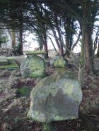
Contextually relevant to the two adjacent carvings, this is the largest of the three stones and comprises of a number of natural deep marks associated with between eight or ten man-made cup-markings.  They’re not all immediately apparent, but stand out more as and when natural lighting conditions change.  All of them are on the north and northwestern section of the stone, and measure between 1-3 inches across.  This is the least visually impressive of the stones in this petroglyph cluster.

Folklore

The carvings here were said by one of the locals to have been part of a “druid’s circle, which we played in as children, and were always told had been a special place of the druids in ancient times.”

References:

  1.  Coles, F.R., “Report on stone circles in Perthshire principally Strathearn,” in Proceedings of the Society of Antiquaries, Scotland, volume 45, 1911.
  2. Haggart, D., “Notice of the discovery of a stone cup and cup-marked stones at Lochearnhead,” in Proceedings of the Society of Antiquaries, Scotland, volume 22, 1888.

Acknowledgements – Huge thanks to Paul Hornby for help and use of his photos.

© Paul Bennett, The Northern Antiquarian