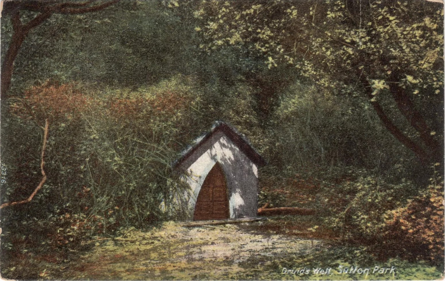
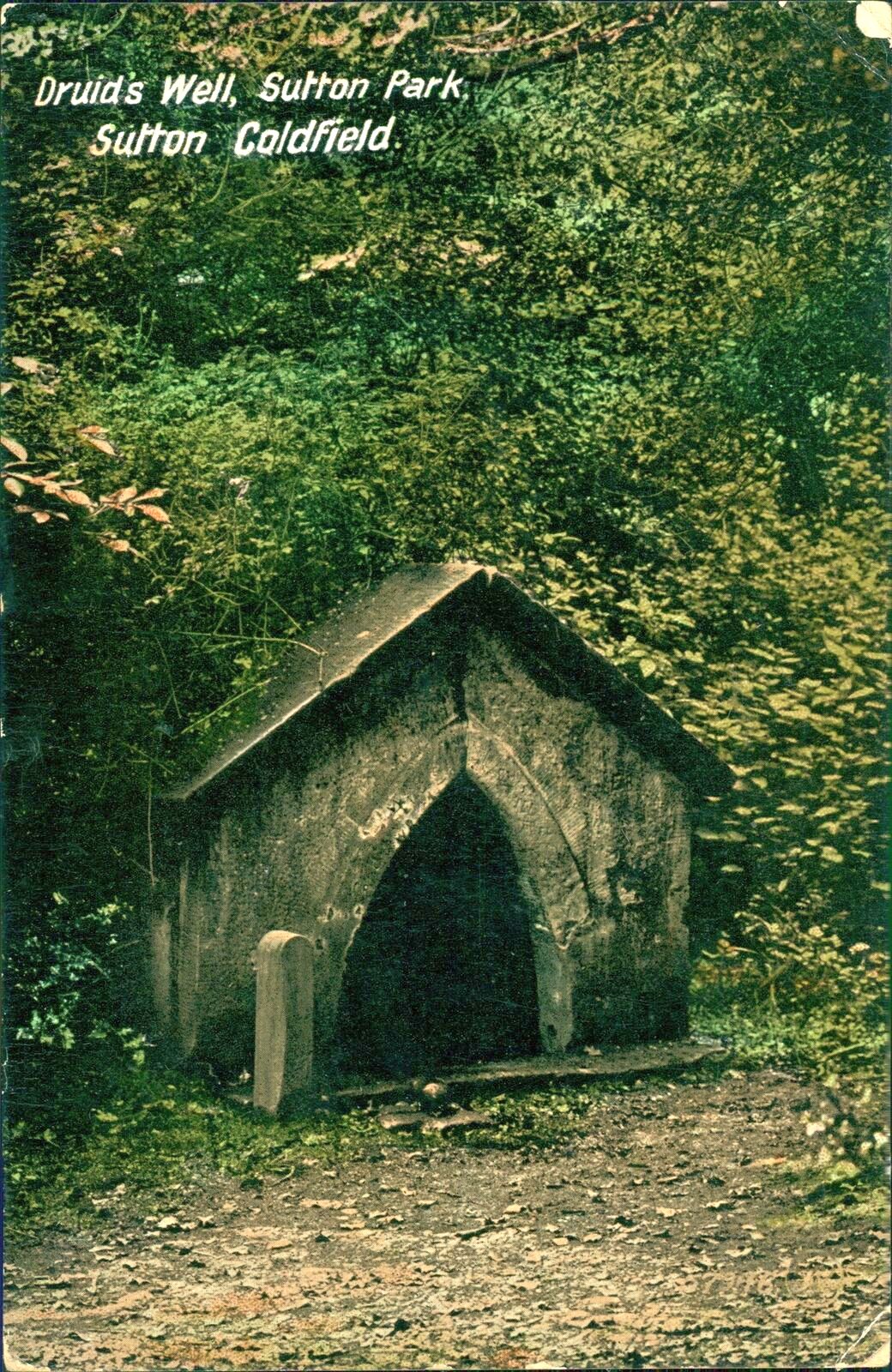
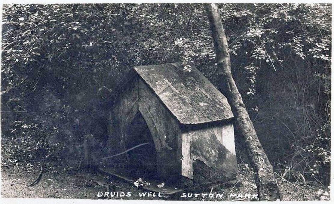
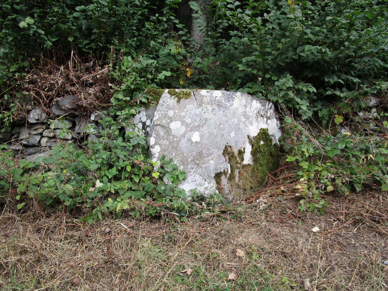
Highlighted on the 1884 Ordnance Survey map of the region and located beyond the far eastern end of Braceridge Lake, this legendary well has seen better days. A small well-house once covered the spring, but all we have left today is little more than a rectangular stone-lined concrete hole-in-the-ground where the waters collect (hopefully some local folk can bring it back to life). But in the 19th century it was well known, much frequented and maintained.
Not much seems to be known about its mythic history, as the traditions surrounding its dual pagan-christian dedication seem to have been forgotten. When the local writer Tom Burgess (1893) came to explore its history, he merely wrote:
“How it came to be called the Druids’ Well is not known, it is scarcely necessary to say that it can have no Druidical connection; it is very probable, however, that it was dedicated to Saint Mary long before the dam of Bracebridge Pool was made by Ralph Bracebridge in the reign of Henry V.”
Druids Well in 1917Druid’s Well in 1932
Jeremy Harte (2008) suggested that this well’s druidic association may have come from a local man, William Hutton who, in the middle of the 18th century, “speculated on a druid sanctuary near Sutton Coldfield.” But before Hutton, the 17th century Staffordshire topographer, Robert Plot, suggested that an arch-druid held residence on Barr Beacon, which is less than three miles west of here. This idea was echoed by Midgley (1904) who told that Barr Beacon “is supposed to have been a Druidical shrine.” Just over three miles to the northwest, the Druid’s Heath (a place-name derived, apparently, from an old family) at Aldridge also had its own array of folklore which, perhaps, may have had something to do with this well’s association. When Roy Palmer (1976) wrote about the Druid’s Well in his folklore survey, he told that Sutton Coldfield,
“is said once to have been the seat of the arch-druid of Britain; perhaps this was his well, which was later christianized.”
So much to choose from…
References:
Bord, Janet, Holy Wells in Britain – A Guide, HOAP: Wymeswold 2008.
Bracken, L., History of the Forest and Chase of Sutton Coldfield, Simpkin Marshall: London 1860.
Harte, Jeremy, English Holy Wells – volume 2, Heart of Albion press: Wymeswold 2008.
Midgley, W., A Short History of the Town and Chase of Suton Coldfield, Midland Counties Herald: Birmingham 1904.
Palmer, Roy, The Folklore of Warwickshire, Batsford: London 1976.
Acknowledgements:Huge thanks for use of the Ordnance Survey map in this site profile, reproduced with the kind permission of the National Library of Scotland.
About mile south of Northchurch, on the far side of the A41 dual carriageway, somewhere past the old crossroads (or perhaps even at the crossing) an ancient tree lived—and truly lived in the minds of local people, for perhaps a thousand years or so. Mentioned in the Lay Subsidy Rolls in 1307, the Cross Oak gave its name to the old building that once stood in the trees and the hill itself, at the place now known as Oak Corner. Whether or not a “cross” of any form was set up by this old oak, records are silent on the matter. Its heathen ways however, were pretty renowned! (a plaque should be mounted here)
Folklore
The first reference I’ve found of this place is in William Black’s (1883) folklore survey where he told that “certain oak trees at Berkhampstead, in Hertfordshire, were long famous for the cure of ague”—ague being an intense fever or even malaria. But a few years later when the local historian Henry Nash (1890) wrote about this place, he told that there was only one tree that was renowned for such curative traditions, that being the Cross Oak. He gave us the longest account of the place, coming from the old tongues who knew of it when they were young—and it had it’s very own ritual which, if abided by, would cure a person of their malady. “The legend ran thus”, wrote Mr Nash:
“Any one suffering from this disease was to proceed, with the assistance of a friend, to the old oak tree, known as Cross Oak, then to bore a small hole in the said tree, gather up a lock of the patient’s hair and make it fast in the hole with a peg, the patient then to tear himself from the tree, leaving the lock behind, and the disease was to disappear.
“This process was found to be rather a trying one for a weak patient, and by some authority unknown the practice was considerably modified. It was found to be equally efficacious to remove a lock of hair by gentle means, and convey it to the tree and peg it in securely, and with the necessary amount of faith the result was generally satisfactory. This is no mere fiction, as the old tree with its innumerable peg-holes was able to testify. This celebrated tree, like many other celebrities, has vanished, and another occupies its place, but whether it possesses the same healing virtues as its predecessor is doubtful. It is however a curious coincidence, that the bane and the antidote have passed away together.”
The lore of this magickal tree even found its way into one of J.G. Frazer’s (1933) volumes of The Golden Bough, where he told how the “transference of the malady to the tree was simple but painful.”
Traditions such as this are found in many aboriginal cultures from different parts of the world, where the spirit of the tree (or stone, or well…) will take on the illness of the person for an offering from the afflicted person: basic sympathetic magick, as it’s known. Our Earth is alive!
References:
Black, William G., Folk Medicine, Folk-lore Society: London 1883.
Frazer, James G., The Scapegoat, MacMillan: London 1933.
Jones-Baker, Doris, The Folklore of Hertfordshire, B.T. Batsford: London 1977.
Nash, Henry, Reminiscences of Berkhamsted, W. Cooper & Nephews: Berkhamsted 1890.
Acknowledgements:Huge thanks for use of the Ordnance Survey map in this site profile, reproduced with the kind permission of the National Library of Scotland.
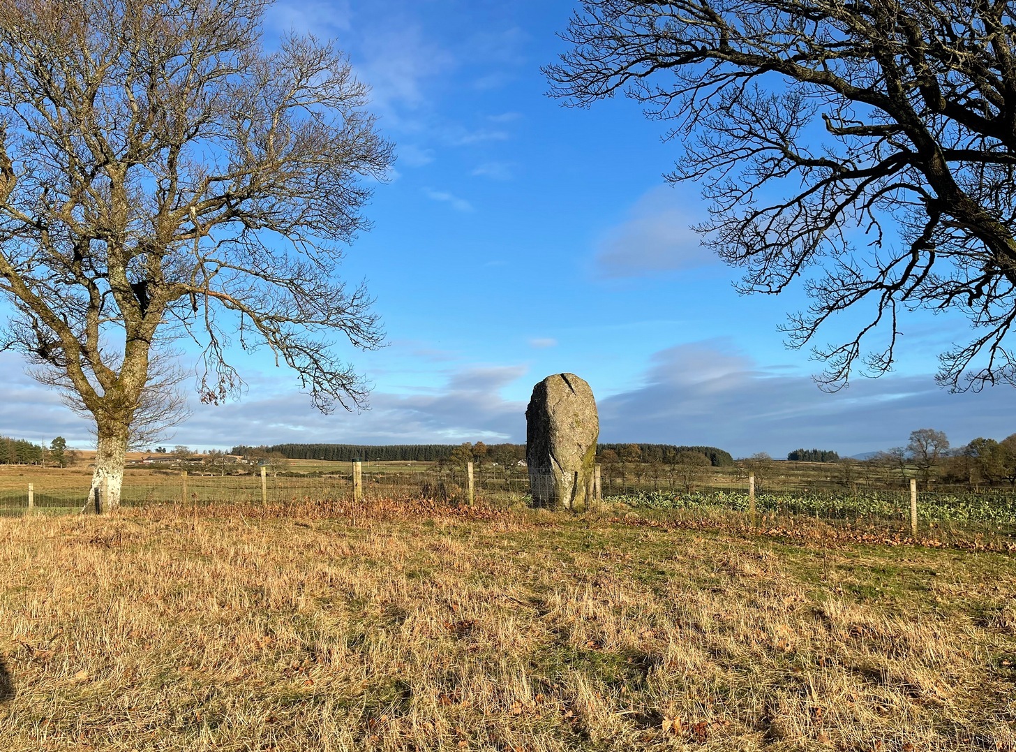
Travel along the B867 road from Bankfoot to Dunkeld (running roughly parallel with the A9) and you’ll reach the hamlet of Waterloo about one mile north of Bankfoot. As you approach the far end of the village, keep your eyes peeled for the small turning on your left and head up there for just over a mile. The road runs to a dead end at Meikle Obney farm, but shortly before reaching there you’ll pass this large standing stone on the right-side of the road, just along the fence-line. It’s almost impossible to miss!
Archaeology & History
This is one of “the large rude upright stones found in the parish” that William Marshall (1880) mentioned briefly, amidst his quick sojourn into the Druidic history of Perthshire. It’s an impressive standing stone on the southern edges of the Obney Hills that doesn’t seem to be in its original position. And it’s another one that was lucky to survive, as solid metal staples were hammered into it more than a hundred years ago when it was incorporated into the fencing, much like the massive Kor Stone 6½ miles south-west of here.
Site shown on 1867 mapWitch’s Stone at roadside
Shown on the first Ordnance Survey map of the area in 1867, its bulky 6½-foot-tall body stands all alone on this relatively flat plain, with open views to the east, south and west. It gave me the distinct impression that it was once part of a larger megalithic complex, but I can find no additional evidence to substantiate this. Call it a gut-feeling if you will. Intriguingly, the closest site to this are two standing stones just out of view literally ⅔-mile (1.07km) to the northeast, aligned perfectly to the Witch’s Stone! Most odd…
Folklore
The story behind this old stone is a creation myth that we find all over the country, but usually relating to prehistoric tombs more than monoliths. The great Fred Coles (1908) wrote:
“the common legend is told of a witch who, when flying through the air on some Satanic behest, let the Stone fall out of her apron.”
Marshall, William, Historic Scenes in Perthshire, William Oliphant: Edinburgh 1880.
Stewart, Elizabeth, Dunkeld – An Ancient City, Munro Press: Perth 1926.
Acknowledgements:Huge thanks for use of the Ordnance Survey map in this site profile, reproduced with the kind permission of the National Library of Scotland.
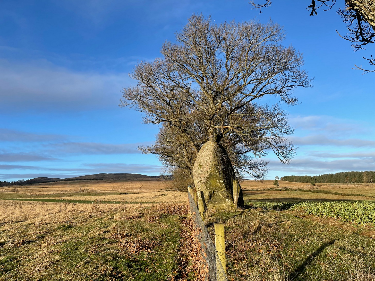
Take the tiny long winding B8063 road that runs west off the A9 at Luncarty, meandering eventually to the entry of the Sma’ Glen. If you’re coming via Luncarty, after going west for 8 miles (12.9km) you pass the hamlet of Harrietfield and just a few hundred yards further a dirt-track on your right goes uphill to Milton. If you’re coming via Crieff/Sma’ Glen direction, along the B8063 road, cross the Bridge of Buchanty and after nearly 3 miles (4.7km) just past a bit of a hairpin, you’ll see the track up to Milton on your left. Walk up, past all the newly modernised houses and go through the gate, bearing right where, in the field on your right (thru another gate) you’ll see this big fella standing alone 200 yards to the east along the fence-line.
Archaeology & History
Looking N to Crochan Hill
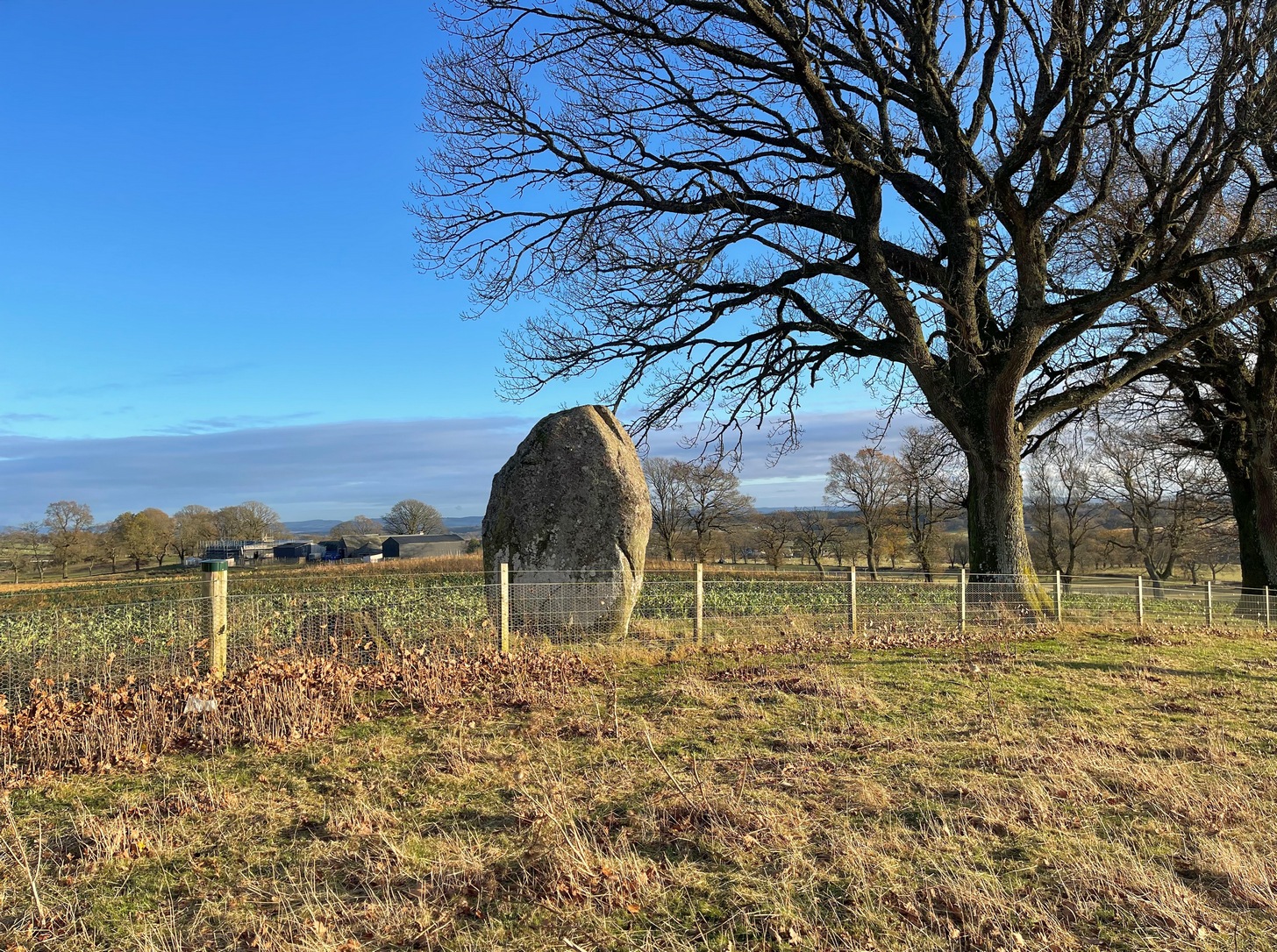
This is a bit of a hidden beauty! Standing nearly ten feet tall on the crest of an elongated ridge with the land ever so gently declining either side of its proud stand, it beckons the impression of partners long since gone (or something truly olde)… and so it proved to be. Very little has been written about the place, despite its impressive stature. It seems to have been described firstly in J.W. Thomson’s essay on the local parish in April 1837 (subsequently published in the NSA in 1845) where, ascribing it as usual to the druids of olde, he told that,
“at the western extremity of Logiealmond, there is one remarkable block about 12 feet high and 18 feet in circumference, standing upon its narrow end, with three other stones in its immediate vicinity. It is commonly called the Kor Stone.”
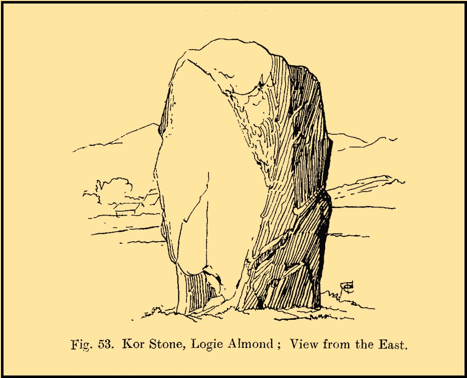
Kor Stone, looking SEFred Coles’ 1911 sketch
William Marshall (1880) also mentioned these three additional standing stones, saying that they were “apparently part of a row.” But they are long gone and we know not what became of them. They were probably uprooted and included in some of the nearby walling or buildings (quite a lot of suspicious-looking stones scatter the edges of many fields around Logiealmond). If we look closely at the surface of our Kor Stone, in earlier times someone has fixed metal loops into the monolith to make it part of an early fence or gate.
The stone was highlighted on the 1867 OS-map of the area and described in the accompanying Name Book,
“Carse” Stone on 1867 map
“A stone about ten feet high, supposed by some people to be the remains of a Druidical Circle, by others to be a mark on a division of lands: in support of the latter supposition they bring forward the fact of a large stone at Dunkeld and one near Fowlis – both similar to this one – and The Carse Stane being in the same straight line.”
The great Fred Coles (1911) also gave the place his attention, but apart from a brief description of its size and position, he found no additional lore about the other three stones, telling us simply:
“It is an imposingly large and erect block of rugged whinstone, 9 feet 9 inches in height, with a basal girth of 15 feet 10 inches, but at about midway of its height the girth increases to fully 17 feet. The view…shows the Stone as seen from the east.”
In truth, the location of this giant stone on the ridge strongly suggests it was once part of a much greater megalithic neolithic monument. But whatever that might have looked like, we may never know. It’s an awesome site though. Well worth checking out if you’re in the area.
Finlayson, Andrew, The Stones of Strathearn, One Tree Island: Comrie 2010.
Marshall, William, Historic Scenes in Perthshire, William Oliphant: Edinburgh 1880.
Thomson, J.W., “Parish of Moneydie,” in New Statistical Account of Scotland – volume X: Perth, William Blackwood: Edinburgh 1845.
Acknowledgements:Huge thanks for use of the Ordnance Survey map in this site profile, reproduced with the kind permission of the National Library of Scotland.
Stone Circle (destroyed): OS Grid Reference – NO 220 416
Archaeology & History
In the first volume of the Royal Society’s Committee on Boulders (yes, there was such a thing!) that was read in April 1872, a megalithic ring was described that stood on the north side of the River Isla, above Coupar Angus. It was told that the minister of Bendochy, Dr Barty, reported to the committee, that
“on the rising ground behind his manse, there was a circle of large stones, boulders, standing on their ends (Druidical); but some years ago they were removed. The place is yet called ‘The Nine Stanes.'”
Despite its destruction, in recent times aerial photography has identified a number of features in the field above the manse, including what seems to be an enclosure and some disc-shaped cropmarks. One of these may be the shadow marks of the circle.
References:
Home, David Milne, First Report by the Committee on Boulders, Royal Society Edinburgh 1872.
Standing Stone (destroyed): OS Grid Reference – NO 483 603(approximation)
Archaeology & History
In an area once teeming with megaliths, this is but one that lost its life in the 19th century. It would seem that the only reference of its existence—and demise—comes from the pen of the great regional historian Andrew Jervise (1853) who, in a description of the nearby holy well of St Ninian, in a field near Wellford,
“within the last half century there were two or three large rude boulders nearby, which were called Druidical stones.”
References:
Jervise, Andrew, The History and Traditions of the Land of the Lindsays in Angus and Mearns, Sutherland & Knox: Edinburgh 1853.
Coming from Harrogate, take the B6162 and B6161 road to Beckwithshaw, through the village and, 4-500 yards on, turn right onto Norwood Lane. 2 miles along, keep your eyes peeled on your left for a gravelled parking spot and you’ll see the large rock outcrop 200 yards south of the road. …Otherwise, from Otley: go over the river bridge and turn right up Farnley Lane and follow the B6451 for a few miles, thru Farnley village up the Washburn valley, past Norwood and at Bland Hill, turn right along Broad Dubb Road for 1¾ miles where you’ll reach that same gravelled parking spot.
Archaeology & History
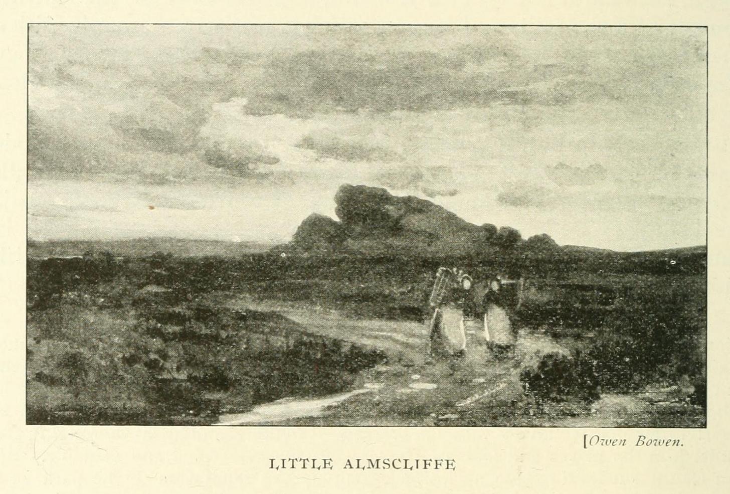
Very much the ‘little brother’ of Great Almscliffe, 3 miles (4.83km) to the southeast, this site would be more of interest to the travelling geologist, perhaps, than to antiquarians. But that depends what tickles y’ fancy I s’ppose.
In 1702 when the northern antiquarian Ralph Thoresby mentioned this and its big brother to the southeast, he described the “two famous crags of Almes Cliff—in some old writings called Aylmoys ut dicitur—but have seen nothing memorial of it, saving its remarkable lofty situation.” He missed the cup-and-ring carving on the east-side of the crags, obviously, which indicates that it had some form of animistic sanctity in ancient times.
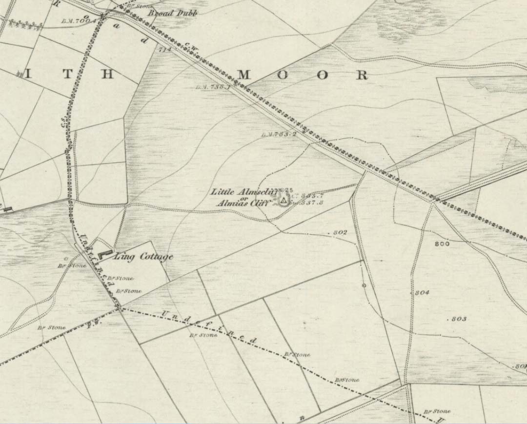
The location on 1851 mapLittle Almscliffe c.1900
Little Almscliffe was one of many impressive places located within the ancient Forest of Knaresborough; and although it wasn’t on the original boundary line, a perambulation (i.e., annual ritual walking to the old stones, trees and wells defining the region) of the area written in 1770, in what Mr Grainge called “the Copyhold Forest”, was undertaken by the Enclosure Commissioners. It differed from the more ancient perambulation rite, in that the newer one included a mention of,
“five bounder stones also marked F to an earth-fast stone, lying northeast of Little Almes Cliffe, marked also with an F; (and) from thence by other four bounder stones marked F to Sandwith Wath…”
The letter ‘F’ here signifying the word ‘forest’, as in the Forest of Knareborough.
William Grainge (1871) also believed these crags to have been a place of druidic worship. He wasn’t the only one. Many other writers of the time thought the same thing; and although we have no concrete evidence to prove this, it is highly likely that these rocks would have served some ritual purpose in pre-christian days. Certainly in more recent times (during the 1980s and ’90s) we know that ritual magickians used this site for their workings. On a more mundane level, the crags were previously used as a site for for beacon fires. One was erected here in 1803 when the first Bonaparte threatened to invade England; but I can find no written accounts of earlier beacons here.
References:
Bennett, Paul, The Old Stones of Elmet, Capall Bann: Milverton 2001.
Bogg, Edmund, From Eden Vale to the Plains of York, James Miles: Leeds 1895.
Bogg, Edmund, Higher Wharfeland, James Miles: Leeds 1904
Cowling, E.T., Rombald’s Way, William Walker: Otley 1946.
Grainge, William, History & Topography of Harrogate and the Forest of Knaresborough, J.R. Smith: London 1871.
Parkinson, Thomas, Lays and Leaves of the Forest, Kent & Co.: London 1882.
Chambered Cairn (destroyed): OS Grid Reference – H 277 998
Archaeology & History
Included in Eamon Cody’s (2002) magnum opus, this site has long since gone. It was highlighted on the 1845-47 OS-map of the area and the only subsequent information about it was written in the 1903 Ordnance Survey Name Book, where it was described as a “supposed Giant’s Grave” that was marked by a large spread of boulders.
Perhaps the only thing we can ascertain here is from the name Giant’s Grave. Invariably, giants are part and parcel of creation myths in early traditional societies. Such giants, as well as being huge mythical creatures, can also be the progenitor of tribes and communities, i.e., the person who laid the initial foundation of where the tribe came to live, usually an early queen, king or shaman figure. So, in the case of this Giant’s Grave, it was likely to have been known as the burial place of such a figure: mythical in importance as well as size.
References:
Cody, Eamon, Survey of the Megalithic Tombs of Ireland: Volume VI – County Donegal, Duchas: Dublin 2002.
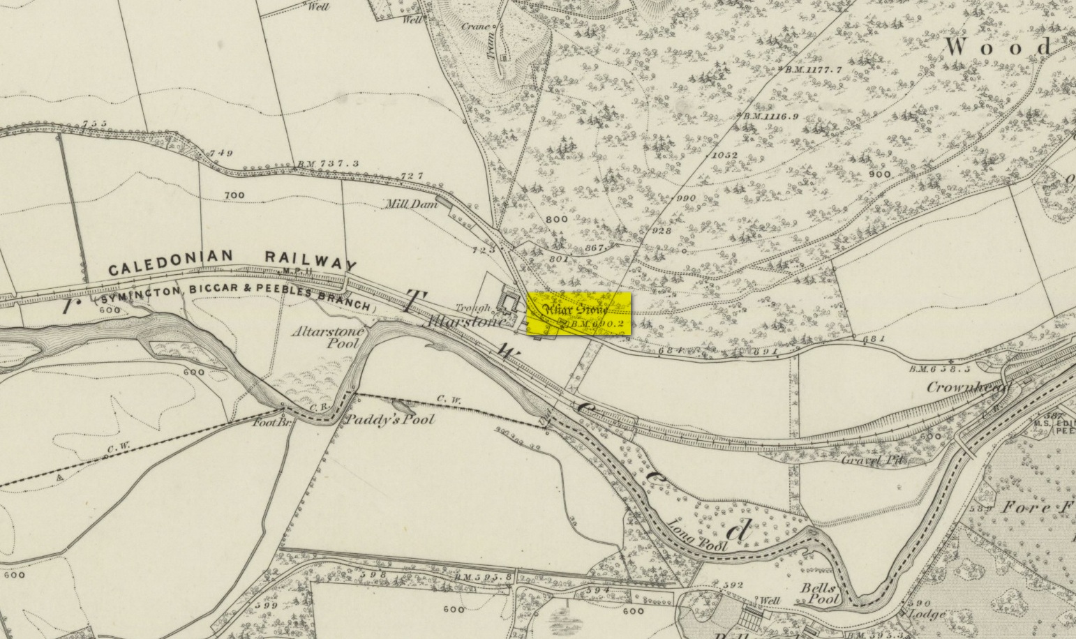
Various ways to get here. From Peebles take the A72 road west to Kirkurd, but after 4 miles turn left onto B712. Several miles down, go past Stobo village and before crossing the bridge over the River Tweed, turn left up minor road leading to Dreva and Broughton. The track into Altarstone Farm is about a mile along and the stone is across the road from there. The other way is going south along the A701 from Broughton village, where you take the left turn towards Stobo. Go along here for just over 3 miles where you reach the woodland (park here where the small track goes into the woods). A coupla hundred yards further along is Altar Stone Farm on your right and the stone is above the verge on your left.
Archaeology & History
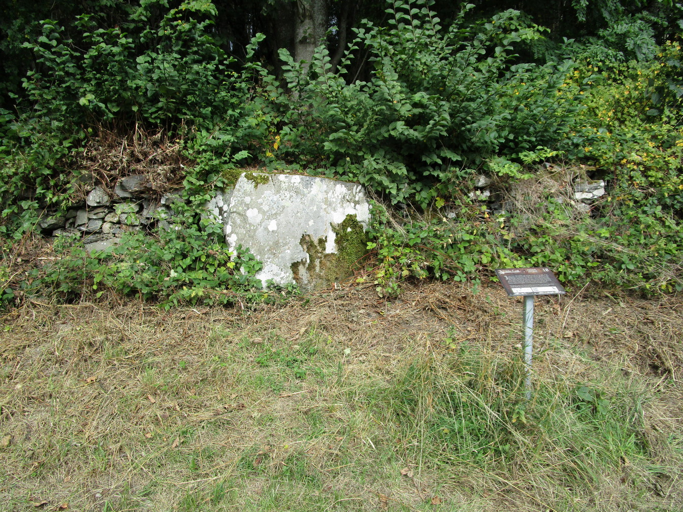
Altar Stone, Stobo
Archaeologically speaking, there’s nowt much to say about this site apart from the usual tedium of its measurements and the rock-type. I’ll give the latter a miss, but the stone stands at nearly five feet high and nearly as broad; with its upper face relatively smooth and the top of it pretty flat. A section from the top of this stone was cut and sliced off a few centuries ago and this was said to have been taken to Stobo church a few miles away, where it was fashioned into a stone font for baptisms. If this is true, then it’s possible that this was once an authentic prehistoric standing stone, but we’ll probably never know for certain. Also on top of the stone you can see a number of geophysical scratches, one of which looks as if it may have been worked by human hands and which has some relevance to the folklore of the stone.
It is shown on the 1859 OS-map of the area and was mentioned in the Ordnance Name Book where they told how it was “supposed to have formed the Altar of a druids Temple or some such object,” but they could find no local verification of such lore at the time of their visit… or at least, no one was telling them anything about it…
Folklore
This fascinating bit of rock—or possible sliced standing stone—is of note due to its association with that old shaman of shamans known as Merlin! Near the end of His days, when He’d truly retired from the world of men and wandered, they say, mad amidst the great lowland forests, an old christian dood by the name of Kentigern—later known as St Mungo—who’d been trying to convert our old magickian away from the animistic ways of Nature. Legend says that He succeeded. The old Scottish traveller Ratcliffe Barnett (1925) wrote:
“Merlin is the real genius of Drumelzier. Dumelzier means the Ridge of Meldred, a pagan prince of the district. And it was Meldred’s shepherds that slew Merlin the bard. The heathen bard was present at the battle of Arthuret in the year 573, when the christian army gained a victory over the Heathen Host. Merlin fled to the forest of Caledon at Drumelzier and there ever after the old Druid spent his life among the wild hills with a repute for insanity. This poet priest was doubtless heart-broken at the defeat of his pagan friends. The old order was changing. But the christian king had brought his friend, St Kentigern or Munro, to preach the gospel in upper Tweedside at Stobo. One day Kentigern met a weird-looking man and demanded who he was. “Once I was the prophet of Vortigern (Gwendollen). My name is Merlin. Now I am in these solitudes enduring many privations.”
“So Kentigern preached the gospel to the old nature worshipper and won him to Christ. Up yonder, at the east end of the Dreva road, you will find the rude Altar Stone where, it is said, Kentigern received the Druid into the christian church and dispensed the sacrament. But in those dark days of the faith, the Druids and their pagan adherents fought hard against the new religion. So immediately after the admission of Merlin to the Church, the shepherds of Meldred sought him out, stoned him to death on the haugh of Drumelzier, and there, where the Powsail Burn falls quietly into Tweed, Merlin the Martyr was buried. For long his grave was marked by a hawthorn tree.”
These shepherds were said to have stoned him and then threw his body upon a sharp stake and then into the stream. (stone – wood – water)
If there is any hint of truth in this tale, it is unlikely Merlin would have given himself over to the christian ways unless—as any shaman would—he knew of his impending death. In which case it would have done him no harm to pretend a final allegiance to the unnatural spirituality that was growing in the land. But whatever he may have been thinking, it is said that this Altar Stone was where he made such a deed.
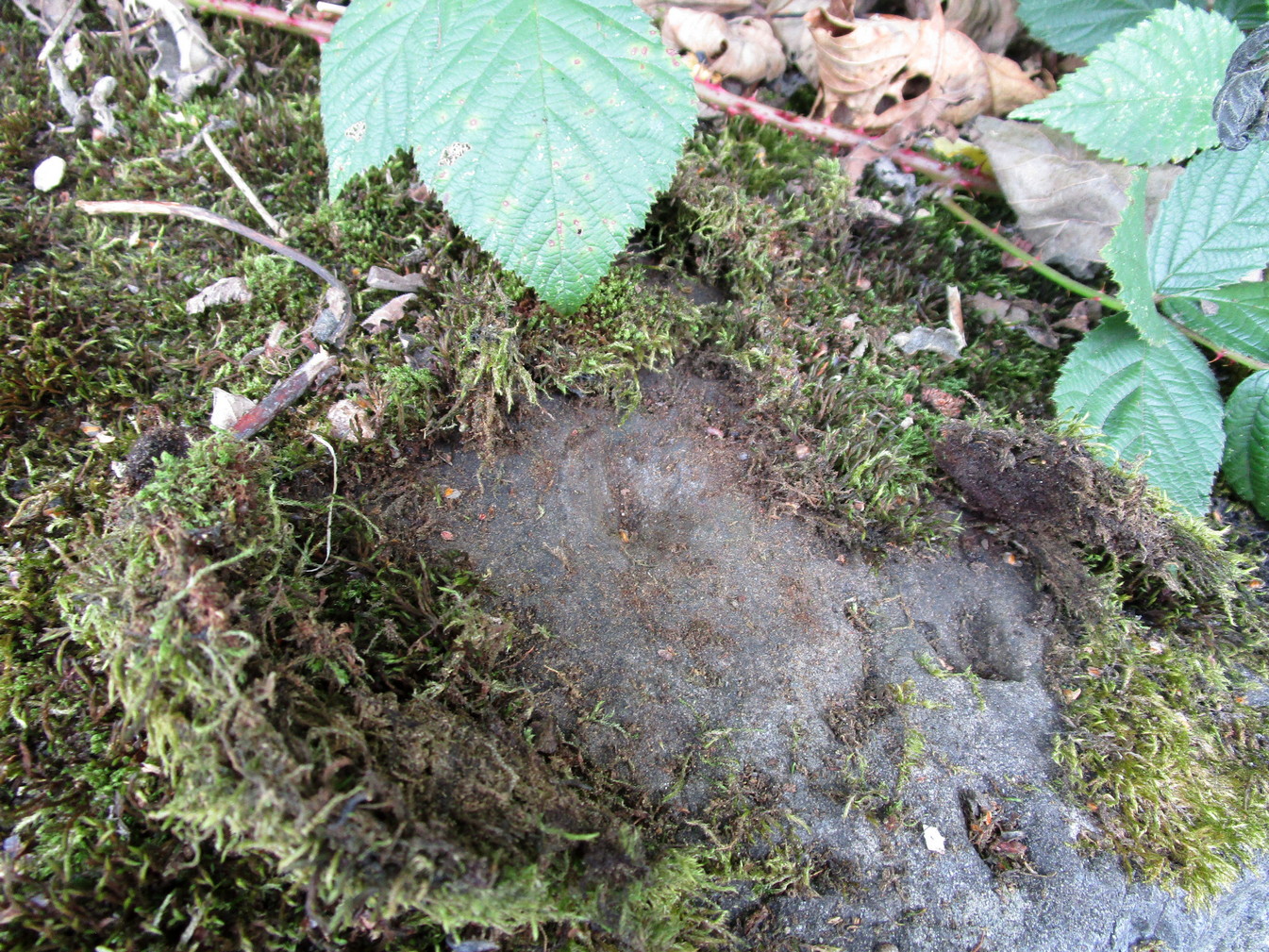
Scratch-marks of the mythic hareAltar Stone, Stobo
An equally peculiar legend—variations of which are found at a number of places in the hills of northern England and Scotland—speaks of another shamanic motif, i.e., of humans changing into animals and back. For here, legend tells, an old witch was being chased (by whom, we know not) across the land. She’d turned herself into the form of a hare and, as she crossed over the Altar Stone, her claws dug so deeply into the rock that they left deep scars that can still be seen to this day. From here, the hare scampered at speed downhill until reaching the River Tweed at the bottom, whereupon transforming itself back into the form of the witch, who promptly fled into the hills above on the far side of the river.
One final thing mentioned by Barnett (1943) was the potential oracular property of the Altar Stone:
“You have to only place your hand on top of this rude altar, shut your eyes, and if you have the gift you will see visions.”
References:
Ardrey, Adam, Finding Merlin, Mainstream 2012.
Barnett, Ratcliffe, Border By-Ways and Lothian Lore, John Grant: Edinburgh 1925.
Buchan, J.W. & Paton, H., A History of Peeblesshire – volume 3, Glasgow 1927.
Crichton, Robin, On the Trail of Merlin in a Dark Age, R. Crichton 2017.
Glennie, John Stuart, Arthurian Localities, Edmonston & Douglas: Edinburgh 1869.
Moffat, Alistair, Arthur and the Lost Kingdoms, Phoenix: London 1999.
Rich, Deike & Begg, Ean, On the Trail of Merlin, Aquarian: London 1991.
Wheatley, Henry B., Merlin, or, The Early History of King Arthur – 2 volumes, Trubner: London 1865.
Acknowledgements: Big thanks for use of the 1st edition OS-map in this site profile, Reproduced with the kind permission of the National Library of Scotland.
Chambered Cairn (destroyed): OS Grid Reference – C 003 396
Archaeology & History
In unpublished Notebooks written by one Thomas Fagan during the years 1845-48 (held by the National Archives in Dublin), he wrote how a local man had told him of the existence of “a supposed Druid’s Altar” in Claggan township, but its precise location has never subsequently been established. In Eamon Cody’s (2002) magnum opus he told what little we know about the place, saying,
“It stood on a slight rise adjoining Claggan Upper, the name assigned to a group of houses in the townland. It was reportedly encircled by “a wall or parapet” and consisted of several large upright stones2-4 feet high and arranged in two rows of few feet apart with a pillar at either end.”
The structure had been completely destroyed just a few years before Fagan’s visit to the place and no further information of it has yet been uncovered.
References:
Cody, Eamon, Survey of the Megalithic Tombs of Ireland: Volume VI – County Donegal, Duchas: Dublin 2002.