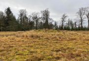
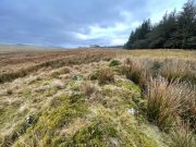
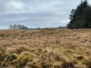
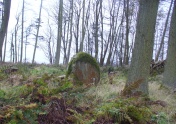
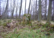
Easter Coillechat, Kilmadock, Stirlingshire

Cairn:  OS Grid Reference – NN 68830 04347

Getting Here

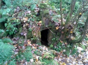
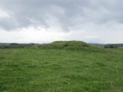
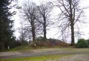
The cairn, looking NW

From Doune, take the A84 road to Callander.  As you pass through the hamlet of Buchany, keep your eyes peeled a few hundred yards on as the road dips down and swerves gently right, for the road sign of Drumloist (or Moist as some locals keep amending!) which goes up to the right.  It’s a small single track road that zigs and zags slowly uphill.  After exact one mile you reach a small track on your right (there one left too).  Carefully park hereby (don’t block the gate!).  Across the road, go through the gate on your right and walk along the edge of the field until you reach the burn.  Go across it, and then across the field, through the gate and you’ll see it ahead of you.  In the tick season (summer) treat the brackens as possessed by a plague and avoid it!

Archaeology & History

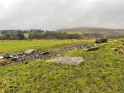
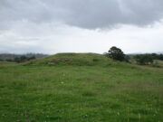
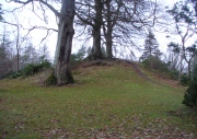
Looking at its stony face

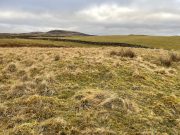
A curiously forgotten place, hidden from sight, this large rounded grass-covered mound with small upright stones around one side, seems timeless amidst the open fields.  It seems alone, but the denuded chambered tomb of Ballachraggan is just visible 1.4 miles to the northwest on the near-horizon; and there’s a hidden cairnfield just a half-mile away.  This cairn measures 18 yards (N-S) by 16 yards (E-W) and stands 7-8 feet high when you look at it from its southern side.  The top of the mound is a mix of stone and grass with a slight dip in the middle, perhaps by someone in ages past digging, albeit only slightly—perhaps scared away by the old folk buried herein.

One of the most notable aspects of this site is the complete silence.  On my last two visits hereby, a fusion of mists from the low cloud above and the breathing Earth below gave an atmosphere the likes of which lived when this tomb was first built.  On one occasion hereby, no vehicles for several hours gave the silence a curious atmosphere (those of you who like sitting in the rain with the wilderness will know what I mean).  To me this is a gorgeous site…

© Paul BennettThe Northern Antiquarian

Ellen’s Well, Blair Drummond, Stirlingshire

Healing Well:  OS Grid Reference – NN 7196 0080

Getting Here

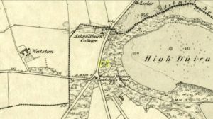
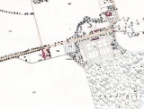
Ellen’s Well on 1856 map

This takes some finding!  From the village of Doune take the A84 road towards Stirling and, just over the bridge barely 100 yards along, on your left, walk down the track past the old lodge house.  350 yards along, up the slope on your right where young trees and an excess of boscage prevails, walk up through it until, about 10 yards below an overgrown path at the top, beneath a raised section of old stonework, an old pipe protrudes from the undergrowth.  The small spring of water that emerges 10 yards beneath this, amidst the brambles and reeds, is what you’re looking for.

Archaeology & History

Wells named ‘Ellen’ usually have a long and sacred history behind them, but this one seems unusually silent.   Apart from being shown on the 1866 OS-map—simply as a ‘Well’—it is only mentioned briefly in Mr Mackay’s (1953) survey of Doune, being not far from the Clans Well, and in his day it was “still in use.”  But not anymore!  The water is barely running, but the trickle that still exists is nice and clear and it tastes good.  It’s seen much better days though….

‘Ellen’s Wells’ tend to have one of three origins, being either 1) dedicated to St Helen, whose festival date is August 18; (2) named after or dedicated to the Elder tree (Sambucus niger); or, (3) named after a local person of this name.  At some wells it may be two of these elements with their relative mythologies complimenting each other, overlapping between heathen peasant lore and early christian folklore. This has been the case at a number of St Helen’s Wells I’ve surveyed in Yorkshire and Lancashire.  At this site however, there are no remaining Elder trees, meaning that its name relates to one of the two other options; but without any extant historical references to St. Helen hereby, we must conclude that at some point in the dim and distant past, a local lady called Ellen found her name immortalized in this all-but-forgotten sweet spring.

References:

  1. Mackay, Moray S., Doune Historical Notes, privately printed: Doune 1953.

Acknowledgements:  The map accompanying this site profile is Reproduced with the kind permission of the National Library of Scotland

© Paul BennettThe Northern Antiquarian


Chapel Well, Cambusbarron, Stirlingshire

Holy Well:  OS Grid Reference – NS 7781 9251

Also Known as:

  1. Bruce’s Well
  2. Canmore ID 46248
  3. Christ’s Well

Getting Here

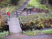
Site of the Chapel Well

Site of the Chapel Well

Along the Main Street in Cambusbarron, walk down Mill Hill for a hundred yards or so, to The Brae.  Just here, a paved footpath goes to the right.  Walk along here for about 120 yards until you reach a small footbridge crossing the stream.  On the other side of this bridge you’ll notice a notice board and a sign.  You’re here!

Archaeology & History

Today, all that remains of this spring of water that was sacred in the animistic pantheon of our ancestors, is a notice board and an epitaph, reading “Site of the Chapelwell (or Christ’s Well)”; but in times past this simple spring of water was a place of considerable activity.  Not only did the local people of Cambusbarron get their water supply from this (and others close to the Main Street), but it was also a place of ritual and reverence.  We know this from early church accounts—most of which were complaints about the traditions performed by local people, in contravention to the christian cult.

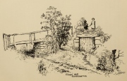
J.S. Fleming's old drawing

J.S. Fleming’s old drawing

The best account of the site is found in J.S. Fleming’s (1898) work, in which we find it also referred to as the ‘Christ’s Well’.  This attribution adds further mystery and controversy regarding another Christ’s Well a few miles away at Blair Drummond, whose position by the academic community is questioned by local historians.  Be that as it may, Mr Fleming’s words on this Chapel Well are worth reading.  He wrote:

“the most famous of all the Stirling Holy Wells, was, early in this century and is still, known by the name of ‘Chapel Well,’ and its water, up till a recent date, was used for domestic purposes by the villagers.  It originally consisted of a square, stone-built, open well, with parapets, but its walls are now built up and roofed, and it has a door, now shut up, however, and the well closed by the sanitary authorities of the district.  The well is situated on the brink of what we assume to be Glenmoray Burn, here crossed by a rustic wooden bridge in a part of the Chapel Croft garden, containing the alleged site of the chapel, from which it is distant a few feet.  The stump of an ancient thorn is shown on the right hand of the sketch.  The overflow of water empties itself into the adjoining burn.  The site of this famous well has been so variously described as to almost challenge its identity, but the authorities examined, all, with one single exception, afternoted, virtually agree in its situation:

“1) Sutherland, about a hundred years ago, writes:  “Not far from St. Thomas’ Well there is another, on the farm of Chapel Croft, called ‘Christ’s Well,’ of great repute, and visited by women, etc.”

“2) Dr. Rogers, later, after referring to the Chapel of Cambusbarron, says ”two of the three wells connected with the establishment still exist near its site by the margin of Glenmoray stream.”

“3) Another writer says: ‘”Christ’s Well,’ now called ‘ Chapel Well,’ is at bottom of a small dell called Glenmoray, immediately adjoining Cambusbarron, and there is a tradition that here the water was got for the religious services at the Battle of Bannockburn, one redeeming quality of the superstition which would consecrate its water.”

“4) A writer, over the initials “S.I.,” in the Stirling Observer of 27th September, 1866, says:  “Within its Chapel King Robert the Bruce partook of the sacrament on the eve of the Sabbath preceding the Battle of Bannockburn, and its sacred font was the resort at Beltane of the superstitious of a former age, as may be seen from extracts from kirk session records.”

“These all agree that ‘Christ’s Well’ was situated not far from St. Thomas’ Well, on Chapel Croft; that it and other two wells existed some few years ago near the site of the Chapel, on the margin of Glenmoray stream, by the name of “Chapel Well”; ” is situated in a small dell called Glenmoray, and is immediately adjoining Cambusbarron; and that it retains, and is presently known by, no other name than the “Chapel Well.”  Further, a small distillery, now removed, situated a few yards from the Chapel on this burn, taking its name from the glen and burn, was called Glenmoray Distillery…”

“However, a writer in the Stirling Observer of 7th September, 1871, in an article on “Touch Glen,” says that not far from the road leading to the three reservoirs on Touch Hills, two of the three Wells connected with the Chapel (which, he states, is 1000 yards distant from Gartur Lodge) still exist, and may be seen near the brink of a little burn which trickles from the miniature glen of Glenmoray, visible on the hillside just below the lowest reservoir. This burn is crossed by a small stone bridge on the main road, and is known as “Johnnie’s Burn.” These Holy Wells, including Chapel Well, would thus, according to this writer, be about a mile, if on “Johnnie’s Burn,” and if near the lower reservoir, on Touch Hill,’ fully a mile and a half from Chapel Croft and the Chapel…

“…The Church dealt severely with the devotees—principally women—who resorted to the virtues of “Christ’s Well,” as is shown by the session records, from which we make a few extracts: —

“July 12, 1610. — The quhilk day compeirit Grissal Glen and Marioun Gillaspie quha for ther superstitione in passing in pilgrimmage to ‘Christe’s Well’ as they confessit the last day ar ordeinit to mak publick repentance the next Sonday in lining claithis.”

” 1 June, 1630. — The quhilk day compeirit Elspet Aiken, spous to Anclro Cuyngham, tinckler; Jonet Harvie, William Huttoune, cutler; Margaret Mitchell, dochter to Alex Mitchell; Jonet Bennet, dochter to James Bennet, cuick; James Ewein, son of John Ewein, wobster, Margt. Wright, James Watsoune, who confessis passing in pilgrimmage to ‘Christe’s Well’ in Mai, and thairfoir they ar ordeaned to mak publik repentance the nixt Sabbat in thair awin habeit, under the paine of disobedience.”

” Lykway I, Mr. Patrik Bell, am ordeaned to desyre the breithren of the Presbyterie to appoint ane actuale minister for to preach upon Sonday nixt for to tak ordour with the said persounes above writen.” (Note — This offence seems a mere ploy of young people observing May morning, as is done at the present day on the first of May, and the responsibility “of asking” an “actual minister’s aid” to take “order” with the accused seems treating the offence too seriously.)

“6 October, 1631. — The quhilk day compeirit Jonet Norbell, in Cambusbarron, for going for water to help her sick son; and Jonet Main, in Cambusbarron, going to ‘Christe’s Well’ for water for help to her bairns; “and for another offence are ordained” to sair the pulpit on Sonday nixt in her ain habit to mak repentance.”

Mr Fleming seemed to think the traditions of Mayday a healthy thing and wrote well of local traditions, speaking of the healing virtues of the dew on May morning, used by people all over the country; also remembering a song that would be sung in honour of “the delightful custom of maying”:

I, been a rambling all this night,
And some time of this day ;
And now returning back again,
I brought you a garland gay.

Why don’t you do as we have done
The very first day of May ?
And from my parents I have come,
And would no longer stay.

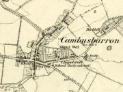
Chapel Well on 1865 map

Chapel Well on 1865 map

Modern plaque at the site

Modern plaque at the site

The fact that Mr Fleming cites the Chapel Well to be known locally as the ‘Christ’s Well’ needs to be remembered when you visit a site of the same name 5 miles northwest of here at Blair Drummond.  It was a place of considerable renown and much used by local people for a variety of indigenous rites and customs for many miles around.  The ancient Scottish practices were still very much alive…

References:

  1. Fleming, J.S., Old Nooks of Stirling, Delineated and Described, Munro & Jamieson: Stirling 1898.
  2. MacKinlay, James M., Folklore of Scottish Lochs and Springs, William Hodge: Glasgow 1893.
  3. Morris, Ruth & Frank, Scottish Healing Wells, Alethea: Sandy 1982.
  4. Roger, Charles, A Week at Bridge of Allan, Adam & Charles Black: Edinburgh 1853.

© Paul BennettThe Northern Antiquarian


Caravan Park, Blair Drummond, Stirlingshire

Tumulus:  OS Grid Reference – NS 7253 9906

Also Known as:

  1. Canmore ID 46065
  2. Old Farm

Getting Here

Caravan Park burial mound

Caravan Park burial mound

Along the A84 Stirling-Doune road, watch out for the minor Cuthill Brae road to the caravan park. Go up and into Blair Drummond caravan park (ignore the old grumpy southern-type fella who tells you “this is private”), right into and through the walled area where the caravans are situated.  Out the other side is a children’s playground— and the very large mound to your left with a tree on top (and a children’s slide built on it) is the burial mound in question.

Archaeology & History

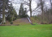
Tumulus from the southeast

Tumulus from the southeast

This comes as something of a surprise when you first set eyes on it.  It’s big! (bigger than I expected anyway!)  Seemingly on its own, rising from the level ground and surrounded by cultivated land, there were probably others of its kin close by, but the closest that we know about is 1.5km to the east; although the standing stone of Boreland Hill a few hundred yards west might have had some relevance….

This tumulus may be the one noted by Charles Roger (1853) in his visit to the area.  He spoke of the now denuded burial mound to the east (in the Safari Park), but also told that,

“Within the park are two other tumuli, one situated in the garden, of a conical form and measuring 92 yards in circumference and about 15 yards in height…”

Blair Drummund tumulus on 1866 OS-map

Blair Drummund tumulus on 1866 OS-map

This mound is more 15 feet in height than yards, but the other measurement is close—and it does seem to be in the right area.

There is much greater certainty in J.G. Callander’s (1929) account.  He was fortunate in being part of the excavations undertaken here by Sir Kay and Lady Muir in 1927-28 and gave a damn good account of what went on:

“The mound is not quite circular, as it measures about 75 feet in diameter from north to south and about 65 feet from east to west, its height being about 15 feet.  Before the excavations were started it seemed as if the monument consisted entirely of earth, but before the examination was completed it was found that it contained a small cairn of stones, heaped over a grave formed of large slabs arid boulders which undoubtedly was the primary interment.

“Commencing at the south-south-eastern edge of the mound, a trench driven in towards the centre, revealed the presence of a short cist which had apparently been disturbed at some previous time.  A large block of stone formed the northern end and a large slab the east side.  A smaller slab lay at the south end and another on the west side, but as the latter was too short to fill the space, a larger slab lay obliquely between it and the large stone at the north end.  There was no appearance of a cover stone.  The length of this grave was 3 feet 3inches, its breadth 3 feet, and its depth 2 feet 3 inches.  The longer axis lay practically north and south.  No traces of human remains or relics of any sort were found here.  This was evidently a secondary burial sunk into the mound as far as the original surface of the ground, and covered with about 4 feet of soil at the centre.

“As the trees interfered with further excavations at this part, another trench was cut in from the northern arc as far as the centre of the mound, where an undisturbed cist, formed of large rough slabs and a cover stone, was encountered.  Although this grave was considerably larger in length, breadth and depth than any of the numerous short cists that I have examined, I think it should be classed with them rather than with the large cist-like chambers sometimes found in long cairns.  It was formed of two side and two end slabs.  The sides were roughly parallel, but the slab at the southern end was placed obliquely so that the length of the grave was 4 feet 6 inches on the east side and 4 feet on the west side. The general breadth was 3 feet at the floor, and the depth 4 feet.  Both side slabs converged towards the top.  As the slabs on the east side and at the ends were not so high as that on the west, the spaces between them and the cover stone were carefully built up with smaller stones.  A slight vacancy between the slabs at the south-east corner was filled in a similar fashion.  A small cairn of clean stones without a mixture of soil had been heaped up over the cist, covering the lid to a depth of about 9 inches: the diameter of the cairn at the base was  not ascertained.  The depth of earth above the summit of the cairn was about 8 feet.  But for a layer of a few inches of earth on the floor the cist was empty.  Nothing was found except some small unburnt fragments of human bone, very much decayed, and a few teeth.  Some small fragments of charred wood were found in making the trench and in the grave, but whether it was charred by natural carbonisation or by burning was not determined.

“In making the trench just before the grave was reached, but at a higher level, a small portion of the cutting edge of a stone axe was found.  It had no evident connection with the cist, and may have happened to be lying about amongst the soil that was piled up over the grave.

“As there remained a space on the top of the mound which could be excavated without destroying any of the trees, it was examined.  About 1 foot under the surface a cinerary urn was found in an inverted position.  The base had been crushed in, and the wall was full of cracks into which tree roots had penetrated.  On taking it out the vessel was found to have originally been about half-filled with cremated human bones.  These after examination were reinterred in the mound.  No other relics were found in the urn.

“The vessel, which is formed of buff-coloured clay with a tinge of red in places, is a cinerary urn of the cordoned variety belonging to the Bronze Age.  It is encircled at the widest part, about 3½ inches below the lip, by a raised moulding or cordon, and about 3 inches lower down by another.  The greater part of the vessel was recovered, but as the basal portion was completely crushed, it is impossible to ascertain the height of the vessel or the width of the base when complete.  It measures 10¾ inches in external diameter at the mouth and 11 inches at the widest part: what remains of the wall is 13 inches in height.  The rim, which is unusually thin for a vessel of this class, is only ⅜-inch in thickness, and it is bevelled downwards towards the interior.  The space between the upper cordon and the rim is the only part which is decorated, and here there is a row of large triangles, alternately plain and filled, with a reticulated design, bordered above and below with a single marginal line, all formed by pressing a twisted cord on the clay before it was fired.”

Protected tumulus, damaged by slide

Protected tumulus, damaged by slide

The burial mound is still in a reasonably good state of preservation… on the whole…  There is however, a slightly worrying note: this tumulus is a protected scheduled monument but despite this it has, as of late, been quite deliberately built upon.  When Penny Sinclair and I visited the nearby Christ’s Well recently (out of season), an unhelpful grumpy man working or living there told us we were “not allowed on the site – it’s private.”  We thought he was joking and I laughed that, “This is Scotland!”  He repeated his words.  A week later, Paul Hornby and I revisited the Christ’s Well and then took to see this large burial mound – only to find that a children’s play area had been built right up to, and upon, the northwestern part of the monument. This is in contravention of legal regulations to build upon Scheduled Monuments, as:

“The area to be scheduled encompasses the mound and an area around it in which traces of associated activity may be expected to survive.”

This has been violated.

If you like your prehistoric burial mounds, this is well worth having a look at.

References:

  1. Callander, J. Graham, “A Bronze Age Burial Mound at Blair Drummond, Perthshire,” in Proceedings Society of Antiquaries Scotland, volume 63, 1929.
  2. Roger, Charles, A Week at Bridge of Allan, Adam & Charles: Edinburgh 1853.
  3. Royal Commission on the Ancient & Historical Monuments of Scotland, Archaeological Sites and Monuments of Stirling District, Central Region, Society of Antiquaries of Scotland 1979.

© Paul BennettThe Northern Antiquarian


Christ’s Well, Blair Drummond, Stirlingshire

Sacred Well:  OS Grid Reference – NS 72919 98903

Also Known as:

  1. Canmore ID 46067
  2. Fountain Head

Getting Here

Christ's Well (allegedly...)

Christ’s Well (allegedly…)

Along the A84 Stirling-Doune road, watch out for the minor Cuthill Brae road to the caravan park. Go past the caravan place (ignore the grumpy fella there who tells you “this is private”) over the cattle grid and walk immediately to your right, along the top of the field, going through the first rickety gate 150 yards along.  Follow the overgrown circular woodland path around, and as you see the Safari Park and Blair Drummond House ahead of you, walk just another 100 yards or so along the path until you reach a boggy hollow in the ground with an old small building inside it. That’s it!

Archaeology & History

For a variety of reasons, this little known site hiding away and all but lost in the mythic lives of homo-profanus, is one of the most important sites in the Stirlingshire region due to it being a site where animistic rites and practices were regularly enacted by local people in the 15th century—and before, no doubt!  We know this because we have a veritable list of, albeit, ranting christian accounts from some early church records, that were thankfully transcribed at the end of the 19th century by local writer R.F. Menzies. (1899)  Despite the seemingly “christian” title given to this old well, the local people used it extensively for their magick, their traditions, their healing, their solace and their spirituality.

The waters within...

The waters within…

Before we start, it’s important to note that the geographical position stated here, in the trees at Blair Drummond, is taken from the reference at Canmore, who do not cite a literary source or oral account which affirms this to be the exact spot.  I mention this as there has been a problem regarding its exact location, not only by Mr Menzies, but also in the texts by MacKinlay (1893) and Morris (1982), each of whom said that the well was in the parish of Menteith, several miles to the west.  In Menzies (1905) history of Logie parish, a footnote is added in relation to the position of the site:

“Mr W.B. Cook considers that ‘there is no authority for saying the well was in Kincardine-in-Menteith.  An exhaustive enquiry by me has narrowed its locality down to two possible places, viz. Walton (i.e., well-town) and Bridge of Teith, both sites of pre-Reformation chapels, in the parish of Kilmadock.  It is as nearly certain as can be that Christ’s Well in Menteith was near the ancient chapel at Bridge of Teith, the remains of which—along with the well itself—are still to be seen.’”

This would therefore differ from the position presently cited by Canmore and the official records.  The ruins of the chapel described by Mr Cook were noted by the Ordnance Survey team at the Bridge of Teith when they visited in 1862 and it was highlighted on their maps four years later.  No “well” was noted however—and although we have Mr Menzies (1899) to thank for the presently accepted spot for this Christ’s Well, we don’t know for certain that this is the correct place.  The situation is made more troublesome if we refer to Moray Mackay’s (1984) definitive history of the adjacent parish of Doune.  Mr Mackay wrote his work in the early 1950s and, like other local historians, was both fascinated and puzzled about this well. He wrote:

“Many writers in the past have been content with placing this well “in Mentieth” and leaving it at that, but my curiosity was aroused by the fact that more than one reference indicated that it was ‘near to Doune,’ and I set about locating it.  It was a somewhat involved process, but I give here a resume of my findings which I published in the Stirling Observer of April 22, 1954.

“Firstly I was led to a paper of modern origin in Blair Drummond Estate Office which gave the site of Christ’s Well as ‘in the fernery at Blair Drummond.’  I found the fernery and also a rather fine well, over which a stone covering has been raised at an unknown date, and thought my quest ended. Later however…a reference in the Register of the Secret Seal, dated 1519, very strongly indicated Bridge of Teith as the site of Christ’s Well, and I was led to a very old well between the back door of the church there and the brink of the river.

“Still later I came across a pencilled note on a map in Doune Lodge Estate Office which read ‘Walton or Christwell unentailed’ as applying to a piece of ground immediately east of the Walton or Welltown site…

“There were, therefore, three alternative sites for Christ’s Well, only one of which had all the qualifications implied in the records as being (1) near Doune; (2) associated with a chapel; (3) in Kilmadock parish.  Consequently, I am convinced that the very old, dry-stone well at Bridge of Teith is, in fact, the once-famous Christ’s Well in Menteith.”
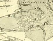
Christ's Well (as 'Fountain Head') on 1866 map

Christ’s Well (as ‘Fountain Head’) on 1866 map
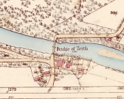
Cook & Mackay's site of Christ's Well, by the chapel

Cook & Mackay’s site of Christ’s Well, by the chapel

The site that Mr Mackay and W.B. Cook believe to be the Christ’s Well is 1.5 miles (2.43km) north of the position cited by Canmore (at NN 7221 0121).  As if to make things even more complicated, if we travel exactly 5 miles (8.05km) southeast to Cambusbarron, anothersite of the same name (later to be called the Chapel Well and associated with ancient ruins) is found!  J.S. Fleming (1898) describes it in some detail.

Carved stone dated 1690

Carved stone dated 1690

Carved stone dated 1678

Carved stone dated 1678

However, for the time being at least, if we assume that the Canmore entry is the real Christ’s Well, if you visit the place you will find an old well-house that has been built over a redirected spring of water which seems to have originally rose just a few yards to the rear of the structure.  Above the open front of the well-house—also constructed only a few hundred years ago—are placed two separate inscribed stones: one with the letters “CD ER” and the year 1690 beneath them; and above this an older stone, with the date 1678 etched on it.  These may be the dates when an earlier stone structure, whose scattered rocky edges are visible beneath the vegetation around and behind the present well-house, were demolished and then rebuilt.  But this is guesswork on my behalf!
'Standing Stone' to the rear

‘Standing Stone’ to the rear

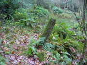
The entire structure is built inside a deep hollow which has no doubt been created and eroded into being by the spring of water itself.  On the rise at the back of this hollow is a curious standing stone which, as Penny Sinclair pointed out when we visited here a few days ago, was made out of a fossilized tree. This standing stone is only a few centuries old and either marks the original rise of the spring, or was erected at the same time of the well-house.

Less confusing were the activities performed here by local people in the 16th century—and way before that no doubt.  We have a lengthy set of accounts that describe how local people visited the Christ’s Well at the traditional dates of Beltane, Midsummer, etc, performing a variety of rites typical of those found in animistic cultures the world over. Sadly, it was the activities of the incoming christian cult that put an end to such ancient traditions by persecuting local people, as we know it has done everywhere that its virulent tendrils have infested.  Anyway, I hope that readers will forgive me citing the entire length of the accounts described by Mr Menzies (1899) about this well; but I think they give us vital insights into traditional healing practices that were just about destroyed by that corrupt institution that is the Church (for ease of reading, I’ve edited and modernized to some degree the repetitive and fragmentary language of the early written accounts):

“The brethren of the Presbytery of Stirling and various Kirk Sessions within the bounds were much exercised and troubled by frequent pilgrimages to a holy well, called Christ’s Well, situated somewhere in the neighbourhood of Ochtertyre, in the parish of Kincardine. For at least thirty years after 1581, pilgrimages were undertaken by certain people, who imagined they could obtain cures for certain diseases at this well. The wonderful thing is that tradition is dumb regarding the exact site of the holy spring.  There is a fine spring situated within the grounds of Blairdrummond, which may have been the Christ’s Well, the supposed virtue of which was, on the one hand, so consequential to the public health, and on the other, so troublesome to the Kirk.

“On 20th August, 1581, the Presbytery Record runs: ‘The brethren understands that a papist pilgrimage began of late at the Christ’s Well, and ordains every minister within their own bounds to try those persons who resort to it, and to call them before the particular Sessions that they can be convicted…’

“Two years later the evil crops up again, and on 7th May, 1583, ‘The brethren understand that a great abuse by the rascal sorts of people that pass in pilgrimage to Christ’s Well and use it for great Idolatry and superstition that are expressedly against God’s law; and because the Kings Majesty with advice of his three estates of parliament, (there shall be) certain punishments as well as corporal pains as pecuniary sums of money to be executed against such persons; and for execution of which against persons passed and to the said Well, the brethren understands my Lord of Doune Stewart of Menteith has commission given to him to that effect to see that punishment is executed in conformity with the said Act.  Therefore the brethren ordains and gives commission to Mr. Andro Zung (Minister at Dunblane), Mr. William Stirling (at Kilmadock), and Michael Lermonthe (at Kilbryde) to pass to my Lord of Doune to treat with him for execution of punishment against the persons according to the said Act and his commission.”  On 4th May, 1583, “The brethren ordains and gives commission to the brothers dwelling in Dunblane or any three of them to pass to Christ’s Well this next Saturday evening, accompanied with such persons as you may have to espy which persons comes to the said Well and report the names of such persons you can get to the brethren.’

“On 28th May, 1583, “On which day the brethren understanding that a great number of people have resorted to, and resorts in pilgrimage to Christ’s Well, using yet superstition and Idolatry expressedly against God’s law and the acts of parliament.  Therefore…the brethren ordains summons to be directed to charging of such the said persons, whose names shall be given in writing to the clerk to appear before the brethren to answer therefore, to the effect that orders may be taken with them that have been there, to the glory of God and execution of the Kings Majesty’s laws and in example of others to do the same.’

“On 4th June, 1583, “Margaret Wright in Cambus, Janet Kidstoun in Cambus, and Thomas Patersone in Black Grainge” did not appear in courtto answer “for passings in pilgrimage to Christs Well,” and were summoned the second time under pain of excommunication. On 11th June, “Janet Tailzor (spouse to Robert Cowane) in Touch, Marione Watsone in Touch, Marjorie Fargusson in Touch, Margaret Downy in Polmais,” also for the same “compeared not.” (i.e., did not appear in court, as ordered – PB)

“The depositions given in excuse referred to some disease or ailment: One, “confessed she passed there to get help for a  soreness in her side and confessed she passed about the well and prayed to Christ’s Well on Sunday and drank of the Well and washed her side with the water thereof and left behind her a  sown thread” (as offering).  Another, “passed….because she was sick in her heart and in her head and lipnit (trusted) that the Well would have helped her sicknesses…and she passed about the Well and cast the water over her shoulder and drank of it and left one piece of silver behind her.”

Ten years later several cases of pilgrimage to Christ’s Well come before the Presbytery.  22nd May, 1593, “On which day the brethren are credibly informed that Malcolme Alexander in Menstrie, James Baird at Muckart mill, and Jonet Mairschell, his spouse, passed in pilgrimage to Christ’s Well and visit superstition and Idolatry thereat. Therefore the brethren ordains them and such others who have done such like within their bounds to be summoned to answer for the same and unduly discipline them therefore under the pain of disobedience; and ordains each Minister to travel with one or two gentlemen in his parish to pass to the said Well on Saturday evening and espy what persons come there and what they do and relate the information to the minister, and see that each minister take Inquisition in his own Eldership what passes at the said Well and relate them to the presbytery.”

29th May, 1593, *On which day the summoned James Baird…to answer for passing in pilgrimage to Christ’s Well appeared in court, the said James, and confessed that through earnest persuasion of his wife (who was also moved to be there by other people), he passed with her to Christ’s Well on Saturday the 12th day of May instant, and that she two hours before the sun went down on Saturday evening drank of the said well and washed her legs and arms in it and did no fairer; he did nothing with the water, for his errand there was only with his wife who was persuaded to go there for her healing by Issobel Scotland.  He confessed that there was at the said Well this year Ewffam Wilsone in Blairhill.  Alaster Leany who was some time servant to Alexander Ezat in Culross.  He confesses that David More is he whom bears aqua-vitae and being oft times in David Fargus house in Alva, said to his wife that there was money brought to that Well…; and that Crystie cadzear in Alva confessed to him when he and his wife came home from the well, that he was three or four times at Christ’s Well and was the better, he confesses that his wife is sick and cannot come to court this day and obey the summons and therefore desires that his excuse for her may be admitted. The brethren having considered the said James Baird’s fault, ordains him to make repentance therefore in Dollar kirk as it is adjacent to him the next Sunday in secclayth (???), and that the plaintiff above written be summoned to answer for the said offence under the pain of disobedience.”

Another case falls to the ground for want of proof.  On 5th June, 1593, “One summons upon Malcolme Alschunder in Menstrie…to answer for passing to Christ’s Well and using superstition and Idolatry there at, but there is no appearance in court.  He appears on 12th June, “And denies that he passed to Christ’s Well or was bewast (to the west of – PB) Teith at any time in May, and therefore the said matter remains to be proven.” On 3rd July, “Inquisition being taken, asks if there be any witnesses that can prove Malcolme Alexander was at Christ’s Well, there is none found, and therefore it is thought good to proceed no farther against him for the said offence.”

On 14th May, 1595, James Duncansone in Fossoway, and Helen Jameson, his spouse, are charged to answer “For superstition and Idolatry in passing to Christ’s Well in pilgrimage… The said Helen confesses she passed to Christ’s Well through the year to get her bairns eye healed which was blind a month before.  She washed his eye thrice with the water thereof, and alleged that the bairn saw or he come home; and confesses that she passed there this year also to give thanks for the benefit she received the year preceding, and left a shirt of the bairns behind her, which was on the first Sunday of May…  The said James Duncansone denies that he passed to the said well with her, but only to Ochtertyre, where he was all night—well the morning that she come to him, and then they passed together to Dunblane.  The brethren finds him also culpable as his wife in her said fault, seeing he has known thereof and past with her to Ochtertyre, which is the most part of the way, where he ought and should have stopped her, and therefore they are ordained to make public repentance in linen clothes the next three sabbath days bare-footed.”

James Duncansone’s wife appears to have refused to obey the Presbytery, and on 16th July, 1595, she is summoned to appear in court, “beand chair- git as said is to heir and sie hir self decernit to be excommunicated for not completing the injunctions to her for passing in pilgrimage to Christ’s Well two different times, who being oft times called, appeared not. Therefore the brethren ordains her to be summoned de novo to the effect aforesaid with certification.”

“As no further mention is made of this woman’s case, she must ultimately have satisfied (them).  The resorting to this well comes before the Presbytery (again) on 23rd April, 1600: ‘The brethren being credibly informed of the great abuse and superstitions of visits by many people at Christs Well, namely in the night immediately preceding the Sabbaths in the month of May; for remaid thereof the brother of the Ministry within their boundaries are ordained that publicly in their kirks the next Sabbath inhibit and forbid in the name of God and his kirk that no persons shall pass to the said Well… And to the end that such abusers that go there may be stopped from their superstition.  The brethren ordains the ministers of Kilmadock and Kincardine with the special gentlemen of their flocks, to await vicissim (in return) at the said well on the night preceding the Sabbath during all the month of May; and to that effect the brethren ordains the clerk to write in the names (of visitors) to the gentlemen of the said parishes.’

“The members of Presbytery were determined to put a stop to such superstitious practices, and ere long, their efforts met with success.  In the meanwhile however, isolated cases came before them for judgment . Thus on 29th July, 1601, “Jonet Rob in Pendreich” is summoned to appear to answer “for disobedience to the elders of her parish church of Logie, conjoined with slandering the kirk by passing in pilgrimage to Christ’s Well.” She does not appear, and is summoned pro tertio, but apparently having satisfied the “eldership” of Logie, the matter is not again referred to.

“The last mention of Christ’s Well is at the meeting held on 1st July, 1607, when a batch of nine penitents from the parishes of Airth and Bothkennar, “Compare and confess they were at Christ’s Well to heal their diseases, and took some of the water and left something behind, every one of them, at the well. The brethren finds that they have committed superstition and have dedicated to Satan that thing they have left behind them (at the well), and are therefore ordained to make public repentance at the next adjacent kirks of Airth and Bothkennar.”

Menzies noted another mention of people using the waters here a few years later, telling:

“As late at June 6, 1630, the Kirk Session Records of Stirling contain an entry, where five women and two men, “confesses passing in pilgrimage to Christ’s Well in May, and therefore they are ordained to make public repentance at the next sabbath, in their own habit, under pain of disobedience.”

In these records we can clearly see that a bunch of incoming religious fanatics have arrived and set themselves up to engage with the Scottish people so as to undermine and destroy the indigenous traditions and practices prevalent at that time, by imposing laws against them which were not for the benefit of the local people.  Indeed, the laws were preposterous!  The initial description that the rituals performed by the local people were ‘papist’ in nature is, of course, a cover—as was the name, Christ’s Well—in an attempt to avert the christian cult from attacking their traditional places of healing and rites.  This failed—but at least we have the accounts describing the outlandish presbyterian impositions.

Penny sits guarding the well

Penny sits guarding the well

However, even with these accounts it is difficult to say with any certainty where the original Christ’s Well emerged.  The position Penny Sinclair and I visited, as marked on the modern OS-maps, is congruous for rites of solitude as described in the church accounts; and a distinct genius loci feels to be just beneath the surface.  However, it is difficult to see how people visiting here would have been noticed by the christian enforcers, as it is away from prying eyes.  However, if the well was at the Bridge of Teith, it would explain how so many people were “caught in the act” of performing their rites, as an old chapel was adjacent to the well.  More research is required, obviously…

In the meantime, I truly recommend visiting this place to those who enjoy the quietude of sacred sites.  Tis a fine secluded place—although it could do with a good tidying-up to free its fresh waters once again…

References:

  1. Bennett, Paul, Holy Wells and Healing Springs of Stirling and District, forthcoming
  2. Bradley, Ian, Water—A Spritual History, Bloomsbury: London 2012.
  3. Edensor, Tim, “Watery Traces and Absences: Sensations and Speculative Histories of an Ancient Well and a Carse Landscape,” in Cultural Geographies, October 2024.
  4. Eliade, Mircea, Patterns in Comparative Religion, Sheed & Ward: London 1958.
  5. Eliade, Mircea, The Sacred and the Profane, Harcourt: New York 1959.
  6. Fergusson, R. Menzies, Alexander Hume: An Early Poet-Pastor of Logie, Alexander Gardner: Paisley 1899.
  7. Fergusson, R. Menzies, Logie: A Parish History – volume 1, Alexander Gardner: Paisley 1905.
  8. Fleming, J.S., Old Nooks of Stirling, Delineated and Described, Munro & Jamieson: Stirling 1898.
  9. Grant, William (ed.), The Scottish National Dictionary – volumes 1-10, SNDA: Edinburgh 1931-1976.
  10. Mackay, Moray S., Doune – Historical Notes, Forth Naturalist: Stirling 1984.
  11. MacKinlay, James M., Folklore of Scottish Lochs and Springs, William Hodge: Glasgow 1893.
  12. Morris, Ruth & Frank, Scottish Healing Wells, Alethea: Sandy 1982.
  13. Wright, Joseph (ed.), English Dialect Dictionary – volumes 1-6, Henry Frowde: London 1898-1905.

Acknowledgements:  Huge thanks to Penny Sinclair for the venture over and help to locate this fascinating site.

© Paul BennettThe Northern Antiquarian


Boreland Hill, Kincardine, Stirlingshire

Standing Stone:  OS Grid Reference – NS 72346 99409

Also Known as:

  1. Blair Drummond Stone
  2. Canmore ID 46064

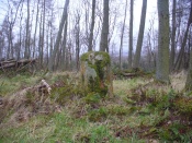
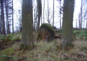
The standing stone

The standing stone

Getting Here

Along the A84 Stirling-Doune road, watch out for the minor Cuthill Brae road to the caravan park.  A couple of hundred yards before reaching the entrance to the caravan park, note the copse of trees more than 200 yards north, on the left, across the field. Walk into the trees and, near the centre, you’ll see the upright stone.

Archaeology & History

Looking to the west

Looking to the west

On the very top of this flattened tree-covered hill between Doune and Stirling, a single upright monolith more than 5½ feet tall quietly rests, seemingly forgotten by just about everyone.  The stone was marked on the earliest OS-maps in the 1860s, though in non-antiquated lettering, as if to question its archaic veracity—and this has continued to the present day, with the likes of Hutchison (1893) and Canmore upholding it as little more than a geological erratic.  Yet as our photos here show, this stone has much greater credibility as an authentic standing stone than Nature’s handiwork.

In Mr Hutchison’s (1893) article on the megalithic remains of the area he said of this stone:

“This is a very fine boulder of Highland grit, stranded on a gravel mound near the official residences on the Blair Drummond estate.  The knoll is wooded, leaving a clear space in the centre for the stone.  It would thus appear to have been thought worthy of preservation for some reason or other.  It has no appearance however, of having been erected as a standing stone.  It measures about 6 feet in height, and 12 feet at its widest circumference.”

Looking northwest-ish

Looking northwest-ish

Looking northeast-ish

Looking northeast-ish

The position of the stone is intriguing, giving a 360° view through the trees to a much greater vista all round, and this does seems to be quite deliberate.  In all honesty, this does look like an authentic standing stone, contrary to the earlier views cited.  A large prehistoric tumulus occurs only 400 yards to the south (recently damaged and built onto by the present land-owner) and other standing stones are in the area.

There are a number of scratch marks on the upright faces of the stone, no doubt caused by the forestry actions here over the last century.  No modern excavations have occurred here.

Folklore

A couple of centuries ago, the New Statistical Account told that,

“a very vague tradition represents it as having been a place of religious worship in superstitious times. There are no other remains near to confirm this opinion; but whether it be correct or not, it is evident that its site is a very important one, and may have been useful as a signal station, as it commands a view not only of the road across the Moss of Kincardine, but also of the line of Roman stations along the Forth and Teith in the direction of the camp at Ardoch.”

References:

  1. Bennett, Paul, The Standing Stones of Stirling and District, TNA: Stirling 2020.
  2. Hutchison, A.F., “The Standing Stones of Stirling District,” in The Stirling Antiquary, volume 1, 1893.

© Paul BennettThe Northern Antiquarian


Judge’s Cairn, Dunblane, Perthshire

Cairn:  OS Grid Reference – NN 73944 05618


Also Known as:

  1. The Big Cairn
  2. Canmore ID 24661
  3. Dalbrack

Getting Here

Judges Cairn, looking west

Along the A820 road between Dunblane and Doune, from the Dunblane-side, take the very first minor road on your right a few hundred yards after you’ve come off (or over) the A9 dual-carriageway.  Go all the way to the very top of this long and winding road for several miles, until you reach the gate which prevents you going any further. Walk up the slope on your left (west) and you’ll see the large grassy mound a coupla hundred yards ahead of you. That’s it!

Archaeology & History

Highlighted on the first Ordnance Survey map of the area in 1862, this is a large rounded prehistoric cairn of some considerable size, whose position in the landscape allows for an impressive 360° view way into the distance in several directions—a deliberate ingredient, no doubt, when it came to building this probable tomb.  I say “probable”, as there has never been a dig (not an ‘official’ one anyway) into the heart of this overgrown rocky mound.

Looking SE into the Ochils
Judges Cairn on 1862 map

More than 60 feet in diameter at its greatest and 6 feet high, with a circumference of 67 yards (61m), the top of the mound has been disturbed and, clearly, has been dug into at some time in the distant past—but archaeohistorical accounts are silent on this matter.  The first description of the Judge’s Cairn seems to have been in Peter Stewart’s (1839) notes on the local antiquities of Dunblane, where he described it most simply as:

“The Judges Cairn, yet undispersed, a circular heap of rough mountains stones covered with furze, on the farm of Bowie, barony of Kilbride.”

Along with the Ordnance Survey lads who came here in 1862, all subsequent visits gave rise to only short notes about the place.  Odd, considering its size and distinct vantage point.  And yet it remains hidden from view unless you come from the north, from whence that archetype of a fairy mound raises itself above Nature’s fair body into the eyes of any ambling wanderer…. A wonderful place to sit and dream for a while…

Folklore

Judges Cairn, looking NE

We enquired with a local whose family had been resident here since the mid-18th century about the name and folklore of the site, but he said he knew of nothing.  However, in earlier times it was said to be a place where the local sheriff held court and dispensed justice.  Mr Mackay (1984) told that the site “has been connected with the Judge’s Seat at Severie” nearby.  It seems possible that, as “it is just outside the parish boundary” between Doune and Dunblane, this may have been a moot site in ancient times, from whence laws were dispensed.  Old perambulation records may, perhaps, prove fruitful…

References:

  1. Barty, Alexander, The History of Dunblane, Eneas MacKay: Stirling 1944.
  2. Mackay, Moray S., Doune – Historical Notes, Forth Naturalist: Stirling 1984.
  3. Royal Commission on the Ancient & Historical Monuments of Scotland, Archaeological Sites and Monuments of Stirling District, Central Region, Society of Antiquaries of Scotland 1979.
  4. Shearer, John E., “Prehistoric Man and Prehistoric Remains in Britain,” in Transactions of the Stirling Natural History & Archaeological Society, 1907.
  5. Stewart, Peter G., Essay on the Dunblane Mineral Springs, Hewit: Dunblane 1839.

© Paul BennettThe Northern Antiquarian


Cromlix Lodge, Dunblane, Perthshire

Long Cairn:  OS Grid Reference – NN 7617 0671

Also Known as:

  1. Bracklin Burn
  2. Canmore ID 73465

Getting Here

Long line of the cairn, looking S

Long line of the cairn, looking S

Take the B8033 north out of Dunblane and, immediately out the other side of Kinbuck, as you cross the river, take the first track on your left to Cromlix.  Keep right along here to Cullings and beyond, till you reach the edge of the forestry plantation.  Go left instead of going into the trees and, instead, follow the edge of the woodland for about 750 yards.  You’ll see the land rise up on the other side of the stream and the huge length of stones thereby.  That’s it!

Archaeology & History

Main axis of the cairn

Main axis of the cairn

Not included in any major archaeology tomes, this giant long prehistoric pile of rocks—probably constructed in neolithic times—sits along the edge of a natural ridge, out of sight of all but the lone wanderer and the birds.  Aligned ESE to WNW, this huge monument measures more than 61 yards (56m) in length and is 12 yards across at its present widest section.  Much of the tomb has been severely robbed for stone in making the local walling: two of which emerge out of the structure itself—one running directly downhill from its larger eastern edge, and a more extensive wide line of walling running west and northwest for quite some distance.  This western section of walling has the hallmarks of being constructed as far back as the Iron Age, which may be when the initial destruction of the chambered cairn first started.  But, until we get an excavation here, we won’t know for sure.

Portion of the central mass of stones

Portion of the central mass of stones

Western wall leads to the cairn

Western wall leads to the cairn

The next closest tomb of any great size is the Judge’s Cairn, 1½ miles (2.4km) to the southwest.  Clusters of smaller single cairns exist about nearly a mile northwest, with prehistoric settlement traces accompanying them—but nothing seems in immediate attendance to this Cromlix giant.

Other sites, obviously, await discovery in this area.  We know that a spring of water roughly 50 yards east of here was used by so-called ‘witches’ in earlier centuries, for both healing and sympathetic magick.  Whether this tradition ever had any relationship with the cairn is difficult to say.


References:

  1. Royal Commission Ancient & Historical Monuments of Scotland, Braes of Doune: An Archaeological Survey, Edinburgh 1994.

© Paul BennettThe Northern Antiquarian


The Crofts, Doune, Perthshire

Cists (destroyed):  OS Grid Reference – NN 7247 0188

Also Known as:

  1. Canmore ID 24760

Archaeology & History

Urns in The Croft cist, Doune

Somewhere in the woodland park, before the area was “ruined”, as Moray Mackay (1984) put it, by “sand and gravel workings”, and within 100 yards of the re-positioned Trysting Stone, there once remained the ruins of ancient tombs—probably neolithic or Bronze Age in nature.  The ‘cists’ as they’re known (stone-lined graves), were described in several short articles at the beginning of the 20th century, shortly after their rediscovery.  Drawing upon the initial article by Joseph Anderson (1902) in the Scottish Antiquaries journal, W.B. Cook (1904) wrote:

“The doubling of the (railway) line from Dunblane to Callander has necessitated the altering of a road at the Crofts, Doune, and on Tuesday, 8 May, while digging, the navvies came across two stone cists containing bones.  The cists were made of stone slabs.  On Thursday, the men came on another cist about five feet from the surface. It was 3 feet long and 2½ feet broad, composed of round stones, and a quantity of bones were found in it, and also an urn. Unfortunately a cart-wheel passed over the urn, smashing it.  The pieces were, however, carefully collected and cemented and they are now in the possession of Mr Smith, Clerk of Works to the Caledonian Railway Company, Doune.  One of the cists first found was quite empty, but the other contained a large number of human bones, the largest about 1½ inches long.  The coffins were about 15 inches from the surface, and lay from east to west.  They measured 2 feet 9 inches in length, and in breadth and depth about 18 inches. They are constructed of local stone, and near the spot there has been a dyke running from the burgh to the sand holes, as the foundation was visible when the soil was being removed.  Some of the stones indicate that a house might have stood near the spot, but there had been no public burying-place nearer than at Kilmadock and at the little chapel of Inverardoch previous to 1784.”

In Mr Joseph’s (1902) article, he told us there wasn’t one, but two urns which, after some considerable effort, were reconstructed.  I’m not a great lover of urns misself, although when found in conjunction with the dead, we must ask, what was in them (if anything) when they were placed with the deceased?  Food? Herbal beverages? Shamanic potions?  In this case, we don’t know; and so all we are left with is Mr Anderson’s description of them:

“Urn No.1 is of the usual type of the so-called ‘food-vessel’, 4¾ inches in height by 5 inches in diameter at the mouth, the lip slightly bevelled inward, and the whole exterior surface ornamented. The ornamentation consists entirely of lines impressed into the soft clay with what seems to have been the roughly broken end of a small twig about ⅛-inch in diameter.  On the level of the lip there are two parallel lines of short scorings going completely round the upper surface. On the exterior surface there is a kind of slightly concave collar half an inch in width immediately under the brim, which is ornamented with short perpendicular indentations about a quarter of an inch apart. Underneath the collar the vessel expands slightly to the shoulder and then contracts to a flattened base of three inches in diameter. The part above the shoulder is slightly concave externally, but the scheme of decoration above and below the shoulder is the same, consisting of a series of short impressed lines scarcely half an inch in length ranged round the circumference in horizontal rows about a quarter of an inch apart, and crossed perpendicularly by lines about half an inch apart, not impressed, but scored into the clay. The perpendicular lines above the shoulder are more divergent than those below the shoulder, which converge towards the bottom in consequence of the tapering form of the lower part of the vessel. The paste is coarse, and mixed with small stones; the wall of the vessel is about a quarter of an inch thick, and the colour a reddish brown on both the exterior and interior surfaces, but quite black in the fractures exposing a section of its thickness.

“Urn No.2 is of the same wide-mouthed, thick-lipped form of the so-called food vessel type, 5 inches high and 5½- inches in diameter at the mouth. The lip is bevelled inwards, and the general shape of the vessel somewhat resembles that of No. 1, except in the lower part, which, instead of tapering to a flat bottom, narrows from the shoulder in a much more gradual curvature to the bottom. The ornamentation also is much more elaborate, though partaking of the same general character, inasmuch as it is a scheme of impressed markings, in bands arranged alternately in vertical and horizontal directions and covering the whole exterior surface of the vessel. On the bevel of the rim is a horizontal band of three lines of impressed markings, surmounted on the upper verge of the rim by a row of shallow oval impressions less than ⅛ of an inch apart. Under this there is a horizontal band of impressed markings as with the teeth of a comb, and below that the general scheme of ornament is carried out in alternate bands of about half an inch in width, running vertically from collar to base. The one set of these bands consists of three parallel rows of impressions of about ⅛ of an inch in width, and ⅛ of an inch apart, which seem to have been produced in the surface of the soft clay by a comb-like instrument, while the other set of bands has been produced by marking the spaces between the triple bands in the same way with a similar instrument, but placing the lines horizontally and closer together.”

A short distance from here, more cists were found. It’s possible that a prehistoric graveyard this way lay, countless centuries ago…

Folklore

Moray Mackay (1984) reports that the Doune fairs used to be held here.

References:

  1. Anderson, Joseph, “Notices of Cists Discovered in a Cairn at Cairnhill, Parish of Monquhitter, Aberdeenshire; and at Doune, Perthshire,” in Proceedings Society of Antiquaries, Scotland, volume 36, 1902.
  2. Cook, W.B. (ed.), “Antiquarian Find at Doune,” in Stirling Antiquary, volume 3, 1904.
  3. Mackay, Moray S., Doune Historical Notes, Forth Naturalist & Historian: Stirling 1984.
  4. Royal Commission Ancient & Historical Monuments, Scotland, Archaeological Sites and Monuments of Stirling District, Central Region, Edinburgh 1979.

© Paul Bennett, The Northern Antiquarian 


Trysting Stone, Doune, Perthshire

Standing Stone:  OS Grid Reference – NN 7256 0182

Also Known as:

  1. Canmore ID 24761
  2. Deil’s Head
  3. Devil’s Head
  4. Fairy Stone
  5. Gold Stone

Getting Here

Trysting Stone of Doune

From the old cross in the middle of the village, walk along the A820 Balkerach Street main road (NOT down George Street) until you reach Station Wynd on your right.  Walk up here for 100 yards towards the new housing estate (don’t buy these places – they’re dreadful quality beneath the veneers) and there, on a small grassy rise on the left just before the car park, stands our stone!

Archaeology & History

This little-known monolith on the northern edge of little Doune village, was recently moved a short distance from its original position thanks to another one of those sad Barratt housing estates being built here; but at least it has received protection with the surrounding fence and notice board telling its brief history and folklore (better than being destroyed I s’ppose).

Stone marked on 1866 OS map

Standing less than five feet tall, local lore tells that it has been moved around close to this spot several times in the last couple of centuries.  Although not mentioned in Hutchinson’s (1893) essay on local megaliths, the stone was highlighted on the 1866 Ordnance Survey of Doune, where the non-antiquated lettering showed how it was thought to be Roman in origin, not prehistoric.

Folklore

Trysting Stane, looking NE

The name of the stone comes from it being used as a place where deeds were sworn, with the stone as witness to the words proclaimed by both parties (implying a living presence, or animistic formula of great age).  This activity was continued in the local ‘trysts’ or cattle fairs held a mile away, where buyers swore the sale of cattle at this stone—again with the stone being ‘witness’ to the spoken deals.  It was also used as a counter where gold was exchanged for cattle bought and sold during the Michaelmas and Martinmas Fairs.  Sue Harvey (2006) told that this standing stone,

“was called the Devil’s Head and was used during past Doune fairs to count gold on when cattle were being bought and sold.”

In local newspaper accounts from the 1950s, local historian Moray S. Mackay (1984) told how the children of the village used to gather round the stone, holding hands, and sing,

Olie Olie, peep, peep, peep,
Here’s the man with the cloven feet,
Here’s his head, but where’s his feet?
Olie Olie, peep, peep, peep.

Notice board telling its tale...
Notice board telling its tale…
Looking at the stone on its rise

This implies the stone once possessed a myth relating to a petrified ancestral deity of animistic (pre-christian) origin, but as yet we have found no additional information allowing us a confirmation of this probability.  A correlate of this theme—i.e., of the stone being the head of a deity—is found in West Yorkshire (amongst many other places), where one of the little known Cuckoo Stones was once known to be a local giant until a hero-figure appeared and cut off his head, leaving only his body which was then turned to stone.  Mircea Eliade (1958; 1963) cites examples of animistic religious rites and events explaining this early petrification formula via creation myths, etc. (we find very clear evidences of animistic worldviews and practices still prevailing in the mountains just a few miles north and west, still enacted by local people)

Folklore also alleged that the stone was Roman in nature, but neither archaeology nor the architectural form of the stone implies this.  Roman stones were cut and dressed—unlike the traditional looking Bronze Age, rough, uncut fella standing here.

References:

  1. Eliade, Mircea, Patterns in Comparative Religion, Sheed & Ward: London 1958.
  2. Eliade, Mircea, Myth and Reality, Harper & Row: San Francisco 1963.
  3. Harvey, Sue, Doune and Deanston, Kilmadock Development Centre 2006.
  4. Hutchinson, A.F., “The Standing Stones of Stirling District,” in The Stirling Antiquary, volume 1, 1893.
  5. Mackay, Moray S., Doune – Historical Notes, Forth Naturalist: Stirling 1984.

© Paul Bennett, The Northern Antiquarian