Weston Moor (543), North Yorkshire

Cup-and-Ring Stone:  OS Grid Reference – SE 18521 49406

Getting Here

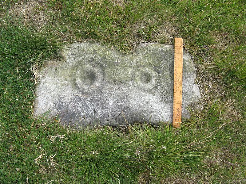
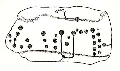
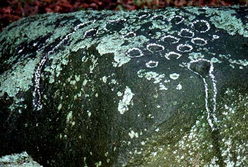
Weston Moor cup-and-rings (after ‘QDanT’)

Get yourself to the impressive multi-ringed Greystone Allotment carving, then walk to the copse of trees close by and bear left, following the edge of the fence along and following it when it turns down at right-angles, until you hit the bottom corner of the trees, where a path cuts in front of you.  From the bottom corner of the trees walk 25-30 yards diagonally away from the trees.  It’s under your nose somewhere damn close!

Archaeology & History

This is another archetypal cup-and-ring stone, similar in size and design to the recently discovered Slade (02) carving on Blubberhouses Moor, just over 4 miles (6.5 km) northwest (followers of Alexander Thom’s megalithic inch theory might be interested in assessing the measure of these two).   It is one of number clustered in and around this small grass ‘moorland’ region, where a number of carvings perished in the 19th century.  Thankfully this one survived.  Boughey & Vickerman’s (2003) brief notes on the stone tell:

“Small, rough grit rough of regular oblong shape set very low in turf.  Two cups, each with a ring, and connected by a groove.”

On a recent visit to see this carving, Danny Tiernan, Paul Hornby, James Elkington and I were unable to locate it.  The carving may well have been destroyed, or moved.  If anyone is aware of what has happened to this petroglyph, please let us know.  We will be contacting the local authorities to see if any explanation is forthcoming from them.

References:

  1. Boughey, Keith & Vickerman, E.A., Prehistoric Rock Art of the West Riding, West Yorkshire Archaeology Service 2003.

Links:

  1. Weston Moor Rock Art – more notes & images


© Paul Bennett, The Northern Antiquarian

Greystone Allotment, Weston, North Yorkshire

Cup-and-Ring Stone:  OS Grid Reference – SE 18433 49648

Also Known as:

  1. Carving no.541 (Boughey & Vickerman)
  2. Greystone Rock

Getting Here

Although cited as being on Weston Moor, it is closer to Askwith village. From the village, take the north road and shortly before reaching the T-junction, park-up (somewhere!). There’s a small copse of trees on your right and fields above them – that’s where you’re heading. You might have to bimble about a bit before the rock catches your attention, but it’s worth the wandering.  Look around!

Archaeology & History

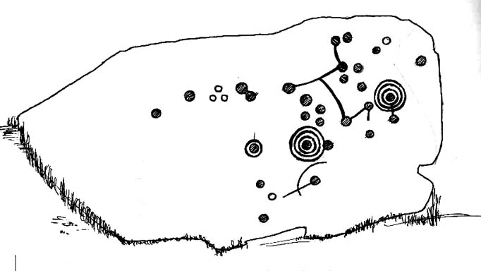
Sketch of the design c.1985

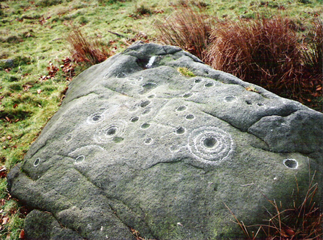
This is an excellent, archetypal cup-and-ring stone that’ll be loved by any real rock art student!  Cups-and-multiple rings are the main visual feature to this stone, along with another 20 single cups and another primary cup-and-ring, all on a medium-sized sloping rock face.  The carving was first described by Cowling & Hartley (1937).  Since their initial discovery, several other writers have mentioned it with little further comment.  The smaller but impressive double cup-and-ring carving 543 can be seen at the bottom left of the woodland in front of you – well worth seeing if you’re visiting here!

References:

  1. Boughey, Keith & Vickerman, E.A., Prehistoric Rock Art of the West Riding, West Yorkshire Archaeology Service 2003.
  2. Cowling, Eric T., Rombald’s Way, William Walker: Otley 1946.
  3. Cowling, E.T. & Hartley, ‘Cup-and-Ring Markings to the North of Otley,’ in Yorkshire Archaeological Journal, 33, 1937.
  4. Hotham, John Paul, Halos and Horizons, Hotham Publishing: Leeds 2021.

© Paul Bennett, The Northern Antiquarian


Ellers Wood (614), Washburn Valley, North Yorkshire

Cup-and-Ring Carving:  OS Grid Reference – SE 1895 5099

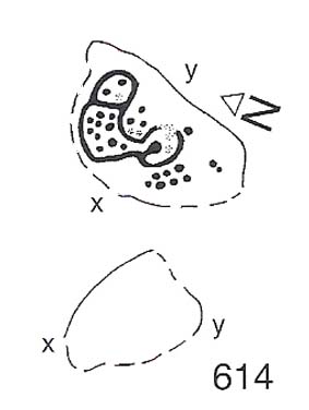
Ellers Wood carving 614 (after Boughey & Vickerman)

Getting Here

Ellers Wood is at the very northern edge of the beautiful parish of Askwith and has a very particular ambience of its own. The small cluster of at least 5 cup-and-ring stones in this lovely little woodland gives you the impression that they stood out on their own, living here representing the genius loci of this luscious watery vale, all-but-hidden from all but the lucky few.  It’s very likely that there are still more carvings hidden away nearby.

The best way to check them out is simply to walk down past the haunted Dobpark Lodge, where it turns into a footpath and where it crosses the lovely old packhorse bridge at the valley bottom, walk a few hundred yards up the river-side (at the bottom of the fields) until you reach Ellers Wood. Once there, look around.  This one’s on the west side of the main stream, close by where it meets up with another small burn coming down from the western wooded slopes.


Archaeology & History

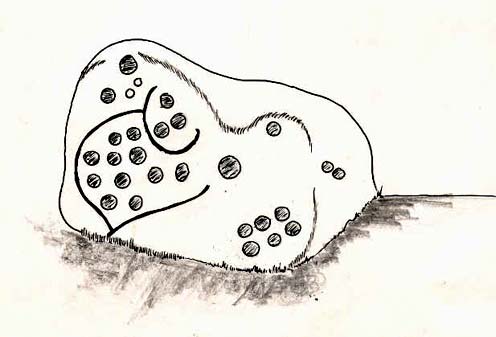
First sketch of the carving, c.1994

In the same region as the Ellers Wood 618 and other carvings and very close to the river, somehow this heavily cup-marked stone evaded the prying eyes of such notaries as Cowling, Stuart Feather and Sidney Jackson – all of whom ventured to look at the other petroglyphs in Ellers Wood.  But with good fortune, Graeme Chappell and I re-discovered this fine-looking carving in our explorations in 1993-94 and gave it back the attention it truly deserves.

The main feature here is the clustering of cups into sections, as the drawing indicates.  It is listed as “stone 614” in Boughey & Vickerman’s (2003) survey.

References:

  1. Boughey, K.J.S. & Vickerman, E.A., Prehistoric Rock Art of the West Riding, WYAS: Exeter 2003.
  2. Cowling, E.T., ‘A Classification of West Yorkshire Cup and Ring Stones,’ in Yorks. Arch. Journal 1940.
  3. Cowling, Eric T., Rombald’s Way, William Walker: Otley 1946.
  4. Cowling, E.T. & Hartley, C.A., ‘Cup and Ring Markings to the North of Otley,’ in Yorks. Arch. Journal 33, 1937.
  5. Grainge, William, The History and Topography of the Forest of Knareborough, J.R. Smith: London 1871.
  6. Grainge, William, History and Topography of the Townships of Little Timble, Great Timble and the Hamlet of Snowden, William Walker: Otley 1895.

© Paul Bennett, The Northern Antiquarian 


Ellers Wood (619), Washburn Valley, North Yorkshire

Cup-and-Ring Carving:  OS Grid Reference – SE 1902 5102

Also Known as:

  1. Airship Carving

Getting Here

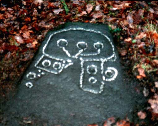
Old photo of CR-619

Follow the same directions for the Ellers Wood 614 and 618 carvings, as it’s nearby. The best way to check them out is simply to walk down past the haunted Dobpark Lodge, where it turns into a footpath and then when you reach the lovely old packhorse bridge at the valley bottom, walk upstream for 3-400 yards until you reach the next small wooded region.  Once there, look around…..

Archaeology & History

Ellers Wood is at the very northern edge of the beautiful parish of Askwith and has a very particular ambience of its own. The small cluster of at least 5 cup-and-ring stones in this lovely little woodland gives you the impression that they stood out on their own, living here respresenting the genius loci of this luscious watery vale, all-but-hidden from all but the lucky few.

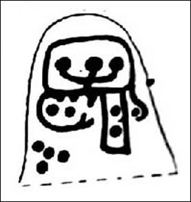
Cowling’s 1937 sketch
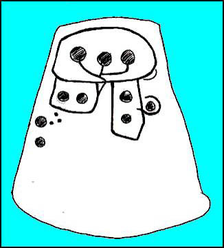
1991 sketch of CR-619

Beautifully preserved, this carving was first described in an article by Cowling & Hartley (1937), then included in Cowling’s Rombald’s Way (1946).  As with the other cup-and-rings close by, the characteristic grouping of certain cups is here focused into three sections by enclosing rings.  This was something I used to call ‘central design’ features, which occur in different locales with their own individual geographical patterns/structures.  These central designs are non-numeric in nature, though have a tendency to cluster in patterns of 2, 3 and 4.  (I need to write a decent essay on this to outline what I’m on about with greater clarity!)

References:

  1. Boughey, K.J.S. & Vickerman, E.A., Prehistoric Rock Art of the West Riding, WYAS: Exeter 2003.
  2. Cowling, E.T., ‘A Classification of West Yorkshire Cup and Ring Stones,’ in Yorks. Arch. Journal 1940.
  3. Cowling, Eric T., Rombald’s Way, William Walker: Otley 1946.
  4. Cowling, E.T. & Hartley, C.A., ‘Cup and Ring Markings to the North of Otley,’ in Yorks. Arch. Journal 33, 1937.
  5. Grainge, William, The History and Topography of the Forest of Knareborough, J.R. Smith: London 1871.
  6. Grainge, William, History and Topography of the Townships of Little Timble, Great Timble and the Hamlet of Snowden, William Walker: Otley 1895.

© Paul BennettThe Northern Antiquarian


Ellers Wood (618), Washburn Valley, North Yorkshire

Cup-and-Ring Carving:  OS Grid Reference – SE 1901 5101

Getting Here

Sketch of CR-618, c.1990

Follow the same directions to reach the other Ellers Woods carvings, staying on the western-side of the river close to where it meets with Snowden Beck, just north of the footpath. Check it out in winter and early Spring — any later in the year and it might be a little overgrown.

Archaeology & History

A truly lovely, lichen enriched carved rock in a lovely little part of the Fewston valley.  The place has a distinct genius loci that’s very different from its carved rock companions on the moorland hills a short distance away.  As I’ve said elsewhere: the surroundings of trees and richer fertile growth is something we must remember to ascribe to these carvings when we encounter them, as the landscape in places such as Ellers Wood is much closer to the scattered forested landscape that profused when first these stones were inscribed.

Section of CR-618

First described by Cowling & Hartley in 1937, it was later included in Cowling’s (1946) more extensive prehistoric survey of mid-Wharfedale.  There may be as many as 38 cup-markings cut onto the rock here, along with several lines and grooves.  A meditative dreaming site indeed…

References:

  1. Boughey, K.J.S. & Vickerman, E.A., Prehistoric Rock Art of the West Riding, WYAS: Exeter 2003.
  2. Cowling, E.T., ‘A Classification of West Yorkshire Cup and Ring Stones,’ in Yorks. Arch. Journal 1940.
  3. Cowling, Eric T., Rombald’s Way, William Walker: Otley 1946.
  4. Cowling, E.T. & Hartley, C.A., ‘Cup and Ring Markings to the North of Otley,’ in Yorks. Arch. Journal 33, 1937.
  5. Grainge, William, The History and Topography of the Forest of Knareborough, J.R. Smith: London 1871.
  6. Grainge, William, History and Topography of the Townships of Little Timble, Great Timble and the Hamlet of Snowden, William Walker: Otley 1895

© Paul BennettThe Northern Antiquarian