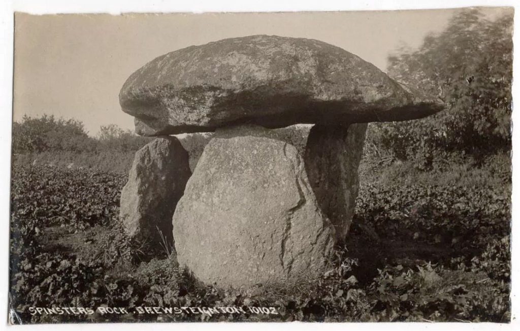
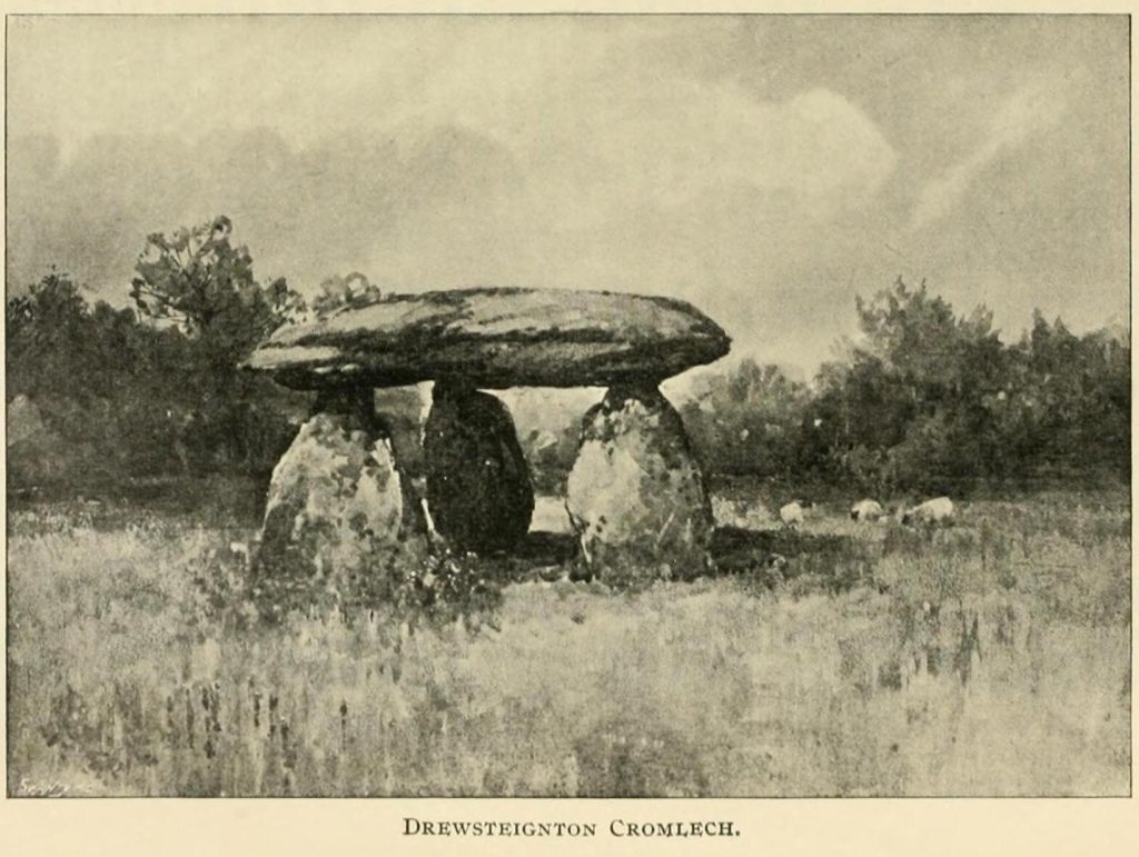
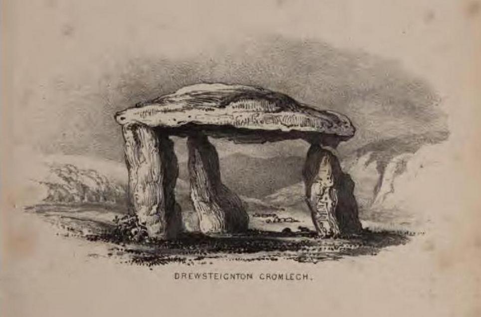
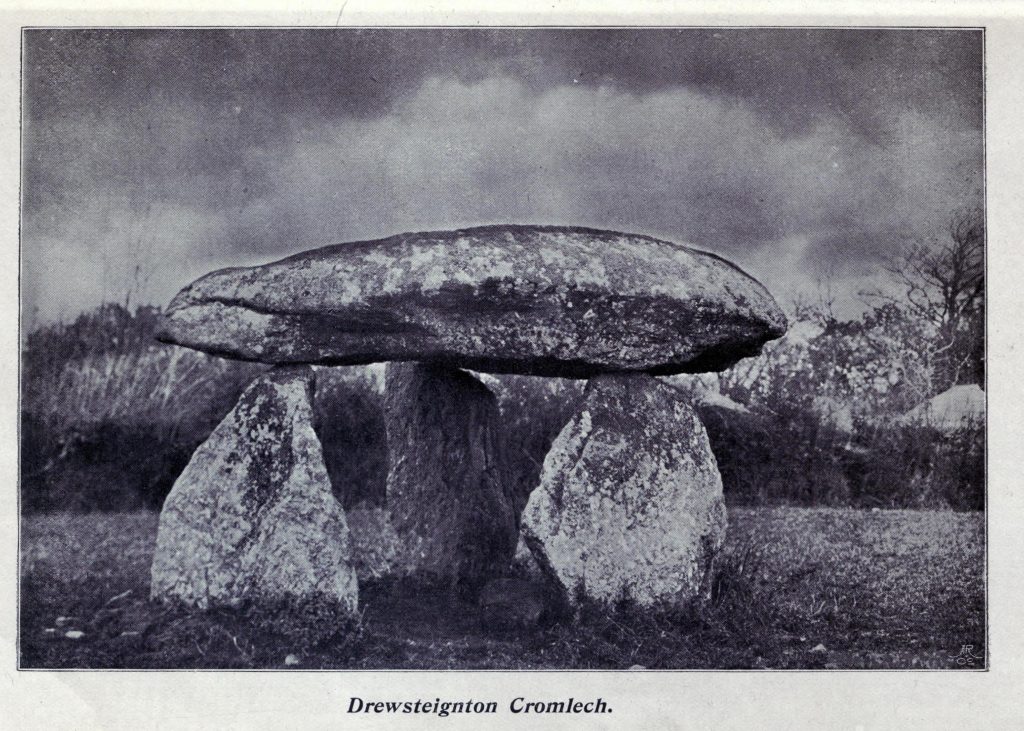
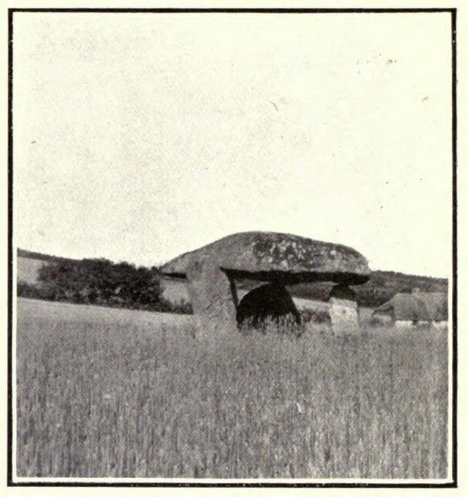
The Spinsters’ Rock, Drewsteignton, Devon

Dolmen:  OS Grid Reference – SX 70092 90783

Also Known as:

  1. Drewsteignton (1)

Archaeology & History

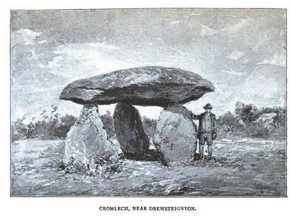
Highlighted on Benjamin Donn’s map of Devon in 1765, this impressive neolithic dolmen consists of three large granite support stones between 5 ft 7 in and 7 ft 7 in tall, surmounted by a large capstone measuring 15 feet by 10 feet.  It collapsed in 1862 but was restored later the same year.
Folklore

In Murray’s (1851) Handbook for Travellers he told the following tale of the site:

This interesting old monument derives its name from a whimsical tradition that three spinsters (who were spinners) erected it one morning before breakfast; but “may we not,”* says Mr. Rowe (Peramb. of Dartmoor), “detect in this legend of the three fabulous spinners the terrible Valkyriur of the dark mythology of our Northern ancesters – the Fatal Sisters, the choosers of the slain, whose dread office was to ‘weave the warp and weave the woof of destiny.'”

Polwhele informs us that the legend varies, in that for the three spinsters some have substituted three young men and their father, who brought the stones from the highest part of Dartmoor; and in this phase of the legend has been traced an obscured tradition of Noah and his three sons.

.. The hill on which it stands commands an excellent view of Cawsand Beacon. About 100 yds. beyond the cromlech on the other (N.) side of the lane, is a pond of water, of about 3 acres, called Bradmere Pool, prettily situated in a wood. It is said to be unfathomable, and to remain full to the brim during the driest seasons, and some regard it as artificially formed and of high antiquity – in short a Druidical pool of lustration connected with the adjacent cromlech..

.. The country-people have a legend of a passage formed of large stones leading underground from Bradmere to the Teign, near the logan stone..

References:

  1. Baring-Gould, Sabine, A Book of Dartmoor, London 1900.
  2. Crossing, William, Gems in a Granite Setting, Western Morning News: Plymouth 1905.
  3. Falcon, T.A., Dartmoor Illustrated, James G. Comin: Exeter 1900.
  4. Murray, John, A Hand-book for Travellers in Devon & Cornwall, John Murray: London 1851.
  5. Ormerod, G. Waring, Notes on Rude Stone Remains Situate on the Easterly Side of Dartmoor, privately printed 1873.
  6. Page, John Lloyd Warden, An Exploration of Dartmoor and its Antiquities, Seeley: London 1892.
  7. Worth, R. Hansford, Worth’s Dartmoor, David & Charles: Newton Abbot 1967.

Acknowledgements:  Huge thanks for use of the Ordnance Survey map in this site profile, reproduced with the kind permission of the National Library of Scotland

© Paul BennettThe Northern Antiquarian

Drizzlecombe 13, Ditsworthy Warren, Sheepstor, Devon

Cairn:  OS Grid Reference – SX 592 675

Archaeology & History

Drizzlecombe Cairn 13 (after Butler 1994)

A very well-preserved prehistoric cist and cairn (grave), sat amidst a valuable prehistoric landscape full of megaliths and other important prehistoric remains.  Megalith enthusiast and antiquarian, Nik Megalithic, told that:

“The cairn is about 12 m diameter and 1 metre high, and has a large Kist in the middle.  The cist has side slabs about 2 metres long and spaced 1 metre apart, and it is about 0.7m deep. The large capstone is tipped off to the west, and can be seen protruding above the cairn from quite some distance away.”

Described in association with the rich mass of other tombs and megalithic stone rows here, author Jeremy Butler told that,

“Cairn 13 is also in line with (cairns) 1-4, but just out of sight around the hillside 150m to the northwest.  The mound contains a well-preserved cist, “a very fine example”, according to Worth, who cleared it out about 1900 but with “no result from excavation.”  The displaced cover and massive side-slabs project well beyond its ends.”

Both Butler and Worth mention how cairn 13 is part of an alignment with two other cairns very close by.

Folklore

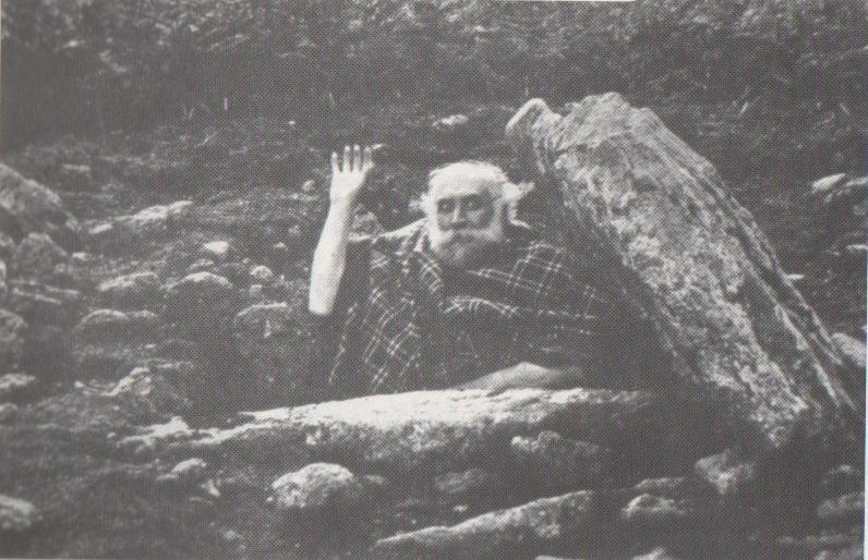
Spike Milligan in his tomb

Although legends of giants and pixy folk are well known round here, there is nothing specific I can find to this one site. One of the most important finds in recent years—as the photo above shows quite clearly—was the fact that before joining The Goons, the British comedian Spike Milligan used to live in this prehistoric tomb. When asked why he didn’t live in a house like other normal people, he invited us in for a cup of tea.  Some historians believe that the person in the photo is in fact Mr R.H. Worth—author of Worth’s Dartmoor—but Mr Milligan insisted that Worth was an imposter!

References:

  1. Butler, Jeremy, Dartmoor Atlas of Antiquities – volume 3, Devon Books: Tiverton 1994.
  2. Crossing, William, Tales of the Dartmoor Pixies, W.H. Hook: London 1890.
  3. Grinsell, Leslie V., The Ancient Burial Mounds of England, Methuen: London 1936.
  4. Worth, R. Hansford, Worth’s Dartmoor, David & Charles: Newton Abbot 1988.

Acknowledgements: – Huge thanks to Nik Megalithic for the info and old photo of ‘Spike Milligan’ in his tomb.

©Paul Bennett, The Northern Antiquarian


Avon Reservoir, Dean Moor, South Brent, Devon

Settlements (destroyed):  OS Grid Reference – SX 677 653

Archaeology & History

Prior to the submergence of one of the many prehistoric settlements in and around the waters of the Avon Reservoir, excavation work was carried out by Lady Aileen Fox between 1954 and 1956 on behalf of the Ministry of Works. The excavation notes in the Proceedings of the Prehistoric Society for 1957 told what Lady Fox and her fellow archaeologists found at the site that was due to be submerged:

“The walled enclosure of 2½ acres contained nine huts from 15-20 feet in diameter and three pens built against the outer wall.  The huts were roofed in the same way as those as Kestor, having a central post and a ring of six or seven uprights supporting the main rafters.  Part of the settlement was incorporated into a medieval farmstead, but the prehistoric occupation proved to be from the local Late Bronze Age.”

Since that report, a number of other prehistoric settlement sites have been found on the surrounding moorland heights (as a quick look at the OS-map clearly shows).  Obviously a very busy place in ancient days!

References:

  1. Clark, J.G.D. (ed.), “Notes on Excavations in Eire, England, Northern Ireland, Scotland and Wales during 1956,” in Proceedings of the Prehistoric Society, volume 23, 1957.

© Paul Bennett, The Northern Antiquarian