Rudston B Cursus, East Yorkshire

Cursus:  OS Grid Reference – TA 0805 6697 to TA 0944 6755 

  1. Rudston Cursus 2

Archaeology & History

One of the four (known) cursus monuments around Rudston: this one stretches between the Ordnance Survey coordinates TA 081669 near Kilham Grange on the southwestern edge of Rudston, then heads northeast towards the village itself at TA 094675.  Described briefly in D.P.Dymond’s essay on (mainly) Cursus A, he said how Cursus B was part of,
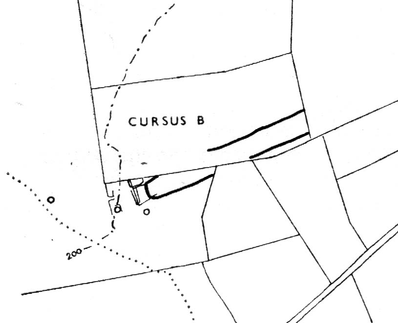
Early ground-plan (after D.P. Dymond)
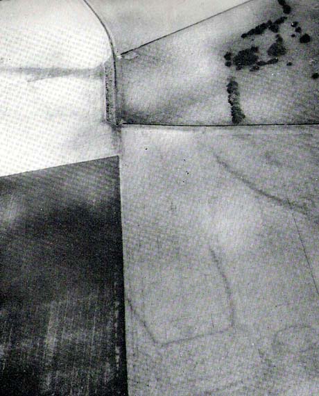
Early photo of Rudston B (after J.K.St Joseph)

“a large complex of crop marks.  The largest feature is the squared, tapering end of Cursus B, which can be traced for 700 yards in a north-easterly direction.  No surface remains seem to survive in an area intensively ploughed, except for a swelling under a hedge on the line of the south-eastern bank (at TA 0834 6703).  West of the square end and partly overlying it, are several small rectangular enclosures, which are probably part of a later (?Romano-British) settlement and field-system.  Also in this tangle of crop-marks there are four roughly circular shapes, which may well be barrow circles associated with the end of the cursus.  On certain barrow just south of the end of the cursus has an inner ring of pits.  Where the cursus is lat visible to the north-east, it is headed roughly for the monolith ¾-mile away.  The width of Cursus B is approximately 90 yards between ditch centres.  It has its square end on the forward slope of a ridge (like Cursus A) at a height of 180 feet OD, and descends towards the village, which is visible from the end, through a shallow valley.”

Dymond’s note about the alignment feature of this cursus, towards the gigantic Rudston monolith, was one echoed in the Hedges & Buckley (1981) survey.  They noted:

“At Rudston, the B cursus extended eastwards aligns upon the Rudston monolith in Rudston churchyard. Destruction of standing stones elsewhere may have removed similar associations between the stones and cursuses.”

This alignment feature was also confirmed by cognitive archaeologist and alignment specialist, Paul Devereux (Pennick & Devereux 1989) in his survey of cursus monuments.

Typical of these fascinating antiquities, nothing of any worth has been found along the length of the cursus that can give us any clues to its nature and function.  However, the presence of this and three others close by indicates that the region was an exceptionally important one in the cosmology of our prehistoric ancestors.  Four of these giant linear cursus monuments occur in relative proximity, and there was an excess of ancient tombs and, of course, we have the largest standing stone in the British Isles stood in the middle of it all.  A full multidisciplinary analysis of the antiquities in this region is long overdue.  To our ancestors, the mythic terrain and emergent monuments hereby related to each other symbiotically, as both primary aspects (natural) and epiphenomena (man-made) of terra mater: a phenomenon long known to comparative religious students and anthropologists exploring the animistic natural relationship of landscape, tribal groups and monuments.

References:

  1. Dymond, D.P., “Ritual Monuments at Rudston, E. Yorkshire, England,” in Proceedings of the Prehistoric Society, volume 32, 1966.
  2. Eliade, Mircea, The Sacred and the Profane, Harvest: New York 1959.
  3. Hedges, John & Buckley, David G., The Springfield Cursus and the Cursus Problem, Essex County Council 1981.
  4. Pennick, Nigel & Devereux, Paul, Lines on the Landscape, Hale: London 1989.

Links:

  1. ADS: Archaeology of Rudston B – Brief archaeological notes on the cursus to the southwest of Rudston.

© Paul Bennett, The Northern Antiquarian 

West Lodge, Touch, Cambusbarron, Stirling

Cairn:  OS Grid Reference – NS 7501 9315

Also Known as:

  1. Canmore ID 46240

Getting Here

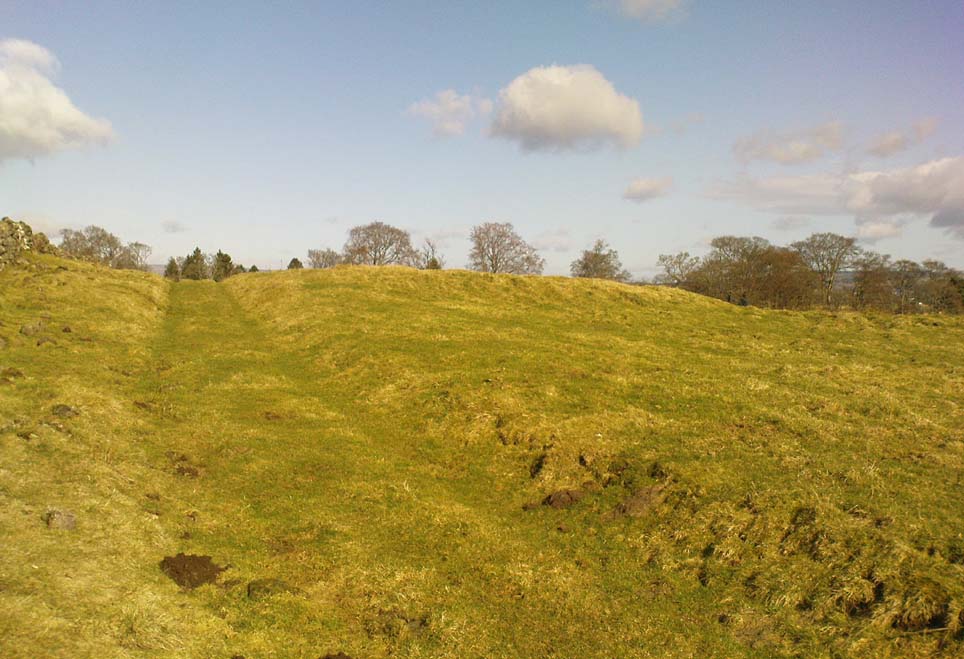
The mound of the cairn

Go west outta Stirling along the Cambusbarron road and along the Main Street until it meets up with Touch Road.  Go along here for a couple of miles, past Touch House and Seton Lodge until you reach the small West Lodge cottage where the road bends.  From here go left up the footpath onto the fields immediately south.  About 200 yards on, where the field rises to the crest of the hill, you’ll note the small mound right next to the track.  If you start walking back down the slope again, you’ve walked past it!

Archaeology & History

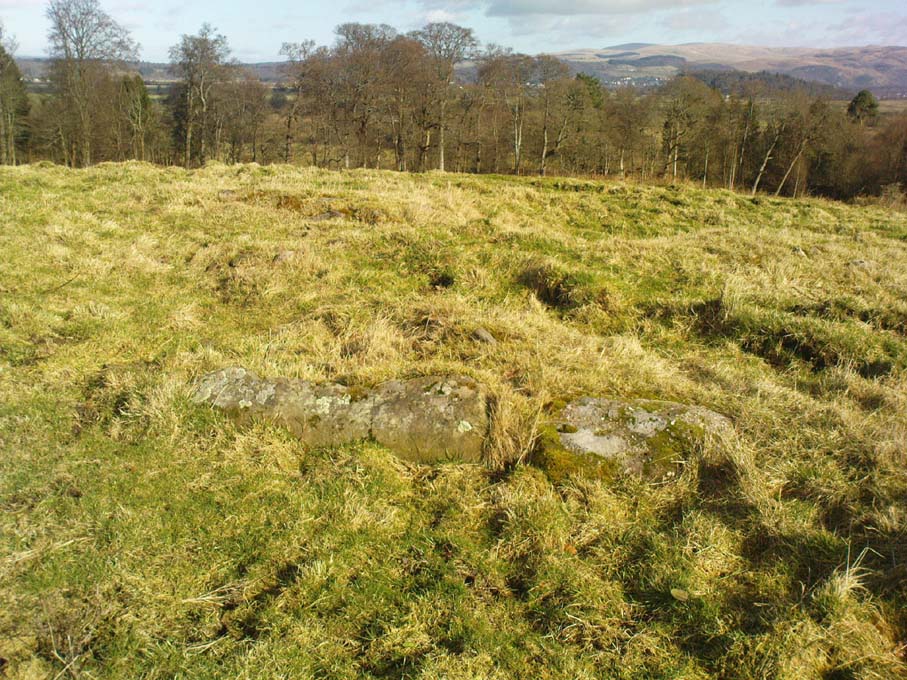
Possible peristalith ruins

There’s not too much to see here as the site is very much overgrown, but it’s in a lovely spot looking across to the Ochil Hills eastwards.  And if  records are anything to go by, it’s a pretty isolated prehistoric site with no companions close by — though a prehistoric food vessel was located a short distance to the east on the Touch House Estate grounds many years ago.  It’s quite a large, roughly circular mound.  Several long stones are visible, laid down, on top of its western side, which archaeologists believe may represent the remains of an encircling stone ring that was built to define the cairn.  As far as I’m aware the site remains unexcavated and its condition is still much as it was when the Scottish Royal Commission fellas visited the place in 1956.  Following their brief excursion, they later (1963) wrote the following notes:

“It is circular on plan, measures 65ft in diameter at the base and stands to a height of 2ft 6in.  Now covered with fine pasture, it appears to have been formerly under cultivation, and the flat top measures 50ft in diameter.  The mound may represent a denuded cairn and three earthfast boulders which protrude through the turf near the W edge may be the remains of a peristalith.  The largest stone has a bench-mark carved on it (125.9).”

A later brief report by the Royal Commission (1979) commented that the site was a cairn measuring 20m across and 0.7m high.

References:

  1. Royal Commission on the Ancient & Historical Monuments Scotland, Stirling – volume 1, HMSO: Edinburgh 1963.
  2. Royal Commission on the Ancient & Historical Monuments of Scotland, Archaeological Sites and Monuments of Stirling District, Central Region, Society of Antiquaries of Scotland 1979.

© Paul Bennett, The Northern Antiquarian 

Achnacree, Achnacreebeag, Argyll

Chambered Cairn:  OS Grid Reference – NM 9227 3636

Also known as:

  1. Achnacridhe
  2. Canmore ID 23223
  3. Carn Ban
  4. Moss of Achnacree
  5. Ossian’s Cairn

Archaeology & History

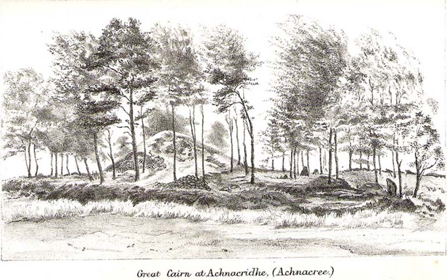
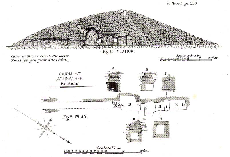
Not to be confused with the Achnacreebeag chambered tomb a short distance to the east, Achnacree is  a site that has been made ruinous over the last 100 years, prior to which — as R.A. Smith’s (1885) illustration here shows — we had a quite grand prehistoric chambered cairn to behold. It’s still worth looking at though!

R.A. Smith’s old drawing
Smith’s early plan of the cairn

The once giant tomb is neolithic in age and nature, and was defined by Audrey Henshall (1972) as a passage grave of the Clyde Cairns group. It appears to have been built over two different periods: the earliest being when the first two internal chambers were done, “which in building technique and plan are comparable to a two-compartment Clyde-chamber and which may have been covered by a small cairn.” (RCAHMS 1974)  Much later, the long passage seems to have been added and built over the original chambers.

Although Smith (1885) and Henshall describe the large cairn, the Scottish Royal Commission (1974) entry gives the most succint archaeocentric summary of the site:

“The cairn is about 24.4m in diameter and now stands to a height of some 3.4m on the S and 4.1m on the NE, although it is said to have been about 4.6m high before excavation; it consists of small and medium-sized stones, interspersed with a few large boulders.  A low platform of cairn material, now grass-covered and about 1m high, extends round the base of the cairn and increases the overall diameter to about 40m.  The entrance to the passage is on the SE side of the cairn and is marked by four upright stones, one of which is now leaning out of position.  The central pair, set about 1.2m apart and protruding 1.3m and 0.4m above the cairn material, are the portal stones on either side of the passage, while the flanking pair may be the remains of a shallow forecourt.  The passage, which measured 6.4m in length and 0.6m in width, was constructed of upright slate slabs about 1m in height, and the roof was composed of similar slabs.  The excavator recorded that the passage was filled with stones, and these seem to indicate a deliberate blocking after the final burial-deposit.  The chamber comprised three compartments.  The outer, measuring 1.8m by 1.2m and about 2.1m in height, was constructed of upright slabs and drystone walling supplemented by corbelling, and was covered by a single capstone.  The central compartment, measuring 2m by 0.7m and 1.6m in height, was entered across a large transverse slab, and the entrance itself appeared to have been deliberately sealed with stones ‘built firmly in after the chamber had been completed.’  The sides of this chamber were formed of blocks of stone supplemented by dry-stone walling, and it was roofed by a singular capstone.  The inner compartment was entered across a sill-stone, and measured 1.4m by 0.9m and 1.7m in height.  A combination of slabs and dry-stone walling had been employed in its construction, and it was roofed by a single massive capstone some 0.4m thick.  Each side-wall was constructed of two slabs set lengthwise one above the other, in such a way that a narrow ledge was formed at their junction.  On these two ledges a number of white quartz pebbles had been deliberately deposited… Three neolithic pottery bowls were discovered in the course of the excavation — a fragmentary vessel from the outer compartment, and one complete and one fragmentary bowl from the inner compartment.”

These bowls were sent to Edinburgh’s National Museum of Antiquities soon after being found.

Folklore

Those of you into earthlights will like this one!  Also known as Carn Ban, or the White Cairn, aswell as Ossian’s Cairn, R. Angus Smith (1885:217) told how,

“it was curious…to listen to the superstitions that came out (about this tomb). One woman who lived here, and might therefore be considered an authority, said that she used to see lights upon it in dark nights.”

Another old local was truly terrified of the place, and said he would not enter this tomb for all the money in Lochnell Estate.

Regarding the various names given to the site, when Mr Smith (1885) wrote about it all those years ago, he told:

“We have often inquired the name of the cairn. The cairn really has had no definite name. Some people have called it Carn Ban or White Cairn, but that is evidently confusing it with the other cairn which we saw over the moss, and which is really whiter. Some people have called it Ossian’s Cairn, but that is not an old name, and even if it had been, we know that it is a common thing to attach this name to anything old.  We call it Achnacree Cairn, from the name of the farm on which it stands.”

References:

  1. Henshall, A.S., The Chambered Tombs of Scotland – volume 2, Edinburgh University Press 1972.
  2. Royal Commission on the Ancient & Historical Monuments of Scotland, Argyll – Volume 2: Lorn, HMSO: Edinburgh 1974.
  3. Smith, R. Angus,”Descriptive List of Antiquities near Loch Etive,” in Proceedings of the Society of Antiquaries, Scotland, volume 9, 1870-72.
  4. Smith, R. Angus, Loch Etive and the Sons of Uisneach, Alexander Gardner: London 1885 (2nd edition).

© Paul Bennett, The Northern Antiquarian 
Two Lads, Withens Moor, West Yorkshire

Cairns: OS Grid Reference – SD 98394 22116

Getting Here

Best way here is, from Mytholmroyd go up the Cragg Vale road for a coupla miles, then turn right and heading down, then up, towards Withens Clough reservoir.  Once there, walk onto the moor to your left (south) until you’re on the ridge above you.  Keep walking until y’ see the rocky cairn-like creatures stood in isolation on a flat moorland plain.

Archaeology & History

Two Lads – on a dark, rainy, windy day

Truly weird spot this one, but I love it! Seemingly miles from anywhere, it’s one helluva walk to most folk, but utterly worthwhile when your arrive.   On a clear day you can see for miles and the landscape is adorable!  On a cloudy rainy day, the feel of the place changes if you take care to stay with the site, saturated, meditating (as no other people ever turn up when She’s like that – so you and the place get the best from each other!).

The site comprises of two boulders, each crowned with a cairn of stones.  The westernmost one of the two (SD 98392 22111) is intriguing as it has, carved upon the rock beneath the stone cairn on the northwestern edge of the stone, what looks like a singular cup-marking, plus a large water-worn bowl on its northern edge, and a very distinct deeply-cut cross-base, several inches deep, near the northeastern corner of the rock.  This cross-base seems slightly more rectangular in form than square; although the large covering of stones makes an accurate ascription difficult.  If this cross-base and cup-markings are authentic, we would have here a clear example of the christianization of a previously heathen site.

A cursory examination of the easternmost of the Two Lads (SD 98397 22117) doesn’t indicate any artificial workings on the rock surface.

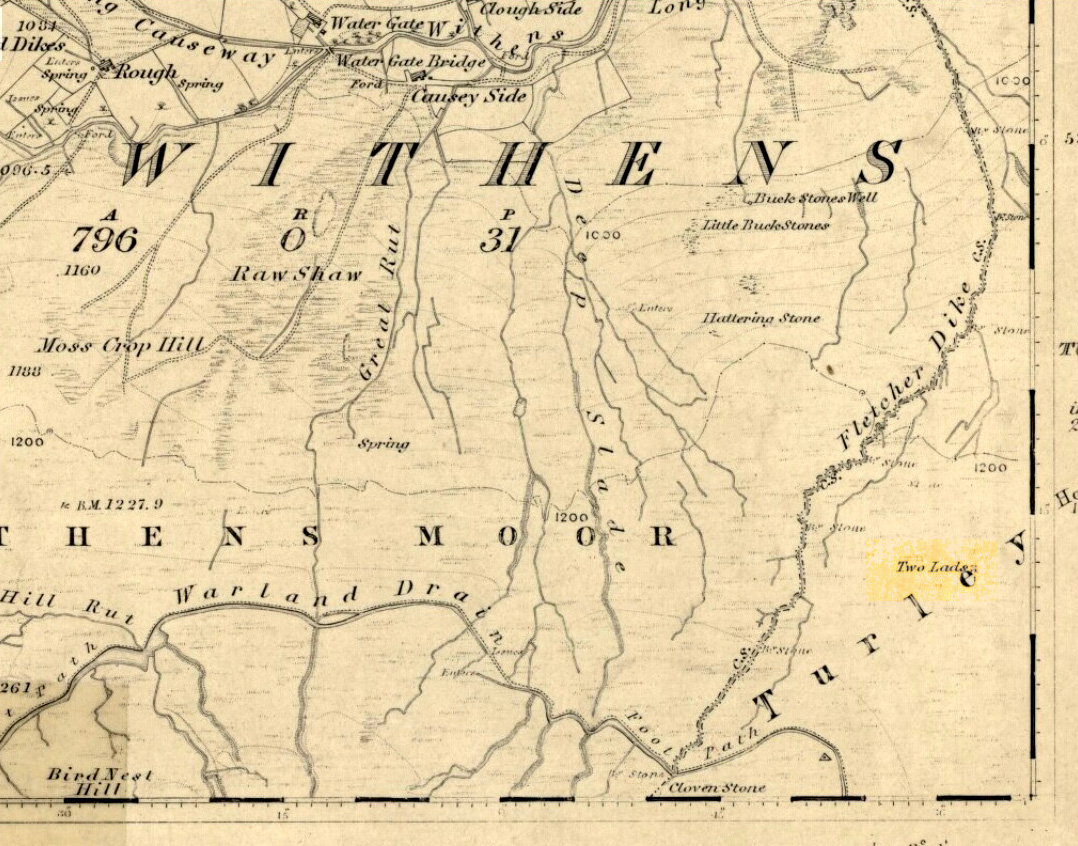
Two Lads on 1853 OS-map

Although the two ‘cairns’ on top of these two rocks are not prehistoric in nature, about 20 yards behind the Two Lads (south) may once have been the severely denuded remains of a once large prehistoric cairn.  Although the position in the landscape is perfect for such a construction, this is somewhat tentative, it’s gotta be said!  Further examinations are obviously necessary here.

The studious A.H. Smith (1961-63) believes that a field-name record from 1624, describing some ‘Lad Stones’ in the parish of Heptonstall relates to this site.  We know with certainty however, that this site was first illustrated on Greenwood’s 1771 map of Yorkshire, then highlighted on more recent 19th century Ordnance Survey maps as ‘cairns.’

Folklore

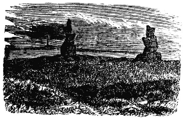
Drawing of the Lads in 1877

The creation myth behind this place is that two lads were walking over the moor in midwinter and got caught in a blizzard. Losing all sense of visibility they tried to shelter from the wind and snow by hiding behind these rocks, but perished. Sometime later their bodies were found and the curious “cairn” of rocks were mounted onto the boulders to mark where they’d died.  This is a folktale we find at many other old stone remains on the hilltops of northern England and Scotland.

The Two Lads seems to be very close to a midwinter alignment (or izzit a lunar standstill line?), linking it with the huge Rudstoop Standing Stone and, eventually, Robin Hood’s Penny Stone on Midgley Moor – which might be the root of the folktale. (i.e. midwinter, snow, death)  Any archaeoastronomy buffs out there wanna check this one out?  Then we can confirm or dismiss it.

References:

  1. Anonymous, “The ‘Two Lads’, Withens Moor,” in Todmorden & Hebden Bridge Historical Almanack, T. Dawson: Todmorden 1877.
  2. Bennett, Paul, The Old Stones of Elmet, Capall Bann: Milverton 2001.
  3. Smith, A.H., The Place-Names of the West Riding of Yorkshire, Cambridge University Press 1961-63.

© Paul Bennett, The Northern Antiquarian 

Nancekuke Carving, Portreath, Cornwall

Cup-Marked Stone:  OS Grid Reference – SW 67 46*

Archaeology & History

Another one of those rare cup-marked stones from Cornwall, once again found in association with a burial— but once again destroyed, this time by having an airfield built over the tomb!  This “cup-marked and perforated slab” was said by Paul Ashbee (1958: 192) to have been unearthed “by Mr C.K. Andrew” in 1941 when he was digging in the Nancekuke round barrow.  Yet an earlier reference to the same site by Mr o’ Neil (1948: 26) told that “the grave was rifled c.1926, but in the ditch there were found traces of a Bronze Age wooden shovel and a perforated and cup-marked slate.”  For any students studying this arena, the correct date would appear to be the earlier of the two.

I’ve not been able to locate any decent photos or diagrams of this small cup-marked stone and would truly appreciate an illustration of it if anyone could get hold of one.

References:

  1. Ashbee, Paul, “The Excavation of Tregulland Burrow, Treneglos Parish, Cornwall,” in Antiquaries Journal, volume 38, 1958.
  2. o’ Neil, B.H. St. John, “War and Archaeology in Britain”, in Antiquaries Journal, volume XXVIII, January-April 1948.

* The OS grid reference here is an approximation

© Paul Bennett, The Northern Antiquarian


Loch Glassy, Weem, Perthshire

Sacred Loch:  OS Grid Reference – NN 850528

Also Known as:

  1. Loch Glassie

Folklore

Here we have another case of another loch in Scotland that was said by local people to be inhabited by legendary water monsters.  In the tale which follows we may simply have a case of a very bad accident that was, in more superstious times, bestowed upon this legendary animal.  We may never know.  James Kennedy (1928) told the story, saying:

“It was inhabited, like Loch Derculich, by the ‘Each Uisge‘ of Icelandic origin.  On summer evenings it could be seen roaming at large on a green meadow adjacent to the tarn, and to all appearance a canny enough creature.  One summer Sunday afternoon, six Strathtay girls and a boy set out from their homes to inspect the ‘Each Uisge.’  They found him, patted him on the head and neck, and this kindness is apparently relished, for it lay on the sward and allowed them to sit on its back.  The boy, who had a semi-bald scabbed head, stood at a distance and watched developments.  He concluded that this animal was not the genuine horse it seemed to be, and thought that it grew considerably larger than it was at first.  When the Each has the six girls comfortably seated on its back, it suddenly rose, plunged into the loch, and drowned the lot.  The boy immediately took to his heels and the Each after him, but fear enabled the boy to outstrip the horse, who would stop now and again in the pursuit and cry, “Fuirich mo ghille maol carrach!  Fuirich mo ghille maol carrach!” — Stop, you bald scabbed-headed boy.  Ultimately the Each gave up the chase, and the boy, much frightened, got safely home and related all that happened on that eventful Sunday evening.  The parents of the girls found parts of their bodies floating on the waters of the loch, and the name Loch Lassie was given to it, which it retains to this day.”

References:

Kennedy, James, Folklore and Reminiscences of Strathtay and Grandtully, Munro Press: Perth 1928.

© Paul Bennett, The Northern Antiquarian
Pleasington Cemetery, Blackburn, Lancashire

Tumulus:  OS Grid Reference – SD 650 272

Getting Here

The site is situated in a natural hollow just above a steep sided ravine known as Scotsman’s Wood through which a stream flows. The location in the hollow obscures all surrounding views of the East Lancashire Pennines and the Billinge Hill massif. The near surrounding area is on a natural sandbank created by the western shore of the post-glacial ‘Lake Accrington’.

Archaeology & History

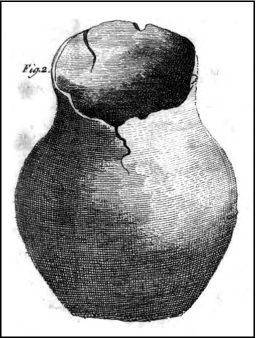
During the early spring of 1996, grave digger Grant Higson, whilst excavating a new grave, uncovered course fragments of pottery displaying a herringbone pattern and other material. Grant stopped work immediately and alerted Blackburn Museum worker Maggy Simms, who gathered together the shattered remains and brought in Lancaster University Archaeological Unit for identification. They identified the fragments to be a Bronze Age Urn some 12 inches in height, decorated with a herringbone pattern and containing bones and ashes of several cremations, some stained green by some copper object that had disintegrated over the years. The burial was assigned to c. 1500 BC, a period of history referred to as the Bronze Age. The urn and its contents are now held by Blackburn Museum. A geo-physical survey was undertaken by the Unit on the surrounding areas that displayed undulation of the ground surface but nothing was found, the undulations deemed natural features.  No archaeological report or radiocarbon dating has been made to date by Blackburn Museum Service, the Lancaster University Archaeological Unit being now defunct.

During August 2009, I visited the site and was fortunate to meet with Grant Higson who not only showed me the location of the find, but also described the geological formation of the cemetery area.

The urn found is typical of the well developed Pennine urns recovered from the Anglezarke, Bleasdale and Burnley districts and a date of 1500+250 BC is more than likely cet. par.

Given the ‘sheltered’ location of the find I would ascribe the site as one of a primary domestic nature, the burial being a secondary feature: primary tumulus burials in prominent locations being the sole preserve of the ruling aristocracy. What we are looking at is a hearth burial within a communal living hut: following the Indo-European custom, the dead were given to the Earth inside the human habitation. The dear departed, who had been so close to the family group in life, had to remain among them in death also and share the family’s joys and struggles, food and drink. While living they had enjoyed nightly rest under the roof of the communal hut, dead they slept the eternal slumber beneath the domestic heart.

This site is noted by ’TheElf’ on The Modern Antiquarian. ‘TheElf’ goes on to mention, “I saw what could possibly be a standing stone, some 200 metres north east of the cemetery.”   I located this stone (SD 648 273) and found it to be a broken 17th century gate-stoop for pole fence – a gate post with a series of holes used to create a ‘heck’, being an adjustable series of pole bars in lieu of a gate.

Article contribution courtesy of John Dixon – © John Dixon 2009.


Duel Cross Hill, Grafton, North Yorkshire

Tumulus (destroyed):  OS Grid Reference – SE 426 634

Also Known as:

  1. Deuill Cross Hill
  2. Devil’s Cross
Urn from Devil’s Cross tumulus

Archaeology & History

In Henry Smith’s wonderful Reliquiae (1852) on the history of Aldborough and district, this intriguingly named but forgotten site is given the greatest literary attention extant.  Assumed by a couple of modern academics – without evidence – to have been little more than a natural hillock, this once great mound was undoubtedly an important burial place for some ancestral characters.  Although its exact location is unknown (anyone out there know for certain?), it was said to have been located about 100 yards from where the old tracks crossed at Duel Cross.

First described by a Mr Urban in the Gentleman’s Magazine of June, 1787.  He told it to be known as the Devil’s Cross and was a tumulus,

“whose elevation is about 18 feet, and circumference at the base 370 feet.  It was broken into some time since to supply materials for the repair of the high road leading from Aldborough to York. The soil consists, first, of a black earth, and under that a red sandy gravel, human bones, some of which are entire, and urns of various sizes.  The urns are composed of blue clay and sand, some ornamented and others quite plain; several Roman coins have also been found here.”

There were a great number of old urns found in the mound when it was dug into in 1756, leading Mr Urban to believe the site was used an ancient cemetery.  Intriguingly he told that all of the urns and their ashes were found to have been placed on one side of the mound, with many human bones being deposited in another section, away from the urns.  This, the finding of Roman coins next to the mound and the proximity of the Roman road led Mr Urban to believe the site was a Roman tumulus, though this seems unlikely.  Years later, Henry Smith’s (1852) commentary on the Devil’s Cross hill led him to believe the mound was from a much earlier period:

“From a sketch of one of these, which is stated to have been nine inches high, there can be little doubt of these cinerary urns bring of the ancient British period, but from the great number of bones discovered, this tumulus was probably used as a cemetery during the Romano-British period, if not still later.  Of its use in Roman times, evidence is unequivocally supplied in the numerous coins found here…”

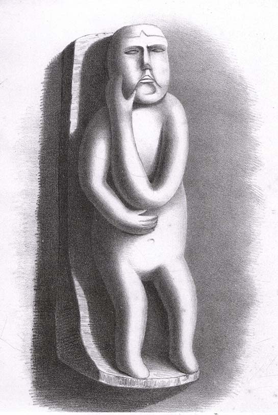
Carved stone figure (from Smith’s ‘Reliquiae’)

Not far from this long lost tumulus,  a curious carved stone figure was located “among ancient foundations” in a cellar!  Thought to be a local deity, it may have been a carved representation of whichever figure or spirit ancestor was buried in Duel Cross Hill — though we’ll never know for sure.

Folklore

Although archaeologically, etymologically and geomantically related to the nearby Devil’s Arrows at Boroughbridge a couple of miles up the road, there is nothing specific I can find of this once important tumulus.  However the place-name in both forms, Deul and Deuill, refers to the pre-christian devil (from deofol, Old English, “devil”).  This name may relate to the stone figure shown in the illustration, or of long lost heathen rites enacted here in bygone times.  Any further info on this place is very welcome.

References:

  1. Hargrove, E., The History of the Castle, Town and Forest of Knaresbrough, Hargrove & Sons: Knaresbrough 1809.
  2. Smith, Henry E., Reliquiae Isurianae, J.R. Smith: London 1852.

© Paul Bennett, The Northern Antiquarian

Intake Lodge, Yearsley, North Yorkshire

‘Tumulus’ (destroyed):  OS Grid Reference – SE 592 737

Archaeology & History

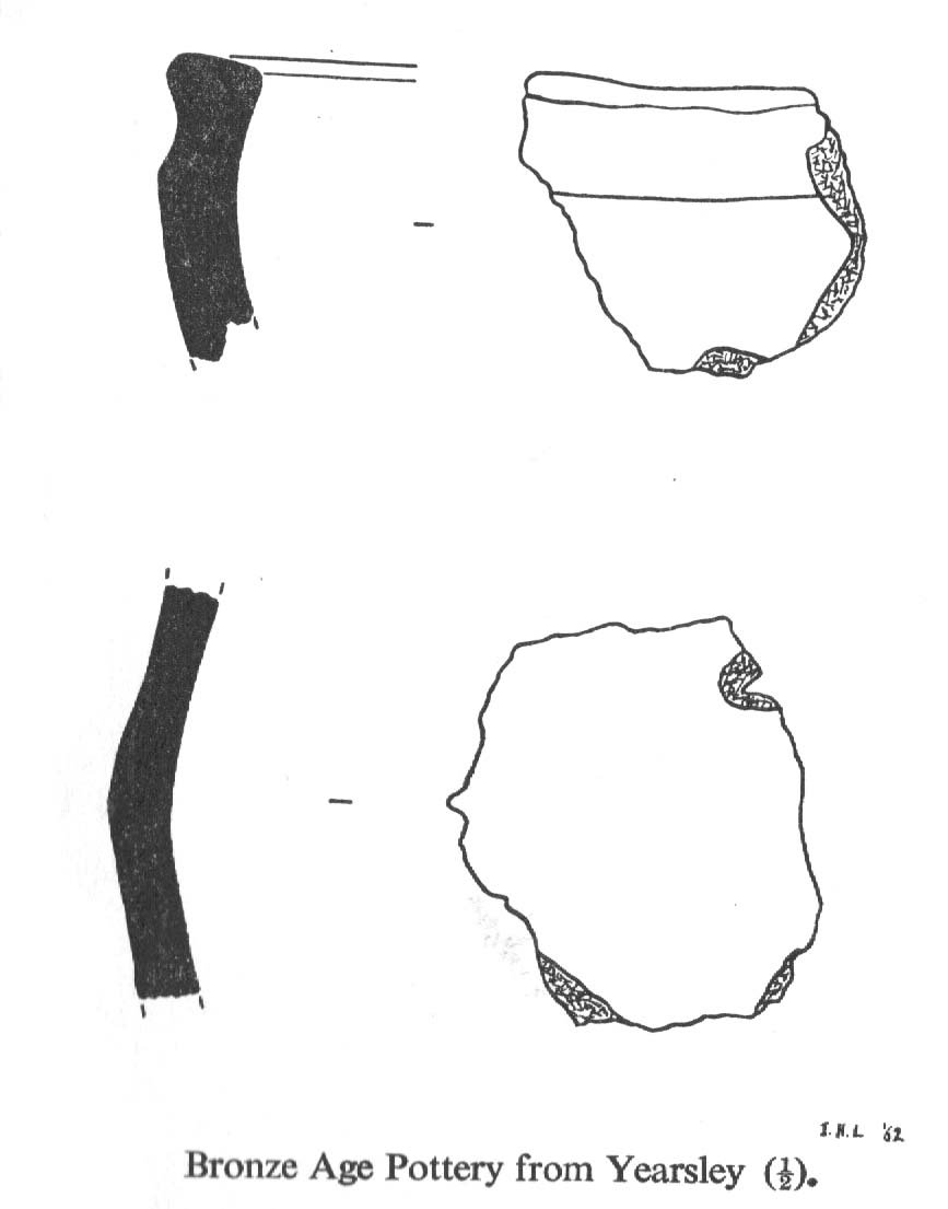
Bronze Age pottery (after YAJ 1963)

A curious entry inasmuch as it’s difficult to categorize the site correctly.  Added to this is the fact that the place has been built over!  But despite these misgivings (if that’s the right word!), the site’s deserving of a posthumous entry…

There used to be a curious-looking mound here, immediately east of Intake Lodge, that “was due to be bulldozed so that a field of rough pasture could be brought under cultivation”, killing the indigenous wildlife that was living here.  However, before this was done, some inspectorate dood who worked for the Ancient Monuments Commission and the Ministry of Works “decided to excavate”, as he believed that an ancient burial mound was in the field.  Mr I.M. Stead (1963) takes up the story, telling:

“”This mound was about 75ft by 90ft diameter and 6ft high, on ground sloping away to the south-east.  It had every appearance of being a barrow.

“The excavation, in October 1961, was supervised by the writer (and) assisted by Mr A.L. Pacitto.  A trench on the east side revealed layers of sand which appeared to be natural, and a second trench, on the west side, uncovered a capping of stone which confirmed that this was not a barrow.  However, it seems that the writer was not the first person to mistake it for an artificial burial mound.  A disturbed area in the centre, some 15ft diameter, where there had been an old water-tank, produced a fragment of Bronze Age pottery and a sherd from another Bronze Age vessel was found in a disturbance on the side of the mound.  A small area near the centre was cleared in the hope of finding an undisturbed burial, but shortage of funds did not permit more extensive stripping.  Judging from the type of pottery (see image) and its situation on the mound, there can be little doubt that one two occasions Bronze Age people placed secondary burials in the natural mound.”

This tells us that although the mound wasn’t a tomb or burial mound in a traditional religious sense, it was instead a sacred hill of the dead for the local people at one time or another in ancient days.   And, if Mr Stead had been a decent archaeologist and continued to excavate here without pay (as he should do if he loves his subject), we may have found more beneath this now-lost sacred mound.  Unfortunately this didn’t happen and we lost vital clues and information.

References:

  1. Stead, I.M., “An Excavation at Yearsley, North Riding, 1961,” in Yorkshire Archaeological Journal, part 161 (volume 41), 1963.

© Paul Bennett, The Northern Antiquarian

Stanwell Cursus, Heathrow, Surrey

Cursus (destroyed):  OS Grid Reference – TQ 0545 7431 to TQ 0448 7782

Also Known as:

  1. Heathrow Cursus

Archaeology & History

Running roughly north-to-south, this cursus was 2¼ miles long (3600 metres) and comprised of two linear sections from a field in Stanwell up through the western side of Heathrow Airport averaging, curiously, just 24 yards (22m) across.  Of course nothing of it can be seen today as the airport and surrounding industrial crap has destroyed it.  The cursus had a lengthy internal bank along its length. During excavation work done at the Perry Oaks Sludge Works section in Hillingdon, archaeologists found evidence for a short avenue of posts, about 110 feet long, apparently constructed prior to the cutting of the cursus’ ditches, following the same direction/alignment of the subsequent monument.  In Roy Loveday’s (2006) survey of cursus monuments he said this of Heathrow’s cursus:

“This site, striking across land so flat that it has been selected  for Heathrow Airport, extends for some 4km, crosses two rivers and stops by a stream — originally perhaps a more major river.  So straight and apparently narrow is it (20m) that it was originally taken to be a Roman road.  Early excavation seemed to support the idea: vestigal remains areas of gravel between the ditches were scored by shallow gullies resembling cart ruts.  Later excavation, however, demonstrated that the ditches of a Late Bronze Age field system cut across it and several scarps of Peterborough Ware (i.e., pottery – PB) were recovered from its ditches.  Evidence also emerged of a short (50m) ragged, double row of posts, removed before the ditches were dug on the same alignment.  That this was a bank barrow was hinted at by the Charlecote test and by reduction in the depth of field ditches as they crossed the central area.”

Confirmation that an earthen bank of some kind running near the middle of the cursus was confirmed by analysis of early Ministry of Defence aerial photographs.  For those who would like a more detailed description on this site, I refer you to the excellent paper by o’ Connell. (1990)

…to be continued…

References:

  1. Barclay, Alistair, et al, Lines in the Landscape, Oxford Archaeological Unit 2003.
  2. Loveday, Roy, Inscribed Across the Landscape, Tempus: Stroud 2006.
  3. o’ Connell, M., “The Heathrow-Stanwell Cursus,” in Current Archaeology, 9, 1986.
  4. o’ Connell, M., “Excavations during 1979-1985 of a Multi-Period Site at Stanwell,” in Surrey Archaeological Collections, 80, 1990.

© Paul Bennett, The Northern Antiquarian