St. Stephen’s Well, Banbury, Oxfordshire

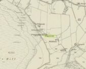
Holy Well (destroyed):  OS Grid Reference – SP 4506 4055

Archaeology & History

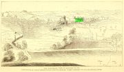
Well highlighted, in 1730

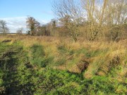
The holy well of Banbury seems to have been destroyed sometime in the second-half of the 19th century, when the industrialists built over the area.  When the historian Alfred Beesley (1841) wrote about it, the waters were still running.  He told it to be, “a chalybeate spring, well-known and still often visited, situated on the west side of the town, a little north of the footway leading to North Newington.”

The footpath is obviously long gone—as is the well.  It’s iron-bearing (chalybeate) properties would have given the waters good fortifying properties, perhaps of some renown to local people yet, according to Mr Beesley, it was a slow-flowing spring.  In his brief history of the site, he also gave us the results of a chemical examination of its healing waters, telling us:

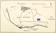
“This is called St. Stephen’s Well in a plan of Sir John Cope’s property at Banbury made in 1764. It also appears prominently as “A Well ” in an unfinished view of Banbury made in 1730 (illustrated above)….

The water of this spring is perfectly clear and colourless, having a brisk and slightly chalybeate taste. The stone channel is coated with a light red deposit, and a scum of the same colour appears on the water in parts where stagnant. The spring discharges from half a gallon to one gallon in a minute.  In 32 oz. of the water at 60° are,

Carbonic Acid gas, 5 cubic inches
Hydrochlorate Magnesia, 0.21 grains.
Chloride Sodium or common Salt, 0.54
Sulphate Lime, 1.5
Carbonate Lime, 3.8
Protoxide Iron, 0.024
Silica a trace
Total weight of solid contents – 6.074″

Folklore

St. Stephen is an odd character.  His annual celebration or feast day in Britain is December 26. (in eastern countries it’s a day later)  Rites connected to this character are decidedly heathen in nature.  From the 10th century, in England, St Stephen’s Day has been inexorably intertwined with horses, bleeding them on his feast days, apparently for their own health.  Water blessed by priests on this day would be kept for the year and used as a medicine for horses during that time. Also on this day, young lads would “hunt the wren” and, once caught, impale it on top of a long pole and take it from house to house.  Despite this curious motif being a puzzle to folklore students, Mircea Eliade (1964) explained how this symbolism is extremely archaic and “the bird perched on a stick is a frequent symbol in shamanic circles.”

References:

  1. Beesley, Alfred, The History of Banbury, Nichols & Son: London 1841.
  2. Eliade, Mircea, Shamanism – Archaic Techniques of Ecstasy, Princeton University Press 1964.
  3. Harte, Jeremy, English Holy Wells – volume 2, Heart of Albion press: Wymeswold 2008.
  4. Johnson, William P., The History of Banbury, G. Walford: Banbury 1860.

Acknowledgements:  Huge thanks for use of the Ordnance Survey map in this site profile, reproduced with the kind permission of the National Library of Scotland

© Paul BennettThe Northern Antiquarian

Hardwick Maypole, Whitchurch, Oxfordshire

Maypole (destroyed):  OS Grid Reference – SU 655 781

Archaeology & History

“g” marks the spot!

Very little is known about the history surrounding Whitchurch’s maypole that once stood more than a mile east of the village, somewhere in the woods immediately south of the present-day cannabis-growing Hempem Organics. (damn those hippies!)  Mentioned in the Enclosure Acts of 1806 and 1813 as the “May Pole Ground”, the monument was mentioned in the Rev. John Slatter’s (1895) local history work and its approximate location was shown on a hand-drawn map he did of the area, in the grounds north of Hardwick House.  He told us that it stood on “an elevated site” and conjectured that it might once have been a place of druidical worship!

“In the centre of the Hardwick property is a plot of ground called the Maypole Piece…. It is an open space, with a tree standing alone, where we may suppose the maypole formerly stood. There is a memorandum made by the last Mrs. Lybbe (nee Isabella Twysden) to this effect:

1713: A maypole set up on ye hill in ye straight way to Collinsend.”

In the event that you manage to discover anything else about the history of this maypole, let us know on our Facebook group.

References:

  1. Gelling, Margaret, The Place-Names of Oxfordshire – volume 1, Cambridge University Press 1953.
  2. Slattter, John, Notes on the History of the Parish of Whitchurch, Elliot Stock: London 1895.

© Paul BennettThe Northern Antiquarian

Ballengeich, Uphall, West Lothian

Standing Stone (destroyed):  OS Grid Reference – NT 074 698

Archaeology & History

A few hundred yards west of the commemorative Wallace Stone monolith could once be seen a standing stone of considerable size.  It was described by James Primrose (1898) in his description of the standing stones of the Strathbrock region; but even in his day, remains of it were fragmentary.  He wrote:

“On Drumshoreland Moor, within the grounds of Pumpherston Oil Company, there is a stone, popularly styled Bucksides — its correct designation being Backsides — from its position at the backside of Pumpherston.  This stone, a huge whinstone boulder about 12 feet long and 8 feet broad, was blasted in 1888, to make room for the site of a bench of retorts; a few fragments of the stone, however, yet remain by the roadside.  The ancient name of this stone was Ballengeich — apparently the Gaelic for “the township towards the wind”, — as if a croft once stood here, near Pumpherston Mains, in an exposed and windy situation.”

A visit to the local history department of the local library might prove fruitful in giving us more information about this place—that’s assuming the filthy tory central government’s theft of taxpayer’s money doesn’t close it! (does that sound a bit harsh? 😁 )

Folklore

The same historian told of a “tradition…that round this stone in days gone by the Broxburn folks, along with their neighbours, used to assemble at Fair time, in the month of August, in order to witness their favourite sport of horse-racing; but whether there was any more ancient custom associated with it, we have never learned.”

References:

  1. Primrose, James, Strathbrock; or, the History and Antiquities of the Parish of Uphall, Andrew Elliot: Edinburgh 1898.

© Paul BennettThe Northern Antiquarian

St. Tredwell’s Loch, Papa Westray, Orkney Isles

Sacred Loch:  OS Grid Reference – HY 495 509

Folklore

I’ve already added a site-profile of the standing stones that used to be close to this loch, and added to it the folklore below; but I realised that for students of water-lore, a separate profile for the loch itself is needed.  For those of you who are not into water-lore, I hope you can forgive this repetition.

The loch, its associated chapel and the standing stones were visited at the end of the 17th century by John Brand, who gave a good account of the rituals performed by local people at the time.  They regarded the waters here as very special indeed, with great medicinal powers.  The loch had sense of sacrality whose nature was intimately tied to the repetition and regeneration of the seasons, valorizing the healing function of the waters.

By the edge of the loch stood St Tredwell’s church, outside of which was a cairn of stones.  When people visited here to be cured of their various ailments, they would pick up one of them and cast it into the loch as an offering (some folk would cast money), so that its waters would heal their illness.  According to Mr Brand and the local minister, such cures were numerous.  The narrative is truly fascinating.  Brand told us that,

“nigh to the east end of which this chapel is, is held by the people as medicinal, whereupon many diseased and infirm persons resort to it, some saying that thereby they have got good; as a certain gentleman’s sister upon the isle, who was not able to go to this loch without help, yet returned without it; as likewise a gentleman in the country who was much distressed wifh sore eyes, went to this loch, and washing there became sound and whole, though he had been at much pains and expense to cure them formerly.  With both which persons he who was minister of the place for many years was well acquainted, and told us that he saw them both before and after the cure.  The present minister of Westra told me that such as are able to walk, use to go so many times about the loch as they think will perfect the cure, before they make any use of the water, and that without speaking to any, for they believe that if they speak this will marr the cure: also he told that on a certain morning not long since he went to this loch and found six so making their circuit, whom with some difficulty he obliging to speak, said to him they came there for their cure.”

For the curing of sore eyes, the loch was specifically resorted to at Easter and during Lent.  Traditions such as these are found at other lochs in Scotland and at lakes in many other parts of the world.

Another interesting feature related to the element of Kingship; for the waters of the loch were said to turn red when anything important was going to happen to a member of the royal family.

St Tredwell herself—also known as St. Triduana—has her saints day on October 8.

References:

  1. Banks, M. MacLeod, British Calendar Customs: Orkney and Shetland, Folk-lore Society: London 1946.
  2. Black, G.F., Examples of Printed Folk-lore Concerning the Orkney and Shetland Islands, Folk-Lore Society: London 1901.
  3. Brand, John, A Brief Description of Orkney, Zetland, Pightland Firth and Caithness, George Mosman: Edinburgh 1701.
  4. Eliade, Mircea, The Sacred and the Profane, Harcourt: New York 1959.
  5. Fergusson, Robert M., Rambling Sketches in the Far North, Simpkin Marshall: London 1883.
  6. MacKinlay, James M., Influence of the Pre-Reformation Church on Scottish Place-Names, William Blackwood: Edinburgh 1904.

© Paul BennettThe Northern Antiquarian

St. Tredwell’s Chapel, Papa Westray, Orkney Isles

Standing Stones (destroyed):  OS Grid Reference – HY 497 509

Archaeology & History

These long lost standing stones most probably played a part in some ritual acts performed by the Orkney people until relatively recent times.  Whilst their simple description doesn’t tell us this, the folklore of the adjacent body of water strongly suggests it.  The stones were visited at the end of the 17th century by the antiquarian John Brand (1701) from whom we gain the only known account.  He told that,

“At the north-east side of (St Tredwell’s) loch, nigh to the chapel, there is a high stone standing, behind which there is another stone lying hollowed in the form of a manger, and nigh to this there is another high stone standing with a round hole through it, for what use these stones served, we could not learn; whether for binding the horses of such to them as came to the chapel, and giving them meat in the hollow stone, or for tying the sacrifices to, as some say, in the times of Pagan idolatry, is uncertain.”

Several other hold stones are found in Orkney, some of which had lore that was thankfully recorded.  We don’t know when these stones were torn down, but there is the possibility that they may have been cast into the loch alongside which they stood.

Folklore

An intriguing piece of folklore relates to the adjacent St Tredwell’s Loch, right next to the stones.  The loch was known of far and wide as possessing great healing properties which Mr Brand told to be distinctly pagan in nature.  St Tredwell’s church had a cairn of stones by its side and those who visited here would pick one up and cast it into the loch as an offering (some folk would cast money), so that its waters would heal that person’s ailment.  According to Brand and the local minister, such cures were numerous.  The narrative is truly fascinating.  Brand told us that,

“nigh to the east end of which this chapel is, is held by the people as medicinal, whereupon many diseased and infirm persons resort to it, some saying that thereby they have got good; as a certain gentleman’s sister upon the isle, who was not able to go to this loch without help, yet returned without it; as likewise a gentleman in the country who was much distressed wifh sore eyes, went to this loch, and washing there became sound and whole, though he had been at much pains and expense to cure them formerly.  With both which persons he who was minister of the place for many years was well acquainted, and told us that he saw them both before and after the cure.  The present minister of Westra told me that such as are able to walk, use to go so many times about the loch as they think will perfect the cure, before they make any use of the water, and that without speaking to any, for they believe that if they speak this will marr the cure: also he told that on a certain morning not long since he went to this loch and found six so making their circuit, whom with some difficulty he obliging to speak, said to him they came there for their cure.”

The reason that I’ve included this folklore to the site profile of the monoliths is that, at some time in the early past the stones would most almost certainly have played some part in the ritual enacted at the loch by which they stood.  The building of Tredwell’s chapel was, quite obviously, an attempt to mark the place as christian in nature; but in such a remote region, old habits truly died hard.  Of particular interest in the rituals described here is the element of silence.  It’s fascinating inasmuch as it’s an integral ingredient in various ritual magick performances in different parts of the world.  Even in some modern magickal rites, this is still vitally important.  It’s a tradition also found at other lochs in Scotland and at lakes in many other parts of the world.

References:

  1. Brand, John, A Brief Description of Orkney, Zetland, Pightland Firth and Caithness, George Mosman: Edinburgh 1701.
  2. Royal Commission Ancient & Historical Monuments, Scotland, Inventory of the Ancient Monuments of Orkney and Shetland – volume 2, HMSO: Edinburgh 1946.

© Paul BennettThe Northern Antiquarian

St. Patrick’s Well (1), Dunruchan, Muthill, Perthshire

Holy Well:  OS Grid Reference – NN 77905 17365

Getting Here

St Patricks Well on 1863 map

Take the B827 road between Comrie and Braco. If you’re coming via Comrie, going uphill for 3.1 miles (5.1km); but if from Braco Roman Camp go along and eventually downhill for 6.6 miles (10.6km), watching out for the track to Middleton Farm by the roadside.  Walk along for 125 yards, keeping your eyes peeled for the boggy ground below on your left. You’re there!

Archaeology & History

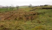
Immediately east of the prodigious megalithic complex of Dunruchan, bubbling up amidst the usual Juncus conglomeratus reeds, are the boggy remnants of St. Patrick’s Well—one of two such sacred wells dedicated to the early Irish saint in Muthill parish. We’re at a loss as to why this Irish dood has such sites in his name in this area.  No doubt some transitional shamanic character was doing the rounds in this glorious landscape, muttering words of some neo-christian animism, eventually settling a mile from the great megalithic complex, perhaps hoping—and failing—to convert our healthy heathen populace into ways unwise.

The shallow boggy waters
The site of St Patricks Well

Whatever he may have been up to, a small stone chapel was built hereby and, it was said, even a christian graveyard, to tempt folk away from the ancient plain of cairns whence our ancestors had long since buried their dead.  But the christian’s chapel and graveyard has long since gone; and when historians before me had visited the place, St Patrick’s Well had also fallen back to Earth in the drier summers, taking the blood of the Earth back into Her body.  The heathen megaliths still remain however, standing proud on the moorland plain in clear sight from these once healing waters, whose mythic history, on the whole, has long since been disregarded….

Folklore

St Patrick’s day on March 17—”a date very near the Spring Equinox,” as Mrs Banks (1939) reminded us—may have been the dates when the waters here were deemed particularly efficacious, although we have nothing in written accounts to tell us for sure. But in the 19th century Statistical Account we find that the site was “much frequented once, as effectual in curing the hooping cough.”  E.J. Guthrie (1885) told of an ancient rite regarding the drinking of the waters for effect of the cure, saying:

“In the course of this century a family came from Edinburgh, a distance of nearly sixty miles, to have the benefit of the well. The water must be drunk before sunrise or immediately after it sets and that out of a “quick cow’s horn”, or a horn taken from a live cow, and probably dedicated to this saint.”

Also in Muthill parish, Guthrie told, St Patrick’s memory was held in such veneration that farmers and millers did not work on his day.

References:

  1. Banks, M. MacLeod, British Calendar Customs: Scotland – volume 2, Folk-lore Society: Glasgow 1939.
  2. Booth, C. Gordon, “St Patrick’s Well (Muthill Parish),” in Discovery & Excavation, Scotland, New Series volume 1, 2000.
  3. Guthrie, E.J., Old Scottish Customs, Thomas D. Morison: Glasgow 1885.
  4. MacKinlay, James M., Folklore of Scottish Lochs and Springs, William Hodge: Glasgow 1893.
  5. Morris, Ruth & Frank, Scottish Healing Wells, Alethea: Sandy 1982.

© Paul BennettThe Northern Antiquarian


Lady Well, Airth, Stirlingshire

Holy Well (destroyed):  OS Grid Reference – NS 89801 86524

Also Known as:

  1. Canmore ID 46862
  2. Lady’s Well
  3. Spaw Well

Archaeology & History

Site of the Lady Well, Airth

Once to be seen flowing on the south-side of the Pow Burn below Airth Castle, all traces of this once sacred site has fallen prey to the usual advance of the so-called ‘civilized’.  In literary terms, the site was first described in church records from 1657—as Ladieswell—and the accounts we have of the place from then are most revealing in describing the traditional use of the place by local people.  It was a sacred site, obviously, chastised by the madness of the christian regime of the period, in their attempt to destroy indigenous customs and societal norms.  William Hone (1837) gave an extended account of what some people were up to here in his Everyday Book:

“In 1657, a mob of parishioners were summoned to the session, for believing in the powers of the well of Airth, a village about six miles north of Falkirk, on the banks of the Forth, and the whole were sentenced to be publicly rebuked for the sin. –

“”Feb. 3, 1757, Session convenit. Compeared Bessie Thomson, who declairit scho went to the well at Airth, and that schoe left money thairat, and after the can was fillat with water, they keepit it from touching the ground till they cam horm.”

“”Ffebruary 24. — Compeired Robert Fuird who declared he went to the well of Airth, and spoke nothing als he went, and that Margrat Walker went with him, and schoe said ye beleif about the well, and left money and ane napkin at the well, and all was done at her injunction.”

“”Compeared Bessie Thomson declarit schoe fetch it horn water from the said well and luit it not touch the ground in homcoming, spoke not as sha went, said the beleif at it, left money and ane nap-kin thair; and all was done at Margrat Walker’s command.”

“”Compeired Margrat Walker who denyit yat scho was at yat well befoir and yat scho gave any directions ”

“”March 10. Compeared Margrat Forsyth being demand it if scho went to the well of Airth, to fetch water thairfrom, spok not by ye waye, luit it not touch ye ground in homcoming? if scho said ye belief? left money and ane napkin at it? Answered affirmatively in every poynt, and yat Nans Brugh directit yem, and yat they had bread at ye well, with them, and yat Nans Burg said shoe wald not be affrayit to goe to yat well at midnight hir alon.”

“”Compeired Nans Burg, denyit yat ever scho had bein at yat well befoir.”

“”Compeired Robert Squir confest he went to yat well at Airth, fetchit hom water untouching ye ground, left money and said ye beleif at it.”

“”March 17. Compeired Robert Cochran, declairit, he went to the well at Airth and ane other well, bot did neither say ye beleif, nor leave money.”

“”Compeired Grissal Hutchin, declairit scho commandit the lasses yat went to yat well, say ye beleif, but dischargit hir dochter.”

“”March 21. Compeired Robert Ffuird who declairit yat Margrat Walker went to ye well of Airth to fetch water to Robert Cowie, and when schoe com thair, scho laid down money in Gods name, and ane napkin in Robert Cowie’s name.”

“”Compeired Jonet Robison who declairit yat when scho was seik, Jean Mathieson com to hir and told hir, that the water of the well of Airth was guid for seik people, and yat the said Jean hir guid sister desyrit hir fetch sum of it to hir guid man as he was seik, bot sho durst never tell him.”

“”These people were all 44 publicly admonishit for superstitious carriage.””

The practices continued.  In 1723, a Mr Johnstoun of Kirkland, writing about the parish of Airth, also told of the reputation of the well, saying,

“Upon the south side of the Pow of Airth, upon its very edge, is a spaw well famous in old times for severall cures, and at this day severalls gets good by it, either by drinking or bathing. Its commonly called by the name of Ladies well. Its about two pair of butts below Abbytown bridge.”

The fact that he told us it was “good for bathing” suggests a pool was adjacent, or at least the tiny tributary between it and the Pow Burn gave room for bathing and had a curative reputation. (there are many pools in the Scottish mountains with this repute – some are still used to this day!)

It was then described by Robert Ure in the first Statistical Account of 1792, where he told how the people were still using the waters, despite the crazy early attempts to stop them.  “There is a Well, near Abbeytown Bridge,” he told,

“called Lady-Well, which is thought to be medicinal.  Numbers have used it, and still use it as such.  It is supposed to have obtained that name, from the holy water, in the time of Popery, being taken from it, to supply the abbacy, or Catholic Church, then at Airth.”
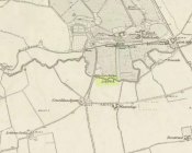
Lady Well on 1865 map

But we know that its origins as a celebrated well pre-date any christian overlay.  People were reported visiting the site from as far away as Edinburgh, such was its repute!

Much later when the Ordnance Survey lads came here, showing it on their first map of Airth, they made their own notes of the place, saying briefly,

“A small well close to the Pow Burn – it is supposed to have derived its name from the Custom of dedicating wells to the Virgin Mary – so Common prior to the Reformation. It is not a mineral well.”

Ugly plastic pipe is all that remains

But its demise was coming.  In the wake of the christian Industrialists and their myth, subsuming the necessary integral sacrality of the Earth, the waters of the well were eventually covered.  When the Royal Commission (1963) lads gave the site their attention in October 1954, they reported that “no structural remains” of any form could be seen here, and in recent years all trace of the well has vanished completely.  When we visited the site a few months ago, perhaps the very last remnant of it was a small plastic pipe sticking out of the muddy bankside, dripping dirty water into the equally dirty Pow Burn.

It would be good if local people could at least put a plaque hereby to remind people of the history and heritage that was once so integral to the way they lived their lives.

References:

  1. Bennett, Paul, Ancient and Holy Wells of Stirling, TNA 2018.
  2. Fraser, Alexander, Northern Folk-lore on Wells and Water, Advertiser Office: Invermess 1878.
  3. Frost, Thomas, “Saints and Holy Wells,” in Bygone Church Life in Scotland (W. Andrews: Hull 1899).
  4. Hone, William, The Every-day Book – volume 2, Thomas Tegg: London 1837.
  5. MacFarlane, Walter, Geographical Collections Relating to Scotland – volume 1, Edinburgh Universoty Press 1906.
  6. MacKinlay, James M., Folklore of Scottish Lochs and Springs, William Hodge: Glasgow 1893.
  7. Morris, Ruth & Frank, Scottish Healing Wells, Alethea: Sandy 1982.
  8. Murray, G.L., Records of Falkirk Parish – volume 1, Duncan & Murray, Falkirk 1887.
  9. Reid, John, The Place-Names of Falkirk and East Stirlingshire, Falkirk Local History Society 2009.
  10. Royal Commission on the Ancient & Historical Monuments Scotland, Stirling – volume 2, HMSO: Edinburgh 1963.

© Paul BennettThe Northern Antiquarian


Bell Stane, Queensferry, Midlothian

Legendary Stone (destroyed):  OS Grid Reference – NT 1292 7840

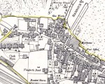
Bell Stane on 1896 map

Bell Stane on 1896 map

Archaeology & History

An intriguing site that needs adding to the Northern Antiquarian due to the foraging research of the Edinburgh historian Stuart Harris (1996).  Although the Bell Stane has been ascribed by the Canmore researchers to be just,

“a stone near the Mercat Cross on which the hand bell was set (rung to herald the opening of the weekly market or annual fair),”

Mr Harris dug deeper and found other references which led him to think that the site was “a conspicuous boulder or standing stone.”  I have to agree with him.  In his outstanding work on the historical place-names of Edinburgh and district, Harris wrote:

“The Bellstane…is noted on Ordnance Survey 1854 as the name of an object just outwith the burgh boundary and in the southwest corner of the little square that now bears the name.  Whilst it has been surmised that it was a stone named for a handbell rung beside it on market days, in point of fact a burgh council meeting of 1642 (quoted in Morison’s Queensferry, p.131) records that a piece of ground hitherto waste and unused, within the burgh but near the bellstane, was to be set aside for markets and fairs in times coming; and the clear inference is that the name belonged to the stone before any markets were held near it.  In absence of a reliable description of the stone or of early forms of its name, the origin of the name can only be guessed at.  Similar names (of sites) in Kirknewton and Whitburn are no better documented, but the early forms of Belstane in Lanarkshire (BellitstaneBellistaneBelstane and Bellstane prior to 1329 and Beldstanein 1452) suggest that its first part may be Anglian ballede or early Scots bellit (from a Celtic root, ball, white), making the name ‘the stone with a white or pale patch or stripe on it’ — such as one with a band of quartz running through it.  A conspicuous boulder or standing stone of this sort on this spur of higher ground above the shore would have been a useful meith or landing mark for boats making for the narrow landing place at the Binks.”

If anyone uncovers additional evidence about this Bell Stane that can affirm it as a standing stone (or otherwise), we will amend its status.

References:

  1. Harris, Stuart, The Place-Names of Edinburgh: Their Origins and History, Gordon Wright: Edinburgh 1996.
  2. Morison, Alexander, Historical Notes on the Ancient and Royal Burgh of Queensferry, West Lothian Courier: Bathgate 1927.
  3. Orrock, Thomas, Fortha’s Lyrics and other Poems, privately printed: Edinburgh 1880.

© Paul Bennett,  The Northern Antiquarian 2016


Moor Lane Well, Gomersal, West Yorkshire

Healing Well:  OS Grid Reference – SE 2071 2677

Archaeology & History

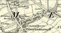
Moor Lane Well on 1847 OS-map

Moor Lane Well on 1847 OS-map

Not far from the old maypole, the Moor Lane Well was the innocuous-sounding site where legend told that a phantom horse was once seen running up and down the lane—said by old locals to be a “very ancient highway”.  It was also a place where we find an intriguing tale of local disrepute, that brought humiliation to the culprit from the entire village.

There used to be a custom called ‘Riding the Stang’ which persisted in Yorkshire until the end of the 19th century. Thought to be of Scandinavian origin, it involved the culprit being hoisted onto a platform, held up by poles, then carried around the village where the person lived in a most ignominious procession. It was invariably described as being a public punishment and humiliation for faults made by one’s wife. Anyway, in the early 1840s, said H.A. Cadman (1930),

“there were two families who lived at Brecks Farm.  I will not of course divulge their true names, so will describe one of them as the Jones family and the other as the Smith family.  Jones’ wife accused Smith’s wife of having polluted the drinking water and the Smith family left the farm and removed to the top of Moor Lane.  The Jones family wishing to make the most of the affair resolved that Mrs Smith’s effigy should ride the stang.  A long pole was obtained and the effigy was affixed to the centre.  Two men then took hold, one at each end, and walked up Moor Lane, folowed by a huge concourse of people.  The procession stopped opposite Mrs Smith’s house and repeated the nominee.  My informant, a dear old lady, would not tell me the whole of the verse, but it commenced thus:

“It’s neither your fault nor my fault that I ride this stang.”

“After all the verses had been repeated, the stang was taken round Gomersal, when ultimately the effigy was burned with the usual solemnities.

“The other instance of riding the stang occurred also in thge early ‘forties and I believe this was the last occasion of the stang being ridden.  On this occasion a man…was in the habit of beating his wife harder than his neighbours thoughts proper with the result that he had to be punished. Now Jim was a most religious man, but the same rites had to be observed as in the other instance,

“It was for Jim Vasey that religious man
He paid her, he paid her indeed and
If Jim doesn’t alter his manners
We will take his skin “…….” to the tanners.
And if the tanner doesn’t tan it well,
We’ll send it to…”

“One must regret that the old custom of riding the stang has died out, as it must have had its good points.”

Local people could, of course, simply bring it back again!  The Moor Lane Well was one of the main water supplies for the old villagers in bygone times, but seems to have disappeared under the modern houses.  There is, however, a small narrow band of trees where the old waters once ran, amidst which it might still be found—if luck is on our side…

References:

  1. Cadman, H. Ashwell, Gomersal, Past and Present, Hunters Armley: Leeds 1930.

© Paul BennettThe Northern Antiquarian


Gomersal Maypole, West Yorkshire

Maypole (destroyed):  OS Grid Reference – SE 2068 2672

Archaeology & History

As in countless villages and towns across the British Isles, Gomersal also once had its maypole near or at the village centre.  We don’t know when the first maypole was erected in the village and many local sites were openly destroyed by rampant christian puritans and similar idiots.  It stood not far from the Moor Lane Well and was described by the regional historian H.A. Cadman (1930), who told:

“The Maypole was at the top of Moor Lane and one can imagine the welkin echoing to the very old song:

‘Come lasses and lads take leave of your dads
And away to the maypole hie.
For every fair has a sweetheart there
And the fiddlers standing by.
For Willy shall dance with Jane
And Johnny has got his Joan.
To trip it, trip it, trip it, trip it,
Trip it up and down.’

Yet as with maypoles up and down the land, testosterone-fuelled Springtime fall-outs happened.  Mr Cadman told:

“Very often May Day gatherings ended up with fights.  Great jealousy always existed between the inhabitants of Great Gomersal, Little Gomersal and Spen.  There is a tradition which has been handed down that the last Maypole in this district stood on Liversedge Green.  This Maypole was demolished in a fight by the Gomersalians and there is a similar tradition about the Maypole on Cleckheaton Green, so as Mr Frank Peel says, “It is evident that ancient inhabitants of Gomersal were more pugnacious than their neighbours.”  I have no evidence when the Gomersal Maypole ceased to exist, but there is abundant evidence to prove that there was one in Gomersal, the proof being that the vane is now in Batley Museum.  It is in the form of a fish.”

If anyone has any further information on this important relic, or its history, please let us know.

References:

  1. Cadman, H. Ashwell, Gomersal, Past and Present, Hunters Armley: Leeds 1930.

© Paul BennettThe Northern Antiquarian