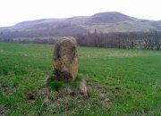
Clach Mhallaichte, Cromarty, Ross & Cromarty

Legendary Rock:  OS Grid Reference – NH 7949 6746

Also Known as:

  1. Clach Mallach
  2. Clach na Mallachd
  3. Clackmalloch Rock
  4. Stone of Cursing

Archaeology & History

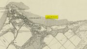
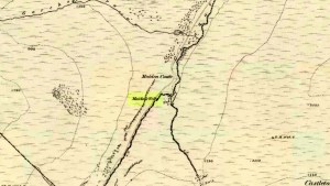
Stone shown on 1880 map

This large boulder found off the Cromarty coast, was highlighted on the 1880 OS-map of the region.  It is one of the ancient boundary stones of the township.

Folklore

We know from the vast array on the folklore of stones that many were imbued with magickal abilities, some of which were witnesses to vows and others to make curses from.  This large boulder off the coast of Cromarty was, according to Donald MacKenzie (1935), a place where the latter used to be done.  He told us:

“At Cromarty there is a big boulder known as the Clach na Mallachd (‘Stone of Cursing’).  Curses were delivered when an individual stood or knelt bare-kneed upon it.”

In an earlier account by the Ordnance Survey lads in one of their Name Books, they gave the following tale that had been narrated to them:

“A large stone Situate at the Low Water, and forming one of the boundary Stones of the burgh, the reason of its having this name is, that a young lad while Sitting on it was overwhelmed by the advancing tide and drowned, his mother when told of it, cursed the stone, hence the name Clach Mallach (Accursed Stone)”

References:

  1. MacKenzie, Donald A., Scottish Folk-lore and Folk Life, Blackie: Glasgow 1935.

© Paul BennettThe Northern Antiquarian


Knockraich, Fintry, Stirlingshire

Standing Stone:  OS Grid Reference – NS 60889 87739

Also Known as:

  1. Canmore ID 45305
  2. Knockcraich

Getting Here

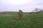
Knockraich standing stone

Knockraich standing stone

From Fintry village take the B822 road towards Kippen.  Only half-a-mile (0.8km) along, take the track on your left to Knockraich Farm and cafe.  Go all the way through the farm along the track and out the other side then follow the fence downhill across the field. At the bottom, go through the gate towards the stone which you’ll already be able to see ahead of you, in the next field. Y’ can’t miss it!

Archaeology & History

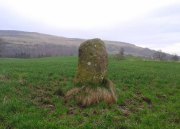
This little-known four-foot tall monolith standing alone in the fields northwest of Fintry, just above the River Endrick, is a fascinating little fella!  It stands at the western end of an elongated rise in the land, almost as if mimicking an ancient long barrow.  But more intriguingly (for me at least) are the cup-markings that adorn each of its four sides.

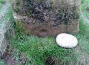
Cup-mark at base of the north side

Cup-mark at base of the north side

Cup-mark near top of west face

Cup-mark near top of west face

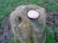
Upon first glance it seems that there are a number of such cup marks on the stone, but further inspection shows that only one occurs on each of the four faces.  Near the very bottom of the stone on its north and south sides a single large cup-mark has been etched; and on its east and western faces, the cup-mark has been carved further up towards the middle of the stone, with the east-facing side having a groove running from near the top and stopping at the cup-mark.  On top of the stone is a large ‘bowl’ (possibly natural, possibly man-made—it is difficult to say with any certainty) and a single cup-mark next to it.  When Nina, Paul and I visited here a few days ago, a palm-sized smooth stone was resting in the large bowl on top, akin to the healing and divination stones found placed in bullauns in Ireland and other parts of the world.

The first description of any length was cited in A.F. Hutchinson’s (1893) paper on the standing stones of Stirlingshire in which he wrote:

“This stone…is placed on the bank rising up from the river.  In shape it is approximately square—the two sides facing nearly east and west, measuring each 1ft 7in, the north face 1ft 6in, and the south 1ft 3in.  These dimensions are uniform from top to bottom.  The total girth is therefore 5ft 11in, while the height is 3ft 8 in.  Orientation 225º.  There are a number of cupmarks both on the top and side, as well as having several incised lines and other markings, some of which, however, give evidence of recent sculpture.”

Knockraich stone, looking south at Dunmore hillfort

Knockraich stone, looking south at Dunmore hillfort

Cupmark, hollow & stone on top

Cupmark, hollow & stone on top

The more modern or “recent sculpture” was that of a human figure, now very faint, etched onto the most western face of the stone, beneath a large solitary cup-mark.  When the site was visited and described by the Royal Commission (1963) lads, they gave a lengthier description of the carved elements on the stone, telling us that:

“On the top, which has been brought to an irregularly rounded point, there is an almost circular hollow measuring 5½in to 6in across and 2½in in depth; it is difficult to suppose that this is other than artificial, although its bottom shows differential weathering.  The SE side of the stone shows several natural cavities, and a deep and wide vertical groove which is also presumably natural.  The NW face seems to have been flattened to a certain extent, a slight ridge which is visible along part of either margin probably representing a survival of the original surface.  On this face, 12in above the ground, a human figure has been outlined in pocked technique.  It is in full-face, the features being indicated by pocked marks; the arms are extended jut below the level of the shoulders and the legs are widely spread with the feet turned outwards.  The lower edge of a tunic or short kilt seems to be indicated by a single line between the legs.  The figure is 8in heigh and measures 7in in breadth between the hands and 7½in between the feet.  This face of the stone also shows a number of small natural cavities, together with a shallow cup which has a somewhat artificial appearance; this cup is in the centre of the face and 2ft 4½in above ground level, apparently at the upper margin of the flattened area.  The figure lacks any distinctive characteristics which might afford evidence of date, but it may be relatively modern…”

Folklore

Mr Hutchinson (1893) told that,

“The stone seems to have brought down through the ages a tradition of sanctity in connection with it, as there is a legend to the effect that any attempt to move it is attended by convulsions of Nature and evil consequences to the rash disturber.”

Whether the position of the water-worn smooth rock found in the bowl on top of this standing stone has any ancient tradition, records seem silent on the matter.

References:

  1. Hutchinson, A.F., “The Standing Stones of Stirling District,” in The Stirling Antiquary, volume 1, 1893.
  2. Royal Commission on the Ancient & Historical Monuments Scotland, Stirling – 2 volumes, HMSO: Edinburgh 1963.
  3. Royal Commission on the Ancient & Historical Monuments of Scotland, Archaeological Sites and Monuments of Stirling District, Central Region, Society of Antiquaries of Scotland 1979.
  4. Smith, H. Guthrie, Strathendrick and its Inhabitants from Early Times, James Maclehose: Glasgow 1896.

Acknowledgements:  Many thanks to Nina Harris and Paul Hornby for their help and attendance at this old stone.

© Paul BennettThe Northern Antiquarian

Craigkennockie, Burntisland, Fife

Tumulus (destroyed):  OS Grid Reference — NT 237 861

Archaeology & History

Very little is known about a prehistoric tomb that once existed near the coast at Craigkennockie.  Its existence was briefly described in Andrew Young’s (1913) fine history of the township where he told that it had been highlighted on an old Estate Map of the area and marked as, “an artificial cairn, probably a place of sepulture.”  On old maps just below the cited place we find the place-name of ‘Lammerlaws’, which may indicate a name once given to the site, as the element -law is commonly found relating to prehistoric cairns.

Although the modern place-name researchers in central Scotland have opted that the word ‘law’ is primarily “a rounded hill”, they have curiously forgotten or omitted its other derivation.  Throughout northern England and beyond, the English Place-Name Society finds that many ‘law’ place-names derive from the old English and Saxon word, hlaw, which is originally told to be “a mound, a hill.” This has been the reference cited throughout in Taylor & Markus’ (2006-2012) otherwise fine multi-volume analysis of Fife county.  But there’s much more to it than that.  I hope that readers will forgive me reciting A.H. Smith’s (1956) full entry about this simple term, as it can (and many times does) show our history is much richer than initially thought.  Prof Smith told that law, hlaw, hlæw, has the following etymological origin:

“(1) In OE (old English) the common meaning in literary contexts is ‘an artificial mound, a burial mound, a mound in which treasure is hidden’, as in Boethius Metr. 10.43, ‘in what hlæwa do the bones of Weland cover the ground?; Beowulf 2802, ‘Bid them make a hlæaw…on Hronesnæsse’; Guthlac 4 ‘there on the island was made a great hlæw, which through the lust for treasure had been dug up and broken into’; or Gnomic Verses 26, ‘a dragon shall be on hlæw’, an allusion (as in Beowulf 2773) to the Germanic tradition that mounds containing valuable grave-goods were guarded by dragons.  The word glosses Latin, agger, ‘something heaped up, a mound, a rampart’ (Wright’s Anglo-Saxon & Old English Vocabularies 355.4).  This meaning ‘tumulus, artificial mound, burial mound’ is well attested in place-names.  According to Grundy, it always denotes a tumulus in the OE charters and doubtless those place-names in which it is combined with personal names are the burial places of the men so named; at Taplow at least a remarkable burial treasure was discovered and Cuckhamsley, Berkshire, is named from Cwichelm, the West Saxon king who died in 593.  The majority of such places-names belong to the heathen period when this method of disposing of the dead was practised.  Particular compounds also suggest that it could be an artificial mound which formed the centre of a place of assembly; Oswaldslow Hundred (Place-names of Worcestershire, 87), for example, was created in 964 and it was to meet at a place to be henceforth called Oswaldeslaw in honour of Bishop Oswald (Cartularium Saxonica 1135).

“(2) The meaning ‘hill, a conical hill resembling a tumulus’ is also found in OE, as in Leechdoms Vol.3, 52, ‘they rode over the hlæw’, and local topography establishes this meaning as a common one in place-names and dialects in certain parts of the country; it survives as law in Durham and Northumberland and as low in northwest Midlands…

“(3) The two forms hlaw and hlæw are on record, the latter being better evidenced in literary use, especially in West Saxon texts, and the former in place-names; hlæw normally becomes low, north country law, whilst the i-mutated hlæw (found in place-names only in the south and south Midlands) later becomes lew, as in Lew, Oxfordshire, Lewes, Sussex and is more frequent in middle-english spellings; it is often later replaced by –low as in Dragley, Lancs, Cuckhamsley, Berkshire…”

Smith continues with many topographical evidences regarding a ‘burial-mound’ derivation for the place-name ‘law’, finally adding notes on relative linguistic similarities, like the “Gothic hlaiw, ‘grave’; old High German hleo, ‘grave mound, hill’; old Saxon hleo, ‘grave mound’…”  It seems pretty convincing, and so we need to take this into account in our walks over the hills if we are exploring ancient history.

As if to emphasize this derivation—’law’ as prehistoric tombs—we find it is cited in the massive Scottish National Dictionary (6,1:16) where—alongside the ’rounded hill’ aspect—Mr Grant (1962) tells it to be,

“An artificial mound or hillock, specif.: (1) a tumlus or barrow, grave-mound….”

thereafter giving a number of Scottish examples.  The same meaning is echoed again in the modern version of Concise Scots Dictionary (2005), along with the rounded-hill.  Jamieson’s (1885) Scottish Dictionary cites similarly, ‘law’ as both hill, aswell as “a tomb, grave or mound.”

This association of ‘law’ with ancient burial mounds in Scotland should not be that surprising.  Despite it having an Anglo-Saxon origin, we must remember that the Saxon kingdom is known to have stretched all the way up to the Firth of Forth (Edinburgh) and across to Glasgow. So if the linguistic roots have any credibility at all, it doesn’t take much stretch of the imagination to have this simple word travel further north amongst the people.  Perhaps this is why, more recently, Margaret Gelling (2000) has said that the association of hlaw with burial mounds up here lessens in Scotland.  Nonetheless, let us not presuppose one meaningful definition of the word above another, as it can, consciously or otherwise, be seen as more symptomatic of the all too common English attitude of papering over another country’s rich and ancient heritage by depleting its language—again…

(Law has another element attached which has all but fallen out of historical analysis.  Prof Smith touched briefly upon it, mentioning ‘law’ as being a meeting place—otherwise known ‘moots’.   Moots occurred everywhere in early times: in England, in Europe and in Scotland too.  They were originally where local tribal gatherings took place, for the purpose of what we might call council or political decisions, amongst other things.  Some of these moots occurred on burial mounds of great age, aswell as  stone circles—and evidence indicates that some of them originated way back in prehistoric times.  Although written accounts of many such moot spots have fallen from historical texts, the term law or low (and their variants) is again found in Scottish etymological and topographical lore.  Mr Grant again cites it to mean:

“Law cairns, or court cairns…the judicial sites of baronial court of justice…”

Thereafter giving numerous citations of its use in both the common tongue and sites where it is known.  As far north as the Shetland Isles, where such law-courts aer known from the Scandinavian ting of thing, the 18th century Statistical Account of Tingwall states there being “the Law Stone” at the cite of the parish court.)

Folklore

Also in Mr Young’s (1913) work, he told how this old tomb was a place that seemed cursed or should not be disturbed, saying,

“About 50 years ago, any illness in the neighbourhood of Craigholm was ascribed to the influence of this burial place…”

adding that an adjacent spring of water, of high esteem, was close by.

References:

  1. Grant, William (ed.), Scottish National Dictionary – volume 6, SNDA: Edinburgh 1962.
  2. Jamieson, John, Etymological Dictionary of the Scottish Language, W.P. Nimmo: Edinburgh 1885.
  3. Robinson, Mairi (ed.), Concise Scots Dictionary, Aberdeen University Press 2005.
  4. Smith, A.H., English Place-Name Elements – volume 1, Cambridge University Press 1956
  5. Young, Andrew, History of Burntisland, Fifeshire Advertiser: Kirkcaldy 1913.

© Paul Bennett, The Northern Antiquarian


Maiden’s Well, Glendevon, Perthshire

Healing Well: OS Grid Reference – NN 9703 0139

Also Known as:

1. Maiden Well

Maidens Well on 1866 map

Getting Here

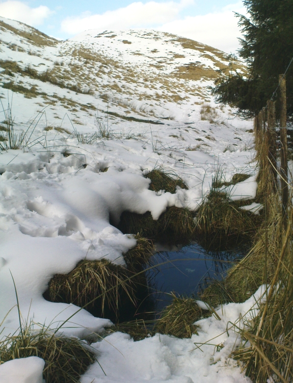
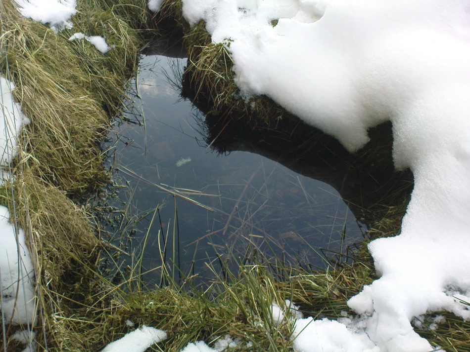
Follow the same directions as if you’re going to the Maiden Castle fairy hill.  About 100 yards before reaching the hill, on the right-hand side of the footpath between the tree-line and the small stream, you’ll see a small pool of water. This is Maiden’s Well.

Archaeology & History

Maiden's Well - and the fairy haunt of Maiden Castle hill behind
Maiden’s Well – and the fairy haunt of Maiden Castle hill behind

A mile northeast of the faerie-haunted Butter Well, just on the border of Clackmannanshire and Perthshire, we find this little-known magickal spring.  More than a century ago, the story of this remote well was heard about hundreds of miles away by one Rev. Andrew Clark of Oxford, “who heard it from the late sexton of the parish of Dollar, in the county of Clackmannan” and who then mentioned its existence to the great Victorian Celtic scholar John Rhys (1901), who subsequently wrote of it as being “a fine spring bordered with flat stones, in the middle of a neat, turfy spot”, close to the legendary faerie hall of Maiden Castle. The well itself has now given birth to a pool whose waters, so folklore and text ascribe, always provides good clear water even in the height of summer.

The local historian Hugh Haliburton (1905) told that the well obtained its name from a princess who was held captive in Castle Campbell in the valley to the southwest, and that she was sometimes allowed out of prison by her captors, to walk to the well and drink its waters.

Folklore

This tale has been mentioned by various historians and, no doubt, has some religious relevance to the faerie lore of Maiden Castle, close by, Bruce Baillie (1998) told:

“A story associated with it states that it is haunted by the spirit of a beautiful maiden which only appears at night and, should any male attempt to kiss her, coronary thrombosis occurs.”!

The Maiden's Well pool
The Maiden’s Well pool

Earlier accounts tell of magickal rites that could be used to invoke the beautiful maiden, but once again dire consequences may befall the poor practitioner.

To this day, local people visit the well and make offerings to the spirit of the waters, as you’ll see if you come here.  Some of the remains here are very old; and a visit not long ago indicated that offerings were made even when surrounded by depths of snow in the middle of a freezing winter.

References:

  1. Baillie, Bruce, History of Dollar, DMT: Dollar 1998.
  2. Fergusson, R. Menzies, The Ochil Fairy Tales, Clackmannan District Libaries 1985.
  3. Haliburton, Hugh, Excursions in Prose and Verse, G.A. Morton: Edinburgh 1905.
  4. Rhys, John, Celtic Folklore – Welsh and Manx: volume 1, Oxford University Press 1901.
  5. Watson, Angus, The Ochils: Placenames, History, Tradition, PKDC: Perth 1995.

© Paul BennettThe Northern Antiquarian


Tarry Stone, Cookham, Berkshire

Legendary Stone:  OS Grid Reference – SU 89745 85392

Also Known as:

  1. Cookham Stone
  2. Tarrystone

Getting Here

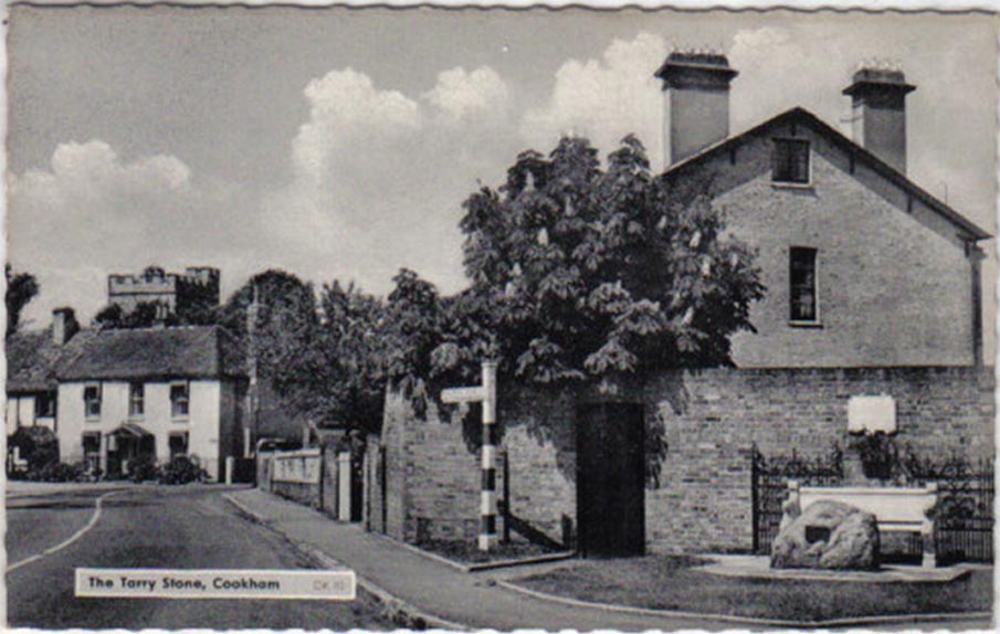
Old postcard of the Tarry Stone

Dead easy!  Just about in the middle of the village, by the side of the road where a seat allows the weary walker a chance to sit and rest, the Tarry Stone stands before it, with a plaque on the wall above the seat.  The old postcard here shows its situation clear enough!

Archaeology & History

The history of this large rock near the middle of Cookham village is important in the history of the old village, though there is no direct evidence to give it a prehistoric pedigree.  It was known to be an ancient boundary stone and is included in perambulation records of the area, where local people would annually walk and redefine the landscape of Cookham: a pastime known across the land, but which fell into disuse in Victorian times.  Such perambulations are thought to trace way back into the mythic lands of prehistory — so the Tarry Stone here may well have an archaic provenance.

The known history of the stone was gathered and described in Stephen Darby’s (1899) rare work on the place-name history of Cookham.  He wrote:

“A stone 3½ ft high, by 4 ft long, and 2½ ft thick. This formerly stood in Cookham village, about two feet from Dodson’s fence, where the roads parted to the church and the ferry. It is now in the Mill Garden at Cookham, where it was removed by the late George Venables when he was church-warden. This stone was formerly known as Cookham Stone.

“A.D. 1506: The tithing man presents that the Warrener ought to hold sports at Cookham Stone on the day of Assumption; and he has not done so (Cookham Manor Court Rolls).

“The stone was originally a boundary stone to the property of the Abbot of Cirencester, whose house was close by, as is shown in the will of John Luffenham, A.D. 1423.”

An old plaque that was once attached to the rock told, “The Tarry Stone at which sports were held before 1507 AD, stood formerly 50 yards NNE and was replaced here AD 1909 by order of the parish council.”  The position described “50 yards away” was next to an old pub with the fascinating legendary name of ‘Bel and the Old Dragon’!

Folklore

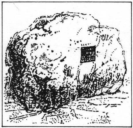
Dennis Curran’s 1976 drawing

One of the main reasons this site has been included here is the legendary attachments.  When the stone was moved from its original position in 1839 by a certain George Venables, to nearby Mill House Gardens, local people told how the Venable family thereafter were cursed.  It was thereafter moved back to its earlier site!

The stone has been suggested as a meteorite — a theme that was echoed in Peter Ackroyd’s Thames (2007), but the Tarry Stone is a regional sarsen rock, albeit peppered with erosion holes, giving a more ‘foreign’ look to it!

Cookham was also the village where the spirit of the god Herne “winds his horn and the music of his hounds can be heard from across the common.”  (Yarrow 1974)  The stone was also the focal point of village games in earlier centuries.

References:

  1. Ackroyd, Peter, The Thames: Sacred River, Chatto & Windus: London 2007.
  2. Darby, Stephen, Place and Field-Names of Cookham, Berkshire, privately printed: London 1899.
  3. Hallam, Elizabeth, Domesday Heritage, Arrow: London 1986.
  4. Yarrow, Ian, Berkshire, Hale: London 1974.

© Paul Bennett, The Northern Antiquarian