Take the road up through Baildon village, across at the roundabout up Northgate and up onto the moor, then after a few hundred yards turn left on the Bingley Road. About five hundred yards along, keep your eyes peeled for where the ruined reservoirs are to the left-side of the road. Straight across the road from here (north) you’ll see the small cliffs of Eaves Crag. Walk along the footpath that runs above the cliffs and, about 80 yards past them, keep your eyes peeled on the ground right in the middle of the path. You can’t really miss it!
Archaeology & History
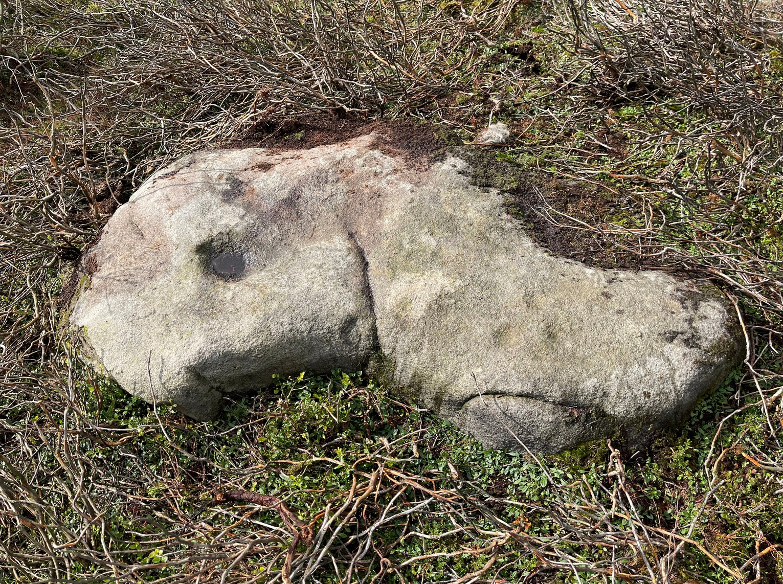
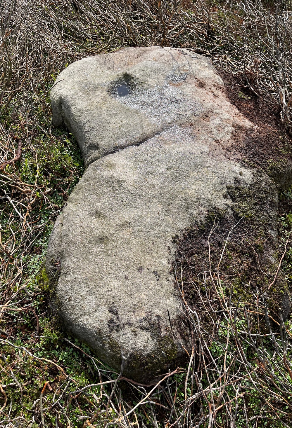
Basic cup-and half-ring
First mentioned in passing in the magnum opus of W. Paley Baildon (1913) and subsequently in one of Sidney Jackson’s (1955) series of profiles on the Baildon Moor carvings, this all but insignificant carving comprises of a simple cup-and-half-ring and another singular cup-mark a little further along the stone. John Hedges (1986) described this carving as being a “well marked cup surrounded by horseshoe groove – also well marked. Possible small cup and incomplete ring.” Whilst the minimalists Boughey & Vickerman (2003) told it to be simply, “two cups, one with incomplete ring.” A peculiarity with this design is that it might have been cut by a metal implement, perhaps in the Bronze Age, perhaps even in the Iron Age. We might never know…
References:
Baildon, W. Paley, Baildon and the Baildons – volume 1, St. Catherines: Adelphi 1913.
Boughey, Keith & Vickerman, E.A., Prehistoric Rock Art of the West Riding, WYAS: Wakefield 2003.
Hedges, John (ed.), The Carved Rocks of Rombald’s Moor, WYMCC: Wakefield 1986.
Jackson, Sidney, ‘Cup and Ring Boulders of Baildon Moor,’ in Bradford’s Cartwright Hall Archaeology Group Bulletin, 1:10, 1955.
Acknowledgements:Huge thanks for use of the Ordnance Survey map in this site profile, reproduced with the kind permission of the National Library of Scotland.
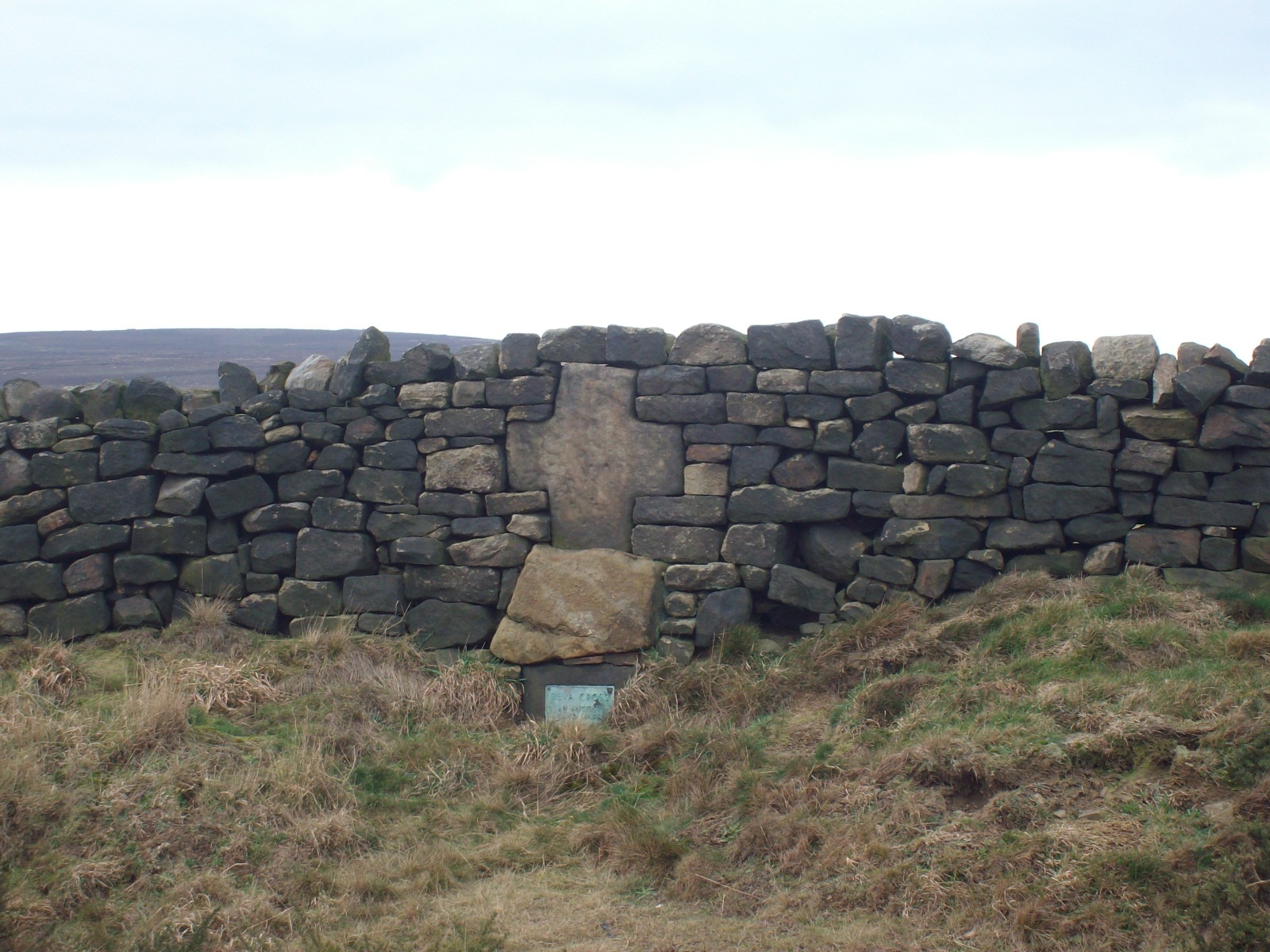
Two main routes to get here: i) from Dick Hudson’s public house, head left (east) along Otley Road (passing Weecher reservoir) for 1.9 miles (3.1km) until you reach Reva reservoir where a track leads you to the waters, and there’s a small parking spot on the left-side of the road. Stop here. (ii) coming from Hawkworth and Guiseley, head west along Hawksworth Lane which runs into Goose Lane and, at the T-junction at the end, turn right and nearly 500 yards along on the left-side of the road is the same small parking spot. From here, walk uphill for nearly 150 yards and then look at the walling to your left.
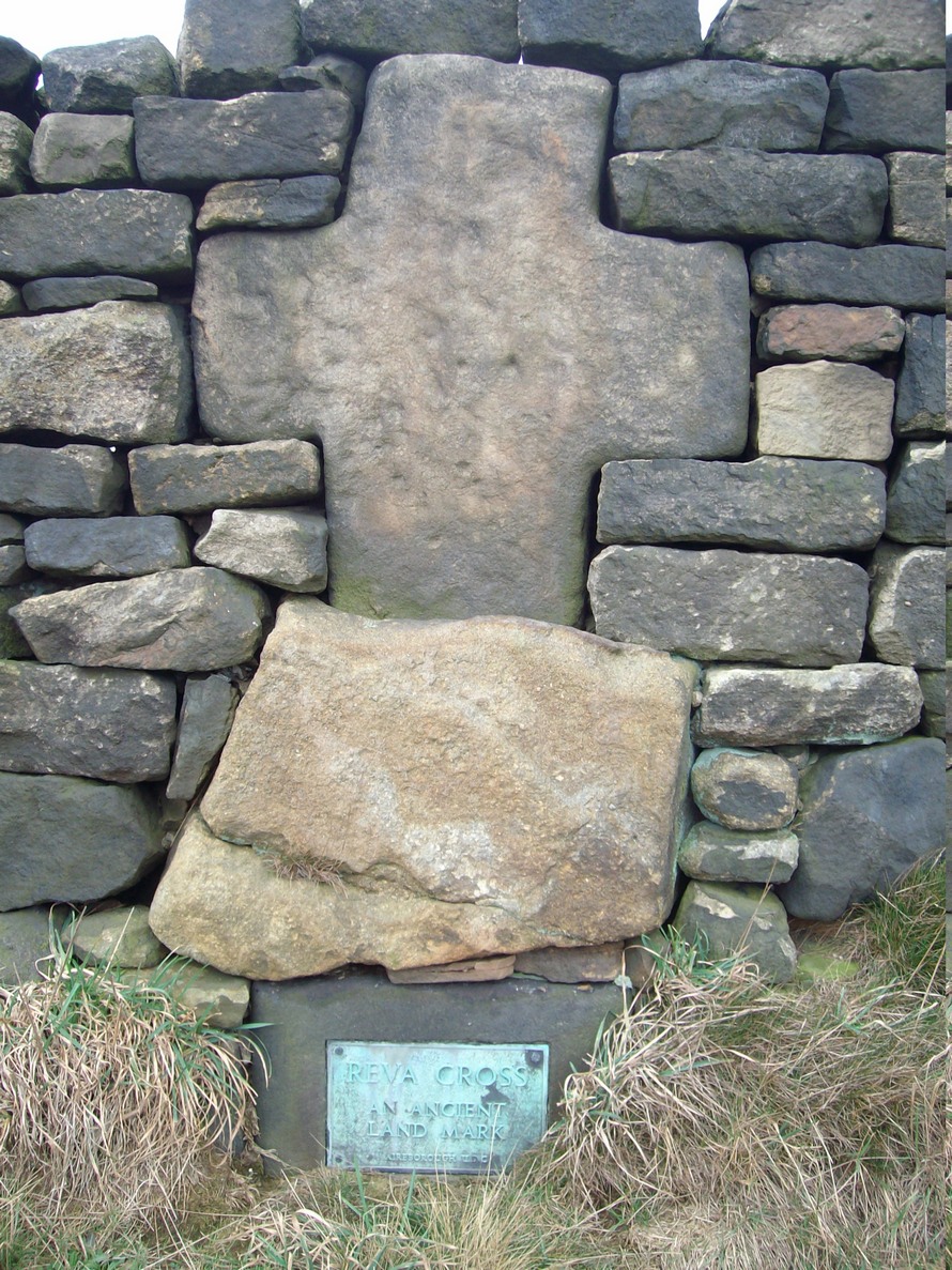
Archaeology & History
Reva Cross on 1851 map
This relic can be found on the far eastern edges of Hawksworth Moor, near Guiseley, and was said by the historian Eric Cowling to have originally stood upon a large rock nearby. It has an odd history. Initially, the cross was an ancient boundary or mark stone, referred to in a 15th Century document and outlined by William Preston in 1911, that marked the limit of the southern township of Burley township. Local historian C.J.F. Atkinson asserted that this cross in fact came from Otley, although his ideas were considered somewhat “fanciful” by archaeologists and other historians.
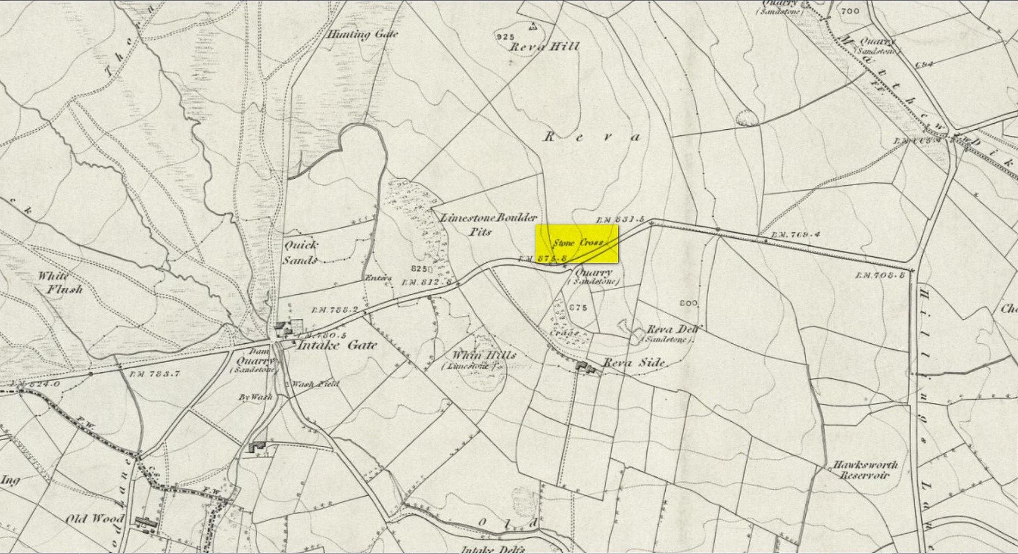
Its present position by the roadside is relatively new as it stood, not too long ago, a short distance away in the field to the rear, as highlighted on the early OS-map of this area. E.C. Waight of the archaeology division to Ordnance Survey wrote:
“Situated at SE 1530 4297 on the western side of the gate from the road into the field containing the remains of Reva Cross is a cross base (apparently in situ) serving as a bolster stone to the wall head at the gate opening.”
He described the dimensions of the base and the remainder of the cross, both of which “are contemporary with one and other,” he told. In the 1960s, the local council moved the cross to its present position.
Tradition told that despite its religious symbolism, it was also used as a market cross in bygone times. A certain Mrs Fletcher (1960), writing to the Cartwright Hall Archaeology Group, narrated that,
“Mrs Turner Greenwood….tells me that her mother, who, if living, would be in her nineties, lived at Gaping Goose Farm on the western side of Reva Hill… Mrs Greenwood’s father.. .remembered the cross erected on this hill, and related seeing the roads black with people climbing to it from Otley and Bingley, for the market held there.”
Despite this, Sidney Jackson was somewhat sceptical of it being the site of a market. Weather conditions and the bleakness of the spot would have made this site somewhat intolerable, he thought. However, people in previous centuries were much hardier than modern people and so it’s not as unlikely as you’d initially think.
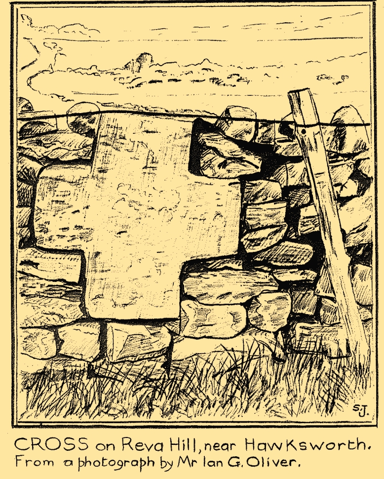
Close-up of crossSid Jackson’s sketch
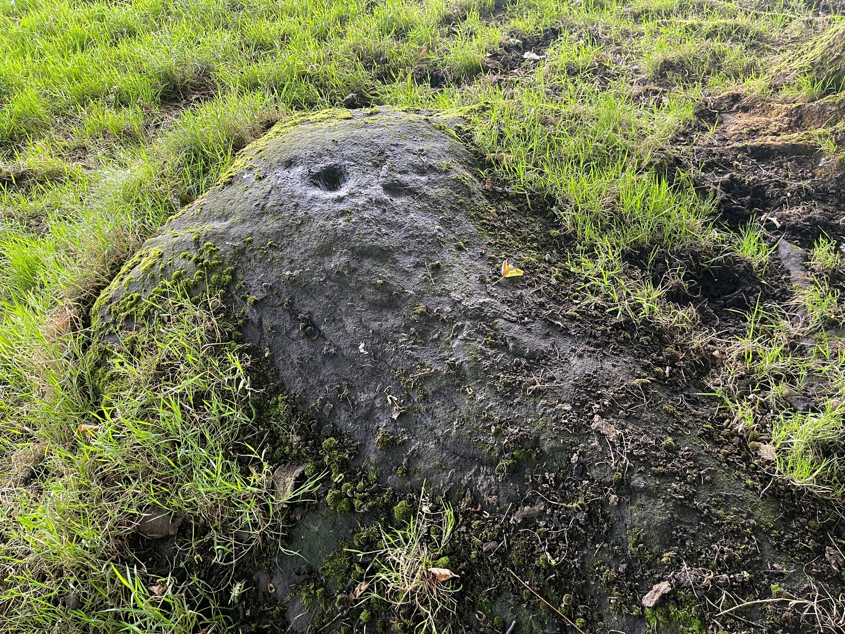
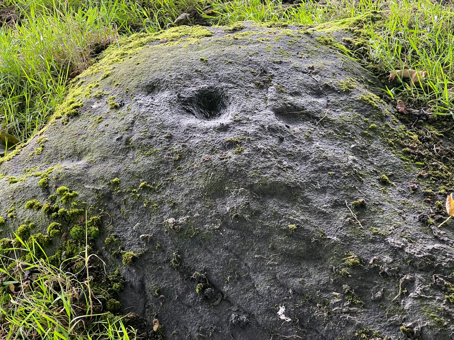
A much more interesting tradition of the cross was its use in times gone by as a Plague Stone. However, this name only applied to the cross-base at the time as no cross was stood upon it; merely a natural rock laid upon the moorside with a basin cut into it. It gained this name around the time of the great plague of 1660. During the plague, food was left on this table-like rock and money in return was placed in a basin full of vinegar. This tradition may have originated at the large natural rock bowl on one of the earthfast stones near the very top of Reva Hill a short distance to the west (also a number of cup-marked stones are close by and folklore records show that some cup-marks had healing properties). One account tells that it was Sir Walter Hawksworth (of the legendary Grand Lodge of ALL England masonic lodge) who was responsible for the siting of the cross as a Plague Stone.
References:
Cowling, Eric T., Rombald’s Way, William Walker: Otley 1946.
Cowling, Eric T., ‘Letter,’ in Cartwright Hall Archaeology Group Bulletin, 5:5, May 1960.
Fletcher, Elsie, “Letter,” in Cartwright Hall Archaeology Group Bulletin, 5:5, May 1960.
Jackson, Sidney, “Ancient Crosses,” in Cartwright Hall Archaeology Group Bulletin, 1:12, 1955.
Jackson, Sidney, “Cross on Reva Hill,” in Cartwright Hall Archaeology Group Bulletin, 5:1, p.2, 1960.
Jackson, Sidney, “Reva Hill Cross Base Found,” in Cartwright Hall Archaeology Group Bulletin, 9:9, September 1964.
Jackson, Sidney, “Fresh Site for Reva Cross,” in Cartwright Hall Archaeology Group Bulletin, 11:7, July 1966.
Preston, William Easterbrook, “On an Ancient Stone Cross on Riva Hill,” in Bradford Antiquary, New Series 3, 1911.
Acknowledgements:Huge thanks for use of the Ordnance Survey map in this site profile, reproduced with the kind permission of the National Library of Scotland.
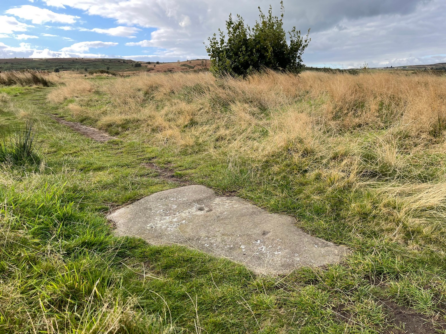
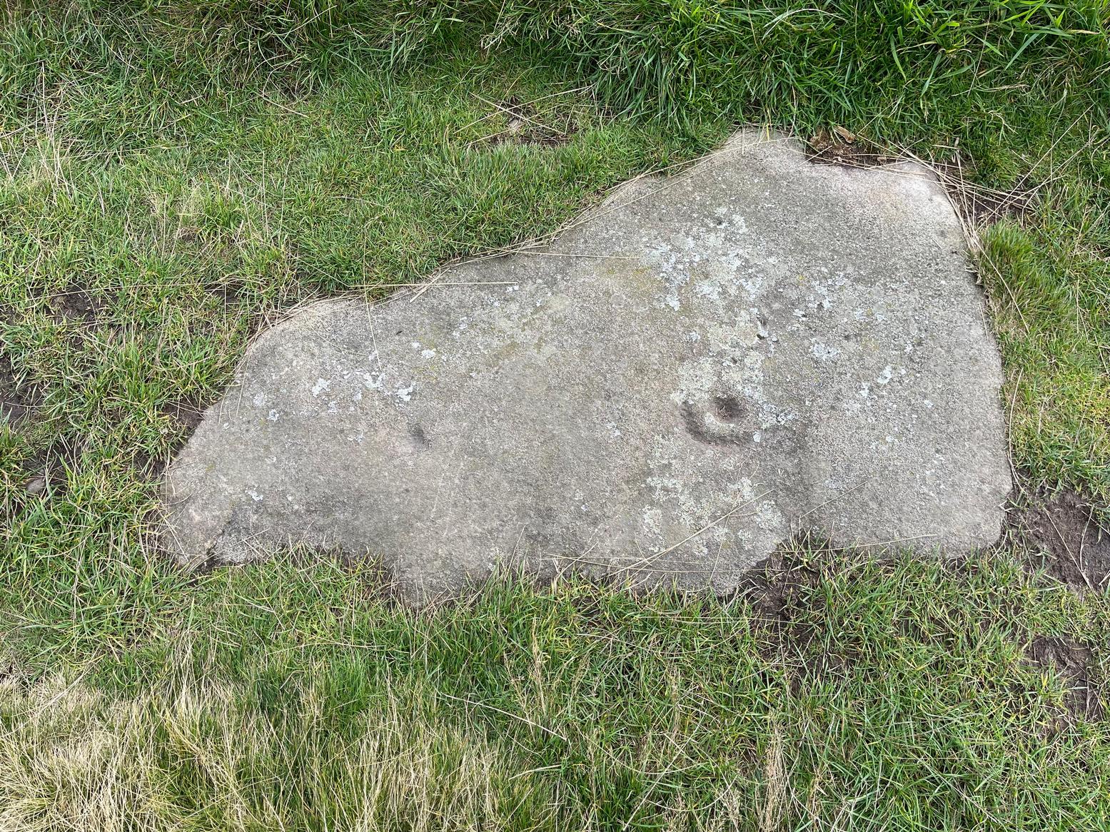
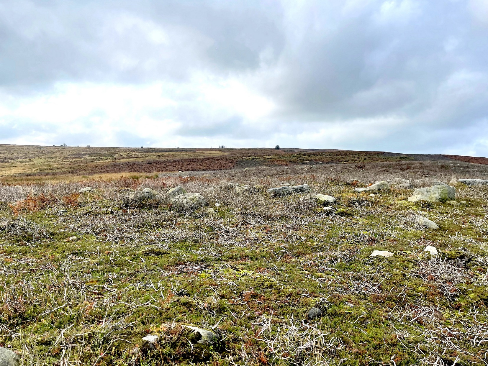
From Steeton village, go up Mill Lane, turning right and then bending up the steep Barrows Lane for a half-mile or so, where in turns into Redcar Lane. There’s a row of old cottages on your left with a green lane track running into the fields at the back of them. Four fields along you’ll reach a long straight line of walling running uphill. Up here, above and past the long geological stretch of quarried rocks, the land levels out and two trees sit next to each other by walling. The carving’s beneath them.
Archaeology & History
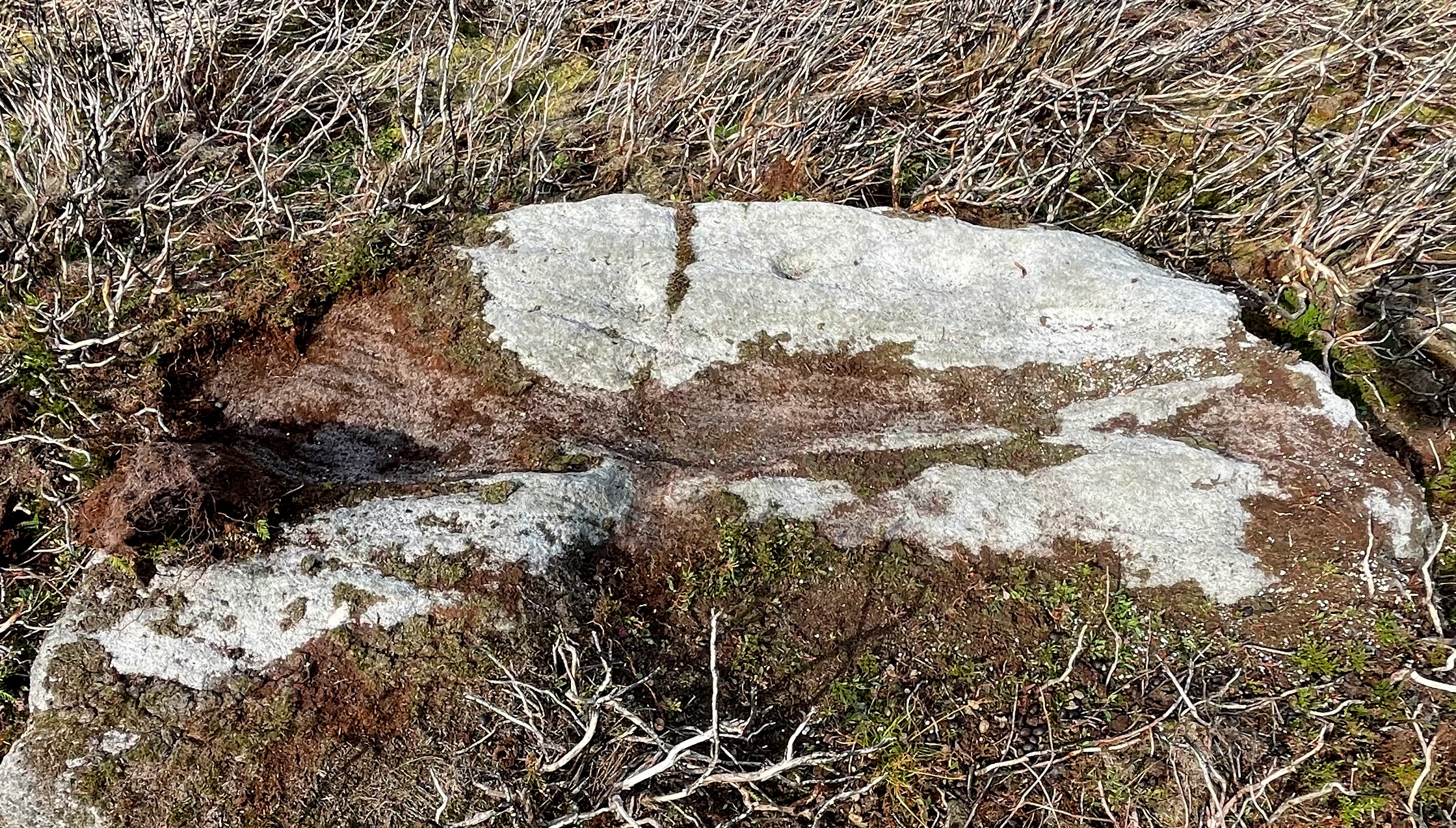
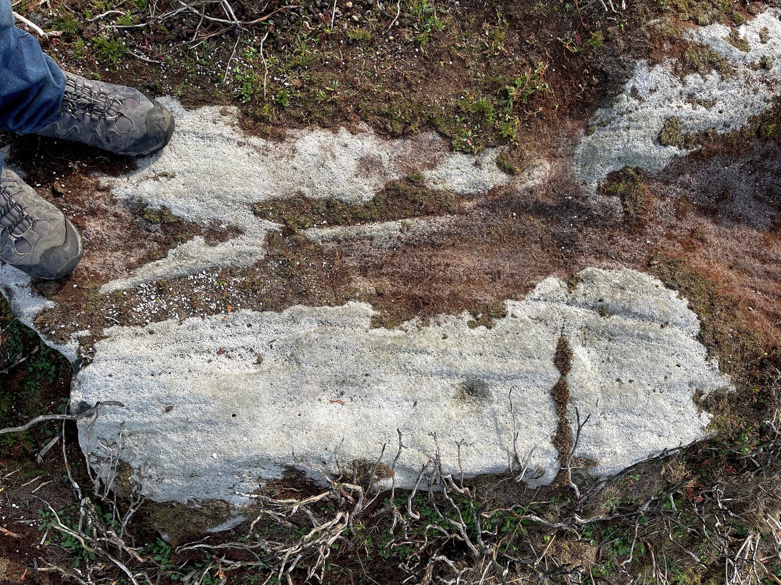
Close-up of carving
Rediscovered in the summer of 2024 by Thomas Cleland, a deeply worn cup-mark is the primary feature of this petroglyph on the topmost section of the stone, with the remains of a faint incomplete ring around one side of it. Three or four other smaller cup-marks can be seen close to the main one. There may be another cup-marked stone on an adjacent rock, with a lines running away from it, but we need to see that in better light or have one of the computer-tech doods to give it their attention to know for sure.
Cup-Marked Stone (destroyed): OS Grid Reference – SE 152 393
Also Known as:
Carving no.195
Archaeology & History
A basic cup-marked stone could once be seen up near the top of the slope behind the Bay Horse pub as you’re heading up to Baildon village. The site would seem to have been destroyed following the demolition of buildings thereby. A photograph of the carving was taken and it was described, albeit briefly, by Sidney Jackson (1961), who told:
“A small boulder with two cups in it was found at the junction of a narrow bye road leading to 30 Lane Ends, Baildon, with the road which runs behind the Bay Horse Inn, on 12 April (1961), by Mr Alan E. Rowe, 10 Beaufort Grove, Bolton, Bradford and a photograph of it was taken for the Museum Reference Collection.”
Years back I contacted the Bradford Museum about this photo and they were about as helpful as a zionist in Palestine! – i.e., I never got to see it. It would be good if someone could locate the image.
References:
Boughey, Keith & Vickerman, E.A., Prehistoric Rock Art of the West Riding, WYAS: Wakefield 2003.
Jackson, Sidney, “Cup-marked Boulders, Baildon Finds,” in Cartwright Hall Archaeology Group Bulletin, volume 6, no. 6, 1961.
From the Askwith Moor car-park (SE 1757 5067), walk along the road north for a few hundred yards until you reach the gate on your right and head through the heather to the Death’s Head carving. From here walk in a northwesterly direction up the gentle slope for 50-60 yards and, before reaching its crown, keep your eyes peeled for a low flat stone with a curvaceous crack running roughly halfway across it. If the heather’s deep, you might not have a cat in hell’s chance of finding it!
Archaeology & History
This carving isn’t much to look at on two levels: i) it’s a pretty simplistic design with no rings, and (ii) it’s very faint and almost impossible to see until the light is just right—except for one of the cups, which itself might be natural (there are a few like that amidst the Askwith complex). It’s very much a carving for the purists among you, as I always say. Nonetheless, for the record:
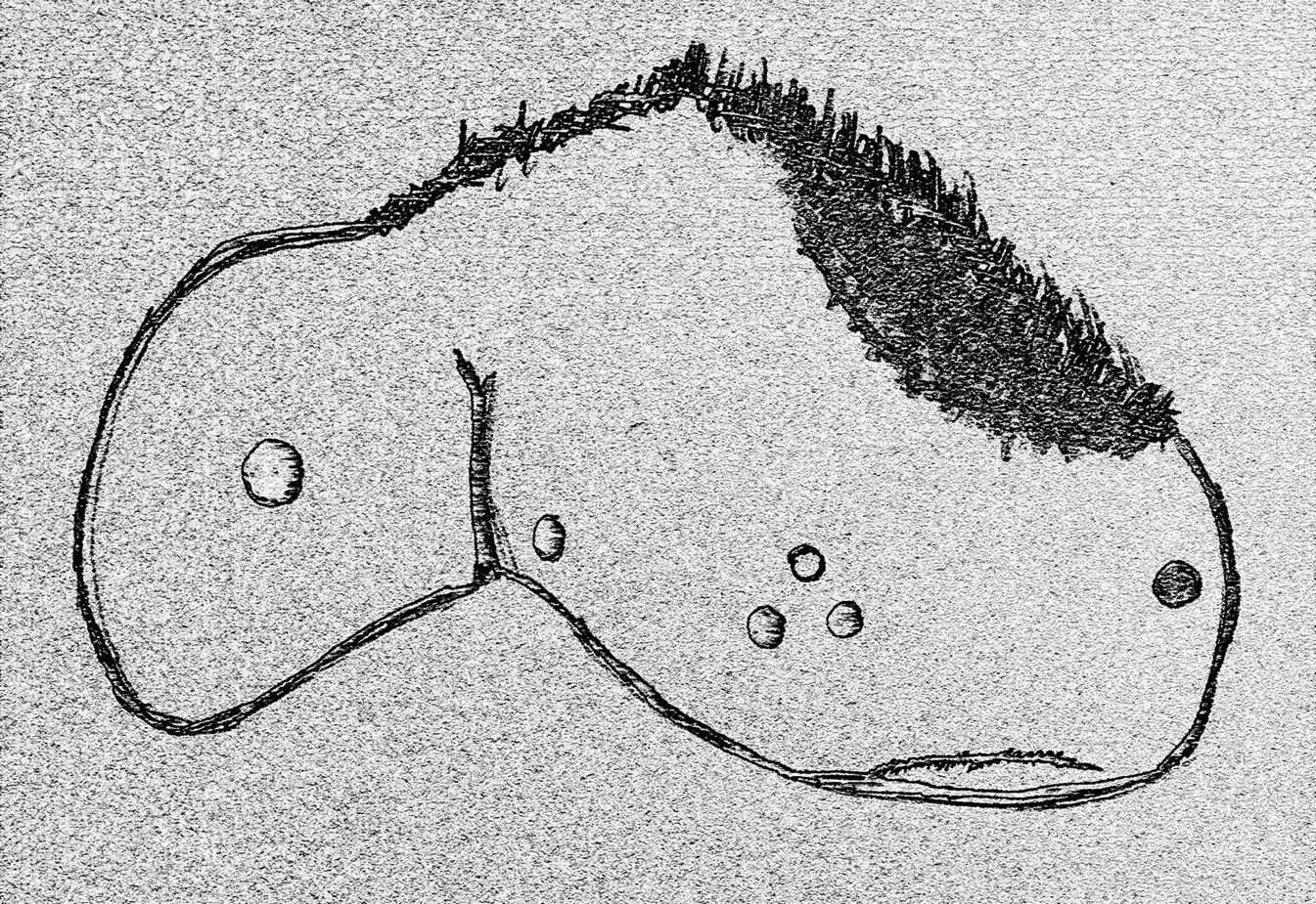
Crap sketch of designFaint cups visible
The most notable element is the single “cup mark” on the more easterly section of the stone, on one side of the natural crack. It catches your eye and is what makes you give the stone a little more attention, although I couldn’t make up my mind whether this was Nature’s handiwork or humans. It may be a bit of both. On the other side the crack we can see a small group of very faint eroded cup-marks — just! What seems to be three of them cluster in a small triangle formation, but one of these may be natural (tis hard to say for sure), with another isolated cup closer to the crack, and a final one further to the outer edge of the stone. All are very faint but stood out when the sun was low on our recent visit here. Give it your attention when you’re next having a look at the settlement and cairnfield close by.
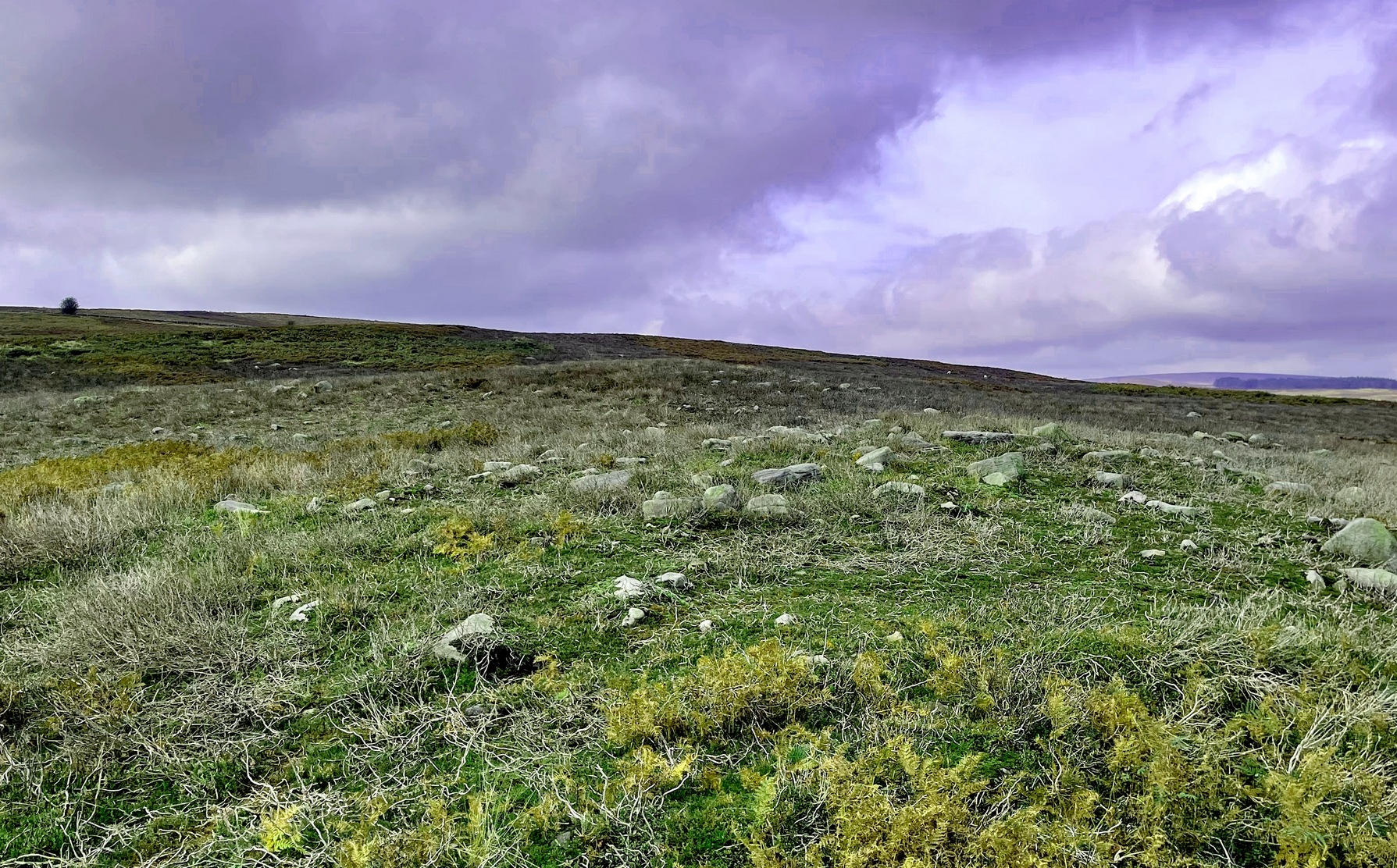
From the Askwith Moor car-park (SE 1757 5067), walk along the road north for several hundred yards and go through the gate on your right. Head northeast through the heather to the Death’s Head carving and keep along the same direction for barely another hundred yards onto the ever-so-slight crown of a small hillock. This is a hut circle you’re standing in/on. A few yards away just to the southeast of where you’re standing is the very denuded remains of this ring cairn.
Archaeology & History
Low remains of rubble wall
Not visible when the heather’s in full growth, it’s nonetheless worth visiting if you’re trying to get a picture of the prehistoric landscape hereby. Less than 10 yards southeast of the notable hut circle on the small crown of a hill, it was first noticed by Sarah Walker on a group visit here recently. Roughly 12 yards across, the most notable section of the circle is the remains of the rubble bank on its east and southeastern sides, raised a few feet above ground level. The majority of the monument comprises of a scatter of various rocks and small stones within and round the edges of the circle. There’s a lot of scattering from other adjacent remains, such as the hut circle and nearby walling, that give the initial impression of it being little more than a spurious mess of stone; but the more you walk around and inside it, the more you come to recognize its structure.
It has that Bronze Age hallmark look about it, but without an excavation this is just educated guesswork. It might actually be older. The widespread mass of prehistoric remains all round here shows that it was once a mass of activity in prehistoric times. It’s a brilliant area, even if you can’t find this particular site!
Cup-and-Ring Stone (destroyed?): OS Grid Reference – SE 314 537
Archaeology & History
The chances of this carving still being alive, so to speak, are pretty slim. It was reported by a Mr. Sullivan to the old Yorkshire petroglyph researcher Stuart Feather back in 1965, in the days when English archaeologists didn’t really give a shit about rock art. Sad but true. The carving was found in the grounds of what used to be the ICI Fibres Research Centre, in the present landscape of Hornbeam Business Park, a hundred yards or more west of Hookstone Beck. According to Feather’s report, the carving consisted of “a single-ringed cup and a groove” surrounding “two short pecked grooves and a meandering groove leading off,” all with clear signs of being pecked and carved in the old-school manner. All trace of the carving has vanished and it was probably destroyed by the Industrialists. (the grid-reference to this site is an approximation)
Easiest way is to park up at the Askwith Moor car-park spot, turn right and walk along the road for about 350 yards until you reach the gate on the right (not the one across the road!). You then need to head to the Death Head’s Stone carving about 450 yards across the moor to the east. It’s pretty conspicuous. From here, walk through the heather 80-odd yards northwest. You’ll walk past some extensive rubble walling (whose nature yet eludes us) before you get there.
Archaeology & History
Looking down at the cups
Discovered recently by Sarah Walker on a venture to see the extensive settlement and graveyard around Snowden Crags, this petroglyph is a simple basic design cut into a relatively large flat stone just above ground level. Found less than 100 yards east of the dubious Snowden Carr (565)carving, there are two large cup-marks on this one: one of them is an inch deep and two-inches across and may originally have been geophysical in nature, but has subsequently been worked by human hands. To its side is another much fainter and shallower cup-mark about the same width. On some photos there’s what appears to be a very faint large ring surrounding the faint cup, but until visits are made at low sun and the stone brushed with water, we cannot be sure whether it’s real or just a trick of the light. There may be more cups on this stone beneath the peat. We didn’t brush it all off.
Some 30-40 yards to the east is the rubble of an extensive prehistoric man-made structure, the nature of which has yet to be discerned. The Snowden Moor cairnfield begins immediately to the northwest, with the first tomb barely 50 yards away.
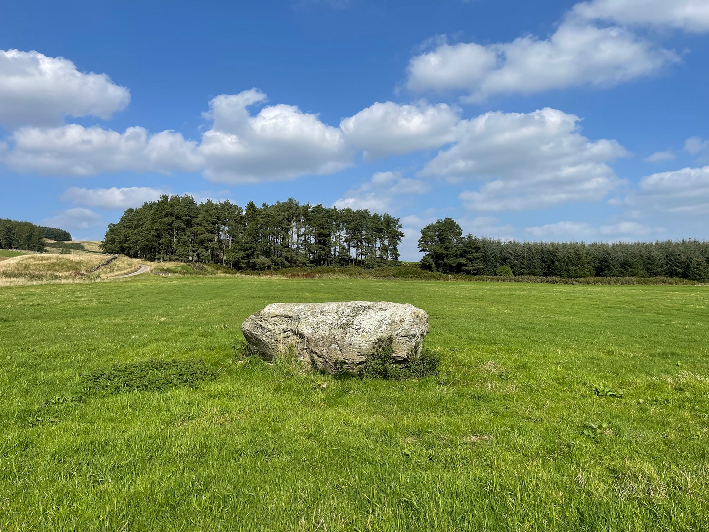
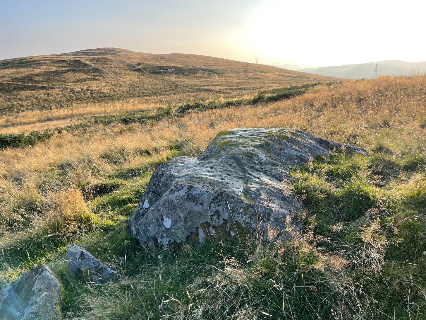
Take the A85 road east out of Crieff and after roughly 2 miles at Gilmerton, turn left up the A822 Dunkeld road. Go along here for nearly 2½ miles, where you’ll reach the Foulford golf course on the right-hand side of the road. Directly opposite the entrance into the golf course, a dirt-track leads you into the fields where, laying alone and standing out like a sore thumb about 300 yards away, you’ll see a large rounded boulder sitting there minding it’s own business. You can see it quite clearly from the roadside. Nice n’ easy.
Archaeology & History
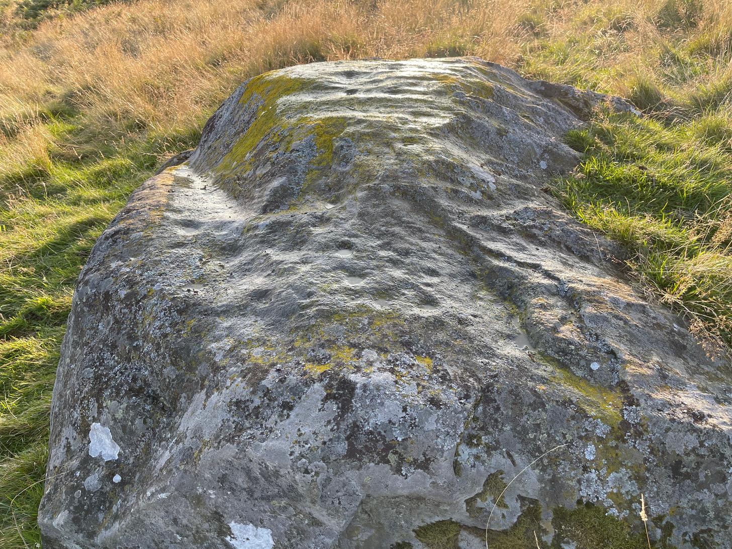
For such a large conspicuous stone, you’d think there’d be quite a lot written about it as well as hope for a good ornate design—but alas!, both hopeful expectations are lacking. Although, as usual, there’s more to it than is described in the official records—although not much more….
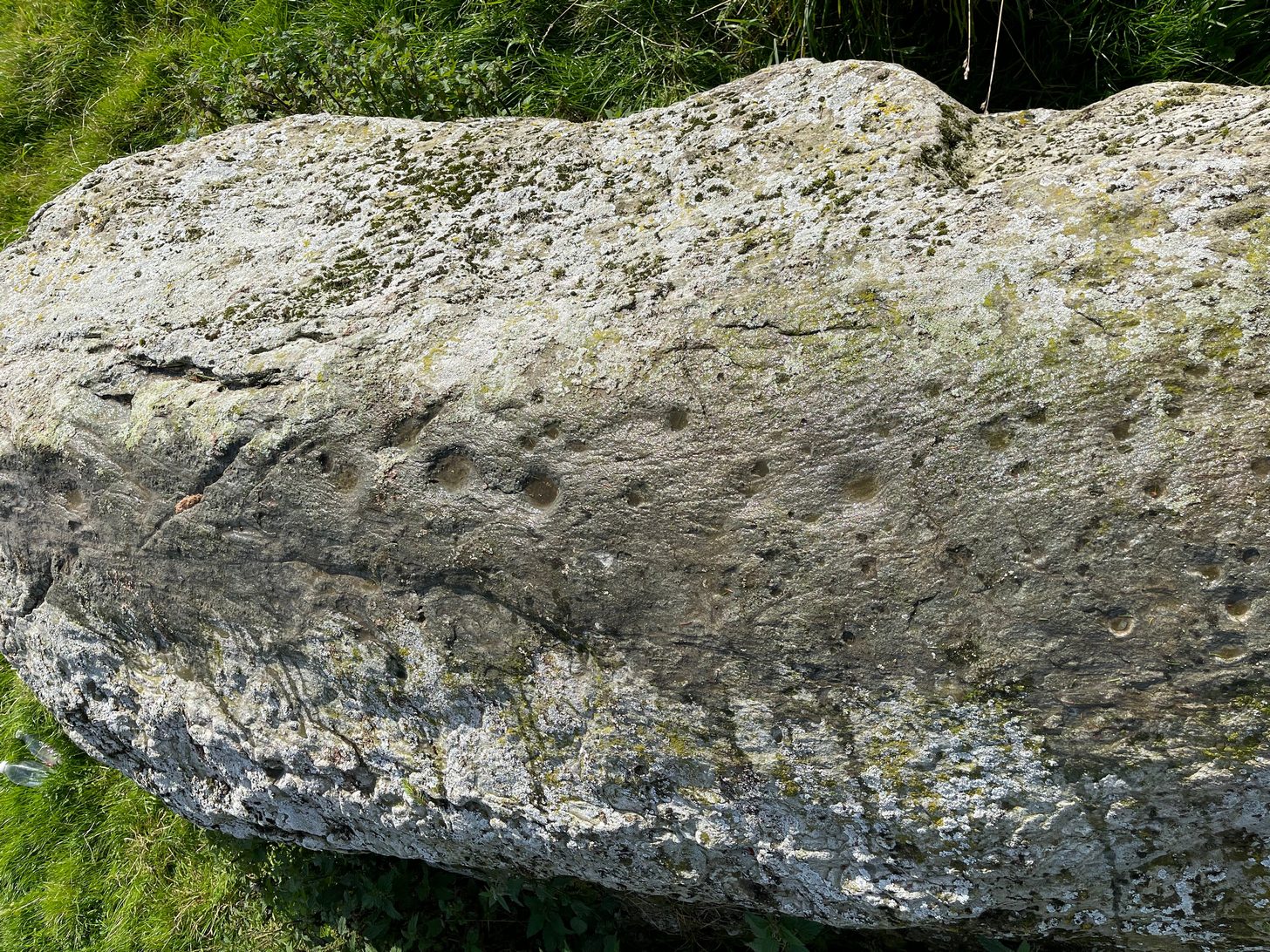
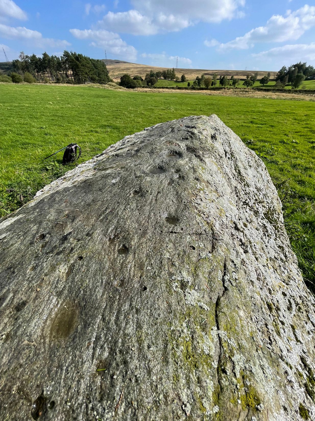
Long stone & its cupmarksCups along the spine
As you walk towards it, it seems as if a rounded earthfast boulder is in front of you, but once you reach it you realise that it’s nothing of the sort. Indeed, the more you looked at the stone, the more it seems as if it might have stood upright not too many centuries ago; the prevalence of other standing stones in the area being well known. But, along the spine of this long stone, a number of cup-marks speak out to you: at least seven of them, perhaps eight. There are a number of smaller “cups” roughly along the same length of stone, but these are Nature’s handiwork; but, it looks as if one or two of the man-made cups might have started their lives as Nature’s indentations and been worked into the symbols that still remain to this day.
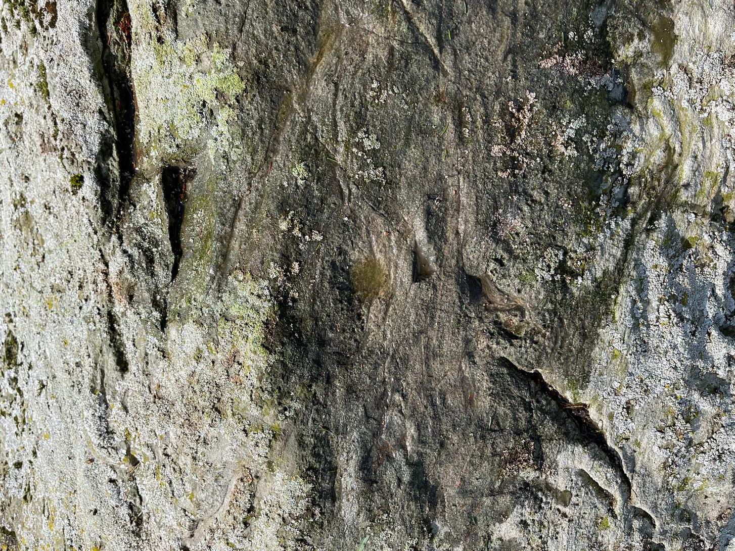
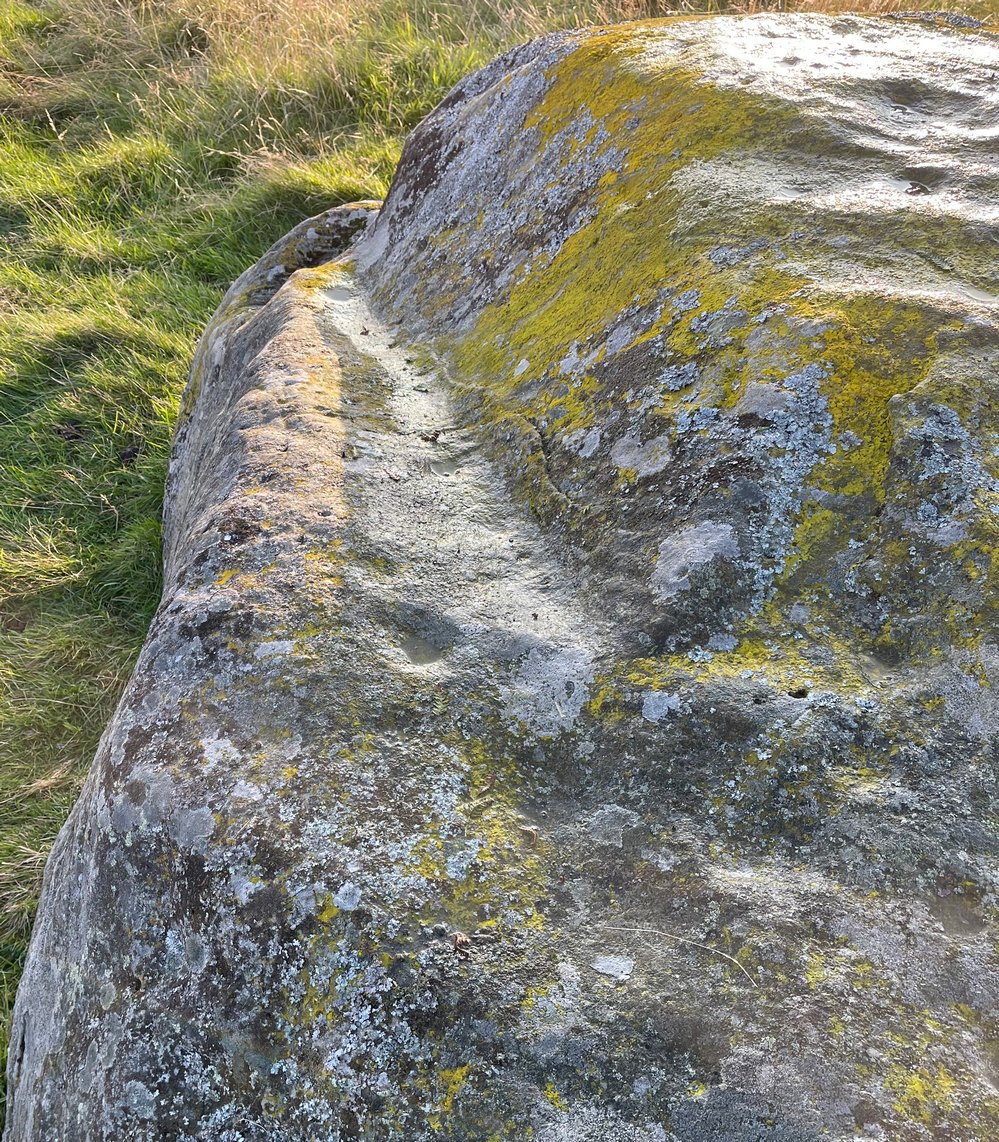
Faint ring around a cupNose of stone, looking E
The official records tell us of the cup-marks, but says nothing of the faint but distinct rings around two or three of the cups. The most notable one, albeit faint, is near the southeastern part of the stone, where the ring seems to be an artistic partnership of Nature and man. You can make it out in the photo, albeit not too clearly. Nearer to the middle of the stone at least one of the cups has a semi-circle around it and, just to the side of it, a natural crack in the stone has been enhanced and carved into a short line. On the whole, it’s not a visually impressive carving and the design is troublesome to see if the lighting isn’t right (as usual), but is worth having a look at if you’re in the area. Very little’s been written about it apart from brief notes in the regional megalithic surveys of both Finlayson (2010) and Watson (2006).
References:
Finlayson, Andrew, The Stones of Strathearn, One Tree Island: Comrie 2010.
Watson, David, A Simple Introduction to the Stone Circles and Standing Stones of Perthshire, Photoprint 2006.
Acknowledgements:Huge thanks for use of the Ordnance Survey map in this site profile, reproduced with the kind permission of the National Library of Scotland.
Take the same direction as if you’re visiting the Ardoch (2) carving, starting from the Foulford golf course on the A822, roughly halfway between Gilmerton and the entrance to the Sma’ Glen. From here, take the track eastwards into the hills and literally ¾-mile along you reach the pylon; keep going along the same track for another 200 yards and on your left watch out for the track-cum-footpath going up the slope past Ardoch (2), onto the hilltop, then through the gate and down the path northeast for about ⅔-mile until you reach the burn. Keep going uphill for 80 yards and through the cronky gate, head 70 yards to your left to the large single rounded boulder.
Archaeology & History
Main scatter of cups
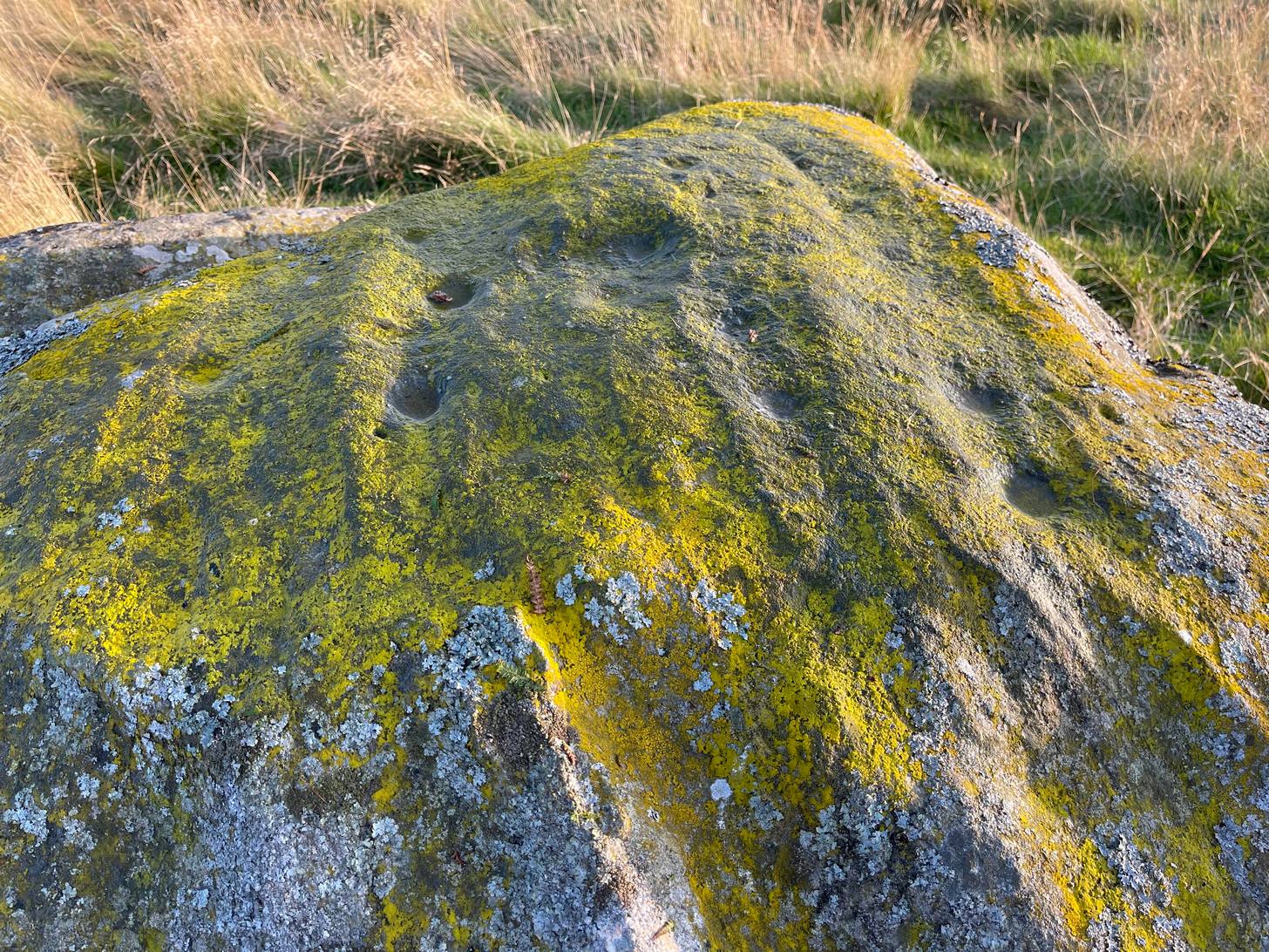
One of several petroglyphs in the area, this is the most notable in terms of its size. It rests just below the two Stroness hut circles which sit on the small level piece of ground nearly 100 yards further up the slope. A considerable scatter of cup-marks cover much of the upper surface of the boulder, some faint, some not so faint, with a number of them painted in a slight cover of lichens at the topmost section of the rock. The carving was first described somewhat blandly by George Currie (2004), who simply wrote:
“Large boulder, 2 x 2m, just W of hut circles; 16+ cups, 40–50 x 14–20mm.”
Faint line near the edgeCups among the lichens
It’s actually south of the hut circles; and there are certainly more than sixteen cup-marks, as the photos here indicate. At the time of my visit here recently, the sun was falling and was just below the level that permitted a perfect highlighting of the cup-marks, but there seemed to be at least 25 of them, scattered in no particular order over much of its upper surface. One curiosity that seemed apparent was a long carved line running along a long slender edge along on the southern side of the stone, from a large cup-mark down to near the southwestern edge, meeting another smaller cupmark. I not 100% certain that it’s actually been carved and it may just be one of Nature’s scratches along the rock, but it does seem to have that “man-made” stamp on it. Another visit in differing light will show us one way or the other.
References:
Currie, George, ‘Buchanty Hill (Fowlis Wester parish): Cup-marked Rocks’, in Discovery & Excavation Scotland, volume 5, 2004.