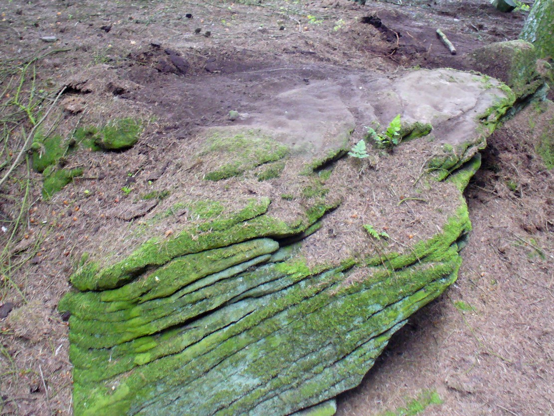
From the Askwith Moor Road parking spot, head west to the Askwith Moor cairnfield. Keep walking west, going downhill past the main cluster of rocks. If you begin zigzagging amidst the heather hereby, you’ll eventually come across this relatively small stone which, even when the heather is deep, thankfully rises to the surface. The Wester Cairnfield 1 carving is close by.
Archaeology & History
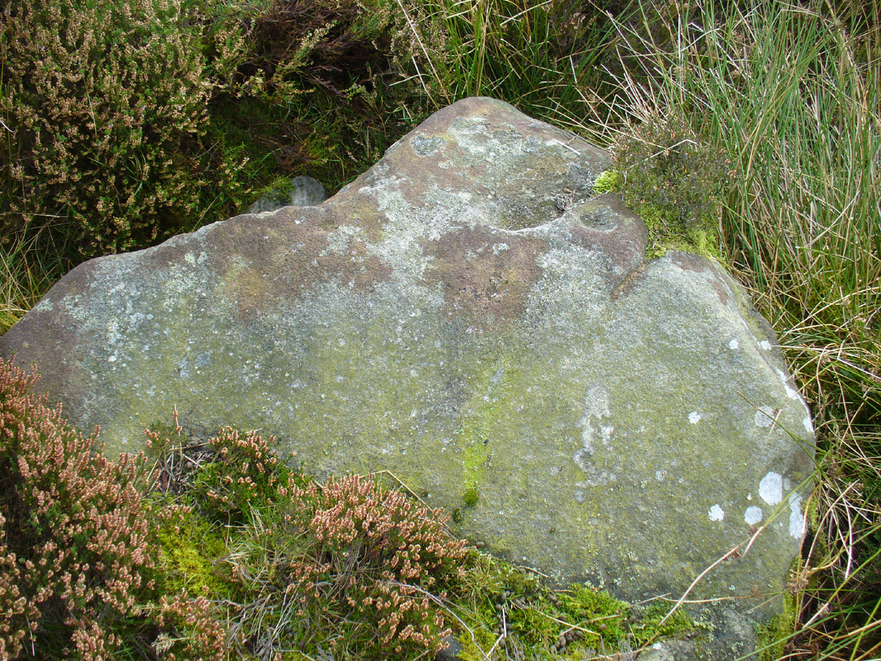
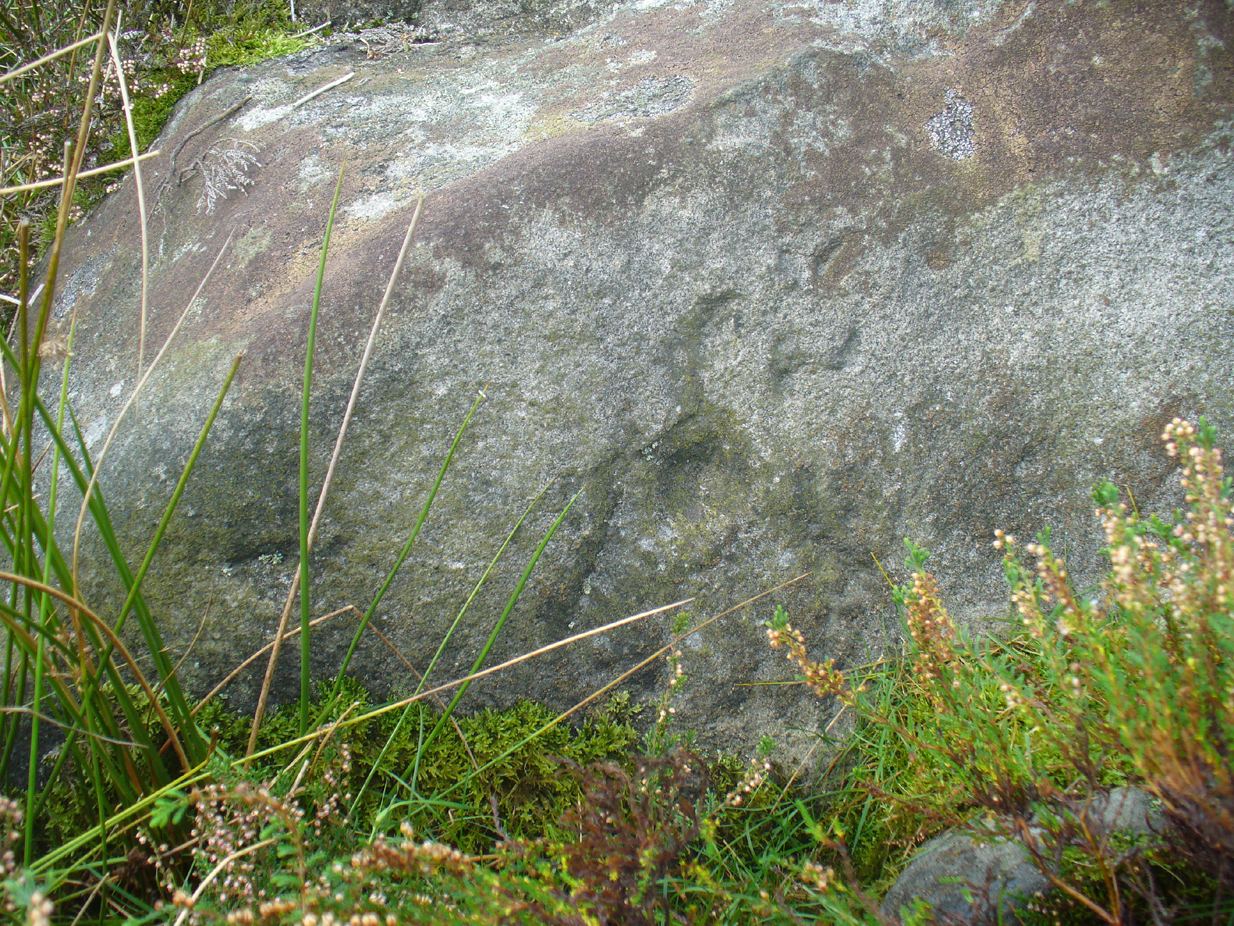
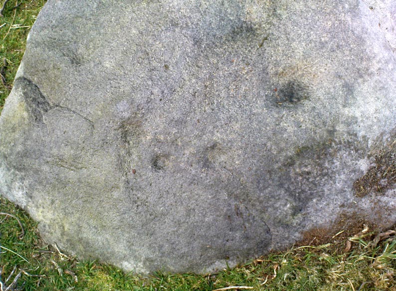
Although I presumed that Graeme Chappell and I found this petroglyph when we surveyed the area in the 1990s, I cannot find an early account of it in my files, so must presume that when James Elkington, James Turner and I came across it a few weeks ago, it was the first view of the stone in many a century… It’s another simple carving, only of interest to the mad rock art hunters out there.
…and from another angle
When we first found it, it seemed to me (with the sunlight effects on the stone) that two cup-marks had been etched here; but as Mr Elkington pointed out, from the angle he was looking at the stone, there were another two. He was right. But it’s nothing special to look at, sadly, and is probably only of interest to the real hardcore petroglyph nutters amongst you. (please note that the grid-ref for this carving needs revising and may be 50 yards either side of the one given)
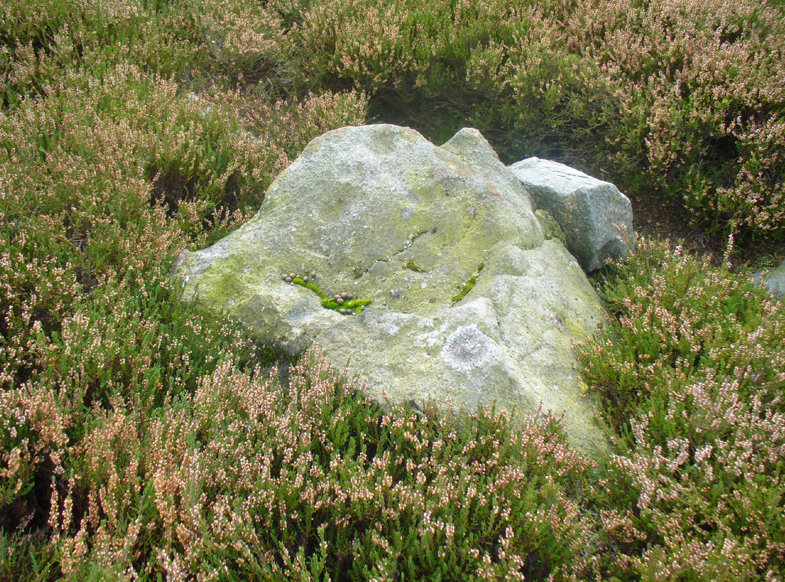
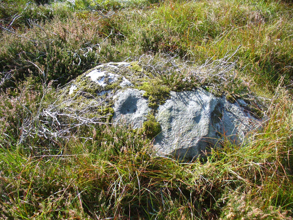
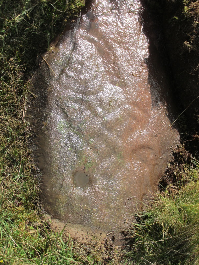
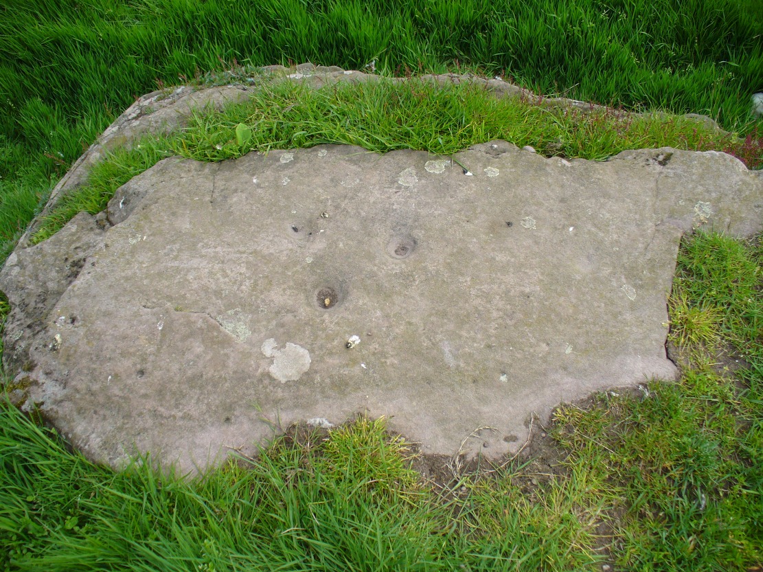
From the Askwith Moor Lane parking site, take the directions to the Askwith Moor Cairnfield. Walk westwards for about 100 yards down the gradual slope, towards the boggy land below, but before reaching the reeds, still in the moorland heather, there are a scatter of rocks. Just keep zigzagging about until you find it. It’s a reasonably large stone.
Archaeology & History
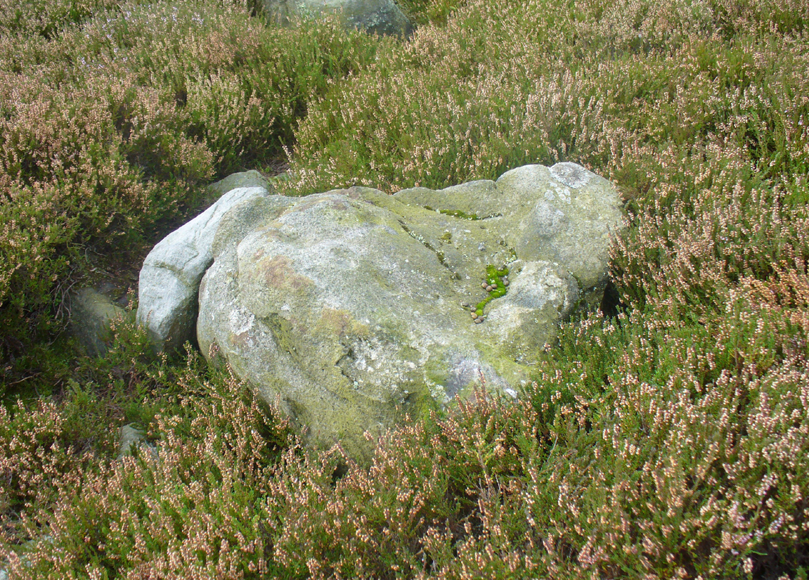
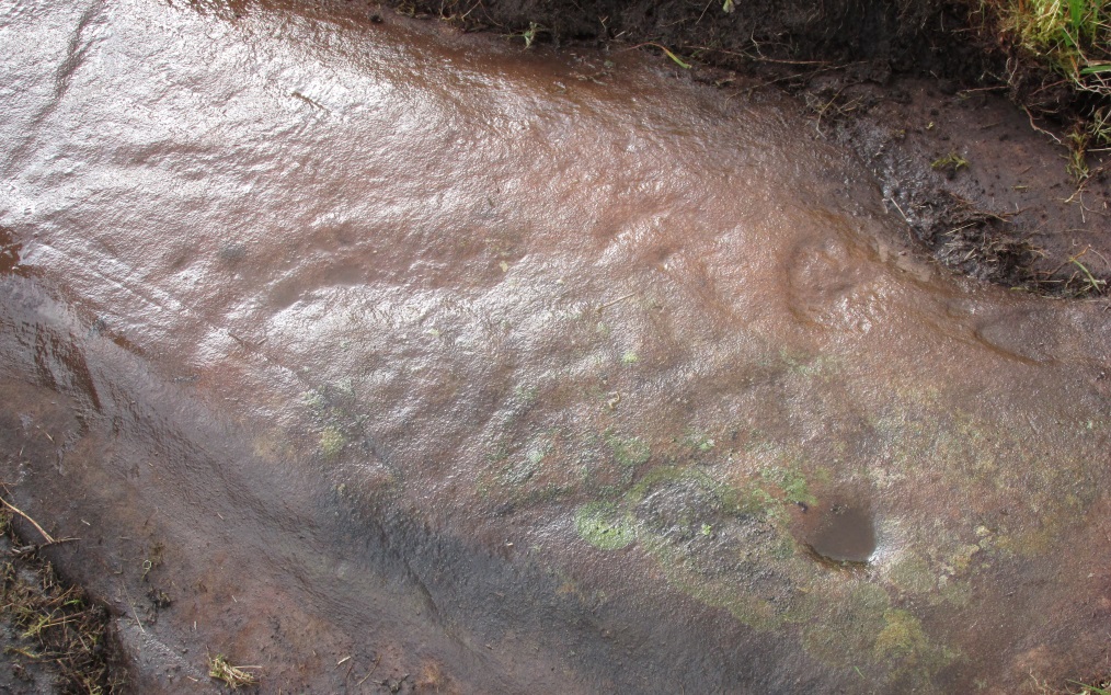
‘Cup mark’ on vertical face
This is one of several simple cup-marked stones found down the slopes about 100 yards west of the Askwith Moor Cairnfield. When James Elkington, James Turner and I re-surveyed this area again recently, I wondered whether it was a newbie or had already been located when Graeme Chappell and I did our tedious surveying of this region in the 1990s—and it turned out that we did! The carving is nothing special to look at, even if you’re a petroglyph zealot. Comprising of a distinct single cup-mark on the top nose of the rock, another is visible on the vertical south face, and another possible is on its eastern face.
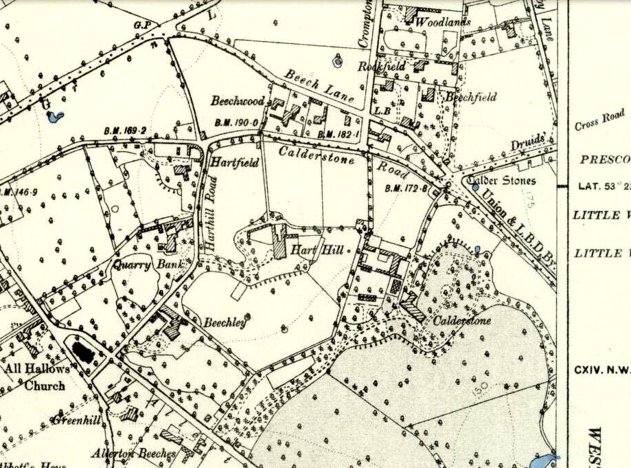
1894 map of shooting target
When we look at the early maps of this area, we find that to the north and south of this stone once existed ‘Shooting Houses’. As we can see on the attached map, the position of one of the shooting targets is very close to the location of this stone and so we must conclude that the cups on the vertical face were done by gunshot and are not prehistoric. However, the distinct cup on top of the stone retains its prehistoric link.
Start at the Askwith Moor parking spot on Askwith Moor Road, then walk down the road (south) 300 yards till you reach the gate and track on the other side of the road, heading southeast. Following the track onto the moor and take the footpath on your right after 75 yards. Follow this along until you hit the gate & fence. Climb over this, then follow the same fence along (left) and down, and keep following the fence and walling all the way on until you reach the very bottom southwestern edge of Askwith Moor itself. Now, walk up the slope to your right and, near the top of this rise 250 yards away, past Lower Lanshaw 01 carving, in some ancient walling, you’ll find it!
Archaeology & History
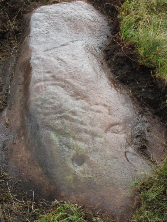
A very faded cup-and-ring carving can be found about 30 yards northeast of the Lower Lanshaw cup-marked stone, just as the hill slopes down to the overgrown stream. It rests on the lower edges of the prehistoric (probably Bronze Age) enclosure in which other archaeological remains can be found. Although the photo here highlights what seems to be 3 cups on the south-face of the rock, only one of them seems authentic. A pecked “line” also seemed evident, but the light conditions were poor when we were here. It does seem that there’s a faded ring around one of the cups, as you can see in the photo.
Take the directions as if you’re visiting the ornate petroglyphs known asthe Lunar Stone and the Spotted Stone. Walk past them and down the slope, NW, as if you’re heading to the small valley a few hundred yards away. As you reach the bottom of the slope, closer to the stream, a large boulder catches your attention. This carved stone is just a few yards before you reach it.
Archaeology & History
This simple cup-marked design below the northern slope of Stanbury Hill has, on its northeastern sloping face, a single cup-mark; then, past a curiously-etched line (probably more recent) is a larger circular feature, like a very shallow ‘bowl’ as in the one found in the superb Stag Cottage petroglyph complex 300 miles north (and several other carvings). A few yards away, a large single cup-mark has been etched onto another stone. As with quite a few carvings in this region, they have been missed in the standard archaeocentric surveys.
Take the same directions to locate the cup-and-ring stone of Ballochraggan 12. There are several rocks adjacent. The one immediately next to it, to the northeast, is the one you’re looking for. Be gentle and careful if you’re gonna look at it — deadly serious, be very careful indeed!
Archaeology & History
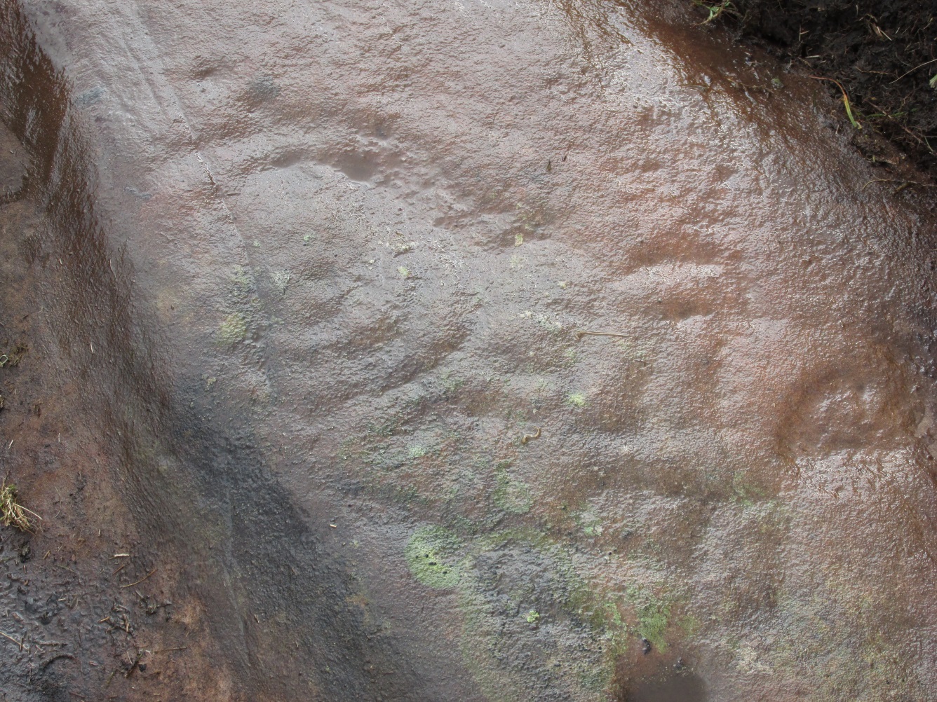
One of the most intriguing and most fascinating of all the prehistoric carvings I’ve yet to discover. Not that this was all my own work. If it hadn’t been for Paul Hornby, we might have simply walked past it as being little more than a single cup-marked stone—and in this area, single cup-marks tend to be little more than geological in nature.
After we’d looked over several of the registered carvings close by, I did my usual meandering back and forth, stroking stones and seeing if there were any carvings that had been missed by previous surveyors. And in walking past a small piece of smooth rock, a singular cupmark seemed to stand out. I walked past it, shouting across to my colleague.
“It looks like we’ve got a single cup-mark here Paul,” I said, “with possible half-ring.” Thankfully Mr Hornby gave it his better attention.
Mask Stone, with faint ‘urn’Close-up of features
The sun was still out and shining across the smooth rock surface, which tends to mean that you’re not seeing any carving on the stone quite as good as it actually is. Thankfully however, the sun was beginning to get lower and, when this happens, if we wet the rock, any carvings that might be there stand out much better. And this little fella just seemed to get better and more curious the more attention Paul gave it!
The first thing that became obvious were a series of faint carved lines above the single cup-mark. Initially these didn’t seem to merit much attention (straight lines on rock are usually more the product of geophysical action than that of humans), but as the rock got wetter, Paul saw something very distinct indeed.
“There’s a face on it!” he exclaimed. And indeed there was. A Rorschach response no doubt, but it was still very much like a face. This looked for all the world akin to the stylised olde English gentry sort of countenance, as in old cartoons. It was quite ‘distinct’, as such characters themselves insist on being! Yet around this initial face, more lines seemed to be emerging as the stone gave up more and more of its hidden story.
Standing back from an initial investigation, the carving was seen to consist of a triple-ring, but without the traditional ‘cup’ in its centre. Instead, the centre was marked simply by a small ‘dot’—perhaps, originally, being a small conglomerate hole formed as a result of another tiny harder fragment of stone falling away from its larger mass. But a ‘dot’ it was. The other carved ‘lines’ however, immediately below and attached to the triple-ring, gave us something almost unique—and another strong Rorschach response. As the photos clearly show, we have a distinct second ‘face’ made up of the same lines but in a quite different form. This ‘face’ has all the attributes we usually associate with pictures of mythical spirits, demons, or a mask—hence the name!
Paul took a series of fine photos, hoping that he could catch the image that our eyes could clearly see. And thankfully, his digital camera brought the image to life even better than our eyes did! The ‘mask’ is comprised of carved lozenge forms, akin to the more decorative ones we find at Kilmartin, and more especially around Newgrange, Ireland. We sat and talked about this: wondering and working out routes that we’d take over mountains and moors, from Ireland, to Kilmartin, then onto Ballochraggan, etching the same designs onto the rocks hereby and attaching similar mythic notions to them: of shamanism and kingship; underworlds and journeys—paradigms lost and certainly misunderstood in the non-polysemia of many modern academics.
Lozenges and rings
…The stone here was still slightly covered over and, beneath the loose grasses, another feature emerged of another petroglyphic rarity. At the topmost western side of the rock a straight line ran across the surface, seemingly marked by the hand of man, with a curious little line almost doubling back on itself for just an inch or so, and then feeling to run down the stone, towards the concentric rings and the face below. When we stood back and took the photos, this line and its tracer took on a form that I’ve only seen echoed in one of the Netherlargie tombs at Kilmartin, Argyll, 44.4 miles (73km) to the west. It is very distinct.
The beaker, rings & ‘face’
Spuriously ascribed as being ‘axe’ carvings (oh how archaeologists love this Rorschach projection), the Netherlargie North tomb cover-stone in Kilmartin has a series of burial ‘urns’ or beakers carved onto the rock, amidst a scattered collection of cup markings. (Beckensall 2005:73-4; Bradley 1983:92-3; Royal Commission 1971:68-70; Twohig 1972, etc) Here too at Ballochraggan we find another such symbol, but just a singular example, much larger and more clearly a beaker or urn, as are traditionally found within many old neolithic and Bronze Age tombs; although no tomb is immediately apparent at this Ballochraggan carving.
The entire carving is very faint indeed (you can’t even see it when you’re looking directly at it unless conditions are good) showing that it remained open to the elements for thousands of years. Other adjacent carvings lack the erosion that we find on this one, even on those which, as archaeologist Lisa Samson said, is “softer sandstone rock than this one”—implying that it’s one of the older carvings in this incredible cluster.
The carving was covered over when we finished examining it, to ensure that Nature’s erosion keeps it alive for just a few more centuries at least, hopefully…..
References:
Beckensall, Stan, The Prehistoric Rock Art of Kilmartin, Kilmartin Trust: Kilmartin 2005.
Bradley, Richard, Altering the Earth, Society of Antiquaries Scotland: Edinburgh 1993.
Royal Commission on the Ancient & Historical Monuments of Scotland, Argyll – volume 6: Mid-Argyll and Cowal, HMSO: Edinburgh 1971.
Twohig, Elizabeth Shee, The Megalithic Art of Western Europe, Clarendon: Oxford 1981.
Acknowledgments: Huge thanks again to Mr Paul Hornby for his considerable help with this site, and for use of his photos.
Cup-Marked Stone (missing): OS Grid Reference – SE 16940 87301
Archaeology & History
A prehistoric carving that is missing and possibly destroyed since being rediscovered in 2001 by Barbara Brown (2008) and subsequently described in her book on North Yorkshire petroglyphs. She told it to be in “Thornton Steward field hedge bottom” and was a simple glyph, being a
“rectangular slab (with) single cup-mark located in hedge bottom part of old walling.”
When she revisited the site with her husband in 2006, the old hedge and wall had been removed, with “new hedging in place.” The carved stone may be buried within a pile of clearance stones adjacent to the hedgerow, but it has yet to be relocated. If anyone finds it, please let us know! It was one of several cup-marked stones that exist in the wider neighbourhood.
References:
Brown, Paul & Barbara, Prehistoric Rock Art in the Northern Dales, Tempus: Stroud 2008.
Access to these stones has, over recent years been pretty dreadful by all accounts. It’s easy enough to locate. Go into Calderstones Park and head for the large old vestibule or large greenhouse. If you’re fortunate enough to get one of the keepers, you may or may not get in. If anyone has clearer info on how to breach this situation and allow access as and when, please let us know.
Archaeology & History
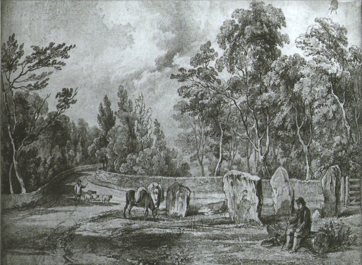
Earliest known drawing from 1825, showing the carvings
Marked on the 1846 Ordnance Survey map in a position by the road junctions at the meeting of township boundaries, where the aptly-named Calderstones Road and Druids Cross Road meet, several hundred yards north of its present site in Harthill Greenhouses in Calderstones Park, this is a completely fascinating site whose modern history is probably as much of a jigsaw puzzle as its previous 5000 years have been!
Thought to have originally have been a chambered tomb of some sort, akin to the usual fairy hill mound of earth, either surrounded by a ring of stones, or the stones were covered by earth. The earliest known literary reference to the Calderstones dates from 1568, where it is referenced in a boundary dispute, typical of the period when the land-grabbers were in full swing. The dispute was over a section of land between Allerton and Wavertree and in it the stones were called “the dojer, rojer or Caldwaye stones.” At that time it is known that the place was a roughly oval mound. But even then, we find that at least one of the stones had been taken away, in 1550.
Little was written about the place from then until the early 19th century, when descriptions and drawings began emerging. The earliest image was by one Captain William Latham in 1825. On this (top-right) we have the first hint of carvings on some of the stones, particularly the upright one to the right showing some of the known cup-markings that still survive. By the year 1833 however, the ‘mound’ that either surrounded or covered the stones was destroyed. Victorian & Paul Morgan (2004) told us,
“The destruction first began in the late 18th or early 19th century when the mound was largely removed to provide sand for making mortar for a Mr Bragg’s House on Woolton Road. It was at this time that a ‘fine sepulchral urn rudely ornamented outside’ was found inside.”
The Calderstones in 1840
The same authors narrated the account of the mound’s final destruction, as remembered by a local man called John Peers—a gardener to some dood called Edward Cox—who was there when it met its final demise. Mr Cox later wrote a letter explaining what his gardener had told him and sent it to The Daily Post in 1896, which lamented,
“When the stones were dug down to, they seemed rather tumbled about in the mound. They looked as if they had been a little hut or cellar. Below the stones was found a large quantity of burnt bones, white and in small pieces. He thought there must have been a cartload or two. He helped to wheel them out and spread them on the field. He saw no metal of any sort nor any flint implements, nor any pottery, either whole or broken; nor did he hear of any. He was quite sure the bones were in large quantity, but he saw no urn with them. Possibly the quantity was enhanced by mixture with the soil. No one made such of old things of that sort in his time, nor cared to keep them up…”
But thankfully the upright stones remained—and on them were found a most curious plethora of neolithic carvings. After the covering cairn had been moved, the six remaining stones were set into a ring and, thankfully, looked after. These stones were later removed from their original spot and, after a bit of messing about, came to reside eventually in the curious greenhouse in Calderstones Park.
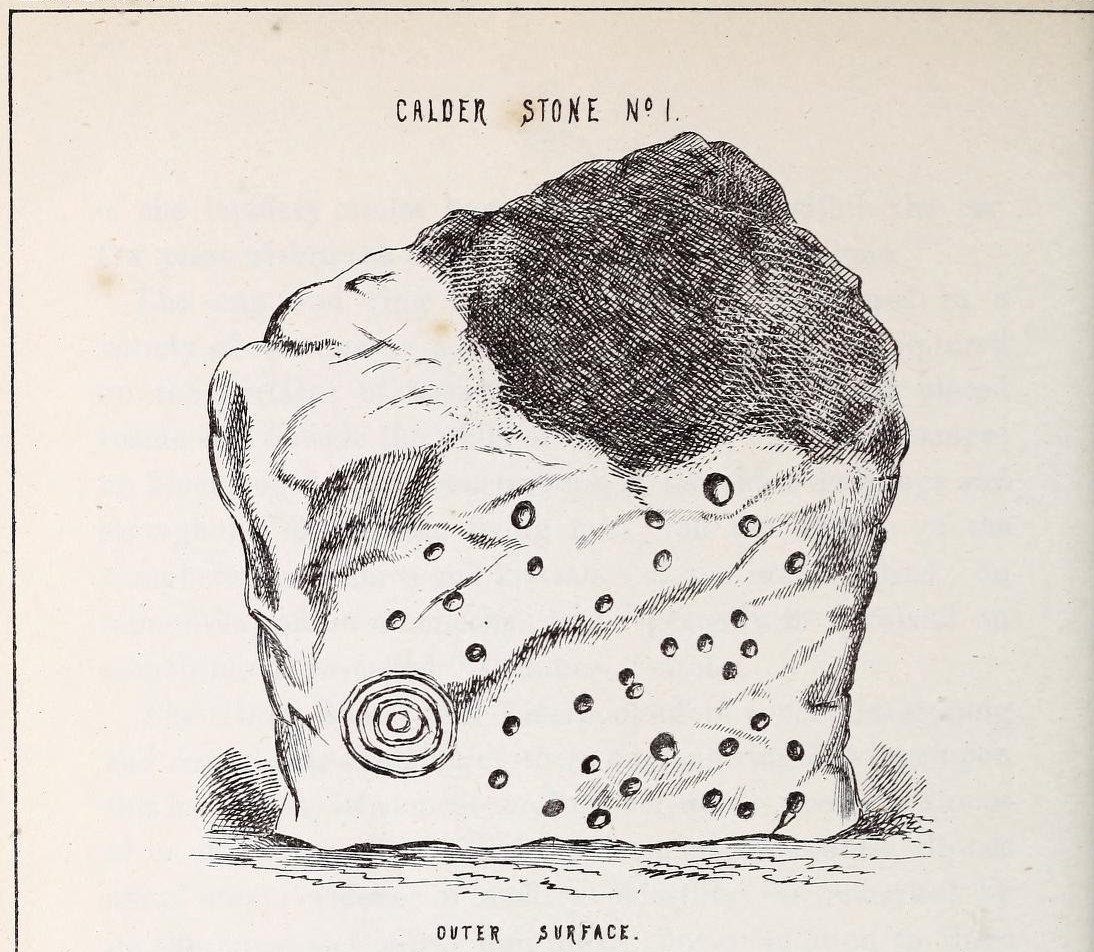
Simpson’s “Stone 1” outer faceSimpson’s “Stone 1” inner face
The carvings on the stones were first described in detail by the pioneering James Simpson. (1865) I hope you’ll forgive me citing his full description of them—on one of which he could find no carvings at the time, but he did state that his assessment may be incomplete as the light conditions weren’t too good. Some things never change! Sir James wrote:
“The Calder circle is about six yards in diameter. It consists of five stones which are still upright, and one that is fallen. The stones consist of slabs and blocks of red sandstone, all different in size and shape.
“The fallen stone is small, and shews nothing on its exposed side; but possibly, if turned over, some markings might be discovered on its other surface.
“Of the five standing stones, the largest of the set (No. I) is a sandstone slab, between five and six feet in height and in breadth. On its outer surface—or the surface turned to the exterior of the circle— there is a flaw above from disintegration and splintering of the stone; but the remaining portion of the surface presents between thirty and forty cup depressions, varying from two to three and a half inches in diameter; and at its lowest and left-hand corner is a concentric circle about a foot in diameter, consisting of four enlarging rings, but apparently without any central depression.
“The opposite surface of this stone, No. 1, or that directed to the interior of the circle, has near its centre a cup cut upon it, with the remains of one surrounding ring. On the right side of this single-ringed cup are the faded remains of a concentric circle of three rings. To the left of it there is another three-ringed circle, with a central depression, but the upper portions of the rings are broken off. Above it is a double-ringed cup, with this peculiarity, that the external ring is a volute leading from the central cup, and between the outer and inner ring is a fragmentary line of apparently another volute, making a double-ringed spiral which is common on some Irish stones, as on those of the great archaic mausoleum at New Grange, but extremely rare in Great Britain. At the very base of this stone, and towards the left, are two small volutes, one with a central depression or cup, the other seemingly without it. One of these small volutes consists of three turns, the other of two.
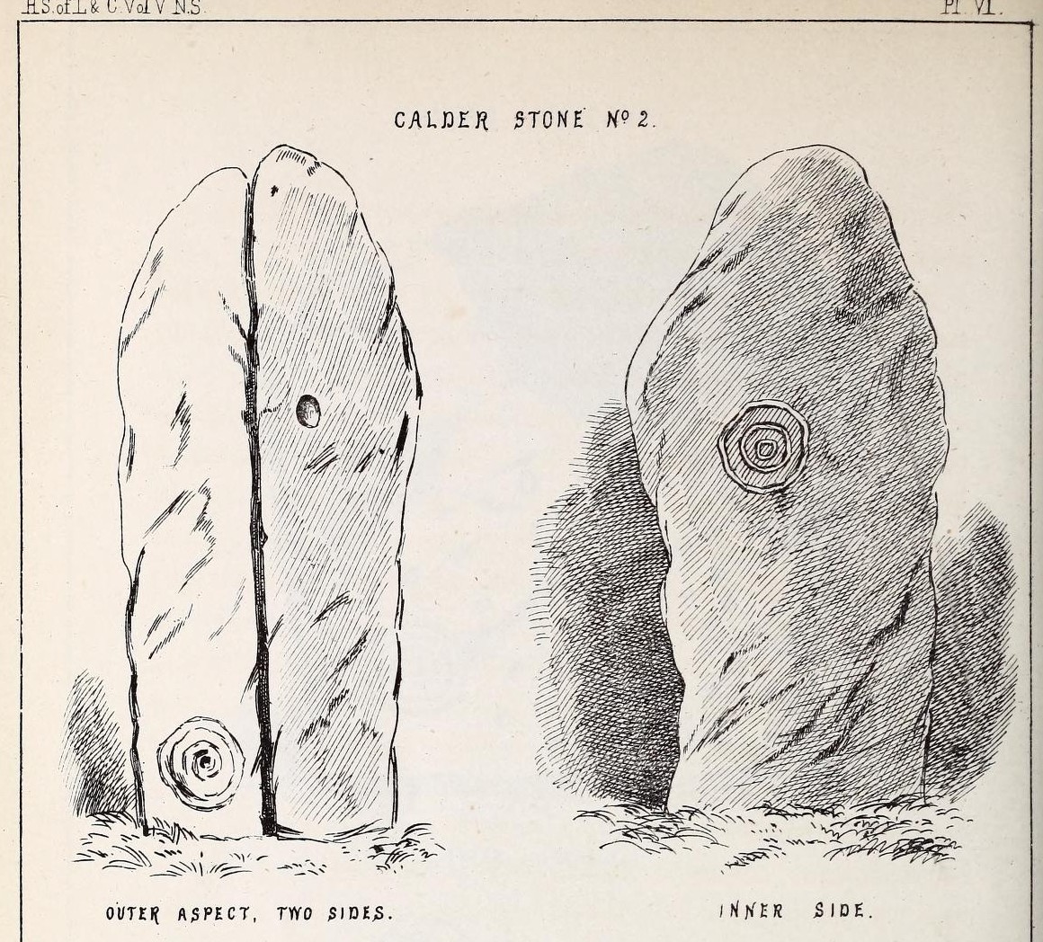
“The next stone, No. 2 in the series, is about six feet high and somewhat quadrangular. On one of its sides, half-way up, is a single cup cutting; on a second side, and near its base, a volute consisting of five rings or turns, and seven inches and a half in breadth ; and on a third side (that pointing to the interior of the circle), a concentric circle of three rings placed half-way or more up the stone.
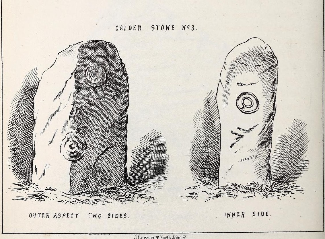
“The stone No. 3, placed next to it in the circle, is between three and four feet in height; thick and somewhat quadrangular, but with the angles much rounded off. On its outermost side is apparently a triple circle cut around a central cup; but more minute examination and fingering of the lines shews that this figure is produced by a spiral line or volute starting from the central cup, and does not consist of separate rings. The diameter of the outermost circle of the volute is nearly ten inches. Below this figure, and on the rounded edge between it and the next surface of the stone to the left, are the imperfect and faded remains of a larger quadruple circle. On one of the two remaining sides of this stone is a double concentric circle with a radial groove or gutter uniting them. This is the only instance of the radial groove which I observed on the Calder Stones, though such radial direct lines or ducts are extremely common elsewhere in the lapidary concentric circles.
“The stone No. 4 is too much weathered and disintegrated on the sides to present any distinct sculpturings. On its flat top are nine or ten cups ; one large and deep (being nearly five inches in diameter). Seven or eight of these cups are irregularly tied or connected together by linear channels or cuttings…
“The fifth stone is too much disfigured by modern apocryphal cuttings and chisellings to deserve archaeological notice.
“The day on which I visited these stones was dark and wet. On a brighter and more favourable occasion perhaps some additional markings may be discovered.”
It wasn’t long, of course, before J. Romilly Allen (1888) visited the Calderstones and examined the carvings; but unusually he gave them only scant attention and added little new information. Apart from reporting that another of the monoliths had carvings on it, amidst a seven-page article the only real thing of relevance was that,
“Five of the Calderstones show traces, more or less distinct, of this kind of carving, the outer surface of the largest stone having about thirty-six cups upon it, and a set of four concentric rings near the bottom at one corner. One of the stones has several cups and grooves on its upper surface.”
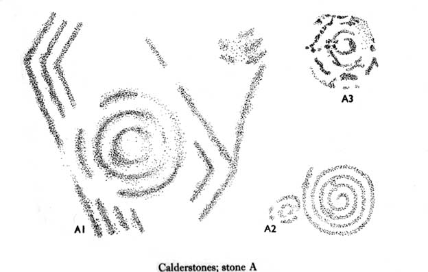
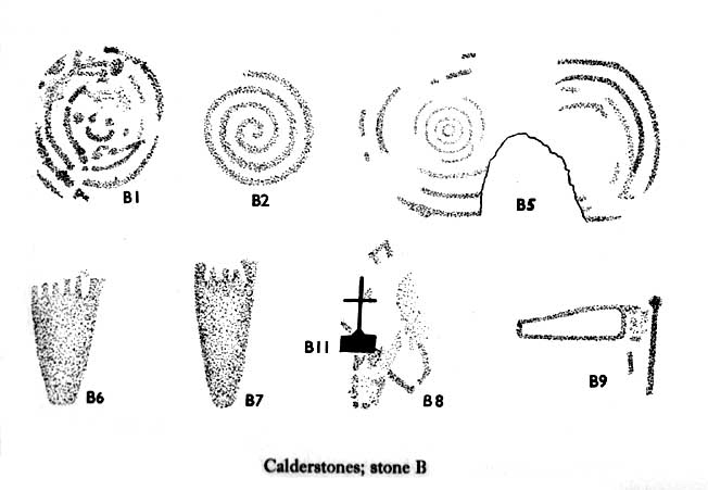
Carvings on Stone A (after Forde-Johnson)Carvings on Stone B (after Forde-Johnson)
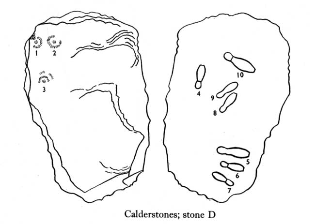
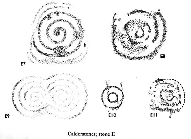
Unusual for him! The major survey of the Calderstone carvings took place in the 1950s when J.L. Forde-Johnson (1956; 1957) examined them in great detail. His findings were little short of incredible and, it has to be said, way ahead of his time (most archaeo’s of his period were simply lazy when it came to researching British petroglyphs). Not only were the early findings of Sir James Simpson confirmed, but some fascinating rare mythic symbols were uncovered that had only previously been located at Dunadd in Argyll, Cochno near Glasgow, and Priddy in Somerset: human feet – some with additional toes! Images of feet were found to be carved on Stones A, B and E. A carved element on Stone C may even represent a human figurine—rare things indeed in the British Isles!
Carvings on Stone DCarvings on Stone E
The detailed sketches here are all from Forde-Johnson’s 1957 article, where five of the six stones were found to bear petroglyphs (the sixth stone has, more recently, also been found to also possess faint carvings of a simple cup-mark and five radiating lines).
Elements on Stone C (after Forde-Johnson)More elements on Stone C (after Forde-Johnson)
The date of the site is obviously difficult to assess with accuracy; but I think it is safe to say that the earlier archaeological assumptions of the Calderstones being Bronze Age are probably wrong, and the site is more likely to have been constructed in the neolithic period. It’s similarity in structure and form to other chambered tombs—mentioned by a number of established students from Glyn Daniel (1950) to Frances Lynch—would indicate an earlier period. The fact that no metals of any form have ever been recovered or reported in any of the early accounts add to this neolithic origin probability.
There is still a lot more to be said about this place, but time and sleep are catching me at the mo, so pray forgive my brevity on this profile, until a later date…
Folklore
Curiously, for such an impressive site with a considerable corpus of literary references behind it, folklore accounts are scant. The best that Leslie Grinsell (1976) could find in his survey was from the earlier student C.R. Hand (1912), who simply said that,
“They were looked upon with awe by the people about as having some religious significance quite beyond their comprehension.”
There is however, additional Fortean lore that has been written about these stones and its locale by John Reppion (2011).
Ashbee, Paul, The Bronze Age Round Barrow in Britain, Phoenix House: London 1960.
Baines, Thomas, Lancashire and Cheshire, Past and Present – volume 2, William MacKenzie: London 1870.
Beckensall, Stan, British Prehistoric Rock Art, Tempus: Stroud 1999.
Beckensall, Stan, Circles in Stone: A British Prehistoric Mystery, Tempus: Stroud 2006.
Cowell, Ron, The Calderstones – A Prehistoric Tomb in Liverpool, Merseyside Archaeological Trust 1984.
Crawford, O.G.S., The Eye Goddess, Phoenix House: London 1957.
Daniel, Glyn E., The Prehistoric Chamber Tombs of England and Wales, Cambridge University Press 1950.
Faulkner, B.M., “An Analysis of Three 19th-century Pictures of the Calderstones,” in Merseyside Archaeological Journal, volume 13, 2010.
Forde-Johnson, J.L., “The Calderstones, Liverpool,” in Powell & Daniel, Barclodiad y Gawres: The excavation of a Megalithic Chambered Tomb in Anglesey, Liverpool University Press 1956.
Forde-Johnson, J.L., “Megalithic Art in the North West of Britain: The Calderstones, Liverpool,” in Proceedings of the Prehistoric Society, volume 23, 1957.
Grinsell, Leslie, Folklore of Prehistoric Sites in Britain, David & Charles: Newton Abbot 1976.
Hand, Charles R., The Story of the Calderstones, Hand & Co.: Liverpool 1912.
Herdman, W.A., “A Contribution to the History of the Calderstones, near Liverpool,” in Proceedings & Transactions of the Liverpool Biological Society, volume 11, 1896.
Morgan, Victoria & Paul, Prehistoric Cheshire, Landmark: Ashbourne 2004.
Nash, George & Stanford, Adam, “Recording Images Old and New on the Calderstones in Liverpool,” in Merseyside Archaeological Journal, volume 13, 2010.
Picton, James A., Memorials of Liverpool – 2 volumes, Longmans Gree: London 1875.
Simpson, James, Archaic Sculpturings of Cups, Circles, etc., Upon Stones and Rocks in Scotland, England and other Countries, Edmonston & Douglas: Edinburgh 1867.
Taylor, Isaac, Words and Places, MacMillam: London 1885.
Stewart-Brown, Ronald, A History of the Manor and Township of Allerton, Liverpool 1911.
Acknowledgements: With huge thanks to the staff at Calderstones Park; thanks also to the very helpful staff at Liverpool Central Library.
Follow the same directions as if you’re looking for the Doo’cot Woods carving; but, in the field that you have to cross before entering the trees, about 50 yards down from the top of the field, a geological ridge of stone runs along into the trees themselves. The carving is along this ridge in the field. Walk along and you’ll find it! (the grid-reference for this carving is slightly off-centre and needs correcting)
Archaeology & History
Cup-marks from above
Not described in earlier surveys, this is one of two cup-marked stones close to each other along this long ridge of stone reaching across the field. The carving has three distinct cups, as shown in the photos, and another two more faded ones. No other features seemed visible when we were here. We must, however, be careful with this and other ‘cup-markings’ in the area, as a lot of the stone is conglomerate and nodules of differing forms of rock (visible on nearby stones) fall away, leaving cup-like impressions where the softer stone erodes. Some of the cup-markings listed in John Sherriff’s (1995) survey of this region seem to be purely geological in nature and not man-made. Several more visits are needed here so we can ascertain the valid carvings from the geological features.
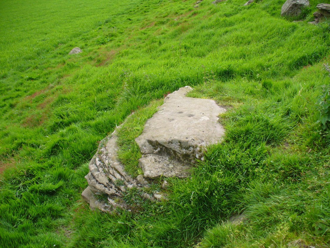
A tricky venture, best approached along the B9113 eastwards out of Forfar, towards Rescobie Loch. Just a coupla hundred yards past the lochside, go up the track that leads you to the farmhouse called West Mains of Turin, below Turin Hill on the left-hand side of the road (north). Go up through and past the farm, up the track until you hit the gate that takes where the old quarries appear. Looking right, a copse of woods appears. Go into it and about two-thirds way up, a slight rise marks a long ridge of rock cutting across the woodland. The carving is near the very eastern end of this ridge at the far side of the trees. Good luck!
Archaeology & History
Cup-markings, faintly visible
Not included in John Sherriff’s (1995) survey of Angus petroglyphs, this “carving”, like many in his survey, may be deemed slightly debatable and require the attention of qualified geologists to ascertain the veracity, or otherwise, of a number of supposed cup-marked stones that he describes. This one, found in the woodland beneath the undergrowth of years of pine needles and such things (hence the poor quality photos), has between 9 and 11 cup-markings etched on the southern sides of a large earthfast stone found in the woodland. There may be more cups on this rock, beneath the compressed vegetation, but we didn’t spend too much time here to find out (bad boys that we are!).
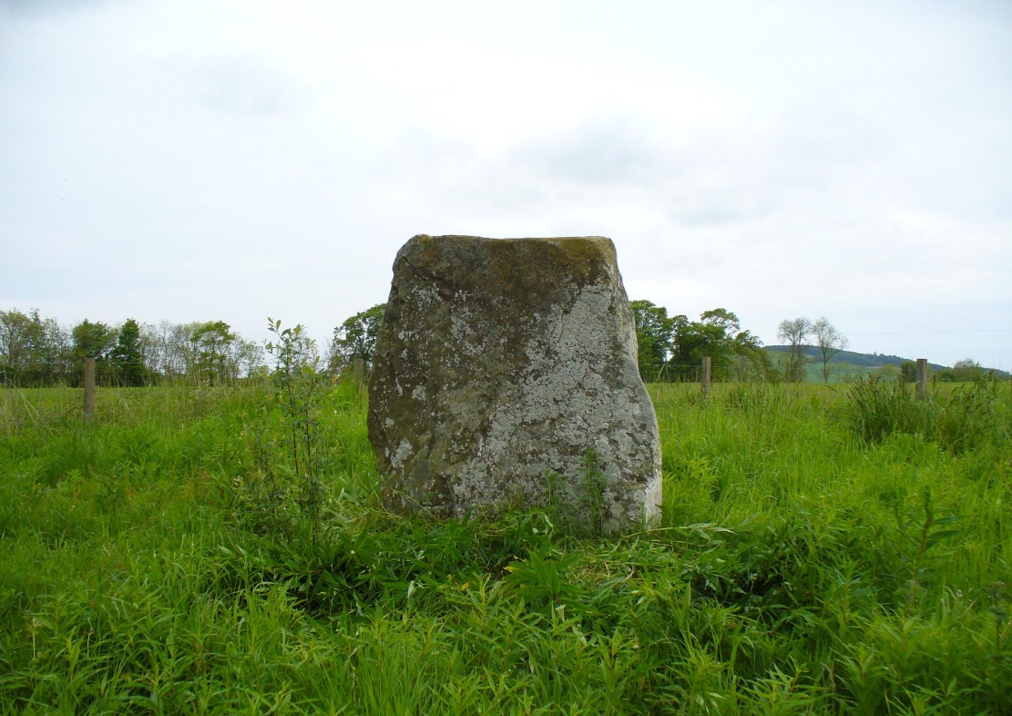
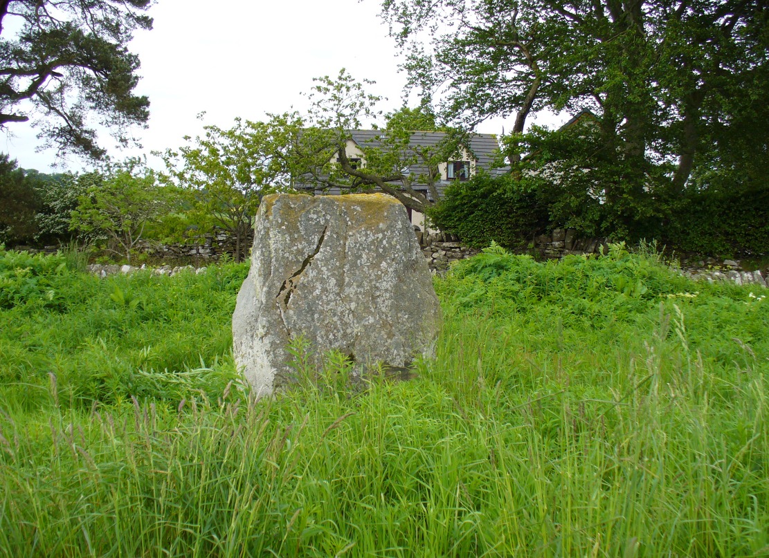
The easiest way to find this is by going along the B9113 road that runs from the east side of Forfar, out to Montreathmont Forest. Along this road, pass the Rescobie Loch and keep going for another mile or so, until you hit the small crossroads. Go left here as if you’re going to Aberlemno. Barely 100 yards up, opposite the newly-built Westerton house, the standing stone is on the rise in the field.
Archaeology & History
The carved west-facing side
A truly fascinating heathen stone in a parish full of Pictish and early christian remains, with the faint remains of an intriguing carving that can still, thankfully, be discerned on the southwestern face of the upright….amongst other things…
Marked as a singular stone after the Ordnance Survey lads visited here in 1901, early mentions of the site are very scant indeed. In Sir James Simpson’s (1866; 1867) early masterpiece on prehistoric rock art, in which he named the place as the “Circle of Turin,” he related how his friend and associate Dr Wyse told him how this stone “once formed one of a fine circle of boulder stones at Nether Turin,” but said little more. (Simpson was the vice president of the Society of Antiquaries of Scotland, a professor of medicine, as well as being one of Queen Victoria’s chief physicians.) The “Dr Wyse” in question was very probably Thomas Alexander Wise, M.D., who wrote the little-known but informative and extravagent analysis of prehistoric sites and their folklore in Scotland called A History of Paganism in Caledonia (1884). Therein he told us:
“At Turin, in Forfarshire, there is a large boulder which had formed one of the stones in a circle. On the flat top are several cups arranged irregularly, and without any enclosing circles. This boulder stone is on the NW face of the circle. The other side was towards the SE, facing the rising sun.”
As a result of these early references the site is listed and documented, correctly, as a “stone circle” in Aubrey Burl’s (2000) magnum opus. We do not have the information to hand about who was responsible for the circle’s desctruction—but it was likely done by the usual self-righteous industrialists or christians. It is a puzzle therefore, why Barclay & Halliday (1982) sought to reject an earlier “megalithic ring” status as mentioned by Sir James and Dr Wise, with little more than a flippant dismissal in their short note on the Westerton stone. Unless those two writers can offer vital evidence that can prove that the Westerton standing stone was not part of a megalithic ring, we can of course safely dismiss their unsubstantiated claim.
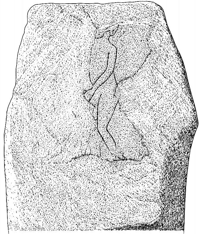
Despite this however, they do give us an intriguing description of a curious carving, faintly visible, of an upright male figure etched onto the west side of this standing stone. The carving has unfortunately been damaged—probably by intruding christians or puritans of some sad form. You’ll see why I’m blaming them in a minute! In their short account of the carving, Barclay & Halliday (1982) state:
“Much of the original surface of the SW face of the stone has scaled off, but, on the surviving portion, there is a part of a human figure…apparently naked, outlined by grooves, measuring between 5mm and 15mm in breadth and up to 7mm in depth. Of the head, only the lower part of the jaw and neck can be identified, and a second groove at the back of the neck probably represents hair or some form of head-covering. The left arm passes across the body into the lap and the arch of the back is shown by a groove which detaches itself from the upper part of the arm. The left leg is bent at the knee and is lost below mid-calf; from mid-calf to jaw is a distance of some 0.85m”
In interpreting this carving the authors make a shallow, if not poor attempt to describe what he may be doing, saying:
“The figure is viewed from its left side and is turned slightly towards the observer. The position of the left arm and leg may be compared with those of a fighting figure depicted on the Shandwick Stone, Easter Ross…but they may also reflect a riding posture; no trace of a mount, however, has survived.”
Damaged carving of a man doing summat with his cock!
Well – that is intriguing. But we have to recognise that our authors work for the Royal Commission, which may have effected their eyes and certainly their minds—as everyone else sees something not drawn out of Rorscharch’s famous psychology test! When I put the drawing you can see here (left) onto various internet archaeology group pages (including the Prehistoric Society, etc) the response was virtually unanimous, with some comical variants on what the carved man is doing — i.e., masturbating, or at least committing some sort of sexual act, possibly with another creature where the rock has been hacked away by the vandals. But a sexual act it is! Although such designs are rare in Britain, they are found in prehistoric rock art and later architectural carvings in most cultures on Earth. The nearest and most extravagant examples of such sexual acts can be found in the Scandinavian countries, where fertility images are profuse, often in tandem with typical prehistoric cup-and-ring designs. (see Coles 2005; Gelling & Davidson 1969, etc)
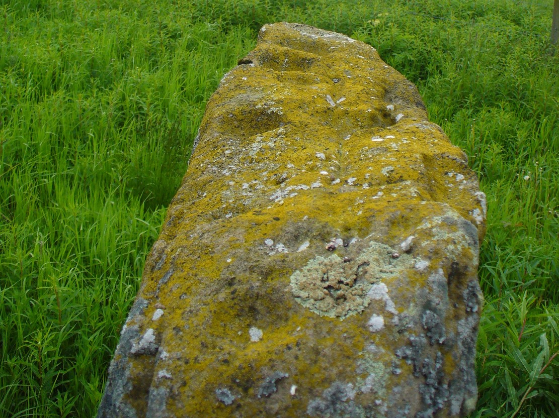
Line of cup-marks on top of stone
…And, on the very top of the stone, running along its near-horizontal surface, a line of six cup-markings are clearly visible. Intrusions of natural geophysical scars are also there, but the cup-marks are quite distinct from Nature’s wear, all on the west side of the natural cut running along the top. These cup-marks were first mentioned in Simpson’s (1866; 1867) early tome, where he told how his “esteemed friend Dr Wyse discovered ‘several carefully excavated cavities upon its top in groups, without circles.'” Whether these neolithic to Bronze Age elements had any association with the later Pictish-style wanking fella (fertility?) is impossible to know, sadly…
References:
Barclay, G.J. & Halliday, S.P., “A Rock Carving from Westerton, Angus District,” in Proceedings of the Society of Antiquaries, Scotland, volume 112, 1982.
Burl, Aubrey, The Stone Circles of Britain, Ireland and Brittany, Yale University Press 2000.
Coles, John, Shadows of a Northern Past, Oxbow: Oxford 2005.
Gelling, Peter & Davidson, Hilda Ellis, The Chariot of the Sun and other Rites and Symbols of the Northern Bronze Age, J.M. Dent: London 1969.
Sherriff, John R., “Prehistoric Rock Carvings in Angus,” in Tayside & Fife Archaeological Journal, volume 1, 1995.
Simpson, James, Archaic Sculpturings of Cups, Circles, etc., Upon Stones and Rocks in Scotland, England and other Countries, Edmonston & Douglas: Edinburgh 1867.
Wise, Thomas A., History of Paganism in Caledonia, Trubner: London 1884.