Cow Keepers Field, Boulby, Easington, North Yorkshire

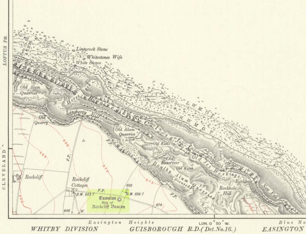
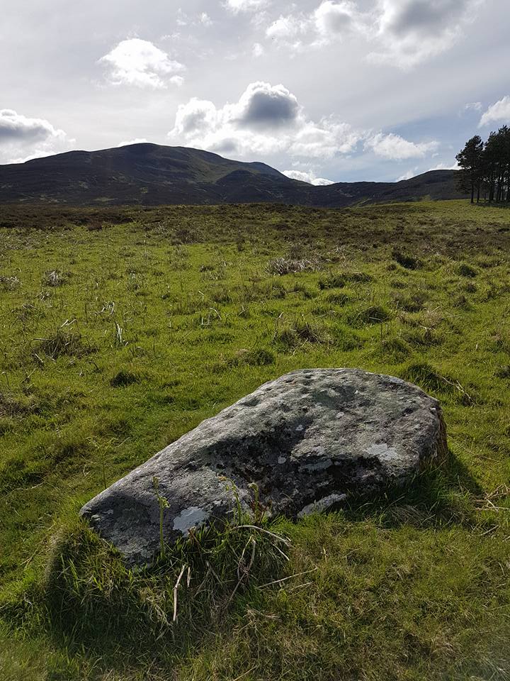
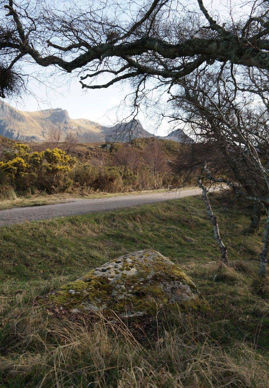
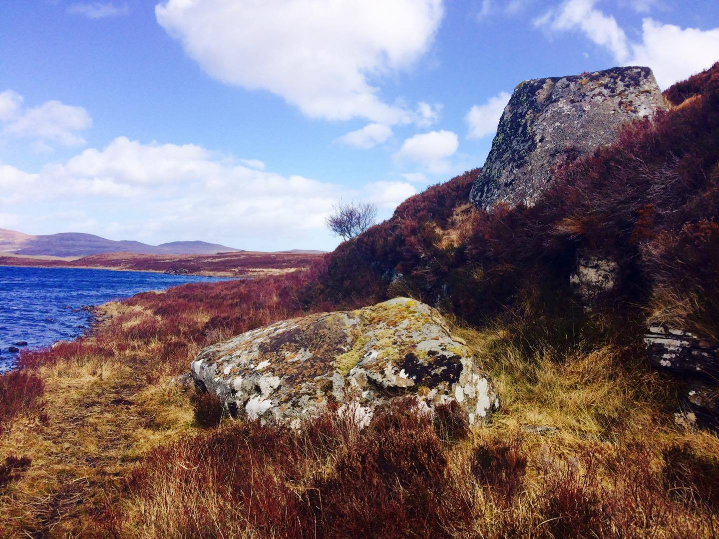
Tumulus (destroyed):  OS Grid Reference – NZ 75400 19220

Also Known as:

  1. Boulby Barns

Archaeology & History

This prehistoric tomb was one in a cluster of tumuli in the Boulby district, uncovered by the northern antiquarians, William Hornsby and John Laverick in 1918.   Most of them have subsequently been destroyed – this one included.  When they visited the site, they described it as “a barrow…with a diameter of 36 feet.”  Once they began digging into it,

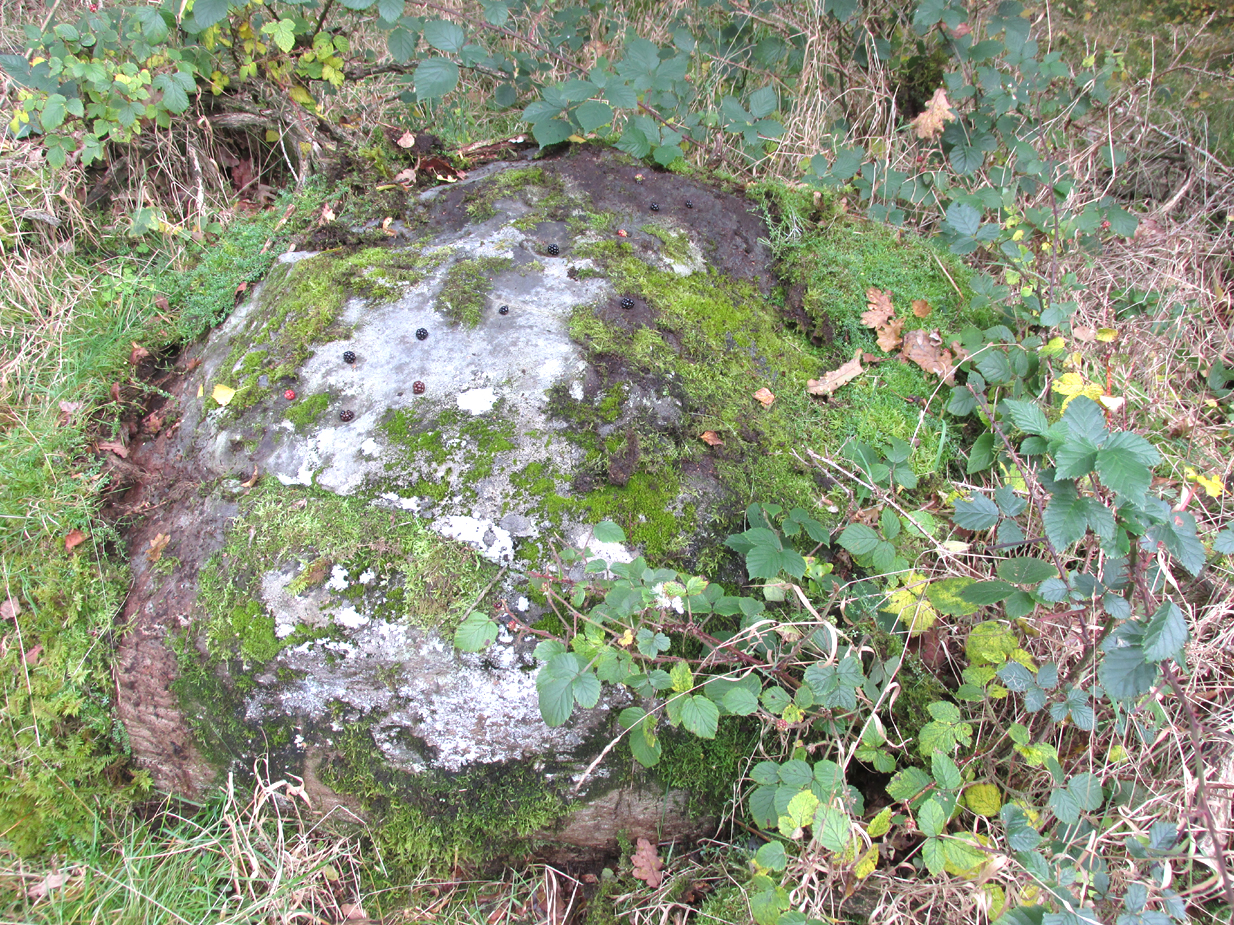
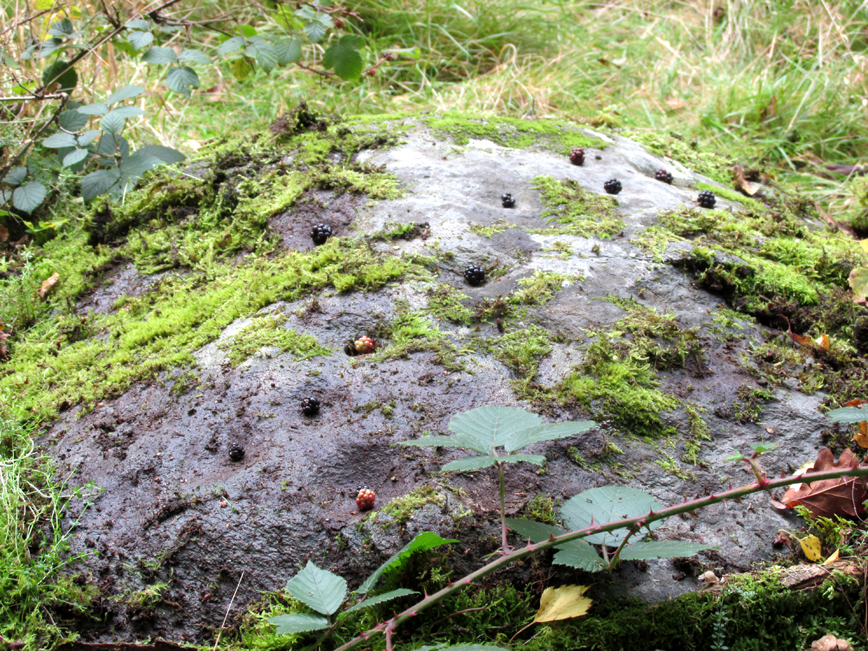
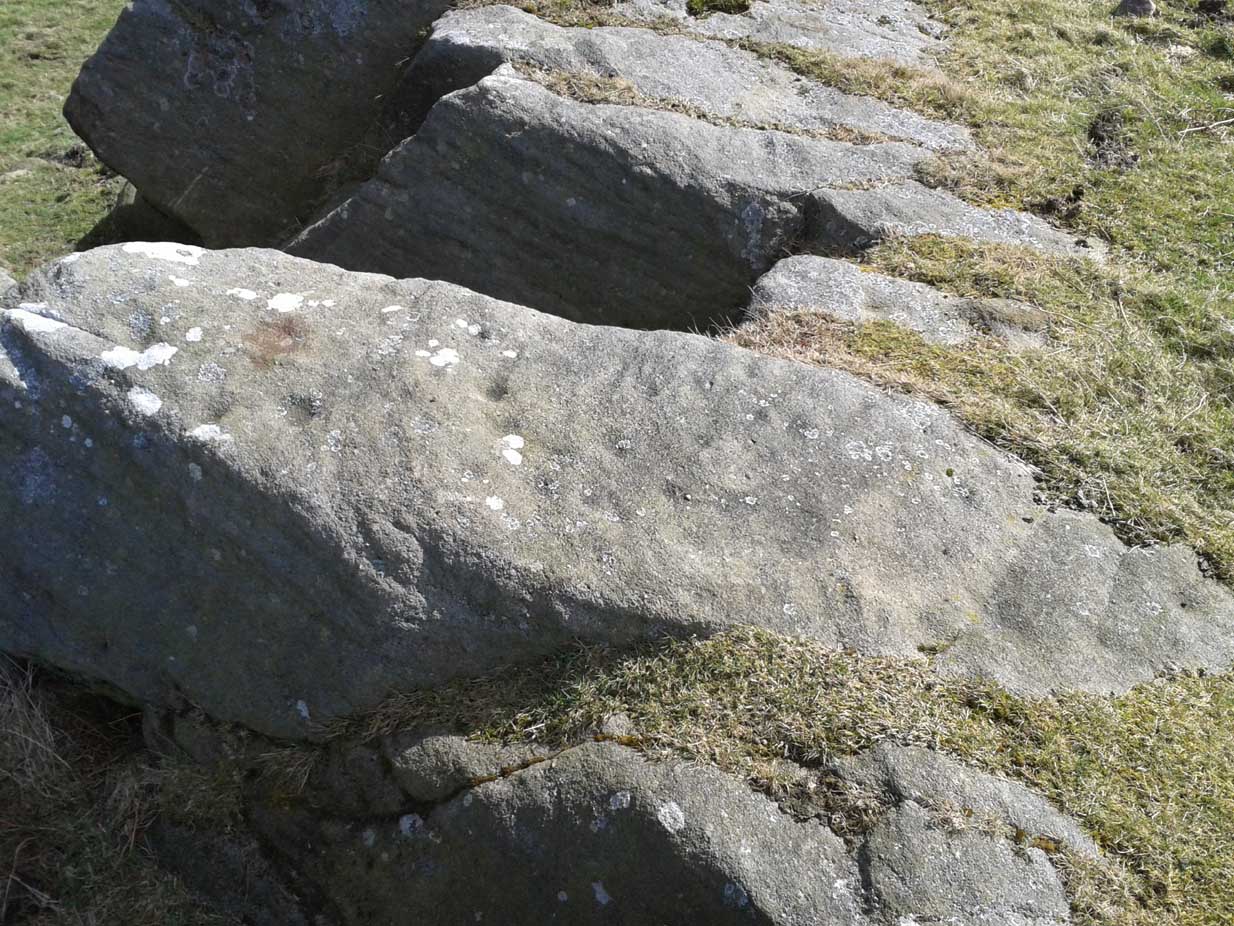
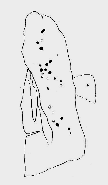
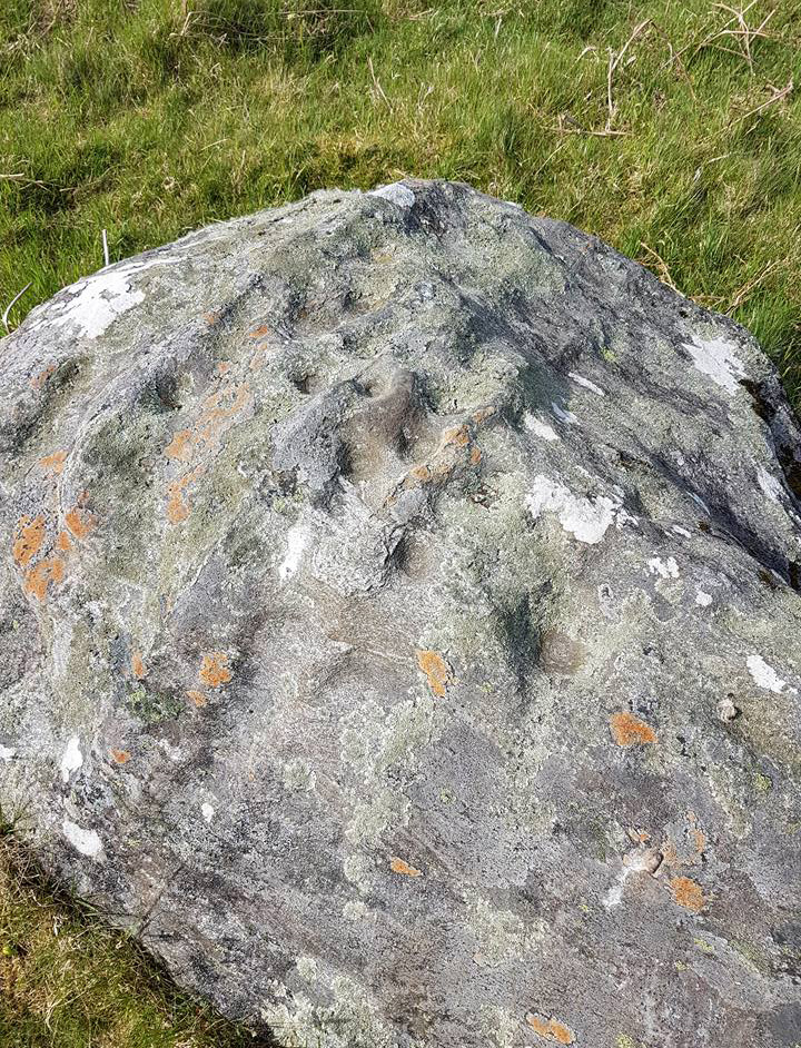
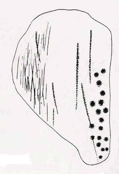
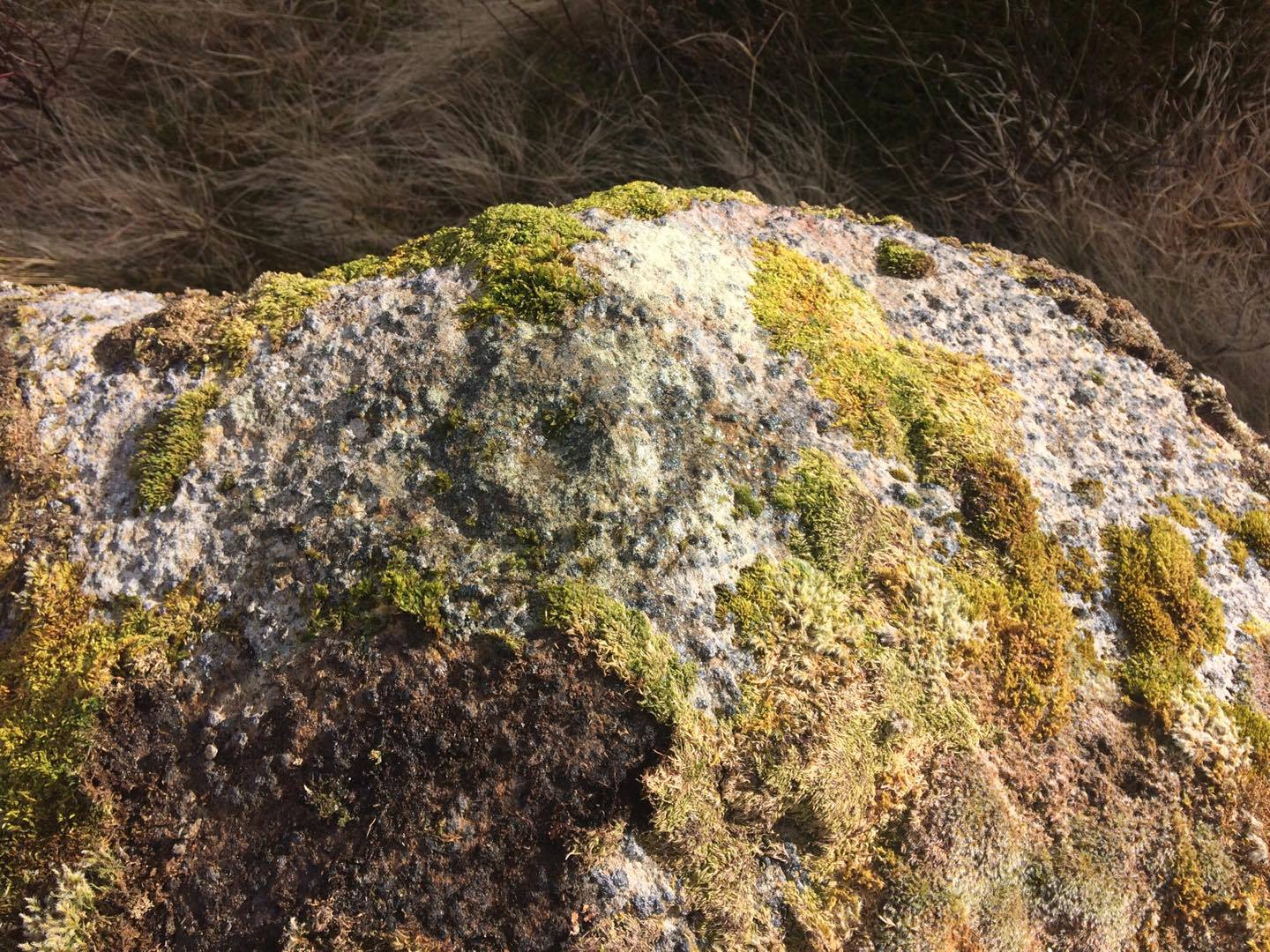
“at the centre we found a cist, the top of which was 2ft 7in below the present surface. The cist lay north 64° west, and south 64° east.  It had no cover and the slab at the north-west end was wanting.  The cist measured: side 3ft 6in, end 3ft 2in.  Its depth was 2ft 2in.  In it we found nothing except sandstone chips.  With these there was no admixture of soil. Above the cist and covering a space of 5 ft by 5 ft there was a layer of burnt earth and black ashes (of furze bushes).  At a distance of 5 ft south of the centre, and 1ft 10in below the present surface, there was a burnt burial, 20in in diameter.  With this we found many flint chips, a shale pendant, and the peculiarly marked stone” we’ve called, simply the Cow Keeper’s Field 2 carving.

A second cup-marked stone was also found inside the tomb, a few feet south of the cist. When G.M. Crawford went to survey the burial mound in the late 1970s, he reported “there is no trace of it” and “has probably been destroyed by ploughing.”

References:

  1. Brown, Paul & Chappell, Graeme, Prehistoric Rock Art in the North York Moors, Tempus: Stroud 2005.
  2. Crawford, G.M., Bronze Age Burial Mounds in Cleveland, Cleveland County Council 1990.
  3. Elgee, Frank, Early Man in North-East Yorkshire, John Bellows: Gloucester 1930.
  4. Hornsby, William & Laverick, John D., “British Barrows round Boulby,” in Yorkshire Archaeological Journal, volume 25, 1920.

© Paul BennettThe Northern Antiquarian 

The map could not be loaded. Please contact the site owner.


The Falls (1), Boulby, Easington, North Yorkshire

Cairn:  OS Grid Reference – NZ 74954 19429

Also Known as:

  1. Rockcliff Beacon

Archaeology & History

Tumulus on 1920 map

Occupying a prominent position above the ever-closer North Sea, upon which an old beacon was subsequently placed, this denuded prehistoric tomb was first surveyed by the Ordnance Survey lads in 1913, and subsequently in an essay by Messers Hornsby & Laverick (1920) on the ancient sites of Boulby, east of Easington.  This was the first one they explored, calling it ‘Mound No.1.”  They located it,

“due south of the ‘Soldier’s Garth’ in the east corner of the field called The Falls.  It was a cairn with a diameter of 50ft.  Two-and-a-half feet northwest of the centre peg, at a depth of 21 inches below the present surface, there was an unaccompanied burnt burial, which occupied a space of 15in by 18in.  In a centre cut 7ft 6in by 6ft, at a depth of 3ft 6in, we found much burnt bone and many potsherds of the Bronze Age type, scattered over the whole space of the trench, down to a further depth of 3ft 10½in.  In the south corner there were four stones set on edge and running in a direct (straight) line.  The interment had been placed upon the clay, the soil of the original surface having been cleaned off.  With this burial we found a good flint made from a polished celt and worn smooth at the point—possibly through having been used for striking fire on iron pyrites—many chips and several cupstones.”

The “several” cup-marked stones they describe at the end seem to have been lost; perhaps sleeping in some museum cellar somewhere (does anyone know?).

This cairn was one in a complex of eight that Frank Elgee (1930) suggested may have been laid out deliberately in the form of the constellation of Ursa Major, or The Plough, also known as ‘Charles Wain’.

References:

  1. Brown, Paul & Chappell, Graeme, Prehistoric Rock Art in the North York Moors, Tempus: Stroud 2005.
  2. Crawford, G.M., Bronze Age Burial Mounds in Cleveland, Cleveland County Council 1990.
  3. Elgee, Frank, Early Man in North-East Yorkshire, John Bellows: Gloucester 1930.
  4. Hornsby, William & Laverick, John D., “British Barrows round Boulby,” in Yorkshire Archaeological Journal, volume 25, 1920.

© Paul BennettThe Northern Antiquarian 

The map could not be loaded. Please contact the site owner.


Witches Stone, Pittensorn, Murthly, Perthshire

Cup Marked Stone: OS Grid Reference — NO 0851 3881  

Getting Here

Witches Stone on 1867 map

Park up at Murthly village, follow the farm road west, opposite the Kinclaven junction up to the cross roads, and turn right and go past Douglasfield Farm, following the road as it bends to the left; then through the metal gates and walk on until you come to an earth bridge over the ditch to your left. Cross the bridge and the low-lying Witches Stone is about 30 yards on to your left by the drainage ditch.

Archaeology & History

The stone with cupmarks highlighted in blackberries

Not recorded on the Canmore online database, the Witches Stone is a low-lying, domed, earthfast rock bearing at least 12 cup marks. One cup mark has been drilled at some time in the past. Did the land owner do this as a preliminary to blowing it up with gunpowder? There is an interesting story relating to the origin of the cup marks, and it seems the name of the rock and its folklore may point to its ritual significance having passed down through oral tradition from the Bronze Age to historical times.

Close-up of cups

Folklore

The mid-nineteenth century Ordnance Survey Name Book has the following record, attested by Sir W.D. Stewart, Mr. T. Cameron & Mr. J. Cameron:-

“A small rock nearly level with the ordinary ground surface, underneath which it is traditionally held that a large sum of money is buried. In order to test the truth of this tradition, it is said that some years ago a man commenced to excavate the soil around the rock in order, if possible, to secure the hidden treasure, while so employed, a small dog suddenly appeared on the top of the rock and desired the man to desist, assuring him at the same time that the reputed treasure was really there, but it was never intended that the eye of mortal should behold it. There are some marks on the rock which the superstitious tell you are the prints of this very sagacious dog’s paws.”

References:

  1. Ordnance Survey Name Book: Perthshire – volume 50, page 63, 1859-62.

© Paul Hornby 2017, The Northern Antiquarian

The map could not be loaded. Please contact the site owner.


Snowden Carr carving (610), Askwith, North Yorkshire

Cup-Marked Stone:  OS Grid Reference – SE 18105 51210

Getting Here

Snowden Carr carving 610

From Otley, take the road north across the River Wharfe up and up, heading towards Askwith Moor.  As the moorland opens up ahead of you, at the crossroads turn right along Snowden Carr Road and literally ¾-mile along (1.25km) where a track on your right goes to Carr Farm, on the left-side of the road is a gate.  Go through here to the Naked Jogger Stone and walk up the rocky ridge ahead of you, alongside the walling (as if you’re going to the Sunrise Stone), and about 20-30 yards up you’ll reach this carving.

Archaeology & History

Best visited on a clear day, this is one carving amidst a small cluster of cup-marked petroglyphs found along the small geological ridge between the Sunrise Stone and Naked Jogger carving (none of which are as impressive as those two!).  This particular design consists of a number of faint cup-marks— between 17 and 25 of them—reaching along the horizontal surface, with no distinct formal pattern, as usual.  The carving continues beneath the encroaching soil.

Looking down at the carving
Archaeo-sketch

It seems to have been described for the first time by Stuart Feather (1973); then subsequently in Boughey & Vickerman’s (2003) survey, in which they attach a single cup-marking on an adjacent rock into the matrix of this design—but the two rock surfaces are distinctly separate.  This apart, their description tells, briefly as always: “Large long rock which may be outcrop, with hill falling away steeply below. Seventeen worn cups.”

References:

  1. Boughey, Keith & Vickerman, E.A., Prehistoric Rock Art of the West Riding, WYAS: Leeds 2003.
  2. Feather, Stuart, “Askwith, W.Yorkshire,” in ‘Yorkshire Archaeological Register’, Yorkshire Archaeology Journal, volume 45, 1973.

© Paul BennettThe Northern Antiquarian 

The map could not be loaded. Please contact the site owner.


Leachd Nam Braoileag, Dull, Perthshire

Cup-Marked Stone:  OS Grid Reference – NN 7526 5531

Also Known as:

  1. Canmore ID 25049

Archaeology & History

Leachd Nam Braoileag (photo by Michelle Allan)

If you take the path up to Schiehallion (the great hill of the faeries) from the car park near the Braes of Foss, just a hundred yards or so past the first set of trees onto the moorland, keep your eyes peeled for the long stone on your right, a few yards off the path.  Upon its upper elongated surface you’ll notice a series of cup-markings etched onto it, oh so long ago now…

Close-up of cups (photo by Michelle Allan)

Located below the legendary Schiehallion, or Mountain of the Faeries, this carving is best visited over the winter and spring months (before the bracken encroaches).  On its upper surface there are about 25 cup-marks, many of them pecked to about an inch deep, with one of them being more than 6 inches across and 2 inches deep.  Weathering over the ages has effected them.  It seems to have been rediscovered in the early 1970s and is, officially speaking, an isolated carving; this is most unlikely—and needs the keen eyes of fellow antiquarians to find others in this beautiful neighbourhood.

Acknowledgements:  Massive thanks to Michelle Allan for allowing us to use her photos of the Leachd Nam Braoileag carving in this site profile.

© Paul Bennett, The Northern Antiquarian

The map could not be loaded. Please contact the site owner.


Kinloch Lodge, Tongue, Sutherland

Cup-Marked Stone:  OS Grid Reference – NC 56201 52713

Also Known as:

  1. Canmore ID 5356
  2. Lochan Hakel A (Gourlay 1996)

Getting Here

Kinloch Lodge carving (by Donna Murray)

Whether you take the A836 or A838 into Tongue (through truly beautiful wilderness), make sure you go into the village itself—and then keep going, south, along the tiny country road for 3 miles.  Hereby, keep your eyes peeled for Lochan na Cuilce on your right; keep going past here, into and through the old trees where you’ll then see Lochan Hakel on your left.  Keep going past here until your reach the next small copse on your right.  Stop here.  A small pool is yards into the trees and here you’ll see a single stone between that and the roadside.  You can’t really miss it!

Archaeology & History

Close-up of some cups (by Donna Murray)

An apparently isolated cup-marked stone, some 3 feet by 5 feet, that was first described in Morrison’s (1883) meanderings amidst Sutherland’s awesome wilderness.  It’s quite plain compared to Lochan Hakel 2 and many other carvings, simply consisting of 18 cups of various sizes, mainly on the eastern side of the rock.  Sarah MacLean pointed out that a line running along the length of the stone seemed, in parts, to have been artificially enhanced by the hand of man, or woman.  I have to agree with her.

The Royal Commission (1911) lads included this petroglyph in their superb survey of Sutherland, telling:

“On the W. side of the road to Kinloch, about ½ m. N of the bridge over the Kinloch River (Amhainn Ceann Locha), and on the N edge of a gravel pit close to the road, is a large earthfast boulder, 5′ in length as far as exposed, and 3′ 10″ in breadth, showing on its upper surface eighteen cup-marks of various depths, of which the most distinct is towards the N end of the stone, measuring about 3″ in diameter and 1″ in depth.  The whole length of the stone is not visible, but the markings do not seem to extend to the portion covered…”

Carving in situ (by Donna Murray)
by Kevin o’ Reilly

Simulacra lovers will love the form of this stone in relation to the background of the mountains, as its shape is echoed in that of the rising hills several miles to the south.  …Of course, the depersonalizing ones amongst you lacking an understanding of animism would reject any such association due to your projection of disbelief.  However—and equally—as we lack any ethnographic data on the carving we must also assume some caution…

A fascinating site – and one which is likely to have neighbours hidden in the surrounding moorlands…

References:

  1. Gourlay, Robert, Sutherland: An Archaeological Guide, Birlinn: Edinburgh 1996.
  2. Michell, John, Simulacra, Thames & Hudson: London 1979.
  3. Morrison, Hew, Tourist’s Guide to Sutherland and Caithness, D.H. Edwards: Brechin 1883.
  4. Royal Commission on Ancient & Historical Monuments, Scotland, Second report and inventory of monuments and constructions in the county of Sutherland, HMSO: Edinburgh 1911.

Acknowledgments:  Huge thanks to Donna Murray for use of her photos in this site profile (aswell as for putting up with me whilst in the area); and also to Sarah MacLean for taking us to the carving in the first place. Many many thanks indeed.  See y’ again soon, hopefully!

© Paul Bennett, The Northern Antiquarian 

The map could not be loaded. Please contact the site owner.

Ringstone Carving, Torrisdale Bay, Farr, Sutherland

Cup-and-Ring Stone:  OS Grid Reference – NC 691 616 

Getting Here

Ringstone Carving, looking NW

Take the A836 road between Tongue and Bettyhill, turning down at Borgie Bridge for 1.8 miles (2.87km) until you reach the little information sign at the roadside. Walk downhill and cross the little bridge and wander onto the west side of the beach.  You’re likely to end up daydreaming… so once you’ve re-focussed, head into the middle of the beach and walk up the steep-ish sand-banks to your right (south).  Once at the top, you’ll see a gigantic rock—the Ringstone—bigger than a house.  Walk up the hill above this until your reach the rocky plateau where things roughly level out.  Look around!

Archaeology & History

This previously unrecognised carving on the edge of the rocky promontory that drops down to the stunning Torrisdale Bay—above the gigantic and legendary Ringstone boulder—is very much like the curious ‘C’-shaped motif on the Fyfield Down petroglyph, a couple of miles east of Avebury, literally 499 miles (803km) to the south.  Indeed, that’s all I kept thinking about when I found it!

Ringstone carving, looking S

The carving’s nowt special—apart from the fact that it’s seemingly isolated and has no apparent companions nearby.  It’s an incomplete circle, perhaps more like a bell-shape than a circle, about six inches across and seems to have no inner cup-mark.  Its general appearance on the rock surface seems to indicate it was carved by a metal tool, instead of being ‘pecked’—but it’s still very old.  Initially, I wondered whether it was an ichnological fossil or stromatolite—but it isn’t.

(Note that the OS-grid-ref is just a 6-figure one. I was ambling about and didn’t make an exact note of the place, but it won’t take much finding on the rocky levels above the giant Ringstone if you zigzag about. Apologies for the poor photos too, but She was cloudy most of the day.)

Acknowledgments:  Huge thanks to Donna Murray, for putting me up in this part of Paradise.  Cheers Donna.

© Paul Bennett, The Northern Antiquarian 


The map could not be loaded. Please contact the site owner.

Lochan Hakel (01), Tongue, Sutherland

Cup-and-Ring Stone:  OS Grid Reference – NC 56988 52656 

Getting Here

Lochan Hakel’s cup & ring (photo by Sarah MacLean)

Whether you take the A836 or A838 into Tongue (through truly beautiful wilderness), make sure you go into the village itself—and then keep going, south, along the tiny country road.  Nearly 2½ miles along, note the small loch of Lochan na Cuilce on your right.  A few hundred yards past this, on the other side of the road (barely visible at first) is Lochan Hakel.  Walk around to the south-side of the loch and, across from where the small island of Grianan lives, you’ll see this large rounded boulder by the loch-side.

Archaeology & History

Stuck in a veritably stunning middle-o’-nowhere below the outstretched northern moors beneath Ben Loyal & co, there is no previous literary account of this faded petroglyph, rediscovered in early April 2017 when Sarah MacLean took us on a visit to the more renowned multiple cup-and-ringer of Lochan Hakel 2, just yards away above the moorland rise (which is unmissable from here).  It’s not too special in comparison with its neighbour and many others—but try telling Sarah that!

Cup & ring atop of stone (photo by Sarah MacLean)

This large rounded lichen-covered boulder has, at its height, a carved ring around a natural rise—known as a ‘boss’—at the very top of the rock.  On its southern side, Sarah found a single cup-mark, along with a couple of others on the more northeasterly sloping face.  At the bottom of this face is another seemingly isolated small cup-marking.  There may well be other carved elements beneath the mass of ancient lichens, but we thought it best to leave them for the time being.  It’s also quite likely that other unrecorded carvings exist in the area.

Acknowledgments:  Huge thanks to Sarah MacLean, not only for helping to locate this carving, but for use of her photos in this site profile.  Cheers Sarah!  And to Donna Murray, for putting up with me whilst in the area! …Now, let’s find some more of them!

© Paul Bennett, The Northern Antiquarian

The map could not be loaded. Please contact the site owner.

Barton Cross Stone, Barton, Lancashire

Cup Marked Stone:  OS Grid Reference – SD 53500 37332  —  NEW FIND

In this view, the carving is right of the Cross surround

Getting Here

At the roadside, on the south side of Barton Lane, where it crosses the minor road joining Cross House Farm and Barton House, you’ll see the Barton Cross standing upright. You can’t miss it!.

Archaeology & History

Carved stone cut to shape

Apparently never before described, this stone has very likely been removed from another locality and cut to shape to form part of the surrounding platform base to Barton Cross, where it is at the southwest corner.  It has ten cup marks.

Until or unless more such stones are located, it is a unique example of rock art in this part of Lancashire.

Nine cups visible here
10th cup nr camera, after rain

Henry Taylor, in his 1906 work The Ancient Crosses and Holy Wells of Lancashire writes inter alia about the Barton Cross that it had been demolished sometime after 1848, and that the base and part of of the Cross shaft had been ‘lately restored to the old site‘.  Thus the cup-marked stone may or not be in its original position as part of the Cross surround, and may have just been a conveniently available slab of stone that was used, rather than a deliberate use of a pre-existing sacred stone.

References:

  1. Taylor, Henry, The Ancient Crosses and Holy Wells of Lancashire, Sherratt & Hughes, Manchester, 1906.

© Paul T. Hornby 2017, The Northern Antiquarian 

The map could not be loaded. Please contact the site owner.


Croft Moraig Carving (02), Kenmore, Perthshire

Cup-Marked Stone:  OS Grid Reference – NN 79744 47263

Also Known as:

  1. Croft Moraig – Stone D

Getting Here

Follow the same directions for the Croft Moraig stone Circle.  Then check out the largest of the fallen or elongated stones on the northwest side of the ring, with a smoothed sloping surface, just at the side of the overgrown stone platform on which it rests.  Y’ can’t really miss it.

Archaeology & History

When William Gillies (1938) wrote about the carvings at the Croft Moraig stone circle, he told how, previously, Fred Coles,

“noticed that several of the upright stones…show cup-markings on their perpendicular surfaces. Some of these are quite distinct, but others are so worn through weathering that they can only be traced with the fingers.”

Stone D, with cupmarks
Stone D, with faint cups
Close-up of the cupmarks

This is one of them. Barely visible at the best of times, the cup-markings are faded and very hard to see unless daylight conditions are just right. As you can see in the photos, several distinct cup-like impressions are visible, but it only appears that two of them are cup-marks.  The others seem to be more geophysical in nature – but I’d love to be wrong!

At the SSW edge of the circle, 13 yards (11.75m) away, is the Croft Moraig cup-and-ring stone.

Folklore

Stone D on Fred Coles' plan
Stone D on Coles’ plan

The great northern Antiquarian Fred Coles (1910) noted that this particular stone (stone D in his ground-plan of the circle) had “been polished by the sliding of generations of children”.  This playful action on stones elsewhere in the UK and around the world sometimes relates to fertility rites (i.e., the spirit of the stone could imbue increased fertility upon the practitioner), but Mr Coles made no mention of such rituals here.

References:

  1. Coles, Fred, “Report on Stone Circles Surveyed in Perthshire,” in Proceedings of the Society of Antiquaries, Scotland, volume 44, 1910.
  2. Gillies, William A., In Famed Breadalbane, Munro Press: Perth 1938.
  3. Yellowlees, Sonia, Cupmarked Stones in Strathtay, Scotland Magazine: Edinburgh 2004.

Acknowledgements:  Many thanks to hardcore crew for our various visits here: to Paul Hornby, Lisa Samson, Fraser Harrick, James Elkington, Penny & Thea Sinclair.

© Paul Bennett, The Northern Antiquarian

The map could not be loaded. Please contact the site owner.