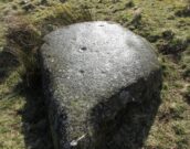
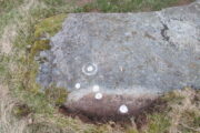
St. Columba’s Stone, Shantallow, Derry, Co. Derry

Petroglyph:  OS Grid Reference – C 4386 1934

Also Known as:

  1. Chieftain’s Installation Stone
  2. Inauguration Stone
  3. St Columb’s Footprints
  4. St Columb’s Stone

Archaeology & History
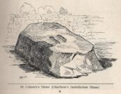
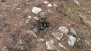
St Columb’s feet carving

To be found in the grounds of Belmont House School, just 1¾ miles (2.8km) north of Derry’s other Columba’s Stone, this is one of the many petroglyphic “footprints” that folklore ascribes to Ireland’s saint Columb/Columba/Columbkille (and other variants).  Said to have originally been carved at the great fortress of Grianan of Aileach, 4½ miles (7.2km) to the west, this great block of stone—roughly 6 feet square on top—has the distinct sculpturings of two feet, each about 10 inches long, etched into its sloping surface.  Archaeologically speaking, there’s little more to say about the stone; but its traditions are another thing altogether and are of considerably greater importance…

Folklore

Like the carved footprint on top of Dunadd in Argyll with its association of tribal initiations, the traditions relating to this footprint follows the same path, so to speak.  It was H.P. Swan (1938) who gave us a good summary of the olde lore here, telling that,

“It is almost absolutely certain that it was brought from the Grianan of Aileach after its destruction, probably by an O’Doherty for his own installation.  If so, the task of removal was no joke, for the stone weighs some seven tons.  It was the “crowning stone” of the Kinel-Owen, or, in other words, the stone upon which the chieftains of the great O’Neill clan were inaugurated.  They reigned in Aileach for many centuries.

“At his installation, as supreme head of the clan, the newly-chosen chief was placed upon this stone, his bare feet in the footmarks; a peeled willow wand was put into his hand, as an emblem of the pure and gentle sway he should exercise over his tribe; an oath was administered to him by the chief ecclesiastic in the neighbourhood, that he should preserve inviolable the ancient custom of his country, and deliver the succession peaceably to his tanist (successor); after which, descending from the stone, he turned himself thrice backwards and thrice forwards, to signify that he was ready to meet all foes, from whatever quarter they might come; and was then, with wild acclamations, hailed as their chief by his assembled clan.

“At the time of Ireland’s conversion to christianity by St Patrick, that holy man visited the Grianan (about AD 443), where this stone had been so used for centuries before; Owen was then King; he was converted from Paganism to the new faith and baptised by Patrick; at the same time, the saint consecrated this stone, and blessed it as the crowning-stone of the Kinel-Owen for ever.  Time, however, has proved his blessing futile, as may be read in the account of the Grianan, which was deserted by the Kinel-Owen after its destruction by the O’Briens in 1101.”

The ritual described here cannot be taken lightly, nor seen as a presentation of fiction, for its ingredients are found echoed in kingship rites in many cultures.

References:

  1. Swan, Harry Percival, The Book of Inishowen, William Doherty: Buncrana 1938.

© Paul BennettThe Northern Antiquarian

Hawksworth Shaw, Hawksworth Moor, West Yorkshire

Cairnfield:  OS Grid Reference – SE 143 439

Also Known as:

  1. Hawksworth Moor cairnfield (2)

Getting Here

Curious small ‘long cairn’ (photo © James Elkington)

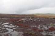
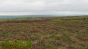
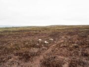
It’s a bittova pain-in-the-arse locating this site unless you’re into walking off-path, through excessive dense heather  or burnt coarse ground.  You can either follow the directions to the Black Beck tomb, or set off from Horncliffe Circle and walk up parallel to the fencing for nearly 300 yards (275m).  From here, walk due east for nearly half a mile through the deep heather until you reach an overgrown track that keeps you eastwards towards a line of grouse butts abaat 275 yards (250m) on.   Naathen, walk on the north-side of this path-track and for a few yards and you’ll begin to see either small piles of stones, or heather-covered mounds.  Zig-zag about.  You’re in the middle of the cemetery!

Archaeology & History

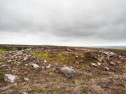
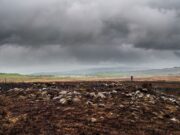
This cairnfield, or burial ground, or necropolis (choose whichever term you prefer) is a bittova beauty!  Although some of the tombs here had been ‘officially’ noticed a few years back, the magnitude of it was understated to say the least.  On a visit to the place a few months ago in the middle of one fuckova downpour, James Elkington and I found not only the large Black Beck tomb, but scattered clusters of many more cairns.  But it wasn’t until a few weeks after that we got a longer time to check it over and, even then, I think the job was only half-done.  So this site profile is merely an overview of some of what we found there.  Along with the Black Beck tomb, we found more than thirty examples of prehistoric cairns—probably Bronze Age in nature—around the Hawksworth Shaw area near the middle of Hawksworth Moor, scattered around (seemingly) in no particular order.

…and another one…
Round cairn in foreground

Three types of cairns were identified in this large cairnfield.  The majority of them are of the standard circular form, averaging 3-4 yards across and rising to about two feet high.  They are of the same architectural form as those found in the Hawksworth Moor cairnfield 4-500 yards northwest of here (there is the possibility that the two of them are part of the same necropolis, but unless we can locate an unbroken continuity between the two groups, it’s best to present them as separate clusters).  When we looked at them a couple of weeks ago, most cairns of the ’round’ type were overgrown, albeit in low growth, as a couple of the photos here show.  The main cluster of the round cairns are just a few yards off the aforementioned track, but there are others scattered here and there at other points on this part of the moorland.  A number of these cairns seem to have have been damaged and robbed of stones to build a line of grouse butts close by.

One of the ‘long cairns’
Another ‘long cairn’ during an utter downpour!

The second type of cairn in the necropolis—close to the main cluster of round cairns—are curious small, long cairns.  Each one of them measures between 8-10 yards in length, are up to three yards across, and rise to a height of about one yard.  They are built of the usual mass of small stones typical of the huge number of other cairns on Rombalds Moor, but have been constructed in an elongated form, in contrast to the more usual circular ones.  Four of them are very close to each other with a fifth further away from this main group.  A sixth one appears to be under the heather 50-60 yards away to the northeast.  Unlike some of the nearby round cairns, this group looks as if it’s barely been touched by the hand of man, with only fallen scatters of stones around the outer edges of them.  Tis an interesting group…

Small cairn, 50 yards N of Black Beck cairn
Small cairn 100 yard SE of Black Beck tomb (photo © James Elkington)

The third architectural cairn-types are scattered unevenly across the necropolis and are characterized as smaller, mini-versions of the round cairns, i.e, small piles of stones between 1-2 yards across and and just one or two feet high.  Each of this type of cairn are more deeply embedded in the peat with more vegetational growth covering them due to their small size.  This makes them much more difficult to see in comparison to their larger  compatriots.  One example (at SE 1423 4404) can be seen in the photo, above left, some 50-60 yards north of the Black Beck tomb; with another, above right, some 100 yards away to the southeast.  There is the possibility they may be so-called ‘clearance cairns’, although I have some doubts about this and believe they are more likely to be individual graves…. but I could be wrong…

There’s little doubt that other tombs are hiding away in this area, waiting for fellow antiquarians to uncover them.  Equally probable is the existence of hut circles or similar living-quarters lost beneath the heather.  Two such sites have been found on recent ventures here: one a short distance west of the Black Beck tomb and another hiding away nearly 300 yards southwest, right beside the Black Beck.  The main thing lacking up here are cup-and-ring stones.  Apart from several uninspiring cup-marked rocks it seems few exist hereby; but there are, no doubt, some hiding away that have been hidden for millenia…

One final thing: the grid-reference given for this necropolis is based loosely on where some of the cairns can be found, but there are others whose positions lies slightly beyond that grid-ref, as you’ll find if you potter about.

Acknowledgements:  With huge thanks, as always, for James Elkington for use of his photos.  Also to the evolving megalith and landscape explorer Mackenzie Erichs; and to Linzi Mitchell, for additional input…

© Paul BennettThe Northern Antiquarian
Black Beck Tomb, Hawksworth Moor, West Yorkshire

Cairn:  OS Grid Reference – SE 14233 43987

Also Known as:

  1. Small Skirtful of Stones

Getting Here

Old tomb looking east (photo © James Elkington)

Probably the easiest way to find this is to use other sites as guides.  From the Great Skirtful of Stones tomb, get over the fencing and follow it eastwards for exactly 500m (238 yards) where you’ll meet a small footpath on your right that goes southeast up the small slope of Craven Hall Hill and onto the moorland.  Go along here for literally 0.2km (223 yards) and, just where the path bends slightly to the left, drop diagonally down the slope to where the moorland levels out close to the Craven Hall Hill (2) tumulus.  From here walk WSW onto the flat moorland for literally ⅓-km (0.21 miles; 365 yards) where you’ll find either a large rounded mass of stones, or a large heather-covered mound—depending on whether there’s been a burning.  Best o’ luck!

Archaeology & History

…and looking NE (photo © James Elkington)

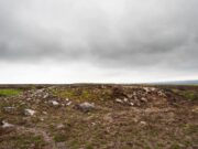
Very troublesome to locate when the heather’s fully grown, this large prehistoric tomb was uncovered very recently as a result of extensive moorland fires.  It’s the largest such structure in a cluster of more than thirty cairns near the middle of Hawksworth Moor, many of which were rediscovered at the end of May, 2021.  Due south of the Great Skirtful of Stones, this smaller skirtful of stones measures some 45 feet across and is more than three feet high in parts.  Probably built in the Bronze Age, the tomb looks as if it’s been deliberately robbed at some time in the past, probably before the Victorians by the look of things—although only an excavation would tell us for sure.  Primarily, the cairn has been robbed from its centre outwards mainly on its western side, where you’ll also see a small and rather dodgy cup-marked stone.  Scattered into the surrounding peat are visible remains of where some of the loose stones have been cast.

Small hole in the middle
Northern edge of cairn

A possible alternative to this being simply a large cairn, is that it’s a much-disturbed ring cairn.  Some sections on the north and western edges give the impression that the mass of stones may be collapsed rubble walling.  There are also a couple of internal features beneath the overgrowth of peat and compressed vegetation: one being a small circular piece of stonework that has either fallen in on itself, been dug into, or is the home of an animal; and a yard or two from this is what looks like another internal U-shaped stone structure – again, deeply encased by centuries of encroaching peat.  But I must emphasize that these features are far from certain and can only be proven one way or the other by an excavation.

Small Skirtful, looking S (photo © James Elkington)
Ring-cairn or just a cairn? (photo © James Elkington)

The site is well worth seeing, not only for its own merit, but also because of its place in a much wider prehistoric cemetery in the middle of Hawksworth Moor.  There are at least six small single cairns (which may be clearance cairns) scattering this area—the closest of which from here is some 20 yards to the north.  A more curious group of at least five small long cairns exist about 100 yards to the south; and below these is the largest cluster of standard tombs in the form of small round cairns.  A curious D-shaped hut circle structure can be found less than 100 yards to the northwest, and what seems to be remains of a larger deeply embedded enclosure exists beyond the long cairns.  Check ’em out!

AcknowledgementsWith huge thanks, as always, for James Elkington for use of his photos.  Also to the evolving megalith and landscape explorer Mackenzie Erichs; and to Linzi Mitchell, for additional stimuli…

© Paul BennettThe Northern Antiquarian
Falls of Monzie (7), Crieff, Perthshire

Cup-Marked Stone:  OS Grid Reference – NN 88737 26366

Getting Here

The site in the landscape

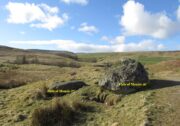
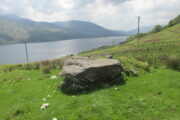
A couple of miles east of Crieff, take the A822 road from the Gilmerton junction towards the Sma’ Glen.  After literally 1¾ miles (2.8km)—just 100 yards before the track up to Connachan Farm—you’ll reach a dirt-track on your left that leads into the hills.  Go on here and after an easy walk of 400 yards or so, you’ll reach the conspicuous boulder known as the Falls of Monzie (6) stone.  Two or three yards to its side is a large flat stone.  That’s it!

Archaeology & History

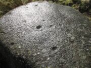
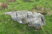
This large flat smooth earthfast rock, is possessed of a number of very faint cup-marks.  Altogether there are at least nine cup-marks, most of which are closing in to the middle of the stone, with other single cups near the western and southern edges.

The faint cupmarks
Close-up of cups

Near the middle of the rock, one cup has an equally faint semi-circular arc, just visible on the photos here.  Close-up photos of this semi-circle seem to suggest it was more complete in ages gone by, but the erosion is such that it’s difficult to say with any certainty. (possibly the computer-tech kids could give us a bit more certainty).  The nearest other carving with more definite cup-and-rings can be found on the Falls of Monzie (8) stone, about 200 yards to the west.

© Paul BennettThe Northern Antiquarian
 

Wester Glentarken (2), St Fillans, Comrie, Perthshire

Cup-Marked Stone:  OS Grid Reference – NN 66431 24782

Getting Here

Singe cup-mark, near the middle of the stone

Follow the same directions as if you’re visiting the Wester Glentarken (1) carving, but some 10-15 yards before reaching it, you’ll notice this smaller rock with a series of curious naturally-eroded features on it.

Archaeology & History

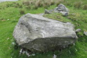
This rounded stone has a series of natural deep cracks and undulating geological features on its surface, some of which look like elongated man-made cup-marks—but they’re not!  The only man-made ingredient on this stone is the deep single cup-mark close to the centre of the stone, as you can see in the photo.  That’s it—nowt else!

© Paul BennettThe Northern Antiquarian
Wester Glentarken (1), St Fillans, Comrie, Perthshire

Cup-Marked Stone:  OS Grid Reference – NN 66412 24783

Getting Here

Cupmarked stone in situ

1½ miles out of St Fillans on the A85 road to Lochearnhead you’ll reach the boating marina by the lochside.  A hundred yards or so past this, park up.  Cross the road and walk 50 yards to your right then follow the dirt-track up into the trees.  After ⅓-Mile (0.5km) turn left to the old house on your left and follow the green path around it, then around the right-side of the rocky knoll in front of you.  Once you’re on the level ground around the knoll, walk forward for less than 100 yards.  Y’ can’t really miss it!

Archaeology & History

4 of the 5 main cups

A simple design, but a clear one, of four deep cup-marks which can be seen on the eastern side of the stone, with a solitary one—much more faint—just over the rise on the more western section of the rock.

There are a number of other large sections of rock around the knoll with what appear to be cup-markings of various forms, but apart from perhaps one or two exceptions, the vast majority of them—as Currie (2005) also noted—seem to be natural.

References:

  1. Currie, George, “Wester Glentarken, Perth and Kinross (Comrie parish), cup-marked rocks,” in Discovery & Excavation Scotland, vol. 6, 2005.

© Paul BennettThe Northern Antiquarian
Balnasuim (3), Kenmore, Perthshire

Cup-Marked Stone:  OS Grid Reference – NN 66075 39622

Getting Here

Take the directions to the Balnasuim (1) carving, then up and across to Balnasuim (2).  From here, walk diagonally uphill to your right (NE) for about 150 yards and head to the the very top-corner of this field.  You’ll see the large embedded rock emerging out of the ground, just ten yards away from a small stream.  You’re there!

Archaeology & History

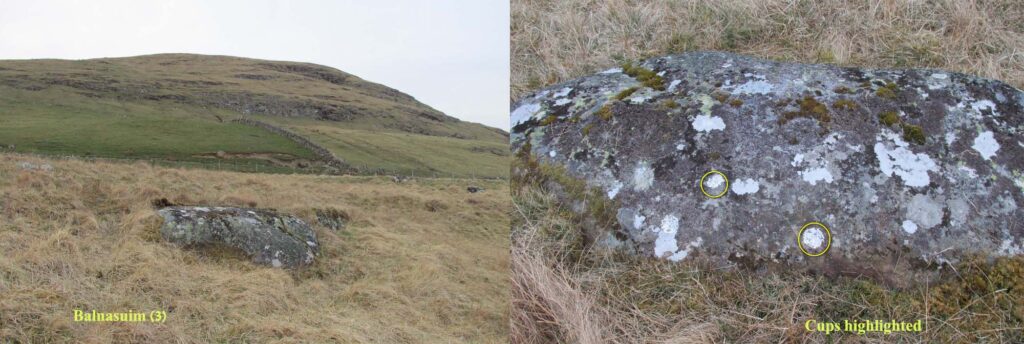
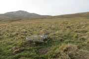
As Officer Barbrady likes to put it, “move along people, there’s nothing to see here!“—and that’s really the case with this, another of Balnasuim’s petroglyphs.  This lichen-encrusted rock has just two simple cup-marks, barely visible when the daylight’s poor – and it’s almost as disappointing when the day is good!  In all honesty, in wilfully visiting this site and its geographical compatriots, I can sincerely understand how people can tell us petroglyph-nuts that we “really have nothing better to do” with our time!

© Paul BennettThe Northern Antiquarian
Balnasuim (1), Kenmore, Perthshire

Cup-Marked Stone:  OS Grid Reference – NN 65813 39268 

Getting Here

Balnasuim (1), beneath Ben Lawers

From Killin, take the A827 road to Kenmore. 6 miles along, on your right, is the track down to the Big Shed at Tombreck.  Keep on the A827 for exactly ⅓-mile (0.53km), and opposite the driveway to Craggantoul is a small parking spot.  A few yards on the road, over the burn, go thru the gate on your left.  From here, follow the straight line of walling uphill and 20 yards before reaching Cragganester (9) carving, follow the line of fencing right (ENE) until you hit the wall more than 350 yards away.  From here, follow the walling uphlil 350 yards where it turns a right-angle west.  About 50 yards east of the right-angled wall, look around…

Archaeology & History

3 faint cups in an arc

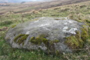
As with the other carvings up here at Balnasuim, there is little to look at unless you’re one of the ardent petroglyphic crazies!  On this small rounded stone, cushioned beneath the skylines of Ben Lawers and Meall Odhar, are at least three cupmarks in a rough arc running from the northern part of the stone, with the most pronounced of them being close to the northern edge of the rock.  The others are very shallow and can be difficult to make out in poor sunlight.  A possible fourth cupmark with a short protruding line may exist close to the SE part of the stone.  The Balnasuim (2) carving is 305 yards (279m) to the NE.

© Paul BennettThe Northern Antiquarian

Balnasuim (2), Kenmore, Perthshire

Cup-and-Ring Stone:  OS Grid Reference – NN 65965 39521

Getting Here

Balnasuim (2), looking N

From Killin, take the A827 road to Kenmore. 6 miles along, on your right, is the track down to the Big Shed at Tombreck.  Keep on the A827 for exactly ⅓-mile (0.53km), and opposite the driveway to Craggantoul is a small parking spot.  A few yards on the road, over the burn, go thru the gate on your left.  From here, follow the straight line of walling up past Cragganester (9) carving, following the burn uphill parallel to the copse of trees until, after about 800 yards, you reach the wall.  From here, walk towards the rounded hill of Meall Odhar and, after about 450 yards, you’ll notice it meets a line of walling that runs downhill.  Keep walking along, past this, but after 150 yards, go into the field on your right and walk downhill for about 100 yards.  Look around!

Archaeology & History

Despite the climb, plus its description as a ‘cup-and-ring’ stone, this petroglyph is somewhat of a disappointment.  An elongated stone, half-covered in earth faces south towards Loch Tay and the mountains across, with a series of very eroded cup-marks.

Cup-marks on SW side
Cup-and-ring on NE side

They are separated into two small groups.  At the southwest side of the rock we can see three or four faded cup-marks.  The middle of the rock seems devoid of anything, but on its more northeastern side we find four more cups in close attendance to a standard cup-and-ring motif.  That’s about it!  The Balnasuim (1) carving can be found 305 yards (279m) to the southwest.


© Paul BennettThe Northern Antiquarian
Falls of Monzie (3), Crieff, Perthshire

Cup-Marked Stone:  OS Grid Reference – NN 88793 26304

Getting Here

Falls of Monzie-3 design

Follow the same directions as if you’re visiting the Falls of Monzie (2) carving; but instead of walking off the track to see that particular carving, keep to the track for about another 60 yards then go up the slight slope on your right.  The stone is pretty much overgrown, but if you’re patient you’ll find it.

Archaeology & History

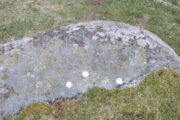
It is difficult to say with any certainty whether or not this petroglyphs has previously been reported.  A somewhat confusing series of descriptions by several writers would indicate that is has not been recorded; but I’m happy to be shown otherwise…  It’s nowt much to look at if truth be had.  Heavily eroded by the elements, this elongated flat stone possesses seven very shallow cups, with a possible eighth, as you can see highlighted in the photo.

© Paul BennettThe Northern Antiquarian