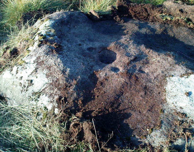
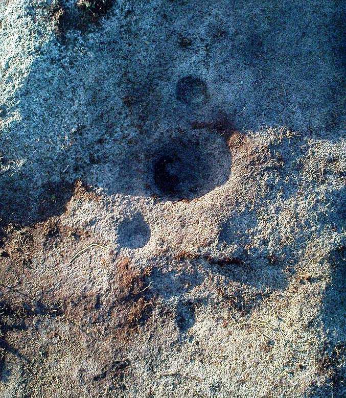
Split Rock, Rivock, Keighley, West Yorkshire

Cup-and-Ring Stone:  OS Grid Reference – SE 07989 44208

Also Known as:

  1. Carving no.39 (Hedges)
  2. Carving no.80 (Boughey & Vickerman)

Getting Here

Split Rock, Rivock
Split Rock, Rivock

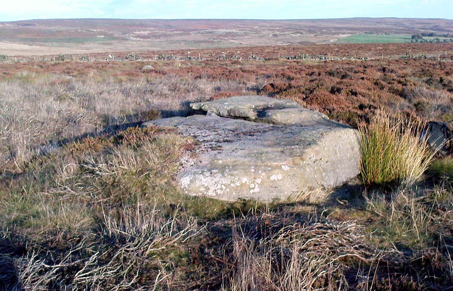
Head up to Rivock’s Wondjina Stone carving, then keep going east to the Long Rock.  Wander 100 or more further east till you see the fence, and about 50 yards before this check out the large rocks which you’ll notice near to each other.  One of them is this Split Rock!

Archaeology & History

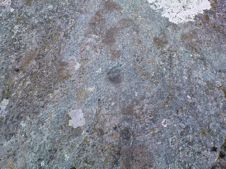
First described in Hedges’ (1986) survey, this is a large flattish boulder, split across one side, with two distinct cup-marks on its eastern side and a number of other ‘possibles’ scattering the surface.  The most intriguing bit to this rock is on its lower eastern side.  Here’s what Boughey & Vickerman (2003) described as,
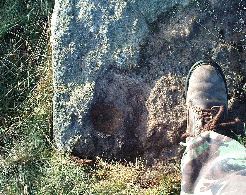
CR80-2
Deep cup-and-half-ring

“one clear cup (doubtful) discovered under turf…at extreme lower SE corner, with possible attempt at pecked partial ring.”

This cup they describe as “doubtful” is quite deep, but the half-ring on its northern side has definite artificial peck-marks.  I’m more of the opinion that this cup-and-half-ring is man-made — though whether it was done in more recent years is the more debatable aspect here.  I’ll try getting some better images (and a drawing) of this stone when we’re next up here.

References:

  1. Boughey, Keith & Vickerman, E.A., Prehistoric Rock Art of the West Riding, West Yorkshire Archaeology Service 2003.
  2. Hedges, John, The Carved Rocks on Rombalds Moor, WYMCC: Wakefield 1986.

© Paul Bennett, The Northern Antiquarian
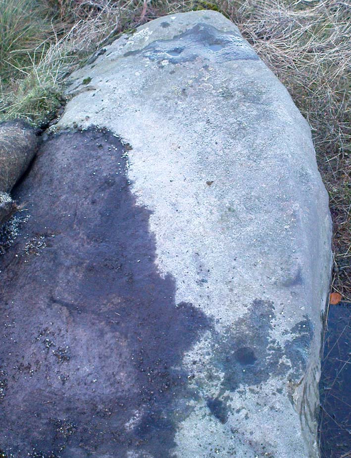

Long Stone, Rivock, Keighley, West Yorkshire

Cup-Marked Stone:  OS Grid Reference – SE 07833 44313

Also Known as:

  1. Carving no.78 (Boughey & Vickerman)

Getting Here

Head up to the lovely Wondjina Stone carving, then walk east towards the triangulation pillar. Keep going, over the wall – and keep going straight on, over the next wall (no footpaths up here at all).  You’re now into rough heathland, but if you’re a real cup-and-ring freak, keep heading another 150 yards east, zigzagging slightly.  You’ll eventually find it!

Archaeology & History

CR78
Long Rock carving, Rivock

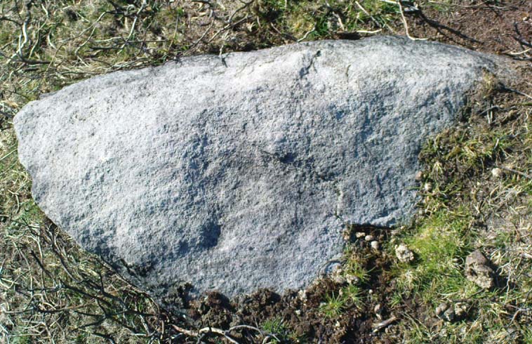
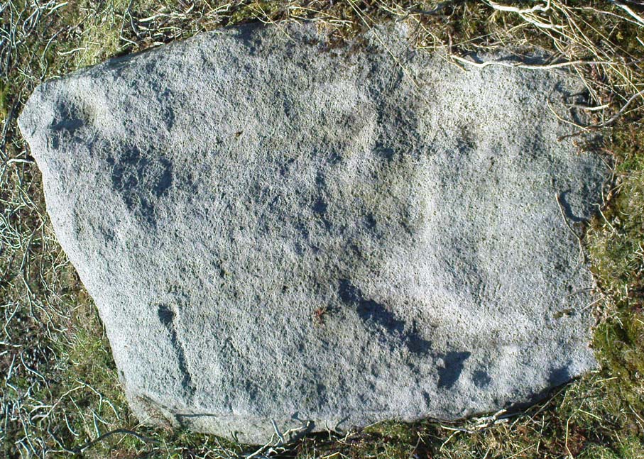
A quite large, smooth earthfast rock, but nowt much to look at unless you’re one of the crazy bunch!  This is just another one of our basic cup-marked rocks with very little modern archaeo-history attached.  There are perhaps as many as four cup-markings etched onto the stone: two at the northern end, one a little further down (not mentioned in Boughey & Vickerman’s survey) and another one cited towards the south end of the stone.  Gotta be honest though: a couple of them are slightly dubious and may be natural — but hopefully not! (soz about the crap photo of this poor carving; but the light was shit & our camera packed-up!)

References:

  1. Boughey, Keith & Vickerman, E.A., Prehistoric Rock Art of the West Riding, West Yorkshire Archaeology Service 2003.

© Paul Bennett, The Northern Antiquarian


Long Stone, Ilkley Moor, West Yorkshire

Cup-Marked Stone:  OS Grid Reference – SE 13282 46222

Also Known as:

  1. Carving no.161 (Hedges)
  2. Carving no.326 (Boughey & Vickerman)

Getting Here

CR326
Large single cup-marked rock

Follow the same directions to reach the Pancake Stone, but about 100 yards west, following the footpath that runs along the edge of the ridge (towards the large Haystack Rock a few hundred yards west), watch out for these large seemingly split rocks, with one elongated length of stone by the pathside.  You can’t really miss it!

Archaeology & History

Very little’s been said of this carving as it’s just one more of the many rocks with just a solitary cup-marking etched on top — as we can see in the photo.  The cup-mark is near the bottom, southeast-ish portion of the rock and is plain to see.

(Note: I’m not 100% sure that I’ve got Boughey & Vickerman’s (2003) numbered carving correct here.  They describe a carved rock very close by here as an “upstanding rock, part of a large split rock,” as their ‘number 326’ carving — which is roughly similar; though I’m not totally sure!  No other single cup-marked stone is listed in their survey close by, so assume it’s the same one as in their work.)

References:

  1. Boughey, Keith & Vickerman, E.A., Prehistoric Rock Art of the West Riding, West Yorkshire Archaeology Service 2003.
  2. Hedges, John, The Carved Rocks on Rombalds Moor, WYMCC: Wakefield 1986.

© Paul Bennett, The Northern Antiquarian

Murlaganmore, Killin, Perthshire

Cup-Marked Stone:  OS Grid Reference – NN 5402 3455

Also Known as:

  1. Morlagganmore

Getting Here

Murlaganmore02
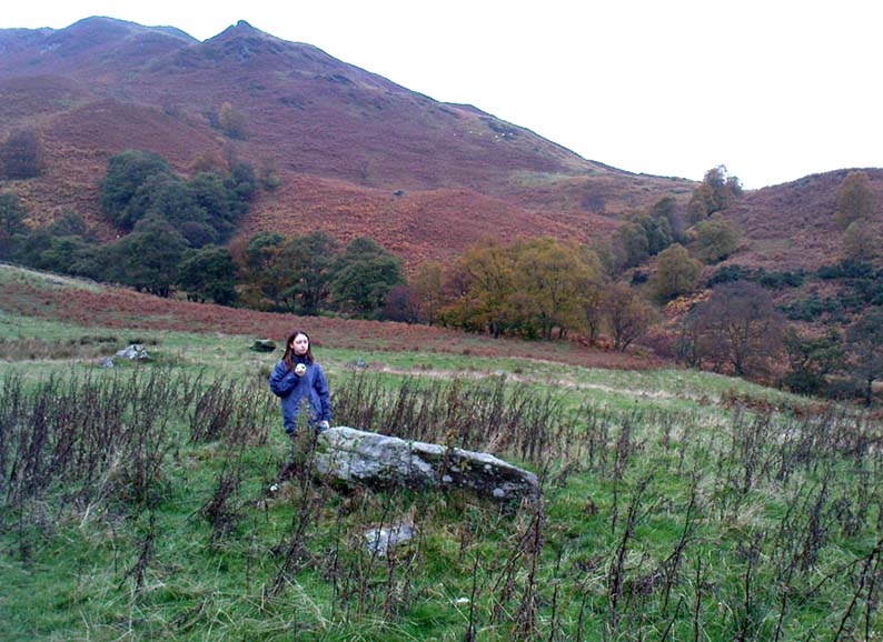
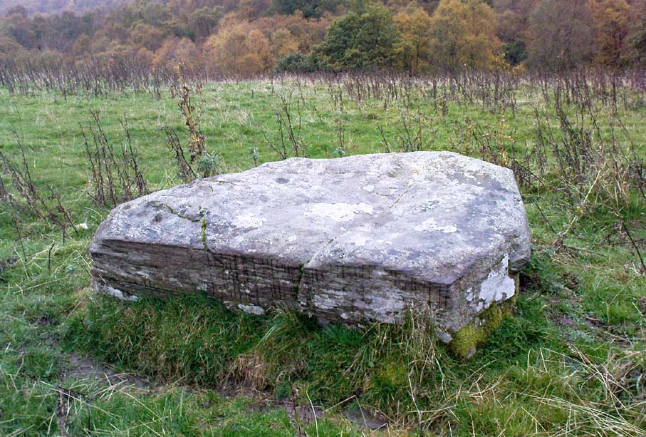
Murlaganmore stone & setting

From Killin, take the Glen Lochay Road past the Moirlanich Longhouse, but keep on for another mile, and take the track on the left up to Murlaganmore cottages.  As the track turns right of the tree-line, cross the field (left) up towards the open gate as if you’re going to the Murlaganmore 2 carving, where you’ll see this large flattish rock in the grasses about 100 yards before it.

Archaeology & History

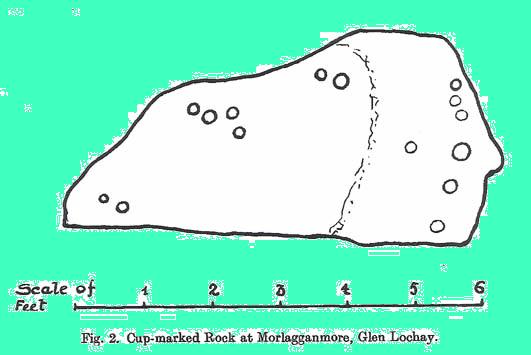
When we visited this old boulder last week, we had the misfortune of grey days and dark clouds throwing their faded light across this cup-marked rock, not really letting us see with any clarity the many cups which pepper (mainly) the edges of the rock.  But the cups are faded anyway, so accounts tell, and the 15 which we counted were same 15 recorded about 100 years ago in C.G. Cash’s (1912) survey.  There, he described this old stone as,

“about 200 yards south of the house, in the middle of the uppermost pasture. It is a large block of quartz schist stuck thick with garnets, and bearing fifteen cup-marks, only one of which — 3 inch in diameter and 1 inch deep — is really well defined, and several of which are faint.”

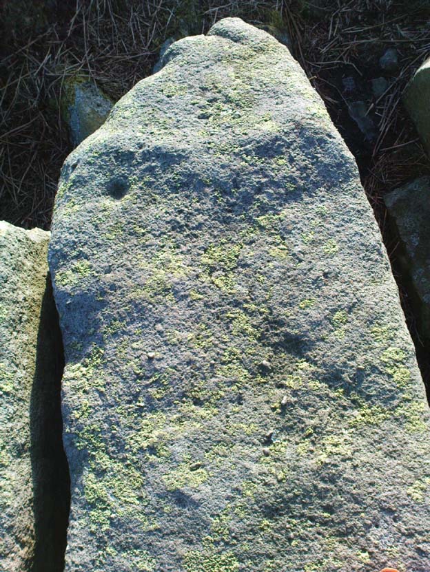
Murlaganmore03
Faint cups barely visible
Murlaganmore01
C.G. Cash’s early drawing

But despite the grey day (She was absolutely teeming with rain half of the time!), I found the setting here absolutely gorgeous, with the many shades of old trees and the clear blood of pure waters falling through the landscape.  And, without doubt, there are other carved stones nearby that have yet to capture the attention of surveyors.  You can smell them!

References:

  1. Cash, C.G., ‘Archaeological Gleanings from Killin,’ in PSAS 46, 1911-12.
  2. Royal Commission on Ancient & Historical Monuments, Scotland, The Archaeological Sites and Monuments of Stirling District, RCAHMS: Edinburgh 1979.

© Paul Bennett, The Northern Antiquarian

Murlaganmore 2, Killin, Perthshire

Cup-Marked Stone: OS Grid Reference – NN 5395 3455

Getting Here

Murlaganmore 2 - 01
Murlaganmore 2

Take the same direction to reach the Murlaganmore Footprint, continuing up past the cottages. 100 yards on, where there’s a bend in the track, cross the field on your left and go thru the gate higher up the slope.  Stick to the small rough ‘path’, past the Murlaganmore 1 carving for nearly 100 yards, where a small rocking-stone-like rock is ahead of you. That’s it!

Archaeology & History

Close-up of cup-marks

This stone’s in a lovely setting, with the craggy rise of Creag Mhor and the waterfall of Airigh an Fhraoich up the rich coloured slope behind it.  But the carving here is a simple one, with perhaps only 2 cup-markings etched on the stone’s upper surface, as the photo here shows.  Tis a lovely setting though, and there are other carved rocks living nearby which aint yet seen the pages of any record-books.

It was first mentioned in C.G. Cash’s (1912) essay on the antiquities of Killin and district, who told that here was “one well-cut cup, 3 inches in diameter and 1½ inches deep, and also a doubtful or faint one.”  The carving was later listed in the Royal Commission’s Stirling District report (1979) as simply “a boulder bearing cup-marks.”

References:

  1. Cash, C.G., ‘Archaeological Gleanings from Killin,’ in PSAS 46, 1911-12.
  2. Royal Commission on Ancient & Historical Monuments, Scotland, The Archaeological Sites and Monuments of Stirling District, RCAHMS: Edinburgh 1979.

© Paul Bennett, The Northern Antiquarian

Murlaganmore Footprint, Killin, Perthshire

Carved Rock:  OS Grid Reference – NN 54321 34840

Also Known as:

  1. CEN 16 (Morris 1981)
  2. Murlaganmore 3

Getting Here

From Killin, take the small road to the Moirlanich Longhouse, but keep on for another mile. Just before the road crosses the river, stop! In the fields above you to the left are a few trees and some rocks. Walk uphill till you’re nearly level with the cottages at Murlaganmore (the gate’s about 10-15 yards away) just above the gorze bushes and check out the long rock.  If you can’t see it at first, bimble about till you find it. You’re just about on it!

Archaeology & History

Murlaganmore footprint02
Murlaganmore’s ‘Footprint’ carving – probably Nature’s artwork

Although shown on modern OS-maps as a ‘Sculptured Rock’ and included in the Canmore survey, when we visited this site a few days ago I have to say that unless evidence to the contrary can be obtained, this ‘site’ should be declassified as an archaeological remnant of the prehistoric period.  It appears to be natural — though could have had some agricultural purpose or origin in centuries past.

The ‘footprint’ appears to have been described first of all by F.W.L. Thomas (1879) in his essay on the inaugural seat of Kings at Dunadd, where a similar footprint is found at the top of the fort.  Thomas thought that this curious footprint could have had a similar function — though even folklore hereabouts seems silent on such a matter.  The site is included in Ron Morris’ 1981 survey, where he too described it as “probably natural but just possibly man-improved.”

References:

  1. Morris, Ronald W.B., The Prehistoric Rock Art of Southern Scotland, BAR: Oxford 1981.
  2. Thomas, F.W.L., ‘Dunadd, Glassary, Argyllshire: The Place of Inauguration of the Dalriadic Kings’, in Proc Soc Antiq Scot, vol.13, 1879.

© Paul Bennett, The Northern Antiquarian

Allt na Ceardaich Knoll, Killin, Perthshire

Cup-Marked Stone:  OS Grid Reference – NN 564 364

Getting Here

Truly troublesome if you aint into walking.  Many ways up, but the easiest has to be the zigzagging trackway up from the valley bottom just by The Green a few hundred yards past Lochay Power Station, up the southern edge of Creag na Cailleach. At the end of the trackway, take the stream uphill for a few hundred yards and watch out for the rocky rise to your right (east).  Head for it and check out the rocks there.  You’ll find it!

Archaeology & History

Allt na Ceardaich01
Single cup-marked rock below Creag na Cailleach

I’m not sure that anything’s previously been written about this curious single cup-marked boulder. I say ‘curious’, simply because of the location and position of the clear cup-mark on this near-gigantic piece of embedded stone.  We walked upon the rocky outcrop south of Creag na Cailleach (above the tree-line where the land levels out) and first saw the cup-marking at the top-end of this huge rock (amidst a number of others) on the large rise a coupla hundred yards west of Allt na Ceardaich.  And as the carved cup was on the top-end of the boulder, I was expecting to find much more of the rock with other motifs scattering its body — but was amazed to find that this was the only single cup-marking on an otherwise huge stone.  A mixture of bewilderment and disappointment came over me as I shook my head in disbelief that only a single cup had been scribed into an otherwise massive rock.

Allt na Ceardaich02
Close-up of the cup-marking

However, the light was poor with low cloud and it was nearing sunset, so there may have been other aspects to this carving which we missed out on.  One other ‘possible’ cup-mark might have been done, but it seemed very dubious even in the poor light.  I was all for having another look at it the following day; but wandering halfway up a mountain just to see if this was the only cup-marking on this outcrop was summat my daughter wasn’t into doing!  So the site must await another mad cup-and-ring-crazed traveller on another day to get a more detailed inspection!  George – are you out there anytime soon!?

© Paul Bennett, The Northern Antiquarian

Littlestone, Bingley Moor, West Yorkshire

Cup-Marked Stone:  OS Grid Reference – SE 11209 43488

Getting Here

Follow the directions to reach the nice Big Rock carving.  Once here, walk up the gentle slope less than 100 yards eastwards.  Get here before the heather grows back, otherwise it’s unlikely you’ll find it!

Archaeology & History

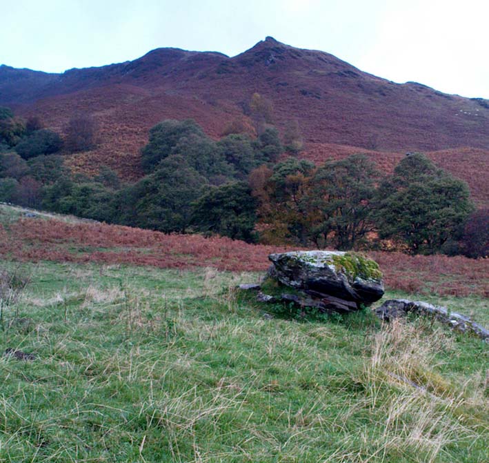
The Little Stone, Bingley Moor

Not previously catalogued, this is just a small trivial little stone with just a single cup-marking on it.  There’s a somewhat debatable line which looks more likely on the photo than when you actually see it in situ.  As we had the Big Rock just down the slope from here, I thought this could be a little rock, or Little Stone (makes sense!).  It was found by your very own Paul and those of you with the wills to seek it out, don’t be disappointed as most are with such a Littlestone. It’s certainly not as rosy as those close by, but hey – it’s another carved rock!

© Paul Bennett, The Northern Antiquarian

Teaspoon Rock, Bingley Moor, West Yorkshire

Cup-Marked Stone:  OS Grid Reference – SE 10997 43357

Also Known as:

  1. Carving no.104 (Boughey & Vickerman)*

Getting Here

Follow the same directions to reach the Lunar Stone carving.  Once here, amble about a few yards to your immediate south and you’ll find it — assuming the heather aint grown back over and covered it!

Archaeology & History

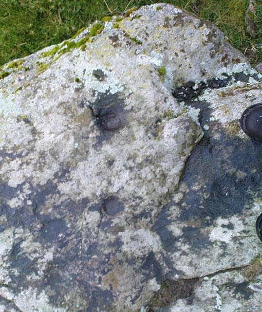
Teaspoon Rock, Stanbury Hill

This’d probably be another of those carvings first found by Stuart Feather in his amblings here in the 1970s, but we can’t say for sure.  In Boughey & Vickerman’s survey (2003), apart from attributing it as being in two separate positions (mistaking some reference from the English Heritage doods as some other carving – though that shouldn’t surprise anyone!),* they then correctly describe it as having “one cup with groove” running outwards — which we can see quite plainly (lending Michala Potts to say, “it reminds me of a teaspoon!” – hence the title!).  There may be as many as four other cups on this rock, though it’s hard to say for sure.  Two of them, perhaps, may have a very worn line linking them together (as you can slightly work out on the top-half of the carving) — but again, this is hard to say for sure.  Certainly this poor little carving aint quite as decorative as its nearby partners!

References:

  1. Boughey, Keith & Vickerman, E.A., Prehistoric Rock Art of the West Riding, WYAS 2003.

* In their survey this stone was also listed as carving no.98 by mistake, which should now be deleted from subsequent survey listings.

© Paul Bennett, The Northern Antiquarian

Ant’s Stone, Rivock, Keighley, West Yorkshire

Cup-Marked Stone:  OS Grid Reference – SE 0791 4422

Archaeology & History

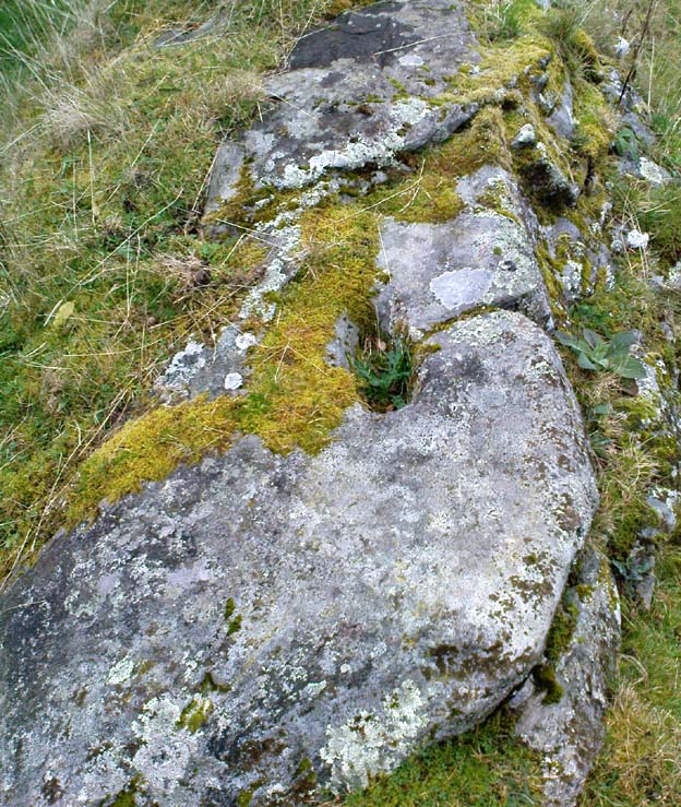
Ant Stone, uncovered

Discovered today, amidst a cluster of other carvings not previously catalogued.  This was hidden beneath a mass of vegetation, but after cutting and digging into the peat on top of the stone, several cup-marks became evident.  By the side of the rock, measuring roughly 8 feet by 5 feet, was a small ant’s nest — hence the convenient name of the carving.

Central design of the carving

The main feature is the large, perhaps natural cup-mark, about 3 inches across.  But three distinct artificial cup-markings were etched around the edges of this larger ‘cup’.  When we found this stone, the daylight was nearing its end and we were unable to ascertain any further features carved onto the rock.  Several other carvings were close by, none of which were included in the survey by Boughey and Vickerman. (2003)  After we’d finished here, we covered the stone back over with its peaty quilt and hoped that the ants weren’t too pissed off about us disturbing them…

© Paul Bennett, The Northern Antiquarian