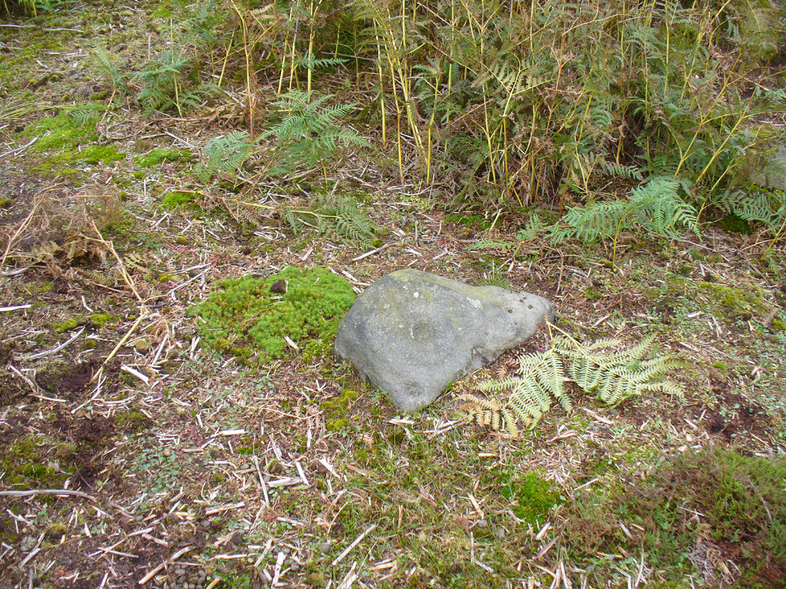
Going out of Killin towards Kenmore on the A827 road, immediately past the Bridge of Lochay Hotel, turn left. Go down here for just over 2 miles and park-up where a small track turns up to the right, close to the riverside and opposite a flat green piece of land—right by The Green cup-marked rock-face. Walk up the small bendy track for about ⅔-mile (1km) and eventually, high above the tree-line, the road splits. Right here, go through the gate and walk downhill, over the boggy land, cross the burn, then the overgrown wall, and a second overgrown wall. Very close hereby is a small rise in the land amidst the mass of bracken, upon which is the stone in question!
Archaeology & History
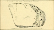
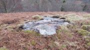
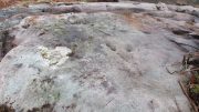
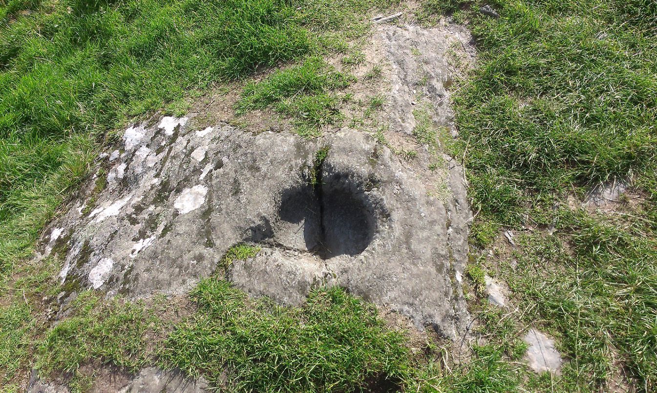
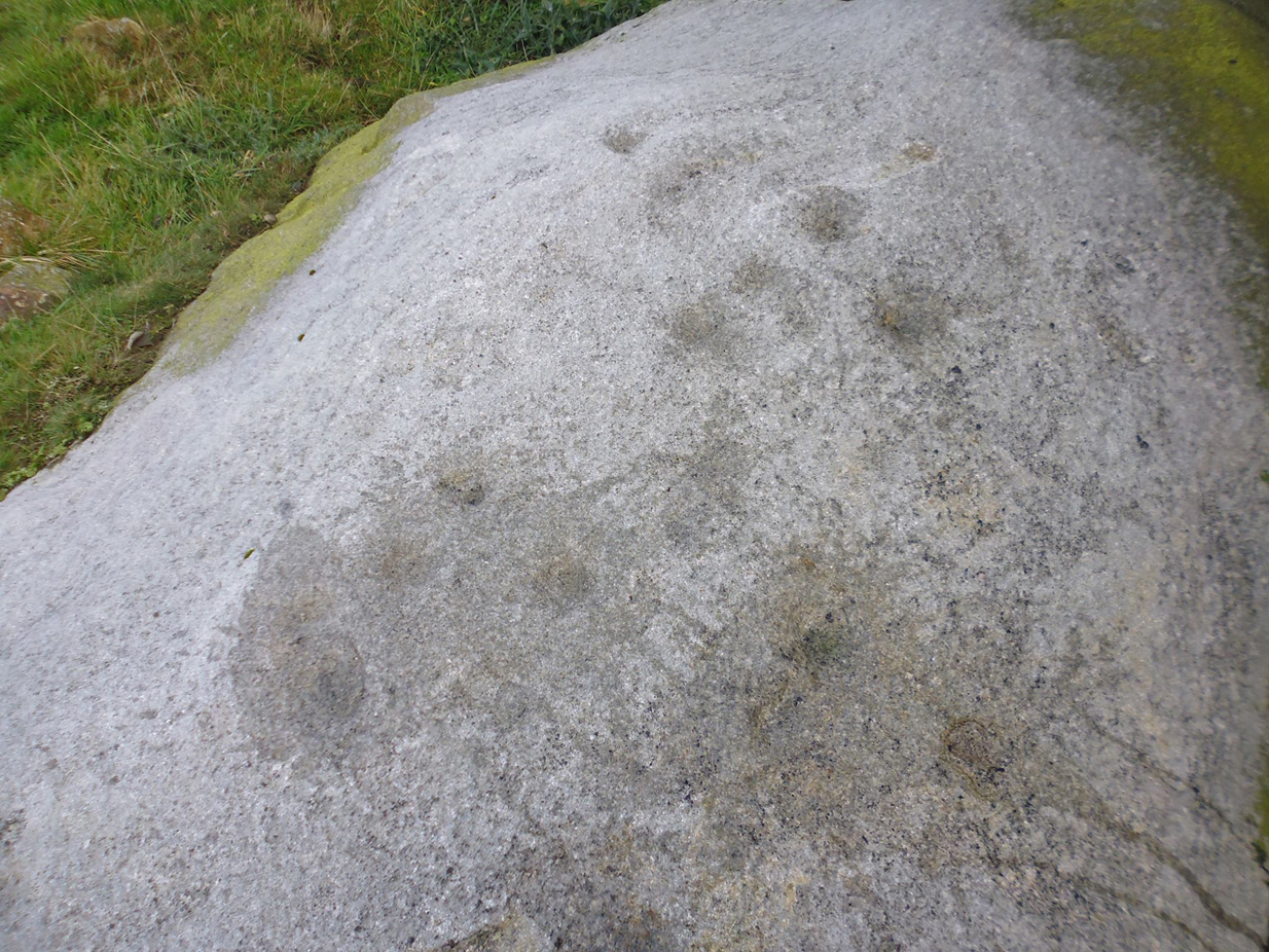
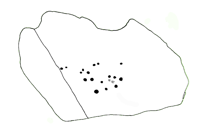
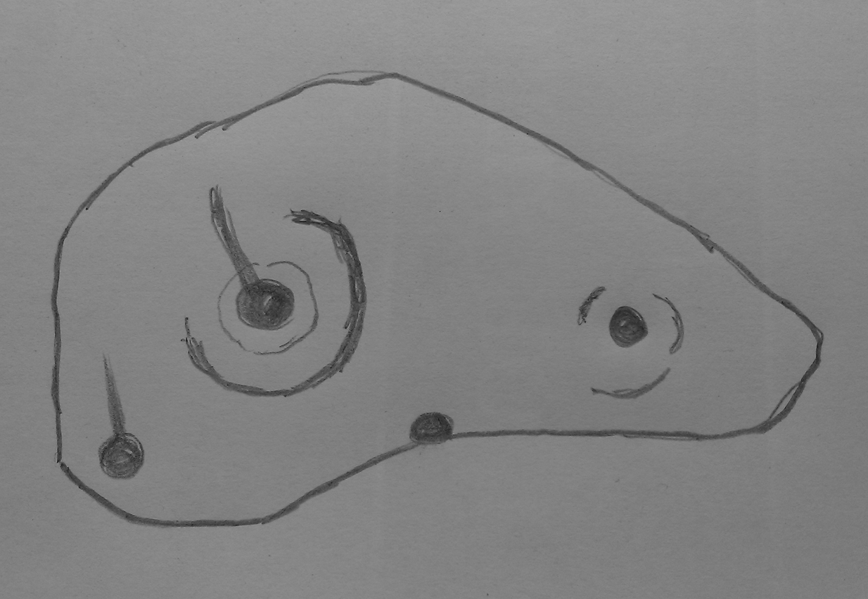
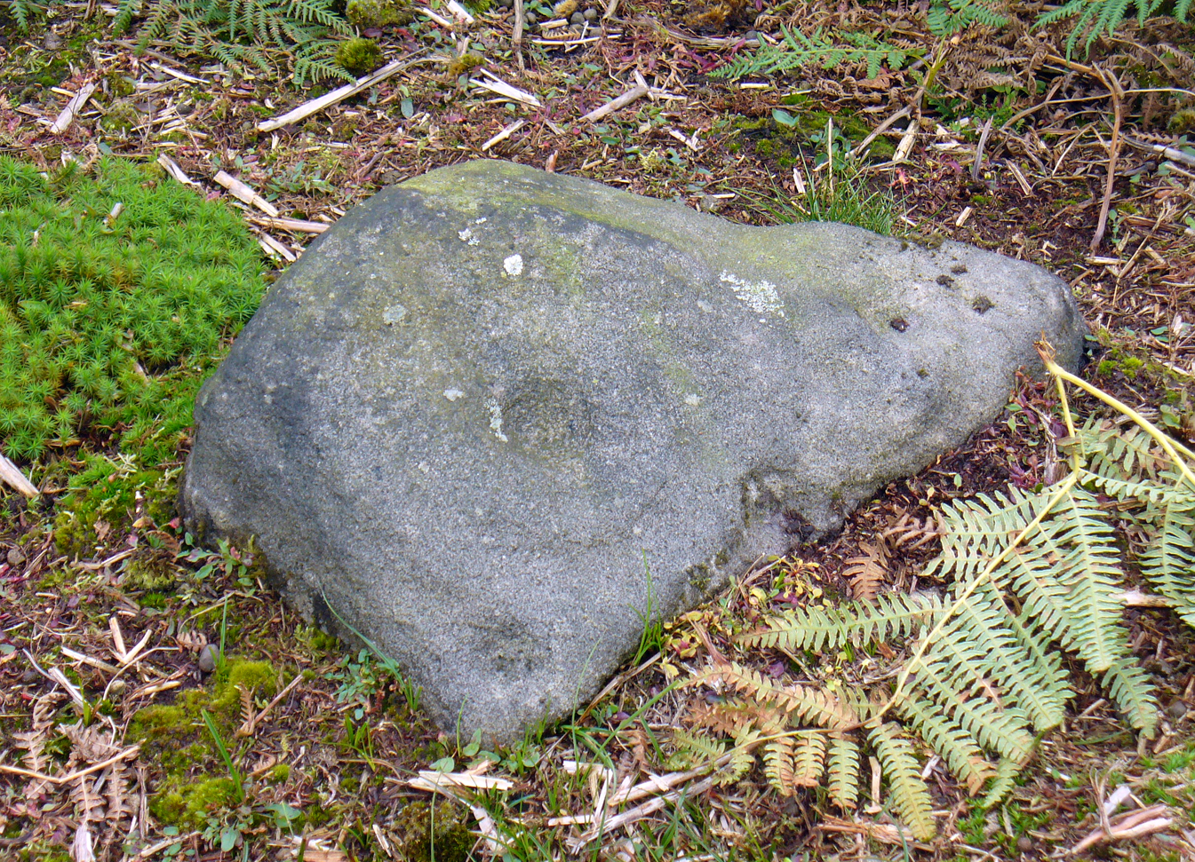
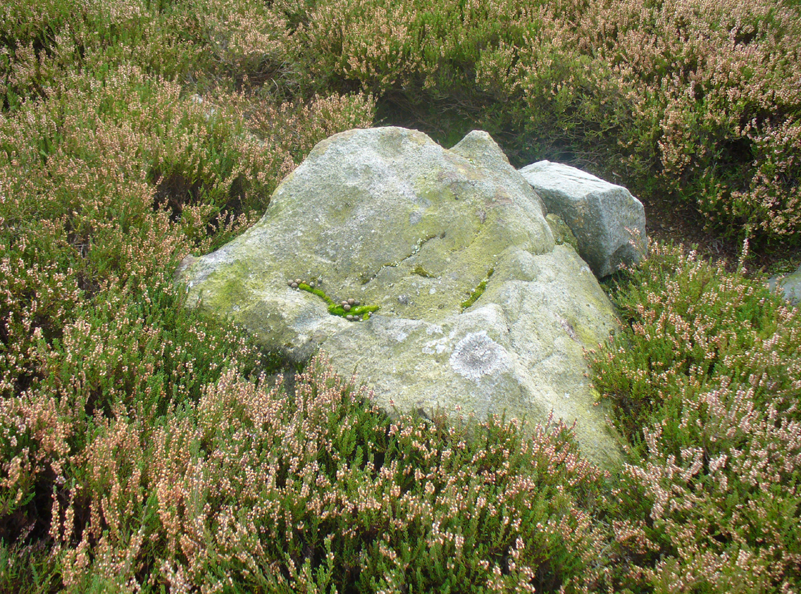
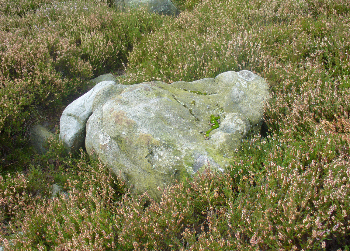
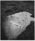
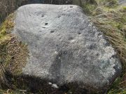
This large long, undulating, quartz-rich stretch of rock has two main petroglyphic sections to it, with curious visual sections of natural geological forms accompanying the cup-markings, found either side of the stone on its north and south sides. Its northern face has at least 20 cup-marks, of differing sizes, measuring between one and two inches across and up to half-an-inch deep. Their visual nature is markedly different to those on the more southern side of the stone, where they are generally smaller and much more shallow, perhaps meaning they were carved much earlier than their northern counterparts. One of the cups on this section has a very faint incomplete ring around it.
Running near the middle of the rock is a large long line of quartz and a deep cleft in which I found a curious worked piece of quartz shaped like a large spear-head, and another that looks like it’s been deliberately smoothed all round the edges. Both these pieces fit nicely in my hand. All around the edges of the stone, many tiny pieces of quartz were scattered, as if they had been struck onto the stone—either to try carving the cups (damn problematic!), or for some visual/magickal reason.
Follow the same directions as if you’re visiting the James Stone monolith. From here, walk about 60 yards southeast and zigzag about in the heather until you find a small squarish-shaped earthfast rock, barely 6 inches above ground-level (might be hard to find when the heather’s fully grown). If you’ve got a petroglyphic nose, you’ll find it!
Archaeology & History
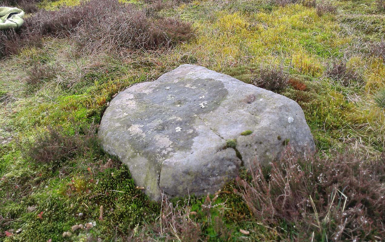
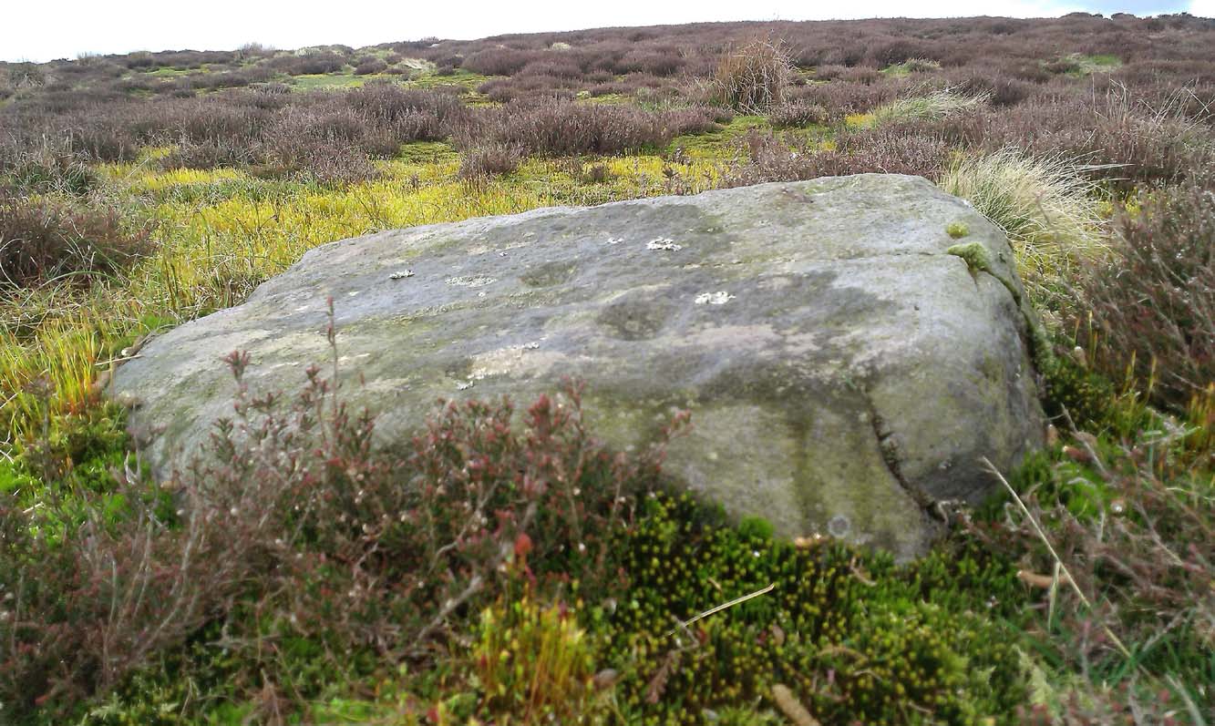
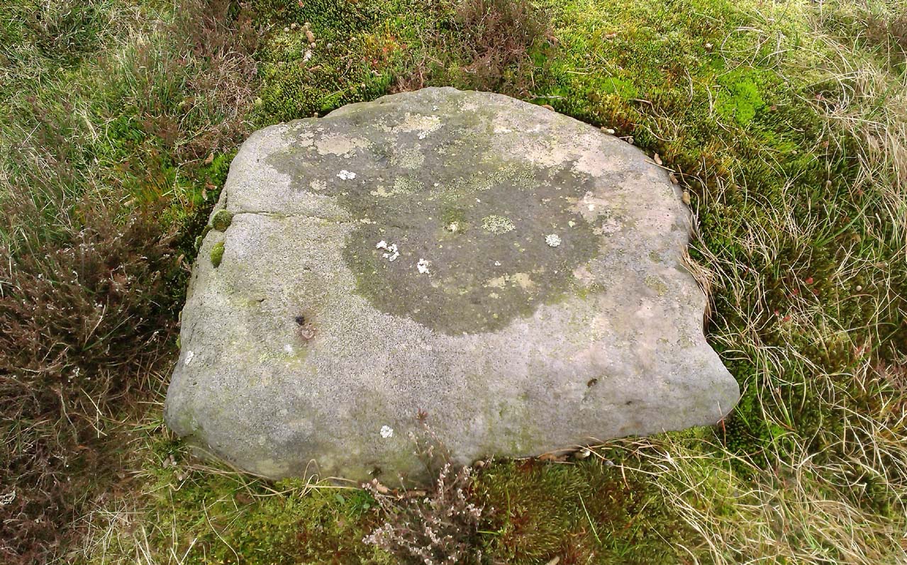
A simple faded cup-marked stone, roughly 2½ feet by 2 feet across, can be found about 65 feet southeast of the James Stone and 40 yards west of the Benty Gate prehistoric enclosure. Sadly when we visited the place a few days ago, the sky was grey and the conditions for good photos were poor.
At least five cup-marks have been etched onto the stone, with the main element being a row a three cups in a straight line from the centre of the stone to its SE edge. The central cup-mark has been carved where a natural crack in the rock, running from the edge of the stone, terminates. There also seemed to be a carved faded line running along the bottom edge of the stone—but it was unclear and another visit is needed in better light to see if there’s more on the stone.
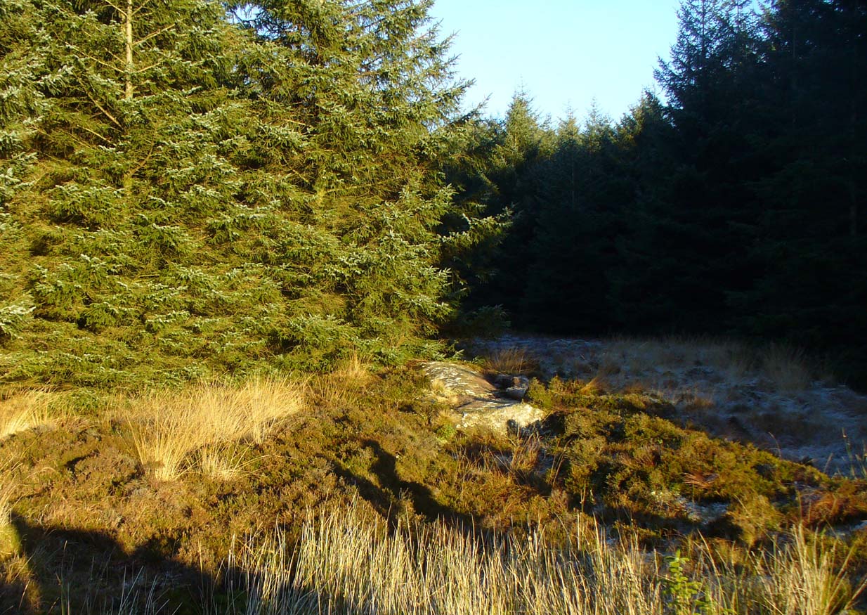
Take the B822 Fintry to Kippen road and just over 2 miles (3.3km) north of Kippen, take the small country lane on your left. Parking is truly troublesome along here, so: nearly half-a-mile along, a road/track on your right takes you into the huge forestry plantation (or ‘tree farm’ as Nina Harris calls them). Go up here and, when you reach the tree-line, walk along the outer perimeter fence to your left. Keep walking – and walking – through bog and over fence – keeping all along to the outside of the forest for more than a mile. You eventually reach a rise on the Balfron side with huge views to the west – and just here is an opening into the trees on your right where a long ridge of rock is obvious. You’re here!
Archaeology & History
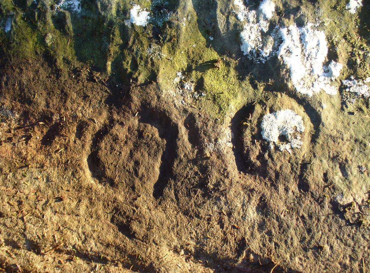
Not far from the recently rediscovered Footsteps Stone (coming soon…), this large cup-and-ring carving was found by Paul Hornby on a TNA rock art venture in November 2016 on a journey to the petroglyphs on Balgair Muir, between Balfron and Fintry. Twas a damn good day indeed! We’d been up here the previous week, but the grey daylight gave little away. Upon revisiting the place, Paul eventually called us over and, beneath a mass of fallen tree foliage, the long raised rock gave up its ancient symbols once again.
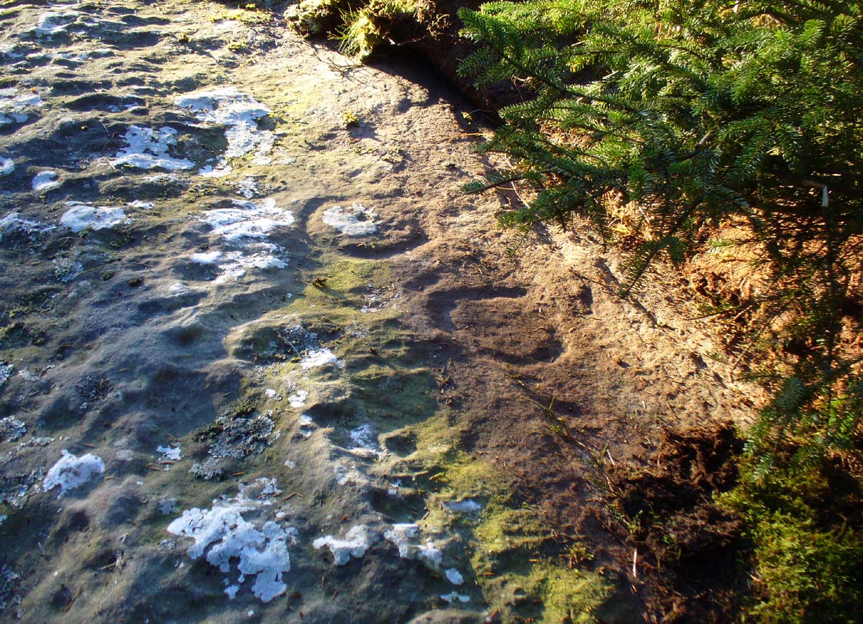
Along the main face of the stone are a variety of geophysical undulations and small natural hollows—lots of them!—some of which give the impression of being primitive cup-markings, but they’re more the result of erosion. However, amidst these are several very possible cup-markings, and some photo-images show that at least one of them has portions of a distinct faint ring around it, possibly two of them. On the whole however, we’d need a geological specialist to tell us with certainty about the other doubtful ‘cups’ here (TNA neeeeds an in-house crazy geologist into petroglyphs and things!).
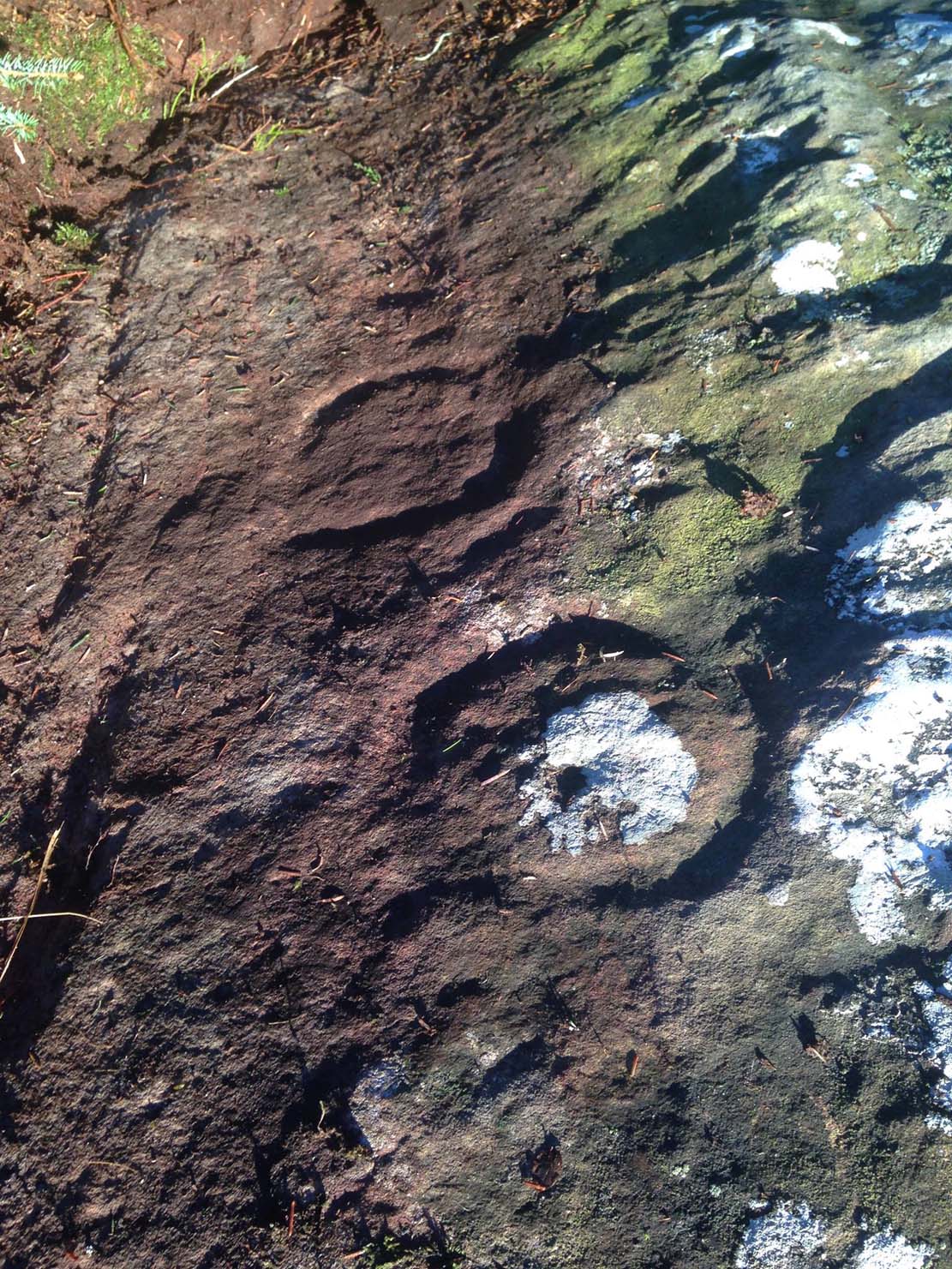
As the rock face slopes down on its northern edges, away from the many natural pits and nodules, Paul uncovered two large incomplete ‘rings’, each with short outer ‘lines’, distinctly carved. The ‘rings’ are somewhat larger than the average cup-and-ring motifs — but it also appears that at least one of the ‘rings’ is lacking an internal cup-mark.
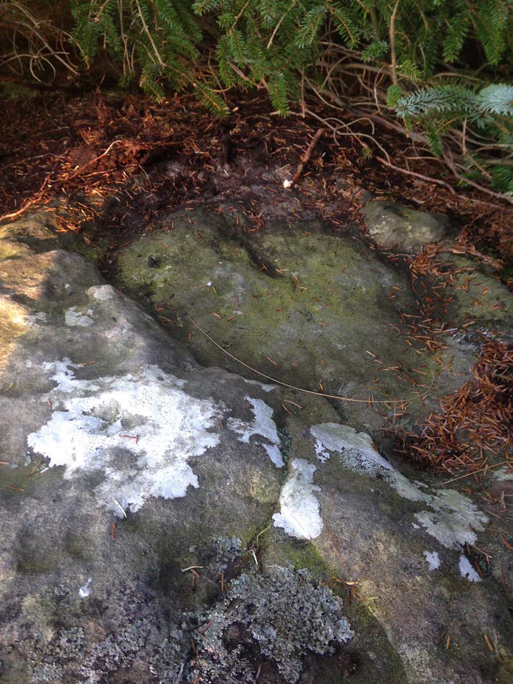
On the same piece of rock, several feet to the east and almost covered by an adjacent tree, we also found a large half-natural half-carved ‘bowl’ more than 12 inches (30cm) across with a possible cup-marking near its centre. Whoever carved this section of the petroglyph has definitely utilised the natural features in the rock and, it seems, may never have finished the work.
We need more visits to this area to find what more lies beneath the fallen forest debris.
Acknowledgements: Massive thanks to Paul Hornby for uncovering this carving. Huge thanks also to Nina Harris for her help and some of the photos; and also to Ann Rankin and Mick for all their relative help too. Until next time…
From Lochgilphead, take the A816 road north for several miles (towards the megalithic paradise of Kilmartin), keeping your eyes peeled for the road-signs saying “Dunadd.” Turn left and park-up a few hundred yards down. Go through the gate and walk up Dunadd. Just before the flattened plateau at the top you’ll come across a length of smooth stone, adjacent to the Dunnad Footprint Stone, with a deep large circular ‘bowl’ cut deep into the rock. That’s the spot!
Archaeology & History
This large ‘bowl’ or basin just below the top of Dunadd—next to the other carvings of footprint, Ogham and boar—is speculated by many to have been a part of the kingship rituals that were alleged to have occurred up here, going way back. But please remember that ‘kingship’ as it was in ages past has nothing to do with the touristy nonsense that prevails in the UK today. Kingship in its early forms relates to rituals for the benefit of the tribe/society, in many cases resulting in sacrifices. (see Frazer 1972; Hocart 1927; Quigley 2005, etc) This is quite probably what occurred at Dunadd. But whether this curious deep bowl with its semi-circular carved ring had anything to do with the kingship rites, we simply don’t know.
An early description of the Dunadd Basin is in Mr Thomas’ (1879) essay on the hill itself. It was a brief note:
“About four yards southwards from the (Dunadd) footmark is a smooth-polished and circular rock basin cut in the living rock; it is 11 inches in diameter and 8 inches deep.”
There is no mention of the incomplete ring which, though faded, can be seen to surround two-thirds of the hollow. And as Dunadd was used by people until medieval times (Lane & Campbell 2000) it not only begs the question: when was it carved; but also: was the myth behind this petroglyph still alive? We’ll probably never know.
The Royal Commission lads (1988) said the following:
“The rock-cut basin measures 0.25m in diameter by 0.14m in depth, and is bisected by a crack. It is surrounded by a shallow pecked ring about 40mm in width, but parts of this have been worn away, especially to the S where the path from (the) enclosure passes the basin.”
Folklore
The basin here was said by the incoming priest R.J. Mapleton (1860) to be entirely natural in origin; though he also noted how Dunadd was known by local people to be the meeting place of witches and the hill of the fairies, whose amblings in this wondrous landscape are legion. Legends and history intermingle upon and around Dunadd. Separating one from the others can be troublesome as Irish and Scottish Kings, their families and the druids were here. One such character was the ever-present Ossian. Mapleton told:
“From these ancient tales we turn to a much later period of romance, when Finn and his companions had developed into extraordinary and magical proportions; a story is current that when Ossian abode at Dunadd, he was on a day hunting by Lochfyneside; a stag, which his dogs had brought to bay, charged him; Ossian turned and fled. On coming to the hill above Kilmichael village, he leapt clean across the valley to the top of Rudal hill, and a second spring brought him to the top of Dunadd. But on landing on Dunadd he fell on his knee, and stretched out his hands to prevent himself from falling backwards. ‘The mark of a right foot is still pointed out on Rudal hill, and that of the left is quite visible on Dunadd, with impressions of the knee and fingers.'”
As Mr Thomas clarifies: “The footmark is that of the right foot, and the adjacent rock-basin is the fabulous impression of a knee.”
References:
Bord, Janet, Footprints in Stone, Heart of Albion Press 2004.
Campbell, Marion, Mid-Argyll: An Archaeological Guide, Dolphin Press: Glenrothes 1984.
Campbell, M. & Sanderman, M., “Mid-Argyll: An Archaeological Survey,” in Proceedings of the Society Antiquaries, Scotland, volume 95, 1962.
Craw, J.H. “Excavations at Dunadd and other Sites,” in Proceedings of the Society Antiquaries, Scotland, volume 64, 1930.
Lane, Alan & Campbell, Ewan, Dunadd: An Early Dalriadic Capital, Oxbow: Oxford 2000.
Mapleton, R.J., Handbook for Ardrishaig Crinan Loch Awe and Pass of Brandir, n.p. 1860.
Morris, Ronald W.B., The Prehistoric Rock Art of Argyll, Dolphin Press: Poole 1977.
Royal Commission on the Ancient & Historical Monuments of Scotland, Argyll – Volume 6: Mid-Argyll and Cowal, HMSO: Edinburgh 1988.
Take the same directions as if you’re visiting the Cob Stone Field carving; but instead of going into the field on your right, walk down the track about 100 yards towards the large barn below. As you walk down keep your eyes peeled to the field on your left and, right up against the wall of the barn, you’ll see a large boulder resting quietly. That’s what yer after!
Archaeology & History
This large faded cup-marked rock whose western side has been split off in recent years, has a scatter of “up to 21 small shallow worn cups” on its upper surface. They can be difficult to see in some light, but they’re definitely there (as Ray Spencer’s photos clearly show), fading slowly into Nature’s winds and storms. A couple of ‘lines’ running down the edge of the stone are due to modern farm-workings.
Several other rocks in this and adjacent fields have what may be faded remains of other cup-markings, but without guidance from a geologist or a stone-mason, we can’t know for sure whether they’re authentic or not. It’s likely that there are other authentic carvings hiding in this area—they just need sniffing out!
References:
Boughey, Keith & Vickerman, E.A., Prehistoric Rock Art of the West Riding, West Yorkshire Archaeology Service 2003.
Acknowledgements: Huge thanks to Ray Spencer for us of his photos in this site profile. Thanks Ray.
From the Askwith Moor Road parking spot, head across the road and take the directions to the Woman Stone carving about 510 yards (467m) across the moors to the west. From here, look straight down the slope and head towards the largest boulder at the bottom, 20-30 yards away. About 10-20 yards to the right of this, zigzag about in the vegetation until you find the small stone amidst the bracken. You’ll find it!
Archaeology & History
This small stone, whose natural contours and cracks have been utilised in the design of the petroglyph, may once have been part of a prehistoric tomb, perhaps rolled or thrown downhill from the nearby Askwith Moor Cairnfield. I say this due to the size and portability of the stone, i.e., it’s small and barely earthfast, giving an increased likelihood that its present position was not its original one. But we might never know…
It’s almost archetypal in design, being a primary cup-and-ring, with what appears to be a faint inner ring etched marginally within the larger notable incomplete circle, just an inch beyond the inner central cup. From this same cup runs a carved line, out to the near edge of the small stone. Single cup-marks occur on the edges of the rock, as can be seen in the photos: three, possibly four of them. One of the cups, where the stone narrows to a rounded point, may also have had a partial ring around it. When we found this stone a few weeks ago, the day was grey and overcast and the light was poor, so our photos do not highlight the carving too well.
(Note: the OS grid-reference for this stone is an approximation: pretty damn close, but not close enough. If someone ventures here and can get the exact grid-ref, we’d be most grateful.)
From the Askwith Moor Road parking spot, head west to the Askwith Moor cairnfield. Keep walking west, going downhill past the main cluster of rocks. If you begin zigzagging amidst the heather hereby, you’ll eventually come across this relatively small stone which, even when the heather is deep, thankfully rises to the surface. The Wester Cairnfield 1 carving is close by.
Archaeology & History
Although I presumed that Graeme Chappell and I found this petroglyph when we surveyed the area in the 1990s, I cannot find an early account of it in my files, so must presume that when James Elkington, James Turner and I came across it a few weeks ago, it was the first view of the stone in many a century… It’s another simple carving, only of interest to the mad rock art hunters out there.
When we first found it, it seemed to me (with the sunlight effects on the stone) that two cup-marks had been etched here; but as Mr Elkington pointed out, from the angle he was looking at the stone, there were another two. He was right. But it’s nothing special to look at, sadly, and is probably only of interest to the real hardcore petroglyph nutters amongst you. (please note that the grid-ref for this carving needs revising and may be 50 yards either side of the one given)
From the Askwith Moor Lane parking site, take the directions to the Askwith Moor Cairnfield. Walk westwards for about 100 yards down the gradual slope, towards the boggy land below, but before reaching the reeds, still in the moorland heather, there are a scatter of rocks. Just keep zigzagging about until you find it. It’s a reasonably large stone.
Archaeology & History
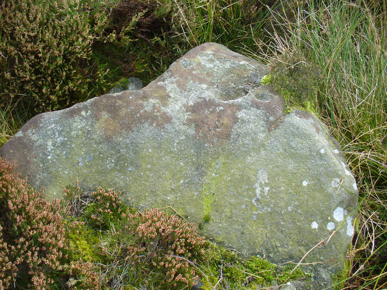
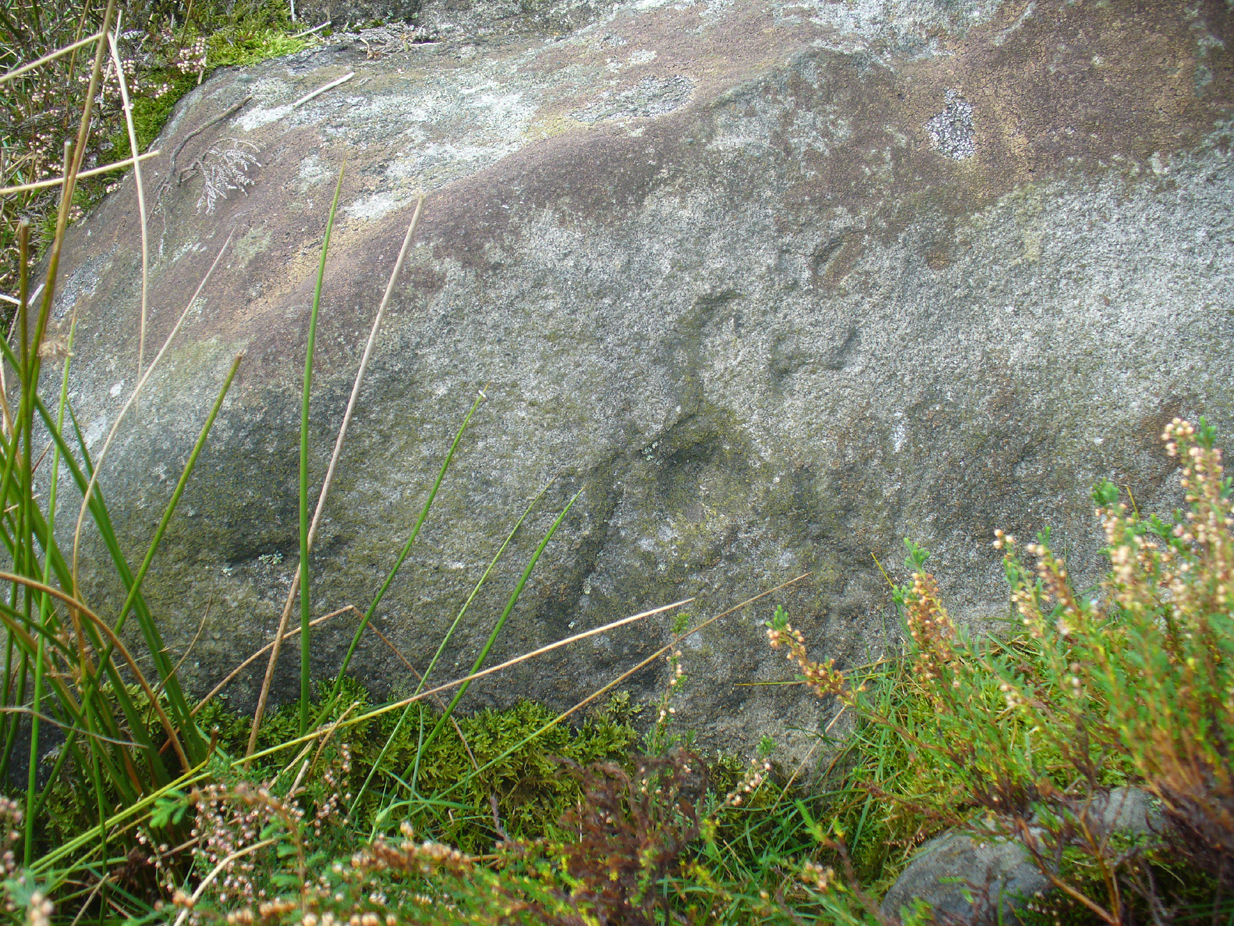
This is one of several simple cup-marked stones found down the slopes about 100 yards west of the Askwith Moor Cairnfield. When James Elkington, James Turner and I re-surveyed this area again recently, I wondered whether it was a newbie or had already been located when Graeme Chappell and I did our tedious surveying of this region in the 1990s—and it turned out that we did! The carving is nothing special to look at, even if you’re a petroglyph zealot. Comprising of a distinct single cup-mark on the top nose of the rock, another is visible on the vertical south face, and another possible is on its eastern face.
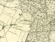
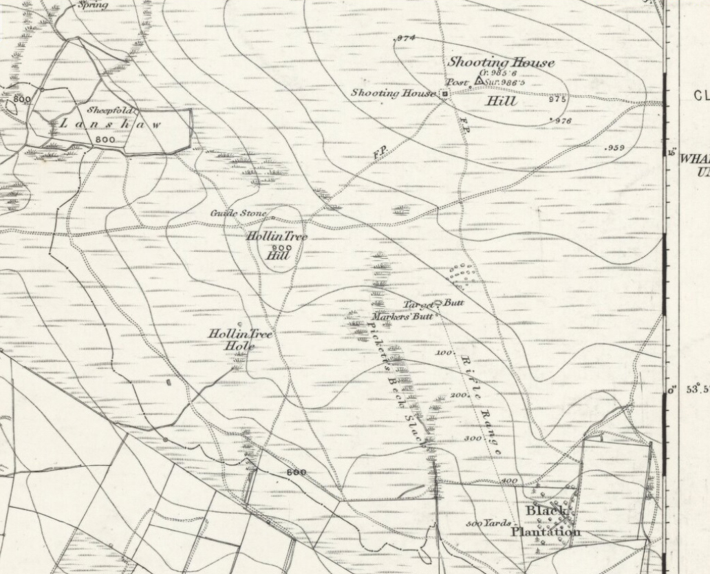
When we look at the early maps of this area, we find that to the north and south of this stone once existed ‘Shooting Houses’. As we can see on the attached map, the position of one of the shooting targets is very close to the location of this stone and so we must conclude that the cups on the vertical face were done by gunshot and are not prehistoric. However, the distinct cup on top of the stone retains its prehistoric link.
On the A81 road from Aberfoyle to Strathblane, about a mile south of Aberfoyle take the tiny right turn (keep your eyes peeled!) to Gartmore. At the end of the village, turn right at the T-junction. Just over a mile along the tiny road, just over the tiny road-bridge, turn right again up up the dead straight road to Drymen for nearly a mile and park up. A dirt-track is on your right: walk along here for ¾-mile (1.2km) and in a large field on your left a huge rock sits (no carvings on it). Keep walking on the track and where the field ends, a path to your left runs above a small burn. Naathen, 150 yards along here, look down at the waters and there’s a clump of large rocks. Check ’em out!
Archaeology & History
This stone and others were mentioned in MacNair’s (1973) essay in the popular history guide to the region, after it had seemingly been rediscovered a few years earlier by Ron Morris (1967; 1969), who listed it in his petroglyph catalogues. It was originally located at the top of the slope above the burn, but was rolled down here shortly after Morris discovered the cup-and-rings on it. The farmer at the time had made a bore-hole into the rock with the intention of blowing it up, but Morris found it just in time and the stone managed to survive!
It’s a large rock with a decent ornate design that was clearly visible when Morris surveyed it (see photo, right). It comprises of, “a cup-and-two-rings, 18cm (7in) diameter, 6 cups-and-one-ring (2 of which are tangential) and at least 8 cups. All rings are complete. Greatest carving depth 2cm (¾in).” There also appears to be a line of four or five small cup-marks running in a short line by one of the lower cup-and-rings, but these are very faint indeed. The double cup-and-ring mentioned by Morris is the one at the top-centre in my photo, but the next cup-and-ring down may also be a double-ring. At the top-right of the photo is where two cup-and-rings are conjoined.
Since being rolled down the slope to the side of the burn, the carving’s much more in the shadows and is more difficult to work out. Sadly on the day when I visited here, Nature bestowed on me a wet and cloudy day, so the design was even more difficult to see, as my photos illustrate.
Morris (1981) told that “other stones in the immediate vicinity bear possible cup-marks,” and one of these may exist just a couple of stones away (Corrie 2), leaning up into the grasses: this is another rock that has been pushed down the slope and has curious natural cup-markings on it, with one or two that could be man-made, but we need a geomorphologist to have a look at it and tell us one way or the other.
References:
Edlin, Herbert L. (ed.), Queen Elizabeth Forest Park, HMSO Edinburgh 1973.
MacNair, A.S., “History,” in Edlin’s Queen Elizabeth Forest Park, HMSO 1973.
Morris, Ronald W.B., “The Cup-and-Ring and Similar Early Sculptures of Scotland; Part 2 – The Rest of Scotland except Kintyre,” in Transactions of the Ancient Monuments Society, volume 16, 1969.
Morris, Ronald W.B., The Prehistoric Rock Art of Southern Scotland, BAR: Oxford 1981.
Along the A915 coastal road from Leven to Largo, as you reach Lundin, look out for signs for the Lundin Ladies Golf Course on the left. Go there and then ask someone at the golf course if you need help; but from here you just walk west over the greens till you are ambling along the back of some houses. You can’t really miss the giant stones a couple of hundred yards ahead of you. If you somehow get lost in Lundin itself, ask a local the directions to the Lundin Ladies golf course. You can’t really go wrong.
Archaeology & History
If you like your megaliths and you venture anywhere near here, make sure you come and visit these stones. They’ll blow you away! The only downfall we have is their location—stuck on the golf course; which, of course, means that meditating here is only possible between sunfall and sunrise (though I’ve usually found that’s the best time to be at stone circles anyway!), or perhaps in the pouring rain. Whichever is your preference, these stones need looking at!
The size of them is the first thing that hits you. They belong more to the Avebury complex than sitting out on their geographical limb near the southern Fife coast. But then, that presupposes other stones of this size didn’t used to be here—and as far as I’m concerned, other giant megaliths and associated monuments must once have stood nearby. But much of the landscape hereby has been taken over by traditional agriculture and any earlier megalithic remains have seemingly been lost.
We know there were at least four stones here in the 18th century and that also, “ancient sepulchres are found near them” according to the New Statistical Account of 1837—but all remains of these burials seem to have been lost or destroyed. These facts are echoed in Leighton, Swan & Stewart’s (1840) gigantic survey. Thought by a variety of archaeological and historical sources to be the remains of a great stone circle “with a diameter of 54 feet”—it’s an assertion that I’m not too sure about myself. They are just as likely to be the remains of a great stone avenue, perhaps leading to a stone circle, long since gone, as much as any small circle of giant uprights.
In 1933, the Royal Commission survey described the size of these great red sandstone monoliths,
“Each of them has been packed at the base with a setting of small stones. Although it is not the highest, the one on the south-east, which stands with a slight inclination towards the north and the east, presents the most massive appearance. The girth at the base is 12 feet 8 inches, but measurements taken at 5 feet from the ground give the following dimensions: north face, 5 feet 2 inches; south face, 5 feet; east face, 1 foot 11 inches; west face, 2 feet 2 inches; girth, 14 feet 3 inches; and the stone becomes even wider as its height increases, until near the top where it again shrinks to a very slightly rounded extremity. The height is approximately 13 feet 6 inches. The surface is pitted by the action of the weather and shows greatest traces of decay on the east, where a crack has developed. The south stone is set with a decided inclination towards the south. It is of very irregular form with a girth at the base of 9 feet 4 inches, expanding to 10 feet at 5 feet higher up, and suddenly becoming gently attenuated at the top. The stone, which does not exhibit the same noticeable traces of weathering as the one first described, is approximately 17 feet high. The north stone, which is set with a slight inclination towards the west, appears to be still taller. It rises to a height estimated at 18 feet and has a sharply pointed top. It shows evidence of weathering at the northwest corner. Like the others, it increases in bulk from the base upwards to the middle of its height, the girth being 9 feet 6 inches at the base, and 10 feet 2 inches at 5 feet up.”
Big buggers by anyone’s estimation! Not mentioned here is the very distinct anthropomorphism, in one stone particularly—that at the southwest: a slim curvaceous body with neck and head at the top, frozen in stone no less. Surely this was intentional by the people who erected these giants? The southern pairing stand like man and wife, awaiting ceremony and customary servitude from us mere mortals. The single northern stone—whose partner was removed in the 19th century—has a similar slim stature and size, like its southwestern companion. Was its now dead partner a similar shape and stature like the southeastern stone? – another petrified pairing of man and woman? …Tis a curious feeling I have of this place…
Our megalithic magus Aubrey Burl (1988) did note the “writhing pillars” of stone here, but ventured no further with it. He did tentatively suggest (and include in his work on the subject) that the Lundin stones were one of his “four poster” circles, but thought it “impossible to prove.” He did however revise the Royal Commission measurements on the respective standing stones, informing us that,
“The NNE is the tallest, 16ft 8ins (5.1m) high, the leaning SSW stone is 15ft (4.6m) high, but the lowest, at the SSE, is also the biggest, 13ft 8ins (4.2m) tall and 6ft 5ins (2m) thick.”
He also told that there were little cairns “about 18ins (46cm) high” around the base of each standing stone when he was here in the 1980s. These were not visible when we visited in May 2013.
When the late great engineer and archaeoastronomer Alexander Thom (1971) came here, he found the layout of the stones to have astronomical meanings, telling:
“It was obviously an important site, so placed on flat ground that there was plenty of room for geometrical extrapolation. The alignment is seen to indicate the setting point of the Moon at the minor standstill. Trees and houses now block the view, but as the new large-scale OS maps are now available…it was possible to construct a reasonably accurate profile of Cormie Hill. In good seeing conditions, a large tumulus could have been seen on the Moon’s disc, and the tumulus shown on the Ordnance Survey happens to indicate the upper limb when the declination was -(ε-ι-Δ). When the Moon set on Cormie Hill it would rise on the Bass Rock, and we see how the stones were so placed that the lower limb just grazed the Rock when the declination was -(ε-ι).”
Thom reiterated his thoughts again in 1990, though pointed out that “the measurements should be checked” to see whether they were right. A few years earlier, Dr Douglas Heggie (1981) had done just such a thing and found the alignment seemed to be a poor one. And so it has turned out to be… Other megalithic sites however, have quite definite solar and lunar correlates in their architecture…but it seems our Lundin stones aren’t quite what Prof. Thom had hoped for.
Along the eastern face of the “fattest” stone we see a number of large cup-markings, but these are all Nature’s handiwork. They were mentioned in Sir James Simpson’s (1867) early survey on the subject. However, we did see, near the base of the stone, just above ground level on its southern-face, a very distinct cup-marking with what may be the remains of a broken-ring around it. You can make it out on the photo here, but I wouldn’t stake my reputation on its legitimacy!
Folklore
Described in the Royal Commission (1933) report “as the burial stone of Danish chiefs,” this is a common tale found at other remaining megaliths along the Forth. The earliest account of this fable I’ve found is in the Edinburgh Magazine of November, 1785, where it was written:
“Various have been the conjectures as to the origin of the erection of the (stones); they are commonly known by the name of the Standing Stanes of Lundy, a seat belonging to a very old family of the name of Lundin, now to Sir William Erskine, near Largo in Fife.
“Tradition tells us, they were placed there in memory of that victory gained by Constantine II over Hubba, one of the generals of the Danish invaders, about the year 874. It is certain that battle was fought near this spot; but whether these were in memory of the action or not, I cannot determine: it is more than probable they were of a much older date.”
Legend also told that there was treasure at the stones, which was one of the reasons Daniel Wilson (1863) told the northwestern stone was broken and left only as a stump in 1792.
…to be continued…
References:
Burl, Aubrey, Four Posters: Bronze Age Stone Circles of Western Europe, BAR 195: Oxford 1988.
Burl, Aubrey, The Stone Circles of Britain, Ireland and Brittany, Yale University Press 2000.
Burl, Aubrey, A Guide to the Stone Circles of Britain, Ireland and Brittany, Yale University Press 2005.
Heggie, Douglas C., Megalithic Science: Ancient Mathematics and Astronomy in Northwest Europe, Thames & Hudson: London 1981.
Leighton, J.M., Swan, J. & Stewart, J., History of the County of Fife – volume 3, John Swan: Glasgow 1840.
Royal Commission on the Ancient & Historical Monuments, Scotland, Inventory of Monuments and Constructions in the Counties of Fife, Kinross and Clackmannan, HMSO: Edinburgh 1933.
Ruggles, Clive, Astronomy in Prehistoric Britain and Ireland, Yale University Press 1999.
Simpkins, John Ewart, Examples of Printed Folk-lore Concerning Fife, with some Notes on Clackmannan and Kinross-shires, Sidgwick & Jackson: London 1914.
Simpson, James, Archaic Sculpturings of Cups, Circles, etc., Upon Stones and Rocks in Scotland, England and other Countries, Edmonston & Douglas: Edinburgh 1867.
Thom, Alexander, Megalithic Lunar Observatories, Oxford University Press 1971.
Thom, A. & A.S., & Burl, Aubrey, Stone Rows and Standing Stones – volume 2, BAR 560(ii): Oxford 1990.
Wilson, Daniel, The Archaeology and Prehistoric Annals of Scotland, Sutherland & Knox: Edinburgh 1863
Acknowledgements: With huge thanks to Paul Hornby, for the photos and the journey! Also a big thanks to Gill Rutter for help in clarifying “Getting there.”