A little-known multiple ringed carving was discovered a few years ago during the excavation of a prehistoric cairn just immediately east of the A701 roadside, several miles south of Broughton. The cairn itself had been recognised many years prior to the recent excavation, when one of two cists inside it was noted by R.B.K. Stevenson (1940), and which was subsequently described in slightly more detail in the Royal Commission Inventory (1967). But when the modern investigation was undertaken by the Biggar Archaeology Group in 2008, a damaged but impressive carving was uncovered that somehow hadn’t been noticed before. It was described in Tam Ward’s (2008) excavation report where he told that,
Carving in situ (photo courtesy Jim Ness)Carving looking N: courtesy Jim Ness
“lying almost immediately on the east side of Cist 1 is an angular rock…measuring 1m long and over 0.3m wide on the uppermost face, itself lying at an angle facing SW and away from the cist. The rock has fractured due to weathering in post deposition times, as indeed several other surface stones had, but on the widest part of the upper surface are at least seven concentric lines faintly pecked into the smooth flat surface of the stone. The lines are up to 10mm wide and appear to have been intended to form semi ovals on the edge of the rock. The outer ring forms an arc of c270mm on the long axis by c140mm on the short one (the former measurement being straight between the ends of the lines and the latter being a radius across the design). The terminals of the inner curved line are about 80mm apart. The lines are slightly irregular in distance from one another. Although it is far from certain, it does not appear that the rock has been part of a larger one with a more complete design on it, rather the pecking appears not to have been finished since the surface of the rock is similar in appearance overall while the abrasion of the carving varies.”
Fractured design (photo courtesy Jim Ness)
The carving remains in place with the cist, which was covered back over when the excavation had been finished.
Carvings such as this are uncommon in this neck o’ the woods; although less than a mile downstream from here, on the other side of the river, another petroglyph—known as the Drumelzier carving—accompanied another prehistoric tomb. Apart from this, there’s a great scarcity of carvings scattering the Lowlands—although it’s likely that there are others hiding away, waiting to be found on these hills…
References:
Royal Commission on the Ancient & Historical Monuments, Scotland, Peeblesshire – volume 1, Aberdeen University Press 1967.
Stevenson, R.B.K., “Cists near Tweedsmuir,” in Proceedings Society Antiquaries, Scotland, volume 74, 1940.
Cup-and-Ring Stone (removed): OS Grid Reference – NT 1872 4072
Archaeology & History
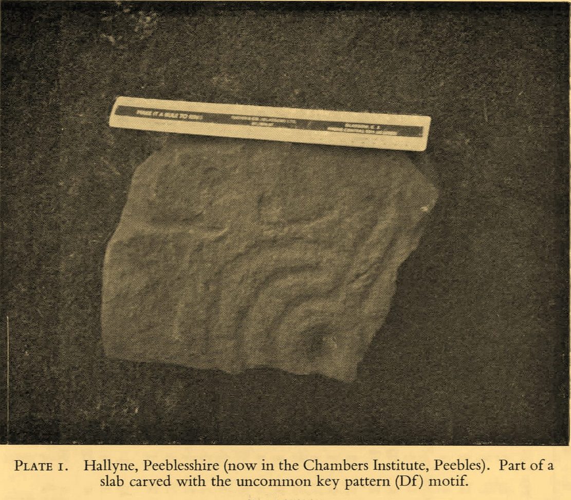
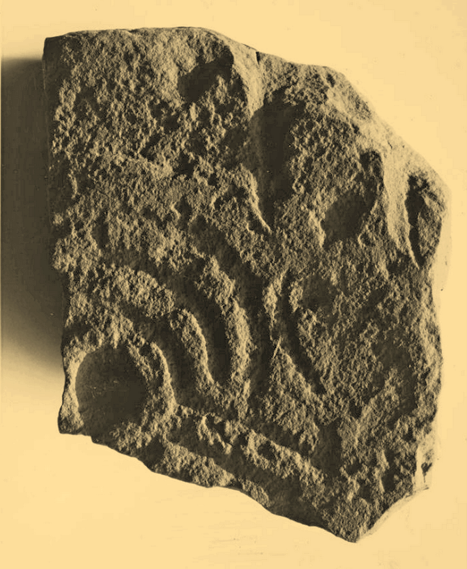
Included in the standard catalogues by Ronald Morris (1967; 1969), this carving was brought to light fortuitously by the local farmer who, thankfully, recognized its archaeological importance. Etched into a small flat broken block of stone, he noticed a cup-marking and the remains of a triple-ring around it, with grooves running out from the central cup. It was described in detail by the Royal Commission (1967) lads in their county survey where they told:
R.W.B. Morris’ 1967 photoHallyne carving in Peebles Museum
“During the excavations at the Roman fort at Lyne…in June 1959, a stone bearing cup-and-ring markings was found lying beside the fence that crosses the North Annexe. According to local information it was found while ploughing in the field on the NE side of the fence. It is a sandstone block, measuring 1ft 5in by one foot, and with an average thickness of 8in. It is clearly a mere fragment of what must have been a larger slab, but it is impossible to estimate its original dimensions. The markings consist of a single well-formed cup, 2in in diameter and three-quarters of an inch in depth, now partly surrounded by the broken arcs of three rings, which, if complete, would measures about 4in, 7in and 10in in diameter respectively. The rings are all half an inch in width and one eighth of an inch in depth. From the innermost ring two radial grooves, set one inch apart, extend outwards for a maximum distance of 4in. They interrupt the two outer rings, which stop short on either side of them, leaving a gap of about half an inch. The grooves are slightly narrower and shallower than the rings. The whole symbol has been formed by the pecking technique and punchmarks are still remarkably fresh. Outside the outermost ring there is a very shallow depression, one inch in diameter, which may be another cup-mark; in addition there are several recent scars caused by the plough.”
It was moved to the museum in Peebles shortly after being found and remains there to this day, apparently. I’ve not seen it.
References:
Morris, Ronald W.B., “The Cup-and-Ring Marks and Similar Sculptures of South-West Scotland,” in Transactions of the Ancient Monuments Society, volume 14, 1967.
Morris, Ronald W.B., “The Cup-and-Ring and Similar Early Sculptures of Scotland; Part 2 – The Rest of Scotland except Kintyre,” in Transactions of the Ancient Monuments Society, volume 16, 1969.
Morris, Ronald W.B., The Prehistoric Rock Art of Southern Scotland, BAR: Oxford 1981.
Royal Commission on the Ancient & Historical Monuments of Scotland, Peeblesshire – volume 1, HMSO: Edinburgh 1967.
Cup-and-Ring Stone (lost): OS Grid Reference – NU 013 264
Also Known as:
Cairnfold Field
Archaeology & History
In James Hardy’s (1889) essay describing new archaeological finds from the Lilburn area, he told of seeing a triple-ringed petroglyph that seems to have been cast up from one of the cairns in the adjacent field. I can find no other reference to this. He wrote:
“On a wall top, near a gate not far from the Cairn-fauld’s field, lies a detached stone, supposed to have come from a cairn, with three circles and a hollow central cup incised on it, which no one seems to care for.”
Does anyone know what has become of it? Mr Hardy also described a series of other carvings a few fields away to the east, some with quite ornate cup-and-ring designs. These have never subsequently been seen and remain hidden.
References:
Hardy, James, “Further Discoveries of Pre-Historic Graves, Urns and other Antiquities, on Lilburn Hill Farm,” in Archaeoogia Aeliana, volume 13, 1889.
Acknowledgements:Huge thanks for use of the Ordnance Survey map in this site profile, reproduced with the kind permission of the National Library of Scotland.
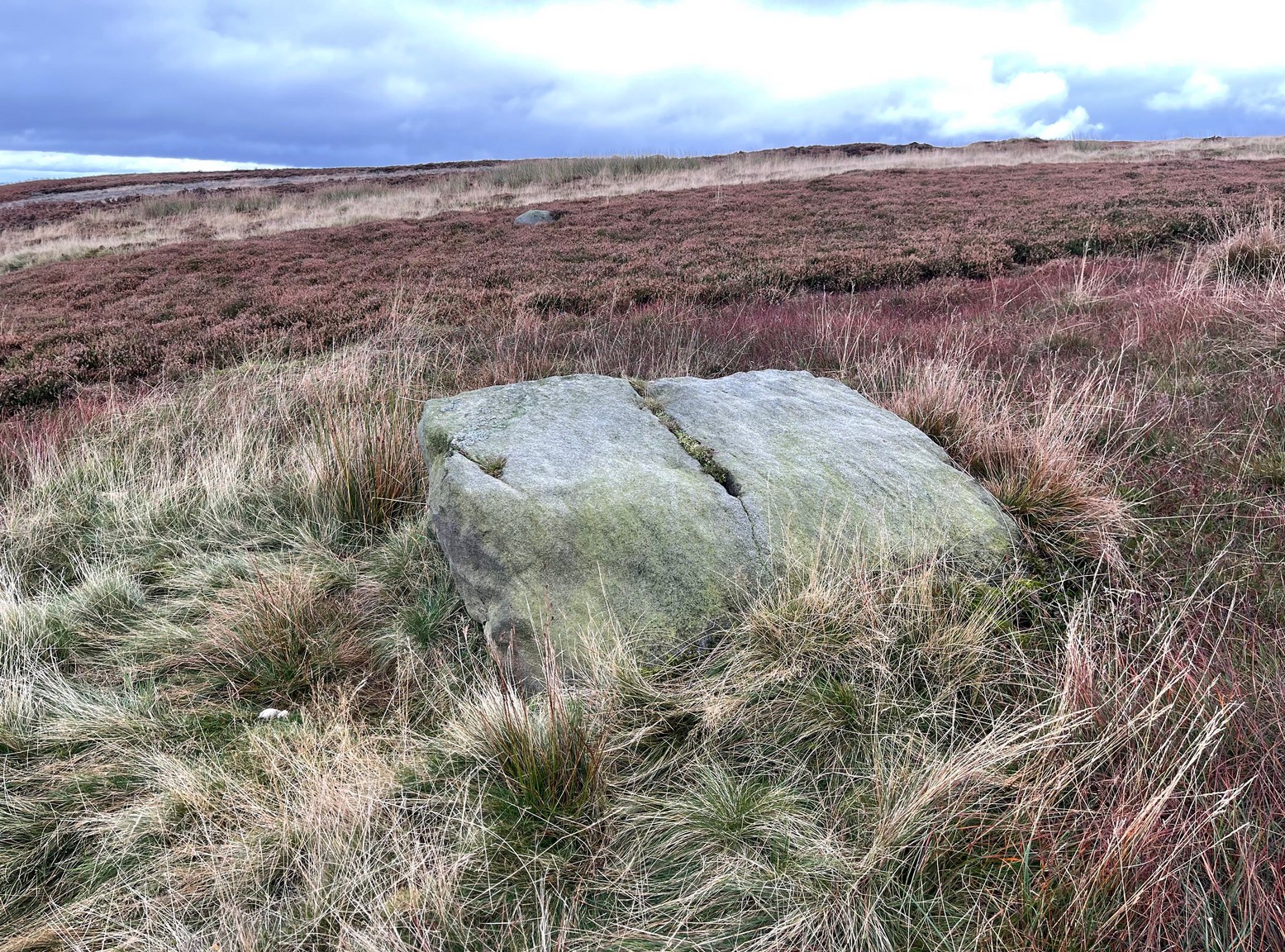
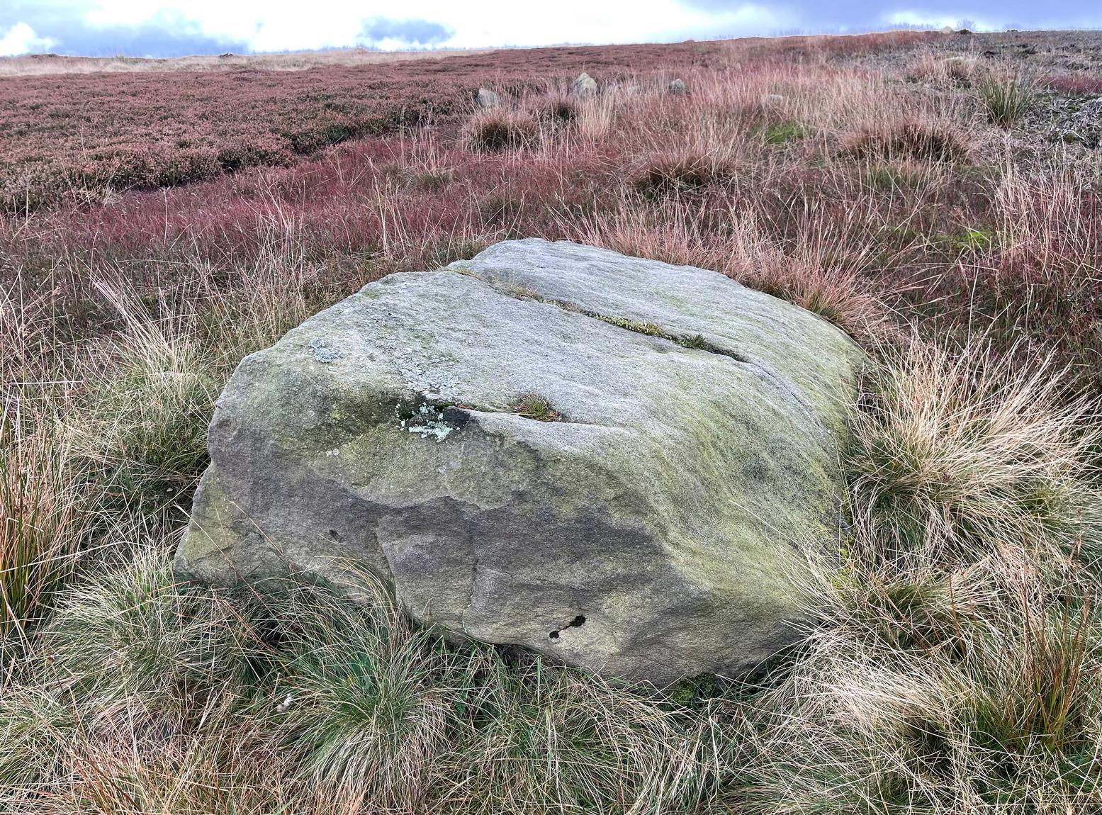
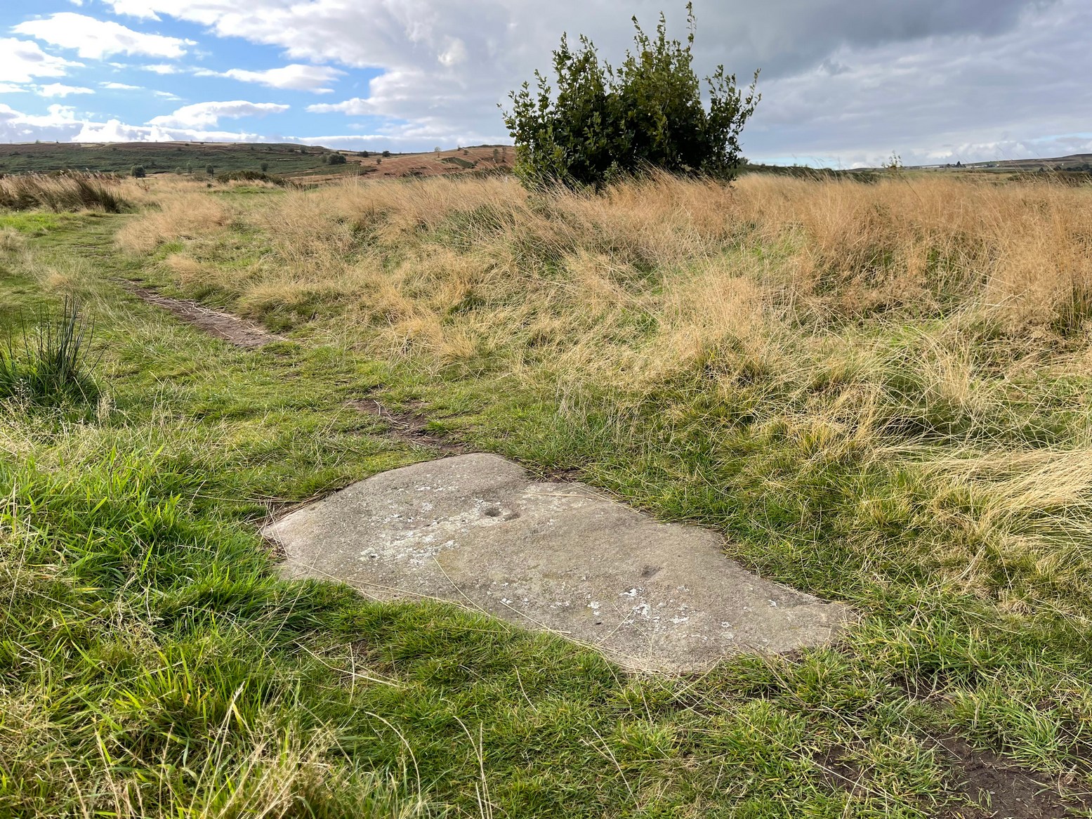
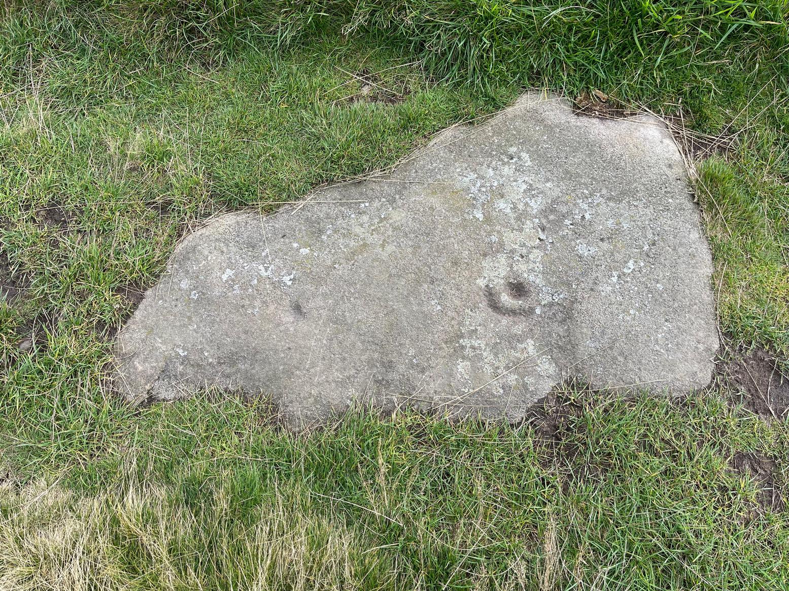
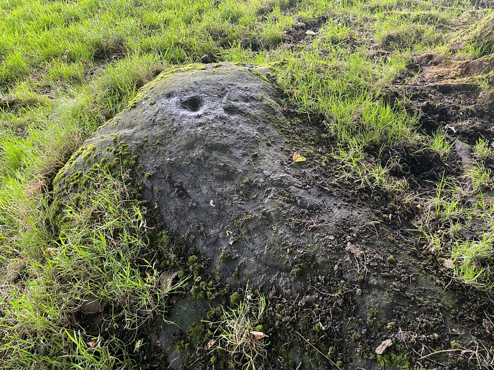
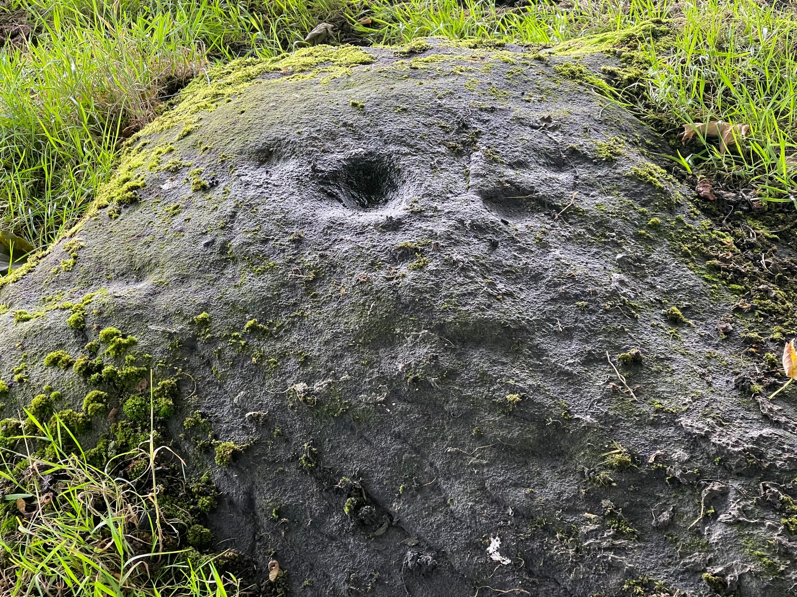
Naathen… I’d give you the directions of how to find this stone, but I’m not sure of its precise location. Just get to the top of Reva Hill, on its more westerly side, and it’s somewhere on its upper slopes. I was up here again recently and hoped to find it, but the grasses might have grown back over it. If one of you petroglyph fans manages to locate it, please can you send me its exact grid-reference, so I can update the site profile.
Carving when wetFaint Reva Hill carvingCarving when wet
Archaeology & History
This was one in a cluster of carvings that were rediscovered in 2011 and which I’ve not managed to re-locate (bad boy). It’s very plain and simple, as you can see. Indeed, I was lucky to even notice it, as the central photograph above shows how faint and eroded the cup-marks are in normal light. Thankfully with a bit of water, what I initially thought may have been two cup-marks, turned into three or four of them. So the next time you’re having a look at the Fraggle Rock carving and its companions, remember that this little fella is hiding somewhere close by…
From Cow & Calf Rocks, walk up the steep footpath and turn left (southeast) when it levels out on the edge of the moor. Walk 250 yards along and, where the main path veers down to the road, just keep walking along in the same direction along the footpath that runs gradually uphill until, after 650 yards (595m) you’ll eventually meet up with the footpath that runs along the moorland proper. Where these two paths meet-up, then head upwards (south) into the heather for 55 yards (50m) until you see a good-size sloping block of stone with a crack roughly down the middle. If you hit the Little Haystack Rock (a big conspicuous stone) you’ve gon too far!
Archaeology & History
Shallow cupmarks visible
This is one of the many basic cup-marked stones you’ll find scattered all over these moors possessing (as it does) only two distinct cup-marks on its more northern half, although a possible faint third one needs looking at in better light. When we were kids exploring this and other areas, single and double cup-marked stones like this seemed ten-a-penny and we’d flippantly pass them by after quick perusal, looking for more impressive designs.
The carving here seems to have been missed in the surveys of Hedges (1986) and Boughey & Vickerman (2003), despite the rock standing out quite distinctly. I can only assume that they checked it out when the skies were grey and dull, making the cup-marks difficult to see. A number of other prehistoric remains can be found close to this carving, including cairns and sections of enclosure walling.
Folklore
Tradition tells that the indigenous Britons had a battle with the Romans on the plain where this carving is found.
Take the road up through Baildon village, across at the roundabout up Northgate and up onto the moor, then after a few hundred yards turn left on the Bingley Road. About five hundred yards along, keep your eyes peeled for where the ruined reservoirs are to the left-side of the road. Straight across the road from here (north) you’ll see the small cliffs of Eaves Crag. Walk along the footpath that runs above the cliffs and, about 80 yards past them, keep your eyes peeled on the ground right in the middle of the path. You can’t really miss it!
Archaeology & History
Basic cup-and half-ring
First mentioned in passing in the magnum opus of W. Paley Baildon (1913) and subsequently in one of Sidney Jackson’s (1955) series of profiles on the Baildon Moor carvings, this all but insignificant carving comprises of a simple cup-and-half-ring and another singular cup-mark a little further along the stone. John Hedges (1986) described this carving as being a “well marked cup surrounded by horseshoe groove – also well marked. Possible small cup and incomplete ring.” Whilst the minimalists Boughey & Vickerman (2003) told it to be simply, “two cups, one with incomplete ring.” A peculiarity with this design is that it might have been cut by a metal implement, perhaps in the Bronze Age, perhaps even in the Iron Age. We might never know…
References:
Baildon, W. Paley, Baildon and the Baildons – volume 1, St. Catherines: Adelphi 1913.
Boughey, Keith & Vickerman, E.A., Prehistoric Rock Art of the West Riding, WYAS: Wakefield 2003.
Hedges, John (ed.), The Carved Rocks of Rombald’s Moor, WYMCC: Wakefield 1986.
Jackson, Sidney, ‘Cup and Ring Boulders of Baildon Moor,’ in Bradford’s Cartwright Hall Archaeology Group Bulletin, 1:10, 1955.
Acknowledgements:Huge thanks for use of the Ordnance Survey map in this site profile, reproduced with the kind permission of the National Library of Scotland.
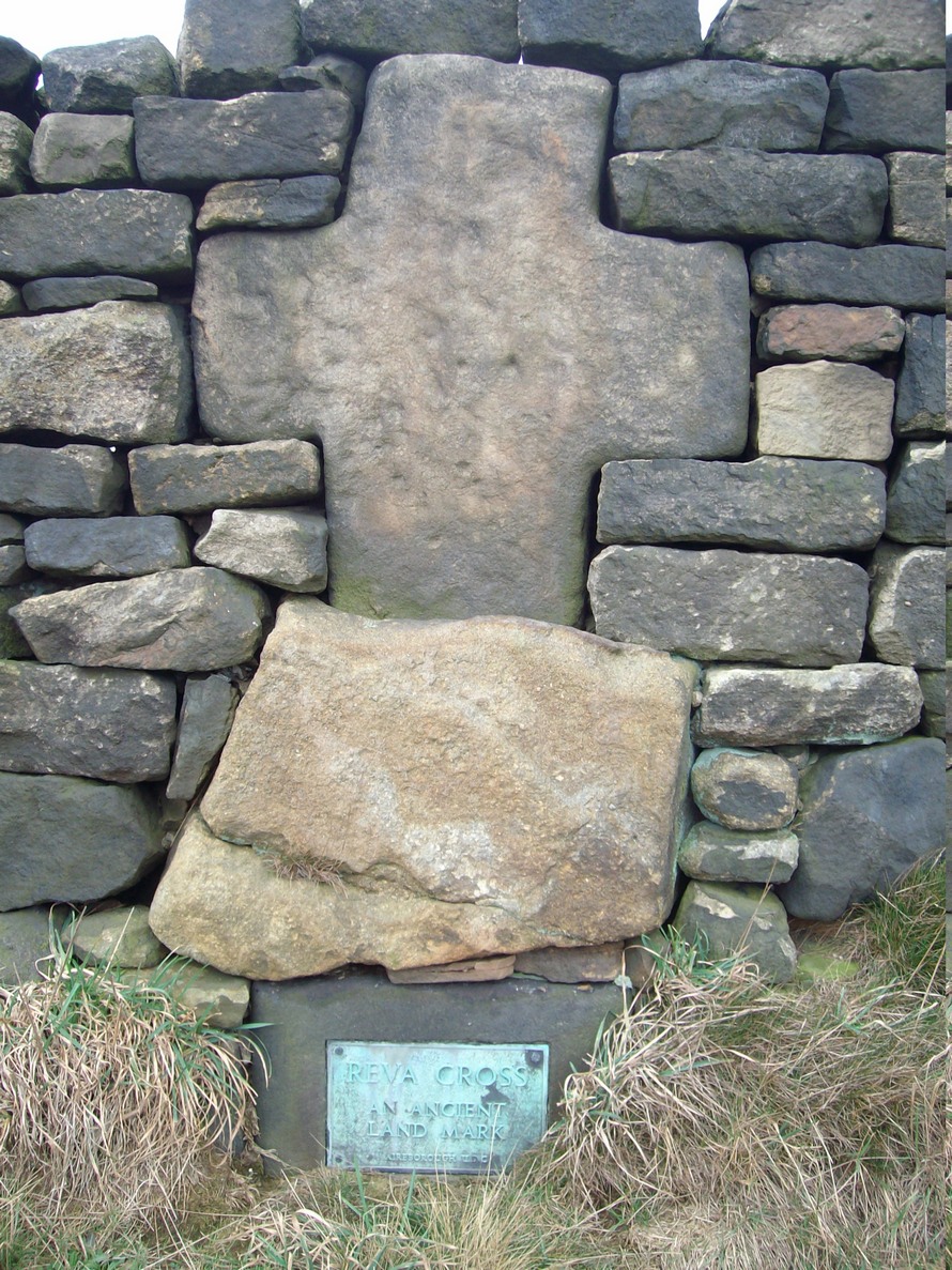
Two main routes to get here: i) from Dick Hudson’s public house, head left (east) along Otley Road (passing Weecher reservoir) for 1.9 miles (3.1km) until you reach Reva reservoir where a track leads you to the waters, and there’s a small parking spot on the left-side of the road. Stop here. (ii) coming from Hawkworth and Guiseley, head west along Hawksworth Lane which runs into Goose Lane and, at the T-junction at the end, turn right and nearly 500 yards along on the left-side of the road is the same small parking spot. From here, walk uphill for nearly 150 yards and then look at the walling to your left.
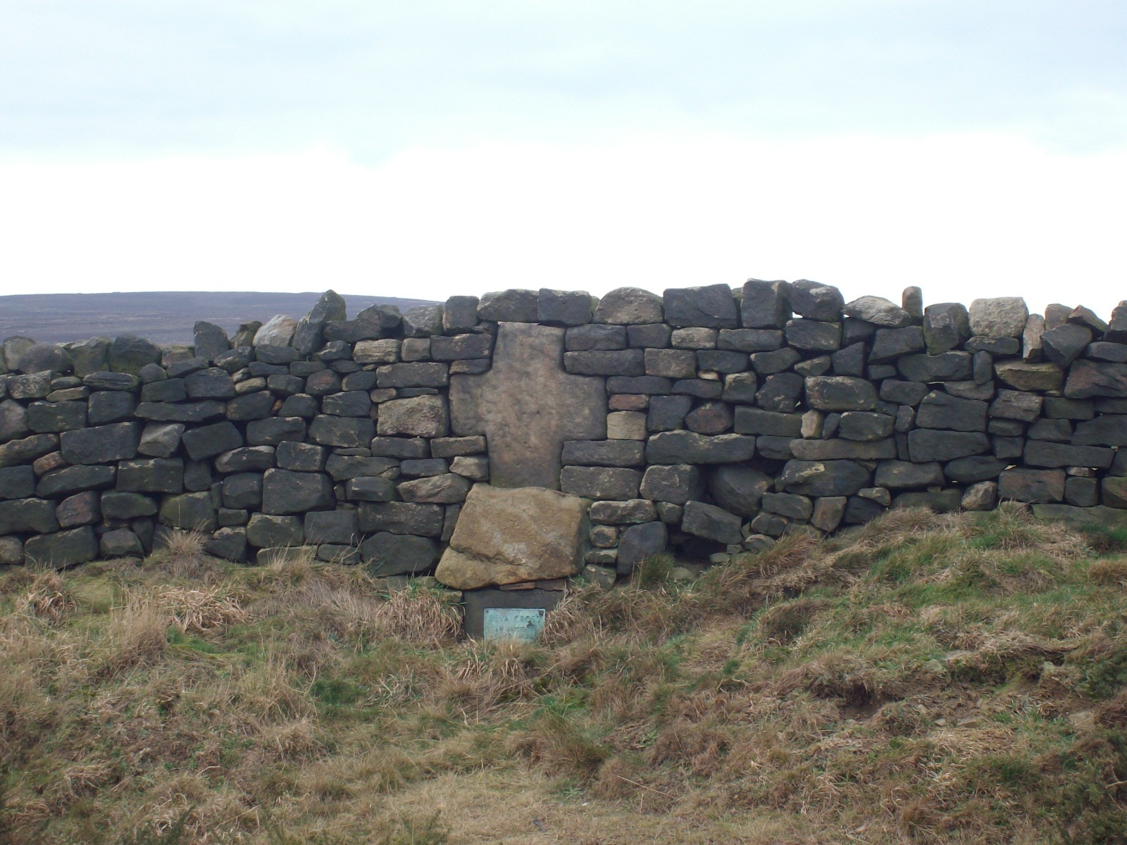
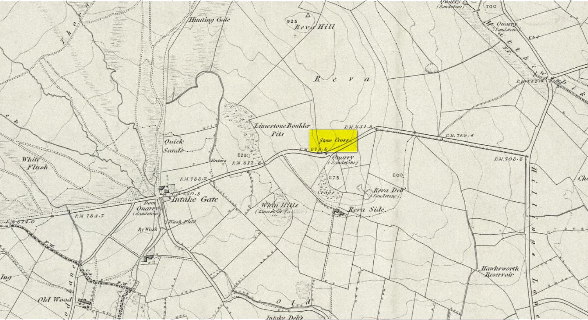
Archaeology & History
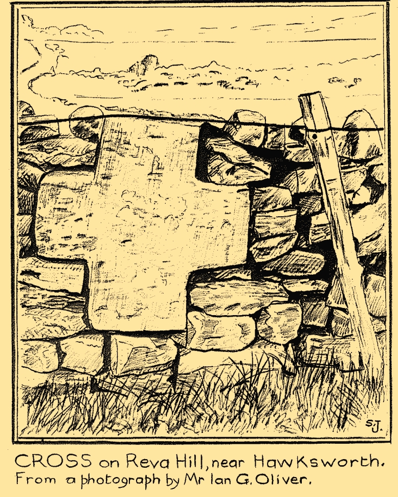
Reva Cross on 1851 map
This relic can be found on the far eastern edges of Hawksworth Moor, near Guiseley, and was said by the historian Eric Cowling to have originally stood upon a large rock nearby. It has an odd history. Initially, the cross was an ancient boundary or mark stone, referred to in a 15th Century document and outlined by William Preston in 1911, that marked the limit of the southern township of Burley township. Local historian C.J.F. Atkinson asserted that this cross in fact came from Otley, although his ideas were considered somewhat “fanciful” by archaeologists and other historians.
Its present position by the roadside is relatively new as it stood, not too long ago, a short distance away in the field to the rear, as highlighted on the early OS-map of this area. E.C. Waight of the archaeology division to Ordnance Survey wrote:
“Situated at SE 1530 4297 on the western side of the gate from the road into the field containing the remains of Reva Cross is a cross base (apparently in situ) serving as a bolster stone to the wall head at the gate opening.”
He described the dimensions of the base and the remainder of the cross, both of which “are contemporary with one and other,” he told. In the 1960s, the local council moved the cross to its present position.
Tradition told that despite its religious symbolism, it was also used as a market cross in bygone times. A certain Mrs Fletcher (1960), writing to the Cartwright Hall Archaeology Group, narrated that,
“Mrs Turner Greenwood….tells me that her mother, who, if living, would be in her nineties, lived at Gaping Goose Farm on the western side of Reva Hill… Mrs Greenwood’s father.. .remembered the cross erected on this hill, and related seeing the roads black with people climbing to it from Otley and Bingley, for the market held there.”
Despite this, Sidney Jackson was somewhat sceptical of it being the site of a market. Weather conditions and the bleakness of the spot would have made this site somewhat intolerable, he thought. However, people in previous centuries were much hardier than modern people and so it’s not as unlikely as you’d initially think.
Close-up of crossSid Jackson’s sketch
A much more interesting tradition of the cross was its use in times gone by as a Plague Stone. However, this name only applied to the cross-base at the time as no cross was stood upon it; merely a natural rock laid upon the moorside with a basin cut into it. It gained this name around the time of the great plague of 1660. During the plague, food was left on this table-like rock and money in return was placed in a basin full of vinegar. This tradition may have originated at the large natural rock bowl on one of the earthfast stones near the very top of Reva Hill a short distance to the west (also a number of cup-marked stones are close by and folklore records show that some cup-marks had healing properties). One account tells that it was Sir Walter Hawksworth (of the legendary Grand Lodge of ALL England masonic lodge) who was responsible for the siting of the cross as a Plague Stone.
References:
Cowling, Eric T., Rombald’s Way, William Walker: Otley 1946.
Cowling, Eric T., ‘Letter,’ in Cartwright Hall Archaeology Group Bulletin, 5:5, May 1960.
Fletcher, Elsie, “Letter,” in Cartwright Hall Archaeology Group Bulletin, 5:5, May 1960.
Jackson, Sidney, “Ancient Crosses,” in Cartwright Hall Archaeology Group Bulletin, 1:12, 1955.
Jackson, Sidney, “Cross on Reva Hill,” in Cartwright Hall Archaeology Group Bulletin, 5:1, p.2, 1960.
Jackson, Sidney, “Reva Hill Cross Base Found,” in Cartwright Hall Archaeology Group Bulletin, 9:9, September 1964.
Jackson, Sidney, “Fresh Site for Reva Cross,” in Cartwright Hall Archaeology Group Bulletin, 11:7, July 1966.
Preston, William Easterbrook, “On an Ancient Stone Cross on Riva Hill,” in Bradford Antiquary, New Series 3, 1911.
Acknowledgements:Huge thanks for use of the Ordnance Survey map in this site profile, reproduced with the kind permission of the National Library of Scotland.
From Steeton village, go up Mill Lane, turning right and then bending up the steep Barrows Lane for a half-mile or so, where in turns into Redcar Lane. There’s a row of old cottages on your left with a green lane track running into the fields at the back of them. Four fields along you’ll reach a long straight line of walling running uphill. Up here, above and past the long geological stretch of quarried rocks, the land levels out and two trees sit next to each other by walling. The carving’s beneath them.
Archaeology & History
Close-up of carving
Rediscovered in the summer of 2024 by Thomas Cleland, a deeply worn cup-mark is the primary feature of this petroglyph on the topmost section of the stone, with the remains of a faint incomplete ring around one side of it. Three or four other smaller cup-marks can be seen close to the main one. There may be another cup-marked stone on an adjacent rock, with a lines running away from it, but we need to see that in better light or have one of the computer-tech doods to give it their attention to know for sure.
Cup-and-Ring Stone (destroyed?): OS Grid Reference – SE 314 537
Archaeology & History
The chances of this carving still being alive, so to speak, are pretty slim. It was reported by a Mr. Sullivan to the old Yorkshire petroglyph researcher Stuart Feather back in 1965, in the days when English archaeologists didn’t really give a shit about rock art. Sad but true. The carving was found in the grounds of what used to be the ICI Fibres Research Centre, in the present landscape of Hornbeam Business Park, a hundred yards or more west of Hookstone Beck. According to Feather’s report, the carving consisted of “a single-ringed cup and a groove” surrounding “two short pecked grooves and a meandering groove leading off,” all with clear signs of being pecked and carved in the old-school manner. All trace of the carving has vanished and it was probably destroyed by the Industrialists. (the grid-reference to this site is an approximation)
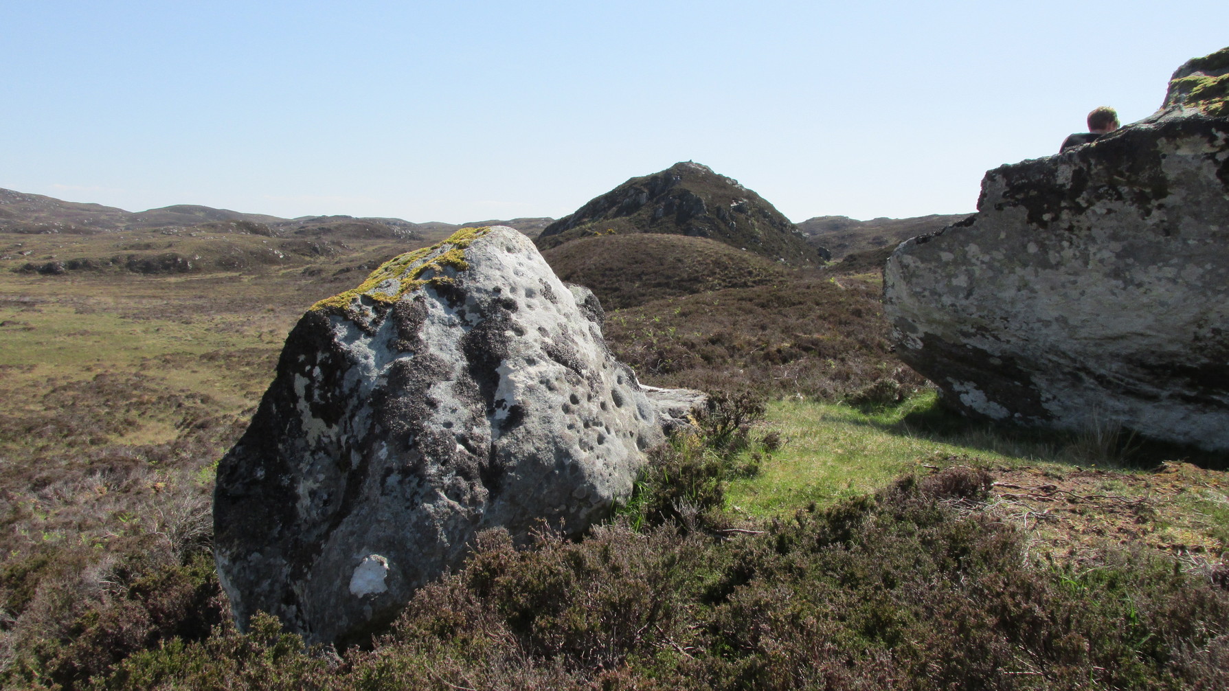
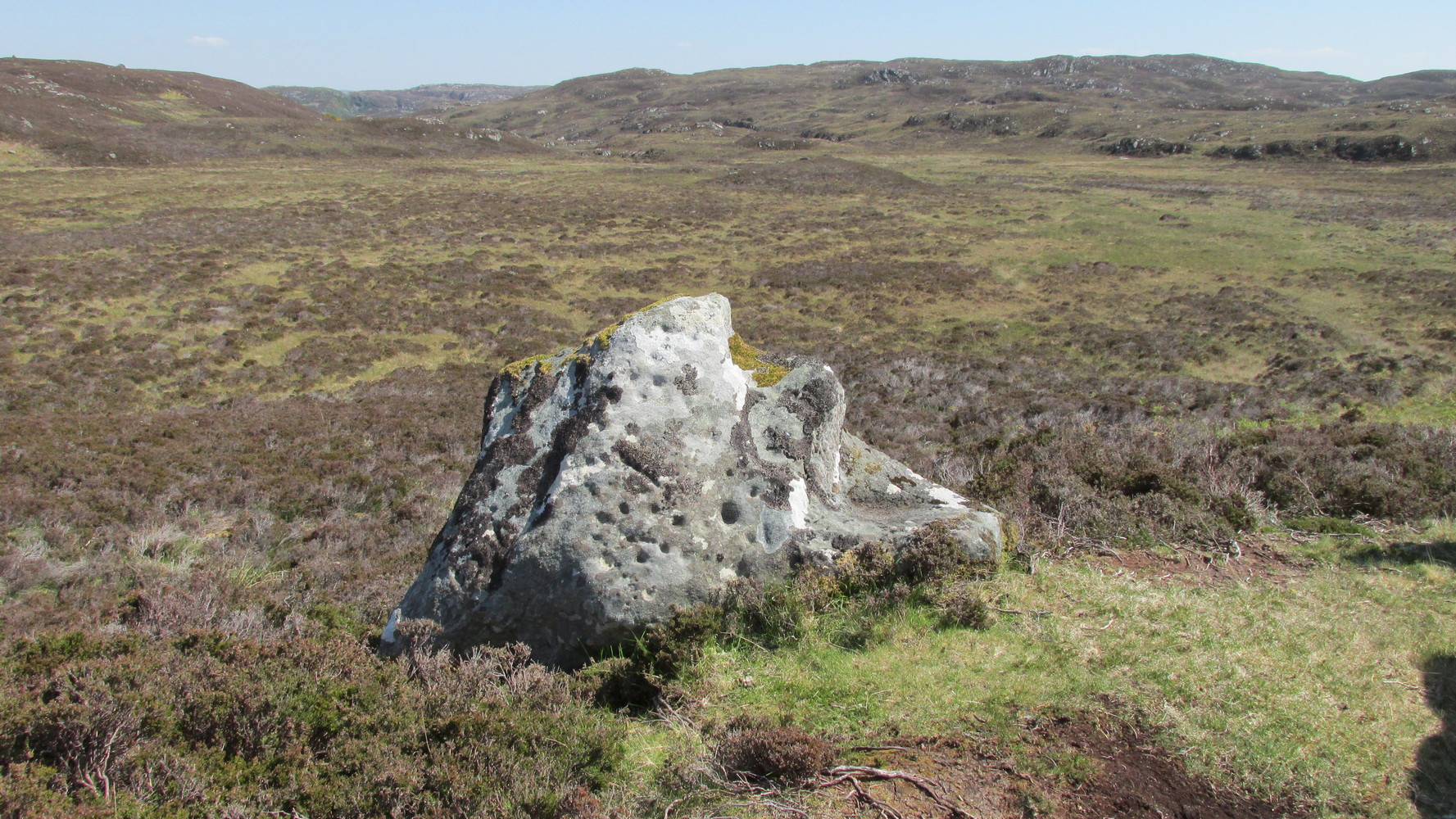
Simply follow the same directions as if you’re going to the Allt Thorrisdail (1) petroglyph, and the large, roughly oval-shaped boulder just a few yards away is the one you’re after. You can’t miss it!
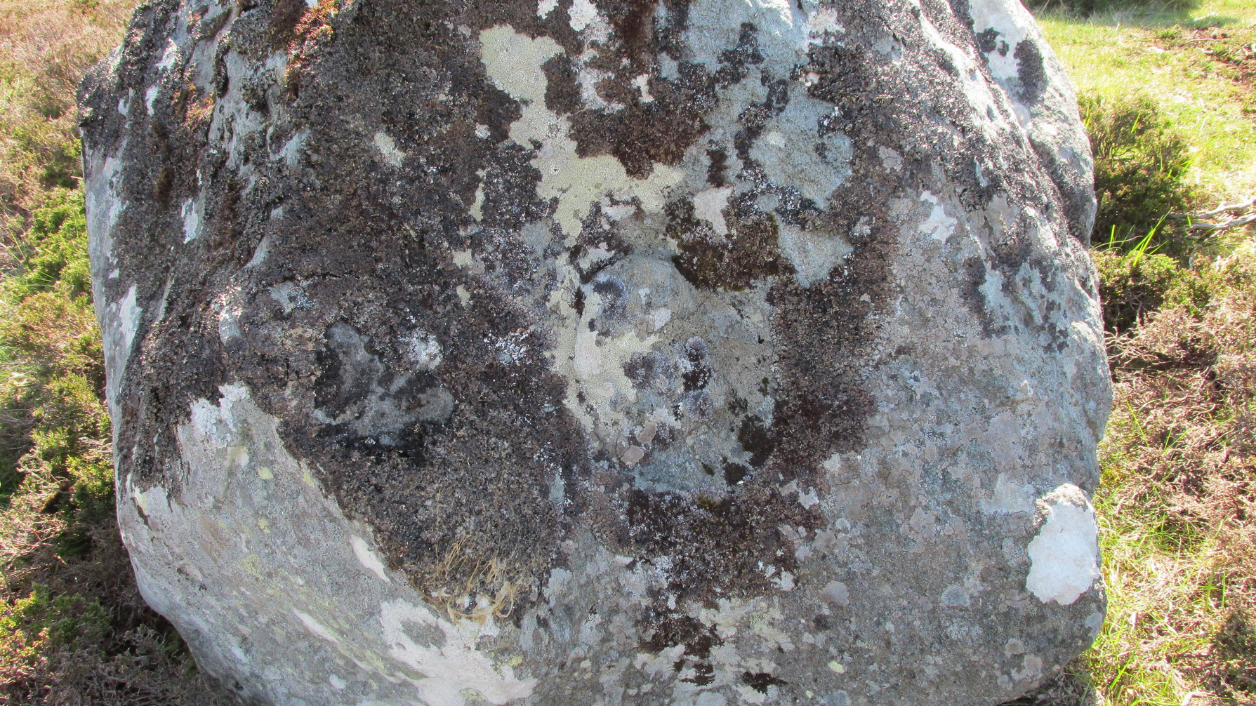
Archaeology & History
This large, earthfast, ovoid ball of rock has a series of cup-marks on three of its curvaceous faces, some of which seem to be natural, with a number of them “enhanced” by human hands at some time in the long long ago….
The main cluster of these cups can be found on its near-vertical western-face: an unusual feature in itself! There are several cups on its southern curve and, further round, low down on the east side of the rock we see a few more of them hiding away. These, too, seem to have been Nature’s handiwork, then enhanced by the hands of wo/men. The carving was described in Hew Morrison’s (1883) work as possessing two groups of cup-marks,
“similar to that on the neighbouring stone, one of eighteen small and one large cup, and another of eleven small marks. There is a solitary mark on the summit of this stone, and its southern face is marked by lines crossing each other, but without any apparent order or design.”
On its northern face we see a large oval hollow, an inch or so deep throughout, that has all the hallmarks of being a primitive face. There is a tradition of such a rock “face” carving somewhere close by, which seems to be lost—and this would seem to be culprit! If you visit the place, let us know what you think!
One feature that stands out at this site is the nearby pyramidal hill whch, I think, had some mythic relationship with the carvings. Impossible to prove, obviously, but the pyramid is such a dominant feature in this landscape that a relationship seems inevitable. I can only echo what I’ve said in the site profile for the adjacent carving here: tis a ritual place indeed – without any shadow of doubt. And I don’t say such things lightly! This place is truly superb!
References:
Mercer, R.J., Archaeological Field Survey in Northern Scotland 1976-1979, University of Edinburgh 1980.
Royal Commission on Ancient & Historical Monuments, Scotland, Second Report and Inventory of Monuments and Constructions in the County of Sutherland. HMSO: Edinburgh 1911.
Acknowledgements: Huge thanks to Sarah MacLean for her company and landscape knowledge in visiting this and other nearby antiquarian sites. And to Aisha Domleo, for getting me into this neck o’ the woods in the first place….where’er She may be….