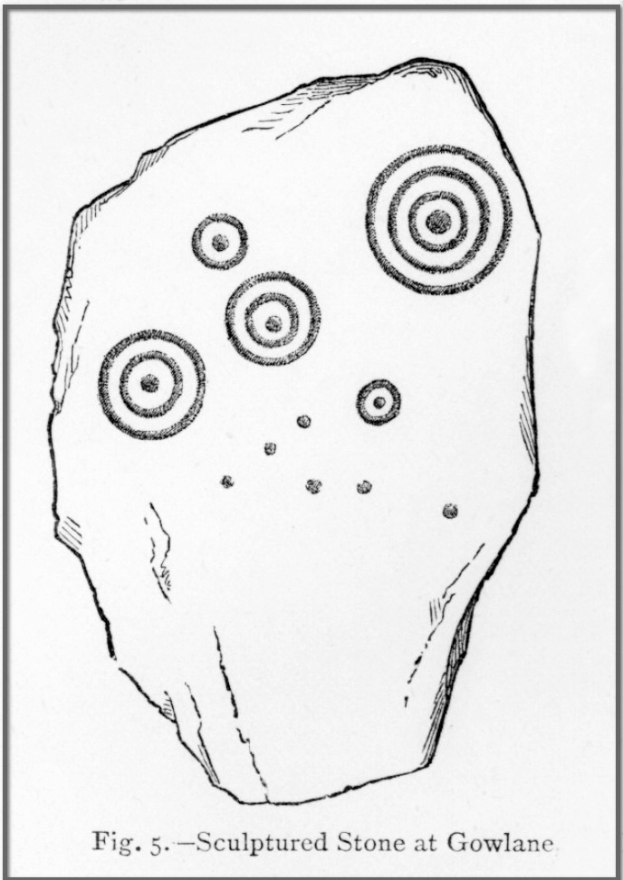
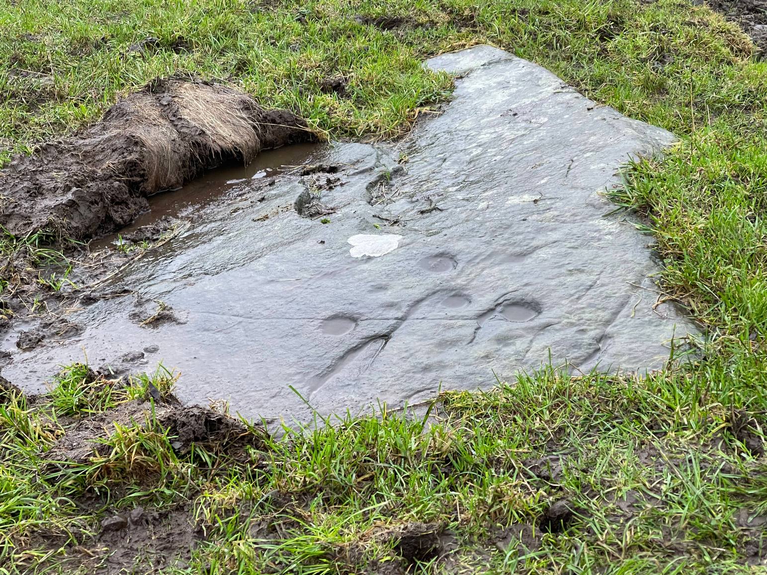
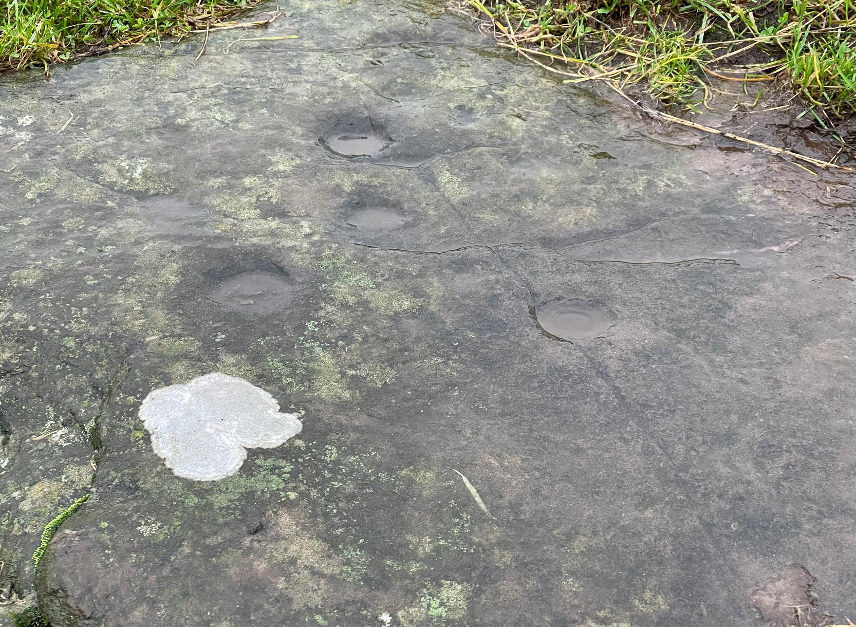
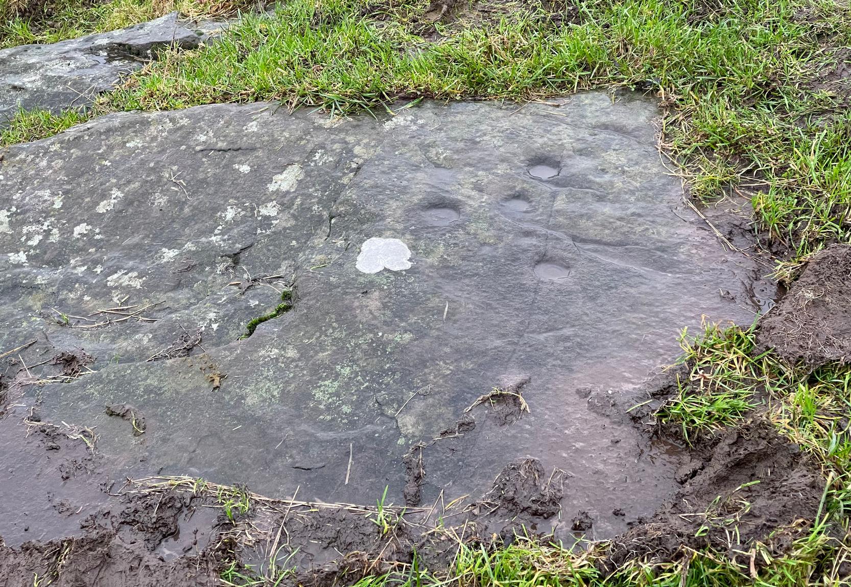
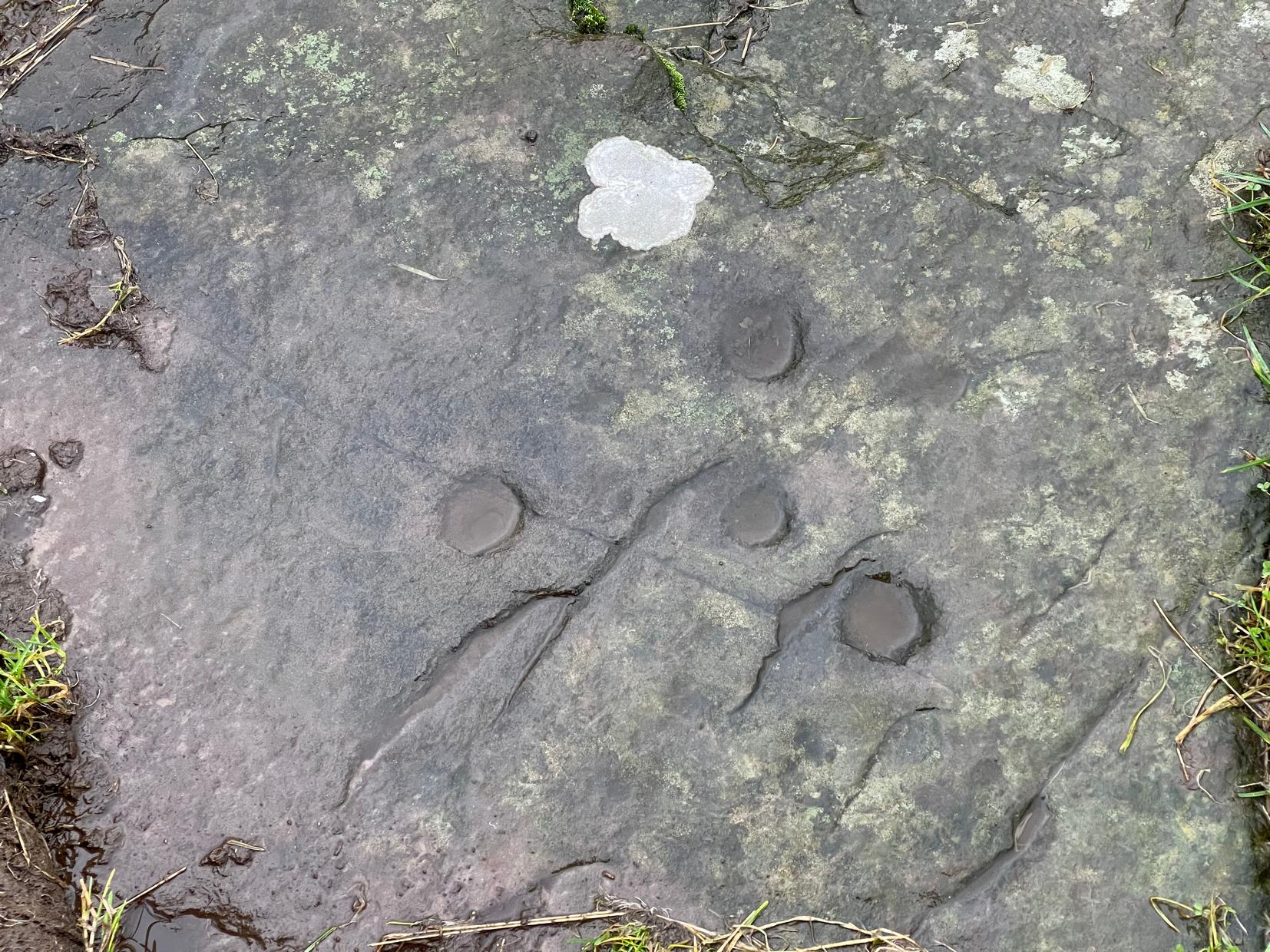
Cup-and-Ring Stone (lost): OS Grid Reference – Q 53 03?
Archaeology & History

When James Graves (1877) described the gorgeous Aghacarrible petroglyph, he told that “in the neighbouring townland of Gowlane” were three other carvings—with this fine multi-ringed design being one of them. It was first discovered and drawn by Richard Hitchcock in 1848 and was thought by Graves to have been broken from “a larger monument.” (like the Gowlane East [3] carving) Whether it was from a cairn, a souterrain or a stone circle, we can but guess. And we must also guess as to where it might be now, for no account of it has appeared since Mr Graves’ description. With any luck it will be in a wall somewhere, or simply buried in a field.
There are several Gowlane place-names in the area, but Judith Cuppage (1986) told that the great 19th century artist and antiquarian George du Noyer “identified the townland as Gowlane East”, although the closest “neighbouring townland” would be Gowlin (Gualainn). If any local folk know where this might be hiding, please let us know. (the grid reference cited here is a very vague guess!)
References:
- Cuppage, Judith, Archaeological Survey of the Dingle Peninsula, Oidhreacht Chorca Dhuibhne: Ballyferriter 1986.
- Graves, James, “On Cup and Circle Sculptures as Occurring in Ireland,” in Journal Royal Society Antiquaries, Ireland, volume 4 (4th series), April 1877.
© Paul Bennett, The Northern Antiquarian
The map could not be loaded. Please contact the site owner.