Ossian’s Stone, Sma’ Glen, Fowlis Wester, Perthshire

Ring Cairn:  OS Grid Reference – NN 89532 30595

Ossian's Stone, Sma' Glen
Ossian’s Stone

Also Known as:

  1. Cairn Ossian
  2. Canmore ID 25554
  3. Clach-na-Ossian
  4. Clach Ossian
  5. Giant’s Grave
  6. Ossian’s Grave
  7. Soldier’s Grave

Getting Here

Shown as Soldier's Graves on 1863 OS-map
Shown as Soldier’s Graves on 1863 OS-map

There are two ways into this glen by road. Whichever route you take (from Crieff side, or via the long Dunkeld route), when you hit the flat bottom of it, where the green fields are right by the roadside, walk along till you find the road meets the river’s edge.  On the south-side of this small roadside section of the river, you’ll see a single large boulder 10-20 yards away. That’s the spot!

Archaeology & History

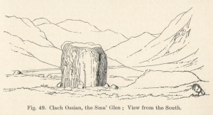
Described in some of the archaeology texts as just a ‘cist’, this giant stone is obviously the remains of much more.  For a start, as the 1834 drawing illustrates here (coupled with several other early descriptions of the place), other visible antiquarian remains were very much apparent at Ossian’s Stone before a destructive 18th century road-laying operation tore up much of this ancient site.  A marauding General Wade of the English establishment was cutting through the Scottish landscape a “military road”, to enable the English to do the usual “civilize the savages”, as they liked to put it.  This curious “Giant’s Grave” was very lucky to survive.

Skene's 1834 sketch, showing surrounding ring
Skene’s 1834 sketch, showing surrounding ring
Ossian's Stone in the Sma' Glen
Ossian’s Stone in the Sma’ Glen

The earliest description of events surrounding the site, as well as the attitude of the Highlanders when they saw the disrespectful English impose their usual disregard, is most insightful.  In a series of letters written by a Captain Edward Burt (1759) in the first-half of the 18th century to the english monarch of the period, we read a quite fascinating account which must have been very intriguing to witness first-hand.

General Wade and his band of marauders had reached the Sma’ Glen at the end of Glen Almond and were about to continue the construction of their road.  Burt (1759) wrote:

“A small part of the way through this glen having been marked out by two rows of camp colours, placed at a good distance one from another, whereby to describe the line of the intended breadth and regularity of the road by the eye, there happened to lie directly in the way an exceedingly large stone; and, as it had been made a rule from the beginning, to carry on the roads in straight lines as far as the way would permit, not only to give them a better air, but to shorten the passenger’s journey, it was resolved the stone should be removed, if possible, though otherwise the work might have been carried along on either side of it.

“The soldiers, by vast labour, with their levers and jacks, or hand-screws, tumbled it over and over till they got it quite out of the way, although it was of such an enormous size that it might be matter of great wonder how it could ever be removed by human strength and art, especially to such who had never seen an operation of that kind: and, upon their digging a little way into that part of the ground where the centre of the base had stood, there was found a small cavity, about two feet square, which was guarded from the outward earth at the bottom, top, and sides, by square flat stones.

“This hollow contained some ashes, scraps of bones, and half-burnt ends of stalks of heath; which last we concluded to be a small remnant of a funeral pile.  Upon the whole, I think there is no room to doubt but it was the urn of some considerable Roman officer, and the best of the kind that could be provided in their military circumstances; and that it was so seems plainly to appear from its vicinity to the Roman camp, the engines that must have been employed to remove that vast piece of a rock, and the unlikeliness it should, or could, have ever been done by the natives of the country. But certainly the design was, to preserve those remains from the injuries of rains and melting snows, and to prevent their being profaned by the sacrilegious hands of those they call Barbarians, for that reproachful name, you know, they gave to the people of almost all nations but their own.

“…As I returned the same way from the Lowlands, I found the officer, with his party of working soldiers, not far from the stone, and asked him what was become of the urn?  To this he answered, that he had intended to preserve it in the condition I left it, till the commander-in-chief had seen it, as a curiosity, but that it was not in his power so to do; for soon after the discovery was known to the Highlanders, they assembled from distant parts, and having formed themselves into a body, they carefully gathered up the relics, and marched with them, in solemn procession, to a new place of burial, and there discharged their fire-arms over the grave, as supposing the deceased had been a military officer.

“You will believe the recital of all this ceremony led me to ask the reason of such homage done to the ashes of a person supposed to have been dead almost two thousand years.  It did so; and the officer, who was himself a native of the Hills, told me that they (the Highlanders) firmly believe that if a dead body should be known to lie above ground, or be disinterred by malice, or the accidents of torrents of water, &c. and care was not immediately taken to perform to it the proper rites, then there would arise such storms and tempests as would destroy their corn, blow away their huts, and all sorts of other mis-fortunes would follow till that duty was performed.  You may here recollect what I told you so long ago, of the great regard the Highlanders have for the remains of their dead…”

Ossian's Stone in his landscape
Ossian’s Stone in his landscape

We can rest assured that the ‘Roman officer’ idea proclaimed by our early narrator is most probably wrong and that the nature of this site, when seen at ground-level even today and moreso by referencing Skene’s 1834 drawing of the place, above (which shows a more complete low surrounding ring of stones) indicate this to be of prehistoric provenance.  Of intrigue to me, is the ritual of the incoming Highlanders, who took the relics onto another place and re-interred them in their own customary manner.  We do not know where the Highlanders moved these (probable) prehistoric relics and I can find no supporting folklore to show precisely where they went—but a likely site would be the prehistoric cairn on the mountaintop southwest of here (at NN 8899 3018), or a site that has sometimes been confused with Ossian’s Stone a short distance to the south in the Sma’ Glen, known as the Giant’s Grave (at NN 9050 2956).  This latter site would seem more probable.

Anyway…. many years after Edward Burt’s initial Letters defined the site for outsiders, one Thomas Newte (1791) came a-wandering hereby.  He found that the account of General Wade’s intrusion was still on the tongues of local people, along with additions of further giant-lore and Fingalian tales, typical of the Creation myths of our early ancestors.  In typically depreciative English manner Newte told:

“In that awful part of Glen Almon, already mentioned, where lofty and impending cliffs on either hand make a solemn and almost perpetual gloom, is found Clachan-Of-Fian, or monumental Stone of Ossian.  It is of uncommon size, measuring seven feet and an half in length, and five feet in breadth. About fifty years ago, certain soldiers, employed under General Wade in making the Military Road from Stirling to Inverness, through the Highlands, raised the stone by large engines, and discovered under it a coffin full of burnt bones. This coffin consisted of four gray stones, which still remain, such as are mentioned in Ossian’s Poems.  Ossian’s Stone, with the four gray stones in which his bones are said to have been deposited, are surrounded by a circular dyke, two hundred feet in circumference, and three feet in height. The Military Road passes through its centre.”

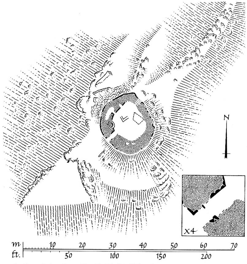
Cole's 1911 plan of stone & surrounding ring
Cole’s 1911 plan of stone & surrounding ring
Ossian Stone by Fred Cole

From hereon, many other writers and travellers came to see this great legendary stone within the depleted remains of its embanked circle—and thankfully it hasn’t been disturbed any further, still being visible to this day.  The greatest ‘archaeological’ attention the site has received was from the early pen of great antiquarian Fred Coles (1911).  On his journey here, after travelling past a large white stone which was mistakenly named as Ossian’s Stone by the usual contenders, he and his friend reached the right place:

“close to a strip of ground where the river and road almost touch each other, and immediately below the steepest of the crags of Dun More on the eastern side and the debris slopes of Meall Tarsuinn on the west, a most impressive environment, be the stone a prehistoric monument or not!  The spot is interesting for itself, apart from all legend; and the remains consist of a mighty monolith…and a narrow grassy mound…to its east, with a few earthfast blocks set edgewise near its eastern extremity.  Close to the roadside, but at the same level of 690 feet above the sea, there is a slab-like stone set up, measuring 3 feet in width, 1 foot 3 inches in thickness, and about 2 feet 6 inches in height.  A space of 63 feet separates this block…from the huge rhomboidal mass called Ossian’s Stone.  Five feet east of the latter is the base of the grassy mound which measures about 12 feet in length, 4 feet in greatest breadth, and 3 feet 10 inches in height.  To the north and the south in a slightly curving line are set the six small slabs shown.  There seems also to be a vague continuation of this strange alignment in both directions.  All over the ground between A and B, are many strangle low parallel ridges of smallish stones having a general direction of nearly north and south.  The rest of the ground is grassy, and here and there a little stony.  In the plan all the stones are drawn larger than exactly to scale.

“The great stone is 8 feet high and has a basal girth of 27 feet.  Several small stones lie near it.  Such are the facts as at present to be observed on the ground.”

Section of outlying grass-covered low ring, just visible
Geological cup-marks?

There are two small conjoined cup-marks on top of the stone, but these seem to be geological in nature.  The precise nature of the site is difficult to ascertain without excavation; but the Royal Commission lads reckon it to be a prehistoric ‘cist’ or grave in their own analysis, based mainly on the quoted literary texts.  The surrounding ‘ring’ of small stones doesn’t seem to have captured their attention too much; but the site needs contextualizing within this damaged circular enclosure, which appears to have been a cairn circle initially, of some sort, with Ossian’s huge stone resting over the grave of one late great ancestral character, probably placed here thousands of years back in the Bronze Age… A truly fascinating place in truly gorgeous landscape.

Folklore

The glen itself has a scattering of giant lore associated with Finn and/or Ossian.  A nearby cave was one of the places where this legendary character, and subsequent bards, were said to have spent time.

There are a small number of heavy rocks presently placed on top of Ossian’s Stone.  These may be due to the site being used as a “lifting stone”: a sort of rite of passage found at a number of sites in the Perthshire mountains and across the Highlands to indicate a boy’s strength before entering manhood. Not until they have lifted and deposited a very heavy rock onto the boulder can they rightly become chief or leader, etc.

The poet William Wordsworth wrote about Ossian’s Stone, calling it “Glen Almein, or The Narrow Glen”:

In this still place, remote from men,
Sleeps Ossian, in the Narrow Glen;
In this still place, where murmurs on
But one meek streamlet, only one:
He sang of battles, and the breath
Of stormy war, and violent death;
And should, methinks, when all was past,
Have rightfully been laid at last
Where rocks were rudely heaped, and rent
As by a spirit turbulent;
Where sights were rough, and sounds were wild,
And everything unreconciled;
In some complaining, dim retreat,
For fear and melancholy meet;
But this is calm; there cannot be
A more entire tranquillity.
Does then the Bard sleep here indeed?
Or is it but a groundless creed?
What matters it? I blame them not
Whose Fancy in this lonely Spot
Was moved; and in such way expressed
Their notion of its perfect rest.
A convent, even a hermit’s cell,
Would break the silence of this Dell:
It is not quiet, is not ease;
But something deeper far than these:
The separation that is here
Is of the grave; and of austere
Yet happy feelings of the dead:
And, therefore, was it rightly said
That Ossian, last of all his race!
Lies buried in this lonely place.

References:

  1. Anonymous, Tourists Guide to Crieff, Comrie and the Vale of Strathearn, Crieff
    1874.
  2. Burt, Edward, Letters from a Gentleman in the North of Scotland – volume 2, L.Pottinger: London 1759.
  3. Coles, F.R., “Report on stone circles in Perthshire principally Strathearn,” in Proceedings of the Society of Antiquaries, Scotland, volume 45, 1911.
  4. Finlayson, Andrew, The Stones of Strathearn, One Tree Island: Comrie 2010.
  5. Gordon, Seton, Highways and Byways in the Central Highlands, MacMillan Press 1948.
  6. Holder, Geoff, The Guide to Mysterious Perthshire, History Press 2006.
  7. Hunter, John, Chronicles of Strathearn, David Philips: Crieff 1896.
  8. Macara, Duncan, Guide to Crieff, Comrie, St Fillans and Upper Strathearn, Edinburgh 1890.
  9. Macculloch, James, The Highlands and Western Isles of Scotland, London 1824.
  10. Marshall, William, Historic Scenes in Perthshire, Edinburgh 1881.
  11. McKerracher, Archie, Perthshire in History and Legend, John Donald: Edinburgh 1988.
  12. Newte, Thomas, Prospects and Observations on a Tour in England and Scotland: Natural, Oenomical and Literary, G.G.J. Robinson: London 1791.

Acknowledgements:  Huge thanks again to Paul Hornby for his assistance with site inspection, and additional use of his photos.

© Paul Bennett, The Northern Antiquarian


Caisteal Nan Coin Dubh, Craobh Haven, Argyll

Dun:  OS Grid Reference – NM 8000 0763

Also Known as:

  1. Canmore ID 22744

Archaeology & History

Caisteal Nan Coin Dubh (after RCAHMS 1988)

Up above the roadside leading down the gorgeous Craobh Haven road, we not only find remains of a previously unrecorded standing stone, but we see this little-known overgrown fort that has been described as a “galleried dun” by the Royal Commission (1988) lads.  Known in folk tradition as the “castle of the black dogs” and an important place in the great legends of the Finns, in archaeological terms the Royal Commission described the site as:

“Oval in plan, the dun measures about 13m by 10m within a wall which varies from 3m to 4m in thickness.  Considerable stretches of the outer face survive and on the N it rises to a height of 1.7m in ten rough courses; the inner face is less well preserved, but a long stretch is visible on the NW.  There are traces of a gallery within the thickness of the wall on the NW; it was entered through a narrow passage, the S-side wall of which it stands to a height of 0.4m in three courses.  A second break in the line of the inner face, 2.5m to the NE, is either another entrance to the gallery or the entrance to a second chamber.  Depressions in the thickness of the wall on the S may indicate the presence of yet another intramural feature.  The entrance to the dun lies on the WSW; it measures about 1m in width at the outer end, 1.8m at the inner end, and is checked for a door 1m from the exterior.  On the NE there is a short stretch of facing at right-angles to the line of the wall, and this may be a straight-joint similar to that at Castle Dounie…or one side of a postern gate. In the interior there are the remains of at least two animal-pens and a modern rectilinear cairn. There is no trace of the midden-deposit noted by Campbell & Sandemann to the W of the dun, and the cairns and stretches of field-walling on the N flank of the ridge are of relatively recent date.”

Folklore

Close to a little-known cailleach site, this ruined fortress was one of the many places which the illustrious historian and folklorist Archibald Campbell told about in his awesome series of Waifs and Strays of Celtic Tradition (1889).  The tale of the fort was known to local people as “The Fight between Bran and Foir and is as follows:

“The black dog, Foir, was the brother of Bran, the far-famed hound of Fionn. Foir was taken early from his dam, and was afterwards nurtured by a band of fair women, who acted as his nurses. He grew up into a handsome hound, which had no equal, in the chase or in fight, in the distant North. His owner, Eubhan Oisein, the black-haired, red-cheeked, fair-skinned young Prince of Innis Torc (Orkney ?) was proud, as well he might be, of his unrivalled hound. Having no further victories to win in the North, his master determined to try him against the strongest dogs in the packs of the Feinne.

“He left home, descended by Lochawe, and entered Craignish through Glen Doan. Before his arrival, the Fienne, after spending the day in the chase, encamped for the night in the upper end of Craignish. Next day Fionn arose before sunrise, and saw a young man, wrapped in a red mantle and leading a black dog, approaching towards him at a rapid pace. The stranger soon drew near, and at once declared his object in coming. He wanted a dog-fight, and so impatient was he to have it, and so restless by reason of his impatience, that he suffered not his shadow to dwell a moment on one spot.

“Fifty of the best hounds of the Feinne were slipped at last, but the black dog killed them all one by one. A second and then a third fifty were uncoupled, but the strange dog disposed of them as easily as he did of the first.

“Fionn now saw that all the dogs of the Feinne were in serious danger of being annihilated, and therefore he turned round and cast an angry look on his own great dog Bran. In a moment Bran’s hair stood on end, his eyes darted fire, and he leaped the full length of his golden chain in his eagerness for the fight. But something else besides the casting of an angry look was still to be done to rouse the fierce hound’s temper to its highest pitch.

“He was placed nose to nose with his rival, and then his golden chain was unclasped. The two hounds, brothers by blood, but now champions on opposite sides, at once closed in deadly fight; but for an adequate description of the struggle between them the reader must consult the bards. See the “Lay of the Black Dog”, in Islay’s Leabhar na Feinne, the McCallum’s Ancient Poetry, etc.

“The contest lasted from morning to evening, and victory remained, almost to the close, uncertain; but in the end Bran vanquished Foir, and, by killing the latter, amply revenged the death of the three fifties. The Feinne buried their own dogs, and the stranger, with a sore heart, laid his black hound in the narrow clay bed.

“This great dog-fight, so celebrated in Gaelic lore, is said to have been fought at Lergychony, in Craignish. It is further said that the place was called Learg-a-choinnimh, or the “Plateau of Meeting”, because it was there the two hounds met in fight. There are, of course, many other places in the Highlands which claim the honour of being the scene of this legendary contest.”

References:

  1. Campbell, Archibald, Waifs and Strays of Celtic Tradition – volume 1, David Nutt: London 1889.
  2. Royal Commission on the Ancient & Historical Monuments of Scotland, Argyll – Volume 6: Mid-Argyll and Cowal, HMSO: Edinburgh 1988.

© Paul Bennett, The Northern Antiquarian

Samson Stone, Callander, Stirlingshire

Legendary Rock:  OS Grid Reference – NN 60399 07820

Also Known as:

  1. Samson’s Putting Stone

Getting Here

Samson Stone on Bochastle Hill

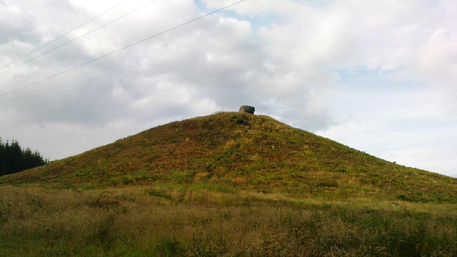
Go west out of Callander on the A84 road and after a mile or so turn left at Kilmahog, down the A821.  After a few hundred yards, past the parking spot by the roadside, look up the small Bochastle Hill on your right and you’ll see a large singular boulder resting on top.  That’s it!

Archaeology & History

When I first wandered up to this giant rock, I was hoping there may have been cup-markings on its surface, but none could be found.  The stone is a glacial erratic.  The Iron Age hillfort of Dunmore is 370 yards (338m) to the southwest.

Folklore

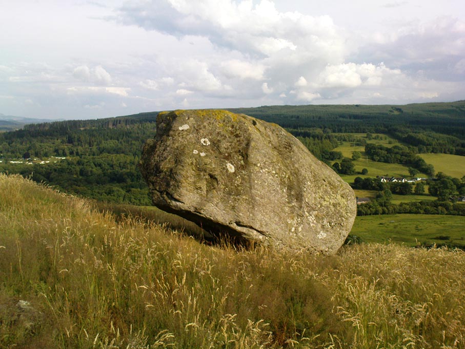
Samson Stone, close-up

In Mr Rogers’ (1853) fine historical tour of the region, he notes the Samson Stone “on the summit of one of the eminences of Bochastle,” a couple of miles west of Callander, but wondered “how it came to occupy this remarkable position.”  If he’d have asked some of the old locals they may have told him what Rennie McOwan (1996) came across and described in his excellent work on the folklore of Scottish mountains.  For the Samson Stone was traditionally thrown here by one of the Fingalian giants in ancient times.  It was originally located upon Ben Ledi, nearly 3 miles northwest, and was one of several stones being thrown in a competition to see who was the strongest of the giants — and Samson was the name of the one who threw this huge rock.  Another version of the same legend tells that the stone was originally thrown from Ben Lawers, 21 miles (34km) to the north.

References:

  1. Bain, William, Around and about Callander, Callander & District Round Table n.d. (c.1978).
  2. McOwan, Rennie, Magic Mountains, Mainstream: Edinburgh 1996.
  3. Roger, Charles, A Week at Bridge of Allan, Adam & Charles Black: Edinburgh 1853.

© Paul Bennett, The Northern Antiquarian


Witch’s Stone, Crossford, Dunfermline, Fife

Legendary Stone (destroyed):  OS Grid Reference – NT 058 865

Archaeology & History

Travelling along the old road between Crossford and towards Cairneyhill, on the right-hand (north) side, there was until recently a huge boulder, described by the folklorist J.E. Simpkins (1914),

“Its horizontal dimensions above ground are diagonally 18 feet by 21 feet; its vertical height above ground 5 feet…  I estimate its weight at nearly 200 tons.”

The stone was proclaimed by 19th century geologists to be a glacial deposit from the upper region of the Forth (the nearest mountain region possessed of this type of stone); although our old petroglyph writer, Sir James Simpson, postulated the Witch’s Stone to be “of meteoric origin.”

But like oh so many old sites with heathen tales attached, the stone was destroyed by a local farmer on 7 February, 1972.  The following interesting notes were made in a Crossford & Cairneyhill School log-book, describing its destruction:

“The local farmer blasted the “Witch’s Stone”, situated about 300m East of school at 2.30 this afternoon.  Children vacated both buildings and sheltered at West End of main building.  All windows were opened.  Police informed that further operations of this nature will be carried out at weekend.”

A week later on February 14, all “remains of “Witch’s Stone” removed by blasting at 3pm today.”

On the other side of the road from our Witch’s Stone was another boulder, this time known as the Cadger’s Stone, said by Beveridge (1888) to have got its name,

“from the circumstance of its having formed a landmark for the ‘cadgers’, or itinerant merchants, who were wont to rest themselves and their ponies whilst they deposited for a short while their burdens on the stone.”

The earliest OS-map of the region in 1856 shows neither of these stones, but does highlight a Capel Stane, or Stone of the Horse, very close by.

Folklore

The stone was obviously of some traditional importance to local people in pre-christian times.  David Beveridge (1888) described the position and creation myth of the Witch’s Stone as follows:

“On our right a singular-looking stone of blue limestone appears in a field, and is known as the Witch’s Stone, the popular legend being that a notable witch in this neighbourhood found it on the seashore, and that after she carried it some distance in her apron, the string of the latter broke, and the stone has since continued to lie in the place where it fell. “

A few years after this, the folklorist J.E. Simpkins (1914) wrote:

“The legend connected with this boulder is, that a witch wishing to bestow a valuable gift on the Pitfirrane family, resolved to present to them a cheese-press. With that view, she lifted this boulder and carried it some distance in her apron, but owing to its excessive weight the apron-strings broke and the stone fell to the ground, where it has remained ever since.”

If anyone knows anything more about this old stone, or has any old photos of the fella, please let us know!

References:

  1. Beveridge, David, Between the Ochils and Forth, William Blackwood: Edinburgh 1888.
  2. Simpkins, John Ewart, Examples of Printed Folk-lore Concerning Fife, with some Notes on Clackmannan and Kinross-shires, Sidgwick & Jackson: London 1914.

© Paul Bennett, The Northern Antiquarian


Thor’s Stone, Thurstaston, Cheshire

Legendary Rock:  OS Grid Reference – SJ 24474 84933

Also Known as:

  1. Thor’s Rocks

Archaeology & History

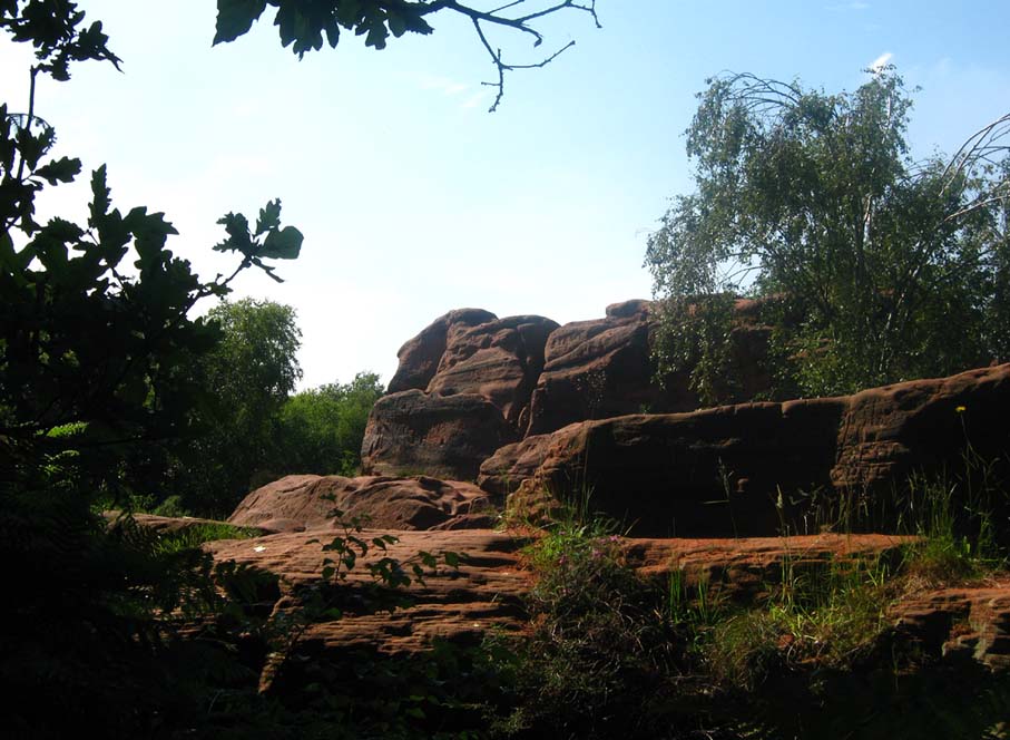
Thor’s Rock (after J.Picton)

On Thurstaston Common a 298 foot high hill has a large red sandstone outcrop, on the landward side, known as Thor’s Stone. One large rectangular block of stone that is 50 feet in length, 30 feet wide by 25 foot high has been eroded over thousands of years. Described by J.A. Picton in 1877 as “the Great Stone of Thor,” the village itself seemed to have gained its name from this prominent mass of rocks.  It was described first of all in the Domesday book, as Turstanetone, and both village and rocks have been written as variants on the original ever since.  The place-names writers Mills & Room (1998) ascribe the name to being a “farmstead or village of a man called Thorstein”; but it’s just as likely to derive from “a farmstead of/at Thor’s Stone.” (Harrison 1898)  As early landscape features were traditionally equated with animistic and mythic lore, the Viking god Thor is more probable than some unlikely chap called Thorstein.

More than 100 miles southeast of here, we find another Thor Stone in the village of Taston, showing similar megalithic etymology.

Folklore

Local folklore tells that the rock is named after the Norse god Thor – he who causes thunder and lightning.  Viking settlers from Thingwell apparently settled here in the 10th century AD and, according to legend, these settlers used the stone as a pagan altar with blood sacrifices taking place here.  A creation myth of the site tells that Thor tossed the large stone here in anger; and yet another says that the stone was raised here to commemorate the battle of Brunanburh in 937 AD.  In modern more times, Morris dancers meet here and enact their rites on Mayday mornings.

The outcrop has been eroded away over thousands of years by the weather, post glacial erosion and even quarrying, leaving strange shapes, features and projections in the soft sandstone. There is much recent graffiti to be seen all over the rock, especially on the summit and sides including one set of graffiti carved by Professor Taylor in 1879.  There used to be a “fairy well” near the stone but this disappeared long ago.  Children took flowers to the well to decorate it, while adults visited it to receive a cure for various ailments of the body.  At nearby Thurstaston Hall, Christina Hole (1937) reported there lived the ghost of a troubled woman.

References:

  1. Harrison, Henry, The Place-Names of Liverpool, Elliot Stock: London 1898.
  2. Hole, Christina, Traditions and Customs of Cheshire, Williams & Norgate: 1937.
  3. Mills, A.D. & Room, Adrian, A Dictionary of English Place-Names, Oxford University Press 1998.

© Ray Spencer, The Northern Antiquarian


Great Stone of Fourstones, Lowgill, North Yorkshire

Legendary Stone:  OS Grid Reference – SD 66972 66292

Also Known as:

  1. Big Stone
  2. Four Stones

Getting Here

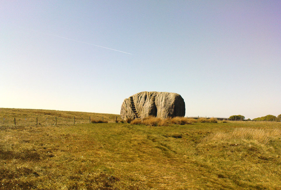
The Great Stone of Fourstones

From near the middle of the large village (or small town!) of High Bentham, go down Station Road, over the river — where the road becomes known as Thickrash Brow! — and keep going for about a mile.  The landscape opens up into the hills and there, on the left-hand side of the road, is a car-parking spot with a footpath taking you straight up to the large boulder a 100 yards on: that’s our Great Stone!  You can’t really miss it.

Archaeology & History

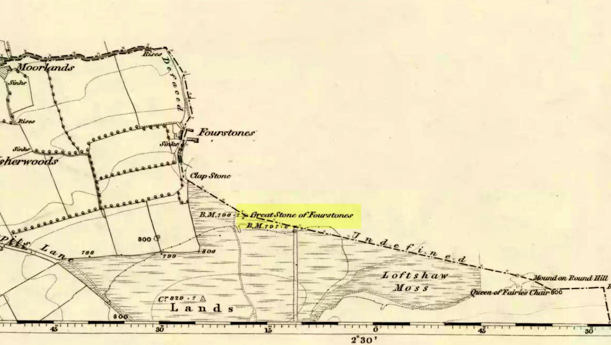
Great Stone on 1847 map

A meeting place of local tribes in more ancient days, the moorland plain upon which the Great Stone sits, beckons to a vast landscape on all quarters (north, south, east and west) calling the elders from their lands for annual rites and decisions to befit the health of the land and the people.  The stone rests on the ancient boundary of Yorkshire and Lancashire, just on the Yorkshire side, and was visited annually in more later centuries during the beating of the bounds, to define the edges of the local township.

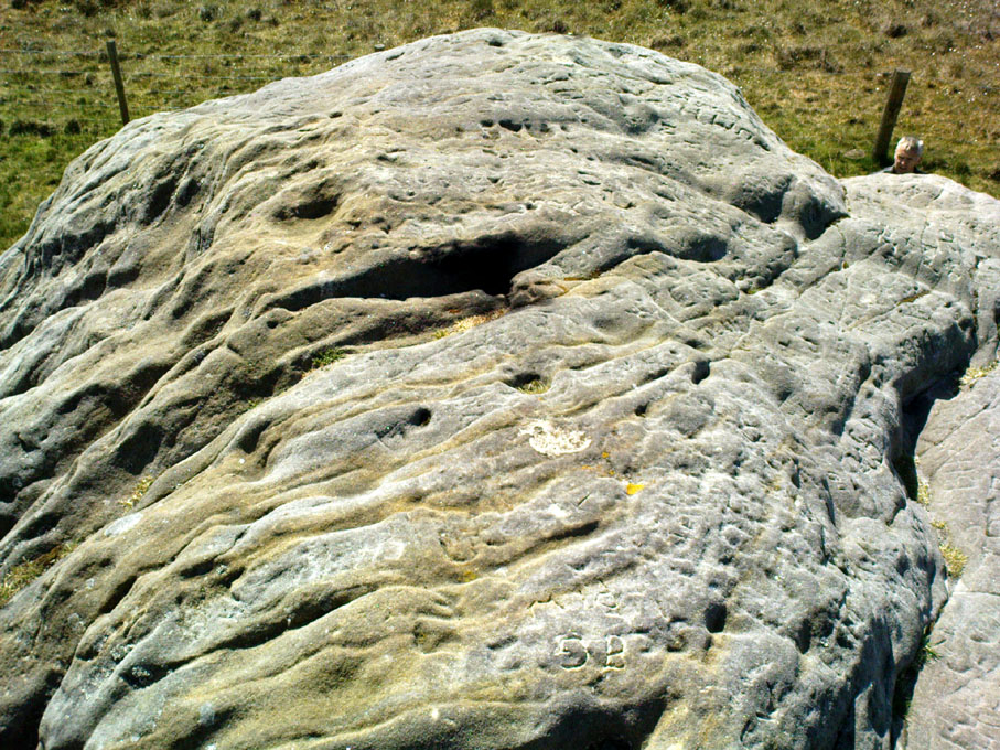
Graffiti & cup-marks on the top

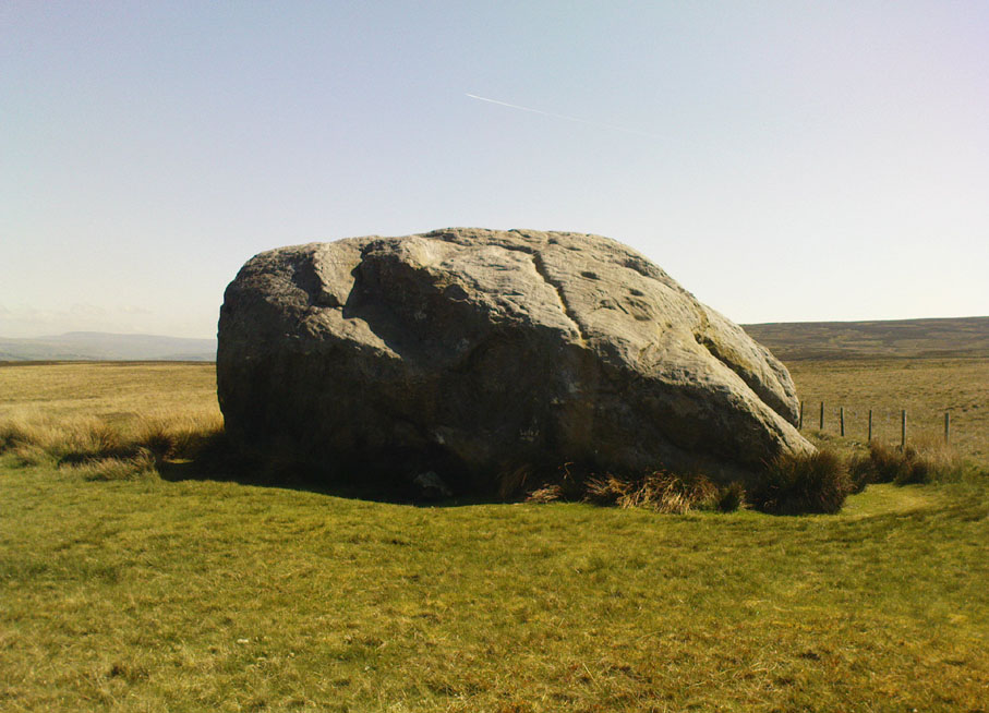
First described in a Yorkshire inquisition account from 1307, this Big Stone was visited by Harry Speight (1892) who described it as measuring 30 feet round and 12 feet high.  I came here for the first time in the 1980s when I was hitch-hiking into the Scottish mountains, but a good old “local” (from the Yorkshire side) took a detour to show me the place!  Once here, I climbed up the very worn “steps” which were carved into the side of the boulder several centuries back and it didn’t surprise me to find a number of cup-markings (no discernible rings) on its top surface.  When I came here again with Michala Potts and Paul Hornby yesterday, I couldn’t believe how many people had carved their names on top of the Great Stone in the intervening years — it’s almost covered in modern graffiti and the old cup-markings were much harder to see.  Taylor (1906) mentions them briefly in his holy wells survey, saying how,

“This great boulder is ascended on its eastern side by fourteen steps, and on the top are two circular holes about two inches deep and two inches in diameter.”

There used to be three others boulders very close to this one (hence its title), making a natural stone circle, but they were “broken up for sharpening scythes” a couple of hundred years back.  A much wider archaeological survey of this region is long overdue.

Folklore

Great Stone, looking east

Harry Speight (1892) told how the (original) Four Stones were the creation of our old friend the Devil, long ago, who dropped them in one his many megalithic travels across our land. The stones were also the meeting place of ancient councils, from the tribes either side of the Yorkshire-Lancashire border. Their presence here also had mythic relationship with the Queen of the Fairies Chair, about a mile southeast, along the same boundary line.

Weird how folklore changes. Whilst old Mr Speight told how the devil created the once great four stones that were here, many years later Jessica Lofthouse (1976) told how the three missing stones – which had been here “since the world began” – were actually taken from here by Old Nick. Carrying them over the land,

“His load he dropped on Casterton Fell, where the rocks he discarded, the Devil’s Apronful, are still lying around. He selected the most suitable, dressed them and carried them in panniers down to the (River) Lune”

— and built the legendary Devil’s Bridge at Kirkby Lonsdale – which itself has strange tales to tell.  Another creation myth about the Great Stone is told on the plaque near the stone, alongside the footpath, which tells:

“Legend has it that it is a small part of the debris hurled by the giant Finn McCool across the Irish Sea in a fit of anger.”

It’s very obvious that a lotta mythic landscape material has been neglected and overlooked around this site.  Something we need to remedy, if we can, in the coming years…

References:

  1. Lofthouse, J., North Country Folklore, Hale: London 1976.
  2. Speight, Harry, The Craven and Northwest Yorkshire Highlands, Elliott Stock: London 1892.
  3. Taylor, Henry, The Ancient Crosses and Holy Wells of Lancashire, Sherratt & Hughes: Manchester 1906.

© Paul Bennett, The Northern Antiquarian 


Robin Hood’s Bed, Blackstone Edge, Lancashire

Legendary Rocks: OS Grid Reference – SD 97204 16356

Getting Here

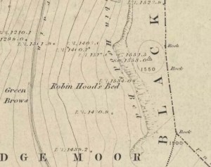
Robin Hoods Bed on 1851 map

Follow the same directions to get to the Aiggin Stone.  Once here, go over the stile by the fence opposite towards the great geological ridge less than half-a-mile south.  Head for the triangulation pillar right on the top of the ridge, and there, about 20 yards past it, higher-up than the triangulation pillar at the very top of Blackstone Edge, is Robin Hood’s legendary stone bed!

Archaeology & History

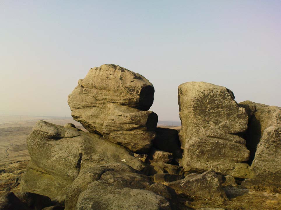
Robin Hoods Bed, looking north

There’s very little of archaeological interest known up here, save a mass of flints and scrapers that have been found scattering the moorland heights hereby, from the mesolithic period onwards.  But we have a relative lack of neolithic to Iron Age remains — officially anyhow!  A possible standing stone can be found a few hundred yards south, but there’s little else.

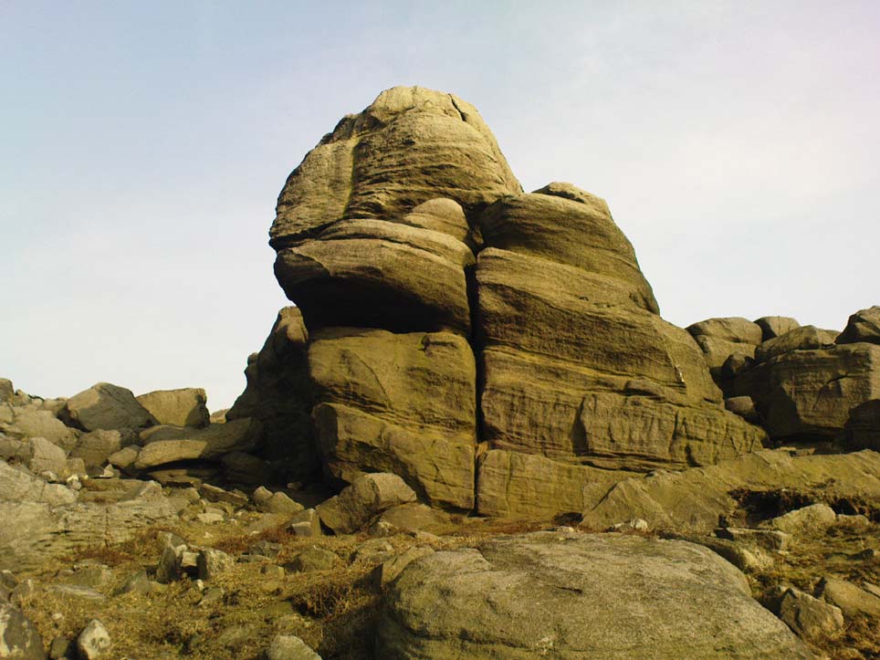
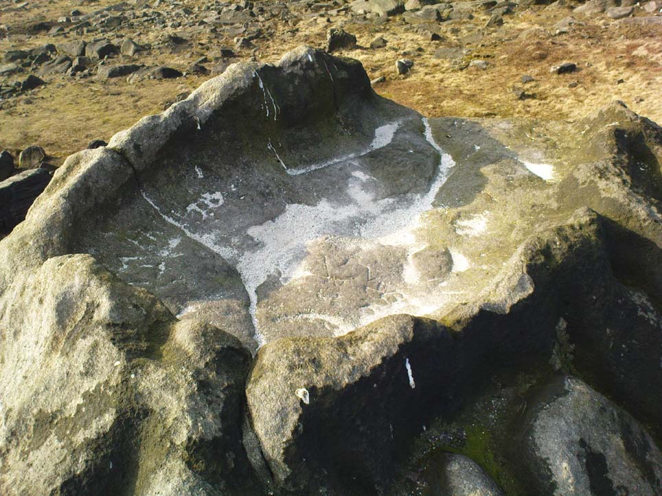
The rock that’s given its name to Robin Hood’s Bed overlooks the very edge of the ridge, detached from the main section, with a large and very curious nature-worn ‘bed’ on its very crown, more than 4 feet wide and about 7 feet long, into which one comfortably lays.  It was named in the boundary records of the township of Rishworth in 1836, where it describes other historical stones, saying:

“thence under Robin Hood’s Bed to a stone marked ‘W.S.G.S. 1742, 1770, 1792, and the following figures and letters, ‘1826 I.L.S.'”

Folklore

This enormous millstone grit boulder, sitting 1550 feet upon the high moors is, according to legend, a place where our famous legendary outlaw once slept.  Whilst sleeping here, some of his followers were said to have kept guard and looked over him.

Robin Hood’s Bed, from below

A rather odd piece of folklore recited by Jessica Lofthouse (1976) is that “no winds ever blow” at Robin Hood’s Bed, who then went on to tell of the time she visited the place.  Walking along the rocky ridge where the stone bed is found, the winds were such that “we had almost been blown over the edge,” until just a few hundred yards further when they eventually reached the fabled site, Nature granted them a sudden calmness unknown to all the high moorlands around, affirming the curious folklore.

The ceremonial stone ‘bed’

Robin Hood’s Bed itself was undeniably an important ceremonial site for both rites of passage and ritual magick to our indigenous ancestors.  The place screams of it!  It also seems very likely that the hero figure of Robin Hood replaced an earlier mythological character, akin to the fabled female creation deity, the cailleach, found commonly in more northern and Irish climes, whose echoes can still be found around our Pennine hills.  For we find that Robin Hood was said to have taken a large boulder from here and with a mighty heave threw it six miles across the landscape due west into the setting sun, where it eventually landed at Monstone Edge, near Rochdale!  Local people were so astounded at this feat that the stone was given the name of Robin Hood’s Quoit.

7ft tall natural standing stone

The old place-name authority Eilert Ekwall (1922) related the folklore that the giant ridge of Blackstone Edge “is said to refer to a boundary stone between Yorkshire and Lancashire.”  Which may be the curious upright standing stone, more than 7 feet tall, less than 50 yards NNE which gives a very distinct impression of having been deliberately stood upright, amidst this mass of loose geological droppings!  It would be helpful if there was a geologist in the house who could tell us decisively one way or the other…

Another etymological possibility that has been posited relates to the word ‘bed’ at this site.  Ordinarily it would be sensible to attach the word to the great stone ‘bed’ atop of the poised boulder.  But with the attached legends symptomatic of prehistoric monuments, it would not be improper to highlight that the old Welsh word ‘bedd‘ (a place-name element that is not uncommon in Lancashire) means, “a grave or tomb”.  And this site would be ideal for such an old prehistoric cairn…

References:

  1. Bennett, Paul, The Old Stones of Elmet, Capall Bann: Milverton 2001.
  2. Ekwall, E., The Place-Names of Lancashire, Manchester University Press 1922.
  3. Lofthouse, Jessica, North Country Folklore, Hale: London 1976.
  4. Smith, A.H., The Place-Names of the West Riding of Yorkshire – volume 3, Cambridge University Press 1961.

© Paul Bennett, The Northern Antiquarian


Two Lads, Withens Moor, West Yorkshire

Cairns: OS Grid Reference – SD 98394 22116

Getting Here

Best way here is, from Mytholmroyd go up the Cragg Vale road for a coupla miles, then turn right and heading down, then up, towards Withens Clough reservoir.  Once there, walk onto the moor to your left (south) until you’re on the ridge above you.  Keep walking until y’ see the rocky cairn-like creatures stood in isolation on a flat moorland plain.

Archaeology & History

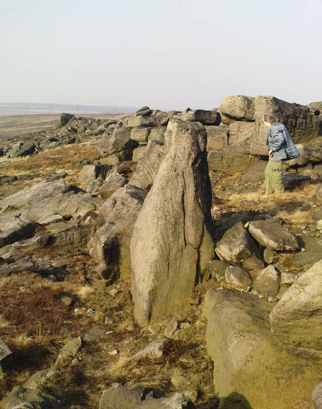
Two Lads – on a dark, rainy, windy day

Truly weird spot this one, but I love it! Seemingly miles from anywhere, it’s one helluva walk to most folk, but utterly worthwhile when your arrive.   On a clear day you can see for miles and the landscape is adorable!  On a cloudy rainy day, the feel of the place changes if you take care to stay with the site, saturated, meditating (as no other people ever turn up when She’s like that – so you and the place get the best from each other!).

The site comprises of two boulders, each crowned with a cairn of stones.  The westernmost one of the two (SD 98392 22111) is intriguing as it has, carved upon the rock beneath the stone cairn on the northwestern edge of the stone, what looks like a singular cup-marking, plus a large water-worn bowl on its northern edge, and a very distinct deeply-cut cross-base, several inches deep, near the northeastern corner of the rock.  This cross-base seems slightly more rectangular in form than square; although the large covering of stones makes an accurate ascription difficult.  If this cross-base and cup-markings are authentic, we would have here a clear example of the christianization of a previously heathen site.

A cursory examination of the easternmost of the Two Lads (SD 98397 22117) doesn’t indicate any artificial workings on the rock surface.

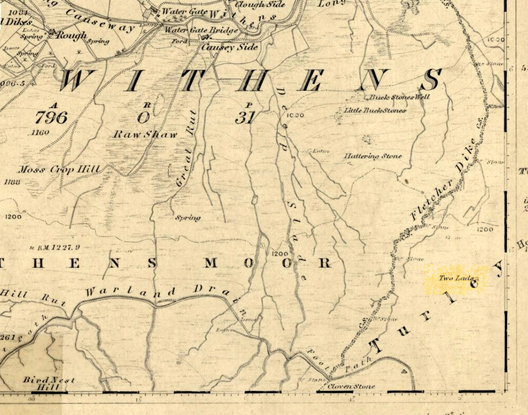
Two Lads on 1853 OS-map

Although the two ‘cairns’ on top of these two rocks are not prehistoric in nature, about 20 yards behind the Two Lads (south) may once have been the severely denuded remains of a once large prehistoric cairn.  Although the position in the landscape is perfect for such a construction, this is somewhat tentative, it’s gotta be said!  Further examinations are obviously necessary here.

The studious A.H. Smith (1961-63) believes that a field-name record from 1624, describing some ‘Lad Stones’ in the parish of Heptonstall relates to this site.  We know with certainty however, that this site was first illustrated on Greenwood’s 1771 map of Yorkshire, then highlighted on more recent 19th century Ordnance Survey maps as ‘cairns.’

Folklore

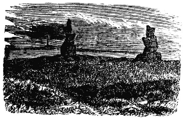
Drawing of the Lads in 1877

The creation myth behind this place is that two lads were walking over the moor in midwinter and got caught in a blizzard. Losing all sense of visibility they tried to shelter from the wind and snow by hiding behind these rocks, but perished. Sometime later their bodies were found and the curious “cairn” of rocks were mounted onto the boulders to mark where they’d died.  This is a folktale we find at many other old stone remains on the hilltops of northern England and Scotland.

The Two Lads seems to be very close to a midwinter alignment (or izzit a lunar standstill line?), linking it with the huge Rudstoop Standing Stone and, eventually, Robin Hood’s Penny Stone on Midgley Moor – which might be the root of the folktale. (i.e. midwinter, snow, death)  Any archaeoastronomy buffs out there wanna check this one out?  Then we can confirm or dismiss it.

References:

  1. Anonymous, “The ‘Two Lads’, Withens Moor,” in Todmorden & Hebden Bridge Historical Almanack, T. Dawson: Todmorden 1877.
  2. Bennett, Paul, The Old Stones of Elmet, Capall Bann: Milverton 2001.
  3. Smith, A.H., The Place-Names of the West Riding of Yorkshire, Cambridge University Press 1961-63.

© Paul Bennett, The Northern Antiquarian 


Devil’s Blue Stane, Crail, Fife

Legendary Rock:  OS Grid Reference – NO 614 079

Also Known as:

  1. Devil’s Blue Stone

Folklore

This curious rounded boulder sitting outside the parish church was described by Alexander Polson in his survey of witch-lore.  He told us that “when the old church was being built, the devil, as a mason out of work, came here and was employed.”  But it wasn’t long before a local christian discovered his disguise and, uttering some magickal biblical words, the devil became furious.

“Immediately he heard this there was a clap of thunder and the fiend flew away to the Isle of May,” about five miles away to the south. “Here in his anger he seized a huge rock and hurled it at the church. It fell quite near, did no harm, and a part of it lay at the church’s door, with the mark of the devil’s thumb on it.”

On the north end of the Isle of May are the Altar Stanes (NT 652 997), thought to have been where the devil stood (close to the holy well of St. Andrew [NT 652 994]) and threw this stone at Crail several miles north.  In pre-christian mythic terms, north is the direction or airt of greatest symbolic darkness.  A variation on the creation myth for this stone tells that when it was thrown from the island, one half of it split off and it fell by the coast in Balcombie, Fife.

References:

  1. Polson, Alexander, Scottish Witchcraft Lore, W. Alexander: Inverness 1932.

© Paul Bennett, The Northern Antiquarian


Apronful of Stones, Bradfield, South Yorkshire

Cairn:  OS Grid Reference – SK 2448 9459

Archaeology & History

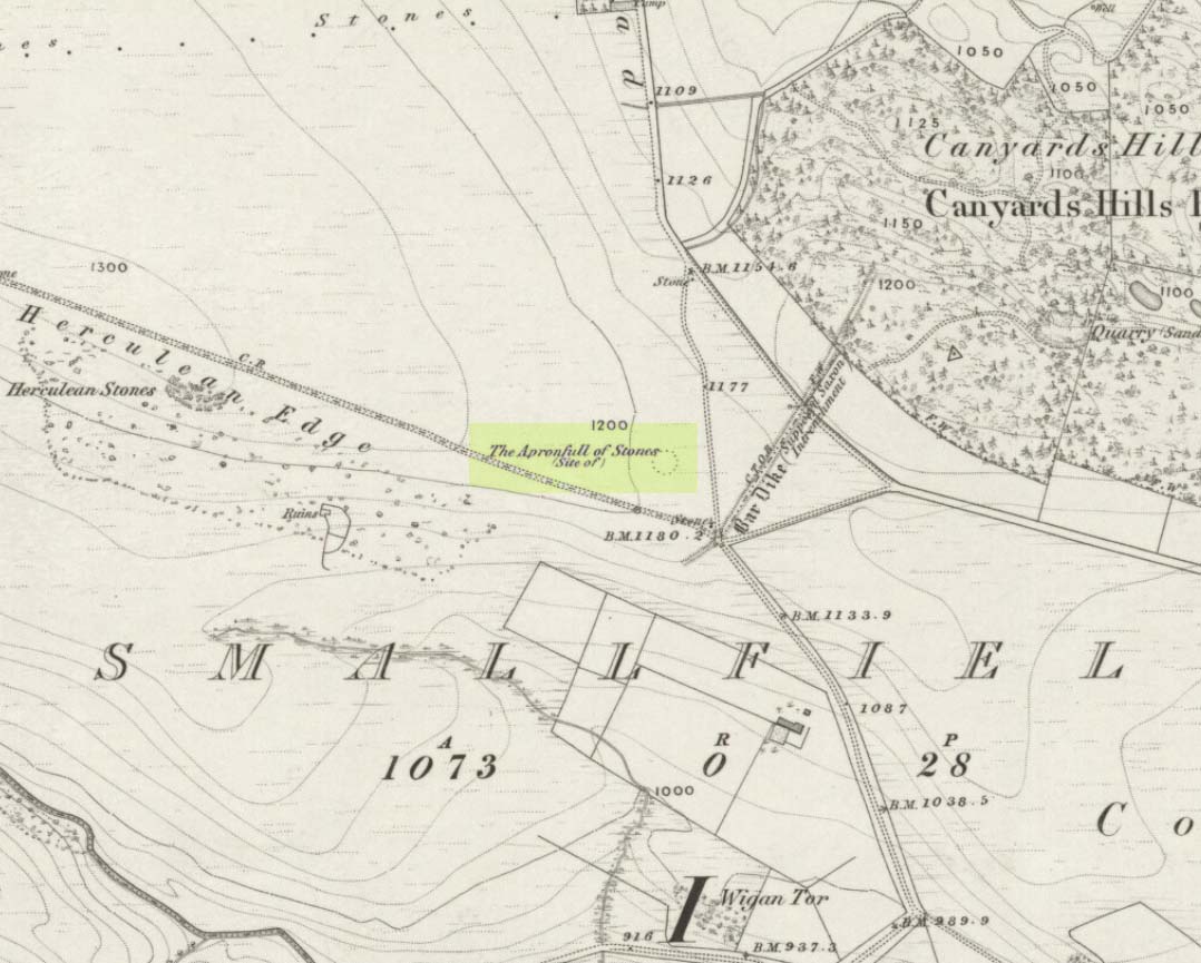
Apronful of Stones on 1855 map

This was another example of the many giant cairns that scatter the upland moors on the Pennines, but much of it has been destroyed, with some halfwits in recent years cutting a track right through whatever remains there might have been!  It was first described in John Watson’s (1776) essay on the local antiquities of Bradfield and district where, in relative conjunction with the curious Bar Dike, he told that “this is not the only curiosity on this common.”  He continued: “there is on one part of it a large carnedde, called by the country people the Apron-full of Stones”, where he conjectured there laid a British tribal chief after he’d been slaughtered by the Romans.  This might have been the folklore of the place, but we know such places were thousands of years earlier than the Romans.

It was later described in Joseph Hunter’s Hallamshire (1819) as a giant barrow, or ‘vast carnedde’, even then in the past tense; but some recent investigation here found “a few small stones and some lumpy turf which looked to be covering a few clumped stones.”  The site requires further investigation by local people to assess the state of damage inflicted on this once great tomb.

Folklore

Said to have been the site of a local battle in ancient times; this is also another site which, as A.H. Smith (1961) tells, “is explained in folklore by tales of the devil undertaking some major building project and tripping up, only to deposit his apronful of stones” here.  Does anyone out there have any more info on this place?

References:

  1. Hunter, Joseph, Hallamshire: The History and Topography of the Parish of Sheffield in the County of York, Lackington: London 1819.
  2. Smith, A.H., The Place-Names of the West Riding of Yorkshire, Cambridge University Press 1961-63.
  3. Watson, John, “An Account of some Hitherto Undescribed Remains of Antiquity”, in Archaeologia, volume 5, 1776.

© Paul Bennett, The Northern Antiquarian