Brink Ends Cairn, Dovestones Moor, Wycoller, Lancashire

Cairn:  OS Grid Reference – SD 96138 42296

Getting Here

Best way to get up here is to start from the old hall and haunted bridge at Wycoller. From here walk upstream, on the footpath on the south side. It wibbles about following the waters for a half-mile until the moors open up when you reach an old stile, past which is another bridge over the stream. Walk past this (keep on the same side) for another 50 yards, then walk up the hillside where, if the vegetation is low, you can just see a decent-sized collection of rocks. This is the old cairn.

Archaeology & History

I don’t think the site is in the Lancashire archaeological register, but it’s described in John Bentley’s fine local history work, Portrait of Wycoller from 1975. He told that,

“a suspected Bronze Age burial mound at Brink Ends in Wycoller was excavated by Stanley Cookson in 1971 and 1972. Although no interment was discovered, the remains of a fire was found in the centre of the mound with half-burnt twigs and coal.”
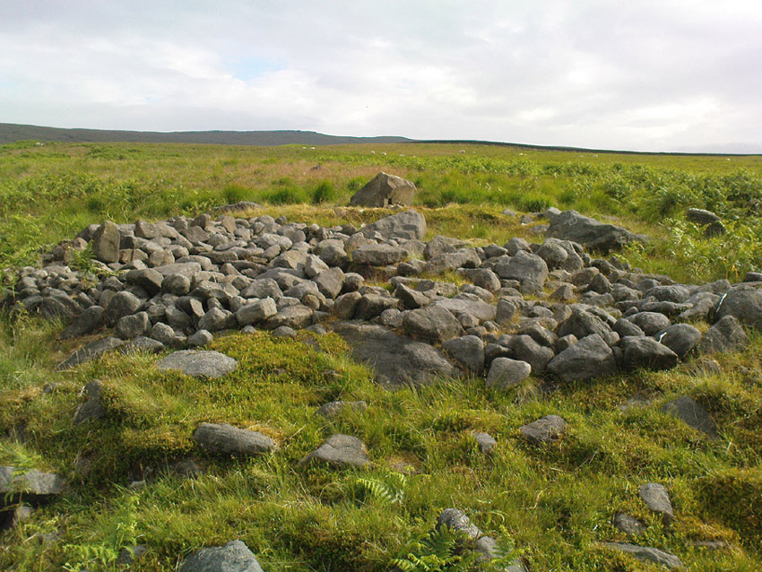
Brink Ends Cairn, Wycoller

It’s not unlike some of the giant cairns on Ilkley Moor and elsewhere, though not as big, nor as high, being only about 22-24 feet across. Some of the stones have evidently been taken for use in the local walling, and the ‘cairn’ is in a pretty abject state. It’s a bittova odd spot to be honest. Not 100% sure what to make of it – though flints, arrowheads and similar implements have been found on the moors here close by. Bentley (1975) also told how “Stanley Cookson had strong suspicions that an Iron Age settlement existed in this area, but only time and further exploration will tell.” A sentiment I tend to agree with. And on our first and only visit here — during one helluvan awesome downpour all day — what seemed like an Iron Age hut circle was noted a few hundred yards to the south; though we got so saturated that day that we decided to turn for home soon after looking at this cairn.

Cookson and Hindle (1985) later described this site as a “middle Bronze Age burial cairn of 1400 to 900 BC, adding:

“The 34ft diameter inner circle was excavated during 1956-58 disclosing flints, a hearth with an abundance of charcoal, and four pieces of coal on a round, heavily burnt stone.”

More visits to these moors to check for other archaeological sites are needed in the near future to see what else might be on these unexplored moors.

References:

  1. Bentley, John, Portrait of Wycoller, Nelson Local History Society 1975.
  2. Cookson, Stanley & Hindle, Herbert, Wycoller Country Park, H.Hindle: Colne 1985.

© Paul Bennett, The Northern Antiquarian

Maiden or Tailor’s Cross, Foulridge, Lancashire

Cross:  OS Grid Reference – SD 890 423

Getting Here

Not hard to locate.  From Colne head up to Foulridge via the skipton Road and as you get to the middle of the town ask find the cenotaph just off the main road.

Archaeology & History

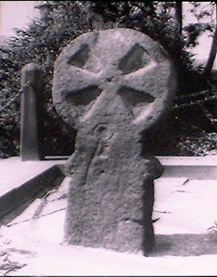
The Maiden or Tailor's Cross, Foulridge
The Maiden or Tailor’s Cross, Foulridge

The Maiden or Tailor’s Cross has at least two old traditions attached to the site, which local historians think originate from the Civil War period.  The first tells of a Royalist tailor who – sensibly – refused to make uniforms for Oliver Cromwell’s traitorous soldiers; but as a result, the poor tailor was shot by the troops and the remains of his body were placed over the old stone cross as a warning to his fellow workers.  If you look closely on the cross you can see a crude carving of what looks like a pair of scissors or shears, and it is this carved symbol which has seemingly given birth to the legend of the tailor.  There may, of course, be some truth in the story; but the carved shears is more likely an old Masonic carving – though quite who did it and when isn’t known.

The other legend is the one which apparently gave birth to the title of the Maiden’s Cross.  It tells of a certain Margaret Burnard whose husband went into battle (on the side of the treacherous Cromwell), but who agreed before he set out that she should wait for him for to return by the side of the old cross; and this she did each and every day, waiting for her husband, Robert, to come back from the Civil War.  But he was one of the many who died in the Battle of Marston Moor.  However, Margaret refused to accept his death and returned to the cross each evening to their agreed meeting place.  The story goes that Margaret herself herself was eventually killed by Royalist soldiers – and her body was buried at the cross where she had so often waited in vain.

It seems likely that this old cross originally replaced an old ‘heathen’ site in Foulridge.  Several such spots were known here, though virtually nothing now remains.  But notices of these sites will appear on TNA in the near future.

References:

  1. Oldland, F., The Story of Foulridge, PHCL: Pendle 1990.

© Paul Bennett, The Northern Antiquarian


Burwains, Foulridge, Lancashire

Cairn (destroyed):  OS Grid Reference – SD 888 421

Archaeology & History

Burwains on the 1848 map

The place-name burwain is an early Old English word meaning “a cairn or tumulus”.  It has variants such as borrans, borwen and borwans.  In the developing survey by Parsons & Styles (2000), other linguistic examples are given, all of which point to the same thing, i.e., a prehistoric burial of one form or another.  Also, in 19th century northern English dialect, Wright (1898) told that borrans is “a cairn, a heap of loose stones”—which is what used to exist hereby.

The fact that there is a place-name telling of its existence implies that it was a cairn of some size, but sadly all remains of it have long since gone.  All that we’ve got left is the name of Burwains house on the early Ordnance Survey maps.  Built on a hilltop rise, which is a common construction spot for such sites up and down the country, it’s possible that the cairn was destroyed when the Foulridge Lower Reservoir was built in 1793, with the mass of stone used in its construction (the reservoir also kept the name of Burwains lake for sometime).

References:

  1. Clayton, John A., Valley of the Drawn Sword, Barrowford Press 2006.
  2. Parsons, D.N. & Styles, T., Vocabulary of English Place-Names – volume 2, EPNS: Nottingham 2000.
  3. Smith, A.H., English Place-Name Elements – volume 1, Cambridge University Press 1954.
  4. Wright, Joseph, English Dialect Dictionary – volume 1, Henry Frowde: London 1898.

© Paul BennettThe Northern Antiquarian

Standing Stone, Foulridge, Lancashire

Standing Stone:  OS grid reference – SD 8803 4316

Also Known as:

  1. Lark Hill Stone
Possible Standing Stone in walling close to Standing Stone Road crossroads
‘Standing Stone Road’ monolith

Getting Here

From Foulridge go west up the long windy road (B6251) till you hit the old crossroads near the top.  Turn right and go on till you hit the modernised farmhouse on your right, where you’ll notice a modern upright stone in the entrance.  You need to go back about 70 yards and you’ll see this old stone in the wall.

Archaeology & History

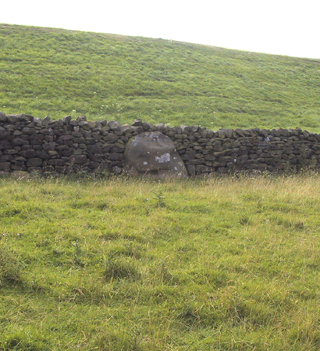
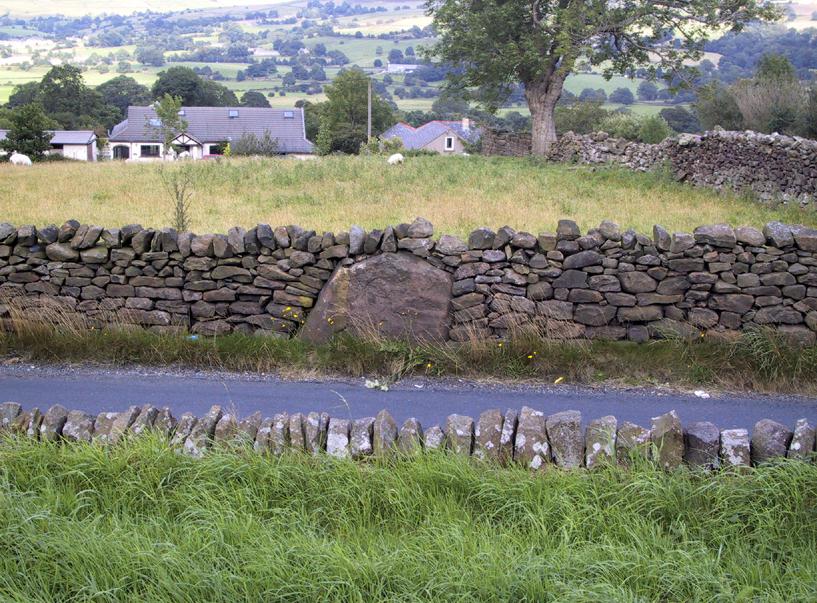
"Standing Stone Road' stone!
“Standing Stone Road’ stone!

Less than a mile northwest of Foulridge along the southern stretch of the Whitemoor Reservoir, on the northern outskirts of Colne, we find the intriguingly-named ‘Standing Stone Lane’ — which seems to indicate that at some time in the not-too-distant past, an old monolith could be found hereabouts.  The old maps show the boundary line turning at right angles just near the crossroads, which is where I thought we might locate some remains of an old standing stone.  But it wasn’t to be.  Instead, we need to travel about 100 yards west along the single-track road, just below the reservoir — and there, in the walling, plain for all to see, is what may be the old standing stone which gave the road its name.  I found this site in early July 2008, and although we can’t be 100% certain, it’s not too bad a good contender as the monolith which first gave the road its name.  Does anyone know anymore about it?

More probably though (and this is what ‘feels’ right): the original stone which gave the road its name was much bigger than this little thing, but was probably destroyed when the reservoir here was constructed.  How much d’ y’ wanna bet!?

© Paul Bennett, The Northern Antiquarian