Whitehillocks Farm, Glen Clova, Angus

Stone Circle:  OS Grid Reference – NO 37095 66958
Getting Here

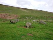
Whitehillock stone circle

From Kirriemuir town centre up the B956 Kinnordy Road, turn left where it goes along the B955 road for several miles towards Cortachy.  Keep going on the B955 for a few more miles into the quiet beauty of Glen Clova.  A third-of-a-mile (0.5km) past Glenarm house, the road splits.  Take the right-hand road, which goes down and across the river below.  Keep on this road for just over a mile (1.8km) and as you approach the large farmhouse of Whitehillock—about 200 yards before it—keep your eyes very well focused in the field on your left and you’ll see a mass of large fallen stones right up against the other side of the fence.  You’ve arrived.

Archaeology & History
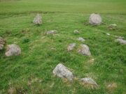
Internal “cairn”

A half-mile north of Clach na Brain, or the Stone of the Raven (a stone that was traditionally used to beat woven cloth after it had been washed), we come across this ruined stone circle, which has seen better days.  Not shown on any of the early OS-maps, nor found in the standard megalithic catalogues (Barnatt 1989; Burl 2000), its existence seems to have been logged for the first time by some of the Royal Commission doods in 1999, but of late its veracity as a prehistoric site has been questioned as the local farmer alleged it to have been built by his father sometime in the 20th century.  It might have been – but if he did, he made a bloody bad job of it!  The site doesn’t have that “new” look about it and, unless someone told you that this was a stone circle, you wouldn’t give it a second look!  That aside…

The stones have been placed around the edge of a small rise in the land, within which is a scatter of small and reasonably large stones that give the impression of a cairn at its centre.  All but one of the stones (the eastern one) is still standing and measures about 3 feet in height.  The rest are either laid down or near to collapse and measure between four and six feet in length.  Without an excavation of the site, we cannot be certain of its age, but the official records still have it listed as a stone circle.  We await further examination…

References:

  1. Dorward, David, The Glens of Angus, Pinkfoor Press: Forfar 2001.

© Paul BennettThe Northern Antiquarian

Dun Mor, Glen Clova, Angus

Hillfort:  OS Grid Reference – NO 2900 7600

Getting Here

Crag of Dun Mor, centre-right

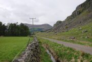
From Kirriemuir town centre up the B956 Kinnordy Road, turn left where it goes along the B955 road for several miles towards Cortachy.  Keep going on the B955 for a few more miles into Glen Clova, past the Caddam stone and eventually, after going over the bridge into Clova village, you turn left and go up towards the mountains.  Nearly 3 miles along you see the very conspicuous and impressive rising crag, like a small volcano on the right-hand side of the road, which is Dun Mor.  Walk up the steep climb round to the back of it – and you’re in the middle of the old ruins…

Archaeology & History

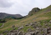
Highlighted on the 1865 OS map of the region, Dun Mor is Gaelic for a “large or great fort” – and such it is!  Those of you with a nose for these sorts o’ things will no doubt take to the remains pretty quickly.  Its position in the landscape is a bit of a gem!  On its north-side— invisible to anyone in the glen below—an overgrown arc of walling some 3 feet high and about 70 yards long bends towards the crag of rocks on each side, with a notable “dip” or entrance about 8 feet wide in the middle of it.  The walling itself averages about 4 yards wide all along its arc.

The crag of Dun Mor

It’s quite impressive once you get a good feel of the place and envisage it as it once was.  The sheltered fortress within the rise of Nature’s crags is about 100 yards across and would be ample space for several families to live in when it was first built, in those mythic times of so so long ago.  It was probably constructed in the Iron Age, although several ruined rectangular stone structures inside it are thought to be mediaeval shelters; and even in those more recent times, the people here would have regularly heard the howl of the wolves, whose names are kept in the hills above as reminders of a world not too long past….

© Paul BennettThe Northern Antiquarian

Caddam, Clova, Angus

Standing Stone:  OS Grid Reference – NO 33546 72144

Getting Here

Caddam stone, looking E

The only real way to get here is via Kirriemuir.  Head north to the hamlet of Cortachy and past it, as you enter Glen Clova, where the road splits make sure you bear to the left-hand (western) side.  Nearly 5½ miles along, keep your eyes peeled on your right where you can’t really miss it.  The stone’s less than 100 yards into the field.  …It may perhaps be a bit easier if you take the eastern road of the glen all the way to Clova village.  Turn right from there, over the small river bridge and as it curves to go back down the glen, a half-mile along you pass Caddam house.  Keep going for another 500 yards and you’ll notice it in the field.

Archaeology & History

Stone and its hut circle

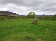
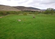
Not to be confused with the ruined stone circle of the same name 10 miles to the south, this small standing stone—only some three feet in height—is at the eastern edge of a small overgrown hut circle measuring some 3 yards by 4 yards across.  You can just make out the overgrown low walling in the second photo (right).  The stone probably had some architectural relationship with the hut circle, but without an excavation we can’t know for certain what that relationship might have been.  A settlement of much larger hut circles can be found on the other side of the river, near Rottal, two miles southeast of here.

© Paul BennettThe Northern Antiquarian