Bàrr a’ Chuirn, Kilmartin, Argyll

Cairn:  OS Grid References – NR 8122 9782

Also Known as:

  1. Canmore ID 39465
  2. Lady’s Seat Cairn

Getting Here

Many ways to get here, but you’ve gotta amble off-path through the woods to eventually find it — but it’s not difficult. From Kilmartin village head to Slockavullin and walk up the winding track which takes you towards the Ballygowan cup-and-ring stones, but follow it into the woods instead. The OS-map’s gonna be your best guide here. I first visited this spot from the south and ambled about, aimlessly at times for several hours, after I’d first been to the great ruined mansion of Poltalloch. Well worth checking out if you enjoy finding allsorts!

Archaeology & History

The old tomb is actually a few hundred yards beneath the small rocky summit of Barr a’ Chuirn, with the overgrowth of the woods imposing itself upon it. The Scottish Royal Commission report (1988) told that there was a large seat built here in the 19th century called the Lady’s Seat, and actually set up on the cairn itself so giving groovy views all round to those who came here. The Seat was made from large slabs of stone, which may originally have come from the old tomb.  An excavation here in the mid-19th century,

“found the remains of two cists and some burnt bones, with a ‘skeleton of later date, between the two cists, but probably put there by the men who destroyed the cairn.’ In 1929 Craw re-examined the site and found that the central cist had chambered and grooved slabs. This cist is aligned ENE and WSW, and the E end-slab is now missing; the cist measured about 1m by 0.5m and about 0.3m in depth internally. The northern side-slab is grooved at the west end.”

References:

  1. Royal Commission on the Ancient & Historical Monuments of Scotland, Argyll: volume 6 – Mid-Argyll and Cowal, HMSO: Edinburgh 1988.

© Paul Bennett, The Northern Antiquarian


Dunblane Cathedral, Stirlingshire

Cists: OS Grid Reference – NN 7811 0141

Archaeology & History

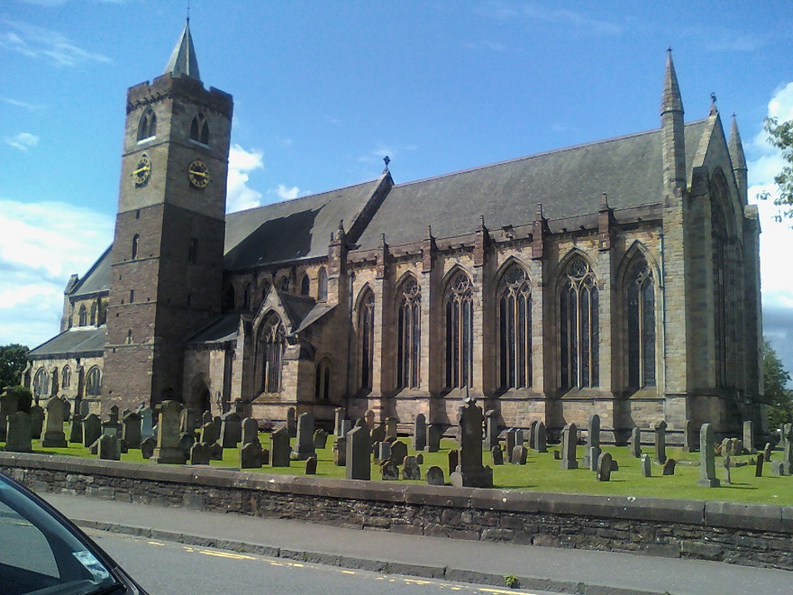
Dunblane Cathedral

Although this great and legendary cathedral is today a christian centre, it seems that the site had been deemed as sacred by a much earlier, indigenous culture — though on a scale much more humbling than the grand edifice we see standing here today!  For in the northwest corner of the church grounds in 1928, a small burial cist was located.  Years later, on October 2, 1975, following work here by the North of Scotland Hydro-electric Board to uncover the main supply “in an area adjacent to the north wall of the Lady Chapel,” they found a slab of stone which, when they lifted it up, covered what appeared to be a burial cist.  Messrs Gordon & Gourlay (1976) narrated:

“The stone slab which the workmen had removed proved to be the western section of a larger slab which at some period had been fractured and the eastern section lost.  As the interior of the cist was filled with soil similar to that surrounding it and containing a considerable quantity of dispersed human bone fragments, it was suggested that the eastern section of the covering slab had been lost when the drainage and/or electricity services were being installed.  The upper surface of the slabs western section was c.35cms below ground surface.  The dispersed bones in the cist were at first considered intrusive — possibly from old burials when the public services were installed — and an undisturbed deposition of bones at the base of the cist seemed to confirm this.  However, an examination of the bones by Dr A. Young…and Dr D. Lunt…showed that the deposit contained remains of two adults and one child and that many of the dispersed bones could be matched with those in the undisturbed group.  In fact, the deposition suggested a re-use of the cist.

“The cist measured internally 1.20m by 0.44m by 0.28m.  It lay 8.4m east of the door of the Lady Chapel and 1.44m from the wall of the same.  The cist was constructed from ten irregularly-shaped sandstone slabs, with one fractured slab forming the floor.  On the south side, two smaller slabs had been placed on the inside of the wall to support the covering slab which only just fitted the cist, and to give extra strength to the wall since they overlapped the vertical joins of the three slabs of the south wall.  The north wall slanted to meet the west-end slab 12cm from its edge, giving the cist a coffin-like appearance.  The north wall was still vertical; the narrowing was probably intentional as the covering slab was only 33cm wide at that point and the bones lay apparently undisturbed, parallel to the north and south walls.  It proved impossible to examine the old ground surface because of the public installations, but it did appear that the ground sloped to the west as the cist certainly did.”

Although the remains found here were not dated, it was initially thought that the cist may have been made around the period when the Lady Chapel was erected around 1250 AD.

“However, Mr J. Stevenson of the Royal Commission for Ancient and Historical Monuments pointed out that the dimensions and construction of the cist accord well with cists of known prehistoric dates in the area; the cist (therefore) would seem to be placed early in the sequences of cist development, assuming it to be prehistoric.”

References:

  1. Cockburn, James H., The Celtic Church in Dunblane, Society of Friends of Dunblane Cathedral: Dunblane 1954.
  2. Gordon, Alistair R. & Gourlay, Robert B., “A Cist Burial, Dunblane Cathedral, Perthshire,” in Glasgow Archaeological Society Bulletin, No.2, 1976.

© Paul Bennett, The Northern Antiquarian

Higher Town Bay, St. Martin’s, Scilly Isles

Cist:  OS Grid Reference – SV 934 153

Also Known as:

  1. Monument no.303793

Archaeology & History

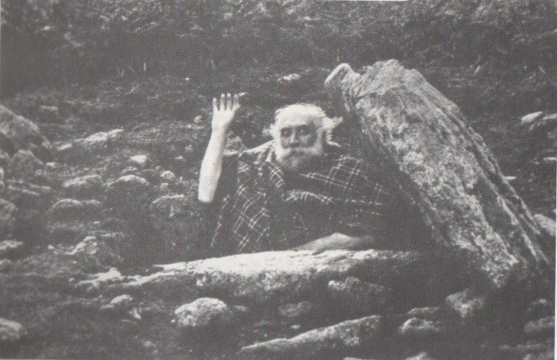
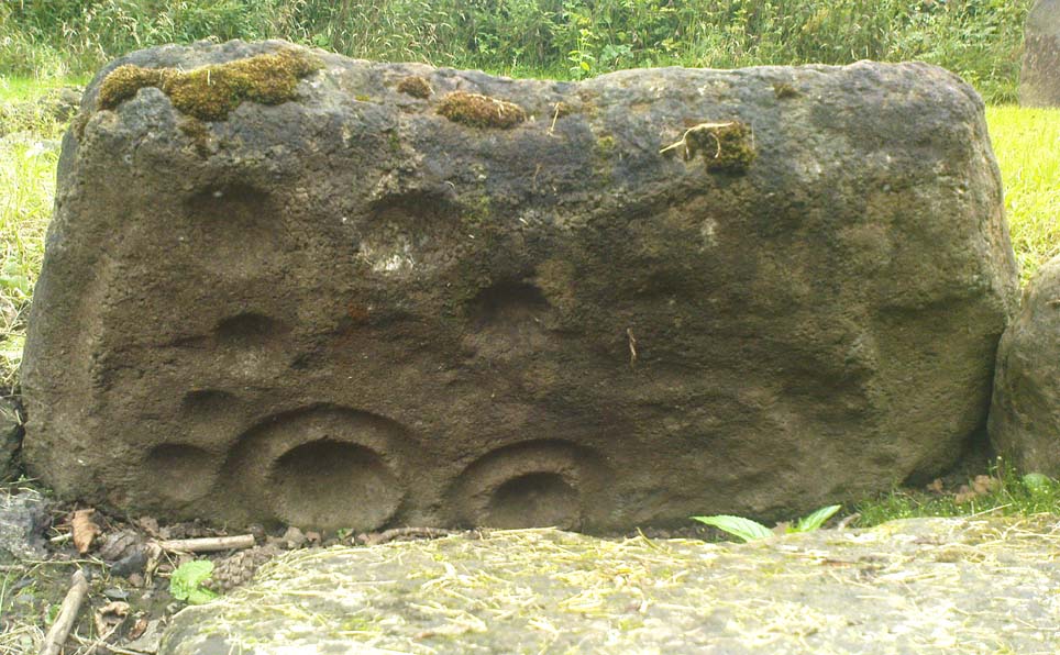
The remains of this old tomb were first noted by Mr Alexander Gibson, whose photograph of the site is here reproduced.  Thought by Paul Ashbee (1974) to date from between the Iron Age and Romano-British period, the site was first described in O.G.S. Crawford’s (1928) essay in Antiquity journal.  It was just one of several such sites in relative proximity to each other and which, due to them being so close to the sea, have been all-but washed over by Nature’s advance.  Mr Crawford told that this,

“cist on the shore…is on St. Martin’s, between Crethus Hill and English Island Point, about 20 yards from the edge of the rushy bank, and at approximately high water-mark.  It is oriented north and south and is 3 feet long by 2 (feet) wide.  It has now no capstone.  The cist when found was full of coarse, gravelly sand and stones, which were cleared out; amongst this were parts of leg bones (the joint-ends missing) and smaller fragments; then a piece of a human jaw, without teeth, and finally the skull.  The facial portion was missing.  The skull fell to pieces on removal but it and all the other pieces were preserved and the cist filled in again.”

In the same article, Crawford notes that,

“nearby, to the west, were two or three other cists of the same type, and many years ago yet others were observed, both round this bay and at Lawrence’s, to the west of Crethus Hill.”

References:

  1. Ashbee, Paul, Ancient Scilly, David & Charles: Newton Abbot 1974.
  2. Crawford, O.G.S., “Stone Cists,” in Antiquity Journal, volume 2, no.8, December 1928.
  3. Weatherhill, Craig, Cornovia, Halsgrove 2009.

Links:

  1. Pastscape Notes on Monument no.303793

© Paul Bennett, The Northern Antiquarian

Town Lane, St. Mary’s, Scilly Isles

Cist:  OS Grid Reference – SV 9157 1175

Also Known as:

  1. Monument no.304025

Archaeology & History

Town Lane cist

In Crawford’s (1928) article on stone-lined burials, or cists, this was one site that he described from the Scilly Isles, though little can be seen of the site nowadays as a road was built on top of it.  It was first discovered by a Mr Alexander Gibson (who took the photo, here reproduced) and was described as “the cist in the road”, due to its position in the middle of the old lane.  A number of flints and other Crawford told that it,

“is in Town Lane, about midway between Holy Vale and the Marconi Station, St. Mary’s (lat. 49° 55′ 35.2″ N, long. 6° 17′ 52.5″ W).  Nothing is known about it, but presumably it was found when the road was made by Mr Augustus Smith more than 80 years ago.  It measures about 3 feet in length by 2 feet in width, and is oriented approximately NE-SW.  There is said to have been another near it, but Mr Gibson has searched without success.”

In Paul Ashbee’s (1974) fine archaeological survey, he describes there being several other small prehistoric burials found in fields a little further down the same lane.

References:

  1. Ashbee, Paul, Ancient Scilly, David & Charles: Newton Abbot 1974.
  2. Crawford, O.G.S., “Stone Cists,” in Antiquity Journal, volume 2, no.8, December 1928.

© Paul Bennett, The Northern Antiquarian

Cock Hill, Wadsworth Moor, West Yorkshire

Cist:  OS Grid Reference – SE 009 275

Also Known as:

  1. Mount Skip tomb

Getting Here

OK – OK – stop laughing at the title!  If you wanna check the hill out for yourselves, get to Hebden Bridge, then go up the long and very steep Birchcliffe Road.  Keep going all the way to the very top (a couple of miles uphill).  When you reach here, the building in front of you was the Mount Skip pub.  From here, walk up over the golf course and you’ll hit the disused quarries on the moor edge.

Archaeology & History

The grid reference given above is an approximation.  The tomb (long gone) was within 100 yards of the coordinate.  But don’t let that put you off having a good bimble around the moors here, cos there are several sites to see.

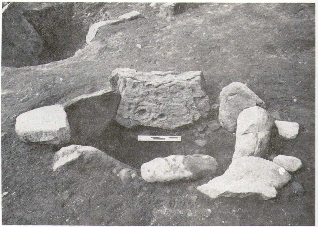
This long-lost burial was located in May, 1897, when quarrying operations were being undertaken behind the Mount Skip Inn, on the edge of Wadsworth Moor.  Ling Roth (1906) told that

“the first indications were the rolling down of pieces of urns which the delvers called flower pots.  Then in digging a hole to fix the leg of a crane, human bones were discovered.”

Geoffrey Watson (1952) later echoing Mr Roth’s comments wrote that,

“a grave containing a skeleton was discovered at a quarry about Mount Skip Inn.  The grave was about 6ft long, 14-18 in wide, and about 2ft deep.  The bones, which were exceedingly brittle, crumbled on handling.  Within the grave, and mainly at the ends, there appeared to be about 6 in of mixed charred wood and bones.  The larger portion of a small earthenware vessel was picked up and retained by one of the quarrymen.”

According to Mr Roth, the “earthware vessel picked up…by one of the quarrymen” was “picked up by a man named Thomas Greenwood, of Shawcroft Hill.”   What became of it, I do not know! If anyone knows, please let us know!

The description telling that “the grave was about 6ft long, 14-18 in wide, and about 2ft deep,” implies it to have been a stone cist – although this is quite long.  The nearest of any similar form would be the giant cairns at Low Bradley, 12½ miles (20km) to the north  This may have been the last remnants of a giant cairn (its landscape position would allow for this).

References:

  1. Roth, H. Ling, The Yorkshire Coiners…and Notes on Old and Prehistoric Haifax, F. King: Halifax 1906.
  2. Watson, Geoffrey G., Early Man in the Halifax District, Halifax Scientific Society 1952.

© Paul Bennett, The Northern Antiquarian

Ardminish, Gigha, Argyll

Cist:  OS Grid Reference – NR 6495 4890

Also Known as:

  1. Canmore ID 38528

Archaeology & History

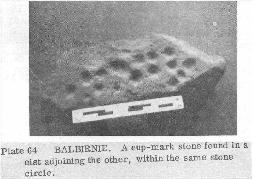
When the Scottish Royal Commission lads came here in 1963, they reported seeing

“the remains of a short cist…set into the west side of a small turf-covered knoll some 18 metres north of the schoolhouse at Ardminish.”

It was first found during quarrying operations here, and was thankfully kept pretty well preserved, apart from the western slab, which was dislodged and fell to the foot of the knoll. The cist aligns roughly north-south (the airt, or cardinal virtue of ‘death’ is north) and measured about 3 feet long by 2 feet wide.

References:

  1. Royal Commission on the Ancient & Historical Monuments, Scotland, Argyll: volume 1 – Kintyre,  HMSO: Edinburgh 1971.

© Paul Bennett, The Northern Antiquarian