St. Columba’s Well, Derry, Co. Derry

Holy Well (destroyed):  OS Grid Reference – C 43117 16615

Archaeology & History

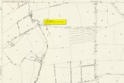
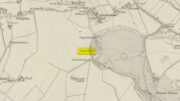
Long since gone, there are very few references to this once sacred site, which seemed to comprise of three sacred wells next to each other, each with its own formal dedication.  This would have made it one fuck of an important place in early- and pre-christian times.  But even when Thomas Colby (1837) and his mates surveyed the area, it seems like it was on its last legs.  He told that:

Site on Colby’s 1837 map

“As connected with the ancient history of Derry the sacred springs, called St. Columb’s Wells, claim some notice in this place.  They are, or rather were, three in number — for one has been dried up, or diverted from its original locality — and are situated near the Roman Catholic chapel, outside the wall.  It appears from the Irish annals that each of these wells had its peculiar name, one being called Tobar Adamnam, another Tobar Martain, and the third Tobar Colum — but the two former names are now quite forgotten, and the springs are popularly called St. Columb’s Wells.  They are regarded with much superstitious veneration by the Roman Catholic peasantry, but no celebration of St. Columb’s festival is now held at them.”

The wells were found very close to St. Columba’s bullaun stone, which possessed its own healing abilities.  The two sites had symbiotic ceremonial relationships with each other, doubtless performed in bygone centuries on St. Columba’s old festival date of June 9.

References:

  1. Colby, Thomas, Ordnance Survey of the County of Londonderry, HMG: Dublin 1837.
  2. Doherty, William, Derry Columbkille, Brown & Nolan: Dublin 1899.

© Paul BennettThe Northern Antiquarian 

Holy Well, Kislingbury, Northamptonshire

Holy Well (lost):  OS Grid Reference – SP 698 575

Archaeology & History

Hollowell Farm on 1885 map

A mile south of Kislingbury village, just by the roadside is the old Hill Farm.  In times gone by—as the early OS-maps show—a trackway led from here, westwards, for just a few hundred yards, until it reached the old farm of Hollowell Hill, all trace of which has long since gone.  The farm owed its name to the existence of a holy well mentioned briefly in 14th century records in the Cartulary of St. Andrews, Northampton, where it was described as Halywellhille, or the Holy Well on a hill.  All trace of it seems to have been lost.  A ‘Spring’ that is shown on the 1885 map, a few hundred yards south of the old farm, seems to be the closest contender, but it seems more likely that the well was adjacent to, or beneath the farm-building.

References:

  1. Gover, J.E.B., Mawer, A. & Stenton, F.M., The Place-Names of Northamptonshire, Cambridge University Press 1975.

© Paul BennettThe Northern Antiquarian

Market Cross, Hastings, Sussex

Cross (destroyed):  OS Grid Reference – TQ 828 099

Also Known as

  1. North End’s Cross

Archaeology & History

This long-lost stone cross should not be confused with the more recent one, erected by one Mr H. C. Richards in 1901 to commemorate some malarky about Edward VII.  The one in this profile was much older than that, although both of them were erected close to each other.  The older cross was found, said T.H. Cole (1884), “at the head of the Town, near All Saints’ Church.” Also known as the North End’s Cross, the old market was held here and close by were the gallows, the whipping post and the stocks.

References:

  1. Cole, Thomas H., The Antiquities of Hastings and the Battlefield, Hastings St Leonards Phil. Society 1884.

© Paul BennettThe Northern Antiquarian

Chapel Well, Clackmannan, Clackmannanshire

Holy Well:  OS Grid Reference – NS 9125 9122

Archaeology & History

Chapel Well on 1866 map

A little-known holy well on the south-side of the village has seen better days – if indeed it’s still there!  Located 500 yards due south of the destroyed Lady Well, this spring of water gained it name, according to local lore, from its proximity to an ancient chapel—remains of which have been frugal to say the least!  Shown on the earliest Ordnance Survey maps and continued to be shown until the 1950s, it seems that the first written account of it was in the Object Name Book of 1861 where it was told:

“A Spring well adjacent to Chapelhill.  It is cut in a freestone rock, from which issues a constant supply of pure spring water even in the dryest Seasons.  It is not impregnated with any Kind of Mineral.  A Chapel Stood near it at one time, the site of which Cannot be pointed out by any person in the neighbourhood.”

A visit by one of the Ordnance Survey lads here in 1950 found the well to be blocked-up by silt and soil; and on a quick visit I made here today I could find no remains of the well, but it may have been beneath the mass of excessive vegetation.  A subsequent visit in the winter may prove more fruitful – he sez, hopefully…..

© Paul BennettThe Northern Antiquarian

Village Cross, Leighterton, Gloucestershire

Cross (destroyed):  OS Grid Reference – ST 824 910

Archaeology & History

Charles Pooley (1868) gave a somewhat vague description of this site, telling that, “there is authority for believing that at one time a Cross was set up in the village.”  I can find no other reference to this monument which, I presume, has been destroyed.  (the grid reference cited is an approximation near the centre of the village, where village crosses were usually located)

References:

  1. Pooley, Charles, Notes on the Old Crosses of Gloucestershire, Longmans Green: London 1868.

© Paul BennettThe Northern Antiquarian

High Cross, Elkstone, Gloucestershire

Cross (destroyed):  OS Grid Reference – SO 9674 1321

Archaeology & History

High Cross on 1883 map

First shown on a 1775 map of the region, this long-lost site is preserved in several place-names near the old crossroads a half-mile north of Elkstone village.  It is mentioned, albeit briefly in Charles Pooley (1868) county survey, where he told that, “in former times a very handsome and lofty High Cross stood in this parish.”  However, there’s the possibility that the name ‘High’ cross may here derive simply from a cross located at a high point in the landscape.

An old ‘Guide Post’ marked on the early Ordnance Survey map at the same spot has been suggested by Danny Sullivan—and not without good reason—to be a prehistoric standing stone.  He may be right.

References:

  1. Pooley, Charles, Notes on the Old Crosses of Gloucestershire, Longmans Green: London 1868.
  2. Sullivan, D.P., Old Stones of the Cotswolds and the Forest of Dean, Reardon: Cheltenham 1999.

© Paul BennettThe Northern Antiquarian

Churchyard Cross, St Briavel’s, Gloucestershire

Cross (destroyed):  OS Grid Reference – SO 559 047

Archaeology & History

At the church of St. Mary at the northern end of the village, Charles Pooley’s (1868) county survey told that,

“There was formerly a Cross in the churchyard near the south porch, but it was removed in the year 1830, when the new tower was built.”

It would seem there is no longer any trace of the monument.

References:

  1. Pooley, Charles, Notes on the Old Crosses of Gloucestershire, Longmans Green: London 1868.

© Paul BennettThe Northern Antiquarian

Market Cross, Lechlade, Gloucestershire

Cross (destroyed):  OS Grid Reference – SU 214 995

Archaeology & History

In days of olde, Charles Pooley (1868) told us that “an old cross formerly stood in the Market-place” in the centre of the town where the old crossroads meet—as was customary for crosses and maypoles—just outside the church of St. Lawrence.  Pyramidal in form, it was mentioned in an old manuscript cited by Adin Williams (1888), which told us,

“Leland saith that in his days there was a Piramid of Stone at ye west end of ye Church, whose foundations are to be seen near Slaughter’s Well, which is said to be medicinal water.”

And although we don’t know when the cross was erected, we know when it was destroyed.  Williams again tells us:

“About 1770, Sir Jacob Wheate pulled down this cross.  He is said to have taken the stones to the house he was building.”

References:

  1. Pooley, Charles, Notes on the Old Crosses of Gloucestershire, Longmans Green: London 1868.
  2. Williams, Adin, Lechlade: Being the History of the Town, Manor and Estates, The Priory and the Church, E.W. Savory: Cirencester 1888.

© Paul BennettThe Northern Antiquarian

Village Cross, Deerhurst, Gloucestershire

Cross (destroyed):  OS Grid Reference – SO 870 299

Archaeology & History

In Charles Pooley’s (1868) definitive account of Gloucestershire county crosses, he informs us that,

“there was formerly a Cross erected in this village, but it has long since disappeared.”

He gives no further information about its history, but we must surmise that it was either associated with the ancient priory on the north side of the village, or in the traditional place at the centre of the the village. The grid-reference cited places the lost cross in the grounds of the priory.

References:

  1. Pooley, Charles, Notes on the Old Crosses of Gloucestershire, Longmans Green: London 1868.

© Paul BennettThe Northern Antiquarian

Churchyard Cross, Lower Dowdeswell, Gloucestershire

Cross (destroyed):  OS Grid Reference – SP 001 199

Archaeology & History

In Charles Pooley’s (1868) definitive history on the county crosses, this monument is mentioned in passing without any known history, apart form it been destroyed sometime in the early 19th century:

“A cross formerly stood in the churchyard, but it has been removed within living memory.”

References:

  1. Pooley, Charles, Notes on the Old Crosses of Gloucestershire, Longmans Green: London 1868.

© Paul BennettThe Northern Antiquarian