St. Thomas’ Well, Cambusbarron, Stirlingshire

Holy Well: OS Grid Reference – NS 7790 9304

Archaeology & History
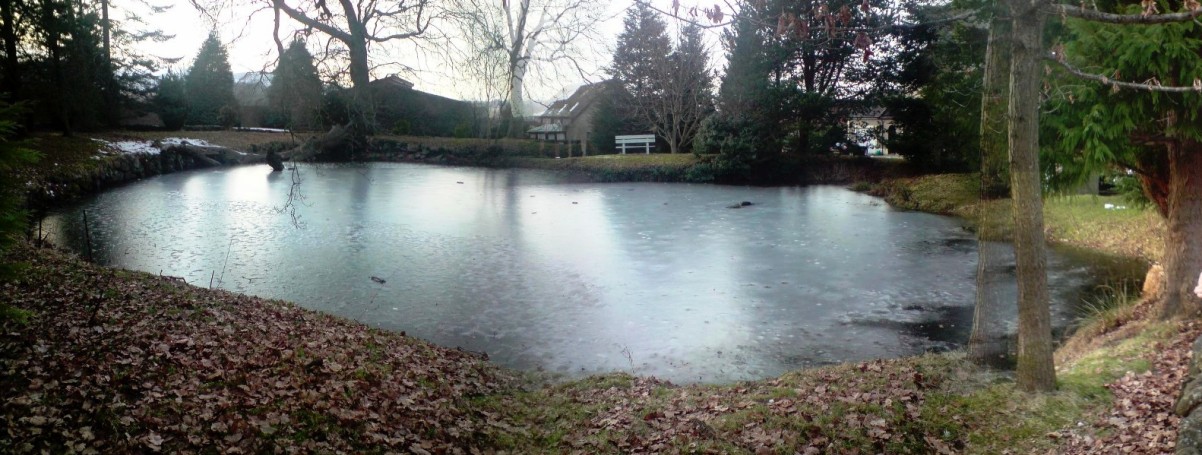
St.Thomas Well pond – on a freezing grey day!

Very close to the edge of the M9, this old water source is thankfully still visible, though not in its original state.  At the bottom of the ridge, loosely enclosed in the grounds of St. Thomas Well House, we find that the original well has been submerged into the pond which covers it.

Folklore

I’ve not yet found the mythic origins behind the dedication to this site, though St. Thomas’ Day is the winter solstice on December 21, and his mythic status was that of didymus, or twin.  In Yorkshire, folk customs surrounding this figure have been found to be inextricably intertwined with death rites, Robin Hood and shamanism!  But this Stirlingshire site is as yet silent.  The presence of numerous prehistoric burials very close by may have something to do with its dedication, as such sites would heighten the likelihood of there being ‘heathen’ practices close by, to which the said ‘St Thomas’—or one of his emissaries—could subdue with their christian figure.  But that’s pure speculation on my part…

References:

  1. Attwater, Donald, The Penguin Dictionary of Saints, Penguin: Harmondsworth 1965.
    Morris, Ruth & Frank, Scottish Healing Wells, Alethea: Sandy 1982.
  2. Fleming, J.S., Old Nooks of Stirling, Delineated and Described, Munro & Jamieson: Stirling 1898.
  3. Royal Commission on the Ancient & Historical Monuments, Scotland, Stirlingshire – volume 2, HMSO: Edinburgh 1963.

© Paul Bennett, The Northern Antiquarian

St. Lambert’s Well, Burneston, North Yorkshire

Holy Well:  OS Grid Reference – SE 3089 8496

Archaeology & History

The local historian, H.B. McCall (1910) described this ‘Saint Lambert’s fountain’, as it was first called, in his fine work on local churches, telling of its early description in the 12th century, saying:

“This is a very early mention of St. Lambert, the patron saint of the church and parish (of Burneston).  The fountain or well was probably situated in what is now the new portion of the churchyard, and the rivulet is now enclosed as a drain.  The name of the wapentake of Halikeld is said to be derived from St. Lambert’s Well at Burneston.”

I can find little else about these old healing waters.  Anyone got anymore info?

References:

  1. McCall, H.B., Richmondshire Churches, Elliott Stock: London 1910.

© Paul Bennett, The Northern Antiquarian 

Exley Head Cross, Keighley, West Yorkshire

Cross:  OS Grid Reference – SE 04818 40146

Getting Here

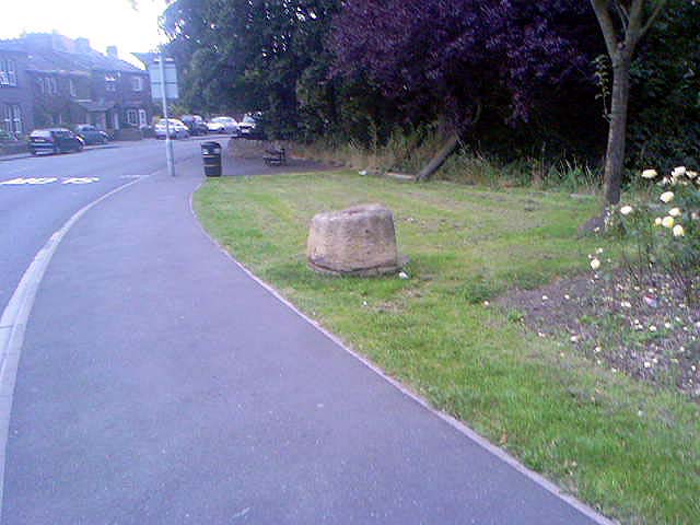
Exley Head Cross base, at roadside

From Keighley town centre, take the main road to Oakworth (B6143) and you’ll see it right by the main roadside, about a mile up on the left-hand side upon a small grassy area in Exley Head, just past the turning up to Wheathead.

Archaeology & History

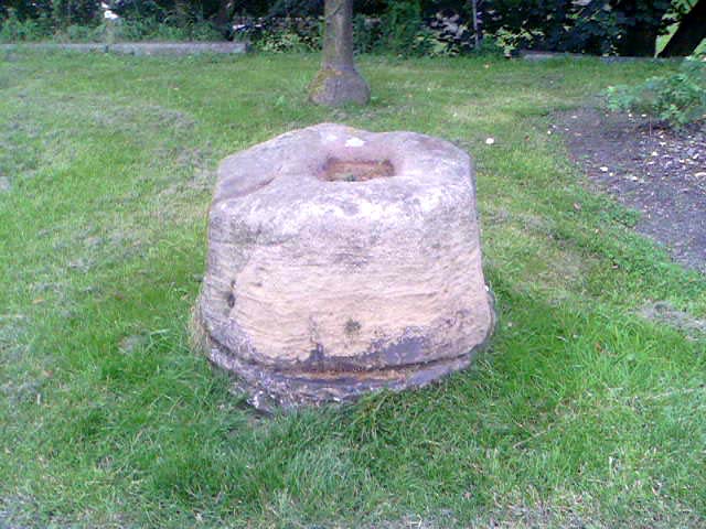
The upright stone monolith, or cross, which would once have stood here has long since disappeared.  All we are left with today is the large cross-base by the roadside: roughly squared, with a large hollow at the centre in which the upright stone cross originally stood erect!  In the past, a number of archaeologists and historians have speculated that the Exley Head Cross dated from as early as the 9th up till the 15th century. We may never find out for certain, though it’s likely a post-Domesday medieval relic.  It’s position at the roadside gives it the category of being a ‘Wayside Cross’ and it is likely one in a deliberate sequence that were placed along the ancient route from above Keighley, to Oakworth and over the border into Lancashire, near Wycoller and beyond.

Close-up of Exley Head Cross base

Quite why it was placed here is something we may never know: though it is close by an old crossroads and could have replaced an earlier heathen site, but I’ve found no records to indicate this. Its position in the landscape would also have been more impressive before the housing was here, previously giving a wide open view of the Aire Valley below.  I’d be grateful for any more info on this site.

References:

  1. Brigg, J.J. & Villy, F., “Three Ancient Crosses near Keighley,” in Bradford Antiquary, New Series 6, 1921.

© Paul Bennett, The Northern Antiquarian

Cowper’s Cross, Ilkley Moor, West Yorkshire

Cross:  OS Grid reference – SE 10223 45609

Also Known as:

  1. Cawper’s Cross

Getting Here

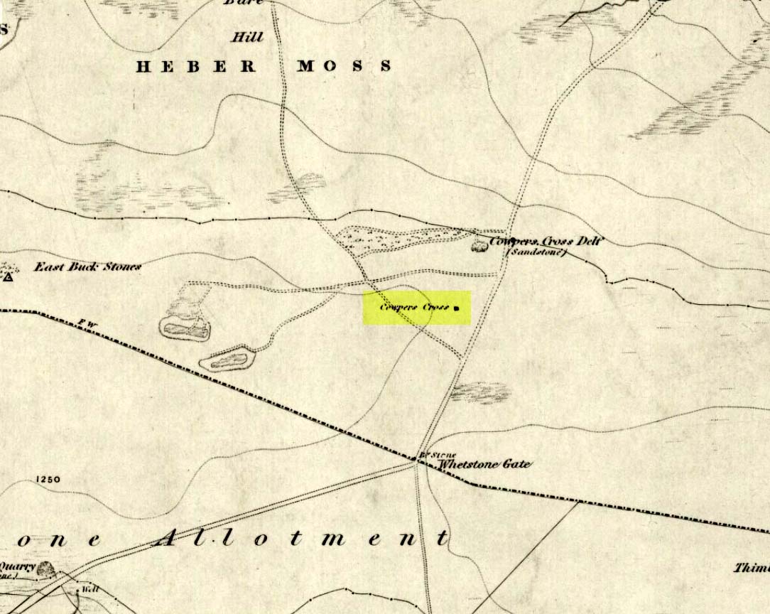
Cowpers Cross on 1851 map

From Ilkley town, head up the road as if you’re going to White Wells but keep following the moorland road up towards Whetstone Gate and the TV masts on the very tops (you’ll have to walk the last half-mile).  Shortly before you get them, you can’t miss this relic by the track-side on your right-hand side.

Archaeology & History

Possibly a christianised monolith, but more likely an original site, put here in an attempt to make local people stop going to the Badger Stone for regular spring gatherings. However, there was until recently what looked like an old monolith on the ground a few yards away, which may have stood upright before the cross was erected. Also on the south-facing side of the cross were four cup-markings, indicating great age.  These may also have been added when the cross was erected. (We know this occurred at other sites in the region, e.g., Churn Milk Joan, Midgley Moor, where such cup-marks were added sometime in the 15th or 16th century.)  However, thanks to some idiotic halfwits in more recent years going up here and vandalizing Cowper’s Cross, the prehistoric cup-markings that were on this relic have been destroyed.  The upright shaft of the cross that’s here now is a re-worked gatepost that replaced the old shaft with its authentic ‘pagan’ carvings.

1920s postcard of Cowper's Cross
1920s postcard of the Cross

But it’s had other bits of bad luck through the years.  The site was struck by lightning many years back, splitting the stone in half, but has since been rebuilt and stands adjacent to its original position, right next to the old Roman road that crosses Ilkley Moor.  Historian Allan Butterfield suggested this site to have originally been an old boundary markstone, christianised many centuries ago.  The name ‘Cowper’ derives from the local Ilkley family of Cawper.

Those of you interested in the early christian history of these moors should also have a look at the little-known Black Knoll Cross, less than a mile south of here in the middle of Morton Moor.

Folklore

Folklore relates that markets were held at this old stone cross many years ago. This gives added weight to the idea that the nearby cup-and-ring marked Badger Stone, where markets were probably held around the time of the equinoxes, was the original site for such gatherings.

Note that another site, the Reva Hill Cross, on the eastern side of this moor, has much the same history.

References:

  1. Bennett, Paul, The Old Stones of Elmet, Capall Bann: Chieveley 2001.
  2. Cowling, E.T., Rombald’s Way, William Walker: Otley 1946.

© Paul Bennett, The Northern Antiquarian