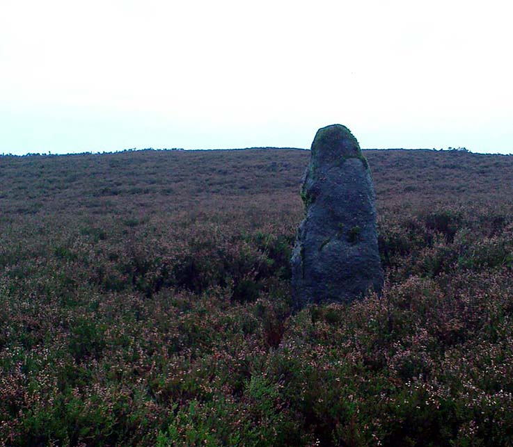
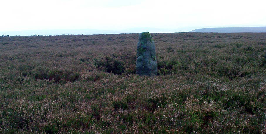
Greenwood Stone, Midgley Moor, West Yorkshire

Boundary Stone:  OS Grid Reference – SE 01652 28514
Getting Here

Greenwood Stone, Midgley Moor

Follow the directions to reach Churn Milk Joan, the head 100 yards east till reaching the crossing of footpaths, beneath Crow Hill.  Take the northern (left) route and keep walking.  Half a mile along you’ll see the tall upright stone to your left.  You can’t really miss it!

Archaeology & History

The Greenwood Stone is an old boundary stone and is not prehistoric.  It stands more than four feet tall.  I first visited the site in 1988 in the company of several folklore and antiquarian writers, including Andy Roberts, Edna Whelan and Graeme Chappell.  Twas a good day and coincided with a small collection of Psilocybes being gathered!

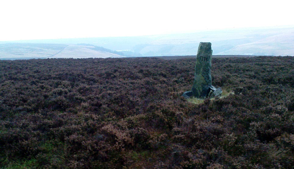
The tall upright is a boundary stone that was erected in 1775, as evidenced by the date carved on its southern face.  I must emphasize however that this was not when the stone came to acquire its name: this was defined in 1594 as evidenced by a boundary perambulation written that year where it is described as being recumbent: “thence to one lying stone, newly named Greenwood Stone.”  About 10-15 yards away is what may have been that very “lying stone,” the original Greenwood Stone, half-buried in the heather some six or seven feet long.   It is possible this may have stood upright in the distant past.

Greenwood Stone, looking south

Moving about 75 yards south we come across another small standing stone at 1360 feet (412m) above sea level. This I’ve called the ‘Greenwood B stone’.  It was marked on an old map as a boundary stone and is distinctly shaped to stand upright, marking a point separating the moors of Midgley and Wadsworth.  When stood upright it is just visible on the horizon when looking from the Miller’s Grave prehistoric tomb several hundred yards east of here and is close to being an equinox indicator.

References:

  1. Bennett, Paul, The Old Stones of Elmet, Capall Bann: Milverton 2001.

© Paul Bennett, The Northern Antiquarian 


Greenwood ‘B’ Stone, Midgley Moor, West Yorkshire

Standing Stone:  OS Grid Reference – SE 01659 28449

Also Known as:

  1. Midgley Moor Standing Stone

Getting Here

Midgley Moor Standing Stone

Takes a bitta finding – especially if some dood’s knocked it down again (as happens up here).  Best thing to do is get to the Miller’s Grave prehistoric cairn, which is only a few hundred yards away.  From Miller’s Grave, walk due west for 200 yards till you hit once a ditched footpaths, where you should turn right.  A short distance along you’ll hit a 5-foot-tall boundary stone called the Greenwood Stone with ‘1775’ carved on one side.  From here, walk due south into the heather for 75 yards.  You’re very close!

Archaeology & History

We resurrected this old standing stone in 1996, several years after first discovering it laid amidst the heather in the early 1990s. It appeared to mark an old boundary line (no longer used) betwixt Wadsworth Moor and Midgley Moor, but its nature is distinctly prehistoric. The remains of a small hut circle (seemingly Bronze Age, though excavation is needed) can be found a short distance to the west, though this is hard to find when the heather has grown. Other seemingly prehistoric remains scatter the ground nearby, none of which have received the attention of archaeologists.

Greenwood ‘B’ on a grey day

As you can see from these grey, rain-swept images, this upright stone is well-weathered (though we need to visit here again soon and get some better photos). It stands some 4-feet tall and may have accompanied one or two other monoliths close by.  The suggestion by one Peter Evans that the Greenwood B stone stood “possibly at the centre of a stone circle” is sadly untrue (soz Peter); though it probably had some relationship with the Millers Grave cairn site, a few hundred yards equinox east.

References:

  1. Bennett, Paul, The Old Stones of Elmet, Capall Bann: Milverton 2001.

© Paul Bennett, The Northern Antiquarian


Cock Hill, Wadsworth Moor, West Yorkshire

Cist:  OS Grid Reference – SE 009 275

Also Known as:

  1. Mount Skip tomb

Getting Here

OK – OK – stop laughing at the title!  If you wanna check the hill out for yourselves, get to Hebden Bridge, then go up the long and very steep Birchcliffe Road.  Keep going all the way to the very top (a couple of miles uphill).  When you reach here, the building in front of you was the Mount Skip pub.  From here, walk up over the golf course and you’ll hit the disused quarries on the moor edge.

Archaeology & History

The grid reference given above is an approximation.  The tomb (long gone) was within 100 yards of the coordinate.  But don’t let that put you off having a good bimble around the moors here, cos there are several sites to see.

This long-lost burial was located in May, 1897, when quarrying operations were being undertaken behind the Mount Skip Inn, on the edge of Wadsworth Moor.  Ling Roth (1906) told that

“the first indications were the rolling down of pieces of urns which the delvers called flower pots.  Then in digging a hole to fix the leg of a crane, human bones were discovered.”

Geoffrey Watson (1952) later echoing Mr Roth’s comments wrote that,

“a grave containing a skeleton was discovered at a quarry about Mount Skip Inn.  The grave was about 6ft long, 14-18 in wide, and about 2ft deep.  The bones, which were exceedingly brittle, crumbled on handling.  Within the grave, and mainly at the ends, there appeared to be about 6 in of mixed charred wood and bones.  The larger portion of a small earthenware vessel was picked up and retained by one of the quarrymen.”

According to Mr Roth, the “earthware vessel picked up…by one of the quarrymen” was “picked up by a man named Thomas Greenwood, of Shawcroft Hill.”   What became of it, I do not know! If anyone knows, please let us know!

The description telling that “the grave was about 6ft long, 14-18 in wide, and about 2ft deep,” implies it to have been a stone cist – although this is quite long.  The nearest of any similar form would be the giant cairns at Low Bradley, 12½ miles (20km) to the north  This may have been the last remnants of a giant cairn (its landscape position would allow for this).

References:

  1. Roth, H. Ling, The Yorkshire Coiners…and Notes on Old and Prehistoric Haifax, F. King: Halifax 1906.
  2. Watson, Geoffrey G., Early Man in the Halifax District, Halifax Scientific Society 1952.

© Paul Bennett, The Northern Antiquarian