Abbey Craig, Stirling, Stirlingshire

Hillfort:  OS Grid Reference – NS 8094 9566

Also Known as:

  1. Canmore ID 47113
  2. Wallace Monument Fort

Getting Here

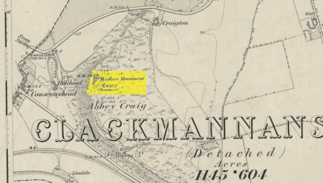
Abbey Craig on 1866 map

Most folk visiting here are coming from Stirling city.  There are various buses to get here, which head out over Stirling Bridge along Causewayhead Road (the A9) for half-a-mile where, at the roundabout and the William Wallace pub, go straight across up the minor road, zigzagging back on itself, until you reach the signs for the Wallace Monument.  Follow the well-defined footpath and, once on top of the hill, walk round the back of the mightily impressive tower.

Archaeology & History

Located right where the impressive Wallace Monument proudly stands, this prehistoric precursor to Sir William Wallace’s memory was where Scotland’s legendary hero and his men cast a clear and easy view over Bannockburn, where the halfwit english came for a fight—and deservedly lost!   The structures that used to be inside the now denuded hillfort would, no doubt, have been used by Wallace’s men; but much of those prehistoric remains have now been destroyed.  The visible remains of the fort can be seen round the back of the Wallace Monument: elongated rises of overgrown walling that run almost all the way round, getting slightly higher as you approach the more northern edges, like a semi-circular enclosure.
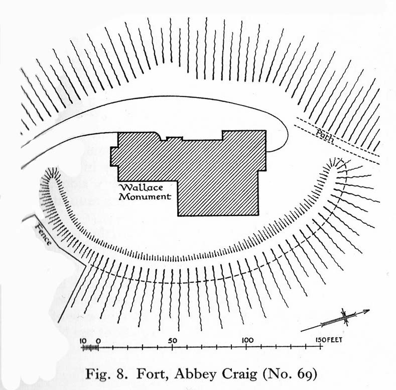
Royal Commission plan
Abbey Craig – and the great Wallace Monument

The site was described very briefly in William Nimmo’s (1880) early survey of the area, where he told that in 1784, “eleven brazen spears were found on the Abbey Craig, by a Mr Harley”, which he thought came from the time when the earlier ‘castle’ stood here.  He was probably right.  Many years later, the prehistoric remains were included in the county survey of archaeological sites by the Royal Commission lads (1963), who told that, near the north end of the summit of Abbey Craig,

“there is a fort which has been damaged by the construction within it of the Wallace Monument.  All that remains is a substantial turf-covered bank, cresentic on plan and 260ft in length, the ends of which lie close to the brink of the precipice that forms the west face of the hill.  The bank stands to a maximum height of 5ft above the level of the interior and presumably represents a ruined timber-laced wall, since numerous pieces of vitrified stone have been found on the slopes immediately below it.

The entrance to the fort presumably lay between one end of the bank and the lip of the precipice, but both the areas concerned have been disturbed by the construction of the modern approaches.  The interior of the fort measures about 175ft from north to south, by about 125ft transversely and the interior is featureless.”

The fort was probably built sometime in the early Iron Age; so the next time you visit this fine spot, check the remains out round the back of the tower—and remember that our ancestors were living up here 2500 years ago!

References:

  1. Aitchison, N.B., “Abbey Craig Rampart’, in Discovery & Excavation, Scotland, 1981.
  2. Feacham, Richard W., Guide to Prehistoric Scotland, Batsford: London 1977.
  3. Hogg, A.H.A., British Hill-Forts: An Index, BAR: Oxford 1979.
  4. Nimmo, William, The History of Stirlingshire – volume 1 (3rd edition), T.D. Morison: London 1880.
  5. Royal Commission on the Ancient & Historical Monuments Scotland, Stirling –  volume 1, HMSO: Edinburgh 1963.
  6. Royal Commission on the Ancient & Historical Monuments of Scotland, Archaeological Sites and Monuments of Stirling District, Central Region, Society of Antiquaries of Scotland 1979.

© Paul Bennett, The Northern Antiquarian


Airthrey Stone, Stirling University, Stirlingshire

Standing Stone:  OS Grid Reference – NS 81410 96489

Also Known as:

  1. Airthrey Castle Stone
  2. Canmore ID 47115
  3. Stirling University Stone

Getting Here

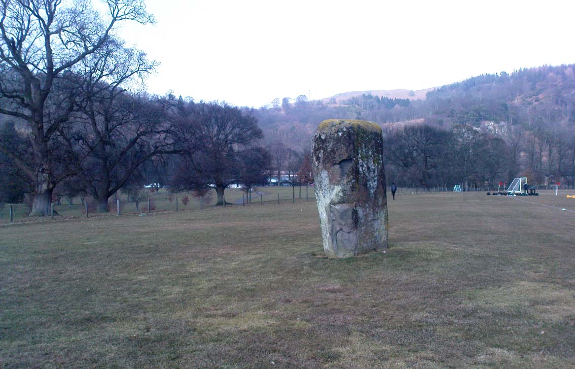
Airthrey stone, looking north

Dead easy to find!  From Stirling head out on the A9 road towards Bridge of Allan and Stirling Uni.  You’ll hit a small roundabout a mile out of Stirling – go straight across and up the little bendy road.  Follow this round the bottom side of the Uni for a half-mile, watching out for the left-turn as the tree-line ends, taking you up to the factory behind the trees (if you hit the roundabout a bit further on, you’ve gone too far!).  Go up the slope and onto the level sports playing fields – where this old beauty will catch your eye!  If you somehow miss it, just get to the Uni and ask some of the students where it is!

Archaeology & History

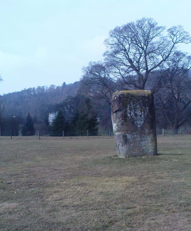
Airthrey Stone, looking NW

This single standing stone is a beauty!  It’s big – it’s hard – and it’s bound to get you going! (assuming you’re into megaliths that is)  Standing proud and upright on the eastern fields of the Stirling University campus, A.F. Hutchinson (1893) measured it as being “9ft 1in in height.  Its greatest breadth is 4ft 10in, and its circumference 14ft.”  A bittova big lad!  More than fifty years later when the Royal Commission (1963) lads got round to measuring its vital statistics, only an inch of the upright had been eaten by the ground.  The stone was highlighted on the earliest OS-maps of the area.

Folklore

Of the potential folklore here, most pens and voices seem quiet; although Mr Hutchinson (1897) told of William Nimmo’s early thoughts, linking the history of this stone with the others nearby, saying:

“Of what events these stones are monuments can not with certainty be determined.  In the ninth century, Kenneth II, assembled the Scottish army in the neighbourhood of Stirling, in order to avenge the death of Alpin his father, taken prisoner and murdered by the Picts.  Before they had time to march from the place of rendezvous, they were attacked by the Picts… As the castle and town of Stirling were at that date in the hands of the Picts, the rendezvous of Kenneth’s army and the battle must have been on the north side of the river; and as every circumstance of that action leads us to conclude that it happened near the spot where these stones stand, we are strongly inclined to consider them as monuments of it.  The conjecture, too, is further confirmed from a tract of ground in the neighbourhood which, from time immemorial, hath gone by the name of Cambuskenneth: that is, the field or creek of Kenneth.”

And although this hypothesis is somewhat improbable, it was reiterated in the new Statistical Account of 1845, which also suggested that this and the other Pathfoot Stone were “intended probably to commemorate some battle or event long since forgotten.”

References:

  1. Hutchinson, A.F., “The Standing Stones of Stirling District,” in The Stirling Antiquary, volume 1, 1893.
  2. Royal Commission on the Ancient & Historical Monuments Scotland, Stirling – volume 1, HMSO: Edinburgh 1963.

© Paul Bennett, The Northern Antiquarian


Bel Stane, Causewayhead, Stirling, Stirlingshire

Standing Stone (destroyed?):  OS Grid Reference – NS 805 958

Archaeology & History

Nearly a hundred years ago Christina Buchan told the local writer Donald Morris (1935) about this seemingly forgotten and lost megalithic site.  The narrative she gave told:

“I remember a stone which was known among the Causewayhead people as the Bel Stane. (The name is significant)  It originally stood in the Doocot Park on Spittal Farm.  This park overlooks the high road from Causewayhead to Bridge of Allan and adjoins the steading of Spittal… When the road leading up through the village of Causewayhead was formed (about 1820), the garden of William Robb’s cottage near the foot of the Broad Loan was somewhat altered in shape.  He put up a new gate and, requiring a gatepost, he lifted the Bel Stane from Doocot Park and set it up at the front of his own house to support the gate.  It was a stone of pillar-shape and stood four or five feet above the ground, and I do not remember whether they were any markings on it.  The cottage became ruinous many years ago and the garden ran waste.  A new house is now built on the site, but the Bel Stane has been lost.”

There is a possible contender for the lost Bel Stane, used again as another gatepost, on the south-side of the road some 450 yards to the east (at NS 80922 95931).  The stone in question is somewhat fatter than usual gateposts, about four-feet tall, and has the eroded appearance of considerably greater age than many others.  The monolith isn’t mentioned in the Royal Commission’s Stirlingshire inventory. Further information would be very welcome.

References:

  1. Morris, David, B., ‘Causewayhead a Hundred Years Ago’, in Transactions of the Stirling Natural History and Archaeological Society, 1935.

© Paul Bennett, The Northern Antiquarian


Pathfoot Stone, Airthrey, Stirling, Stirlingshire

Standing Stone:  OS Grid Reference – NS 80604 96871

Also Known as:

  1. Airthrey Castle West
  2. Canmore ID 47166

Getting Here

Not too troublesome to locate really… It’s at the top-end of the University, just above the side of the small Hermitage Road, about 100 yards along.  Keep your eyes peeled to your left!

Archaeology & History

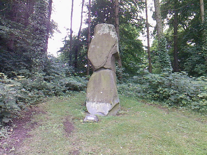
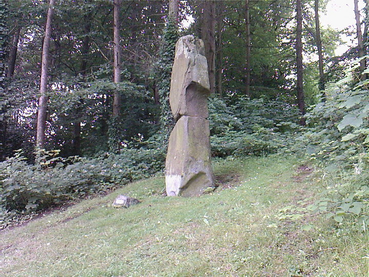
Pathfoot Stone

Today standing proud and upright, this ruinous standing stone has been knocked about in the last couple of hundred years.   Although we can clearly see that it’s been “fixed” in its present condition, standing more than 10 feet high, when the Royal Commission lads came here in August 1952 (as they reported in their utterly spiffing Stirlingshire (1963) inventory), it wasn’t quite as healthy back.  They reported:

“Many years ago the stone, which is of dark grey dolerite, fell down and was broken, and the basal portion, now re-erected, is only 3ft 10in high; two large fragments however, still lie beside the base, and the original stone is said to have stood to a height of 9ft 4in.  Of a more or less oblong section throughout, the re-erected stones measures 2ft 10in by 1ft 10in at ground level, swells to its greatest dimensions (3ft 2 in by 1ft 9in) at a height of 1ft 4in, and diminishes at the top…”

…and again!

But the scenario got even worse, cos after the Royal Commission boys had measured it up and did their report, it was completely removed!  Thankfully, following pressure from themselves and the help of the usual locals, the stone was stood back upright in the position we can see it today.  And — fingers crossed — long may it stay here!

Folklore

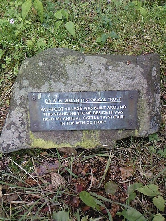
Commemorative plaque!

A plaque that accompanies the monolith tells that the old village of Pathfoot itself was actually “built around this standing stone” — which sounds more like it was the ‘centre’ or focus of the old place.  An omphalos perhaps?  The additional piece of lore described in Menzies (1905) work, that an annual cattle fair was held here,  indicates it as an ancient site of trade, as well as a possible gathering stone: folklore that we find is attributed to another standing stone nearby.

References:

  1. Fergusson, R. Menzies, Logie: A Parish History – volume 1, Alexander Gardner: Paisley 1905.
  2. Hutchinson, A.F., “The Standing Stones of Stirling District,” in The Stirling Antiquary, volume 1, 1893.
  3. Hutchinson, A.F., “The Standing Stones and other Rude Monuments of Stirling District,” in Transactions of the Stirling Natural History and Antiquarian Society, 1893.
  4. Royal Commission on the Ancient and Historical Monuments of Scotland, Stirlingshire – volume 1, HMSO: Edinburgh 1963.

© Paul Bennett, The Northern Antiquarian