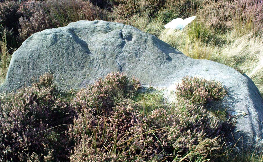
Carlowrie, Kirkliston, Midlothian

Cup-and-Ring Stone (destroyed):  OS Grid Reference – NT 138 746

Archaeology & History
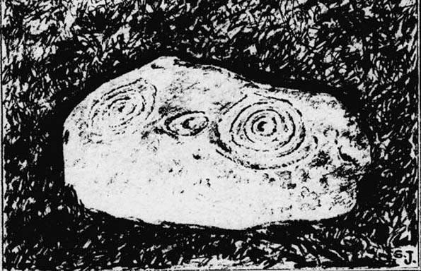
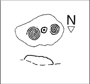
Lost carving of Carlowrie

Two-thirds of a mile west of the Cat Stane, on land immediately north of the River Almond by Edinburgh Airport in an area that was reported in 1780 to be “filled with the skeletons of human bodies,” this old petroglyph could once be found.  The Scottish Royal Commission (1929) described it as being a covering stone for a short prehistoric tomb near the OS-grid reference cited here, “but when discovered it was much broken by the plough that it does not appear to have been preserved.”  They refer instead to the last report of the site in the Scottish Society of Antiquaries journal, where we were informed that the cover stone was,

“marked with three series at least of concentric circles… The widest diameters of the sets of rings cut on the inside of the lid is about five inches, and each set is composed of five concentric circles.”

All trace of this carving appears to have been lost.  Other carvings reported nearby in the 19th century also appear to have been lost or destroyed.

References:

  1. Morris, Ronald W.B., The Prehistoric Rock Art of Southern Scotland, BAR 86: Oxford 1981.
  2. Royal Commission on Ancient & Historical Monuments, Scotland, Midlothian and Westlothian, HMSO: Edinburgh 1929.
  3. Simpson, J.Y., The Cat-Stane, Edinburghshire, Neill & Co: Edinburgh 1862.
  4. Simpson, J.Y., “On Ancient Sculpturings of Cups and Concentric Rings,” in Proceedings of the Society of Antiquaries, Scotland, volume 6, 1864-66.

© Paul Bennett, The Northern Antiquarian

Corwen Cross, Denbighshire

Cross & Cup-Marked Stone:  OS Grid Reference – SJ 0787 4340

Getting Here

Simple.  The church in the centre of the village across from the T-junction with the A5 is where it’s at!

Archaeology & History

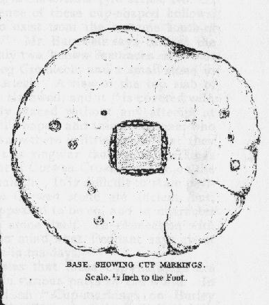
Cross-base with cup-marks (from Owen, 1886)

At Corwen churchyard we find a number of curious old stone relics — not least of which is this seemingly 12th century christian cross, more than seven-feet tall, on the west side of the church. Not only does this have a curious history in itself, but the base on which the cross stands has what may be at least seven cup-markings etched on it.  These were first mentioned – I think – by Elias Owen in his Old Stone Crosses of the Vale of Clwyd, (1886) who wrote:

“The stone basement in which the (cross) shaft is placed is elliptical in form, with transverse and conjugate diameters measuring respectively 64 and 60 inches; it is 12 inches or so thick, is of a slaty nature and might have been procured in the neighbourhood… There are seven peculiar artificial depressions along the surface of the pedestal, strongly resembling the cup-markings which are found occasionally on the capstones of cromlechs, etc. They are irregularly arranged: on the north side there are three, almost in a line; and on other parts of the stone there are four of these marks. They differ somewhat from each other in size and shape, but they are for the most part circular, though one is more of an oblong than a circle. They vary also in depth, one being two-and-half inches deep, while the others are shallow. The largest is three inches in diameter; the others are not so broad.”

Owen makes note of a previous description of the Corwen “cross” by Thomas Pennant in 1784, where sounds as if this stone had a decidedly megalithic precursor. He told us:

“A most singular cross in the churchyard merits attention: the shaft is let into a flat stone, and that again is supported by four or five rude stones, as if the whole had been formed in imitation of, and in veneration of, the sacred Cromlech of very early times.”

Two other crosses are found at Corwen church – one of which has a decidely heathen legend attached to it. The Carreg y Big yn y Fach Rhewllyd monolith is also found here, in the porch wall.  A few miles east of here we also find another cup-marked stone, shown on The Old-Fashioned Antiquarian website.  Looks a good n’!

References:

  1. Owen, Elias, Old Stone Crosses of the Vale of Clwyd and Neighbouring Parishes, Bernard Quaritch: London & Oswestry 1886.

© Paul Bennett, The Northern Antiquarian
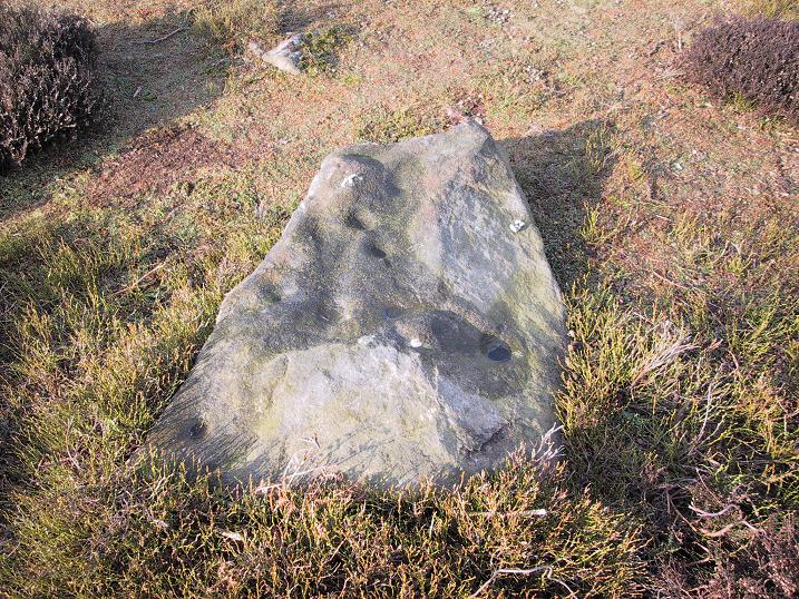

Middleton Moor Carving (006), North Yorkshire

Cup-Marked Stone:  OS Grid Reference – SE 12292 52144

Getting Here

Middleton Moor CR-006

Another off-the-beaten track site!  Follow the directions to reach the Middleton Moor 001 carving, then walk due east for about 500 yards until you reach the distinct footpath that’s the Roman Road.  Once here, zigzag along its edge on the western side, up and down hereabouts.  Keep looking around till you see the stone shown in Richard’s photo here!

Archaeology & History

First found in April 2005, this medium-sized flattish stone is just 10 yards west of the prehistoric trackway which cuts across the moors  — later used as a Roman road — on Middle Gill Bents.  A somewhat simplistic design, it was found by Richard Stroud when we were exploring some of the many other carvings up here, and looking for previously unrecorded ones hiding in the heather.  Carved onto this stone are eight, perhaps nine cup-markings, with grooved lines connecting at least two of them.  That’s it!

© Paul Bennett, The Northern Antiquarian

Middleton Moor Carving (441), North Yorkshire

Cup-and-Ring Stone:  OS Grid Reference – SE 10887 51381


Getting Here

From the back of Moor End Farm on the south-side of Langbar village, follow the Long Ridge footpath up onto the moor. Walk along the path until its starts dipping down again, onto the moor proper and where another footpath crosses and goes down into the small valley of the Dryas Dike stream, follow it – though only for about 75 yards, heading diagonally into the heather slowly towards the stream.  You’re getting close!

Archaeology & History

Crude drawing of CR441

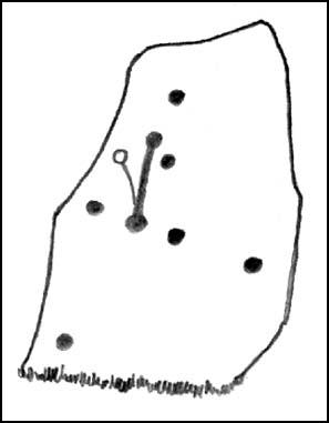
Yet another small carving found amidst a decent cluster of cup-and-rings and other archaeological remains near the top of Dryas Dike, this stone was first described in the Boughey & Vickerman (2003) survey.  It’s located about 10 yards below Middleton Moor CR-440, above the stream of Dryas Dike.  It’s a simple design, comprising of a central groove with a cup at either end and several other cups either side of this central line.  (cheers to Richard Stroud for use of his photo).

References:

  1. Boughey, Keith & Vickerman, E.A., Prehistoric Rock Art of the West Riding, WYAS 2003.

© Paul Bennett, The Northern Antiquarian

Crowbar Stone, Weetwood Moor, Wooler, Northumbria

Cup-and-Ring Stone:  OS Grid Reference – NU 021 278

Also known as:

  1. North Plantation 3
  2. Fowberry Moor Stone 3

Archaeology & History

Davison’s sketch

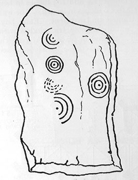
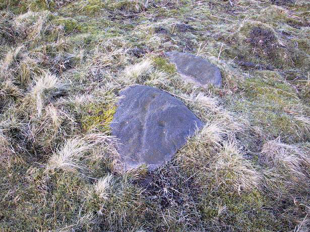
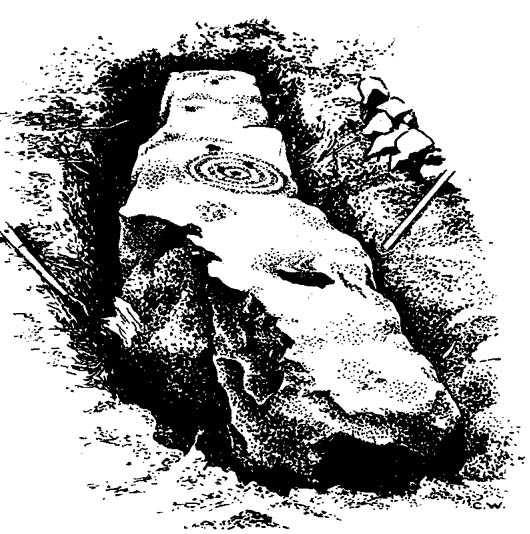
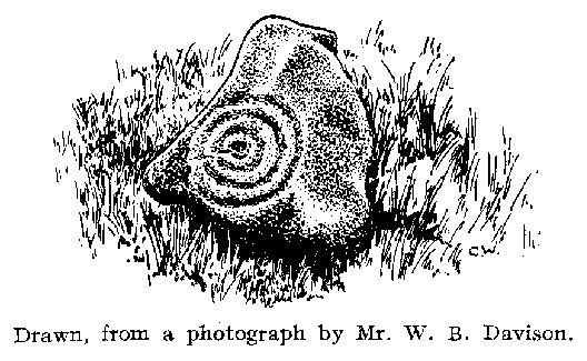
This is an excellent-looking carving which, it would seem, remains buried in the Earth nice n’ sleepy!  Located “in the inner rampart on the south side of an unrecorded camp in North Plantation, Fowberry Moor, Chatton,” the carving was unexpectedly found during some basic excavation work on the camp itself.  Described and illustrated by W.B. Davison (1934), this was one of two cup-and-ring stones hereby.  He reckoned it wasn’t in its original position and seems – from the illustration here – to have been etched onto a fallen monolith.  Davison’s detailed description told:

“The…stone was completely excavated and was found to be built into the inner rampart across its track.  This stone measures 7’6″ north to south, is 1’2″ wide at its north end, 1’11” at its widest part, and 1’3″ at its foot.  The average depth is 2’6″.  The base is rough-surfaced and is prow-shaped at the northern end.

“Incised markings occur on the top only, and are as follows, reading from north to south.  1 cup surrounded by a ring and a half-ring lying east to west by south.  1 small cup.  1 cup.  1 cup surrounded by four rings, the largest of which has a diameter of 13½”.  On the top of the outer ring occurs an abutting semicircle enclosing a cup.  On the accompanying (image) will be observed what appears to be another cup on the innermost ring.  1 cup.  1 cup surrounded by a ring and a half-ring lying north to south by west.  This marking rests on a two-inch deep slot possibly made for quarrying purposes.  No other markings occur between this slot and the foot of the stone.  Tool marks are very distinct on some of the above markings.”

Rock art researchers Jan Brouwer (2007) and Stan Beckensall have searched unsuccessfully for the stone in recent years.

References:

  1. Beckensall, Stan, Northumberland’s Prehistoric Rock Carvings, Pendulum: Rothbury 1983.
  2. Beckensall, Stan, Prehistoric Rock Art in Northumberland, Tempus: Stroud 2001.
  3. Brouwer, Jan, ‘In Search of the Crowbar Stone,’ BRAC 2007.
  4. Davison, W.B., ‘Cup-and-Ring Marked Rocks at Fowberry Park,’ in Proceedings of the Society of Antiquaries of Newcastle-upon-Tyne (4th Series), 4:7, October 1934.

© Paul Bennett, The Northern Antiquarian
Fowberry Moor Farm, Wooler, Northumberland

Cup-and-Ring Stone:  OS Grid Reference – NU 029 261

Also known as:

  1. Deershed Plantation Stone

Archaeology & History

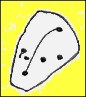
This is a small but impressive stone, presently housed in the Musuem of Antiquities in Newcastle.  It was first mentioned by Mr H.L. Honeyman (1934) as being donated to Newcastle’s Society of Antiquaries by a Mr J.M. Strother of Fowberry Moor Farm in 1934.  He described the carving as,

“a sculptured ring-marked stone, 1ft 2in by 1ft 2in, bearing a cup with three rings and duct. Found in Island Plantation (camp), Fowberry Moor, Chatton, 22.7.34, by Mr Wake.”

Stan Beckensall (1983:127) described it in passing his early work on Northumberland rock art, then again in his updated edition.

References:

  1. Beckensall, Stan, Northumberland’s Prehistoric Rock Carvings, Pendulum: Rothbury 1983.
  2. Beckensall, Stan, Prehistoric Rock Art in Northumberland, Tempus: Stroud 2001.
  3. Honeyman, Herbert L., ‘The Society’s Meetings: July,’ in Proceedings of the Society of Antiquaries of Newcastle-upon-Tyne (4th Series), 4:7, October 1934.

© Paul Bennett, The Northern Antiquarian

Spring Stone Carving, Middleton Moor, North Yorkshire

Cup-Marked Stone:  OS Grid Reference – SE 11611 51610

Also Known as:

  1. Middleton Moor carving 483 (Boughey & Vickerman)

Getting Here

From Ilkley go up to Middleton and from there go up Harding Lane and, where the road bends left a track goes straight north onto the moors. Go up this until you’re onto the moor proper. Keep going until you’re following the line of walling, where a small stream is trickling right by your right-hand side. Follow this to its source a coupla hundred yards up. Stop!

Archaeology & History

Middleton Moor CR483: single cup-and-line

First mentioned by Stuart Feather in 1965, this simple cup-marking has a long line squirming away to the edge of the rock on which it’s carved.  The cup-marking is some 3 inches across and about ½-inch deep, with the long line about 24 inches long.  There’s really nowt much to look at here unless you’re a real cup-and-ring freak — though note that the carving occurs on a broken piece of stone just where a spring of water emerges from the ground.  Some archaeo’s have a notion that sometimes our cup-and-ring stones have some sorta relationship with water — though they’re not into sticking their necks out and saying anymore than that!  And of course, some carvings obviously relate to water. This one here is a strong contender, with the long wiggly line perhaps representative of the stream running from its source, which itself is the cup-mark.

However, we might just aswell surmise that the carving here was executed by some bored teenager, just testing out his first antler pick, or flintstone, telling his mates, “I woz ‘ere!”

References:

  1. Boughey, Keith & Vickerman, E.A., Prehistoric Rock Art of the West Riding, WYAS 2003.
  2. ather, Stuart, ‘Cup and Ring Boulders,’ in the Cartwright Hall Archaeology group Bulletin, 10:7, July 1965.

© Paul Bennett, The Northern Antiquarian

Middleton Moor Carving (482), North Yorkshire

Cup-and-Ring Stone:  OS Grid Reference – SE 11600 51455

Also Known as:

  1. Owl Carving

Getting Here

Multiple-ringed carving (© Richard Stroud)

Best approached from the south, up Hardings Lane, then where its bends and the track of Parks Lane goes onto the moor, follow it.  Onto the moor, keep on the track as it follows the walling until you reach the gate on your right.  From here you’re close: head into the grasses and heather (left) not far off the western edge of the footpath at the eastern end of Dryas Dike.  Look around!

Archaeology & History

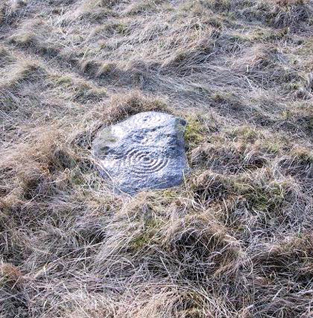
This lovely looking carving “quite near to the footpath and enclosed fields above March Ghyll reservoir,” was first described by Stuart Feather. (1965)  It can be found on a small flat stone and is easily obscured if the grasses are long – but it’s worth searching for.  It’s an archetypal cup-and-ring stone, consisting of a cup-and-five rings, a cup-and-ring, and a cup-and-three rings — though they are rather faint and can be missed in bad light.  As with other carvings, it’s best to splash water over it (as me & Richard did in the photo above) so you can see it a bit clearer.  Feather (1965) told us:

“The symbols are very fine, consisting of three cup-and-rings.  One of them, a quadruple, concentrically-circled cup with part of a fifth, unfinished ring.  The cup is very shallow, 1 inch across, and the circles…½ inch wide and shallow, with an overall diameter of 8 inch for the four circles; 9 inch with the other unfinished section.  The single cup-and-ring has a cup ¾-inch in diameter, ½-inch deep and a 4-inch diameter ring somewhat broader than the other rings on the rock and abutting on the north side against a slightly raised part of the rock surface.”

Sidney Jackson’s drawing
Boughey & Vickerman’s drawing

The triple-ringed cup is of similar dimensions to the larger example, with the cup being 1½ inch across and deep, with the circles being 7 to 7½-inch across.

About a half-mile northeast of here is the old Langbar Stone where I got the distinct impression that the same person was responsible for both of these carvings.  God knows why!

References:

  1. Boughey, Keith & Vickerman, E.A., Prehistoric Rock Art of the West Riding, WYAS 2003.
  2. Feather, Stuart, ‘Mid-Wharfedale Cup-and-Ring Markings: No.32-3, Middleton Moor,’ in the Cartwright Hall Archaeology group Bulletin, February 1965.

© Paul Bennett, The Northern Antiquarian 

Winter Hill Stone, Cowling, North Yorkshire

Cup-Marked Stone:  OS Grid Reference – SD 98288 41976

Getting Here

Winter Hill Stone, looking NW

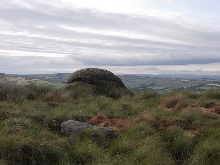
The easiest way to get here if you’re coming for the first time is via the A6068 Glusburn to Cowling road. On the south side of Cowling, take the small road Old Lane, uphill on the east side of the road (very easily missed – keep your eyes peeled!) and keep going up until the road just about levels out, where there’s a muddy parking spot on your left (the giant Wainman’s pinnacle is down the path from here).  Cross over the road and head up towards the giant Hitching Stone. When you reach the first fence, cross over it and follow it into the boggy heathlands to your right (west-ish).  Head into the tribbly grass and keep walking for 3-400 yards till you see the large rock growing out of the Earth.

Archaeology & History

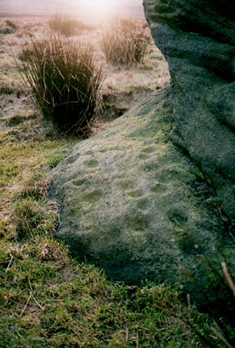
Cup-markings near ground-level
Looking from above

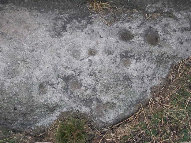
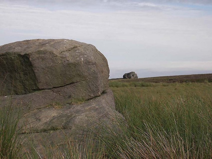
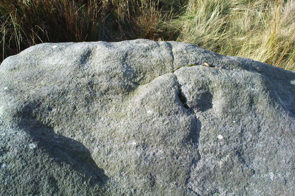
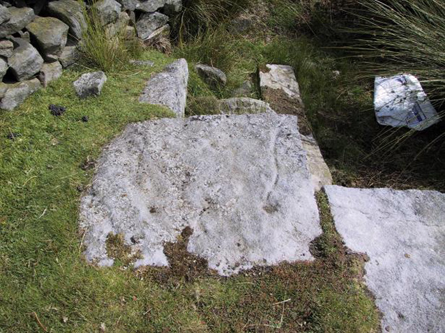
Not far from the legendary Hitching Stone is this curiously-shaped boulder sitting peacefully and alone in its landscape.  It is in fact a large cup-marked boulder, previously unrecorded until being described in The Old Stones of Elmet. There are no totally guaranteed cup-markings on top of the stone (many of ’em seem to be natural, though some could have been etched all those years ago and have weathered well); instead they are curiously etched at the base of this large rock, just above ground-level.

Hitching Stone on horizon

As can be seen in the photos, on its lower south-facing edge there are around 20 well-defined cups that clearly stand out.  No other cup-marked stones appear to be nearby (surely there’s a few more kicking about…?).

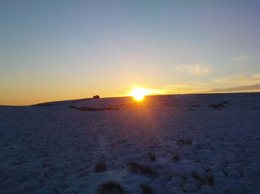
An earlier assertion I made (2001) about the nearby Hitching Stone aligning with the winter solstice sunrise from here was recently put to bed following the morning observations of myself and Dave Hazell on December 21st, 2010, when — as can be seen in the photo here — the midwinter sun emerges from the land a few degrees of arc further southeast than expected.  However, I aint checked what the alignment here would have been when the cup-markings were first etched here, around 5000 years ago perhaps…  Would any of you archaeo-astronomers out there know about this?

References:

  1. Bennett, P., The Old Stones of Elmet, Capall Bann: Milverton 2001.

© Paul Bennett, The Northern Antiquarian

Fenny Shaw Cup-Mark, Bingley Moor, West Yorkshire

Cup-Marked Stone:  OS Grid Reference – SE 11271 43565

Also Known as:

  1. Carving no.112 (Boughey & Vickerman)

Getting Here

Close-up of 'cup-mark'
Close-up of ‘cup-mark’
Fenny Shaw Cup-Marked Stone

Follow the same directions to reach the Big Rock carving.  From here walk less than 100 yards up the slope, veering to your left and where you reach the rushes (Juncus grasses), walk up and keep your eyes peeled for the singular upright rock.  Or as ‘Redkiteyorks’ said, go “up the slope 82.4 metres, 54.5 degrees(True) from IAG108 (Big Rock).” It aint hard to find really…

Archaeology & History

Another stone mainly for the purists amongst you.  Little has been written on this possible carving.  Boughey & Vickerman (2003) said simply:

“Large rough rock. Two possible cups on top and one further possible cup on W vertical face. Doubtful”.

References:

  1. Boughey, K.J.S. & Vickerman, E.A., Prehistoric Rock Art of the West Riding, WYAS: Leeds 2003.
  2. Hedges, John (ed.), The Carved Rocks of Rombald’s Moor, WYMCC: Wakefield 1986.

© Paul Bennett, The Northern Antiquarian