Ringstone Edge, Barkisland, Ripponden, West Yorkshire

Ring Cairn:  OS Grid Reference – SE 04436 18247

Also known as:

  1. Ring of Stones
  2. Wolf Fold
  3. Wolf Stones

Getting Here

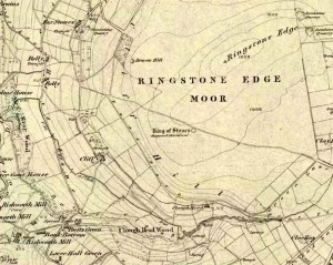
Ring of Stones on 1854 map

From Ripponden, taken the steep road up to Barkisland, but at the crossroads just before the village, turn right (south) and keep going for a mile till you reach the reservoir.  At the far-end of the reservoir, take the track down by its side and follow the footpath that bends round the edge of the grasslands.  Go up onto this small moorland and,  once you’re on the level, head towards where you’ll see a large pile of stones a coupla hundred yards away.  That’s it!

Archaeology & History
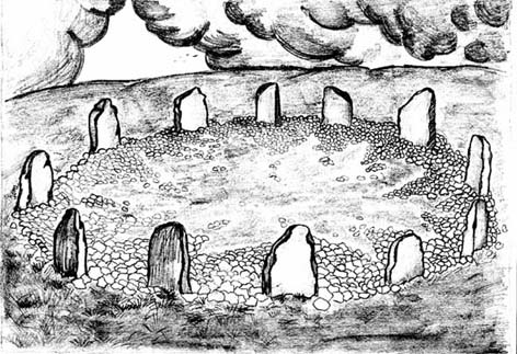
Artist’s impression of site (© Inmaculada Ibanez-Sanchez)

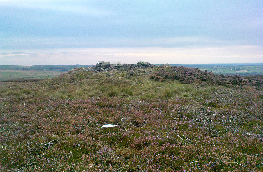
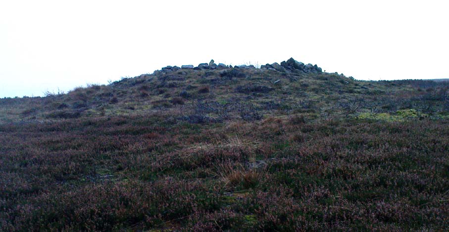
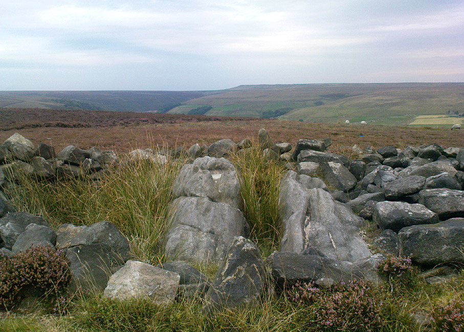
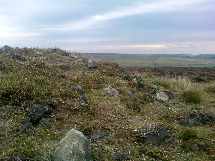
If we visit this site today, all we are left with is a scattered mass (or perhaps that should that be ‘mess’) of many hundreds of stones: the last remnants of what once would have been a proud circle of one form or another upon this small moorland plain.  Its significance was such that the very moor on which its remains are scattered, was named after it: the Ringstone Edge Moor.  But as with many sites from our megalithic period, this old place is but a shadow of its former self.

Gone are the upright monoliths which, tradition relates, once surrounded this low scattered circle of small loose stones (which would have made it look not unlike the wonderful stone circle of Temple Wood, Argyll). These standing stones were, so the folk record tells, removed near the end of the 18th century for use in some walling.

Described variously as a stone circle, ring cairn, cairn circle, an enclosure, and more, the site first seems to have been written about in 1775 by the great historian John Watson.  When he was vicar of the local parish in Halifax (not far from here) this “ring of stones” as he called them, was “called the Wolf-fold.”  Nearly one hundred years later, in F.A. Leyland’s superb commentary to Watson’s work, he wrote,

“The stones which constituted the circle at the time of their removal stood upwards of three feet…and the remain formed a striking object on the moor. The original number of stones of which the circle was formed is unknown, having long been in ruin and reduced in quantity before being finally removed. This was effected about twelve years since by the present tenant of the dam.” – that is, around 1859.

However, when Crabtree (1836) described the circle a decade or two earlier, he made no mention of such standing stones — although we must consider that Crabtree was very much like many modern academic archaeologists who tended to copy the works of others, much less than getting out in the field to see for himself.

At the beginning of the 20th century, the lore telling of the standing stones’ demise was repeated by local historian John Priestley (1903), when he said that: “all the large stones…were carted away about forty years ago” — that is, around 1863.

So it would seem that the very final destruction of the standing stones here, occurred sometime during the four year gap which Messrs. Leyland and Priestley describe.

More than fifty years later, Huddersfield historian James Petch (1924) came here to explore whatever remains he could find, and told:

“On top of a flat plateau on this moor, with an extensive view on all sides save on the north, where there is a gentle slope for some hundreds of yards up to the summit of the hill, there are distinct traces of a circular ring of small stones.  Pygmie flints have been picked up within a yard or two, but the only other fact to be noted about this earthwork is that there is a tradition to the effect that much earth has been removed from this site. It is not altogether impossible that this is a scanty remnant of a round barrow.”

This latter remark of Mr Petch seems most probable. The excessive scatter of small stones typifies the remains of many of the Pennine giant cairns, from the Little Skirtful on Burley Moor and giant tombs of the Black Hills near Skipton, to the similar monuments of our Devil’s Apronful, Pendle, etc, etc.

Close to this cairn circle, wrote Sidney Jackson (1968), there used to be the remains of an Iron Age settlement, “marked by wall foundations (but) is now covered by the waters of Ringstone Reservoir.”

Folklore

There is very little folklore that I’ve found here. Watson (1775) throws the usual idea that the place was a site of druidical worship; but other than that we only have a local Ripponden writer’s account, which told that there was once the ghost of a white lady that was once said to walk along the path somewhere between here and the Beacon Hill tumulus, a short distance to the north.

…to be continued…

References:

  1. Abraham, John Harris, Hidden Prehistory around the North West, Kindle 2012.
  2. Bennett, Paul, The Old Stones of Elmet, Capall Bann: Milverton 2001.
  3. Burl, Aubrey, The Stone Circles of Britain, Ireland and Brittany, Yale University Press 2000.
  4. Crabtree, John, Concise History of the Parish and Vicarage of Halifax, Hartley & Walker: Halifax 1836.
  5. Jackson, Sidney, “Tricephalic Heads from Greetland, Yorks,” in Antiquity journal, volume 42, no.168, December 1968.
  6. Keighley, J.J., ‘The Prehistoric Period,’ in Faull & Moorhouse’s West Yorkshire: An Archaeological Guide to AD 1500, WYMCC: Wakefield 1981.
  7. Leyland, F.A. (ed.), The History and Antiquities of the Parish of Halifax by the Rev. John Watson, M.A., R. Leyland: Halifax n.d. (c.1867)
  8. Longbotham, A.T., ‘Prehistoric Remains at Barkisland,’ in Proceedings of the Halifax Antiquarian Society, 1932.
  9. Petch, James A.,  Early Man in the District of Huddersfield, Advertiser Press: Huddersfield 1924.
  10. Priestley, John H., The History of Ripponden, John Mellor: Ripponden 1903.
  11. Smith, A.H., The Place-Names of the West Riding of Yorkshire – volume 3, Cambridge University Press 1963.
  12. Watson, Geoffrey G., Early Man in the Halifax District, HAS: Halifax 1952.
  13. Watson, John, The History and Antiquities of the Parish of Halifax, T.Lowndes: London 1775.
  14. Whiteley, Hazel, Ryburn Tapestry, Halifax Evening Courier n.d. (c.1974)

© Paul Bennett, The Northern Antiquarian

Greenwood ‘B’ Stone, Midgley Moor, West Yorkshire

Standing Stone:  OS Grid Reference – SE 01659 28449

Also Known as:

  1. Midgley Moor Standing Stone

Getting Here

Midgley Moor Standing Stone

Takes a bitta finding – especially if some dood’s knocked it down again (as happens up here).  Best thing to do is get to the Miller’s Grave prehistoric cairn, which is only a few hundred yards away.  From Miller’s Grave, walk due west for 200 yards till you hit once a ditched footpaths, where you should turn right.  A short distance along you’ll hit a 5-foot-tall boundary stone called the Greenwood Stone with ‘1775’ carved on one side.  From here, walk due south into the heather for 75 yards.  You’re very close!

Archaeology & History

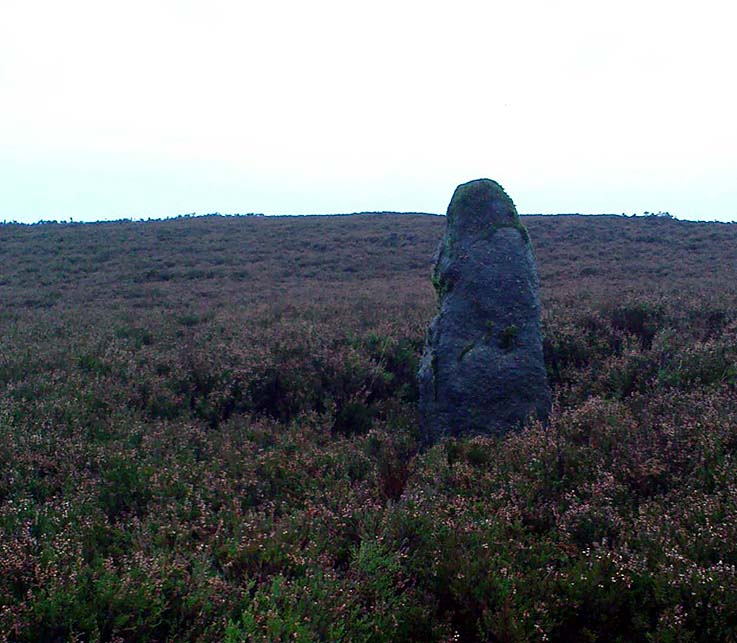
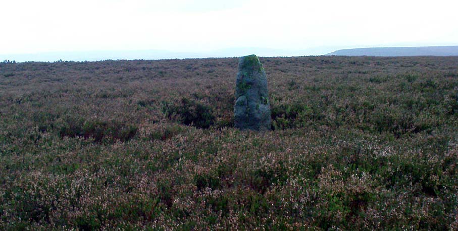
We resurrected this old standing stone in 1996, several years after first discovering it laid amidst the heather in the early 1990s. It appeared to mark an old boundary line (no longer used) betwixt Wadsworth Moor and Midgley Moor, but its nature is distinctly prehistoric. The remains of a small hut circle (seemingly Bronze Age, though excavation is needed) can be found a short distance to the west, though this is hard to find when the heather has grown. Other seemingly prehistoric remains scatter the ground nearby, none of which have received the attention of archaeologists.

Greenwood ‘B’ on a grey day

As you can see from these grey, rain-swept images, this upright stone is well-weathered (though we need to visit here again soon and get some better photos). It stands some 4-feet tall and may have accompanied one or two other monoliths close by.  The suggestion by one Peter Evans that the Greenwood B stone stood “possibly at the centre of a stone circle” is sadly untrue (soz Peter); though it probably had some relationship with the Millers Grave cairn site, a few hundred yards equinox east.

References:

  1. Bennett, Paul, The Old Stones of Elmet, Capall Bann: Milverton 2001.

© Paul Bennett, The Northern Antiquarian

Miller’s Grave, Midgley Moor, West Yorkshire

Cairn:  OS Grid Reference – SE 01912 28366

Getting Here

Millers Grave cairn

From the village of Midgley, high above the A646 Halifax-to-Todmorden road, travel west along the moorland road until you reach the sharp-ish bend in the road, with steep wooded waterfall to your left.  From here, across the road (roughly) there’s a track onto the moor.  Go up this, keeping to the line of the straight walling uphill by the stream-side (instead of following the path up the quarries) all the way to the top. Here you’ll see the boundary stone of  Churn Milk Joan. Take the footpath to its side for up onto the moor 250 yards or so, taking a right turn into the deeply cut footpath and walk along for several hundred yards, keeping your eyes to the north (right).  You’ll see the rocky cairn of Miller’s Grave not far away in the heather, near to the large rounded boulder known as Robin Hood’s Pennystone.

Archaeology & History

Ascribed by some as neolithic, and others as Bronze Age (the more probable), here is a curious archaeological relic: curious, inasmuch as it’s received very little attention from archaeologists.  It’s quite a large monument — and perhaps the fact that it has always seemed to be in isolation from other prehistoric remains has held it back a little.  But recent ventures here have brought about the discovery of more cairns (though singular small ones), neolithic walling, hut circles and other prehistoric remains that have never previously been reported.

Millers Grave01
Miller’s Grave, Midgley Moor (in VERY heavy rain!)
Central stone aligning north to Nab End

It’s a decent site aswell.  Mainly consisting of the usual mass of smaller stones piled up and around one main point; in the middle of this ‘tomb’ is a large split glacial erratic boulder, which may have been the original focus of the builders.  Some may even ascribe a coupla cup-markings on this ‘ere central rock form — but they’d be pushing it a bit! This large central feature aligns to the high peak of Nab Hill several miles north, above Oxenhope.  Whether this feature was of any significance in the cairn’s construction is debatable (though as north represents death in pre-christian peasant lore, this ingredient has to be noted).

Profile shot – looking NE
Looking SE, with small cairn in foreground

The cairn is a goodly size: some 4 feet tall and about 50 foot across at its greatest diameter.  Some of the stones near the centre of the stones have been put there in more recent years.  In previous centuries, treasure-seekers came here in the hope that they’d uncover gold or other trinkets and stripped off much of the original cover, moving many rocks to the edges.  Others were also stolen from here to make some of the grouse-butts, not far from away.  In a foray to the site on 5.9.10. we were lucky to find the heather had been burnt back and found, some ten yards to the north and to the southwest, the remains of small, outlying singular cairns (though these need excavating to ascertain their precise nature).

Calderdale Council’s archaeology notes on Miller’s Grave tell it to be “situated on the summit of Midgley Moor”, which is quite wrong.  The summit of the moor is some distance west of here, near where an old standing stone called the Greenwood B stone (75 yards south of the Greenwood Stone) and the much denuded remains of other prehistoric sites could once be found — though I’m not sure that they, nor the regional archaeologist for Upper Calderdale has ever been aware of them.

Folklore

In F.A. Leyland’s (c.1869) extensive commentary to Watson’s History of Halifax (1775), he relates a fascinating tale which seems to account for the name of this old tomb:

“About ninety years ago,” he wrote, “that is, towards the end of the eighteenth century – one Lee, a miller, committed suicide in Mayroyd Mill near Hebden Bridge. The jury at the inquest held on the occasion returned a verdict of felo-de-se, and the body was buried at Four Lane Ends, the Rough, in Midgley. The fact, however, of the body of one who had laid violent hands upon himself, lying in unconsecrated ground at a point where the highways met, and at a spot which the inhabitants passed early and late, oppressed the people of the neighbourhood with an irresistible dread. Persons going to market and passing from village to village, feared and avoided the unhallowed spot, until the feeling increased to one of insupportable terror; and, in the night time, a multitude collected with torches to disinter the body. This was speedily effected and violence was even offered to the dead. A man named Mark Sutcliffe, and others, who attempted to prevent the exhumation, were stoned* by the mob, and the body was hurried to the cairn on Midgley Moor, where it was hastily interred. Here however, it was not allowed to rest; the isolation of the body, though buried in a lonely spot, was yet apart from the common cemetery where the dead lie together in their special domain; and this invested the surrounding district with a superstitious awe difficult to describe. The body was still too near the haunts of the living; and, to the perturbed imagination of the inhabitants, the unquiet ghost of the suicide constantly brooded over the hills. As this was not to be endured, the body was at last removed from the cairn, and finally buried in the churchyard of St. Thomas a’ Beckett’s, Heptonstall. Although the interment of Lee, at the cairn, has conferred upon the spot the name of the Miller’s Grave, it cannot be doubted that the large quantity of heavy stones which we find heaped together at this place…was piled up in distant times…”

Modern pagan folklore ascribes the name of this site to relate to Much, the Miller’s Son: acquaintance of the legendary Robin Hood, whose ‘Penny Stone’ boulder is just 100 yards west of here.

References:

  1. Abraham, John Harris, Hidden Prehistory around the North West, Kindle 2012.
  2. Leyland, F.A. (ed.), The History and Antiquities of the Parish of Halifax by the Rev. John Watson, R. Leyland: Halifax n.d. (c.1869)

* Nothing too unusual there for the people of Hebden Bridge!

© Paul Bennett, The Northern Antiquarian

Cock Hill, Wadsworth Moor, West Yorkshire

Cist:  OS Grid Reference – SE 009 275

Also Known as:

  1. Mount Skip tomb

Getting Here

OK – OK – stop laughing at the title!  If you wanna check the hill out for yourselves, get to Hebden Bridge, then go up the long and very steep Birchcliffe Road.  Keep going all the way to the very top (a couple of miles uphill).  When you reach here, the building in front of you was the Mount Skip pub.  From here, walk up over the golf course and you’ll hit the disused quarries on the moor edge.

Archaeology & History

The grid reference given above is an approximation.  The tomb (long gone) was within 100 yards of the coordinate.  But don’t let that put you off having a good bimble around the moors here, cos there are several sites to see.

This long-lost burial was located in May, 1897, when quarrying operations were being undertaken behind the Mount Skip Inn, on the edge of Wadsworth Moor.  Ling Roth (1906) told that

“the first indications were the rolling down of pieces of urns which the delvers called flower pots.  Then in digging a hole to fix the leg of a crane, human bones were discovered.”

Geoffrey Watson (1952) later echoing Mr Roth’s comments wrote that,

“a grave containing a skeleton was discovered at a quarry about Mount Skip Inn.  The grave was about 6ft long, 14-18 in wide, and about 2ft deep.  The bones, which were exceedingly brittle, crumbled on handling.  Within the grave, and mainly at the ends, there appeared to be about 6 in of mixed charred wood and bones.  The larger portion of a small earthenware vessel was picked up and retained by one of the quarrymen.”

According to Mr Roth, the “earthware vessel picked up…by one of the quarrymen” was “picked up by a man named Thomas Greenwood, of Shawcroft Hill.”   What became of it, I do not know! If anyone knows, please let us know!

The description telling that “the grave was about 6ft long, 14-18 in wide, and about 2ft deep,” implies it to have been a stone cist – although this is quite long.  The nearest of any similar form would be the giant cairns at Low Bradley, 12½ miles (20km) to the north  This may have been the last remnants of a giant cairn (its landscape position would allow for this).

References:

  1. Roth, H. Ling, The Yorkshire Coiners…and Notes on Old and Prehistoric Haifax, F. King: Halifax 1906.
  2. Watson, Geoffrey G., Early Man in the Halifax District, Halifax Scientific Society 1952.

© Paul Bennett, The Northern Antiquarian

Holy Well, Todmorden, West Yorkshire

Holy Well:  OS Grid Reference – SD 9344 2441

Getting Here

Now I aint been here for a few years, but it’s hopefully still where I last left it!  You need to get into the trees behind the Christ’s Church just out of the town centre, along the south-side of the Burnley valley road. (A646)  When you get to the footpath which runs just above the tree-line in the woods (it’s known locally as the ‘Lover’s Walk’ path), wander along for just a couple of hundred yards.  You’ll eventually get to the small spring of water and the tiny stream which runs down the slope, just to the left of the path. According to the old map I’ve got – that’s it!

Archaeology & History

This long-lost sacred well originally emerged a little bit further up the hill from where it is today.  Almost nothing is known about it.  Seemingly first highlighted in 1852, my first “discovery” of the place came as a result of going through some local old maps I’d had the fortune of obtaining.  In Victorian days when the site was much more prominent, the old road that took you into the woods was called Holy Well Lane.  Now, its memory has been subdued, and the old road is known simply as ‘Well Lane.’

A local writer, J.W. Crowther, mentioned the site in his local place-name survey, where he told that the Holy Well was a “name given to a well of excellent spring water” — but nothing more.  It was later mentioned in an article by J.A. Heginbottom [1988] who wrongly reported it as being “destroyed.”

Folklore

Local tradition told that ‘memaws’ (offerings such as rags, coins, flowers, etc) used to be left here by local people in olden times, as offerings to pacify or give respect to the waters; although what time of the year these were left, and the nature of the resident deity, has all been forgotten.  In very recent years however, it seems that some modern NewAge-types are now visiting the place once again.

References:

  1. Crowther, J.W., Place Names of Todmorden, privately printed: Todmorden (n.d.)
  2. Heginbottom, J.A., ‘Early Christian Sites in Calderdale’, in PHAS 1988.

© Paul Bennett, The Northern Antiquarian

Warley Edge, Halifax, West Yorkshire

Cup-and-Ring Stone (lost):  OS Grid Reference – SE 062 253

Archaeology & History

Warley Edge Cup-and-ring stone

A rare find in Calderdale, as it’s only one of a very small number of full cup-and-ring designs — though its exact whereabouts remains elusive.  From Heginbottom’s (1979) OS-reference, it’s close to a pretty built-up area, so may be destroyed.

He described it as a “large block with cup and ring markings, built into a dry stone wall,” 900ft above sea level. So where eactly is it…?

References:

  1. Heginbottom, J.A., The Prehistoric Rock Art of Upper Calderdale and the Surrounding Area, YAS: Leeds 1979.

© Paul Bennett, The Northern Antiquarian

Stoodley Pike Circle, Mankinholes, West Yorkshire

Ring Cairn (destroyed):  OS Grid Reference – SD 9730 2418

Getting Here

Stoodley Pike is unmissable! Get to either Hebden Bridge or Todmorden – ask someone – then get to it! Nice climb – nice view – excellent moors all round!

Archaeology & History

Artist’s impression of Stoodley Pike Circle (bottom left of ruin)

All traces of this site have gone, but local gossip still tells there was once something here. When building work commenced on the huge folly in 1814, in clearing the ground “an accumulation of stones (and)…a quantity of bones” were unearthed. After the huge folly had been built, a curious ritual was made by local Freemasons, from here to the nearby Slake Well. The circle was only a small one, but ideal for the spirit of the ancestor to both look-out from, and fly across the landscape.  In another description of the place from 1832 — wrote E.M. Savage (1974) — local writer and poet, William Law, told how “a rude heap of stones had stood on the site from time immemorial.”

Folklore

Suggested by earlier writers to have been an old beacon site, though evidence for this is uncertain.  The site was said to be a meeting place of the “gude grannies,” who met here and told old stories.  E.M. Savage (1974) told us:

“Another story was that the cairn marked the grave of an old chietain and that the bones of a human skeleton had been found… A contemporary of (William) Law, called Holt…stated that this was so.  Another story was that someone had been murdered and buried there.  Many years later, Law quizzed the workmen.  Bones had been found but no one knew whose bones, or their age, so the mystery remained.

“Yet another story had it that the occupant, presumably owner, of Stoodley, had to keep the original Pike, the cairn, in neat and good order.  If a single stone was out of place, no one could sleep.  The banging of doors and other noises started up, to remind the owner to tidy up the stones.  Elusive flames were to be seen playing round the stones. Sor the stories went.”

As can be seen in the artist’s drawing above, done more than a century after the cairn had been destroyed, a ring of stones is shown just below the remains of the earlier of the Peace Monuments, which today carries the old name of Stoodley Pike.

References:

  1. Booth, Thomas, Ancient Grave Mounds on the Slopes of the Pennine Range, R. Chambers: Todmorden 1899.
  2. Savage, E.M., Stoodley Pike, Todmorden Antiquarian Society 1974.

© Paul Bennett, The Northern Antiquarian

Sowerby Lad, Mytholmroyd, West Yorkshire

Standing Stone (destroyed): OS Grid Reference – SE 024 244

Archaeology & History

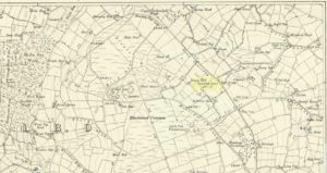
Standing stone on 1894 map

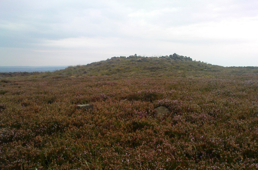
Also known as the Field House Standing Stone, this monolith seems to have gone.  It was first described in local Minister’s Accounts of 1403, and then again in the Wakefield court-rolls of 1515.  By the time John Watson (1775) wrote about the place there had been several other references describing this old “standyngstone”. It was still upright in 1852, but Ordnance Survey showed it as “Site of – ” at the beginning of the 20th century, and the stone had been moved a short distance away, further down from its original position to a spot at the side of the old trackway — but all trace of it has since vanished.

Folklore

This is thought to have been the standing stone which Robin Hood threw here, from the appropriately called Robin Hood’s Penny Stone at Wainstalls. The tale tells how he dug it out of the ground with a spade and threw it three-and-half miles across the valley until it landed here. Ooh, what a strong boy!

References:

  1. Bennett, Paul, The Old Stones of Elmet, Capall Bann: Milverton 2001.
  2. Smith, A.H., The Place-Names of the West Riding of Yorkshire, volume 3, Cambridge University Press 1961.
  3. Watson, John, The History and Antiquities of the Parish of Halifax, T. Lowndes: London 1775.

© Paul Bennett, The Northern Antiquarian

Robin Hood’s Penny Stone, Wainstalls, West Yorkshire

Stone Circle (destroyed):  OS Grid Reference – SE 046 288

Archaeology & History

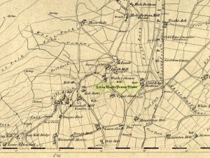
The Pennystone on 1852 map

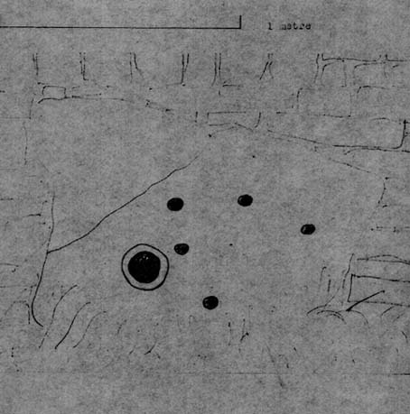
All remains of this site, first mentioned as a stone circle in 1836, have gone. The place could be found by the appropriately named Stone Farm at the top end of Wainstalls and was first mentioned by John Watson (1775), who strangely said nothing about any circle here.  However, this changed when John Crabtree (1836) arrived and described a ring of stones surrounding a large boulder in the centre (illustrated here). The boulder itself was actually called the Robin Hood Penny Stone.

Folklore

Watson's 1775 drawing
Watson’s 1775 drawing

This was one of the many legendary sites from where our legendary outlaw practiced shooting his arrows.  He was also said to have picked up and thrown a large standing stone from this spot, until it landed three-and-a-half miles away on the hillside on the other side of the Calder Valley. (this was known as the Field House, or Sowerby Lad Standing Stone)

References:

  1. Bennett, Paul, The Old Stones of Elmet, Capall Bann 2001.
  2. Crabtree, John, Concise History of the Parish and Vicarage of Halifax, Hartley & Walker: Halifax 1836.
  3. Dobson, R.B. & Taylor, J., Rymes of Robyn Hood, Alan Sutton: Gloucester 1989.
  4. Faull, M.L. & Moorhouse, S.A., West Yorkshire: An Archaeological Guide (4 volumes), WYMCC: Wakefield 1981.
  5. Varley, Raymond, “A Stone-Axe Hammer, Robin Hood’s Penny Stone and Stone Circle at Wainstalls, Warley, near Halifax,” in Yorks. Arch. Journal 69, 1997.
  6. Watson, John, The History and Antiquities of the Parish of Halifax, T. Lowndes: London 1775.

© Paul Bennett, The Northern Antiquarian

Rocking Stone, Rishworth Moor, West Yorkshire

Legendary Rock:  OS Grid Reference – SD 990 150

Archaeology & History

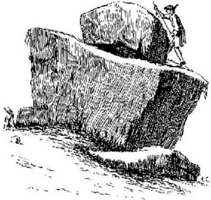
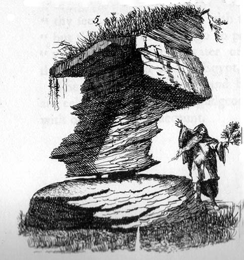
Rishworth Moor Rocking Stone, 1775

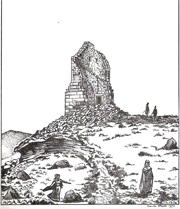
The reverend John Watson (1775) first wrote about this place, describing it as, “a group of stones, laid, seemingly, one above another, to the height of several yards, and called the Rocking stone.”  Very little archaeological remains have been described hereabouts, save the odd flint scatters here and there.  Anything which might have been here in the past was likely destroyed when the M62 was built right next to the site.

Folklore

The rocking stone was long ascribed in local tradition to be a  site used by the druids.  It was said that in bygone days the great boulder would rock, but this must have been a long time ago as even when Mr Watson described it, he told how “that quality is lost.”

Close by is the sometimes dried-up spring known as the Booth Dean Spa, which Watson thought might have been related to whatever ancient rituals occurred here.

References:

  1. Watson, John, The History and Antiquities of the Parish of Halifax, T.Lowndes: London 1775.

© Paul Bennett, The Northern Antiquarian