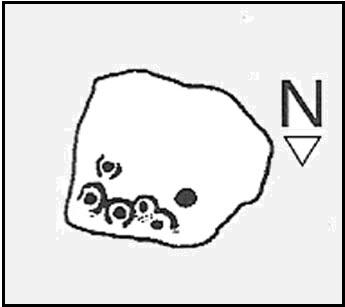
Snowden Carr (570a), Timble, North Yorkshire

Cup-Marked Stone:  OS Grid Reference – SE 1777 5128

Getting Here
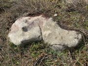
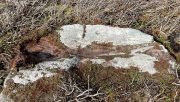
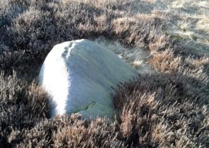
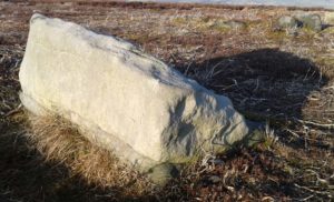
The stone in question

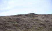
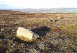
From the Askwith Moor car-park (SE 1757 5067), walk along the road north for a few hundred yards until you reach the gate on your right and head through the heather to the Death’s Head carving.  From here walk in a northwesterly direction up the gentle slope for 50-60 yards and, before reaching its crown, keep your eyes peeled for a low flat stone with a curvaceous crack running roughly halfway across it.  If the heather’s deep, you might not have a cat in hell’s chance of finding it!

Archaeology & History

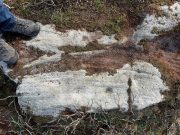
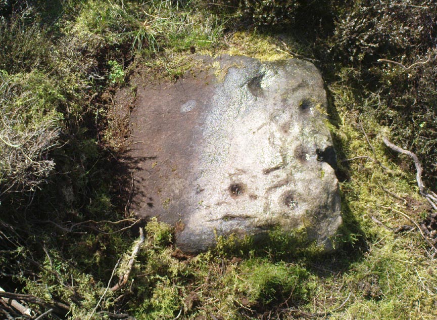
This carving isn’t much to look at on two levels: i) it’s a pretty simplistic design with no rings, and (ii) it’s very faint and almost impossible to see until the light is just right—except for one of the cups, which itself might be natural (there are a few like that amidst the Askwith complex).  It’s very much a carving for the purists among you, as I always say.  Nonetheless, for the record:
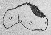
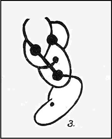
Crap sketch of design
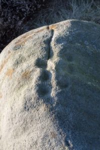
Faint cups visible

The most notable element is the single “cup mark” on the more easterly section of the stone, on one side of the natural crack.  It catches your eye and is what makes you give the stone a little more attention, although I couldn’t make up my mind whether this was Nature’s handiwork or humans.  It may be a bit of both.  On the other side the crack we can see a small group of very faint eroded cup-marks — just!  What seems to be three of them cluster in a small triangle formation, but one of these may be natural (tis hard to say for sure), with another isolated cup closer to the crack, and a final one further to the outer edge of the stone.  All are very faint but stood out when the sun was low on our recent visit here.  Give it your attention when you’re next having a look at the settlement and cairnfield close by.

© Paul BennettThe Northern Antiquarian

Hornbeam Farm, Harrogate, North Yorkshire

Cup-and-Ring Stone (destroyed?):  OS Grid Reference – SE 314 537

Archaeology & History

The chances of this carving still being alive, so to speak, are pretty slim.  It was reported by a Mr. Sullivan to the old Yorkshire petroglyph researcher Stuart Feather back in 1965, in the days when English archaeologists didn’t really give a shit about rock art.  Sad but true.  The carving was found in the grounds of what used to be the ICI Fibres Research Centre, in the present landscape of Hornbeam Business Park, a hundred yards or more west of Hookstone Beck.  According to Feather’s report, the carving consisted of “a single-ringed cup and a groove” surrounding “two short pecked grooves and a meandering groove leading off,” all with clear signs of being pecked and carved in the old-school manner.  All trace of the carving has vanished and it was probably destroyed by the Industrialists. (the grid-reference to this site is an approximation)

© Paul BennettThe Northern Antiquarian

Snowden Carr (566a), Timble, North Yorkshire

Cup-Marked Stone:  OS Grid Reference – SE 17724 51258

Getting Here

The 2 cups, top-middle

Easiest way is to park up at the Askwith Moor car-park spot, turn right and walk along the road for about 350 yards until you reach the gate on the right (not the one across the road!).  You then need to head to the Death Head’s Stone carving about 450 yards across the moor to the east. It’s pretty conspicuous.  From here, walk through the heather 80-odd yards northwest.  You’ll walk past some extensive rubble walling (whose nature yet eludes us) before you get there.

Archaeology & History

Looking down at the cups

Discovered recently by Sarah Walker on a venture to see the extensive settlement and graveyard around Snowden Crags, this petroglyph is a simple basic design cut into a relatively large flat stone just above ground level.  Found less than 100 yards east of the dubious Snowden Carr (565) carving, there are two large cup-marks on this one: one of them is an inch deep and two-inches across and may originally have been geophysical in nature, but has subsequently been worked by human hands.  To its side is another much fainter and shallower cup-mark about the same width.  On some photos there’s what appears to be a very faint large ring surrounding the faint cup, but until visits are made at low sun and the stone brushed with water, we cannot be sure whether it’s real or just a trick of the light.  There may be more cups on this stone beneath the peat.  We didn’t brush it all off.

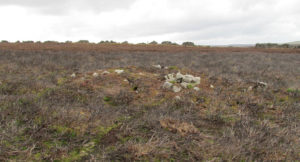
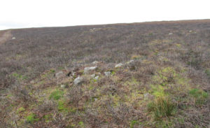
Some 30-40 yards to the east is the rubble of an extensive prehistoric man-made structure, the nature of which has yet to be discerned.  The Snowden Moor cairnfield begins immediately to the northwest, with the first tomb barely 50 yards away.

© Paul BennettThe Northern Antiquarian

Fiscary Cairnfield, Bettyhill, Sutherland

Cairnfield:  OS Grid Reference – NC 7279 6232

Getting Here

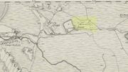
Tumuli on 1878 map

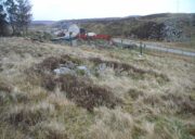
From Bettyhill, go out of the village along the A836 Thurso road for just over a mile.  You go uphill for a few hundred yards and just as the road levels-out, there’s the small Farr Road on your left and the cattle-grid in front of you.  Just before here is a small cottage on your left.  In the scrubland on the sloping hillside just below the cottage, a number of small mounds and undulations can be seen.  That’s it!

Archaeology & History

Although this place was highlighted on the first OS-map of the area in 1878, I can only find one modern reference describing this somewhat anomalous cluster of sites.  It’s anomalous, inasmuch as it doesn’t have the general hallmark of being a standard cairnfield or cluster of tumuli.  For one, it’s on a slightly steep slope; and another is that amidst what seems to be cairns there are other, more structured remains.  As I wandered back and forth here with Aisha, I kept shaking my head as it seemed somewhat of a puzzling site.  As it turns out, thankfully, I wasn’t the only one who thought this…

One of the ‘cairns’ from above
Profile of a typical cairn

In R.J. Mercer’s (1981) huge work on the prehistory of the region, he described the site as a whole as a field system comprising “enclosures, structures, cairns and field walls” and is part of a continual archaeological landscape that exists immediately east, of which the impressive Fiscary cairns are attached.  In all, this ‘cairnfield’ or field system is made up of at least 23 small man-made structures, with each one surviving “to a height of c.0.5m and are associated with 11 cairns from 2-6m is diameter.”

In truth, this site is probably of little interest visually unless you’re a hardcore archaeologist or explorer.

References:

  1. Mercer, R.J., Archaeological Field Survey in Northern Scotland – volume 2: 1980-1981, University of Edinburgh 1981.

Acknowledgments:  To the awesome Aisha Domleo, for her images, bounce, spirit and madness – as well as getting me up here to see this cluster of sites.

© Paul BennettThe Northern Antiquarian

Lower Lanshaw Dam (02), Burley Moor, West Yorkshire

Cup-Marked Stone:  OS Grid Reference – SE 14223 44888

Getting Here

Along the moorland road between Cow & Calf and The Hermit pub, park up at the small wooded bit by the right-angle bend and cross over the Coldstone Beck.  Walk up onto the moor itself and stick to the path that runs roughly parallel with the slowly-drying stream, towards Lower Lanshaw Dam.  About 100 yards before it, walk left, into the heather, for about 50 yards.  You’re damn close!

Archaeology & History

Lower Lanshaw Dam carving
Close-up of cupmarks (by James Elkington)

This is another neolithic or Bronze Age carving I first came across during one of my weekly rambles across these hills as a child, and upon revisiting the place a few days ago with James Elkington, found it associated with nearby cairns and what looks to be the remains of prehistoric walling – none of which I noticed when I was a kid.  The petroglyph is a simple design, primarily consisting of two rows of three cup-marks: one row of three along the top or spine of the rock, and another one immediately beneath it, an inch or so below.  The topmost line of cups runs into a natural crack in the rock, which runs down the northwest edge of the stone.  A possible faint cup and partial ring emerges on the southeast side of the topmost row of cups, but this is difficult to make out.  On the sloping northwest face of the rock is another single cup-marking.

References:

  1. Bennett, Paul, Of Cups and Rings and Things, unpublished: Shipley 1981.

Acknowledgements:  Many thanks to James Elkington for use of his photo to illustrate this petroglyph

© Paul Bennett, The Northern Antiquarian


Lower Lanshaw Dam (01), Burley Moor, West Yorkshire

Cup-Marked Stone:  OS Grid Reference – SE 1416 4489

Getting Here

Take the same directions as if you’re visiting the Lanshaw Dam 2 petroglyph, then keep walking directly towards the Lanshaw Dam, 130 yards east.  Halfway between the two, closer to the footpath, look out for a stone of similar shape and dimensions to Lanshaw 2, just by a prehistoric cairn.  You’ll find it!

Archaeology & History

Cup-marked stone & cairn
Close-up of cup marking

As with a great number of petroglyphs in and around Yorkshire, this large single cup-marked rock is found in close association with a reasonably large prehistoric cairn (several others are close by), some 3 yards in diameter.  The cup-marking here is larger than yer average cup-mark on these moors, being four inches across. It can clearly be seen on the southern vertical face of the rock and doesn’t appear to have been recorded before.  On the whole, it’s nothing special to look at and is probably just one for the petroglyphic purists amongst you.

© Paul Bennett, The Northern Antiquarian

Cock Howe, Skelton Moor, Marske, North Yorkshire

Cairn:  OS Grid Reference – NZ 0811 0063

Getting Here

Cock Howe1 cairn

Take the minor high road between the hamlets of Marske and Fremington (up Hard Stiles from Marske side), turning up Stelling Road at the crossroads, and ⅔-mile (1.1km) along, turn right up Helwith Road. ¾-mile (1.2km) along, on the right, walk thru the gate onto the moor following the walling.  Nearly 400 yards on you meet a junction of walling: walk past this until you reach the next line of walling and then follow it northeast for just over 500 yards. Once there, look for the mounds in the heather immediately south, less than 50 yards away.

Archaeology & History

This is one of the “isolated cairns of fair size” mentioned in passing by Tim Laurie (1985) in his survey of the massive settlement and field systems scattering this gorgeous moorland arena.  It is one amongst a scatter of several in and around the eastern height of Cock Howe hill on the south side of Skelton Moor.  The area has sadly been scarred by an excess of old lime mines—many of which are visible close by—damaging with some severity the excess of prehistoric remains on these moors, none of which have yet been excavated in any detail.  This cairn included.

More cairns to the rear

Even though much of the heather here had been burnt back when James Elkington and I visited the place recently, the pile of stones was still very embedded into the peat.  The moorland rabbits had dislodged some of the stones, highlighting the mass of rocks much better.  It stands nearly a metre high and is roughly 7 yards by 8 yards in diameter from edge to edge, structurally similar to the many Bronze Age cairns scattering Rombalds Moor, Askwith Moor and other Yorkshire clusters.  A second cairn of similar size and stature exists some 30 yards to the southeast (visible on one of the photos).

For anyone who might visit this site, the most impressive features hereby are the huge settlement remains scattering the moors just north of the wall a few yards away.  When the heather has been burnt back, a veritable prehistoric city unfolds before your eyes, with extensive lengths of walling, hut circles and what can only be described as huge halls, in which tribal meetings probably occurred – much of it in superb condition!  Well worth visiting.

References:

  1. Laurie, T.C., “Early Land Division and Settlement in Swaledale,” in Upland Settlement in Britain: the Second Millennium B.C. and After, ed. Don Spratt and Colin Burgess, BAR British Series 143, 1985.
  2. Martlew, R.D., Prehistory in the Yorkshire Dales, YDLRT: York 2011.

© Paul BennettThe Northern Antiquarian


Death’s Head Carving (577), Askwith Moor, North Yorkshire

Cup-and-Ring Stone:  OS Grid Reference – SE 17795 51235

Also Known as:

  1. Carving no.577

Getting Here

Follow the directions to find the Tree of Life Stone, then follow the main footpath uphill from it.  Once on the level, look out for a couple of large rocks abaat 100 yards to your left.  Check ’em out, cos it’s on one of ’em!

Archaeology & History

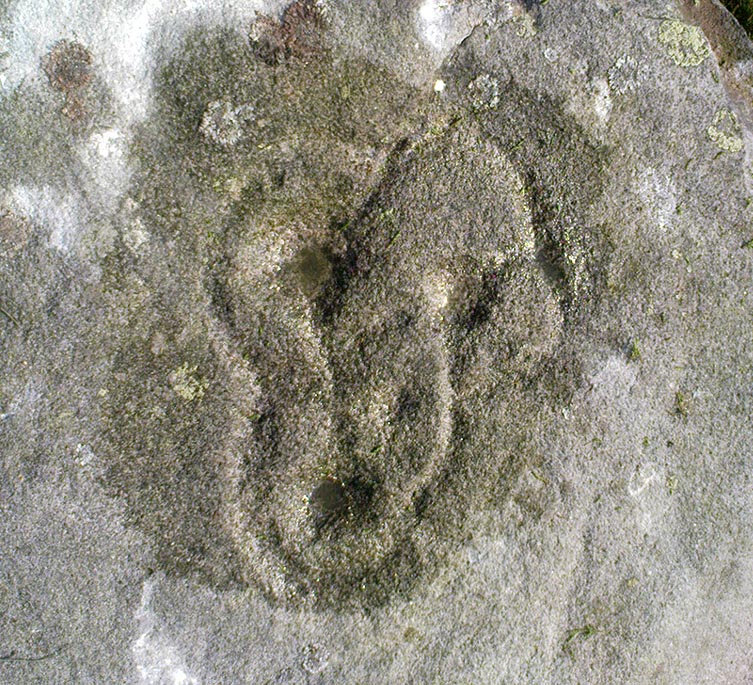
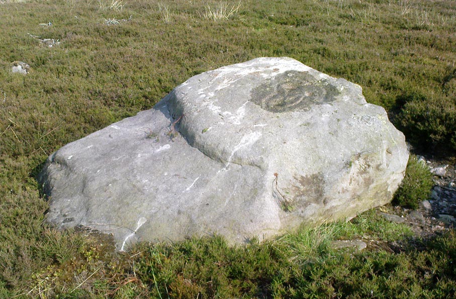
This is another decent carving living on these prolific moors.  Found near the end of a lengthy line of prehistoric walling that runs east-west over this part of the moor, the general Rorsharch-response to this carving is of some sorta skull or screaming face.  My impression of it the other day was, “it looks like a pig!”

Although mentioned by numerous writers, the first description of it was in Eric Cowling’s (1937) essay on the cup-and-ring stones north of Otley, saying:

“On an isolated table stone, situated at the upper end of the shallow valley which drains Snowden Carr, the writer found a marking having a strangely skull-like appearance, but which is really a group of three large cups which are linked by inter-turning curved grooves.”

Close-up of main design
The Death’s Head Rock

He then strives to make links between this carving and the design on the Swastika Stone above Ilkley — which in some way is a little similar, i.e., as a three-armed triskele swastika; but the notion is perhaps as accurate as saying it represents a cloud, or a tree, or bird-flight, or any number of other natural phenomena.  Beckensall’s (1999) brief note of the stone — despite getting his grid-ref off by a few hundred yards — described it as “four cups linked and enclosed by grooves, unconvincingly suggesting a skull to some people.”  With Boughey & Vickerman (2003) saying:

“Fairly large, upstanding rock with surface sloping down to N. Figure of four cups linked by and enclosed by grooves: entire pattern resembles a skull, hence the name ‘Death’s Head Rock.'”

References:

  1. Beckensall, Stan, British Prehistoric Rock Art, Tempus: Stroud 1999.
  2. Boughey, Keith & Vickerman, E.A., Prehistoric Rock Art of the West Riding, WYAS 2003.
  3. Cowling, Eric T., “Cup and Ring Markings to the North of Otley,” in Yorkshire Archaeological Journal, part 131, 33:3, 1937.
  4. Cowling, Eric T., Rombald’s Way: A Prehistory of Mid-Wharfedale, William Walker: Otley 1946.

© Paul Bennett, The Northern Antiquarian


Snowden Carr Carving (580), Askwith, North Yorkshire

Cup-and-Ring Stone:  OS Grid Reference – SE 17797 51007

Getting Here

Same direction as for cup-and-ring carving 581.  This small pyramidal stone (easily missed if you aint careful) is a yard or two away beneath the heather. You might have to scrabble round on the ground, but you’ll find it.

Archaeology & History

Faint cup-and-ring

The first description of this little stone was by Boughey & Vickerman (2003). Found amidst the cairnfield first mentioned by Cowling (1937), he missed this in his early days — but it’s easily done!  All we have here on the very top of the stone is a “cup with a gapped ring”, fading away beneath elements and poor light conditions.  As you can see in this photo, it’s hard to make out (so if you can get a good photo or two stick it on our Facebook group).

References:

  1. Boughey, Keith & Vickerman, E.A., Prehistoric Rock Art of the West Riding, WYAS 2003.
  2. Cowling, Eric T., “Cup and Ring Markings to the North of Otley,” in Yorkshire Archaeological Journal, part 131, 33:3, 1937.

© Paul Bennett, The Northern Antiquarian 


Snowden Carr Carving (579), Askwith, North Yorkshire

Cup-Marked Stone:  OS Grid Reference – SE 17798 51007

Also Known as:

  1. Small Rings Stone

Getting Here

Follow the directions to reach cup-and-ring Carving 581 and this small stone is about 10 yards above it, up the slight slope amidst the heather.  You might have to look around a bit though, as it’s a small flat stone and gets easily overgrown.

Archaeology & History

Broken cup-and-ring stone

Founds amidst a cluster of what Eric Cowling called “a barrow group,” or a cluster of cairns, is this excellent little carved stone, with a number of cup-and-rings close to what is now the northern edge of the rock.  But this small stone has blatantly been split off from a larger piece (perhaps split in half), but a brief scramble in the heather here couldn’t locate the other part of the stone — which is a great pity.  For although we have four or five cup-and-rings linking onto each other, where the stone has been split, one of the cups has been cut away and it seems obvious that there was more carved onto the other lost section of the stone — wherever it may be!  There is the possibility that this stone was thrown down from a nearby cairn and was broken in the course of its movement; but we might only find this after the heather’s been burnt back in the near future.  Anyway, Boughey & Vickerman (2003) discerned this as a

“small square rock with smooth level surface.  Six cups, five with incomplete rings and some running into one and other.”

It’s a good one (despite what my poor photos may infer) and well worth a look at if you’re into your rock art!

References:

  1. Boughey, Keith & Vickerman, E.A., Prehistoric Rock Art of the West Riding, WYAS 2003.
  2. Cowling, Eric T., Rombald’s Way: A Prehistory of Mid-Wharfedale, William Walker: Otley 1946.

© Paul Bennett, The Northern Antiquarian