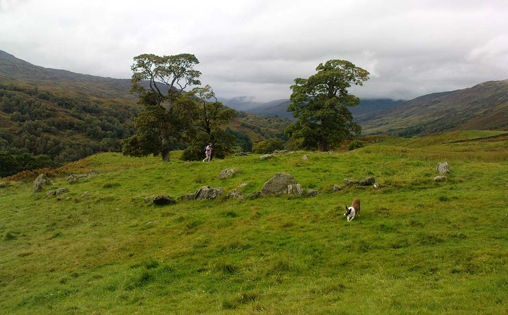
Tullich, Glen Lochay, Killin, Perthshire

Enclosure:  OS Grid Reference – NN 5235 3684

Also Known as:

  1. Tirai West
  2. Tullich East
  3. Canmore ID 78043

Getting Here

The ‘stone circle’ of Tullich!

Go through Killin past the Bridge of Lochay pub, turning immediately down the small lane by its side.  After about 3 miles you’ll cross over the small river past Duncroisk.  Keep going for another few hundred yards (if you reach Tullich you’ve gone too far), watching out for the gate on your left.  Walk up to the top of this field, over the wall and up again.  You’ll see a couple of tall trees with distinctive walling next to them, just on a ridge above you.  That’s where you’re heading!

Archaeology & History

This is a fine-looking example of a prehistoric enclosure, perched on the edge of one of the grassy knolls on the far western extremities of the deserted village of Tirai.  If you walk towards it from the derelict village east of here, the elliptical form of the site gives you the distinct impression that you’ve just chanced upon a seemingly unknown stone circle nestled upon the edges of this gorgeous Scottish glen; but this initial excitement is soon dispelled once you get into the heart of the site!
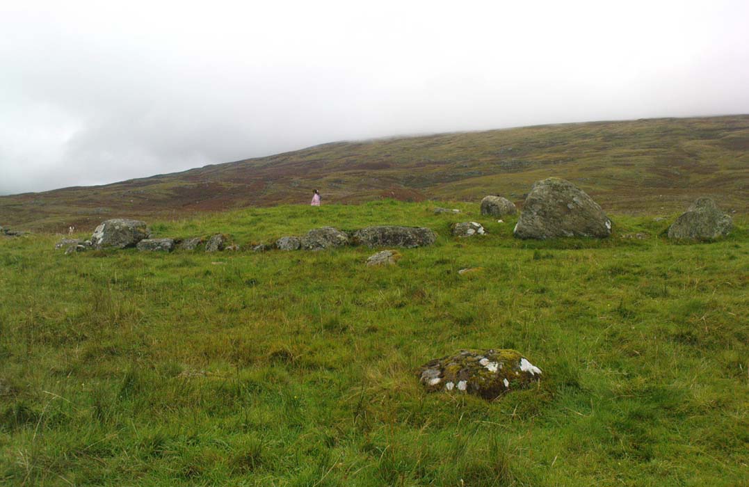
Southern line of walling
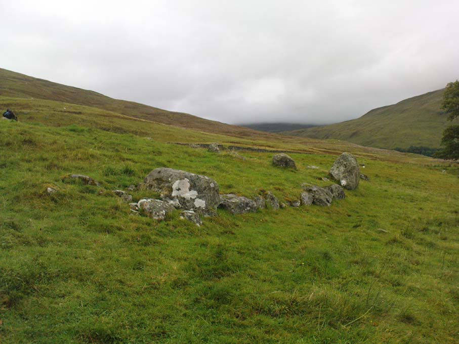
Looking east

Although you’ll find a couple of derelict post-medieval buildings on the western side of this structure, the lay-out of this monument would seem to be Iron Age origin, perhaps earlier.  It certainly has all the hallmarks of a walled structure from that period and typifies many others that I’ve explored down the years.

The eastern and southern sections of the walls are in very good states of preservation, although the ground has obviously grown up and around the bases of the stonework.  It has a total outer circumferences of about 95 yards (87m), with the many upright stones measuring between 12 inches to more than 3 feet in height.  The western section of the enclosure is mostly overgrown but easily traced on foot.  Near the centre of the site is a large flattish stone that gave the impression of having an oratory function from where one could speak to the rest of the people sat around the inner edges of the enclosure — but this was a purely subjective impression.
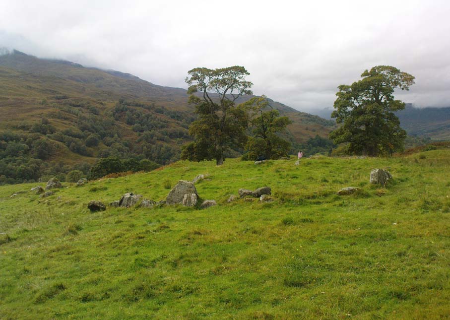
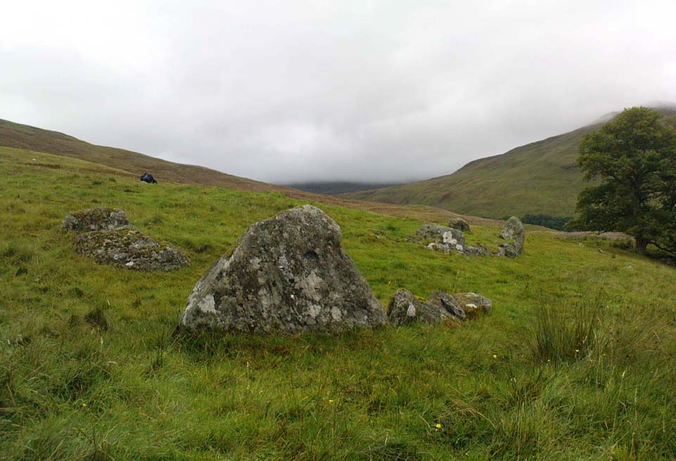
NE sections of enclosure
Outer section & ‘standing stone’

On the southern side of the elliptical structure is another, outer line of walling, or a stone alignment of some sort just a few yards long, consisting of just a few upright stones — one of which stands considerably taller than all the others hereby, giving the impression of a standing stone.  It has a large natural cup-marking on its southern face.

To my limited knowledge there’s been no excavations here, so one wonders whether or how or if the people of Tirai made use of this much earlier building.  The Canmore entry of the place tells:

“The N side of this enclosure is a low turf and stone bank of height 0.3m and is 20m long, spread to about 1.2m. The E side is outlined by large stones set on edge with no evidence of intermediate stone walling or turf. A bank of similar more continuous stone extends to the W from the S of the main enclosure down sloping ground. This type of walling is different from any other on Tirai. The large stones set on end have suggested a prehistoric date for this enclosure.”

References:

  1. Johnstone, A. & Wood, S., “Tirai (Killin Parish), Pre-Enclosure Settlements,” in Discovery & Excavation in Scotland, 1990.

© Paul Bennett, The Northern Antiquarian

The map could not be loaded. Please contact the site owner.

Tobar na Cailleach, Keith, Banffshire

Sacred Well:  OS Grid Reference – NJ 42659 47528 

Also Known as:

  1. Cailleach Well 
  2. Tobar Chailleach 
  3. Well of the Cailleach

Folklore

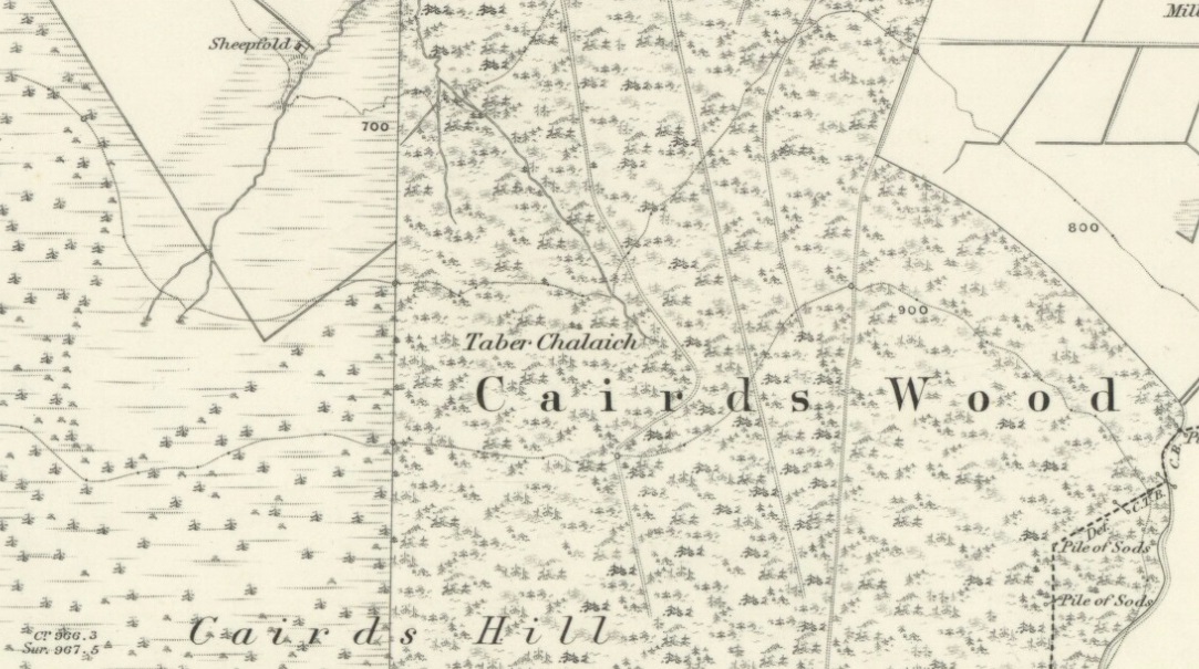
Cailleach Well on 1869 map

Described on the earliest OS-map of the region as Taber Chalaich, this great “well of the old woman, or hag” is found on the northern slopes of Cairds Hill, amidst increasingly dense woodland up the top of the stream which ebbs and flows in strength (depending on the weather).  A water source dedicated the prima mater Herself — i.e., the heathen pre-Celtic female creation deity par excellence — it was once of considerable repute locally as being a great curing well and was described by Ruth and Frank Morris (1981) as being,

“the scene of a pagan ceremony in which the Earth Mother in her old woman phase bathed at the well and returned as a young maiden.”

On the hill at the top we find remains of old tombs (mistakenly ascribed by Mr & Mrs Morris as ‘stone circles’), some of which may have had some mythic relationship with this legendary water source.  Further information and/or any photos of this little-known site would be hugely welcomed!

References:

  1. Morris, Ruth & Frank, Scottish Healing Wells, Alethea Press: Sandy 1982.

© Paul Bennett, The Northern Antiquarian

The map could not be loaded. Please contact the site owner.

Devil’s Dyke, Poynings, Sussex

Hillfort:  OS Grid Reference – TQ 260 111

Also Known as:

  1. Brighton Dyke
  2. Poor Man’s Wall 

Getting Here

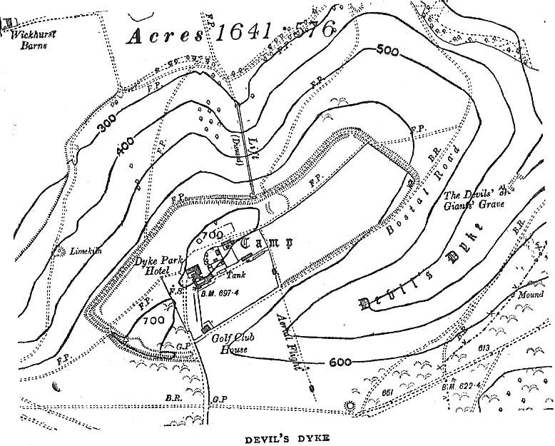
Map of Devil's Dyke
Map of Devil’s Dyke

Plenty of ways of approaching this huge fella!  Personally, I’d take it from the steep valley immediately east and north where the ramparts drop you down the hill, if only to get a decent idea of the scale of the thing!  But those of you into taking it easy can do no better than take the country road south out of Poynings village (towards Brighton), down Saddlescombe Road, for just under a mile, where you should take a right-hand turn along the Summer Down lane for a mile. You’ll then hit the Devil’s Dyke Road. Turn right here and go to the end.  You’re right in the middle of it!

Archaeology & History

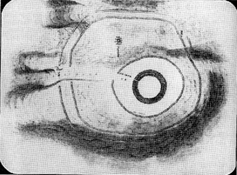
Early plan of Devil’s Dyke ‘camp’

Although most of this huge monument hasn’t been given the investigation it deserves — hence making knowledge of its origins more speculative than factual — as Jacquetta Hawkes (1973) wrote, seemingly all those years ago now, “it is known that a village lying half in and round them was occupied in the Belgic period at the end of the Iron Age.”  And it’s certainly big enough!  The encircling circuit of dykes themselves stretch all the way round a distance of more than 2150 yards long (that’s 1.22 miles, or 1.97km!), with the longest east-west axis being more than half-a-mile across.

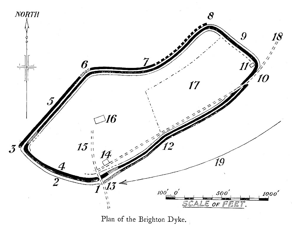
Nowadays it seems, the Devil’s Dyke is the name given to the steep valley below the encampment, but a hundred years back it was the camp itself that was known by this name.  Described by the wandering antiquarian R. Hippisley Cox (1927) as “a camp containing forty acres (with) very steep and difficult approaches,” another early account in The Antiquaries Journal — commenting on a ground-plan of the site from the Brighton and Hove Herald of 1925 — told:

“The heavy encircling lines represent ramparts, and the thin line marks the outer margin of the accompanying ditch.  A spur renders the earthwork weakest on the south-west, and the rampart is therefore highest between the points 1 and 3, rising 21ft vertically above the ditch, which is nearly filled up at the present time.  On the north-west there is steep slope outside the camp, and the ramparts are considerably lower, the iner ditch being nearly obliterated.  The outer rampart is now wanting betwen 7 and 8, but this inner one becomes stronger as the outer slope of the ground decreases, only to die away again on the south-east where the camp overlooks the steep Dyke Valley.  A double-bank and inner ditch can still be traced from the north-east angle to a point near the old golf-club house.”

I first came here as a young lad and the site was lost on me (in them days, if monuments weren’t stiff and upright, I really didn’t see the point!).  These days however, the size of it alone blows you away somewhat.

Folklore

As you’d expect the creation myths of this site and its edges relate to our old heathen friend, the devil!  The landscape itself was, in old lore, the work of the devil (though prior to this, the devil was known in peasant-lore to be a legendary giant, though I am unaware of the name/s of the giant in question); and the great valley below the Devil’s Dyke encampment was actually dug out by Old Nick in the old tales.  That old folklorist Jacqueline Simpson (1973) takes up the story:

“The Devil…had been infuriated by the conversion of Sussex, one of the last strongholds of paganism in England, and more particularly by the way the men of the Weald were building churches in all their villages.  So he swore that he would dig right through the Downs in a single night, to let in the sea and drown them all.  He started just near Poynings and dug and dug most furiously, sending great clods of earth flying left and right — one became Chanctonbury, another Cissbury,  another Rackham Hill, and yet another Mount Caburn.  Towards midnight, the noise he was making disturbed an old woman, who looked out to see what was going on.  As soon as she understood what he was up to, she lit a candle and set it on her window-sill, holding up a sieve in front of it to make a dimly glowing globe.  The Devil looked round, and thought this was the rising sun.  At first he could hardly believe his eyes, but then he heard a cock crowing — for the old woman, just to make quite sure, had knocked her cockerel off his perch.  So Satan flew away, leaving his work half done.  Some say that as he went out over the Channel, a great dollop of earth fell from his cloven hoof, and that’s how the Isle of Wight was made; others, that he bounded straight over into Surry, where the impact of his landing formed the hollow known as his Punch Bowl.”

That’s the story anyway — take it or leave it!  Of importance in this fable is the figure of the “old woman”: a much watered-down version of the cailleach figure of more ancient northern and Irish climes, where tales of her doings are still very much alive.  And many are the tales of her battles with other giant figures, just as we evidently once had here.

Ghosts have been reported by local people upon this hill-top site; and there are a number of other folktales to be found here…which I’ll unfold over time as the months pass by…

References:

  1. Anon., “Notes: The Brighton Dyke,” in The Antiquaries Journal, 5:4, October 1925.
  2. Clinch, G., “Ancient Earthworks,” in Victoria County History of Sussex – volume 2 (edited by W. Page), St. Catherine’s Press: London 1905.
  3. Cox, R. Hippisley, The Green Roads of England, Methuen: London 1927.
  4. Hawkes, Jacquetta, A Guide to the Prehistoric and Roman Monuments in England and Wales, Chatto & Windus: London 1973.
  5. Hogg, A.H.A., “Some Aspects of Surface Fieldwork,” in The Iron Age and its Hillforts (edited by M. Jesson & David Hill), Southampton University Archaeology Society 1971.
  6. Simpson, Jacqueline, The Folklore of Sussex, Batsford: London 1973.
  7. Simpson, Jacqueline, “Sussex Local Legends,” in Folklore Journal, volume 84, 1973.

© Paul Bennett, The Northern Antiquarian

The map could not be loaded. Please contact the site owner.

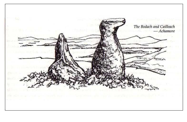
The Bodach and Cailleach, Gigha, Argyll

Sacred Stones:  OS Grid Reference – NR 6382 4730

Folklore

The Bodach and the Cailleach
The Bodach & the Cailleach

On this “Isle of the Gods” — as some historians proclaim Gigha to mean — the ancient rites and ceremonies of local folk continued until pretty recent times.  One writer narrated some intriguing pre-christian events connected to this curious and little-known place, speaking of indigenous heathen rites:

“These are in fact known to have persisted on the island until well into the early part of the (19th) century when Irish fishermen could still be seen climbing the little hill of Moinean Sitheil, in the sacred Moss of Peace below Ardminish, to pay homage to the “Old Ones” of Gigha: a pair of ancient legend-shrouded stones known as the Bodach and the Cailleach, that from time immemorial have stood upon a low green knoll below the farm of Achamore.

“Through the countless ages the strange jug-headed little Bodach and his smaller consort have kept steadfast vigil over Gigha: their mysterious aura said to guarantee its continuing fertility and prosperity as they link the thriving island of today with beliefs and traditions having roots in the earth-cults and sun-worship of primeval times.  In the past folk would have honoured them with offerings of meal or milk and even now they still command considerable local affectation and respect, albeit expressed in less overtly pagan ways.  And so they stand as ever upon their tiny hillock gazing out across tumbling terraces of old Cantereoch and beautiful Ardlamey Bay, inscrutable and silent, yet with a strangely ‘knowing’ air impossible to define.”

References:

  1. Anonymous, Exploring Historic Kintyre and the Isle of Gigha, Harlequin Press: Oban n.d.

© Paul Bennett, The Northern Antiquarian

The map could not be loaded. Please contact the site owner.

Allt na Ceardaich Knoll, Killin, Perthshire

Cup-Marked Stone:  OS Grid Reference – NN 564 364

Getting Here

Truly troublesome if you aint into walking.  Many ways up, but the easiest has to be the zigzagging trackway up from the valley bottom just by The Green a few hundred yards past Lochay Power Station, up the southern edge of Creag na Cailleach. At the end of the trackway, take the stream uphill for a few hundred yards and watch out for the rocky rise to your right (east).  Head for it and check out the rocks there.  You’ll find it!

Archaeology & History

Allt na Ceardaich01
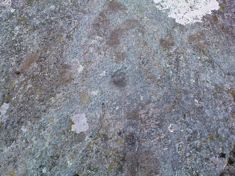
Single cup-marked rock below Creag na Cailleach

I’m not sure that anything’s previously been written about this curious single cup-marked boulder. I say ‘curious’, simply because of the location and position of the clear cup-mark on this near-gigantic piece of embedded stone.  We walked upon the rocky outcrop south of Creag na Cailleach (above the tree-line where the land levels out) and first saw the cup-marking at the top-end of this huge rock (amidst a number of others) on the large rise a coupla hundred yards west of Allt na Ceardaich.  And as the carved cup was on the top-end of the boulder, I was expecting to find much more of the rock with other motifs scattering its body — but was amazed to find that this was the only single cup-marking on an otherwise huge stone.  A mixture of bewilderment and disappointment came over me as I shook my head in disbelief that only a single cup had been scribed into an otherwise massive rock.

Allt na Ceardaich02
Close-up of the cup-marking

However, the light was poor with low cloud and it was nearing sunset, so there may have been other aspects to this carving which we missed out on.  One other ‘possible’ cup-mark might have been done, but it seemed very dubious even in the poor light.  I was all for having another look at it the following day; but wandering halfway up a mountain just to see if this was the only cup-marking on this outcrop was summat my daughter wasn’t into doing!  So the site must await another mad cup-and-ring-crazed traveller on another day to get a more detailed inspection!  George – are you out there anytime soon!?

© Paul Bennett, The Northern Antiquarian

The map could not be loaded. Please contact the site owner.


Grianan of Aileach, Carrowreagh, Donegal

Hillfort:  OS Grid Reference – C 36686 19721

Also Known as:

  1. Grianan Ailighe
  2. Grianan of Ailech
  3. National Monument 140

Archaeology & History

Attributed by Michael Dames (1996) and others before him as the abode of the Dagda and the house of the sun, this huge monument was recorded in the Irish Annals as being destroyed in 1101 AD following a great battle.  A site of mythic importance to the very early Irish Kings and Queens, and used by the shamans of the tribes, The Grianan is a place of of legendary importance to folklorists, historians and archaeologists alike and has been widely described over the last 150 years.  Although the site you see today was hugely reconstructed between the years 1874 and 1878, it’s still impressive and, wrote George Petrie (1840), commands,

“one of the most extensive and beautifully varied panoramic prospects to be found in Ireland”!

Used over very long periods of time, the archaeologist Brian Lacy (1983) described the Grianan, on the whole, as,

“a restored ‘cashel’*, centrally placed within a series of three enclosing earthen banks; the site of an approaching ‘ancient road’; and a holy well.”

Grianan of Ailech
Early ground-plan of the Grianon

Lacy’s description in the Donegal Inventory is considerable and culls from the various surveys and reports done in the past.  First surveyed by George Petrie in 1835, the internal body of the stone-built site is roughly circular and measures around 25 yards across, with a singular entrance on its eastern (sunrise) side. A stone ‘seat’ is at the end of the internal passage.  At the centre of the huge ‘room’, Petrie recorded traces of a rectangular stone structure that he thought might have been the remnants of some old chapel built sometime in the 18th century.

More than 25 yards outside of the primary stone building is another surrounding embankment, oval in shape, low to the ground and with another singular entrance to the east — though this entrance is not in line with that of the main structure.  At a further distance out from this embankment are the remains of another two oval ‘enclosures’, though the the remains of the outermost one is considerably more fragmented.

Although the replenished ‘fort’ dates from the Iron Age, early remains here are thought to have been of Bronze Age origin.  A ‘tumulus’, now gone, being one such find here.

Folklore

There is much legend here.  The creation myth narrated by Scott (1938) tells that it was,

“built originally by the Daghda, the celebrated king of the Tuatha de Danann, who planned and fought the battle of the second or northern Magh Tuireadh against the Formorians. The fort was erected around the grave of his son Aeah (or Hugh) who had been killed through jealousy by Corgenn, a Connacht chieftain.”

From similar legendary sources, it is told that,

“the time to which the first building of Aileach may be referred, according to the chronology of the Four Masters, would be about seventeen hundred years before the christian era.  There are strong grounds for believing that the Grianan as a ‘royal’ seat was known to Ptolemy, the Greek geographer, who wrote in AD 120.  In his map of Ireland he marks a place, Regia…which corresponds fairly well with its situation.”

By the outer banking on the south-side of the fortress is the remains of a much-denuded spring of water, the old water supply for this place.  It gained the reputation of being a holy well, dedicated to St. Patrick.

…the be continued…

References:

  1. Dames, Michael, Mythic Ireland, Thames & Hudson: London 1996.
  2. Harbison, Peter, Guide to the National Monuments in the Republic of Ireland, Gill & MacMillan: Dublin 1982.
  3. Lacy, Brian, Archaeological Survey of County Donegal, DCC: Lifford 1983.
  4. Petrie, George, ‘The Castle of Donegal,’ in Irish Penny Journal, 1,  1840.
  5. Scott, Samuel, ‘Grianan of Aileach,’ in H.P. Swan’s Book of Inishowen, Buncrana 1938.
  6. Swan, Harry Percival, The Book of Inishowen, William Doherty: Buncrana 1938.

Links:

  1. Guarding the Grianan – the WordPress Word
  2. Grianan of Aileagh – Stone House of the Sun

* Cashels are “monuments similar in type to earthen ringforts, but enclosed by walls of drystone construction.”

© Paul Bennett, The Northern Antiquarian

The map could not be loaded. Please contact the site owner.


Old Man of Snowden, Askwith, North Yorkshire

Standing Stone (destroyed?):  OS Grid Reference – SE 1765 5032

Archaeology & History

Eric Cowling (1946) described this lost or destroyed stone as “a squat standing stone at junction of the Askwith bridge-path with the Otley-Timble highway, saying how it gave its name to Stoop Hill, “which it surmounts.” But in several ambles here in search of this old stone, we’ve yet to locate it; though we did find the Stoup Hill cup-marking and possible neighbour on the southern edge of the hilltop.

Folklore

In days of olde, the ‘Old Man’ was the fabled companion of the legendary ‘Old Woman,’ or great cailleach (the christian cult stupidly, somehow, turned this mythic figure into their ‘devil’ – to which it has no relationship whatsoever).  Although no specific folktale remains here, the name of this lost stone tells that it had some mythic tale underscoring it; perhaps simply that it marked the burial of some forgotten chief or elder.

References:

  1. Bennett, Paul, The Old Stones of Elmet, Capall Bann: Chieveley 2001.
  2. Cowling, E.T., Rombald’s Way: A Prehistory of Mid-Wharfedale, William Walker: Otley 1946.

© Paul Bennett, The Northern Antiquarian

The map could not be loaded. Please contact the site owner.

Ardtalla, Islay, Argyll

Standing Stone:  OS Grid Reference – NR 4657 5456

Also Known as:

  1. Canmore ID 38056

Getting Here

Takes a bitta getting to this one, right at the far end of the road, leading to nowhere – so those of us who like Scotland for its vast expanses of ‘middle o’ nowhere’ should like it! From Port Ellen, travel along the A846 eastwards, all the way to the where it ends in Ardbeg. But the smaller track road continues up the coast. Keep going – and keep going all the way up; past the ‘stone circle’ of Ardilistry, past the standing stone of Trudernish, right to the very end where the track leads you to the farmhouse of Ardtalla. Once here, you’ll see the stone about 20 yards west of the farm.

Archaeology & History

This old stone is only 4-foot-tall, leaning slightly, but—as I recall from many years back—”it’s cute!” (sad aren’t I?!)  All the way up here to see a small monolith!  Even the Royal Commission (1984) lads didn’t have much to say about it, merely:

“This standing stone is situated 18m NW of the SW gable of Ardtalla farmhouse.  Leaning slightly to the SSE, it measures 0.48m by 0.48m at the base and 1.25m in height.”

But if you like walking, the rest of the route up the coast is excellent. Stick yer tent in the small woodland by the fort a mile or two further north, then bring your attention to the legendary Beinn na Cailleach, if the heathen within you stirs…

References:

  1. Royal Commission on the Ancient & Historical Monuments of Scotland, Argyll – volume 5: Islay, Jura, Colonsay and Oronsay, HMSO: Edinburgh 1984.

© Paul Bennett, The Northern Antiquarian

The map could not be loaded. Please contact the site owner.

Old Woman’s Well, Guisborough, North Yorkshire

Holy Well (lost): OS Grid Reference – NZ 610 180

Getting Here

The grid reference here is an approximation, but the old well was definitely somewhere very close by, as evidenced by the place-name of the farmhouse. But if you wanna get here and wander about in the hope that you can re-locate this once sacred water source, go up the B1269 road north of Guisborough for about a mile. Carling Howe farmhouse is on the left-hand side of the road. Obviously the old well is somewhere close by…

Archaeology & History

The information I have of this site comes from old place-name listings. I found the reference in the directory for North Yorkshire by A.H. Smith (1928), in his entry for the etymology of ‘Carling Howe’ at Guisborough.  Smith ascribes the references of ‘Kerlinghou’ (which itself appears to have been lost) to mean the ‘Old woman’s mound’ and variants thereof, also saying, “There is an unidentified place in this township called Kerlingkelde,” (12th century ref. Guisborough Cartulary)—the ‘Old Woman’s Well’.  Very commonly in this part of Yorkshire—as at many other locations in northern England—a hou or howe (and variants thereof) relates to a prehistoric tomb – which is probably what we had here: a prehistoric Old Woman’s Grave with an associated Old Woman’s Well in close attendance.

The ‘old woman’ element in this name very probably relates to that primal mythic deity, the cailleach, the great prima mater of indigenous heathen folk, beloved mainly in Scottish and Irish lore, where her copious name and tales resonate to this day. This “well of the Old Woman, or cailleach“, would have been a place of particular importance in the mythic cosmology of our ancestors, but its precise whereabouts seems forgotten. There is a plentiful supply of water around Carling Howe Farm, one or more of which may once have been the site of this well. However, a lot of quarrying operations occurred here in the not-too-distant past, and this may have irreparably damaged our ability to accurately find the site – though perhaps a perusal of old field-maps could be productive.

It would also be good if we could locate the original whereabouts of the old tomb here which gave the place its name – the ‘Carling Howe’.  Other ‘howe’ sites in East and North Yorkshire turn out to be prehistoric burials and I have little doubt that the same occurred here.

References:

  1. o’ Crualaoich, Gearoid, The Book of the Cailleach, Cork University Press 2003.
  2. Smith, A.H., The Place-Names of the North Riding of Yorkshire, Cambridge University Press 1928.

© Paul Bennett, The Northern Antiquarian

The map could not be loaded. Please contact the site owner.

Tirai, Glen Lochay, Perthshire

Standing Stones:  OS Grid Reference – NN 5308 3670

Also Known as:

  1. Canmore ID 24172

Getting Here

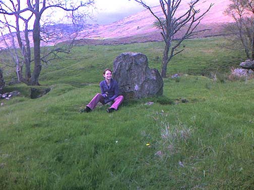
Standing stones of Tirai

From Killin, travel down Glen Lochay, past Stag Cottage or Duncroisk and over the shallow river of Allt Dhun Croisg.  If you’re in a car you can park up a 100 yards past the river bridge and walk up the track from here.  After a 10 minute walk, above the trees you come to the derelict village of Tirai* where, until recently, you were greeted by a tall totem-pole of a gnarled tree (it was superb!) which is now Earth-lain, and a fine view of the evolving hills.  Here amidst the ruins we also find a standing stone or two.

Archaeology & History

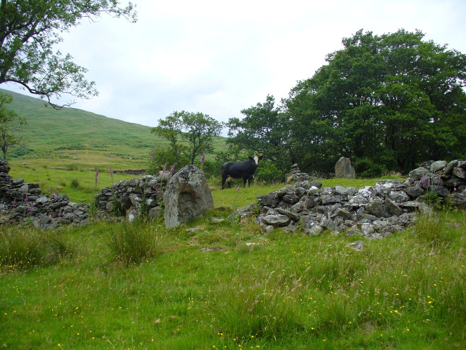
The village of Tirai was deserted sometime in the 19th century (due to the disgusting clearances of the English), but at least two standing stones still live amidst its ruins.  The tallest is nearly four-feet tall in the middle of the grassy patch and is much used by grateful cattle to rub themselves against when midges and horseflies drive them mad!  The Scottish Royal Commission lads reckon the megaliths here are,

“possibly a survivor of a stone circle as a similar stone is used nearby as a gate-post to an enclosure and several other large stones have been incorporated in the walls of the surrounding buildings.”

This may well be so – but it is equally possible that these are merely the remains of standing stones which once stood along this ridge and which were taken for use in the village.

One of the Tirai standing stones

Of the remaining standing stones in this idyllic setting – the Royal Commission fellas counted possibly four of ’em – all are roughly the same size, between 3 and 4 feet high.  Johnstone & Wood (1996) also think the stones here may once have related to a prehistoric cairn in the village.

This is an utterly beautiful arena, even in the heights of winter.  The village sits on the rear slopes behind the old cailleach, and there are plenty of cup-and-ring carvings, both known and unknown scattering the rocks and nearby hills.  The curious Duncroisk Crosses carving is just visible from here, on the other side of the rocky gorge.  Lost tales and lost sites abound here also.  I did sit and wonder though… Considering that the villagers here left the old standing stones in place until very recent centuries at the heart of their hamlet, what uses did they make of it, or what tales did it speak?  Or had the purge of the Church already taken its toll…?

References:

  1. Gillies, William A., In Famed Breadalbane, Munro Press: Perth 1938.
  2. Johnstone, A.S.K. & Wood, J.S., ‘An Archaeological Field Survey of Deserted Townships at Tirai, Glen Lochay, Killin,’ Association of Certificated Field Archaeologists (Glasgow University) Occasional Paper no 9 (1996).

* The place-name Tirai means ‘land of good luck or joy,’ which truly speaks well of its spirit and setting to me.

© Paul Bennett, The Northern Antiquarian

The map could not be loaded. Please contact the site owner.