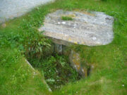
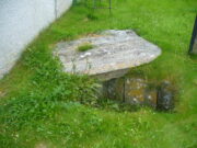
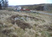
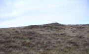
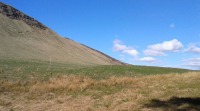
Alexander’s Hill, Follifoot, North Yorkshire

Tumulus (destroyed):  OS Grid Reference – SE 3222 5211

Archaeology & History

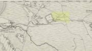
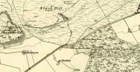
Site of tomb on 1894 map

We are thankful that the antiquarian James Wardell (1881) gave us some details of this long lost site in his survey of prehistoric remains, otherwise information about it would certainly have been lost.  Prehistoric burial mounds are rare in this part of Yorkshire, but on the rise of land behind Follifoot Ridge house could once be seen “a large barrow measuring 50 feet in diameter.”  Believed by Challis and Harding (1975) to have been a late Bronze Age structure, the story of its demise was told by Wardell as follows:

“This monument of a former age…exists no longer, owing to the ignorance and cupidity of the surveyors of the highways of the township in which it was situate; by whose orders the stones, of which it was partially composed, were carted away at intervals, during a period of some five or six years, to keep in repair a neighbouring road.  At the base were several very large stones, probably a kistvaen, and at the same time were found fragments of urns, bones and ‘pieces of brass’, which immediately became dispersed.  Some of the latter articles came into the possession of the village smith, from whom this information was obtained, and were disposed of by him to a brass-founder as old metal, and in due time, doubtless, found their way to the foundry.  From the description given of them by this person, there seems to have been amongst them some spear-heads and a palstave, but after a most diligent inquiry, there could not, as might be expected, anything whatever be recovered.  I should say that from weapons of bronze being found in this huge sepulchral mound, it was not one of the most ancient kind, but has perhaps covered the remains of British warriors slain in conflict with the Roman invaders… I am indebted to Mr John Dixon of Leeds for the information relating to the demolition of this barrow, which was only obtained by him after a lengthy enquiry; and he states that on his visit to the site, it could distinctly be traced by the grass there being of a darker hue than in other parts of the field.”

A mile to the northwest, one would have been able to see the Stone Rings of Pannal, also destroyed, and the two sites may have served some geomantic relationship with each other.

References:

  1. Challis, A.J. & Harding, D.W., Later Prehistory from the Trent to the Tyne, BAR: Oxford 1975.
  2. Wardell, James, Historical Notes of Ilkley, Rombald’s Moor, Baildon Common, and other Matters of the British and Roman Periods, Joseph Dodgson: Leeds 1869. (2nd edition 1881).

Acknowledgements:  Big thanks for being able to use the 1st edition OS-map for this site profile, Reproduced with the kind permission of the National Library of Scotland

© Paul BennettThe Northern Antiquarian


Chellow Heights, Heaton, Bradford, West Yorkshire

Cist (destroyed):  OS Grid Reference – SE 117 353

Archaeology & History

High up in the landscape on the northwestern edges of Bradford, where we now find the Chellow Heights reservoirs, ancient man saw fit to place the remains of their dead.  It’s in a damn good location too, typical of burial sites.  The views to the immediate north are directly at Rombalds Moor where, as we all know, Bronze Age and other prehistoric remains are found in huge numbers.

It was during the construction of the Chellow Heights reservoirs when the site was uncovered.  Twas here, in June 1921, where segments of three urns and,

“an incomplete incense cup, 2 inches high and 3 inches diameter at its base, were found together with partly burnt bones”,

of what were thought to be a young female adult. There are few other details.  The fact that there was no mention of any covering mound, nor mass or stones, strongly implies that neither a tumulus or cairn covered these urns—and neither place-name evidences nor early maps indicate anything to suggest such a monument—so it would be fair to surmise they had been deposited in a stone cist.

References:

  1. Barnes, Bernard, Man and the Changing Landscape, Merseyside County Council 1982.
  2. Longworth, Ian, Collared Urns of the Bronze Age in Great Britain and Ireland, Cambridge University Press 1984.
  3. Rowe, J.H., “An Ancient Burial at Chellow, near Heaton,” in Heaton Review, volume 2, 1928.

© Paul BennettThe Northern Antiquarian

Dowley Gap, Bingley, West Yorkshire

Cist (destroyed):  OS Grid Reference – SE 1196 3824

Archaeology & History

The remains of a prehistoric tomb existed near the foot-bridge on the south-side of the canal at Dowley Gap, but was destroyed during the building of the sewage works there in 1951.  It was reported by a Mr Duncanson to Bradford’s Cartwright Hall archaeology group, who told how they accidentally uncovered it during construction work.  He told that the

“stone cist (was) about 3½ feet long and 1½ feet deep and was found on rising ground at the western end of the works where the storm water tanks are now situated.”

We obviously don’t know the age of the cist, but such grave monuments are most commonly Bronze Age.  The existence of the Crosley Wood Iron Age enclosure 4-500 yards NNW and the prehistoric circle 800 yards east are the nearest other known early period monuments.

References:

  1. Jackson, Sidney, “Stone Cist at Bingley,” in Cartwright Hall Archaeology Group Bulletin, 3:6, 1958.

© Paul BennettThe Northern Antiquarian

Farr Church, Bettyhill, Sutherland

Cist:  OS Grid Reference – NC 71455 62258 

Also Known as:

  1. Canmore ID 6360
  2. Chealamay

Getting Here

The cist in its new home

Dead easy.  From the top of the hill at Bettyhill, take the road east out of the village along the A836 Thurso road.  At the bottom of the hill, on your left, you’ll see the white building of Farr church Museum.  Walk to it and instead of going in the door, walk past it and round the back, or north-side of the church where, up against the wall, you’ll see this small stone-lined hole in the ground.  Y’ can’t really miss it.

Archaeology & History

Originally located 7½ miles (12.1km) to the south at Chealamy (NC 7240 5017), in the prehistoric paradise of Strathnaver, it was uncovered following road-building operations in 1981 and, to save it from complete destruction, was moved to its present position on the north-side of Farr church museum.  It was fortunate in being saved, as it was covered by a large boulder which the road operators tried to smash with a large jack-hammer; but in breaking it up, they noticed a hole beneath it.  Thankfully, old Eliot Rudie of Bettyhill—a well respected amateur historian and archaeologist in the area—was driving past just as it had been uncovered by the workmen.  He recognised it as being a probable cist and so further operations were stopped until it was investigated more thoroughly.

The relocated cist

The cist—measuring some 4 feet long by 3 feet wide and about 1½ feet deep—contained the burial of what was thought to be a man in his mid- to late-twenties.  The remains were obviously in very decayed state and it was thought by archaeologist Robert Gourlay (1996), that the body itself had been “deposited in the grave (when it was) in an advanced state of decomposition.”  Also in the cist they found a well-preserved decorated beaker, within which Gourlay thought “probably contained some kind of semi-alcoholic gruel for the journey of the departed to the after-life.”

References:

  1. Gourlay, Robert, Sutherland – An Archaeological Guide, Birlinn: Edinburgh 1996.
  2. Gourlay, Robert B., “A Short Cist Beaker Inhumation from Chealamy, Strathnaver, Sutherland”, in Proceedings Society Antiquaries Scotland, volume 114, 1984.
  3. Gourlay, Robert & Rudie, Eliot, “Chealamy, Strathnaver (Farr) Beaker Cist”, in Discovery Excavation Scotland, 1981.

Acknowledgments:  To that inspiring creature Aisha Domleo, for her bounce, spirit and madness to get me up here; and for little Lara too, for meandering to the church museum where this cist can be seen; and to Eliot Rudie, who pointed it out to us.

© Paul BennettThe Northern Antiquarian


Fiscary Cairnfield, Bettyhill, Sutherland

Cairnfield:  OS Grid Reference – NC 7279 6232

Getting Here

Tumuli on 1878 map

From Bettyhill, go out of the village along the A836 Thurso road for just over a mile.  You go uphill for a few hundred yards and just as the road levels-out, there’s the small Farr Road on your left and the cattle-grid in front of you.  Just before here is a small cottage on your left.  In the scrubland on the sloping hillside just below the cottage, a number of small mounds and undulations can be seen.  That’s it!

Archaeology & History

Although this place was highlighted on the first OS-map of the area in 1878, I can only find one modern reference describing this somewhat anomalous cluster of sites.  It’s anomalous, inasmuch as it doesn’t have the general hallmark of being a standard cairnfield or cluster of tumuli.  For one, it’s on a slightly steep slope; and another is that amidst what seems to be cairns there are other, more structured remains.  As I wandered back and forth here with Aisha, I kept shaking my head as it seemed somewhat of a puzzling site.  As it turns out, thankfully, I wasn’t the only one who thought this…

One of the ‘cairns’ from above
Profile of a typical cairn

In R.J. Mercer’s (1981) huge work on the prehistory of the region, he described the site as a whole as a field system comprising “enclosures, structures, cairns and field walls” and is part of a continual archaeological landscape that exists immediately east, of which the impressive Fiscary cairns are attached.  In all, this ‘cairnfield’ or field system is made up of at least 23 small man-made structures, with each one surviving “to a height of c.0.5m and are associated with 11 cairns from 2-6m is diameter.”

In truth, this site is probably of little interest visually unless you’re a hardcore archaeologist or explorer.

References:

  1. Mercer, R.J., Archaeological Field Survey in Northern Scotland – volume 2: 1980-1981, University of Edinburgh 1981.

Acknowledgments:  To the awesome Aisha Domleo, for her images, bounce, spirit and madness – as well as getting me up here to see this cluster of sites.

© Paul BennettThe Northern Antiquarian

Simon Howe, Goathland, North Yorkshire

Cairn:  OS Grid Reference – SE 83007 98096

Getting Here

Simon Howe on 1854 map

From Pickering take the moor road towards Whitby (A169) for approx. 12 miles.  After passing the huge Fylingdales Early Warning radar on the right (you can’t miss it), the road dips down to cross Eller Beck as a dog leg. After a half mile turn off left (west) towards Goathland (signposted). There’s a free car park on the left where you can sit for awhile and enjoy the views.  Follow the road under the North Yorks Moor railway bridge, and after a third-of-a-mile the road turns slightly left.  Park in the little layby and follow the track onto the moors. Cross the small stream and walk along the narrow track through gorgeous heather for a mile and a half. Ahead you will see Simon Howe prominent on a ridge, with a stone row leading to it.

Archaeology & History

This impressive prehistoric tomb was first described in deeds as early as 1335 as Simondshou, which A.H. Smith (1928) translates to mean ‘Sigemund’s mound’ – alluding it to have been either the burial of someone with that name, or a name given to it by the incoming Vikings, oh so many centuries ago.  The latter is the more probable of the two…

Simon Howe (photo by James Elkington)
Hayes’ 1947 photo of Simon Howe

With excellent views in all directions, this monument is found high up in the landscape at the meeting of four paths that are closely aligned to the cardinal directions.  It was highlighted as a tumulus on the 1854 OS-map of the region and subsequently included in Windle’s (1909) listings as a “round barrow”, found in association with “three upright stones” running to the northeast. There are in fact four stones.

Not much has been written about it in archaeological circles.  Thankfully a brief survey of it was undertaken in 1947 by Raymond Hayes (1988) after a moorland blaze had cleared the heather, enabling good conditions to see the site more clearly.  He told that,

“Simon Howe…is very mutilated, what survives indicates that it was 11.50m in diameter and it is clear that it incorporated a stone kerb.”

This “stone kerb”, or surrounding ring of stones, is a feature found at other tombs on these hills—Flat Howe (1) being just one example.  However, in contrast to Flat Howe (1), Simon Howe has had most of its central mound totally stripped by peoples unknown a few centuries ago.  The remains we see today look more like a small ruined stone circle with internal rubble and a new walker’s cairn growing slowly from its centre.  Outside the cairn, just a few yards northeast, a fascinating megalithic stone row emerges.  Whether these were erected at the same time (in the early to mid-Bronze age, in my opinion) only an excavation would tell.

References:

  1. Hayes, Raymond H., North-East Yorkshire Studies: Archaeological Papers, YAS: Leeds 1988.
  2. Smith, A.H., The Place-Names of the North Riding of Yorkshire, Cambridge University Press 1928.
  3. White, Stanhope, Standing Stones and Earthworks on the North Yorkshire Moors, privately printed: Scarborough 1987.
  4. Windle, Bertram C.A., Remains of the Prehistoric Age in England, Methuen: London 1909.

Links

  1. Simon Howe on The Megalithic Portal
  2. Simon Howe on Stone Rows of Great Britain

Acknowledgements:  A huge thanks to James Elkington for use of the photograph in this site profile, as well as telling us about Getting Here.  And the map accompanying this site profile is Reproduced with the kind permission of the National Library of Scotland

© Paul BennettThe Northern Antiquarian


Machar Stones, Fintry, Stirlingshire

Standing Stones:  OS Grid Reference – NS 65705 83932

Also Known as:

  1. Canmore ID 45311
  2. Waterhead Stones

Getting Here

The Machar Stones

The Machar Stones

Of the 2 ways to reach here: one via the Crow Road, up to Waterhead Farm and then meandering through the forest—we took the other one!  From the car park at the western end of Carron Reservoir, take the track into the forest. Stick to the track closest to the loch until, after crossing the small river bridge, veer right at the next junction 200 yards on.  Another 600 yards (0.5km) along, take the right turn and walk all along this track to the very end.  From here, take your feet down into the opening along the small burn and stick to this gap in the trees for 100 yards or so, where the gap in the trees veers left.  Keep walking for another 200 yards.

Archaeology & History

These stones might take some finding, but they’re worth the effort if you like your megaliths.  When Nina, Paul and I visited them yesterday, the meander turned into what have become known as Barmy Bennett Bimbles as we ventured off-path and into the forest, wading through marshland and getting our eyes poked out in the dense trees!  And then the snow came. Twas gorgeous to be honest…
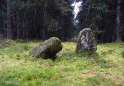
Machar Stones, looking SE
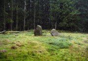
Machar Stones, looking SE

Machar Stones, looking west

Machar Stones, looking west

Probably neolithic in origin, the Machar Stones are set upon an elevated rise above the confluence of the Bin Burn and the River Carron on what seems to be an enhanced artificial platform, akin to those which some stone circles and ring cairns are mounted upon. Around the edges of the stones themselves, the earth has been dug into at some point in the past, as evidenced by the distinct oval dip in the ground surrounding the stones; although I can find no antiquarian accounts describing such a dig.  There is the possibility that these stones may once have marked the site of a prehistoric tomb.

Once you walk ten yards away from the stones in any direction, you begin to walk downhill.  Sadly the trees presently obscure any view from the stones, completely silencing the panorama that quite intentionally awoke from here in centuries gone by, disabling any immediate visual landscape analysis or geomancy.  The proximity of the two rivers was probably relevant in the construction of the stones; as may be the ridge between the Little and Meikle Bin to the southeast.

First described in Nimmo’s Stirlingshire (1817) as “a druidical remain…in the parish of Fintry, about the middle of the moor towards Campsie and northwest of the Meikle Bin”, another early account of these megaliths was in H.G. Smith’s (1896) work on the parish of Strathendrick, before the imposition of the modern ‘forest’ occurred and the views from the stones were unrestricted.  After describing their geographical position, he told:

“On a comparatively level part of the muirland between the two rivers and under Meikle Bin, there are two old standing stones known locally as the Machar Stones, this name being derived from the Gaelic magh, a plain.  The more northerly stones measures 8 feet in height, and the other is 5 feet 7 inches high.  Little…is known of the origin of these standing stones… They were apparently in some way connected with the religious worship of the prehistoric inhabitants of the land.  The general uniform direction in which they point, which is to the north of east, looking as nearly as possible to the quarter of sunrise at the summer solstice, seems to point to their having been erected by a race of sun worshippers.”

Machar Stones, looking NW

Machar Stones, looking NW

Around the same time, A.F. Hutchison (1893) gave a lecture on these and other Stirlingshire megaliths, giving slight variants on the heights of the monoliths, adding that “the two stones are standing in a line pointing to 220°.”  Sadly, even the great authorities of Aubrey Burl (1993) and Alexander Thom (1990), in their respective tomes on the subject, were unable to define any astronomical alignments here.  Hutchison puzzled about the seeming artificiality of the platform upon which the stones appear to have been set, though wrote how “geological authority pronounces it to be a quite natural formation.”

As to the name of the site, William Grant (1963) ascribes the word ‘Machar’ and its variants to mean “a stretch of low-lying land adjacent to the sand” or “low-lying fertile plain”—which doesn’t seem relevant here, unless it was so named by people living on the higher grounds.  It seems odd… As does the alignment of the stones.  When Nina Harris stood between the stones with a compass to work out the cardinal points, the stone that was leaning was due north of the upright stone.  When she walked several yards away from them, the compass deviated and we were given a more northeast-southwest alignment from stone to stone.  This isn’t too unusual as we find similar magnetic anomalies at other megalithic sites in Britain (see Devereux 1989), due to a variety of geophysical ingredients.
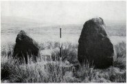
Royal Commission 1954 photo

Royal Commission 1954 photo

Not that your bog standard archaeo-tomes ever mention magnetic anomalies, as basic physics is too complex a subject for your standard archaeo-types!  Instead however, we just get the usual measurements and data-sets, much as the Royal Commission (1963) lads gave us after their visit here in 1954—but at least there was no forest when they came here!  They were fortunate.  “These two stones,” they told us,

“stand on a slight eminence in open moorland, half a mile ENE of Waterhead farmhouse and at an elevation of 850ft… Described by Nimmo’s editor as “a Druidical remain”, they have also been nown as the Machar Stones.  The more northerly stone, a four-sided pillar of irregular section, has fallen almost prostrate and its whole length, 7ft 6in, is revealed.  At the centre it measures 3ft in width by 2ft 6in in breadth.  The other stone stands 4ft 6in further S.  It is a slab…standing to a height of 5ft and measuring about 2ft in thickness.  Its width is 2ft 8in at ground level, 3ft 8in at a point 2ft above this, and 2ft at the top.”

They posit the idea that the reason the taller stone is leaning at such an angle was due to there being a prehistoric cist nearby which had been ‘excavated’ by peoples unknown, who then took it upon themselves to explore the Machar Stones with similar venture.
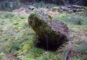
The 'cup-marked' stone

The ‘cup-marked’ stone

In recent years it has been said that there are cup-markings on the leaning stone, seven of them apparently.  When we visited yesterday they were difficult to make out.  There were a number of ‘cups’ on the stone, but these were debatable and seemed more the result of conglomerate disintegration than man-made.  A couple of them were perhaps ‘possibles’.  However, the light was poor and I’d prefer another visit before making my mind up!

The Machar Stones are quite evocative megaliths, despite their lack of grandeur.  Maybe it was the snow.  Maybe it was the trees.  Maybe it was me.  Or probably a mix of all three and more; but this had a real feel to the place.  Well hidden, miles from human touch or visits, awaiting just the occasional visitor—and in this weather (of floods, downpours, cold and snow) saturated humans would be the only sorts of crazy people whose spirits would risk getting completely lost to find them.  And my god were they worth the effort!  Paul, Nina and I thought so anyway!

References:

  1. Burl, Aubrey, From Carnac to Callanish, Yale University Press 1993.
  2. Devereux, Paul, Places of Power, Blandford: London 1990.
  3. Feachem, Richard, Guide to Prehistoric Scotland, Batsford: London 1977.
  4. Grant, William (ed.), Scottish National Dictionary – volume 6, SNDA: Edinburgh 1963.
  5. Hutchison, A.F., “The Standing Stones of Stirling District,” in The Stirling Antiquary, volume 1, 1893.
  6. Nimmo. William, History of Stirlingshire, Andrew Bean: Stirling 1817.
  7. Royal Commission on the Ancient & Historical Monuments Scotland, Stirlingshire – volume 1, HMSO: Edinburgh 1963.
  8. Royal Commission on the Ancient & Historical Monuments of Scotland, Archaeological Sites and Monuments of Stirling District, Central Region, Society of Antiquaries of Scotland 1979.
  9. Smith, H. Guthrie, Strathendrick and its Inhabitants from Early Times, James Maclehose: Glasgow 1896.
  10. Thom, A., Thom, A.S. & Burl, Aubrey, Stone Rows and Standing Stones – 2 volumes, BAR: Oxford 1990.

Acknowledgements:  Huge thanks to Nina Harris and Paul Hornby for their endurance and endeavor in locating these great old stones, in attendance with the great rain, snow and deep muddy bogs!

© Paul BennettThe Northern Antiquarian
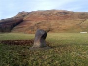

Broadgate Farm, Strathblane, Stirlingshire

Standing Stone:  OS Grid Reference – NS 56929 79402

Also Known as:

  1. Canmore ID 44439

Getting Here

Broadgate Farm standing stone

Broadgate Farm standing stone

From Strathblane, take the A891 road eastwards out of the village, past the standing stone in the churchyard and the row of houses set back off the road until, a few hundred yards along, the fields open up on both sides of you.  In the very first field on the north side of the road, you’ll see the standing stone, all alone, resting quietly.  There’s a gate enabling you access into the field…

Archaeology & History

Broadgate Stone, with Dunglass SE

Broadgate Stone, with Dunglass SE

Found in close proximity to the destroyed chambered tomb of Broadgate, this small standing stone is presently set in a concrete base after an excavation here in 1982 located a cremation urn beneath the stone, confirming an old tradition that told as much.  But there are some who think the stone isn’t a prehistoric one—the Royal Commission (1963) lads for one.  In their brief resumé of the site they wrote:

“This stone stands just N of the road from Campsie to Strathblane, 140 yds E of Broadgate farmhouse.  It is 4ft high and measures 2ft 3inches by 3ft at ground level.  It may well be the stone referred to in the New Statistical Account as marking the spot where Mr Stirling of Ballagan was murdered in the 17th century and should therefore not necessarily be accepted as of prehistoric origin.”

And were it not for an excavation nearly twenty years later, this view may have been maintained.  However, when Lorna Main (1982) told of what was found beneath the monolith, no mention was made of any recent remains.  She wrote:

“Excavation at the base of the fallen standing stone was undertaken prior to its re-erection. A ledge had been cut on the south-west side of the shallow stone hole and fragments of the base survived and the diameter of the base is approximately 17cm.  The urn contained a cremation and a small quantity of charcoal.  It lay only 15cm below the ground surface and is in a poor condition.”

The very fragile state of the urn and the very eroded rounded stature of the rock itself would seem to indicate that this is more a prehistoric upright than a later 17th century one.

Folklore

There are legends of early battles in this region and J.G. Smith (1886) thought that perhaps “this great stone…mark the resting-places of Cymric heroes who did their share of the battle on the north side of the valley.”

References:

  1. Main, Lorna, “Broadgate Farm – Standing Stone and Cinerary Urn,” in Discovery & Excavation Scotland, 1982.
  2. Royal Commission on the Ancient & Historical Monuments Scotland, Stirling – volume 1, HMSO: Edinburgh 1963.
  3. Smith, John G., The Parish of Strathblane, James Maclehose: Glasgow 1886.
  4. Ure, David, The History of Rutherglen and East Kilbride, Glasgow 1793.

© Paul BennettThe Northern Antiquarian


Broadgate, Strathblane, Stirlingshire

Chambered Cairn (destroyed):  OS Grid Reference – NS 5674 7938

Also Known as:

  1. Canmore ID 44453

Archaeology & History

A once-impressive large prehistoric long cairn could be found close to the grid-reference given here, whose existence and destruction was recorded, thankfully, by local antiquarians in the 18th and 19th centuries respectively.   There are remains of other prehistoric sites in and around the spot—including the standing stones of both Broadgate Farm and Strathblane Church—close to which Mr J.G. Smith (1866) described,

“towards the end of last century a mound was levelled at Broadgate near this spot, and many stone coffins, each containing an urn full of earth and burnt bones, were found.”

Smith himself refers to the lengthier description of the mound’s destruction in Ure’s History of Rutherglen (1793), in which the site was described as

“an ancient burying place, the origins of which is unknown, was 60 yards in length, 14 feet in height, and of a considerable breadth.  It was composed of gravel, and lay east and west.  In the bottom were a great many coffins of stone, placed in a row, and separated from one another by a single flag.  Every coffin contained an urn, that was full of earth and burnt bones.  Beside each urn was a pillar about 3 feet in height, and 8 inches in thickness.  They were fragments of basaltic five-sided columns, a few rocks of which are found in the parish.  Most of the pillars are built in a dyke adjoining to the church.  The urns on being touched fell in pieces.”

Due to the seemingly extravagant lay-out of this cairn, Audrey Henshall (1972) took the site to be a chambered tomb of some considerable importance.  She was probably right!  In her magnum opus (1972) on the subject she wrote:

“The description of the ‘cists’ suggests a segmented chamber of Clyde type, but the mound composed of gravel (instead of being a cairn) suggests a natural feature.  A long mound, probably natural, exists on Broadgate Farm in which a restricted excavation produced a cist of Bronze Age type. Possibly the Strathblane mound was similar; it may have contained a segmented chamber (…where a chamber has been built into a natural mound), or it may have contained cists of later type for single burials.”

Subsequent explorations by the Royal Commission (1963) and local historians to find any remains of the site have proved fruitless.

References:

  1. Henshall, Audrey S., The Chambered Tombs of Scotland – volume 2, Edinburgh University Press 1972.
  2. Royal Commission on the Ancient & Historical Monuments Scotland, Stirling – volume 1, HMSO: Edinburgh 1963.
  3. Scott, J.G., “Inventory of Clyde Cairns,” in Megalithic Enquiries in the West of Britain,Liverpool University Press 1969.
  4. Smith, John G., The Parish of Strathblane, James Maclehose: Glasgow 1886.
  5. Ure, David, The History of Rutherglen and East Kilbride, Glasgow 1793.

© Paul BennettThe Northern Antiquarian


Long Man’s Grave, Abernyte, Perthshire

Tomb:  OS Grid Reference – NO 2218 3153

1867 OS-map of the site

1867 OS-map of the site

Also Known as:

  1. Canmore ID 30663
  2. Hoolmyre
  3. The Lang Man’s Grave
  4. MacBeth’s Grave

Archaeology & History

A little-known, but once important site in the mythic history of Scotland, this Long Man’s Grave was said to be the spot where MacBeth—described by Aitchison (1999) as “Scotland’s foremost King”—died.  It would seem that any remains of the stone which once stood here has gone.  When Robert Chambers (1827) told of the site, he said that

“At the bottom of Dunsinnan Hill, on the east side, and near the west end of a drystone wall which runs along the side of the road from Baledgarno, is a large stone about eight feet in length, beneath which MacBeth is said to have been interred.  It is usually called the Lang Man’s Graff, probably from a supposition that the stone was made to suit the length of the deceased.”

More than fifty years later when the Scottish historian Thomas Hunter (1883) wrote about the site, he thought that it had probably been a prehistoric one, telling that

“The tumulus, on being examined, proved to be a druidical stone that had toppled over, and no relic was discovered that could throw light on the tradition.”

Long Man's Grave on 1867 6-inch map

Long Man’s Grave on 1867 6-inch map

Site of the Long Mans Grave

Site of the Long Mans Grave

The site was shown on the earliest OS-maps of the region (as highlighted here), but we don’t know for certain about the exact nature of the site.  Although a bunch of lads from the Royal Commission popped along to see the place in 1969 and proclaimed (without excavation) that the stone was “probably a ‘grave slab’ and not a “standing stone” which has toppled over”, we have to treat their words with caution.  Close by are the remains of Bronze Age stone circles; above us we have the prehistoric hillfort of Dunsinane, with even older neolithic remains being found within it; and we also have neolithic rock art remains nearby; other prehistoric tombs, and plenty more besides…

Folklore

Echoing the early folklore of the site as narrated by local people, Hunter (1883) told that,

“the tradition of the district is that MacBeth, finding it impossible to escape from MacDuff, threw himself from the top of the (Dunsinane) Hill, was killed upon the rocks, and buried at the ‘Lang Man’s Grave’.”

References:

  1. Aitchison, Nick, MacBeth – Man and Myth, Sutton: Stroud 1999.
  2. Chambers, Robert, The Picture of Scotland – volume 2, William Tait: Edinburgh 1827.
  3. Hunter, Thomas, Woods, Forests and Estates of Perthshire, Henderson, Robertson & Hunter: Perth 1883.
  4. Melville, Lawrence, The Fair Land of Gowrie, W.Culross 1939.
  5. Pennant, Thomas, A Tour in Scotland and Voyage to the Hebrides – volume 2, London 1776.
  6. Royal Commission on Ancient & Historical Monuments, Scotland, South-East Perth: An Archaeological Landscape, HMSO: Edinburgh 1994.
  7. Sinclair, John, The Statistical Account of Scotland, 1797 – volume 11: South and East Perthshire, Kinross-shire, EP: Wakefield 1976.

© Paul BennettThe Northern Antiquarian