Cup-and-Ring Stone (removed): OS Grid Reference – NT 12364 32627
Also Known as:
Drumelzier Carving
Archaeology & History
Position of stone in cairn
A carving that was located at the edge of a cairn on a knoll on the east-side of the River Tweed, this is an odd design that now lives in Edinburgh’s central museum: odd, inasmuch as the design looks as if it’s a typical cup-and-ring carving, yet none of the cups on this stone were ever hollowed or pecked out, and so the “cups”, so to speak, are actually small rings (if that makes sense!). There are a number of similar unhollowed “cups” on other carvings that are found associated with prehistoric tombs, so perhaps this aspect was something of a burial trend—amongst a very small tribal group, perhaps… It’s an element that was remarked upon in Simpson & Thawley’s (1972) examination of petroglyphs in neolithic tombs that were called “passage grave style” carvings: a sort of dyslexic cup-and-ring design no less! The intriguing thing about this carving is that it’s one in a small cluster of dyslexic cup-and-rings that are found in this part of Scotland—in an area where rock art itself is pretty scarce. Which begs the question: was it a local tribal style? Anyhow…
The carving was first uncovered when J.H. Craw (1930) excavated the aforementioned cairn, finding therein a number of cists. There’s speculation that the petroglyph might originally have been a covering stone for one of the cists, but we don’t know for sure. Craw described the carving as follows:
Craw’s 1930 sketchRon Morris’ 1981 sketch
“The ring-marked slab…measures 3 feet by 2 feet by 6 inches. It lay at the north side of the cairn (highlighted in sketch, PB), outside the encircling ring, but may originally have been the cover of cist No.2. On the upper side are five shallow ring-markings, four being double and one single. The former measure 3 inches to 4 inches in diameter, and the latter 1¾ inch. The figures are thus much smaller than in typical cup-and-ring-marked stones, and the lines are only ¼ inch in width. The only similar markings known to me are on a slab which I found a number of years ago near the site of several former cairns, and forts at Harelawside near Grant’s House, Berwickshire. The stone is now in our Museum.”
The “museum” in question being Edinburgh’s National Museum (I don’t know if it’s in a box somewhere or on public display, which is where it needs to be). If anyone can get a good photo of this carving, please send it to us or add it on on our Facebook group.
Morris, Ronald W.B., “The Cup-and-Ring and Similar Early Sculptures of Scotland; Part 2 – The Rest of Scotland except Kintyre,” in Transactions of the Ancient Monuments Society, volume 16, 1969.
Morris, Ronald W.B., The Prehistoric Rock Art of Southern Scotland, BAR: Oxford 1981.
Ritchie, Graham & Anna, Edinburgh and South-East Scotland, Heinnemann: London 1972.
Royal Commission on the Ancient & Historical Monuments, Scotland, Peeblesshire – volume 1, Aberdeen University Press 1967.
Simpson, D.D.A. & Thawley, J.E., “Single Grave Art in Britain,” in Scottish Archaeological Forum, no.4, 1972.
Acknowledgements:Huge thanks for use of the Ordnance Survey map in this site profile, reproduced with the kind permission of the National Library of Scotland.
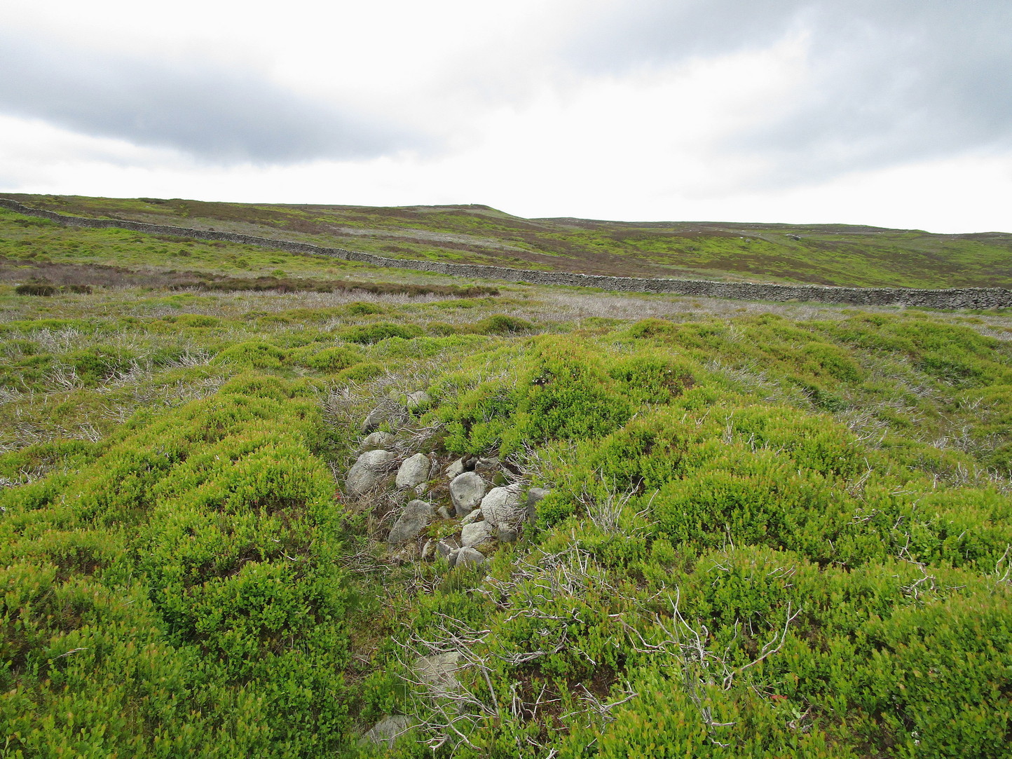
A little-known multiple ringed carving was discovered a few years ago during the excavation of a prehistoric cairn just immediately east of the A701 roadside, several miles south of Broughton. The cairn itself had been recognised many years prior to the recent excavation, when one of two cists inside it was noted by R.B.K. Stevenson (1940), and which was subsequently described in slightly more detail in the Royal Commission Inventory (1967). But when the modern investigation was undertaken by the Biggar Archaeology Group in 2008, a damaged but impressive carving was uncovered that somehow hadn’t been noticed before. It was described in Tam Ward’s (2008) excavation report where he told that,
Carving in situ (photo courtesy Jim Ness)Carving looking N: courtesy Jim Ness
“lying almost immediately on the east side of Cist 1 is an angular rock…measuring 1m long and over 0.3m wide on the uppermost face, itself lying at an angle facing SW and away from the cist. The rock has fractured due to weathering in post deposition times, as indeed several other surface stones had, but on the widest part of the upper surface are at least seven concentric lines faintly pecked into the smooth flat surface of the stone. The lines are up to 10mm wide and appear to have been intended to form semi ovals on the edge of the rock. The outer ring forms an arc of c270mm on the long axis by c140mm on the short one (the former measurement being straight between the ends of the lines and the latter being a radius across the design). The terminals of the inner curved line are about 80mm apart. The lines are slightly irregular in distance from one another. Although it is far from certain, it does not appear that the rock has been part of a larger one with a more complete design on it, rather the pecking appears not to have been finished since the surface of the rock is similar in appearance overall while the abrasion of the carving varies.”
Fractured design (photo courtesy Jim Ness)
The carving remains in place with the cist, which was covered back over when the excavation had been finished.
Carvings such as this are uncommon in this neck o’ the woods; although less than a mile downstream from here, on the other side of the river, another petroglyph—known as the Drumelzier carving—accompanied another prehistoric tomb. Apart from this, there’s a great scarcity of carvings scattering the Lowlands—although it’s likely that there are others hiding away, waiting to be found on these hills…
References:
Royal Commission on the Ancient & Historical Monuments, Scotland, Peeblesshire – volume 1, Aberdeen University Press 1967.
Stevenson, R.B.K., “Cists near Tweedsmuir,” in Proceedings Society Antiquaries, Scotland, volume 74, 1940.
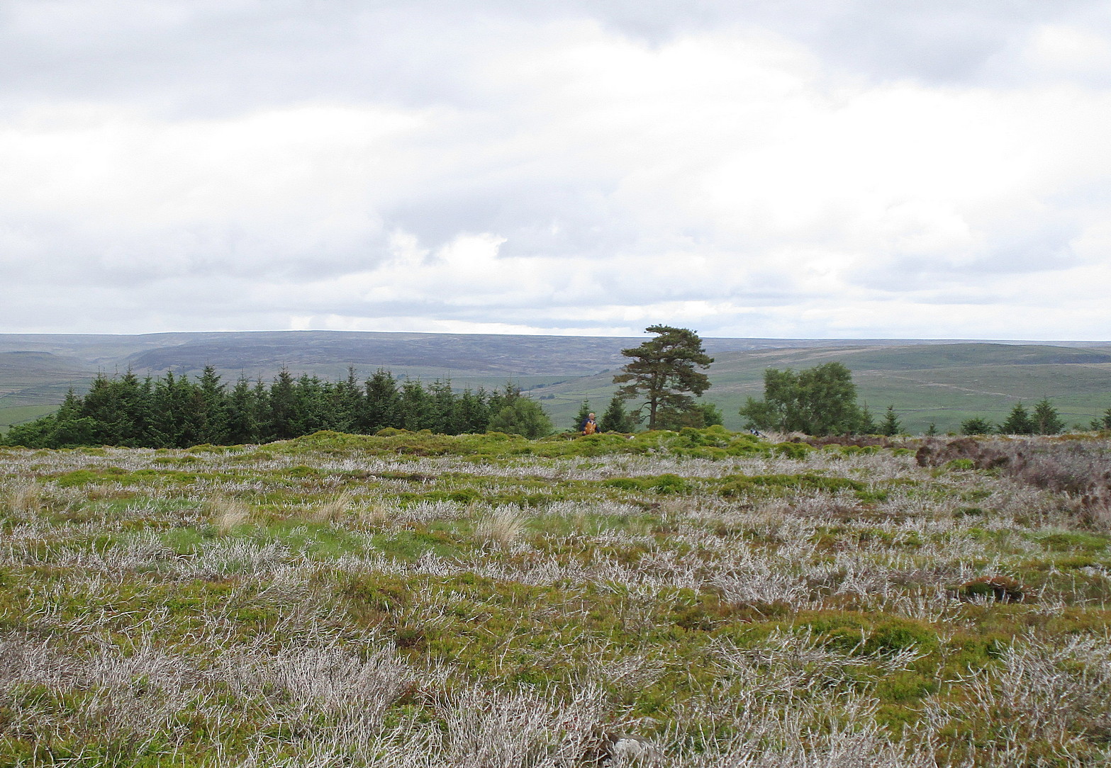
Naathen… I’d give you the directions of how to find this stone, but I’m not sure of its precise location. Just get to the top of Reva Hill, on its more westerly side, and it’s somewhere on its upper slopes. I was up here again recently and hoped to find it, but the grasses might have grown back over it. If one of you petroglyph fans manages to locate it, please can you send me its exact grid-reference, so I can update the site profile.
Carving when wetFaint Reva Hill carvingCarving when wet
Archaeology & History
This was one in a cluster of carvings that were rediscovered in 2011 and which I’ve not managed to re-locate (bad boy). It’s very plain and simple, as you can see. Indeed, I was lucky to even notice it, as the central photograph above shows how faint and eroded the cup-marks are in normal light. Thankfully with a bit of water, what I initially thought may have been two cup-marks, turned into three or four of them. So the next time you’re having a look at the Fraggle Rock carving and its companions, remember that this little fella is hiding somewhere close by…
Take the road up through Baildon village, across at the roundabout up Northgate and up onto the moor, then after a few hundred yards turn left on the Bingley Road. About five hundred yards along, keep your eyes peeled for where the ruined reservoirs are to the left-side of the road. Straight across the road from here (north) you’ll see the small cliffs of Eaves Crag. Walk along the footpath that runs above the cliffs and, about 80 yards past them, keep your eyes peeled on the ground right in the middle of the path. You can’t really miss it!
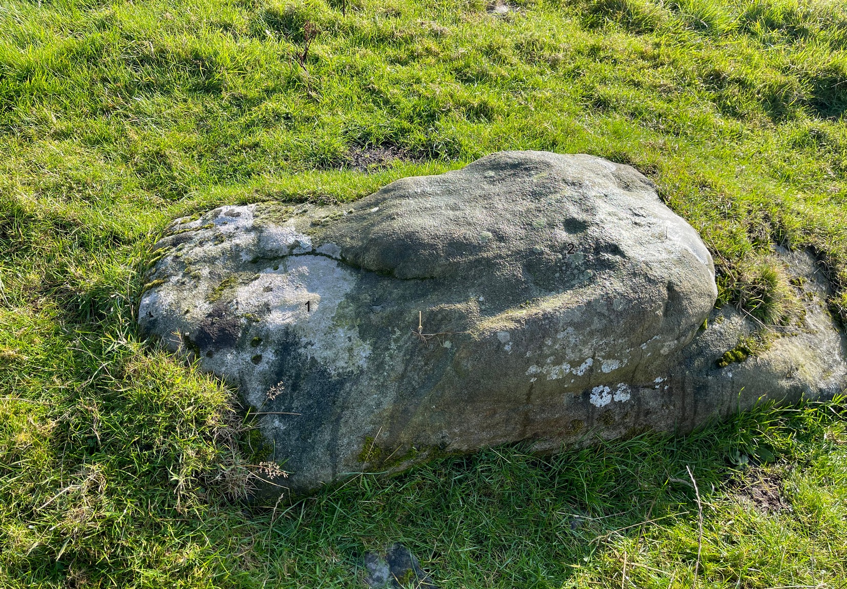
Archaeology & History
Basic cup-and half-ring
First mentioned in passing in the magnum opus of W. Paley Baildon (1913) and subsequently in one of Sidney Jackson’s (1955) series of profiles on the Baildon Moor carvings, this all but insignificant carving comprises of a simple cup-and-half-ring and another singular cup-mark a little further along the stone. John Hedges (1986) described this carving as being a “well marked cup surrounded by horseshoe groove – also well marked. Possible small cup and incomplete ring.” Whilst the minimalists Boughey & Vickerman (2003) told it to be simply, “two cups, one with incomplete ring.” A peculiarity with this design is that it might have been cut by a metal implement, perhaps in the Bronze Age, perhaps even in the Iron Age. We might never know…
References:
Baildon, W. Paley, Baildon and the Baildons – volume 1, St. Catherines: Adelphi 1913.
Boughey, Keith & Vickerman, E.A., Prehistoric Rock Art of the West Riding, WYAS: Wakefield 2003.
Hedges, John (ed.), The Carved Rocks of Rombald’s Moor, WYMCC: Wakefield 1986.
Jackson, Sidney, ‘Cup and Ring Boulders of Baildon Moor,’ in Bradford’s Cartwright Hall Archaeology Group Bulletin, 1:10, 1955.
Acknowledgements:Huge thanks for use of the Ordnance Survey map in this site profile, reproduced with the kind permission of the National Library of Scotland.
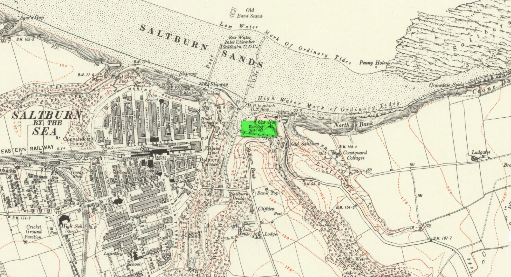
Tumulus (destroyed): OS Grid Reference – NZ 6692 2154
Archaeology & History
Location on 1930 OS-map
This long lost burial mound was first located by the local antiquarian William Hornsby in the early 20th century. It had been constructed close to the summit of the prominent rise of Cat Nab, immediately east above Saltburn. Its position was shown on the 1930 OS-map of the area. Destroyed by quarrying, it was thankfully excavated by Hornsby in 1913; and although his finds were never published, he left notes which told us that,
“there were two cremations and the sherds of at least three vessels: a collared urn, a pygmy cup and a vessel with an everted rim.” (Crawford 1980)
Crawford (1980) told that these finds could been seen in the Middlesborough Collection.
References:
Crawford, G.M., Bronze Age Burial Mounds in Cleveland, Cleveland County Council 1980.
Acknowledgements:Huge thanks for use of the Ordnance Survey map in this site profile, reproduced with the kind permission of the National Library of Scotland.
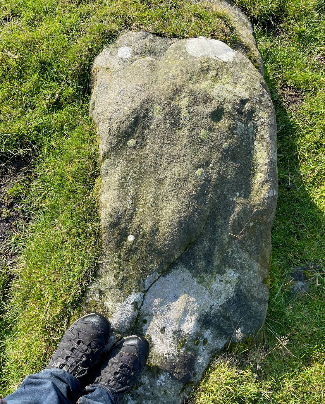
Numerous ways to get here, it’s probably the easiest (direction wise) to reach here starting from Dick Hudson’s public house on the southern road surrounding Rombalds Moor. From the pub, head left (east) along Otley Road (passing Weecher reservoir) for 1.9 miles (3.1km) until you reach Reva reservoir where a track leads you to the waters. A small parking spot is on the left-side of the road. From here, go through the gate and up the footpath (north) for about 200 yards then turn right and go up the field towards the wall where, about 20 yards before it, you’ll see find the stone in question.
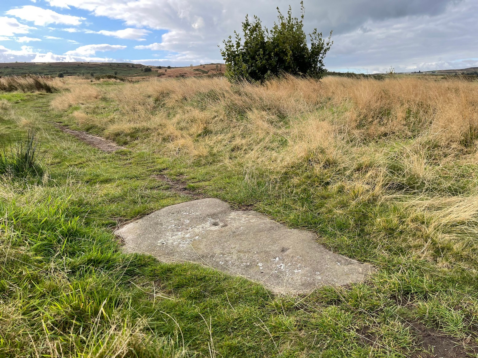
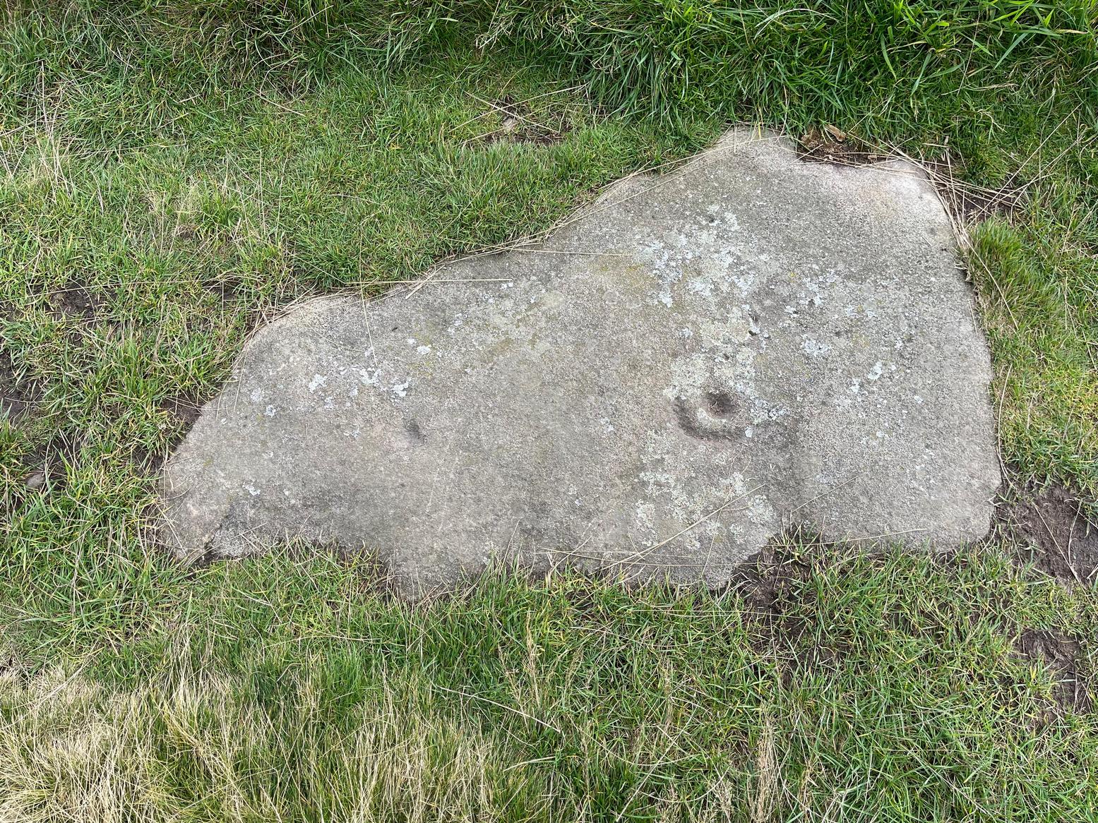
Archaeology & History
This long earthfast stone has two distinct cup-markings: one near its northern upper end, and the other near the lower southern end, as highlighted on the above photo. (forgive the poor image, but we took it when the sun was pretty high in the sky) It seems as if there are two or three other very faint cup-marks on the upper end of the stone, close to the most distinct one, but none of our photos show them with any clarity.
Acknowledgements: Huge thanks to Sarah Walker and Thomas Cleland for help with location and imagery for this stone.
Cairn (destroyed): OS Grid Reference – NT 3071 7366
Archaeology & History
The only reference I can find of this long lost cairn is in William Baird’s (1898) massive history work of the area—but even in his day he reported that “it has long since disappeared.” He wrote:
“We have a curious reference in a charter of Kelso Abbey, granted about 1466, to a cairn of stones which stood near the south-east corner of the garden wall at Mount Lodge, Portobello. In the charter, where it is referred to as forming part of the boundary of the lands of Figgate, it is described as, ‘a certain heap of stones there deposited.'”
The cairn was likely of considerable size and, said Baird, “in all probability marked the site of an ancient place of sepulture.”
References:
Baird, William, Annals of Duddingston and Portobello, Andrew Elliot: Edinburgh 1898.
Round Barrows (destroyed): OS Grid Reference – NZ 692 214
Archaeology & History
Tumuli shown on 1920 map
On top of the large plateau that is Warsett Hill, on the southwest side of the old trig-point, could once be seen a cluster of at least seven burial mounds or tumuli. The mounds are shown on the first OS-map of the area, but merely as mounds. It wasn’t until there’d been a subsequent investigation here by local historian J.C. Atkinson in the 19th century that they were highlighted on the 1920 map as “Tumuli.” Sadly, since then, they’ve all been destroyed.
Very brief notes were written on six out of the seven tombs here by William Hornsby (1917), with only one of them receiving any real attention. “Of the other six,” Crawford (1980) wrote,
“there is very little information; all were excavated by Atkinson prior to 1893, but his excavations revealed no finds and he stated that all of the mounds had been previously disturbed. They were later dug by Hornsby, who stated that although he found no sepulchral deposits, all the mounds contained flints.”
In medieval times this became a beacon site, where bonfires were lit. I can find no further information about this. (NB: This site should not to be confused with another Warsett Hill that exists two miles southeast of here above Skinningrove.)
References:
Crawford, G.M., Bronze Age Burial Mounds in Cleveland, Cleveland County Council 1980.
Hornsby, William & Stanton, R., “British Barrows near Brotton,” in Yorkshire Archaeological Journal, volume 24, 1917.
Acknowledgements:Huge thanks for use of the Ordnance Survey map in this site profile, reproduced with the kind permission of the National Library of Scotland.
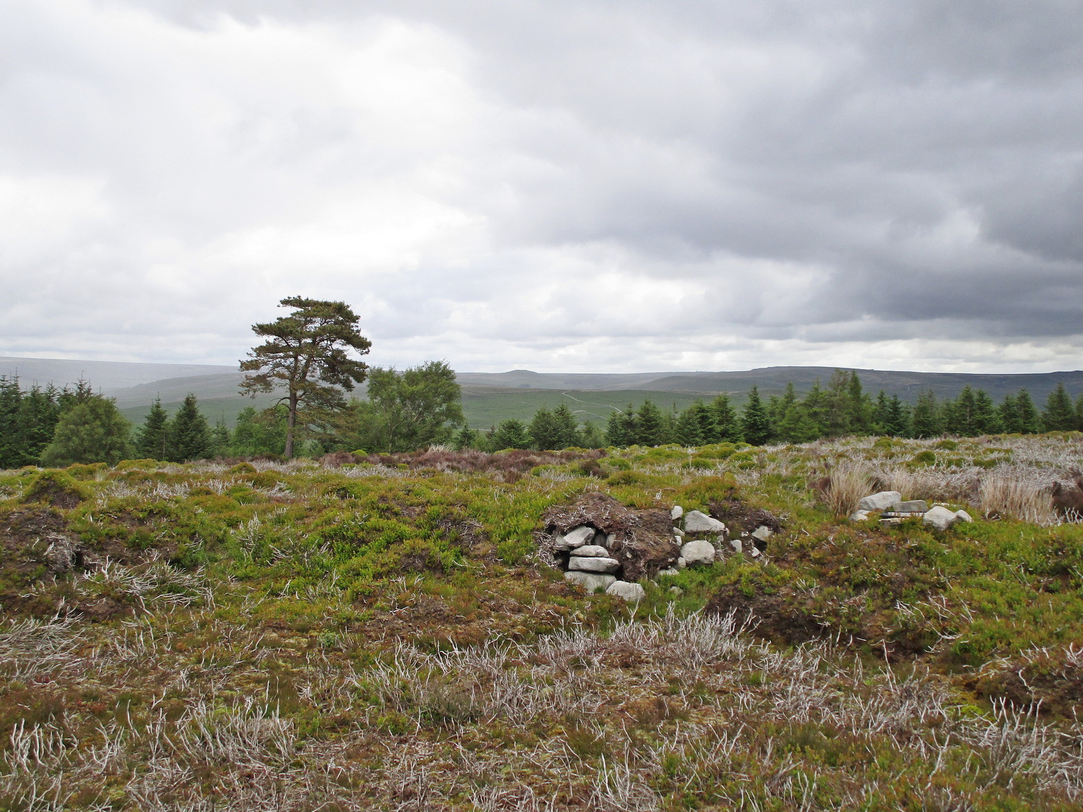
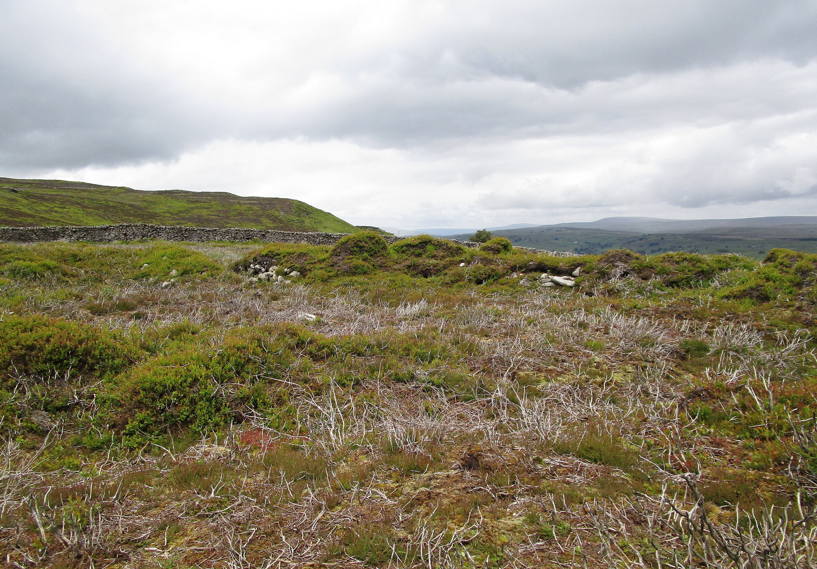
It’s easier to explain how to get here if you’re coming from the Burnsall-side of the B6160 road that leads to Bolton Abbey. A half-mile out of Burnsall village you a small woodland with a small parking spot. From here, a footpath runs up the steep hill above the parking spot. It zigzags a little and you eventually come out on the south-side of the trees where it meets some tall walling. Follow this walling further uphill for more than 600 yards (past more woodland) until the land starts to level out. Hereby, go thru an opening in the wall and less than 100 yards away (west) amidst the overgrown heather, you’ll see what you’re looking for.
Archaeology & History
A large but peculiar site resting on a moorland plateau on the eastern edges of the mighty Barden Moor. Peculiar inasmuch as it’s completely isolated from any other monument of the same age and type anywhere on these huge moors. A few miles east, on the moors around Appletreewick, Thruscross and Beamsley we have a plethora of prehistoric sites—but up here on Barden Moor there’s apparently nowt else! I find that hard to believe….
Inner rubble wallingRubble walling, looking N
Listed on official websites as being a ring cairn, it’s difficult without a detailed excavation of the site (there hasn’t been one) so say that’s what it is. But we’ll stick with it for the time being. My initial impression of the site was that it was a crude form of a collapsed Scottish dun: impressive large circular monuments—buildings if you like—with very well-built large stone walls, usually several yards thick, a little bit like the Scottish brochs (mighty things indeed!). This thing at Folly Top isn’t quite as impressive, but it’s like a collapsed version of a dun.
Arc of western walling
The site consists of large ring of raised collapsed rubble walling, more than a yard high in places, and about three yards thick all the way round, measuring roughly 21 yards (N-S) by 19 yards (E-W) from outer wall to outer wall. There are “entrances” on the east and west sides; but there seemed to be little of any note in the middle of the ring, although the site was somewhat overgrown on our visit here. Outside of the ring there was also nothing of any note. It’s a pretty isolated monument which seems to have more of an Iron Age look about it than the Bronze Age—but until there’s an excavation, we’ll not know for sure.
It’s well worth checking out—and from here, walk onto the huge moorland above you to the west….
Acknowledgements: Huge thanks to the Crazy-gang of Sarah, Helen and James for their awesome assistance on our venture up here. A damn good day indeed! Cheers doods.
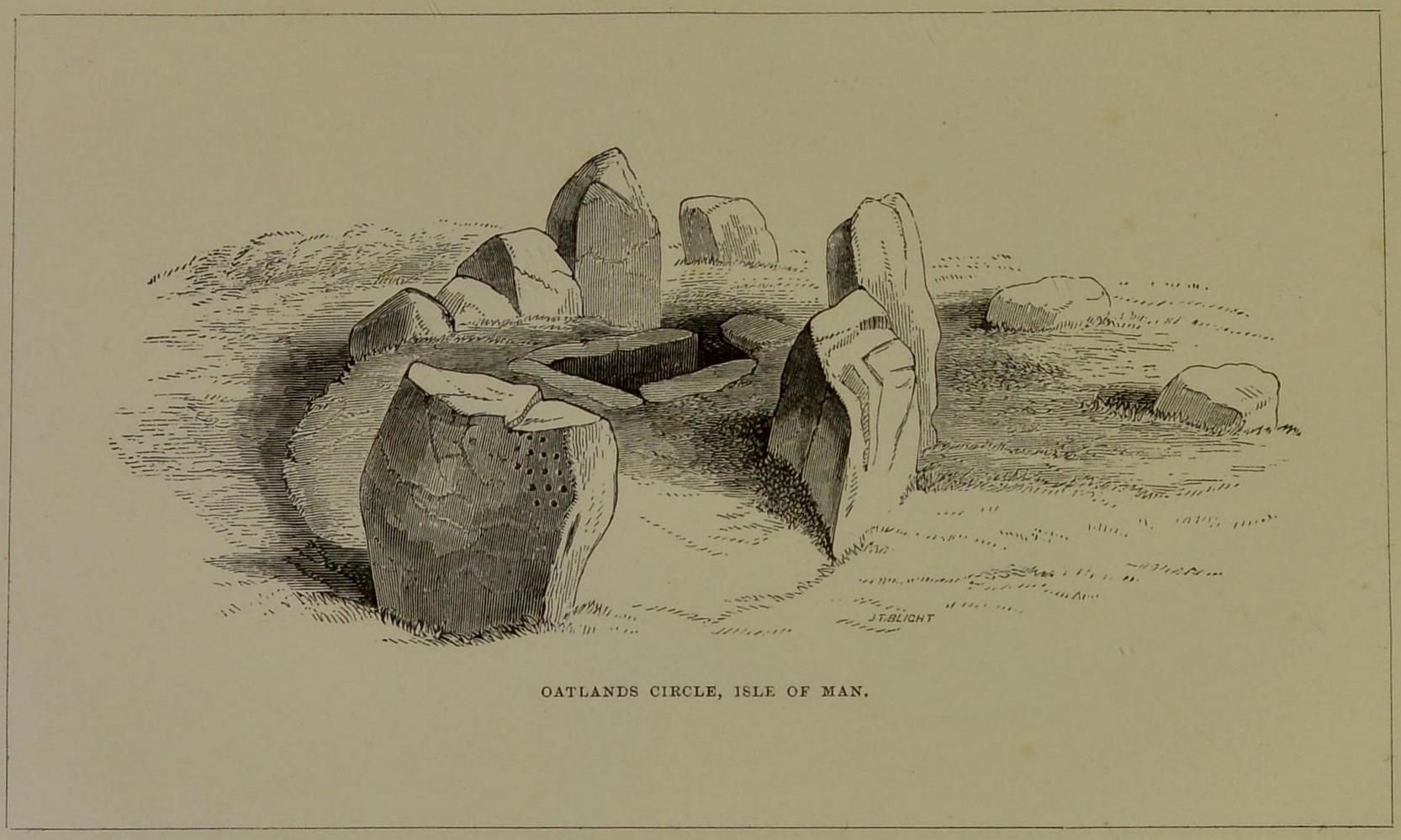
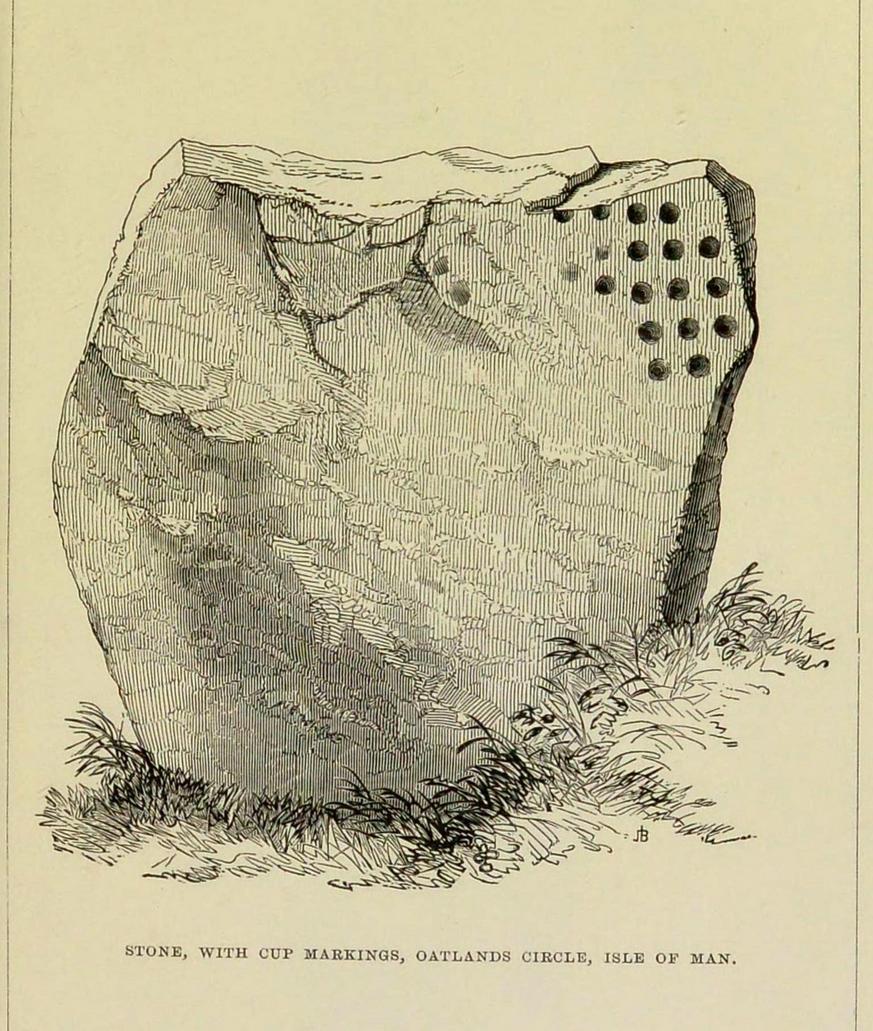
Cup-Marked Stone: OS Grid Reference – SC 32144 71990
Also Known as:
Oatland
Archaeology & History
This carving is one that was found inside the remains of a chambered cairn and so, as with all things petroglyphic, it deserves its very own site profile. It’s been mentioned before—in fact many times before, from the legendary J.T. Blight (1868) to our modern researchers—although it was curiously absent in Ron Morris’ (1989) otherwise excellent survey. When Mr Blight described the tomb, he told us that,
“Its outer ring, of which but three or four stones are left, was about 45 feet in diameter; the inner one 15 feet, with a kistvaen in its midst. As on the external face of one of the uprights of the inner circle there are rows of cup carvings … it may be presumed that this was always exposed to view.”
Position of cups in the tombE.L. Barnwell’s 1868 sketch
The same year, Barnwell (1868) mentioned the same carvings—albeit briefly—telling us “that one of the stones has several rows of the curious cups.” The design faced to the north, which is the traditional direction relating to Death in most northern hemisphere cultures.
As you can see, this design is similar to other petroglyphs that some students have suggested have a numeric nature (see the Idol Stone on Ilkley Moor for example). You can understand why! The basic linearity of the cups, in rows, certainly gives that impression and indeed it’s not unreasonable to make such an assumption—but, as always, we simply don’t know. A similar design was found on a stone at Ballagawne in the parish of Kirk Arbory, but the cups were much deeper and deemed as being a medieval game played on stone, known as Nine Man’s Morris. The original function of the game may have been divinatory.
References:
Barnwell, E.L., “Notes on the Stone Monuments in the Isle of Man,” in J.G.,Cumming (ed.) Antiquitates Manniae, London 1868.
Blight, J.T., “Stone Circles and Megalithic Remains,” in Gentleman’s Magazine 1868.
Cubbon, A. M., Prehistoric Sites in the Isle of Man, Manx Museum: Douglas 1971.
Gale, J. & Darvill, T., “A Survey of the Ballakelly Chambered Tomb,” in Darvill, & T. Billown (eds.), Neolithic Landscape Project, Isle of Man, 1997, Bournemouth University 1998.
Henshall, A. S., “Manx Megaliths Again: An Attempt at Structural Analysis,” in P. Davey (ed.), Man and Environment in the Isle of Man, BAR: Oxford 1978.
Kermode, P.M.C., “The Ancient Monuments of the Isle of Man,” in Archaeologia Cambrensis, volume 84, 1929.
Kermode, P.M.C. & Herdman, W.A., Manks Antiquities, University of Liverpool 1914.
Simpson, James, Archaic Sculpturings of Cups, Circles, etc., Upon Stones and Rocks in Scotland, England and other Countries, Edmonston & Douglas: Edinburgh 1867.