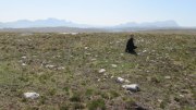
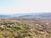
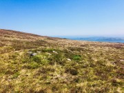
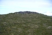
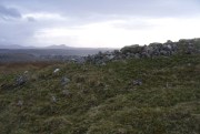
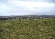
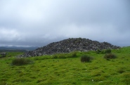
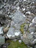
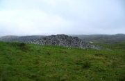
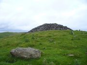
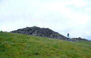
Fenton Hill, Airlie, Angus

Souterrain (destroyed):  OS Grid Reference – NO 3044 5040

Also Known as:

  1. Airlie II
  2. Canmore ID 32376

Archaeology & History

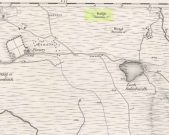
One in a cluster of at least seven souterrains that could once be found to the east of Alyth, this was first described in notes by David Whyte in the 1845 New Statistical Account as being “about a mile to the south” of those at Barns of Airlie.  Although Whyte told that the two places “are separated by a deep hollow but are within view of each other,” the explorer F.T. Wainwright (1963) was unable to locate the precise spot, despite several visits.  Three earlier writers (Anderson, Jervise and Warden) merely echoed notes of there being a cluster of sites hereby and made no personal explorations of their own.  Without the expertise of local people, the exact status of this underground chamber remains unknown…

References:

  1. Anderson, Joseph, Scotland in Pagan Times – volume 1: The Iron Age, David Douglas: Edinburgh 1883.
  2. Jervise, A., “Notice of Antiquities in the Parish of Airlie, Forfarshire,” in Proceedings of the Society of Antiquaries, Scotland, volume 5, 1864.
  3. Royal Commission of Ancient & Historicc Monuments, Scotland, The Archaeological Sites and Monuments of Scotland: Central Angus, RCAHMS: Edinburgh 1983.
  4. Wainwright, F T., The Souterrains of Southern Pictland, RKP: London 1963.
  5. Warden, Angus J., Angus or Forfarshire – volume 1, Charles Alexander: Dundee 1880.

© Paul BennettThe Northern Antiquarian


Balkello, Tealing, Angus

Standing Stone:  OS Grid Reference – NO 36332 38305

Also Known as:

  1. Canmore ID 31871
  2. The Standing Stone of Balkello

Getting Here

Balkello Stone, W of Tealing

From the little village of Kirkton of Auchterhouse, take the winding road uphill east as if you’re heading to Tealing.  About 1⅓ mile along, where the road has straightened out, keep your eyes peeled on your right (to the south) where—if the vegetation isn’t too high—you’ll see a tall upright stone in the field.  You’ll have to walk along the roadside until you find a gate into the overgrown field.  Good luck!

Archaeology & History

Not to be confused with the legendary Martin’s Stone of Balkello ⅘-mile to the southeast, this is a little-known standing stone hiding above a mass of boscage ‘pon a quiet ridge that fades focus away from the world.  It’s a bittova giant, all but forgotten it seems, and with little history to speak of in literary terms at least.  When we visited the place a short while ago, summer nettles and willowherbs obstructed our initial contact—but we got to the fella eventually.

This dood lives & sleeps at the stone!

Looking east

Standing more than nine feet high and about five feet across, it’s quite a slender monolith that has seen better days.  Its southern face is crumbling away and a large section of it is close to splitting off completely (surely a case for Historic Scotland to fix?).  As you can see in the photos, upper portions of the stone have fallen into the widening crack that promises to fell the stone at some time in the not-too-distant future.  Let’s get it sorted —before it collapses!

Balkello Stone on 1865 map

It was highlighted on the first OS-map in 1865 as the Standing Stone of Balkello, although without antiquated lettering.  But unless there is excellent reason to suggest this was erected in recent times (it wasn’t), its ‘prehistoric’ status needs activating—cos it’s surely prehistoric!  We all thought so anyhoo…  It’s well worth checking out when you’re in the area!

Folklore

When the Ordnance Survey lads first visited the site in 1861, local people informed them that the stone was said to be,

“in Connection with some others in the Parish (and) are supposed to have (been) used to point out the Roads as they were then, merely beaten paths.”

Alfred Watkins students take note!

Acknowledgements:  Huge thanks as always to Paul Hornby, Nina Harris & Frank Mercer for their assistance in our visit here.

© Paul BennettThe Northern Antiquarian


Brae of Airlie, Airlie, Angus

Souterrain (destroyed):  OS Grid Reference – NO 3102 5187

Also Known as:

  1. Airlie IV (Wainwright)
  2. Canmore ID 32383

Archaeology & History

This was one amongst a good cluster of souterrains that existed hereby, remains of which may still exist beneath the ground.  It was rediscovered in the 19th century through a series of most curious events—owing more to the local belief in spirits and witches than any archaeological rationale.  Mr A. Jervise (1864) told the story in his essay on Airlie parish:

“The circumstances which led to the discovery of one of these weems is curious.  Local story says, that the wife of a poor cottar could not for long understand why, whatever sort of fuel she burned, no ashes were left upon the hearth; and if a pin or any similar article was dropt at the fireside, it could not be recovered.  Having “a bakin” of bannocks, or oatmeal cakes, on some occasion, one of the cakes accidentally slipped from off “the toaster,” and passed from the poor woman’s sight!  This was more than she was prepared for; and, believing that the house was bewitched, she alarmed her neighbours, who collected in great numbers, and, as may be supposed, after many surmises and grave deliberation, they resolved to pull down the house!  This was actually done: still the mystery remained unsolved, until one lad, more courageous and intelligent than the rest, looking attentively about the floor, observed a long narrow crevice at the hearth. Sounding the spot, and believing the place to be hollow, he set to work and had the flag lifted, when the fact was disclosed, that the luckless cottage had been built right over an “eirde” house.  The disappearance of ashes, and the occasional loss of small articles of household use, were thus satisfactorily accounted for; but, unfortunately, although the site of this weem remains, as well as that of another near the same place, both were long ago destroyed, and the materials of which they were constructed used for a variety of utilitarian purposes.”

Or to put it simply: right beneath the fireplace, a small opening into the souterrain below appeared, into which all things fell.  F.T. Wainwright (1963) placed the position of the site “about 100 feet east of the road between Barns of Airlie and Brae of Airlie, about 200 yards from the former.”  On the 1865 OS-map, this spot is marked with a small unnamed building.  No excavation has ever been tried here

References:

  1. Jervise, A., “Notice of Antiquities in the Parish of Airlie, Forfarshire,” in Proceedings of the Society of Antiquaries, Scotland, volume 5, 1864.
  2. Wainwright, F T., The Souterrains of Southern Pictland. RKP: London 1963.

© Paul BennettThe Northern Antiquarian


Barns of Airlie (2), Airlie, Angus

Souterrain (destroyed):  OS Grid Reference – NO 3052 5152

Also Known as:

  1. Airlie III (Wainwright 1963)
  2. Canmore ID 32385

Archaeology & History

There are no remains left of this old ‘weem’, earth-house, or souterrain as they are now commonly known.  It was one of at least seven separate souterrains beneath the fields between the Barns of Airlie and Brae of Airlie, but very little is now known of this one.  The first and only real note of the site was given in Mr A. Jervise’s (1864) essay on the antiquities of Airlie parish.  Nearly a hundred years later when F.T. Wainwright (1963) went to investigate any possible remains, he found very little, telling:

“A possible location for Airlie III…presented itself on 24 June, 1951, when Mr D.B. Taylor and I noticed a considerable number of boulders and slabs cast up in the field which lies over the wall from the entrance to Airlie I (souterrain).  The farmer was aware that there was a heavy concentration of stones spread over an area of two or three thousand square feet, but he could add no further information.  In 1951 we were not able to do more than record this possibly significant scatter of stones—it lies between 150 and 200 feet west from the present entrance of Airlie I on a bearing of 260º—and to note that it could very well indicate a souterrain settlement.”

Most of the scattered stone was subsequently removed for use in walling and no trace remains of the place.

References:

  1. Jervise, A., “Notice of Antiquities in the Parish of Airlie, Forfarshire,” in Proceedings of the Society of Antiquaries, Scotland, volume 5, 1864.
  2. Wainwright, F T., The Souterrains of Southern Pictland. RKP: London 1963.

© Paul BennettThe Northern Antiquarian 


Hillhead, Forgue, Aberdeenshire

Stone Circle (destroyed):  OS Grid Reference – NJ 638 367

Also Known as:

  1. Canmore ID 18237 
  2. Hillhead of Bogfouton
  3. Wether Hill

Archaeology & History

Described by the early 20th century antiquarian and megalithomaniac Fred Coles (1903) as being situated “about 1¼ mile SE from the church at Ythan Wells,” all trace of this stone circle has long gone, and had already disappeared when Coles was surveying the region, telling merely that it had been here “in open fields.”  All subsequent explorations looking for remains of the site has proven fruitless.

References:

  1. Barnatt, John, Stone Circles of Britain – volume 2, British Archaeological Report: Oxford 1989.
  2. Cole, Fred, “Report on the stone circles of North-Eastern Scotland, chiefly in Auchterless and Forgue,” in Proceedings of the Society of Antiquaries, Scotland, volume 37, 1903.

© Paul BennettThe Northern Antiquarian


Barrow Hill Stone, Chastleton, Oxfordshire

Standing Stone (destroyed):  OS Grid Reference – SP 257 282

Archaeology & History

We have found only one reference to this lost standing stone that could once be seen adjacent to the very well-preserved Chastleton Barrow Camp to the east of the village. In her scarce little work on the history of Chastleton House, Margaret Dickins (1900) told that,

“the oldest thing to be seen at Chastleton is the prehistoric stone, which till lately served as a field gate post on the Barrow Hill.”

This monolith was one in a series of megalithic sites in and around the village that have been destroyed due to the actions of ill-informed land-owners. In this case, the standing stone was in close association with the subsequent Iron Age encampment (this missing stone should not be confused with the nearby Goose Stones, greatly damaged).

References:

  1. Bennett, P. & Chanter, James, The Complete Rollright Stones, forthcoming
  2. Dickins, Margaret, Chastleton House, Walker: Stratford 1900.

© Paul Bennett, The Northern Antiquarian


Power Station Road, Sheerness, Isle of Sheppey, Kent

Settlement (destroyed):  OS Grid Reference – TQ 932 733

Archaeology & History

An extensive site that was uncovered when a housing estate was being built on the south-side of Power Station Road at the end of the 20th century.  During the Spring and Summer of 1998, the Canterbury Archaeological Trust began cutting trenches across the land and did some minor excavation work on the west side of the area, finding some traces of early human activity.

A second series of investigations was then undertaken by the Hertfordshire Archaeological Trust  over the Autumn and Winter months of 1998-99, with the Kent Archaeological Rescue Unit then taking over for the rest of the year.  Their team split the land into eight large sections and began a more detailed analysis and uncovered a huge number of finds.  Amidst this, wrote Brian Philp (2002), there

“included an important collection of Bronze Age material, including large clay-weights, perforated baked-clay slabs and a good range of pottery types.  Of special interest was the spinal bone of a large whale, perhaps washed up on the nearby shore.

“The picture now emerging is that of a substantial Bronze Age settlement site, spread across several acres and probably farming the adjacent land… It seems likely that three large ponds and…eight stone-lined pits were primarily for water-storage, both for watering cattle and for other agricultural or semi-industrial purposes… All this seemed to be happening about 900-400 BC on what still appears to be the largest Bronze Age settlement so far discovered on this important island.”

The archaeocentric place-name of Barrows Hill rises a mile to the southwest.

References:

  1. Philp, Brian, Archaeology in the Front Line, KARU: Dover 2002.
  2. Schuster, Jorn, “The Neolithic to Post-Medieval Archaeology of Kingsborough, Eastchurch, Isle of Sheppey: From Monuments to Fields,” in Archaeologia Cantiana, volume 130, 2010.

Links:

  1. Kent Archaeological Review

© Paul BennettThe Northern Antiquarian 2016


Dumpton Park, Ramsgate, Kent

Tumulus (destroyed):  OS Grid Reference – TR 389 661

Archaeology & History

A little-known site which archaeologist Brian Philp (2002) called “a Bronze Age barrow”.  When the old Greyhound Stadium at Ramsgate was being demolished for a new housing estate, planning conditions required an archaeological evaluation and so Philps and his team set out to explore the area in February 2000.  They weren’t to be disappointed!  Unearthing a ring ditch nearly 20 yards (18m) across, they found that it had been cut into the local chalk some three feet deep.  Although there was no obvious entrance, the northeast section of the ancient monument,

“was found to be covered by a compact layer of flint metalling.  This was a wide and well-made surface or platform, perhaps of Iron Age date, which clearly covered the silted ring-ditch,  Nearby was a large male skeleton in a very shallow grave and with head missing due to later disturbances.”

The excavated ring ditch (after Philp 2002)

The excavated ring ditch (after Philp 2002)

The crouched skeleton (after Philp 2002)

The crouched skeleton (after Philp 2002)

But the best was yet to come!  In another section of the circular monument, cut into the chalk itself, they found a complete male skeleton laid in typical foetus position, on its left side, with a large beaker pot positioned in front of it.  These beakers are pretty common and tend to be seen as once holding food enabling the dead to eat in their journey into the Land of the Dead.  It makes sense.  The entire monument has since been completely destroyed.

References:

  1. Philp, Brian, Archaeology in the Front Line, KARU: Dover 2002.

Links:

  1. Kent Archaeological Review

© Paul BennettThe Northern Antiquarian 2016


Baston Manor, Hayes, Kent

Settlement:  OS Grid Reference – TQ 407 649

Archaeology & History

This settlement site was found thanks to the good work of the Bromley & West Kent Archaeology Group in the 1960s, when they decided to do follow-up work to what Brian Philp (2002) described as “doubtful sites reported mainly in the 19th century.”  Time and again these “doubtful sites” at least turn into something of value — and such was the case here!  The group commenced digging selective trenches in July 1964 in a small wooded area near to Baston Manor and they soon came across “a stratified deposit of late-Neolithic (2500 BC) pottery and flint.”

In successive returns to the site over two years, 5630 items—primarily fire-cracked stones, flints and more than 200 pieces of pottery, some of which was highly decorative—were unearthed and the site was recognised as an important settlement arena many thousands of years ago.  In Kent, this was a rarity!  Philps’ resumé of the site and its many remains told,

“Sometime about 2500 BC, a group of late-Stone Age farmers had selected this quiet hillside (now just in Hayes) to settle and live.  Here they must have farmed  small cultivated areas close to their huts and herded sheep and cattle to fresh areas and nearby streams.  These were the first occupants of the West Wickham valley over 4000 years ago…”

References:

  1. Philp, Brian, “The Discovery of a Secondary Neolithic Site at Hayes,” in Kent Archaeological Review, no.5, 1966.
  2. Philp, Brian, Archaeology in the Front Line, KARU: Dover 2002.
  3. Smith, Isobel, “Prehistoric Pottery from Baston Manor, Hayes,” in Kent Archaeological Review, no.18, 1969.

Links:

  1. Kent Archaeological Review

© Paul BennettThe Northern Antiquarian


Down Farm, Basingstoke, Hampshire

Barrow (destroyed):  OS Grid Reference – SU 6018 5013

Archaeology & History

Downs Farm tumulus on 1897 map

Downs Farm tumulus on 1897 map

On the western edges of Basingstoke, at Kempshott, could once be found this ancient site—destroyed many decades ago.  It was one of number of similar prehistoric burial mounds in the area.  First described in a listing of tumuli by Mr Andrews (1898) who told us that it was “oval” in shape, the monument was completely destroyed in 1939 and according to the Royal Commission (1979) lads,

“its site now lies beneath a house at the southwest corner of Kempshott Lane and Homesteads Lane.”

When the house where it once stood was being constructed, a collared urn was recovered from the tomb, which the Royal Commission thought indicated “that the monument (was) likely to have been of early Bronze Age date”—but obviously we cannot be sure.  The site was listed in Leslie Grinsell’s (1979) extensive survey of prehistoric tombs in the area, in which he suggested it may have been a long barrow.

References:

  1. Andrews, S., “A Short List of Some Tumuli in North Hampshire,” in Proceedings of the Hampshire Field Club & Archaeological Society, volume 4, 1898.
  2. Grinsell, Leslie V., “Hampshire Barrows – part 3,” in Proceedings of the Hampshire Field Club & Archaeological Society, volume 14, 1940.
  3. Royal Commission on Historic Monuments, England, Long Barrows in Hampshire and the Isle of Wight, HMSO: London 1979.
  4. Willis, G.W., “Bronze Age Burials round Basingstoke,” in Proceedings of the Hampshire Field Club & Archaeological Society, volume 18, 1953.

© Paul Bennett, The Northern Antiquarian