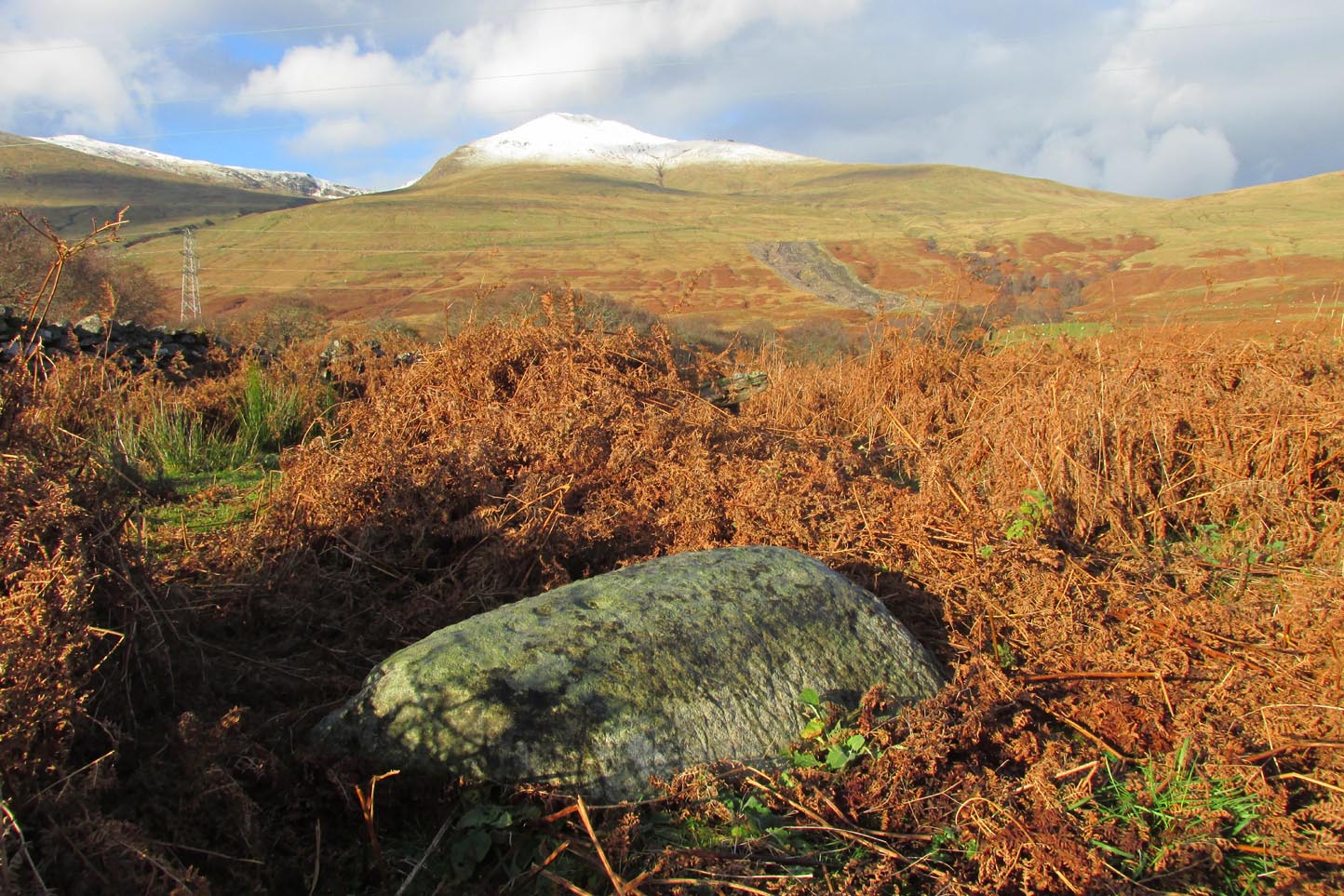
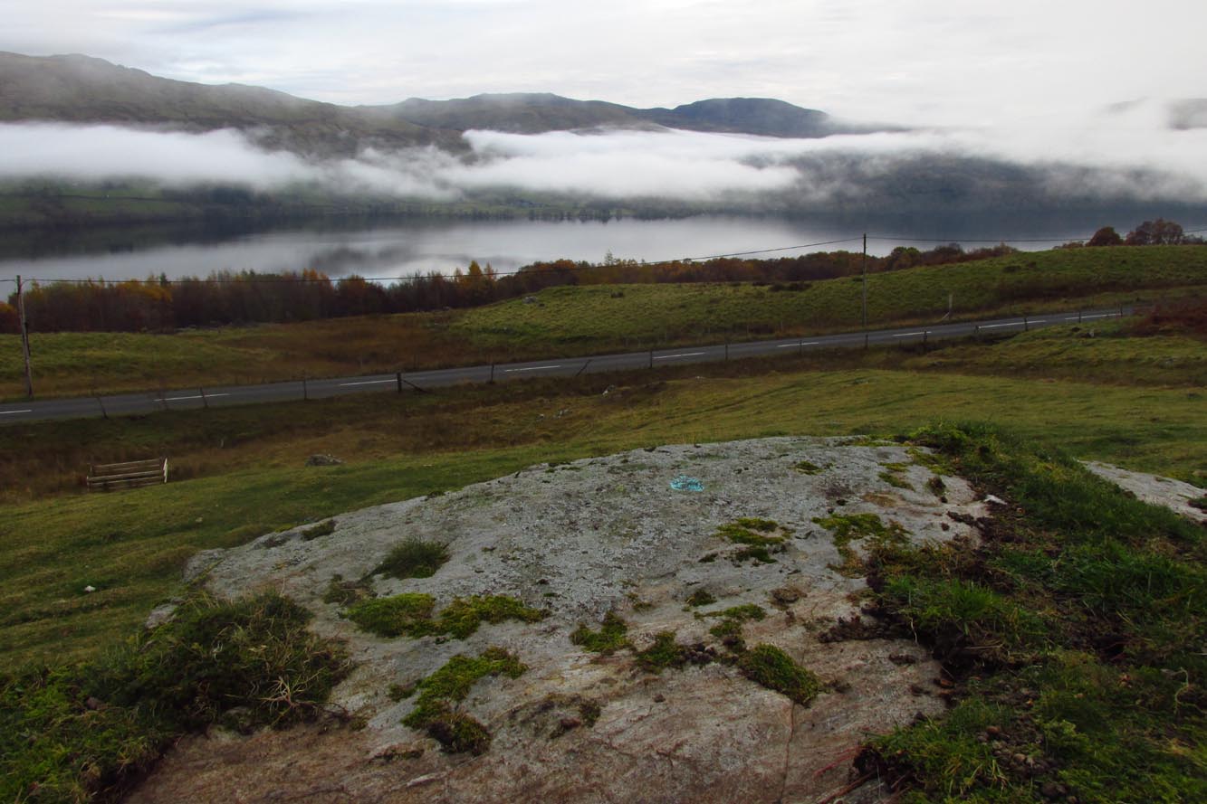
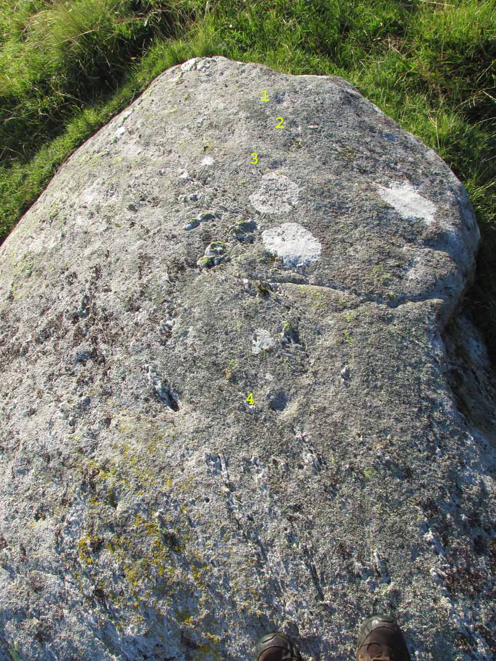
From Killin, take the A827 road to Kenmore. 6 miles along, on your right, is the track down to the Big Shed at Tombreck. Keep on the A827 for exactly ⅓-mile (0.53km), and opposite the driveway to Craggantoul is a small parking spot. A few yards on the road, over the burn, go thru the gate on your left and walk up the path for less than 100 yards. The stone is just a coupla yards on your right (if you reach the derelict tractor, you’ve gone about 10 yards past the stone).
Archaeology & History
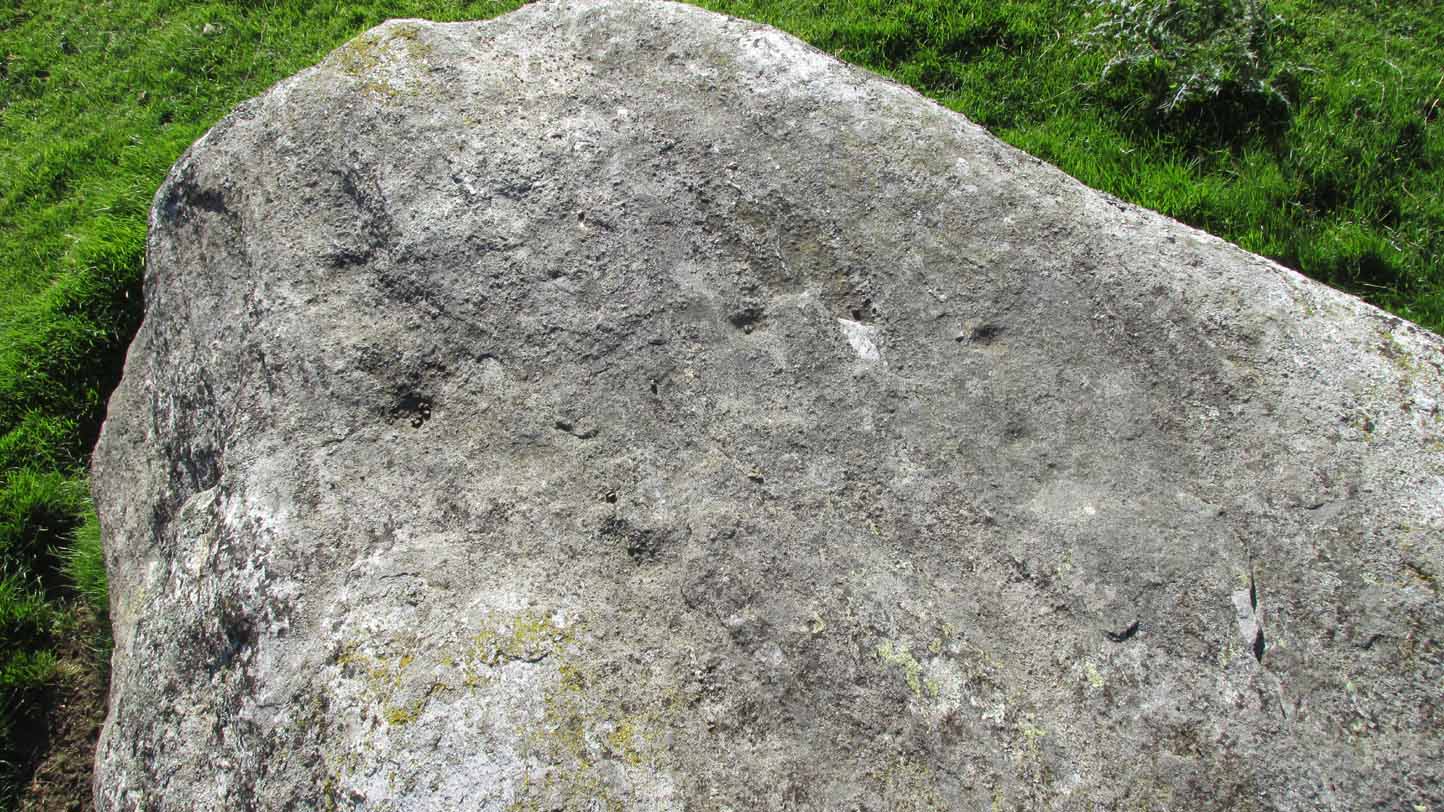
Cupmarks along the top
This is another one of the many simple cup-marked petroglyphs scattering the Cragganester and Tombreck regions beneath the slope of Ben Lawers. It’s an elongated, smoothly-shaped ‘female’ stone, aligned north-south, possessing four distinct cups along its crown: three in a small line at the south-end of the stone and a single one close to the north end. However between these is what may be another, shallow fifth cupmark—but this is uncertain.
One notable feature here is that the rock is encrusted with small garnets. This geological ingredient isn’t uncommon in this area, and we’ve found that quite a proportion of the petroglyphs hereby possess this feature. It was probably of some importance to the people who carved them.
Acknowledgements: Thanks to Paul Hornby for use of his photograph.
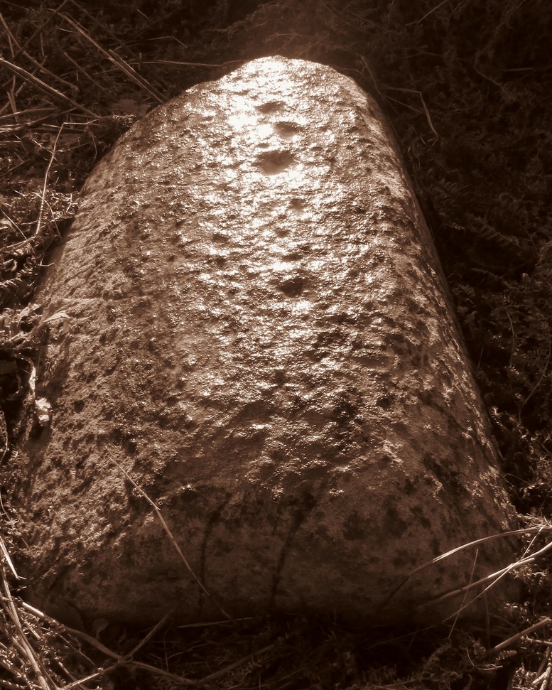
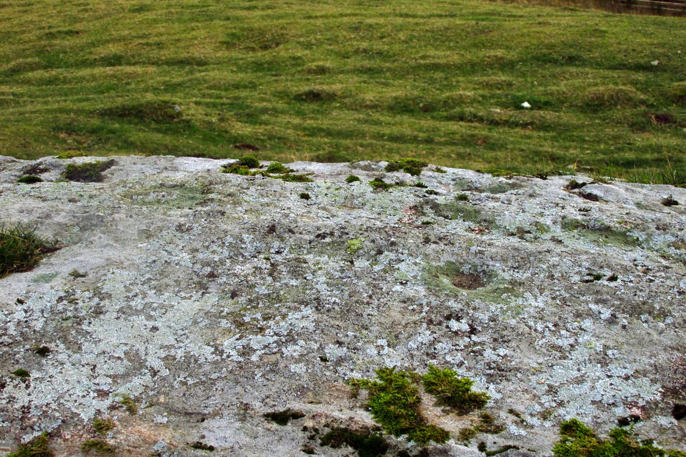
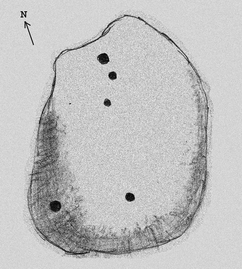
Although you could just as well follow the directions to reach the Cragganester 22 carving (exactly 100 yards away), it’s probably easier to get there from where the track leads down to Balnasuim, but there’s nowhere to park any vehicle here—unless you’re on a bike! Across the road from the Balnasuim track is a gate. Go thru this and then follow the fence immediately on your left, running parallel with the road for roughly 250 yards (218m), until you reach a denuded wall that runs onto the hillside above you. Follow this up for roughly 200 yards (96m) until you reach a grass-lined track. Walk to your left and keep your eyes peeled for a reasonably large rounded boulder next to the track 40 yards on. That’s it!
Archaeology & History
2 cupmarks highlighted
This is one of the many simplistic petroglyphs in the Cragganester complex, probably only of interest to the fanatics amongst you! There are two distinct cup-marks on this nice rounded ‘female’ stone, one near the top and one near the middle, amidst the olde lichen growth. Loch Tay stretches along the glen below here, but only a portion of it is visible nowadays. In times gone by, tree growth probably prevented any vision of the waters below…
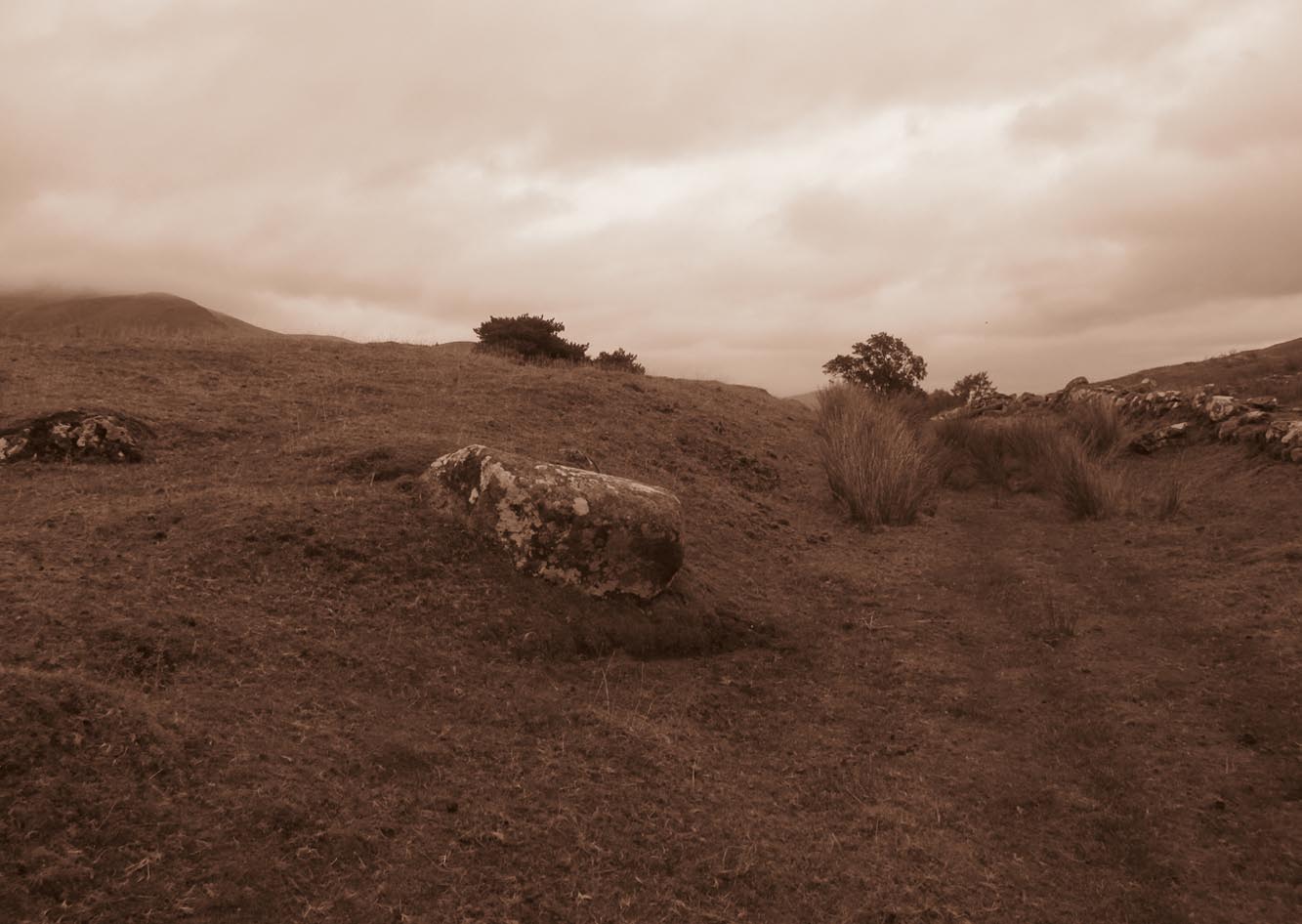
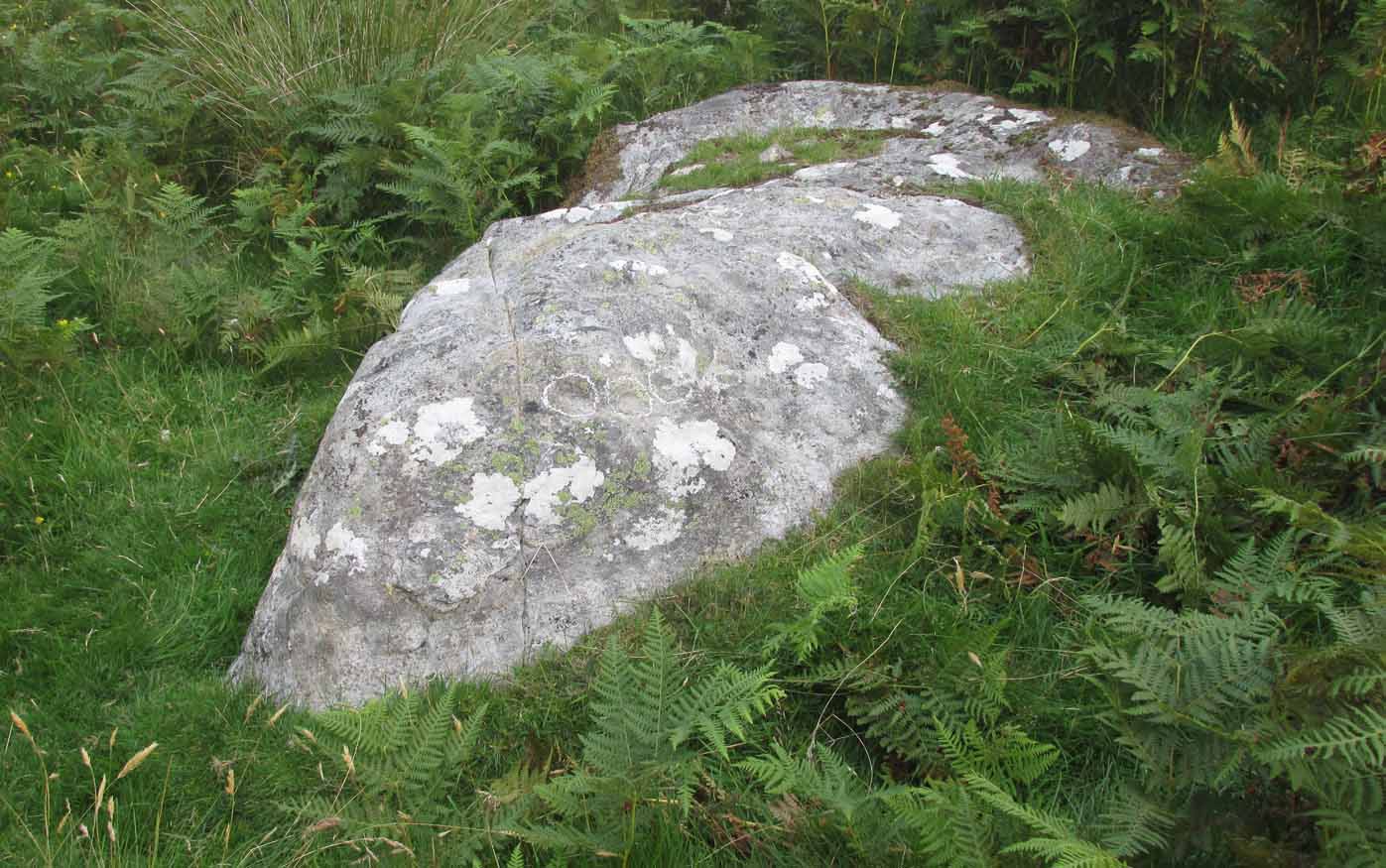
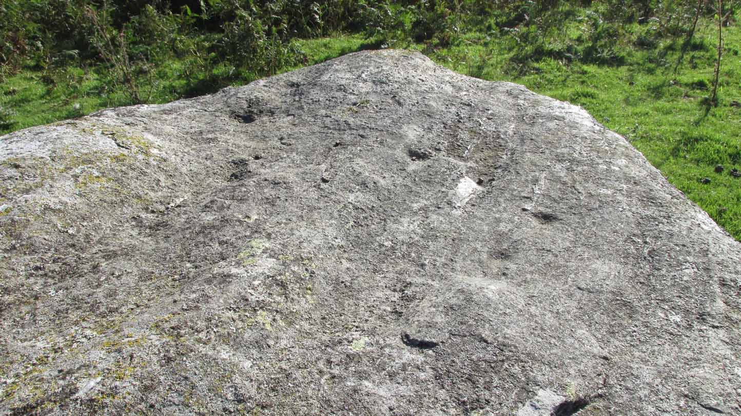
It’s a bittova pain-in-the-arse to reach this and its associated carvings, as there’s little place to park along here. The easiest is to park 600 yards east of Tombreck at the spot just by the small bridge at Craggantoul. Keep your eyes truly peeled! From here, walk along the road for ⅔-mile where you’ll hit a gate taking you onto the boggy hillside. Go diagonally up here for 150 yards where you’ll hit an overgrown track and small disused quarry. Some 50 yards along you’ll see a small rock outcrop on your left (as if you’re going back to the road). That’s the spot!
Archaeology & History
Close-up of cupmark
Not previously recorded, this simple petroglyph on a small rock outcrop—barely 50 yards above the A827 Killin-Kenmore road—comprises of one clear cup-mark prominently etched near the middle of the upper surface; and another possible cup on the left (eastern) section of the rock. Cragganester carvings 19 and 20 are respectively about 100 yards NE and NW of here but, like other carvings nearby, is only gonna be of interest to the fanatic nutters out there!
Standing Stone (lost): OS Grid Reference – SU 161 432
Archaeology & History
In William Stukeley’s Stonehenge, he described a number of monoliths outlying Salisbury Plain that also possessed a prehistoric pedigree. Most of them have been recorded, but this one seems to have been forgotten about — perhaps by virtue of it having fallen into the River Avon! Edgar Barclay (1895) described it in his fine survey, saying:
“In the bend of the river below the village, is a large submerged stone; only during drought is any portion of it visible above water; it can, however, in ordinary times, be dimly seen from the bank, which is of chalk, here very steep and overgrown. The country people assert that a metal ring, “turning always,” is let into its upper end. Legend relates that when the Devil brought the rocks of Stonehenge from Ireland, tied together with withes, this stone escaped from the bundle and fell into the river. Its position forbids the belief that it got fixed in the bed of the stream when its passage to Stonehenge was being attempted, for it lies immediately beneath the crest of a very steep bank, and at its most inaccessible point; as the stream sweeps against this, the water must always have been deep at this spot, the open valley would everywhere offer more favourable points for such an operation, especially would this be the case before the Avon was dyked. A boundary stone would have been placed on the brow of the hill; if the stone be a grey-wether, as report says, and as is probable, it may originally have stood on the bank, and “once upon a time”, a ring having been fixed in it, it may have been dragged into the stream to moor a ferry-boat. It lies closely midway between the stone on Bulford Down and that in Durrington fields.”
One wonders if any local people might know more about this…
References:
Barclay, Edgar, Stonehenge and its Earth-works, D. Nutt: London 1895.
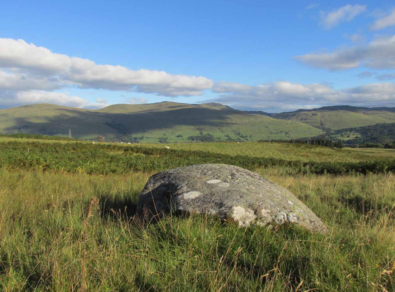
From Killin, take the A827 road to Kenmore. 6 miles along, on your right, is the track down to the Big Shed at Tombreck. Keep on the A827 for exactly ⅓-mile (0.53km), and opposite the driveway to Craggantoul is a small parking spot. Go through the gate here and walk up the little hill right in front of you until you can see an electricity pylon 200 yards away. Head for, go up the slope behind and along until you drop into a tiny little valley where a long line of very distinct old walling runs east-west. Walk back and forth along it till you see a reasonably large earthfast stone on its own.
Archaeology & History
Close to a long line of what I think is pre-medieval walling—possibly Iron Age—is what can only be described as a truly crap-looking petroglyph which, to be honest, I’d walk past and give not a jot of notice if it wasn’t for the fact that it’s been recorded. When we visited here, three very worn large cup-marks were visible on its sloping west face, with what looked like two more on top of the stone—but these seemed questionable in terms of them being man-made. Apparently there’s another one on it, but in the searing heat and overhead midday sun when we visited, this couldn’t be seen.
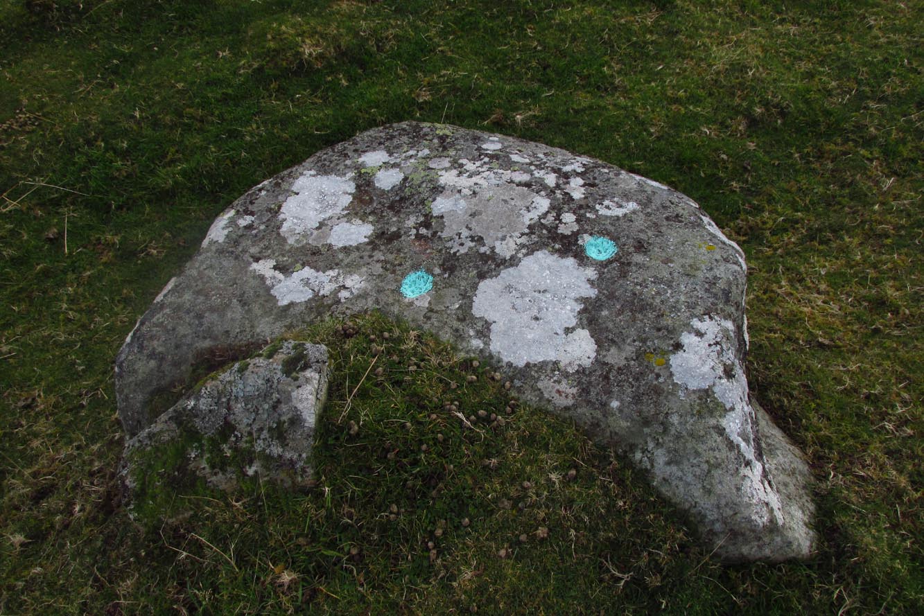
From Killin, take the A827 road to Kenmore. 6 miles along, on your right, is the track down to the Big Shed at Tombreck. Keep on the A827 for exactly ⅓-mile (0.53km), and opposite the driveway to Craggantoul is a small parking spot. A few yards on the road, over the burn, go thru the gate on your left. Follow the straight line of walling up for 800 yards where the walling hits the burn, then follow the water up until you cross a fence. Once over this, 50- yards to your right you’ll see a large rounded rock and companion. It’s the rounded rock.
Archaeology & History
As with most the carvings along here, it is the setting that captivates more than the petroglyph. This is another one mainly for the purists amongst you, but there’s a distinct feel of other carvings hiding very close by that remain hidden. Anyhoo…
4 of the cups numeratedRough sketch of design
This reasonably large, rounded, female stone has the usual scatter of quartz in its veins, along with at least four cup-marks on its upper sloping surface. Three of them are seen in a slight arc on the more northern slope of the stone with one of them particularly faint; but the most notable of the lot on the very crown of the stone. (see the numerated image, right) A fifth cup-mark is clearly visible on the western face of the boulder, shortly below where the rock begins to level out. You’ll see it. Some 200 yards west of this carving, the prominent rock hosting the Cragganester 10 carving is visible on top of its rounded knoll.
From Killin, take the A827 road to Kenmore. 6 miles along, on your right, is the track down to the Big Shed at Tombreck. Keep on the A827 for exactly ⅓-mile (0.53km), and opposite the driveway to Craggantoul is a small parking spot. A few yards on the road, over the burn, go thru the gate on your left. Follow the straight line of walling up for 7-800 yards and then walk to your right, into the field. About 300 yards into the overgrown meadowland you’ll see a rounded knoll with a very notable boulder on its crown. Y’ can’t really miss it!
Archaeology & History
It’s the setting of this carving that captures you way more than the carving itself—which is probably somewhat of a disappointment to most folk, unless you’re a petroglyph fanatic like myself.
The five cup-marks…and from another angle
Found relatively close to other carvings, this reasonably large boulder has, upon its roughly smooth top, just five simple cup-marks with varying degrees of weathering, from the very noticeable to the somewhat faint—hinting at the unlikely possibility that it might have been carved at different times. A possible sixth cup can be seen in certain daylight conditions on the southwest section of the stone. That’s it!
Tumuli (destroyed): OS Grid Reference – TL 6246 6048
Also Known as:
Two Howes
Archaeology & History
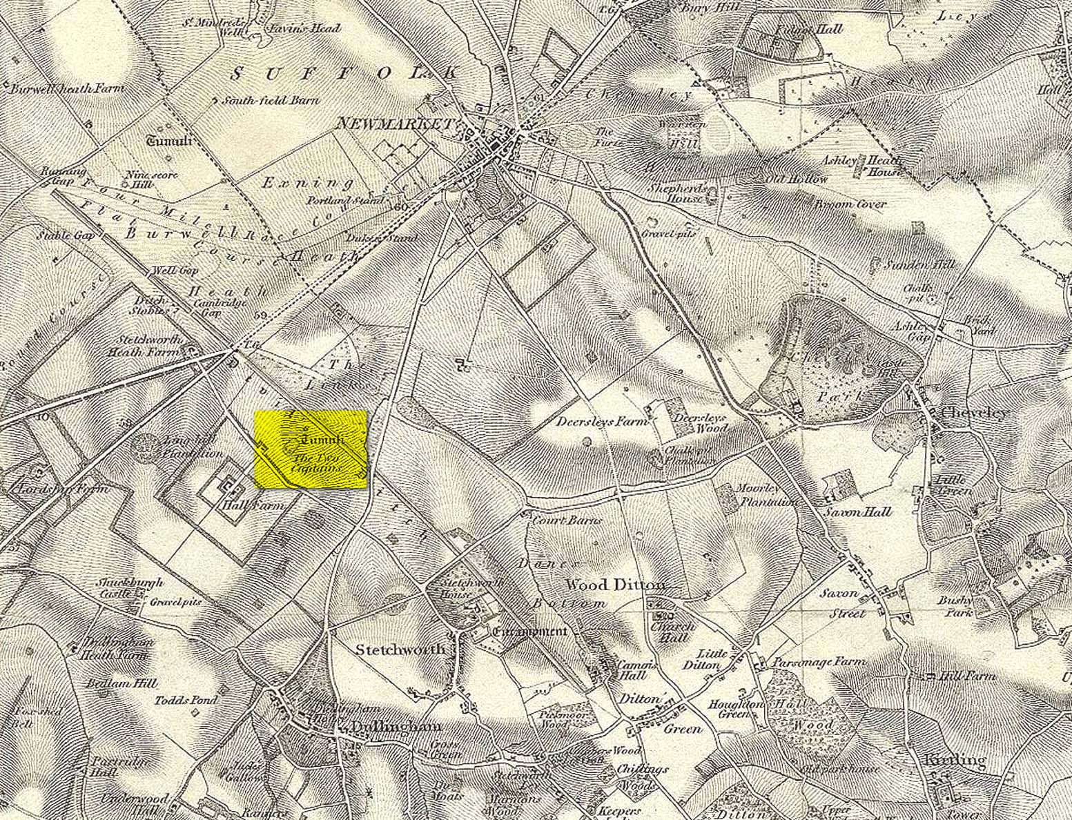
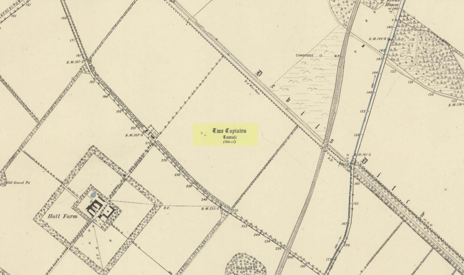
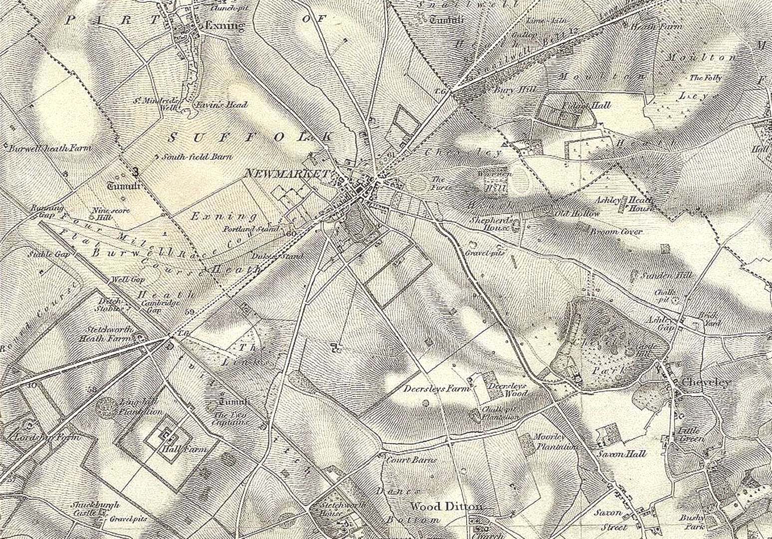
Mentioned as early as the 15th century in the Ely Cartulary as the “Tuomhowe,” or “two hills”, the place-name authority P.H. Reaney (1945) identifies this with the two “barrows” which our early cartographers map as our ‘Two Captains’.
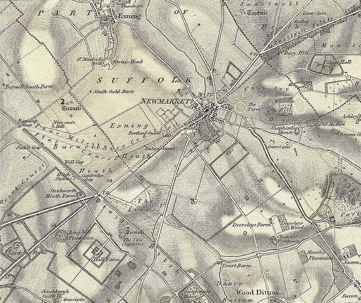
Site shown on 1834 mapSite of the Two Captains on the 1885 OS map
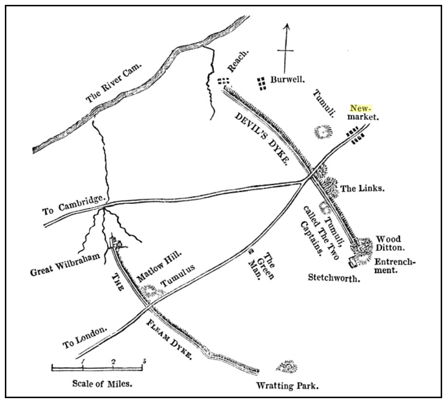
In the 1834 survey by the Ordnance Survey lads, these conspicuous burial mounds were clearly marked on the west side of the Devil’s Dyke, less than 2 miles south of the Newmarket Necropolis. They were seen first-hand by a number of local walkers, including A.J. King (1845) in his account of the aforementioned dyke. But on the 1885 OS map, the old tombs had apparently gone. Evidently some local knob-head had come along and took it upon himself to destroy these two burial mounds, which had lived here for thousands of years. However, despite the OS-maps indicating that it had been totally destroyed in the 1880s, a couple of later writers said that faint traces were still visible, including the historian Charles Harper. (1904) When he came here, he told how
“Little is now left of this once prominent mound, once important enough to be marked on Ordnance maps, but now ploughed nearly flat. It stands in the third field from the road, on the right hand, a field now under corn, but until forty years ago a wood.”
A.J. King’s 1845 map
Very little is known about the place and even the late great barrow fetishist, L.V. Grinsell (1936) could dig nothing out, despite the two tombs mentioned in passing by a number of writers.
Folklore
In Grinsell’s (1976) book on the folklore of ancient sites, he drops the Two Captains into a simple category of them relating to some battle, without any information. But it seems there isn’t much to go on. The local history work of Charles Harper (1904) intimates the same thing, bringing attention to the folklore of the adjacent Devil’s Dyke, as
“it is one of the many sites identified as the scene of Boadicea’s defeat by Suetonius Paulinus, but we are sceptical of this particular one, although the ancient tumulus on the outer face of the Ditch, still called the Two Captains, points to some forgotten conflict in which two leaders were slain and buried on the contested field.”
References:
Gomme, G.L., The Gentleman’s Library: Archaeology – volume 2, Elliot Stock: London 1886.
Grinsell, Leslie V., The Ancient Burial Mounds of England, Methuen: London 1936.
Grinsell, Leslie, Folklore of Prehistoric Sites in Britain, David & Charles: Newton Abbot 1976.
King, A.J., “The Devil’s Dyke, Newmarket,” in The Gentleman’s Magazine, January 1845.
Reaney, P.H., The Place-Names of Cambridgeshire and the Isle of Ely, Cambridge University Press 1943.
Royal Commission Ancient Historical Monuments, Inventory of Historical Monuments in the County of Cambridgeshire – Volume 2: North-East Cambridgeshire, HMSO: London 1972.
Tymms, S., “The Devil’s Dyke, Newmarket” in Proceedings Suffolk Inst. Archaeology. 1, 1849-53 168-70
Tumulus (destroyed): OS Grid Reference – TL 6122 6358
Archaeology & History
Tumulus ‘3’ on 1834 map
This is one of at least five prehistoric tombs that were known to have existed in and around the Newmarket race-course—all long gone. It stood some 50-60 yards northeast of the Newmarket Heath (2) tumulus and was one in the cluster highlighted as ‘tumuli’ on the 1834 OS-map (right). Despite its destruction sometime in 1883, a scar of the monument was seen from the air in the 1940s by J.K.S. St Joseph as a ploughed-out ring ditch, showing it to have been some seventy feet across. Sadly, no ground trace of the monument exists.
Royal Commission Ancient Historical Monuments, Inventory of Historical Monuments in the County of Cambridgeshire – Volume 2: North-East Cambridgeshire, HMSO: London 1972.
Tumulus (destroyed): OS Grid Reference – TL 6116 6352
Archaeology & History
Tumulus 2, centre-left
This is one of at least five prehistoric tombs that were known to have existed in and around the Newmarket race-course. Found some 600 yards NNE of the Ninescore Hill tumulus, and some 40 yards from its nearest companion, it was shown as one in a group of ‘Tumuli’ on the 1834 OS-map (right) but, along with the rest, was subsequently destroyed sometime around 1883. A landscape scar of the monument was seen from the air in the 1940s by J.K.S. St Joseph as a ploughed-out ring ditch some 75 feet across. This was reported as still visible by the Royal Commission doods in the 1970s, but no ground trace whatsoever exists.
Royal Commission Ancient Historical Monuments, Inventory of Historical Monuments in the County of Cambridgeshire – Volume 2: North-East Cambridgeshire, HMSO: London 1972.