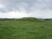
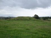
Folly Top, Barden Moor, North Yorkshire

Ring Cairn:  OS Grid Reference – SE 03536 59756

Getting Here

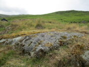
Folly Top ring, looking E

It’s easier to explain how to get here if you’re coming from the Burnsall-side of the B6160 road that leads to Bolton Abbey.  A half-mile out of Burnsall village you a small woodland with a small parking spot.  From here, a footpath runs up the steep hill above the parking spot.  It zigzags a little and you eventually come out on the south-side of the trees where it meets some tall walling.  Follow this walling further uphill for more than 600 yards (past more woodland) until the land starts to level out.  Hereby, go thru an opening in the wall and less than 100 yards away (west) amidst the overgrown heather, you’ll see what you’re looking for.

Archaeology & History

A large but peculiar site resting on a moorland plateau on the eastern edges of the mighty Barden Moor.  Peculiar inasmuch as it’s completely isolated from any other monument of the same age and type anywhere on these huge moors.  A few miles east, on the moors around Appletreewick, Thruscross and Beamsley we have a plethora of prehistoric sites—but up here on Barden Moor there’s apparently nowt else!  I find that hard to believe….

Inner rubble walling
Rubble walling, looking N

Listed on official websites as being a ring cairn, it’s difficult without a detailed excavation of the site (there hasn’t been one) so say that’s what it is.  But we’ll stick with it for the time being.  My initial impression of the site was that it was a crude form of a collapsed Scottish dun: impressive large circular monuments—buildings if you like—with very well-built large stone walls, usually several yards thick, a little bit like the Scottish brochs (mighty things indeed!).  This thing at Folly Top isn’t quite as impressive, but it’s like a collapsed version of a dun.

Arc of western walling

The site consists of large ring of raised collapsed rubble walling, more than a yard high in places, and about three yards thick all the way round, measuring roughly 21 yards (N-S) by 19 yards (E-W) from outer wall to outer wall.  There are “entrances” on the east and west sides; but there seemed to be little of any note in the middle of the ring, although the site was somewhat overgrown on our visit here.  Outside of the ring there was also nothing of any note.  It’s a pretty isolated monument which seems to have more of an Iron Age look about it than the Bronze Age—but until there’s an excavation, we’ll not know for sure.

It’s well worth checking out—and from here, walk onto the huge moorland above you to the west….

Acknowledgements:  Huge thanks to the Crazy-gang of Sarah, Helen and James for their awesome assistance on our venture up here.  A damn good day indeed!  Cheers doods. 🙂

© Paul BennettThe Northern Antiquarian

Millden, Glen Esk, Edzell, Angus

Stone Circle:  OS Grid Reference – NO 54 79

Archaeology & History

I add this brief site profile in the hope that we can clarify, one way or the other, whether the report of a stone circle described in a letter by G.W. Zealand to the Ordnance Survey in November, 1978, has any basis in fact.  Zealand said that the structure comprised of “red stone, not very large” at Millden in Glen Esk.  Perhaps local people or megalithic explorers who may visit this area could try locating it so we can confirm it as real, or strike it from the listings.  It is included in the Canmore catalogues. I must point out that there were a large number of prehistoric sites in this area destroyed in recent centuries, meaning that this report may be authentic.

© Paul BennettThe Northern Antiquarian

Ballakelly, Santon, Isle of Man

Cup-Marked Stone:  OS Grid Reference – SC 32144 71990

Also Known as:

  1. Oatland

Archaeology & History

This carving is one that was found inside the remains of a chambered cairn and so, as with all things petroglyphic, it deserves its very own site profile.  It’s been mentioned before—in fact many times before, from the legendary J.T. Blight (1868) to our modern researchers—although it was curiously absent in Ron Morris’ (1989) otherwise excellent survey.  When Mr Blight described the tomb, he told us that,

“Its outer ring, of which but three or four stones are left, was about 45 feet in diameter; the inner one 15 feet, with a kistvaen in its midst.  As on the external face of one of the uprights of the inner circle there are rows of cup carvings … it may be presumed that this was always exposed to view.”

Position of cups in the tomb
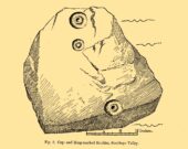
E.L. Barnwell’s 1868 sketch

The same year, Barnwell (1868) mentioned the same carvings—albeit briefly—telling us “that one of the stones has several rows of the curious cups.”  The design faced to the north, which is the traditional direction relating to Death in most northern hemisphere cultures.

As you can see, this design is similar to other petroglyphs that some students have suggested have a numeric nature (see the Idol Stone on Ilkley Moor for example).  You can understand why!  The basic linearity of the cups, in rows, certainly gives that impression and indeed it’s not unreasonable to make such an assumption—but, as always, we simply don’t know.  A similar design was found on a stone at Ballagawne in the parish of Kirk Arbory, but the cups were much deeper and deemed as being a medieval game played on stone, known as Nine Man’s Morris.  The original function of the game may have been divinatory.

References:

  1. Barnwell, E.L., “Notes on the Stone Monuments in the Isle of Man,” in J.G.,Cumming (ed.) Antiquitates Manniae, London 1868.
  2. Blight, J.T., “Stone Circles and Megalithic Remains,” in Gentleman’s Magazine 1868.
  3. Cubbon, A. M., Prehistoric Sites in the Isle of Man, Manx Museum: Douglas 1971.
  4. Cumming, J.G. (ed.), Antiquitates Manniae, Manx Society: London 1868.
  5. Gale, J. & Darvill, T., “A Survey of the Ballakelly Chambered Tomb,” in Darvill, & T. Billown (eds.), Neolithic Landscape Project, Isle of Man, 1997, Bournemouth University 1998.
  6. Henshall, A. S., “Manx Megaliths Again: An Attempt at Structural Analysis,” in P. Davey (ed.), Man and Environment in the Isle of Man, BAR: Oxford 1978.
  7. Kermode, P.M.C., “The Ancient Monuments of the Isle of Man,” in Archaeologia Cambrensis, volume 84, 1929.
  8. Kermode, P.M.C. & Herdman, W.A., Manks Antiquities, University of Liverpool 1914.
  9. Simpson, James, Archaic Sculpturings of Cups, Circles, etc., Upon Stones and Rocks in Scotland, England and other Countries, Edmonston & Douglas: Edinburgh 1867.

© Paul BennettThe Northern Antiquarian

Pen Twyn, Bargoed, Glamorgan

Cup-Marked Stone (lost):  OS Grid Reference – SO 1491 0045

Archaeology & History

Sometime in the 1940s, a certain Lady A. Fox recorded a cup-marked stone “in the vicinity of Pen-twyn” near Bargoed.  Its position in the landscape is a good one: on a geological promontory and overlooking the valley below.  The find was indexed by the Ordnance Survey, but apart from it’s grid-reference, all attempts to locate the design have so far proved unsuccessful.

It was mentioned briefly in the Royal Commission (1976) survey of Glamorgan, then subsequently listed in the surveys of Sharkey (2004) and Nash (2007), but none of them were able to locate it.  And hence, I post it here, in the hope that some local hunter will be able to recover it from its hiding place!

References:

  1. Mazel, A., Nash, G. & Waddington, C. (eds.), Art as Metaphor: The Prehistoric Rock Art of Britain, ArchaeoPress: Oxford 2007.
  2. Nash, George, “A Scattering of Images: the Rock Art of Southern Britain,” in Art as Metaphor, ArchaeoPress: Oxford 2007.
  3. Royal Commission on the Ancient & Historical Monuments, Wales, An Inventory of the Ancient Monuments in Glamorgan – Volume 1: Pre-Norman, Part 1: The Stone and Bronze Ages, HMSO: Cardiff 1976.
  4. Sharkey, John, The Meeting of the Tracks: Rock Art in Ancient Wales, Gwasg Carreg Gwalch: Llanrwst 2004.

© Paul BennettThe Northern Antiquarian

Grey Wether, Ewes, Langholm, Dumfriesshire

Standing Stone:  OS Grid Reference – NY 37616 92734

Archaeology & History

Grey Wether in 1911

This is a site that requires the attention of some local antiquarians, as there are conflicting reports as to whether or not it still lives in its old haunt.  Very little has been written about it and its whereabouts seems to have been completely missed in the radars of all megalithic guides.  The Langholm historians—John and Robert Hyslop (1912)—who wrote about the place in their gigantic history work more than a hundred years ago, would no doubt be shaking their heads at such lackings.

They told:

“The best example of the standing stones in the Eskdale district is that at Meikledale in Ewes, locally known as ” The Grey Wether,” a print of which is here given.  It is about 5 feet in height and its girth is 8 feet 7 inches, and it would probably weigh about two tons.  The stone is the common greywacke, or whinstone of the Silurian series, rough and unhewn.  It stands in the centre of a field in front of Meikledale House, and can be seen from the highway.  The field is surrounded by hills on every side,”

which the writers thought might have been the reason for its erection here, although having more to do with the natural beauty of the landscape than any archaeocentric or geomantic factor.

Shortly after this had been written, Alexander Curle of the Royal Commission visited the area and made note of this “standing stone known as the Grey Wether…situated on the haughland some 250 yds SSE of Meikledale”, but added nothing more.  It was several years later before a Royal Commission (1920) team came here and told that,

“A standing-stone, known as the “Grey Wether,” is situated on the haugh-land, some 250 yards south-south-east of Meikledale.  It is a large whinstone slab, measuring in greatest height 4 feet 8 inches, in breadth 3 feet 5 inches, and in thickness 1 foot, and faces west-south-west and east-north-east.”

Stone shown on 1857 map

But they subsequently reported that, prior to World War 2, some complete dickhead knocked it down, broke it up and dumped it in a nearby stream!  However, in 1980 some more lads from the Scottish Royal Commission revisited the area and alleged that a stone laid in the field 250 yards below of Meikledale farmhouse was our old Grey Wether.  The position they describe is the same spot as the one shown on the 1857 OS-map; and at this very spot on GoogleEarth it seems that a stone there lies…  Are there are any local folk in that neck o’ the woods who could find out…?

Folklore

The Greywethers stone circle on Dartmoor has a veritable mass of folklore attached to it, but its namesake here at Langholm has very little.  The origin of its name has been forgotten.  All we have left is what the Ordnance Name Book in 1857 recorded, telling that “it is supposed to have been erected in memory of some Hero, but no further account of it can be obtained.”

References:

  1. Hyslop, John & Robert, Langholm, As it Was, Hills: Sunderland 1912.
  2. Royal Commission on Ancient & Historical Monuments Scotland, Inventory of Monuments and Constructions in the County of Dumfries, HMSO: Edinburgh 1920.
  3. Royal Commission on Ancient & Historical Monuments Scotland, Eastern Dumfriesshire: An Archaeological Landscape, HMSO: Edinburgh 1997.

© Paul BennettThe Northern Antiquarian 

Careg Bica, Dyffryn Clydach, Glamorgan

Cup-Marked Stone:  OS Grid Reference – SS 72500 99602

Archaeology & History

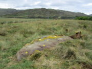
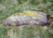
An interesting new cup-marked stone found by Paul Blades is this smooth rounded (female) stone that may originally have had some relationship with the tall standing stone of Careg Bica 160 yards to the south.  Around ten cup-marks are etched onto its surface, in a seemingly random arrangement (as usual!).  Although it seems to be an isolated carving, it’s likely that others will exist in the area.

Carving & outlying monolith
Careg Bica petroglyph

The direction and proximity of the standing stone may have had some relationship with the carving.  In traditional northern hemisphere societies, the cardinal direction North is generally associated with darkness and death, primarily due to the fact that this is the area in the heavens where neither sun or moon ever appear; whilst South relates to life and positive natural associations due to it being the high point of the sun during the day. This animistic attribute existed till recently in the water-lore of northern England and Scotland where “south-running streams bore a high repute.”  Whilst such mythic attributes are well established, any cardinal relationship here is purely speculative.

AcknowledgementsHuge thanks to Paul Blades for use of his photos in this site profile – and of course for finding the stone!

© Paul BennettThe Northern Antiquarian 

Table Rock, Rivock, Silsden, West Yorkshire

Cup-Marked Stone:  OS Grid reference – SE 07326 44696

Also Known as:

  1. Carving no.43 (Boughey & Vickerman)

Getting Here

Table Rock cupmarked stone

If you’re coming via the Keighley-Bingley (Airedale) road, go up to Riddlesden and then up the winding Banks Lane until it meets the edge of the moors.  At the T-junction, turn left and about 330 yards along on your right there’s a dirt-track.  Walk up here, sticking to the track (not the footpath) towards the cliffs of Rivock ahead of you, going through the gate and into the Rivock woods area.  About 450 yards on from the gate on your right-hand side you’ll see the long straight length of walling that runs uphill—and about 60 yards up here, on the left-hand side of the wall you’ll see a very large boulder.  Y’ can’t really miss it!

Archaeology & History

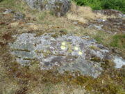
2 of the several cups here

This large natural block, embedded into the hillside about 80 yards below the Wondjina Stone and its companions, is nothing much in the petroglyphic visual scale of things, but is worth checking out for a break if you’re checking out the other good designs in the Rivock cluster.  Upon its sloping flat two-tiered surface there are just a small number of randomly spaced cup-marks of varying sizes: six at least, but perhaps as many as nine altogether.  In times gone by (many years ago) we thought one of them might have had a very faint ring around it, but on my last couple of visits here I couldn’t see anything.

References:

  1. Boughey, Keith & Vickerman, E.A., Prehistoric Rock Art of the West Riding, WYAS: Wakefield 2003.
  2. Hedges, John (ed.), The Carved Rocks on Rombalds Moor, WYMCC: Wakefield 1986.

© Paul BennettThe Northern Antiquarian


Rivock Top, Silsden, West Yorkshire

Cup-Marked Stone:  OS Grid Reference – SE 0745 4470

Getting Here

Rivock Top stone

Best approached via the Wondjina Stone, then over the wall and follow the geological ridge that bends into the trees.  It’s difficult to find amidst the dense forest and is another one of those carvings that’s probably only for the purists amongst you.

Archaeology & History

If you’re doing the Rivock rock art tour, you might as well give this a go once you’ve checked ou the decent ones nearby.   Here, on a rather large stone we find, on its uppermost ridge, three faint cup-marks next to each other in a very slight curve.  The cup-mark in the middle is slightly larger than its two compatriots and might be natural.  If you were to wet the rock when the sunlight is just right, you’ll probably get a better idea of its real appearance—otherwise we’ll have to let the computer-gadget lads suss it out!

© Paul BennettThe Northern Antiquarian

Mixing Stone, Low Snowden, Askwith, North Yorkshire

Cup-and-Bowl Stone:  OS Grid Reference – SE 18074 51241

Getting Here

Follow the directions to reach the Ancestors’ Stone and the Sunrise Stone; and there, roughly halfway between them, right by the edge of the old collapsed walling, you’ll see this rise of a stone with a large ‘bowl’ on top.  That’s it!

Archaeology & History

Mixing Stone, looking E

Laid upon the same geological ridge as our Ancestors’ and Sunrise carvings, there are one, possibly two faint cup-marks visible on the low flat surface near the edge of this rock, barely visible unless the light’s right.  But the important element here, perhaps regardless of the cup-marks, is the ‘bowl’ or rock basin on top of the stone.  Internally, it’s smoothed equally on all sides and, due to being in-between the two impressive petroglyphs, may well have had a practical function to it.  Bear with me on this one…

The Mixing Stone’s bowl

Stone ‘bowls’ or cavities—natural and otherwise—have been made use of in many cultures for simple functional purposes, such as grinding flour, herbal mixes, etc.  We find such traditions in some of the bullauns of Ireland and Scotland; whereas in similar stone bowls known as cat troughs in nearby Haworth, milk was poured to appease the spirits of the land (this tradition was still being maintained in 2001!).  Folklore and traditions of such rock basins spread far and wide beyond the UK: one of the German terms for rock basins is Opferkessel, meaning ‘sacrificial basin’ and suggests ritualistic usage by early societies.  Elsewhere on Earth there are numerous accounts of the ritual use of petroglyphs in which indigenous peoples tell of their use of plant- or rock-based paints (in many cases red ochre) to decorate the carvings.  And it’s this element that I’m interested in here.

Water-painted cupmarks

The Sunrise and Ancestors’ Stones 10-15 yards either side of this Mixing Stone are ideal candidates for such petroglyphic paintings using early ochre and other stone or plant-based agents.  Such activities would always have been ritualised, either in honour of ancestors, genius loci, calendrical rites, or whatever the pertinent ingredient was at that place and time.  I’m suggesting simply that the rock basin on the Mixing Stone was used for just such purposes.  This is no spurious suggestion, but at the same time it’s important to recognise that my thoughts here represent merely an idea, nothing more—not a fact.  Whilst we know full well that these carvings were imbued fundamentally with animistic properties—a simple ‘fact’—this functional idea is just that—an idea.  Students and petroglyph-nuts need to understand this.  And the faded cup-marks at its edge are perhaps merely incidental…. though I don’t buy that misself!

© Paul BennettThe Northern Antiquarian 

Killiesmont, Keith, Moray

Cup-Marked Stone (destroyed):  OS Grid Reference – NJ 4124 5308

Archaeology & History

Diagonally across the road from Killiesmont, about a hundred yards up the sloping field on “a piece of ground called the Helliman Rig,” could once be seen a large flat stone with cup-markings on its surface.  Walter Gregor (1881) told that,

“It lay on the top of a rising ground, and commanded a very wide view of the country, stretching for many miles over the hills of Banff and Moray.  In a part of it the rock–a kind of slate–came to the surface.  In the rock were cut out nine cups in three rows.”

The carving was earlier described in one of the Topographical Gazetteers of Scotland (1848) where its story is bound up with local tradition and folklore of the land where it lie.  There it was described as being “a flat circular stone of about 8 feet in diameter, in which there are a number of holes, but for what purpose tradition is silent.”  Subsequently the local historian J.F.S. Gordon (1880) talked of this “large flat circular Stone, of about 8 feet in diameter, in which there was a number of half-pierced holes…. It was too large for a Quern or even a Millstone; and its purpose remained an enigma.”

The stone came to light when a local farmer was digging in the field and, “at the upper end of the Rig, there was found a rude Cist among a heap of stones, which contained ashes.”  The cup-marked stone was “turned up” at the same time.  It has sadly been destroyed—along with the associated cairn that probably had some relationship with the carving.  Prehistoric tombs and rock art are frequent bedfellows and it seems likely that the equation occurred here.  But the location of the site had some fascinating local lore told of it…

Folklore

The location of this carved stone in the field called ‘Helliman Rig’, was also known as the Guidman’s Croft or the Gi’en Rig.  This was a portion of land that was never to be touched or ploughed as it was “given or appropriated…to the sole use of the devil, in order to propitiate the good services of that malign being.”  This devilish tradition superseded the earlier faith of it being a place set aside for the fairy folk and their allies—nature spirits no less.  And it’s a tradition found in many places across Scotland and elsewhere, as the account in the Scottish Gazetteer told :

“Like other crofts of this description in Scotland, the present remained long uncultivated, in spite of the spread of intelligence (pedantic bastard! PB).  The first attempt to reclaim it was made not more than 50 years since, when a farmer endeavoured to improve it; but, by an accidental circumstance, it happened that no sooner had the plough entered the ground than one of the oxen dropped down dead. Taking this as an irrefragable proof of the indignation of its supernatural proprietor, the peasant desisted, and it remained untilled till it came into the possession of the present occupant…”

This of course fortified the old folklore in the eyes of local people.  I’ve found that even up to recent times, such folklore is still held quite seriously by some of the old folk in the mountain villages and hamlets.

References:

  1. Anon, The Topographical, Statistical and Historical Gazetteer of Scotland – volume 2, A. Fullarton: Edinburgh 1848.
  2. Gregor, Walter, Notes on the Folk-lore of the Northeast of Scotland, Folklore Society: London 1881.
  3. Gordon, J.F.S.,  The Book of the Chronicles of Keith, Grange, Ruthven, Cairney and Botriphnie, Robert Forrester: Glasgow 1880.

© Paul BennettThe Northern Antiquarian