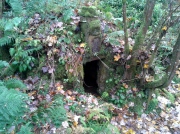
Katie Thirsty’s Well, Logie, Stirlingshire

Sacred Well:  OS Grid Reference – NS 81787 97653

Getting Here

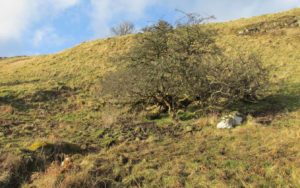
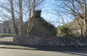
The scraggy hawthorn of Katie Thirsty’s Well

Not too tricky to locate, as long as you get onto the right footpath!  Take either road (both steep narrow and very bendy in places!) up from Logie on one side or Bridge of Allan on the other, towards Sheriffmuir and head to the Faerie or Highlandman’s Well.  About 150 yards before this, note the small car-park.  From here, go through the gate as if you’re walking to Dumyat, but 50 yards along the footpath it splits into two.  Take the lower right-hand path and keep walking for another 600 yards until you see a large worn hawthorn tree on your left, with boggy land just in front of it that runs to the path you’re walking on.  That’s it!

Archaeology & History

‘Katie Thirsty’ is a most intriguing character who pops up at a number of healing wells, primarily in Scotland.  Dedications to her are known near Abernethy, Falkirk, Innerleithen, Killearn, Kilsyth and elsewhere, with one example just over the Scottish border in Northumberland.  So who was she? And what’s the story behind this little known example, close to the ruinous Iron Age village east of Dumyat?  The truth is, we don’t know for sure as yet.  Tales are told of a local lady called ‘Katie’ at the wells near Abernethy and Kilsyth, each with their own domestic myth—but it seems that a wider mythic status underlies this dedication.

One very fine notion comes from the pen of Pictish researcher Ronald Henderson (2008; 2014), who tells that the name derives from a corruption of both St. Katherine of Alexandria [Katie] and the Pictish King, Drust or Drustan [Thirsty].  The latter etymological postulation finds faith in the fact that the great crags of Dumyat less than a mile to the east is universally credited with being the last Pictish stronghold at the old hillfort there.

The flowing clear waters

…This well on the hills north of Logie village—with its old hawthorn for companion above the old path to medieval Fossachie village—flows nicely, and its freezing waters are very good to drink.  Twenty yards east of the boggy overflow are the overgrown remains of an isolated Iron Age ‘homestead’ or hut circle, and the waters of Katie Thirsty’s Well would have been the primary drinking supply to the people living there in ancient times.

Very little is known about the specific history or folklore of the site and it is mentioned only in passing by David Morris (1935) who told us simply:

‘“Katie Thirty’s Well’ was the old name of a clear spring on the hillside by the track leading to Dumyat.”

It’s a beautiful spot to visit, with lovely views for many miles to the east, south and west.  If you’re going to visit the Fairy or Highlandman’s Well nearby, take time to visit Katie Thirsty’s refreshing flow too.

As for Katie herself: does anyone have their own ideas about her…?

References:

  1. Henderson, Ronald W., Rex Pictorum – The History of the Kings of the Picts, Perth 2008.
  2. Henderson, Ronald W., “Drust… of the Hundred Battles,” in Celtic Guide, 3:4, April 2014.
  3. Morris, David B., “Causewayhead a Hundred Years Ago,” in Stirling Natural History & Archaeological Society Transactions, 1935.

© Paul BennettThe Northern Antiquarian

Airthrey Mineral Wells, Bridge of Allan, Stirlingshire

Healing Wells:  OS Grid Reference – NS 79504 97686

Also Known as:

  1. Airthrey Spa
  2. Airthrey Springs
  3. Bridge of Allan Spa
  4. Canmore ID 317260

Getting Here

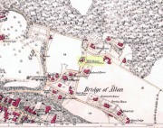
Site shown on 1865 OS map

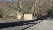
The old well-house is accessed easily.  From the main road of Henderson Street (or A9), that runs through the town, as you approach the main shopping area, go up Alexander Drive, then immediately turn right up Well Road. 100 yards up, take your first right again along Kenilworth Road and then first right up Mine Road.  100 yards or so along here, as you reach the tennis courts on your right, a small crumbly-tumbly building is to your left, just by the car-park to the hotel, with some old trees hiding its presence.  You can’t get into it and the waters therein sound to have fallen silent.

Archaeology & History

In 1761, the great writer Daniel Defoe in his Tour across Britain, found himself visiting a healing spring under the western reaches of the Ochils:

“Airthrey Well, two miles north of Stirling, flows from a mountain, where is a copper mine, with some mixture of gold; the water is very cold, and being tinctured with the minerals it flows through, is of use against outward distempers.”

Airthrey Wellhouse in ruins

Perhaps the earliest literary description of this site, the Bridge of Allan that we see today was little more than a stretch of old abodes, reaching into woodland above the crystal clear river and burns, chiming with countless fauna and that rich chorus of colours that pre-date the Industrialist’s ‘progress’.  The old hamlet was said by Robert Chambers (1827) to be “a confusion of straw-roofed cottages and rich massy trees; possessed of a bridge and a mill, together with kail-yards, bee-skeps, colleys, callants, and old inns.” But all of this was about to change.

In the old woods on the northwest slopes above the hamlet was indeed an old copper mine as Defoe described, and housed therein were a number of mineral springs–six of them according to the early reports of Forrest (1831) and Thomson. (1827)  They were obviously “known to the country people,” said Thomson, and had been “used by them as an occasional remedy for more than forty years”; although in Forrest’s very detailed account of these wells, he told how

“one of the old miners, an intelligent man and an enthusiastic admirer of the medicinal virtues of these waters, informs me, that they have been known for at least one hundred years.”

This comment was echoed a few years later when Charles Roger (1853) wrote his extensive book on the village.

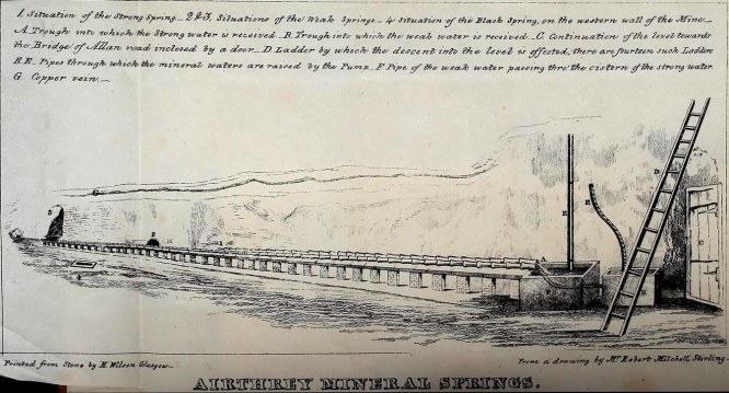
It was in the 1790s when the mineral waters were channeled out of the mines for the first time, and Mr Forrest told that they were collected lower down the slope,

“in a wooden trough, for the use of the miners, and of the country people, some of whom used it as an aperient, whilst others, deeming the water impregnated with common salt merely, employed it for culinary purposes. …It was…much used as a medicine by the country people of the neighbourhood who attended regularly every Sunday morning to partake of it.”

Airthrey waters channeled along the long trough (Robert Mitchell 1831)

The fact that Sunday mornings was when people came here tell us that the Church had something to do with the timing; strongly implying that the wells possessed earlier indigenous traditions—probably similar to those practiced at the Christ’s Well, the Chapel Well and countless others across the country.  But written records on this are silent.

The main history of the Airthrey Springs is of them becoming famous Spa Wells and, much like Harrogate in Yorkshire, were responsible for the very growth of Bridge of Allan itself.  Oddly enough, this came about a few years after the copper mines were closed in 1807.  This wouldn’t have stopped some of the local people still getting into them and drinking the waters when needed—but the written records simply tell that, for a few years at least, their reputation faded.  Around the same time in the village of Dunblane, just a few miles to the north, another Spa Well had been discovered and it was attracting quite a lot of those rich wealthy types—bringing fame and money to the area.  As a result of this, the medicinal virtues of the Airthrey Springs were revived thanks to the attention of the local lord, a Mr Robert Abercromby, who thought that Bridge of Allan could gain a reputation of his own.  And so in the winter of 1821-22, Abercromby procured the research chemist Thomas Thompson to analyse the medicinal waters at Airthrey and have them compared with the ones at Dunblane.  He was in luck! Not only were they medicinal, they were incredibly medicinal!

Dr Thomson then wrote a series of articles in various academic journals in the early 19th century—each espousing, not just the health-giving property of the Airthrey waters, but lengthy chemical analyses outlining the active constituents.  To his considerable surprise he found that the Airthrey waters were as good as any of the great spa towns in England at Harrogate, Buxton, Bath and Leamington.  Their virtues were so good that Mr Forrest (1831) doubted any of the Spa Wells in England were as beneficial as the waters here!  R.M. Fergusson (1905) echoed this sentiment in his massive work on the adjacent parish of Logie, calling the Airthrey springs “the Queen of Scottish Spas”!—and these accolades prevailed long after Dr Thomson’s analyses.  He wrote:

“At Airthrey there are six springs containing, all of them, the same saline constituents, but differing a good deal in their relative strengths. I analyzed two of these during the winter of 1821-22, and the other four during the autumn of 1827.”

He found that, in varying degrees, the main constituents were salt, muriate of lime, sulphate of lime and muriate of magnesia. At that time, in medical circles, these ingredients were beauties!  As Mr Logie (1905) said:

“This mineral water has been for long distinguished as a specific for derangements of the stomach and liver, and skin and chest diseases, rheumatism, gout, sciatica, and nerve affections…”

Thomson’s initial findings were much to the liking of Mr Abercromby; for hereafter, he realised, all and sundry who could read and travel to the country spas in England and beyond, would visit Bridge of Allan and bring with it great trade.  So Abercromby quickly,

“caused the water of the two Springs analysed by Dr. Thomson, one of which was characterised by its strength, the other by its comparative weakness, to be carefully collected and conveyed apart in earthen pipes, to two stone troughs placed in a convenient situation, from which it was raised by two well-constructed forcing pumps. Over these pumps a commodious house was erected.

In 1822, several thousand copies of Dr. Thomson’s analyses were circulated; and the water acquired immediate celebrity.  Invalids from all parts of the country, but especially from Glasgow and its vicinity, resorted to Airthrey. Every house, in fact, in its neighbourhood, however mean and incommodious, was occupied by strangers; and so great was the popularity of the new springs that even in 1823 they threatened to supersede all the other same springs of Scotland.”

The success of these medicinal waters created the town itself and, unlike many other spa wells, this one continued to be used until the end of the 1950s.  Its demise came when, in one financial year, only two people came to “take the cure,” as it was called.

Side wall of ruined wellhouse

If you visit the well-house nowadays, it’s in rather poor condition and will be of little interest unless you’re a devout architectural fanatic.  It’s thought to be the earliest surviving building associated with this spa town, said by Mr Roger (1853) to have been built in 1821.  Shown on the first OS-map of the area, adjacent buildings were constructed to accommodate the overflow of people who came here.  And in the woodlands above, if you look around halfway up the slopes, an old trough has water running into it just by the side of a path.  This, say some local folk, is the trickling remains of the medicinal waters, still used occasionally by some people…

References:

  1. Durie, Alastair J., “Bridge of Allan: Queen of the Scottish Spas,” in Forth Naturalist & Historian, volume 16, 1993.
  2. Erskine, John, Guide to Bridge of Allan, Observer Press: Stirling: 1901.
  3. Fergusson, R. Menzies, Logie: A Parish History – 2 volumes, Alexander Gardner: Paisley 1905.
  4. Forrest, W.H., Report, Chemical and Medical, of the Airthrey Mineral Springs, John Hewit: Stirling 1831.
  5. Morris, Ruth & Frank, Scottish Healing Wells, Alethea: Sandy 1982.
  6. Roger, Charles, A Week at Bridge of Allan, Adam & Charles Black: Edinburgh 1853.
  7. Stewart, Peter G., Essay on the Dunblane Mineral Springs, Hewit: Dunblane 1839.
  8. Thomson, Thomas, “On the Mineral Waters of Scotland,” in Glasgow Medical Journal, volume 1, 1827.
  9. Turner, E.S., Taking the Cure, Michael Joseph: London 1967.

© Paul BennettThe Northern Antiquarian


Fairy Well, Logie, Stirlingshire

Sacred Well:  OS Grid Reference – NS 8135 9804

Also Known as:

  1. Canmore ID 47123
  2. Hielantman’s Well
  3. Highlandman’s Well
  4. Holy Well

Getting Here

Fairy Well, emerging from wall

Fairy Well, emerging from wall

From Stirling, take the A9 to Bridge of Allan, turning right at the roundabout along the A907 for less than a mile, then turning left at the next roundabout up the A91.  A half-mile down, at the small roundabout, bear left and first right, up to Logie Church.  Keep going all the way up this steep winding road, turning right at the junction.  Go along here for a quarter of a mile and park up at the roadside.  Walk along a bit further where the road has a bittova sharp bend.  The sound of the stream coming out of the small glen is obvious.  Walk past this and, on the right-hand side of the road, past the stream, you’ll find a water source emerging from the boscage of an overgrown wall.  Keep looking.  It’s damn close!

Archaeology & History

In the 1792 Statistical Account of this northeastern edge of Stirling, moving into the ancient parish of Logie, we were given an early brief account of this all-but-forgotten sacred water source which, thankfully, still runs fine water to this day.  It was described in tandem with the ancient Hill of the Picts called Dunmyatt, more than a mile to the east; but,

“About half-a-mile from the foot of this hill…is a very fine well, which issues from more than sixty springs, that rise through the sand and channel.  It is called the Holy Well, and is said to have been much resorted to by the Roman Catholics.”

Close-up of the running waters

Close-up of the running waters

In R.M. Menzies (1905) magnum opus on the parish of Logie, he told that it “was popularly known as ‘the Heilantman’s Well’, a possible reminiscence of the ’15 where the battle of Sheriffmuir was fought nearby.”  This tradition is echoed by several local historians; though Angus Watson (1995) wonders whether it’s ‘Highlandman’s Well’ name (and its variants) is “perhaps more likely to the use of the well by Highland drovers.”  It’s in the perfect spot too!

When the Royal Commission (1963) lads visited the place in 1952, they described the well to have “been filled up.”  Thankfully today, the old well emerges out of the overgrown remains of an old wall, the waters of which still run fast and free and into the larger stream ahead of it.  The waters are fine and clear, and tasted cold and refreshing when I drank some a few days ago.  It’s an excellent spot to quench the thirst after a day out in the Ochils.

Folklore

Of the various titles given to this old water source, the more popular choice in recent years has been to call it the Highlandman’s Well.  However, local lore had always known it to be a place where the little people had acquaintance and it seems more vital to maintain its old folk-name.  In R.M. Menzies (1912) rare work on the folklore of the region, he told us the story behind the name:

“Once upon a time, when people took life more leisurely, and when the wee folk frequented the glens and hills of Scotland, there was one little fairy whose duty it was to look after certain wells renowned for their curative properties.  This fairy was called Blue Jacket, and his favourite haunt was the Fairy Well on the Sheriffmuir Road, where the water was so pure and cool that nobody could pass along without taking a drink of the magic spring.  A draught of this water would have such a refreshing effect that the drinker could go on his journey without feeling either thirsty or hungry.  Many travellers who had refreshed themselves at the Fairy Well would bless the good little man who kept guard over its purity, and proceed upon their way dreaming of pleasant things all the day long.

“One warm day in June, a Highland drover from the Braes of Rannoch came along with a drove of Highland cattle, which he was taking to Falkirk Tryst, and feeling tired and thirsty he stopped at the Fairy Well, took a good drink of its limpid water, and sat down beside it to rest, while his cattle browsed nearby.  The heat was very overpowering, and he fell into a dreamy sleep.

“As he lay enjoying his noonday siesta, Blue Jacket stepped out from among the brackens and approaching the wearied drover, asked him whence he came.  The drover said:

“‘I come from the Highland hills beside the Moor of Rannoch; but I have never seen such a wee man as you before.  Wha’ may you be?’

“‘Oh,’ said the fairy, ‘I am Blue Jacket, one of the wee folk!’

“‘Ay, ay man, ye have got a blue jacket, right enough; but I’ve never met ony o’ your kind before. Do ye bide here?’

“‘Sometimes; but I am the guardian of the spring from which you have just been drinking.’

“‘Weel, a’ I can say is that it is grand water; there is no’ the likes o’t frae this to Rannoch.’

“‘What’s your name?’ asked the fairy.

“‘They ca’ me Sandy Sinclair, the Piper o’ Rannoch,’ was the reply.

“‘Have you got your pipes?’ asked Blue Jacket.

“‘Aye, my mannie, here they are.  Wad ye like a tune?  Ye see there’s no’ a piper like me in a’ Perthshire.’

“‘Play away then,’ said Blue Jacket.

“Sandy Sinclair took up his pipes and, blowing up the bag, played a merry Highland reel.  When he finished, he was greatly surprised to see above the well a crowd of little folk, like Blue Jacket, dancing to the music he had been playing.  As he stopped they clapped their little hands and exclaimed, ‘Well done Sandy! You’re the piper we need.’

“Thereupon Blue Jacket blew a silver whistle, which he took from his belt, and all the wee folk formed themselves into a double row.  Blue Jacket then took the Highland piper by the hand, led him to the front of the procession, and told him to play a march.  Sandy felt himself unable to resist the command of the fairy, and, putting the chanter into his mouth, blew his hardest and played his best, marching at the head of the long line of little people, who tripped along, keeping time to the strains of the bagpipes.  Blue Jacket walked in front of the piper, leading the way in the direction of the Fairy Knowe.

“Sandy Sinclair never marched so proudly as he did that day, and the road, though fairly long, seemed to be no distance at all; the music of the pibroch fired his blood and made him feel as if he was leading his clansmen to battle.   When the Fairy Knowe was reached, the wee folk formed themselves into a circle round the little hill, and sang a song the sweetest that ever fell upon the ears of the Highlandman.  Blue Jacket once more took his whistle and, blowing three times upon it, held up his hand, and immediately the side of the knoll opened.  Bidding the piper to play on, Blue Jacket led the procession into the interior; and when all were inside, the fairies formed themselves into sets, and the piper playing a strathspey, they began dancing with might and main.

“One dance succeeded another, and still Sandy played on, the wee folk tripping it as merrily as ever.  All thoughts of Sandy’s drove had gone quite out of his head, and all he thought of now was how best to keep the fairies dancing: he had never seen such nimble dancers, and every motion was so graceful and becoming as made him play his very best to keep the fun going.  Sandy Sinclair was in Fairyland, and every other consideration was forgotten.

“Meanwhile his cattle and sheep were following their own sweet will, the only guardian left to take care of them being his collie dog.  This faithful animal kept watch as well as he could, and wondered what had become of his master.  Towards evening another drover came along with his cattle for the same tryst.  He knew the dog at once, and began to pet the animal, saying at the same time, ‘Where’s your master, Oscar? What’s become o’ Sandy?’

“All the dog would do was to wag his bushy tail, and look up with a pleading air, as if to say, ‘I don’t know; will you not find him?’

“‘My puir wee doggie, I wonder what’s come over Sandy?  It’s no like him to leave his cattle stravaiging by the roadside.  Ay ay man; and at the Fairy Well too!  Indeed, this looks unco bad.’

“The newcomer, who was also a Highlander, made up his mind to spend the night with his own drove and that of Sandy Sinclair, thinking that the missing man would turn up in the morning.  But when the morning came there was no sign of Sandy.

“Taking Sandy’s collie and leaving his own dog in charge of the combined droves, he said, ‘Find master, Oscar!’  The wise beast sniffed around for a little and then trotted off in the direction taken the day before by Sandy Sinclair and the fairies.  By and by they reached the Fairy Knowe; but there was nobody there as far as the drover could see.  The dog ran round and round the knoll, barking vigorously all the time, and looking up into the face of the drover as if to say, ‘This is where he is; this is where he is.’  The drover examined every bit of the Fairy Knowe, but there was no trace of Sandy Sinclair.  As the drover sat upon the top of the Fairy Knowe, wondering what he should do next, he seemed to hear the sound of distant music.  Telling the faithful dog to keep quiet, he listened attentively, and by-and-by made out the sound of the pibroch; but whether it was at a long distance or not, he could not be certain.  In the meantime, the dog began to scrape at the side of the mound and whimper in a plaintive manner.  Noticing this, the drover put his ear to the ground and listened.  There could be no mistake this time: the music of the pibroch came from the centre of the Fairy Knowe.

“‘Bless my soul!’ exclaimed Sandy’s friend. ‘He’s been enticed by the fairies to pipe at their dances.  We’ll ne’er see Sandy Sinclair again.’

“It was as true as he said.  The Piper of Rannoch never returned to the friends he knew, and the lads and lasses had to get another piper to play their dance music when they wished to spend a happy evening by the shore of the loch.  Long, long afterwards, the passers-by often heard the sound of pipe music, muffled and far away, coming from the Fairy Knowe; but the hidden piper was never seen.  When long absent friends returned to Rannoch and enquired about Sandy Sinclair, they were told that he had gone to be piper to the wee folk and had never come home again.”

The Fairy Knowe is the large prehistoric burial mound, neolithic in origin, found 1.08 miles (1.74km) west of the Fairy Well, above Bridge of Allan—and an absolute must to visit for any lovers of fairy lore!

References:

  1. Fergusson, R. Menzies, Logie: A Parish History – volume 1, Alexander Gardner: Paisley 1905.
  2. Fergusson, R. Menzies, The Ochil Fairy Tales, David Nutt: London 1912.
  3. Royal Commission on the Ancient & Historical Monuments Scotland, Stirling – volume 2, HMSO: Edinburgh 1963.
  4. Watson, Angus, The Ochils – Placenames, History, Tradition, Perth & Kinross District Libraries 1995.

© Paul BennettThe Northern Antiquarian


Christ’s Well, Blair Drummond, Stirlingshire

Sacred Well:  OS Grid Reference – NS 72919 98903

Also Known as:

  1. Canmore ID 46067
  2. Fountain Head

Getting Here

Christ's Well (allegedly...)

Christ’s Well (allegedly…)

Along the A84 Stirling-Doune road, watch out for the minor Cuthill Brae road to the caravan park. Go past the caravan place (ignore the grumpy fella there who tells you “this is private”) over the cattle grid and walk immediately to your right, along the top of the field, going through the first rickety gate 150 yards along.  Follow the overgrown circular woodland path around, and as you see the Safari Park and Blair Drummond House ahead of you, walk just another 100 yards or so along the path until you reach a boggy hollow in the ground with an old small building inside it. That’s it!

Archaeology & History

For a variety of reasons, this little known site hiding away and all but lost in the mythic lives of homo-profanus, is one of the most important sites in the Stirlingshire region due to it being a site where animistic rites and practices were regularly enacted by local people in the 15th century—and before, no doubt!  We know this because we have a veritable list of, albeit, ranting christian accounts from some early church records, that were thankfully transcribed at the end of the 19th century by local writer R.F. Menzies. (1899)  Despite the seemingly “christian” title given to this old well, the local people used it extensively for their magick, their traditions, their healing, their solace and their spirituality.

The waters within...

The waters within…

Before we start, it’s important to note that the geographical position stated here, in the trees at Blair Drummond, is taken from the reference at Canmore, who do not cite a literary source or oral account which affirms this to be the exact spot.  I mention this as there has been a problem regarding its exact location, not only by Mr Menzies, but also in the texts by MacKinlay (1893) and Morris (1982), each of whom said that the well was in the parish of Menteith, several miles to the west.  In Menzies (1905) history of Logie parish, a footnote is added in relation to the position of the site:

“Mr W.B. Cook considers that ‘there is no authority for saying the well was in Kincardine-in-Menteith.  An exhaustive enquiry by me has narrowed its locality down to two possible places, viz. Walton (i.e., well-town) and Bridge of Teith, both sites of pre-Reformation chapels, in the parish of Kilmadock.  It is as nearly certain as can be that Christ’s Well in Menteith was near the ancient chapel at Bridge of Teith, the remains of which—along with the well itself—are still to be seen.’”

This would therefore differ from the position presently cited by Canmore and the official records.  The ruins of the chapel described by Mr Cook were noted by the Ordnance Survey team at the Bridge of Teith when they visited in 1862 and it was highlighted on their maps four years later.  No “well” was noted however—and although we have Mr Menzies (1899) to thank for the presently accepted spot for this Christ’s Well, we don’t know for certain that this is the correct place.  The situation is made more troublesome if we refer to Moray Mackay’s (1984) definitive history of the adjacent parish of Doune.  Mr Mackay wrote his work in the early 1950s and, like other local historians, was both fascinated and puzzled about this well. He wrote:

“Many writers in the past have been content with placing this well “in Mentieth” and leaving it at that, but my curiosity was aroused by the fact that more than one reference indicated that it was ‘near to Doune,’ and I set about locating it.  It was a somewhat involved process, but I give here a resume of my findings which I published in the Stirling Observer of April 22, 1954.

“Firstly I was led to a paper of modern origin in Blair Drummond Estate Office which gave the site of Christ’s Well as ‘in the fernery at Blair Drummond.’  I found the fernery and also a rather fine well, over which a stone covering has been raised at an unknown date, and thought my quest ended. Later however…a reference in the Register of the Secret Seal, dated 1519, very strongly indicated Bridge of Teith as the site of Christ’s Well, and I was led to a very old well between the back door of the church there and the brink of the river.

“Still later I came across a pencilled note on a map in Doune Lodge Estate Office which read ‘Walton or Christwell unentailed’ as applying to a piece of ground immediately east of the Walton or Welltown site…

“There were, therefore, three alternative sites for Christ’s Well, only one of which had all the qualifications implied in the records as being (1) near Doune; (2) associated with a chapel; (3) in Kilmadock parish.  Consequently, I am convinced that the very old, dry-stone well at Bridge of Teith is, in fact, the once-famous Christ’s Well in Menteith.”
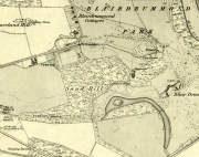
Christ's Well (as 'Fountain Head') on 1866 map

Christ’s Well (as ‘Fountain Head’) on 1866 map
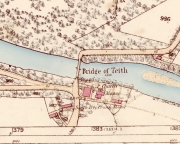
Cook & Mackay's site of Christ's Well, by the chapel

Cook & Mackay’s site of Christ’s Well, by the chapel

The site that Mr Mackay and W.B. Cook believe to be the Christ’s Well is 1.5 miles (2.43km) north of the position cited by Canmore (at NN 7221 0121).  As if to make things even more complicated, if we travel exactly 5 miles (8.05km) southeast to Cambusbarron, anothersite of the same name (later to be called the Chapel Well and associated with ancient ruins) is found!  J.S. Fleming (1898) describes it in some detail.

Carved stone dated 1690

Carved stone dated 1690

Carved stone dated 1678

Carved stone dated 1678

However, for the time being at least, if we assume that the Canmore entry is the real Christ’s Well, if you visit the place you will find an old well-house that has been built over a redirected spring of water which seems to have originally rose just a few yards to the rear of the structure.  Above the open front of the well-house—also constructed only a few hundred years ago—are placed two separate inscribed stones: one with the letters “CD ER” and the year 1690 beneath them; and above this an older stone, with the date 1678 etched on it.  These may be the dates when an earlier stone structure, whose scattered rocky edges are visible beneath the vegetation around and behind the present well-house, were demolished and then rebuilt.  But this is guesswork on my behalf!
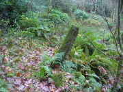
'Standing Stone' to the rear

‘Standing Stone’ to the rear

The entire structure is built inside a deep hollow which has no doubt been created and eroded into being by the spring of water itself.  On the rise at the back of this hollow is a curious standing stone which, as Penny Sinclair pointed out when we visited here a few days ago, was made out of a fossilized tree. This standing stone is only a few centuries old and either marks the original rise of the spring, or was erected at the same time of the well-house.

Less confusing were the activities performed here by local people in the 16th century—and way before that no doubt.  We have a lengthy set of accounts that describe how local people visited the Christ’s Well at the traditional dates of Beltane, Midsummer, etc, performing a variety of rites typical of those found in animistic cultures the world over. Sadly, it was the activities of the incoming christian cult that put an end to such ancient traditions by persecuting local people, as we know it has done everywhere that its virulent tendrils have infested.  Anyway, I hope that readers will forgive me citing the entire length of the accounts described by Mr Menzies (1899) about this well; but I think they give us vital insights into traditional healing practices that were just about destroyed by that corrupt institution that is the Church (for ease of reading, I’ve edited and modernized to some degree the repetitive and fragmentary language of the early written accounts):

“The brethren of the Presbytery of Stirling and various Kirk Sessions within the bounds were much exercised and troubled by frequent pilgrimages to a holy well, called Christ’s Well, situated somewhere in the neighbourhood of Ochtertyre, in the parish of Kincardine. For at least thirty years after 1581, pilgrimages were undertaken by certain people, who imagined they could obtain cures for certain diseases at this well. The wonderful thing is that tradition is dumb regarding the exact site of the holy spring.  There is a fine spring situated within the grounds of Blairdrummond, which may have been the Christ’s Well, the supposed virtue of which was, on the one hand, so consequential to the public health, and on the other, so troublesome to the Kirk.

“On 20th August, 1581, the Presbytery Record runs: ‘The brethren understands that a papist pilgrimage began of late at the Christ’s Well, and ordains every minister within their own bounds to try those persons who resort to it, and to call them before the particular Sessions that they can be convicted…’

“Two years later the evil crops up again, and on 7th May, 1583, ‘The brethren understand that a great abuse by the rascal sorts of people that pass in pilgrimage to Christ’s Well and use it for great Idolatry and superstition that are expressedly against God’s law; and because the Kings Majesty with advice of his three estates of parliament, (there shall be) certain punishments as well as corporal pains as pecuniary sums of money to be executed against such persons; and for execution of which against persons passed and to the said Well, the brethren understands my Lord of Doune Stewart of Menteith has commission given to him to that effect to see that punishment is executed in conformity with the said Act.  Therefore the brethren ordains and gives commission to Mr. Andro Zung (Minister at Dunblane), Mr. William Stirling (at Kilmadock), and Michael Lermonthe (at Kilbryde) to pass to my Lord of Doune to treat with him for execution of punishment against the persons according to the said Act and his commission.”  On 4th May, 1583, “The brethren ordains and gives commission to the brothers dwelling in Dunblane or any three of them to pass to Christ’s Well this next Saturday evening, accompanied with such persons as you may have to espy which persons comes to the said Well and report the names of such persons you can get to the brethren.’

“On 28th May, 1583, “On which day the brethren understanding that a great number of people have resorted to, and resorts in pilgrimage to Christ’s Well, using yet superstition and Idolatry expressedly against God’s law and the acts of parliament.  Therefore…the brethren ordains summons to be directed to charging of such the said persons, whose names shall be given in writing to the clerk to appear before the brethren to answer therefore, to the effect that orders may be taken with them that have been there, to the glory of God and execution of the Kings Majesty’s laws and in example of others to do the same.’

“On 4th June, 1583, “Margaret Wright in Cambus, Janet Kidstoun in Cambus, and Thomas Patersone in Black Grainge” did not appear in courtto answer “for passings in pilgrimage to Christs Well,” and were summoned the second time under pain of excommunication. On 11th June, “Janet Tailzor (spouse to Robert Cowane) in Touch, Marione Watsone in Touch, Marjorie Fargusson in Touch, Margaret Downy in Polmais,” also for the same “compeared not.” (i.e., did not appear in court, as ordered – PB)

“The depositions given in excuse referred to some disease or ailment: One, “confessed she passed there to get help for a  soreness in her side and confessed she passed about the well and prayed to Christ’s Well on Sunday and drank of the Well and washed her side with the water thereof and left behind her a  sown thread” (as offering).  Another, “passed….because she was sick in her heart and in her head and lipnit (trusted) that the Well would have helped her sicknesses…and she passed about the Well and cast the water over her shoulder and drank of it and left one piece of silver behind her.”

Ten years later several cases of pilgrimage to Christ’s Well come before the Presbytery.  22nd May, 1593, “On which day the brethren are credibly informed that Malcolme Alexander in Menstrie, James Baird at Muckart mill, and Jonet Mairschell, his spouse, passed in pilgrimage to Christ’s Well and visit superstition and Idolatry thereat. Therefore the brethren ordains them and such others who have done such like within their bounds to be summoned to answer for the same and unduly discipline them therefore under the pain of disobedience; and ordains each Minister to travel with one or two gentlemen in his parish to pass to the said Well on Saturday evening and espy what persons come there and what they do and relate the information to the minister, and see that each minister take Inquisition in his own Eldership what passes at the said Well and relate them to the presbytery.”

29th May, 1593, *On which day the summoned James Baird…to answer for passing in pilgrimage to Christ’s Well appeared in court, the said James, and confessed that through earnest persuasion of his wife (who was also moved to be there by other people), he passed with her to Christ’s Well on Saturday the 12th day of May instant, and that she two hours before the sun went down on Saturday evening drank of the said well and washed her legs and arms in it and did no fairer; he did nothing with the water, for his errand there was only with his wife who was persuaded to go there for her healing by Issobel Scotland.  He confessed that there was at the said Well this year Ewffam Wilsone in Blairhill.  Alaster Leany who was some time servant to Alexander Ezat in Culross.  He confesses that David More is he whom bears aqua-vitae and being oft times in David Fargus house in Alva, said to his wife that there was money brought to that Well…; and that Crystie cadzear in Alva confessed to him when he and his wife came home from the well, that he was three or four times at Christ’s Well and was the better, he confesses that his wife is sick and cannot come to court this day and obey the summons and therefore desires that his excuse for her may be admitted. The brethren having considered the said James Baird’s fault, ordains him to make repentance therefore in Dollar kirk as it is adjacent to him the next Sunday in secclayth (???), and that the plaintiff above written be summoned to answer for the said offence under the pain of disobedience.”

Another case falls to the ground for want of proof.  On 5th June, 1593, “One summons upon Malcolme Alschunder in Menstrie…to answer for passing to Christ’s Well and using superstition and Idolatry there at, but there is no appearance in court.  He appears on 12th June, “And denies that he passed to Christ’s Well or was bewast (to the west of – PB) Teith at any time in May, and therefore the said matter remains to be proven.” On 3rd July, “Inquisition being taken, asks if there be any witnesses that can prove Malcolme Alexander was at Christ’s Well, there is none found, and therefore it is thought good to proceed no farther against him for the said offence.”

On 14th May, 1595, James Duncansone in Fossoway, and Helen Jameson, his spouse, are charged to answer “For superstition and Idolatry in passing to Christ’s Well in pilgrimage… The said Helen confesses she passed to Christ’s Well through the year to get her bairns eye healed which was blind a month before.  She washed his eye thrice with the water thereof, and alleged that the bairn saw or he come home; and confesses that she passed there this year also to give thanks for the benefit she received the year preceding, and left a shirt of the bairns behind her, which was on the first Sunday of May…  The said James Duncansone denies that he passed to the said well with her, but only to Ochtertyre, where he was all night—well the morning that she come to him, and then they passed together to Dunblane.  The brethren finds him also culpable as his wife in her said fault, seeing he has known thereof and past with her to Ochtertyre, which is the most part of the way, where he ought and should have stopped her, and therefore they are ordained to make public repentance in linen clothes the next three sabbath days bare-footed.”

James Duncansone’s wife appears to have refused to obey the Presbytery, and on 16th July, 1595, she is summoned to appear in court, “beand chair- git as said is to heir and sie hir self decernit to be excommunicated for not completing the injunctions to her for passing in pilgrimage to Christ’s Well two different times, who being oft times called, appeared not. Therefore the brethren ordains her to be summoned de novo to the effect aforesaid with certification.”

“As no further mention is made of this woman’s case, she must ultimately have satisfied (them).  The resorting to this well comes before the Presbytery (again) on 23rd April, 1600: ‘The brethren being credibly informed of the great abuse and superstitions of visits by many people at Christs Well, namely in the night immediately preceding the Sabbaths in the month of May; for remaid thereof the brother of the Ministry within their boundaries are ordained that publicly in their kirks the next Sabbath inhibit and forbid in the name of God and his kirk that no persons shall pass to the said Well… And to the end that such abusers that go there may be stopped from their superstition.  The brethren ordains the ministers of Kilmadock and Kincardine with the special gentlemen of their flocks, to await vicissim (in return) at the said well on the night preceding the Sabbath during all the month of May; and to that effect the brethren ordains the clerk to write in the names (of visitors) to the gentlemen of the said parishes.’

“The members of Presbytery were determined to put a stop to such superstitious practices, and ere long, their efforts met with success.  In the meanwhile however, isolated cases came before them for judgment . Thus on 29th July, 1601, “Jonet Rob in Pendreich” is summoned to appear to answer “for disobedience to the elders of her parish church of Logie, conjoined with slandering the kirk by passing in pilgrimage to Christ’s Well.” She does not appear, and is summoned pro tertio, but apparently having satisfied the “eldership” of Logie, the matter is not again referred to.

“The last mention of Christ’s Well is at the meeting held on 1st July, 1607, when a batch of nine penitents from the parishes of Airth and Bothkennar, “Compare and confess they were at Christ’s Well to heal their diseases, and took some of the water and left something behind, every one of them, at the well. The brethren finds that they have committed superstition and have dedicated to Satan that thing they have left behind them (at the well), and are therefore ordained to make public repentance at the next adjacent kirks of Airth and Bothkennar.”

Menzies noted another mention of people using the waters here a few years later, telling:

“As late at June 6, 1630, the Kirk Session Records of Stirling contain an entry, where five women and two men, “confesses passing in pilgrimage to Christ’s Well in May, and therefore they are ordained to make public repentance at the next sabbath, in their own habit, under pain of disobedience.”

In these records we can clearly see that a bunch of incoming religious fanatics have arrived and set themselves up to engage with the Scottish people so as to undermine and destroy the indigenous traditions and practices prevalent at that time, by imposing laws against them which were not for the benefit of the local people.  Indeed, the laws were preposterous!  The initial description that the rituals performed by the local people were ‘papist’ in nature is, of course, a cover—as was the name, Christ’s Well—in an attempt to avert the christian cult from attacking their traditional places of healing and rites.  This failed—but at least we have the accounts describing the outlandish presbyterian impositions.

Penny sits guarding the well

Penny sits guarding the well

However, even with these accounts it is difficult to say with any certainty where the original Christ’s Well emerged.  The position Penny Sinclair and I visited, as marked on the modern OS-maps, is congruous for rites of solitude as described in the church accounts; and a distinct genius loci feels to be just beneath the surface.  However, it is difficult to see how people visiting here would have been noticed by the christian enforcers, as it is away from prying eyes.  However, if the well was at the Bridge of Teith, it would explain how so many people were “caught in the act” of performing their rites, as an old chapel was adjacent to the well.  More research is required, obviously…

In the meantime, I truly recommend visiting this place to those who enjoy the quietude of sacred sites.  Tis a fine secluded place—although it could do with a good tidying-up to free its fresh waters once again…

References:

  1. Bennett, Paul, Holy Wells and Healing Springs of Stirling and District, forthcoming
  2. Bradley, Ian, Water—A Spritual History, Bloomsbury: London 2012.
  3. Edensor, Tim, “Watery Traces and Absences: Sensations and Speculative Histories of an Ancient Well and a Carse Landscape,” in Cultural Geographies, October 2024.
  4. Eliade, Mircea, Patterns in Comparative Religion, Sheed & Ward: London 1958.
  5. Eliade, Mircea, The Sacred and the Profane, Harcourt: New York 1959.
  6. Fergusson, R. Menzies, Alexander Hume: An Early Poet-Pastor of Logie, Alexander Gardner: Paisley 1899.
  7. Fergusson, R. Menzies, Logie: A Parish History – volume 1, Alexander Gardner: Paisley 1905.
  8. Fleming, J.S., Old Nooks of Stirling, Delineated and Described, Munro & Jamieson: Stirling 1898.
  9. Grant, William (ed.), The Scottish National Dictionary – volumes 1-10, SNDA: Edinburgh 1931-1976.
  10. Mackay, Moray S., Doune – Historical Notes, Forth Naturalist: Stirling 1984.
  11. MacKinlay, James M., Folklore of Scottish Lochs and Springs, William Hodge: Glasgow 1893.
  12. Morris, Ruth & Frank, Scottish Healing Wells, Alethea: Sandy 1982.
  13. Wright, Joseph (ed.), English Dialect Dictionary – volumes 1-6, Henry Frowde: London 1898-1905.

Acknowledgements:  Huge thanks to Penny Sinclair for the venture over and help to locate this fascinating site.

© Paul BennettThe Northern Antiquarian


Abbey Craig, Stirling, Stirlingshire

Hillfort:  OS Grid Reference – NS 8094 9566

Also Known as:

  1. Canmore ID 47113
  2. Wallace Monument Fort

Getting Here

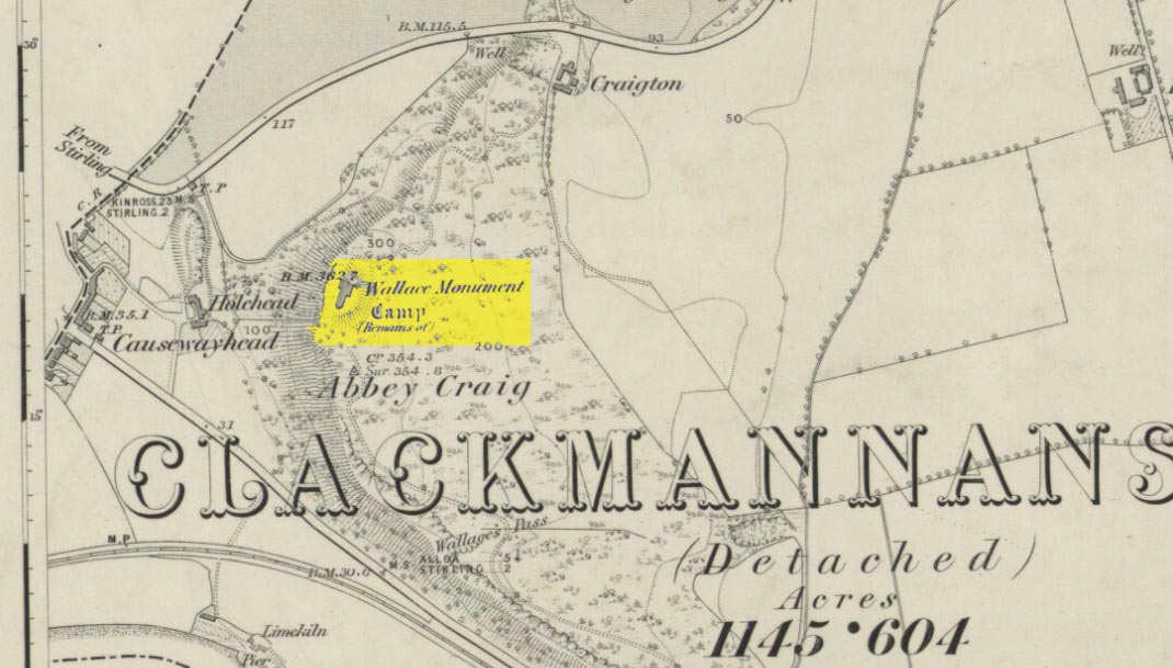
Abbey Craig on 1866 map

Most folk visiting here are coming from Stirling city.  There are various buses to get here, which head out over Stirling Bridge along Causewayhead Road (the A9) for half-a-mile where, at the roundabout and the William Wallace pub, go straight across up the minor road, zigzagging back on itself, until you reach the signs for the Wallace Monument.  Follow the well-defined footpath and, once on top of the hill, walk round the back of the mightily impressive tower.

Archaeology & History

Located right where the impressive Wallace Monument proudly stands, this prehistoric precursor to Sir William Wallace’s memory was where Scotland’s legendary hero and his men cast a clear and easy view over Bannockburn, where the halfwit english came for a fight—and deservedly lost!   The structures that used to be inside the now denuded hillfort would, no doubt, have been used by Wallace’s men; but much of those prehistoric remains have now been destroyed.  The visible remains of the fort can be seen round the back of the Wallace Monument: elongated rises of overgrown walling that run almost all the way round, getting slightly higher as you approach the more northern edges, like a semi-circular enclosure.

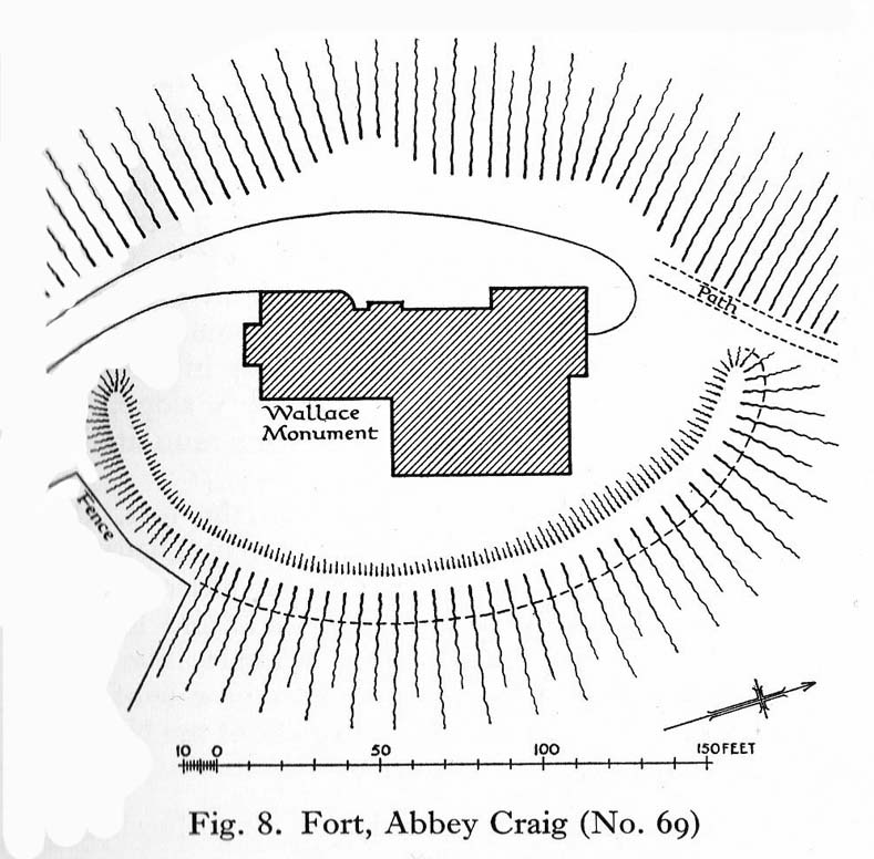
Royal Commission plan
Abbey Craig – and the great Wallace Monument

The site was described very briefly in William Nimmo’s (1880) early survey of the area, where he told that in 1784, “eleven brazen spears were found on the Abbey Craig, by a Mr Harley”, which he thought came from the time when the earlier ‘castle’ stood here.  He was probably right.  Many years later, the prehistoric remains were included in the county survey of archaeological sites by the Royal Commission lads (1963), who told that, near the north end of the summit of Abbey Craig,

“there is a fort which has been damaged by the construction within it of the Wallace Monument.  All that remains is a substantial turf-covered bank, cresentic on plan and 260ft in length, the ends of which lie close to the brink of the precipice that forms the west face of the hill.  The bank stands to a maximum height of 5ft above the level of the interior and presumably represents a ruined timber-laced wall, since numerous pieces of vitrified stone have been found on the slopes immediately below it.

The entrance to the fort presumably lay between one end of the bank and the lip of the precipice, but both the areas concerned have been disturbed by the construction of the modern approaches.  The interior of the fort measures about 175ft from north to south, by about 125ft transversely and the interior is featureless.”

The fort was probably built sometime in the early Iron Age; so the next time you visit this fine spot, check the remains out round the back of the tower—and remember that our ancestors were living up here 2500 years ago!

References:

  1. Aitchison, N.B., “Abbey Craig Rampart’, in Discovery & Excavation, Scotland, 1981.
  2. Feacham, Richard W., Guide to Prehistoric Scotland, Batsford: London 1977.
  3. Hogg, A.H.A., British Hill-Forts: An Index, BAR: Oxford 1979.
  4. Nimmo, William, The History of Stirlingshire – volume 1 (3rd edition), T.D. Morison: London 1880.
  5. Royal Commission on the Ancient & Historical Monuments Scotland, Stirling –  volume 1, HMSO: Edinburgh 1963.
  6. Royal Commission on the Ancient & Historical Monuments of Scotland, Archaeological Sites and Monuments of Stirling District, Central Region, Society of Antiquaries of Scotland 1979.

© Paul Bennett, The Northern Antiquarian


Split Stone, Bridge of Allan, Stirlingshire

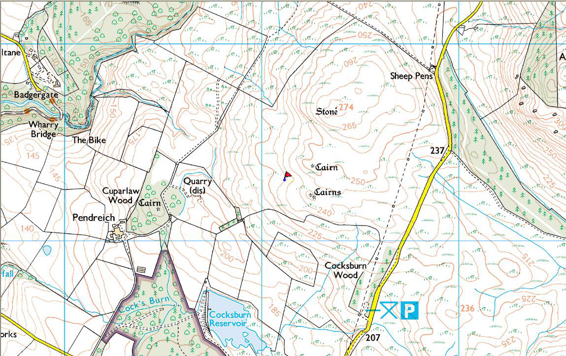
Split Stone mapStanding Stone: OS Grid Reference – NS 81116 99311

Getting Here

Take the same directions as if you’re gonna find the Pendreich Moor cairn up the hills behind and north of Stirling University (there are 2 very close to each other).  Once upon the cairned hill, walk dead straight WNW for 100 yards or so, or down the slope into the small valley, then westwards.  You’ll hit an overgrown length of very old walling.  Keep walking along here and, below it, you’ll find these stones laying down in the shallow grasses on the south-side of the all-but dried stream.  The large Cuparlaw Wood cairn is 0.4 miles west of here.

Archaeology & History

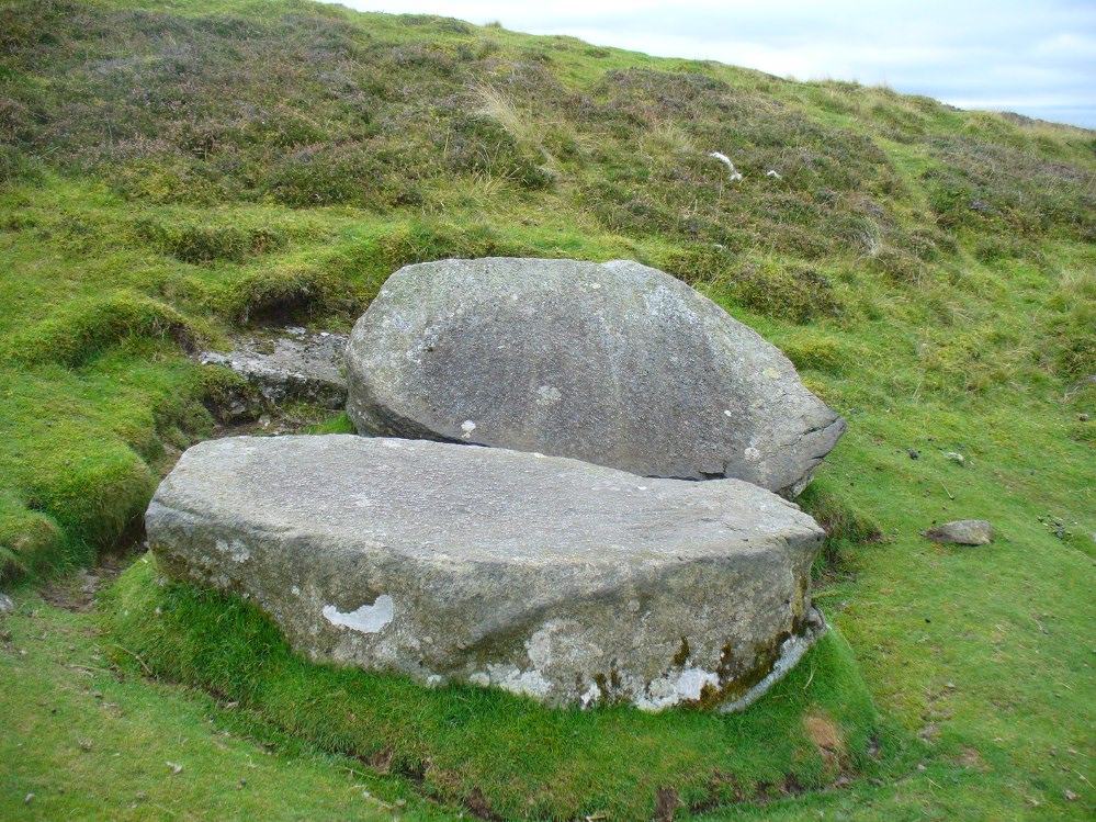
The Split Stone, Pendreich

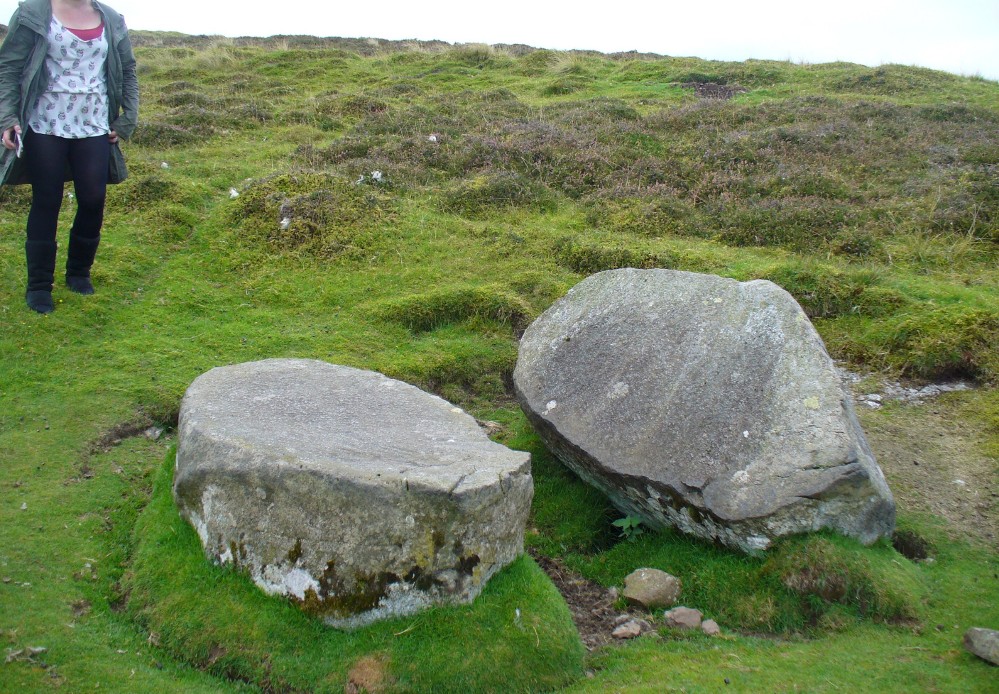
This is something of an anomaly.  There is no previous written history about the place (that I can find) and archaeologists and historians on The Prehistoric Society and CBA forums can offer no other explanation when asked: is this a standing stone that, many centuries ago, was cut and prepared to be erected, but never made it into the intended monument? (wherever that might have been)  And so, I offer it onto TNA and ask the same of any readers, geologists or archaeo’s who might have an explanation for this curious, large split piece of stone, that lays silently on the western moorland edges of the Ochils, asking the same question.

When I first came across this site I was simply perplexed as to the why’s and wherefore’s of who had cut such a large rock into approximate halves.  I must have walked around it many times, puzzling what the purpose would have been of doing such a thing, and how long ago the ‘split’ had been performed.  About a year later I ventured up again and, when leaving to head back into Stirling, found no resolution to my puzzlement.  It had me truly stumped!

It wasn’t until I visited the prehistoric Witches’ Stone about 15 miles away near Monzie Castle last year, that one of those ‘eureka!’ events occurred.  The last thing on my mind was the curious split rock above Bridge of Allan.  Fellow antiquarian Paul Hornby and I were taking photos of the Witches’ Stone, when one of us remarked how unusually flat and smooth one face of this upright standing stone was – in fact, incredibly flat and smooth – and that’s when it hit me! As I walked round and round the Witches’ Stone, the similarity between this upright example and the one laid on the ground about 15 miles away got stronger and stronger.

The Split Stone, looking east

A week or two later, archaeology student Lisa Samson and I went back to the Split Stone to have another look at it.  Without doubt, the appearance and size and type of rock were one and the same.  The only real difference between the Witches Stone and this Split Stone on the edge of Pendreich Moor, is that one stands upright and the other is laid down.

As you can see from the photos, we have a large rock, 5-6 feet long, which was, at some time many centuries ago, split almost straight down the middle, following a natural line of weakness or mineral deposit running through the stone.  In all probability this was a standing stone prepared and ready to be used in some neolithic or Bronze Age monument not too far way—but for some reason it never made the journey to its intended spot.

The age of this split rock needs assessing correctly by geologists.  Walking around the earthfast halves, it is difficult to see any recent evidence of mason marks that might help us determine when the rock was cut like this.  In looking at erosion marks on cut-and-dressed quarried stone from post-medieval periods, we find no equivalent scars on this Split Stone.  There is what may be faint evidence of some cuts into the stone at the top and side, but these are very debatable; and very probably it seems that the stone must have been cut a very long time ago, thousands of years back, in order to erode all obvious mason marks.  But it would be good to get a geologist to have a look and confirm or deny such things.

…And, as if this isn’t a mystery unto itself:  walk across the dried stream and go up the slope right in front of you immediately north.  There’s a small, almost level ridge you’ll reach after 30 yards up, before the hill then rises further.  If you notice, in the grasses and heather around you, there’s much more of the overgrown ‘walling’ here along this ridge—and some of it, with dips here and there and about three feet tall in places, is in a circle!  It’s man-made, it’s a ring of stones, you can see it on GoogleEarth pretty clearly, and it’s not in any official record books.

Watch this space!

© Paul Bennett, The Northern Antiquarian


Cuparlaw Wood, Bridge of Allan, Stirlingshire

Cairn:  OS Grid Reference – NS 8046 9916

Also Known as:

  1. Canmore ID 47128
  2. Pendreich

Getting Here

The rise of Cuparlaw cairn

From Bridge of Allan go down the main A9 road towards the University, but turn left up the Sheriffmuir road, 100 yards up turning right to keep you on track up the steep narrow dark lane, turning left at the next split in the road. Follow this for a mile or two all the way to the very end where the tell-tale signs of the unwelcoming english incomers of ‘Private’ now adorns the Pendreich farm buildings.  There’s a dirt-track veering uphill diagonally right from here. Go up here and as it bends slightly left, look into the open copse of trees to the highest point here less than 100 yards to you right. That’s it!

Archaeology & History

Lisa gives an idea of scale

The remains of this prehistoric tomb sits right on the very crown of the hill round the back of Pendreich, covered on its western edges by old gorse bushes.  Its eye speaks with the nearby sites of the Fairy Knowe to the south, the fallen standing stone of Pendreich Muir to the northeast, the associated cairns to the east, and the Pictish fortress of Dumyat behind them.  When I came up here for the first time last week with local archaeologist Lisa Samson, we found that the land upon which the cairn now lives is fertile with a variety of edible (Boletus, Amanita, etc) and sacred mushrooms (Panaeolina, Psilocybes, etc).  And, despite being told by locals and the archaeology record as a place where very little can be seen, I have to beg to differ.

Fallen stone at the cairn edge

The crowning cairn is of course much overgrown and has been dug into in earlier years, but just beneath the grassy surface you can feel and see much of the stone that constitutes this buried site.  The cairn itself rises a couple of feet beneath the grass and is clearly visible as you walk towards it.  At its edges there seems to be the fallen remains of a surrounding ring of stones.  Inside of this ring we can see and feel the overgrown rocky mass and open cists sleeping quietly, awaiting a more modern analysis to tell us of its ancient past.  When the site was visited by the Royal Commission lads in the 1960s, they went on to tell us the following about the place:

“This cairn is situated on the summit of a low knoll within a felled wood, 170 yards ENE of Pendreich farmhouse at a height of 600ft OD. It consists of a low, grass-covered mound which measures 40ft in diameter and stands to a maximum height of 1ft 6in.  The surface is disfigured by pits caused in 1926 when the cairn was opened and three cists were uncovered. Two of these contained no relics; in the third there were fragments of bones and a broken beaker, some sherds of which are preserved in the Smith Institute, Stirling.”

Although we find the scattered remains of old farm equipment lying round the edge of this tomb, it’s still a good site to visit and, I’d say, worthy of further archaeological attention.

References:

  1. Royal Commission on the Ancient & Historical Monuments Scotland, Stirling – 2 volumes, HMSO: Edinburgh 1963.
  2. Royal Commission on the Ancient & Historical Monuments of Scotland, Archaeological Sites and Monuments of Stirling District, Central Region, Society of Antiquaries of Scotland 1979.
  3. Watson, Angus, The Ochils – Placenames, History, Tradition, Perth & Kinross District Libraries 1995.

© Paul Bennett, The Northern Antiquarian


Lentran, Bridge of Allan, Stirlingshire

Cist (destroyed):  OS Grid Reference – NS 798 973

Also Known as:

  1. Annfield
  2. Canmore ID 47129

Archaeology & History

On the level ground a half-mile south of the large Fairy Knowe prehistoric tomb, Bridge of Allan had a site of its own up until being destroyed sometime in the 19th century.  Nothing much is known about the tomb – or “cist containing a skeleton”, as the Royal Commission (1963) lads called it – apart from the notes given in J.E. Alexander’s (1868) essay on the Fairy Knowe, where he told:

“It is right, however, to mention, that a few years ago, in digging the foundations of the house of Annfield, Bridge of Allan, at nine feet from the surface, there was found in the sand, and apparently undisturbed, a fine cist, containing the skeleton of a young female; and under the right arm was a small clay urn, corroborating the opinion of Professor Innes, that in many cases the so-called urn was simply a domestic jar to contain food for the deceased.”

A Mr R. Swift from Bridge of Allan told that the cist was located at the newly-named Lentran, along Kenilworth Road.  Does anyone know anything more about it?

References:

  1. Alexander, J.E., “Opening of the Fairy Knowe of Pendreich, Bridge of Allan,” in Proceedings of the Society of Antiquaries, Scotland, volume 7, 1868.
  2. Royal Commission on the Ancient & Historical Monuments Scotland, Stirlingshire: An Inventory of the Ancient Monuments – volume 1, HMSO: Edinburgh 1963.

© Paul BennettThe Northern Antiquarian


Knock Hill, Dunblane, Stirlingshire

Hillfort:  OS Grid Reference – NS 7825 9845

Also Known as:

  1. Canmore ID 45987
  2. Gallow Hill

Getting Here

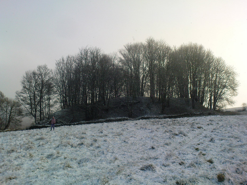
The snow-covered old fort

You can come here from either Dunblane to the north, or Bridge of Allan immediately south: either way you reach the site by going along the A9 road until you reach the Lecropt Church, a half-mile north of Bridge of Allan.  On the other side of the road is a somewhat battered wooden gate.  Go through here and up towards the tree-covered hill, following its edges to the right for a few hundred yards, until you come to another very large mound covered in trees.  That’s what you’re looking for!

Archaeology & History

Described on early OS-maps as a “Supposed Roman Camp,” this large fortified stone hillock has more recently been considered a creation of indigenous Scots.  Hemmed in and hidden on most sides, by the rises of Knock Hill to the west and Gallows Hill to the east, the only lines of visibility out of the fortress is along a northwest to southeast corridor, keeping the site quite secret to outsiders.  It would have been a fine place for a small community in ages not-so-long-ago, keeping the people hidden from the pestilent invasions of both Romans and english in bygone times.

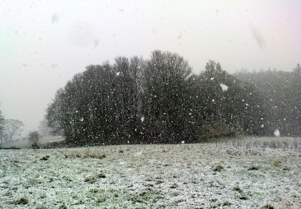
The tree-clad fort, through blizzard

The large raised oval enclosure was walled around its sloping sides and edges, with remains of a walled embankment still visible running around the top of the slopes.  What may have been traces of hut circles were on top of the hillock until recent times, but these have been much reduced by some digging near the middle of the site.  It would appear that an ‘entrance’ was once visible on the southeastern side of the fort, but when we came here the other day, a lovely blizzard covered the place in snow, so this was difficult to see.

When the Royal Commission chaps came to visit the place in 1979, they didn’t really say much about the place, merely telling of its dimensions, saying:

“This fort measures 48m by 32m within the remains of a single rampart 4.5m thick and 1m high.”

I’m sure there must be much to be said of this lovely old site by local antiquarians, but I haven’t found much as yet.  But if you’re wanting a nice quiet spot to sit for a while on the outskirts of Stirling and Dunblane, I’d heartily recommend visiting this place.  Badgers and deer also seem to like the place!

References:

  1. Royal Commission on the Ancient & Historical Monuments of Scotland, Archaeological Sites and Monuments of Stirling District, Central Region, Society of Antiquaries of Scotland 1979.

© Paul Bennett, The Northern Antiquarian 


Pendreich (2), Bridge of Allan, Stirlingshire

Cairn:  OS Grid Reference – NS 8123 9938

Also Known as:

  1. Canmore ID 47119
  2. Sheriffmuir Road 1

Getting Here

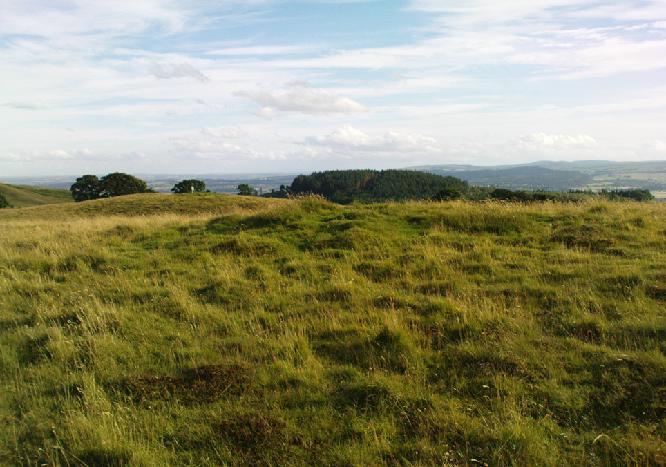
Overgrown Pendreich 2 cairn (Pendreich 1 in background)

Take the same directions to get to the Pendreich 1 cairn.  Once on the hilltop, look across the moor a short distance to the north and you can just see this overgrown site a couple of hundred yards away.  From Pendreich 1 walk down the grassy slope and then up the gentle ahead of you, till it levels out a bit, keeping your eyes peeled for the change in vegetation and colour that gives the game away!

Archaeology & History

Like its companion cairns — Pendreich 1 & 3  — little has been said of the place.  Although much overgrown and visible as a small bumpy grassy mass, with the stones beneath the surface, it’s never been excavated as far as I’m aware.  It was referred to in the Scottish Royal Commission inventory for Stirlingshire (1963), site no.4, as ‘Mound, Sheriffmuir Road 1’, in which they wrote:

“Another possible Bronze Age cairn is situated on a low ridge, 200yd N of (Pendreich 1), and at a height of a little over 800ft OD.  It is a grass-covered, stony mound which measures 20ft in diameter and stands to a height of 9in above ground level.”

References:

  1. Royal Commission on the Ancient & Historical Monuments Scotland, Stirling – volume 1, HMSO: Edinburgh 1963.

© Paul Bennett, The Northern Antiquarian