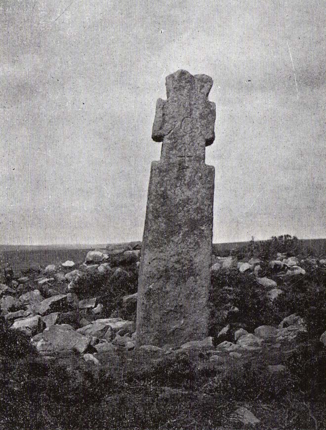
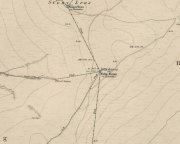
Megget Stane, Yarrow, Selkirkshire

Standing Stone:  OS Grid Reference – NT 15061 20292

Archaeology & History
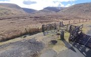
Small stone by the roadside

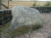
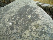
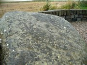
This curiously-named and barely frequented Megget Stane has seen better days.  Found in the middle of a veritable nowhere, when Duncan Fraser (1901) first wrote about it there was only a solitary pathway running between these uninhabited glens, with this old stone standing as a solitary sentinel—albeit a not very grand one!  It’s present position at the roadside was given it following a forced removal into a nearby ditch, when the old Edinburgh District Water authority who built the Talla Reservoir a couple of miles away all but destroyed it!  On one of Mr Fraser’s many visits, in August 1899, he found what he called his “old friend…lying among the heather broken into three pieces.”

“I frankly confess that this wanton act of vandalism filled me with the deepest indignation,” he wrote—and so he sought to redress the situation and find out who’d damaged the old stone.  It transpired that,

“The Edinburgh District Water Trust had a few months before this time purchased from Lord Wemyss the ground at the head of Meggat, which slopes down to Talla.  In marking off their new possession, the Trust had run a strong five-barred wire fence along the march, and as Meggatstane stood on the line, why, Meggatstane was bound to go!”

He contacted a local farmer and, between them, they protested to the water company who, eventually, fixed the pieces of the stone back together and erected it in the position that we see today, very close to its original spot.  Prior to it being damaged, Fraser told that it stood four feet tall, but when cementing it all back together again, some of its original size was lost.

Its history and legends had been forgotten even in his day and despite enquiries with other local wanderers, all that was ever told of it were variants on it standing hereby since time immemorial.  For my part, I’m somewhat sceptical about it having a prehistoric provenance, despite the Royal Commission (1957) lads suggesting a Bronze Age origin—but that’s just my own feeling on the place.  I’m more inclined to see this as an early mediaeval stone—but would love to be wrong.  It may, perhaps, even date from Viking times…..

Fraser told us an intriguing note when the stone was eventually re-assembled,

” I was interested to learn that when they dug to the bottom of the stone, they found the part underground covered with certain runic-like characters.”

These don’t appear to have been seen since.

References:

  1. Fraser, Duncan, “Meggatstane – An Incident in a Riverside Ramble,” in Border Magazine, volume 6, no.70, November 1901.
  2. Royal Commission Ancient & Historic Monuments, Scotland, An Inventory of the Ancient and Historical Monuments of Selkirkshire, HMSO: Edinburgh 1957.

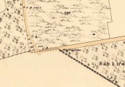
Acknowledgements:  Huge thanks for use of the Ordnance Survey map in this site profile, reproduced with the kind permission of the National Library of Scotland

© Paul BennettThe Northern Antiquarian

Girdle Stane, Dunnichen, Angus

Cup-and-Ring Stone:  OS Grid Reference – NO 52808 49737

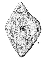
John Sheriff's 1995 drawing of Girdle Stane

John Sheriff’s 1995 drawing of Girdle Stane

Also Known as:

  1. Canmore ID 34662
  2. Dunnichen 1
  3. Girdlestane
  4. The Girdle Stane of Dunnichen
  5. Girdle Stone

Getting Here

From The Square in Letham village, go north up Auldbar Road and out of the village for 0.6 miles (1km).  Shortly before reaching the road junction at the top, on the left-side of the road is a recess with a stone and a small aging plaque telling you that you’ve reached the Girdle Stane.

Archaeology & History

The Girdle Stane

The Girdle Stane

This cup-and-ring stone is not in its original position.  Although we know from Ordnance Survey records in the 1860s that it was located about 130 yards north of here, close to the road junction, even that is unlikely to have been its original position—but we know not where that might have been!  It is an undoubted multi-period carving, with the earliest section being our typical neolithic or Bronze Age cup-and-ring near the centre of the stone, with several outlying cup-marks toying with our intellect as per usual!  The central cup-and-ring may have an incised line running down out of it, although this isn’t highlighted on John Sheriff’s (1995) drawing of the stone.

Girdle Stane on 1865 map

Girdle Stane on 1865 map

Surrounding the central archetype, by some distance, is a much wider carved ring that almost reaches to defines the edges of the stone itself.  This large encircling motif and other features of the petroglyph—including a large elongated “S” and marks that were probably executed by the Ordnance Survey lads at the bottom corner—were ingredients which prompted Sir James Simpson (1867) to question the veracity of the Girdle Stane’s antiquity.  He wrote:

“The so-called ‘Girdle-stone’ in the…parish of Rescobie, about four feet long and three broad, is cut on its surface with two circles, the largest of which is above two feet and a half broad, and hence does not, I believe, belong to the class which we are considering in this essay”—

More recent "S"-shaped motif

More recent “S”-shaped motif

Close-up of cups, ring and lines

Close-up of cups, ring and lines

i.e., neolithic or Bronze Age petroglyphs.  And you can see his point!  My first impression when Prof Paul Hornby and I visited the site a few days ago, after the initial “that’s a cup-and-ring in the middle”, was to proclaim: “that bit’s much more recent, maybe Pictish?”  But it probably isn’t even Pictish.  This “more recent” carved element is a distinct large elongated “S”, which may have been marked onto it when the stone was used as a township boundary marker between the local parishes.  The grand historical writer Alex Warden (1882) talks about this in his magnum opus, saying:

“At the junction of two roads, a little to the northeastward of Letham, there is a rough boulder, about five feet long by three in breadth, having on its face a circle of about thirty inches in diameter, and another smaller circle about six inches across.  It is called the Girdle Stane of Dunnichen, from the larger circle resembling the utensil called the girdle, s.c. This stone marks the boundaries between the parishes of Dunnichen and Rescobie, also between the lands of Dunnichen and Ochterlony (Balmadies).  It is probably the Grey Stone referred to in a note on the marches of Dunnichen, about 1280.”

Folklore

The folklore of the stone indicates how its origins are rooted in prehistory, despite the later additional symbols.  Alex Warden (1882) tells the all-too-familiar creation myth, usually symptomatic of giant prehistoric cairns:

“Tradition says a witch was carrying this boulder from ‘the Crafts’ of Carmylie in her apron, when the strings broke, and the stone fell where it now lies.”

Carmyllie Hill is 5 miles (8km) to the south and is a place rich in fairy-lore and vandalized prehistoric sites.

References:

  1. Coutts, Herbert, Ancient Monuments of Tayside, Dundee Museum 1970.
  2. Kidd, Scott, The Churches of the Parish of Dunnichen, David Winter: Dundee 1995.
  3. Sherriff, John, “Prehistoric rock-carving in Angus,” in Tayside & Fife Archaeological Journal, volume 1, 1995.
  4. Simpson, James, Archaic Sculpturings of Cups, Circles, etc., Upon Stones and Rocks in Scotland, England and other Countries, Edmonston & Douglas: Edinburgh 1867.
  5. Warden, Alex J., Angus or Forfarshire – volume 3, Charles Alexander: Dundee 1882.

© Paul Bennett, The Northern Antiquarian

Gray Stone, Burley, Leeds, West Yorkshire

Legendary Rock:  OS Grid Reference – SE 28659 34229

Also Known as:

  1. Giant’s Stone

Getting Here

Originally located at SE 28449 34364, the site is now to be found halfway along Westfield Road, where it meets up with Hollis Place, along the footpath at the back of the school, set back against the walling.  A plaque by the rock kinda gives the game away!

Archaeology & History

Gray Stone on 1852 map

Gray Stone on 1852 map

The large vandalised stone you see here—sprayed-painted quite eloquently it has to be said!—is apparently a replica of the old stone which could once be found about 300 yards northwest of here.  Typifying stones of this name—graygrey and variants thereof—the original Gray Stone was an old boundary marker (Smith 1956), and the last reference to it as an archaeological site was by James Wardell (1853), who even in his day said that it was “almost buried in the ground, on the Burley Road.” It is shown on the first OS-map by the roadside, close to the junction of Woodside View and Burley Road, but was said to have been removed at the beginning of the 20th century and moved to its new and present position.  However, somewhere along the line, the original stone has been destroyed and the thing that we see today has taken its place.

The original Gray Stone may have been a standing stone, but we cannot be certain about this.  The present boulder stands about four feet tall and is a rather fat-looking standing stone. You can just about squeeze round the back of it, around which is an incised line which cuts around the stone – but this obviously quite modern. A plaque stands in front of the stone, telling its brief history.  (if anyone can send us some photos of the site that would be great – I’ve gone and lost mine, somehow!)

Folklore

A creation myth of this site tells it to have been made by a giant, who threw the Gray Stone from the appropriately named Giant’s Hill (a supposed old camp, now destroyed), less than a mile southeast of here: an alignment which corresponds closely to the midsummer sunrise. In throwing it, he was said to have left the indentations of his finger-marks in the rock – thought to have been cup-markings.  Examples of other cup-and-ring stones occur a short distance west, at Kirkstall.

References:

  1. Bennett, Paul, The Old Stones of Elmet, Capall Bann: Milverton 2001.
  2. Smith, A.H., English Place-Name Elements – 2 volumes, Cambridge University Press 1956.
  3. Wardell, James, The Antiquities of the Borough of Leeds, John Russell Smith: London 1853.

© Paul BennettThe Northern Antiquarian


James Stone, Blubberhouses Moor, North Yorkshire

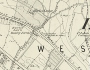
Standing Stone: OS Grid reference – SE 15196 54722

Getting Here

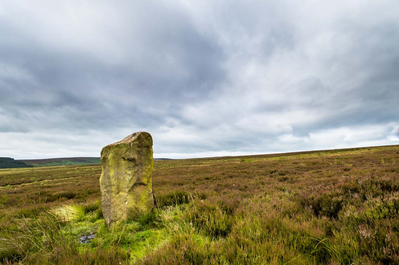
James Stone, looking SW

From Blubberhouses church by the crossroads, walk up the slope (south) as if you’re going to Askwith, for 100 yards or so, taking the track and footpath past the Manor House and onto the moor.  Once you hit the moorland proper, take the footpath that bears left going down into heather and keep going till you hit the dead straight Roman Road path running west onto Blubberhouses Moor. Carry along the Roman Road for about 200 yards as though you are going towards the Eagle Stone, and looking right (if you squint) you can just make out a small pimple on the top of the moors about a quarter of a mile away. That is where you are heading (be warned – it is boggy getting there).

Archaeology and History

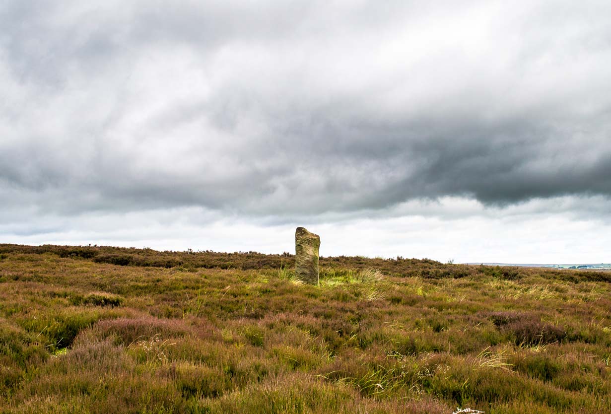
James Stone, looking NE

Discovered (or rather ‘noticed’) by James Turner and James Elkington in July 2016 (hence the name James Stone), this standing stone is of an indeterminable age – although it does look ancient.  Standing more than 5 feet tall, and in the middle of nowhere, it is fairly difficult to get to unless you want to get wet feet.  It is situated very close to a small and unexcavated prehistoric settlement and we could find no physical evidence of any tracks nearby (although Google Earth does show what looks like one or two very short, faint tracks near the stone, which is the old ‘Benty Gate’ track).

It could be a boundary stone, although doubtful – it has a feel to it that says it is prehistoric, although this is just guesswork on our part.  I can find no reference to it in Cowlings Rombalds Way (1946) and there seems nothing about it in either of William Grainge’s (1871; 1895) detailed history works of the region.

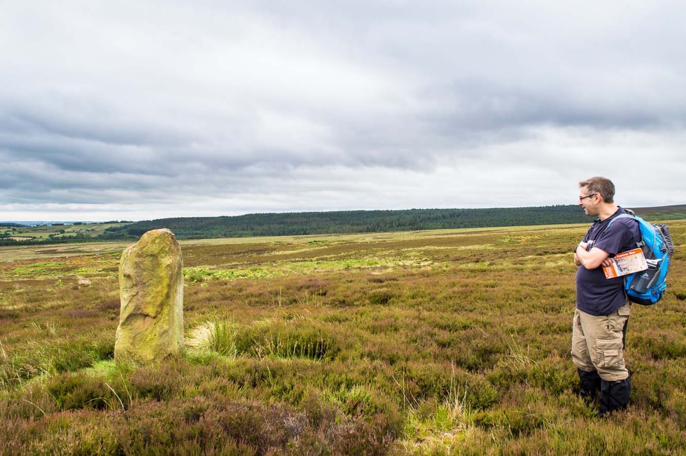
Mr Turner gazing at the stone

At first we thought it unlikely to be a new find, however the stone is difficult to see from the Roman Road (I had been up here dozens of times before I noticed it) and seeing that people rarely go up here anyway, and it is relatively difficult terrain getting to it, it is not surprising that no one has bothered visiting it. It would take someone who is quite keen on megaliths to want to examine it and it is well off any tracks.

Having said that, it is a nice find and it could be linked in some way with the small unexcavated settlement nearby, or possibly the large Green Plain settlement nearly a mile away.  Well worth a visit…bring your wellies!

References:

  1. Cowling, Eric T., Rombald’s Way, William Walker: Otley 1946.
  2. Grainge, William, The History and Topography of Harrogate and the Forest of Knaresborough, John Russell Smith: London 1871.
  3. Grainge, William, The History and Topography of the Townships of Little Timble, Great Timble and the Hamlet of Snowden, William Walker: Otley 1895.

© James Elkington, The Northern Antiquarian


Fairy Stone, Fourstones, Northumberland

Legendary Stone:  OS Grid Reference – NY 893 680

Archaeology & History

Thought to have been destroyed in the 19th century, folklorists and historians alike didn’t seem to be able to locate this little-known folklore relic, which is still alive and well in one of the fields by the village.  The exact nature of the stone isn’t known for certain.  Legend reputes it to have been one of the four boundary stones which gave the village its name; it was also said that they were Roman altars and the Fairy Stone was one of them, which was moved from the village boundary during the Rebellion of 1715 and placed nearer the centre.

Folklorist M.C. Balfour (1904) seemed to think that stone had gone when he wrote about it.  Writing about it in the past tense, he told,

“The Fairy Stone however, certainly had an existence, for a person, 80 years of age, remembered its situation to the south of the village, near the old road, and that it was squared, and had a square “cistern hewn out of its top,” which was called the Fairy Trough, and traditionally said to have had a pillar fixed in it.”

But when former Ley Hunter editor Paul Screeton (1982) came looking for the stone in the late 1970s, he was fortunate in coming across an old local:

“Some time ago while looking for the Fairy Stone at Fourstones…I came across a farmer who pointed it out and remarked that a few years previously when the road was widened the local lengthsman made sure it was not destroyed, though it had to be moved a short distance.”

Folklore

Of the four boundary stones surrounding the village, they were “supposed to have been formed to hold holy water,” said Balfour (1904).  But the title Fairy Stone given to one of them had this tale to account for it:

“A couple of miles or more down the South Tyne is Fourstones, so called because of four stones, said to have been Roman altars, having been used to mark its boundaries. A romantic use was made of one of these stones in the early days of “The Fifteen.” Every evening, as dusk fell, a little figure, clad in green, stole up to the ancient altar, which had been slightly hollowed out, and, taking out a packet, laid another in its place. The mysterious packets, placed there so secretly, were letters from the Jacobites of the neighbourhood to each other; and the little figure in green was a boy who acted as messenger for them. No wonder that the people of the district gave this altar the name of the ‘Fairy Stone’.”

References:

  1. Balfour, M.C., Country Folk-lore volume 4: Examples of Printed Folk-lore Concerning Northumberland, David Nutt: London 1904.
  2. Screeton, Paul, “The Long Man of Wilmington,” in The Ley Hunter, no.92, 1982.
  3. Terry, Jean F., Northumberland Yesterday and Today, Andrew Reid: Newcastle 1913.
  4. Watson, Godfrey, Northumberland Place Names, Sandhill: Morpeth 1995.

Acknowledgements:  Big thanks to Paul Screeton for the grid-reference!

© Paul BennettThe Northern Antiquarian


Ashlar Chair, Burley Moor, West Yorkshire

Legendary Rock:  OS Grid Reference – SE 12075 44833

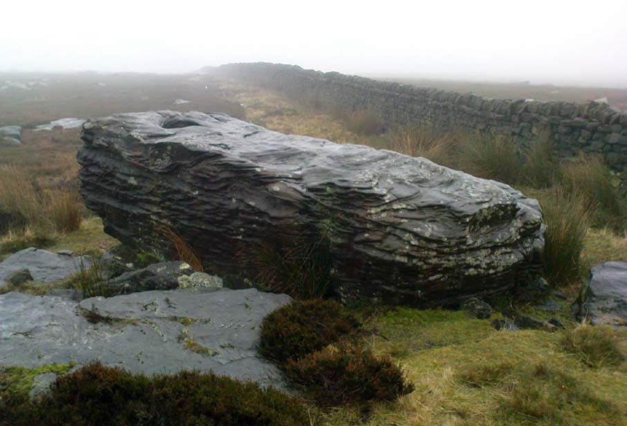
Ashlar Chair, looking southeast

Also Known as:

  1. Carving no.111 (Hedges)
  2. Carving no.115 (Boughey & Vickerman)
  3. Druid’s Chair
  4. Etching Stone

Getting Here

There are two large boulders here, one of which was deemed the Ashlar many moons back. You can approach it from the lazy way: park y’ car at the top of the road by the Whetstone Gate TV masts and walk east right along the boundary path till you get here. The better way is from Twelve Apostles: from there walk a coupla hundred yards north to the Lanshaw Lad boundary stone, where a small path heads west. Along here for another coupla hundred yards, then hit the footpath south for the roughly the same distance again. You’ve arrived!

Archaeology & History

The Ashlar Chair is ascribed in folklore, said Harry Speight (1892), “to be a relic of druidism,” as one of its titles in ages past was the Druid’s Chair.  In the nineteenth century it also became known as the Etching Stone, (Smith 1961-63) but it has retained its present title for more than two hundred years.  Shaped more like a couch than a chair, its present title—the Ashlar—is important in ritual Freemasonry, which has two aspects to it: the ‘rough’ and the ‘perfect’.  The first represents the neophyte; the latter, the illumined one.  Oaths are sworn on the ashlar, and laws are spoken from it.  In its higher aspect it is representative of the spiritual maturity  of evolved man.

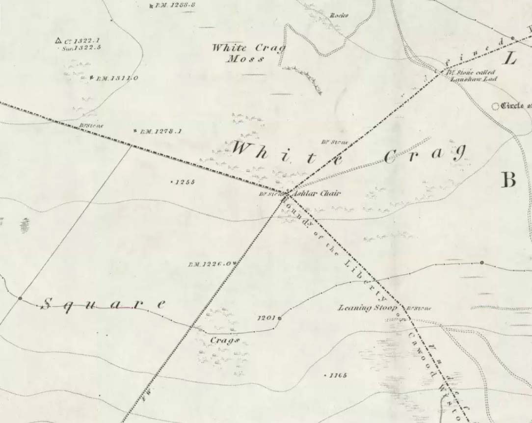
Ashlar Chair on 1851 map

Although there are no public records as to who gave the site its present name, the land which lays before it, The Square, is an even greater indicator that this rock was was considerably more than just a curious place-name, for the open moorland that is overseen from Ashlar Chair—The Square — is 396,000 square yards of flat open heathlands that have never been archaeologically explored.  The Square is also one of the most important elements of Freemasonry: representing the manifest universe, its laws are spoken from the Ashlar. (Jones 1950)

Between the two of them, represented here in the landscape near the very tops of these moors, we have a form of late geomancy, although the names of our geomancers are nowhere to be found.  It is obvious though, simply from the name of the land, that dramatic ritual of some form was enacted here.  In recent times, ritual magickians from differing Orders have found the place most effective, as have wiccan folk and other pagans who have frequented it at the summer solstice.  The possibility that some members of the Grand Lodge of ALL England (a legendary Masonic Order, said by the modern London masons not to have existed until the eighteenth century) gave this place its name is not unreasonable.  Records show that in the fourteenth century at least one member of the Order, Sir Walter Hawksworth, frequented ritual circles on these moors; and another member of the same Lodge from the nearby Washburn valley was an ally to the Pendle and Washburn witches who, we know, met on these moors at Twelve Apostles stone circle and probably the Ashlar.  But it proves nothing I suppose. (I tend to believe (not a necessarily healthy viewpoint) that the Grand Lodge did use the Ashlar as one of their moot points, along with the Pendle and Washburn witches.)

Its primary geomantic attribute is as an omphalos.  Geographically the Ashlar Chair is the meeting-point of Bingley, Burley, Morton and Ilkley moors and, metaphorically speaking, when you stand here you are outside the confines of the four worlds yet still a purveyor of them.

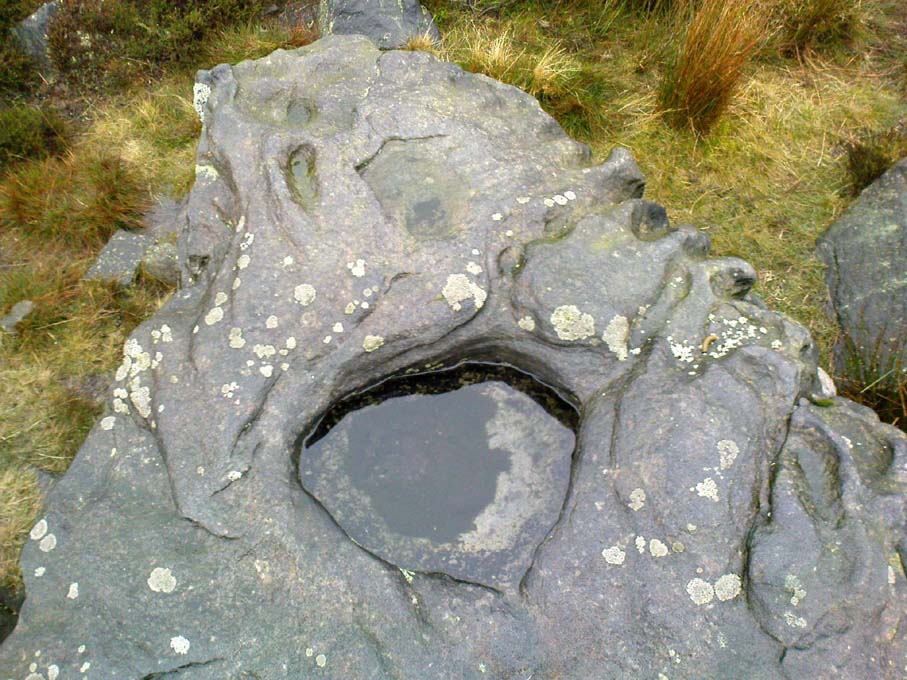
Nature’s cups-and-grooves on the Ashlar

Upon the large rock itself it are carved the faint initials, “MM, BTP, ISP and IG, 1826.”  Several early records described cup-and-ring designs on the Ashlar: firstly in Forrest & Grainge’s (1868) archaeological tour; then in Collyer & Turner’s Ilkley (1885); and lastly by the great Yorkshire historian and topographer Harry Speight (1892, 1900), who said “it bears numerous cups and channels.”  Although we can see some of these on top of the Ashlar, they are mainly Nature’s handiwork.  It is possible that some man-made cup-and-rings once existed on the rock, but if so they have eroded over time.

References:

  1. Bennett, Paul, The Old Stones of Elmet, Capall Bann: Milverton 2001.
  2. Collyer, Robert & Turner, J.H., Ilkley Ancient & Modern, William Walker: Leeds 1885.
  3. Forrest, C. & Grainge, William, A Ramble on Rumbald’s Moor, among the Dwellings, Cairns and Circles of the Ancient Britons in the Summer of 1867 – Part 1, W.T. Lamb: Wakefield 1868.
  4. Jones, Bernard E., Freemason’s Guide and Compendium, Harrap: London 1950.
  5. Speight, Harry, Chronicles & Stories of Old Bingley and District, Elliott Stock: London 1892.
  6. Speight, Harry, Upper Wharfedale, Elliott Stock: London 1900.

© Paul Bennett, The Northern Antiquarian

Tarry Stone, Cookham, Berkshire

Legendary Stone:  OS Grid Reference – SU 89745 85392

Also Known as:

  1. Cookham Stone
  2. Tarrystone

Getting Here

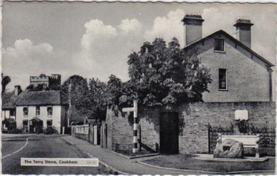
Old postcard of the Tarry Stone

Dead easy!  Just about in the middle of the village, by the side of the road where a seat allows the weary walker a chance to sit and rest, the Tarry Stone stands before it, with a plaque on the wall above the seat.  The old postcard here shows its situation clear enough!

Archaeology & History

The history of this large rock near the middle of Cookham village is important in the history of the old village, though there is no direct evidence to give it a prehistoric pedigree.  It was known to be an ancient boundary stone and is included in perambulation records of the area, where local people would annually walk and redefine the landscape of Cookham: a pastime known across the land, but which fell into disuse in Victorian times.  Such perambulations are thought to trace way back into the mythic lands of prehistory — so the Tarry Stone here may well have an archaic provenance.

The known history of the stone was gathered and described in Stephen Darby’s (1899) rare work on the place-name history of Cookham.  He wrote:

“A stone 3½ ft high, by 4 ft long, and 2½ ft thick. This formerly stood in Cookham village, about two feet from Dodson’s fence, where the roads parted to the church and the ferry. It is now in the Mill Garden at Cookham, where it was removed by the late George Venables when he was church-warden. This stone was formerly known as Cookham Stone.

“A.D. 1506: The tithing man presents that the Warrener ought to hold sports at Cookham Stone on the day of Assumption; and he has not done so (Cookham Manor Court Rolls).

“The stone was originally a boundary stone to the property of the Abbot of Cirencester, whose house was close by, as is shown in the will of John Luffenham, A.D. 1423.”

An old plaque that was once attached to the rock told, “The Tarry Stone at which sports were held before 1507 AD, stood formerly 50 yards NNE and was replaced here AD 1909 by order of the parish council.”  The position described “50 yards away” was next to an old pub with the fascinating legendary name of ‘Bel and the Old Dragon’!

Folklore

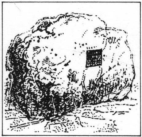
Dennis Curran’s 1976 drawing

One of the main reasons this site has been included here is the legendary attachments.  When the stone was moved from its original position in 1839 by a certain George Venables, to nearby Mill House Gardens, local people told how the Venable family thereafter were cursed.  It was thereafter moved back to its earlier site!

The stone has been suggested as a meteorite — a theme that was echoed in Peter Ackroyd’s Thames (2007), but the Tarry Stone is a regional sarsen rock, albeit peppered with erosion holes, giving a more ‘foreign’ look to it!

Cookham was also the village where the spirit of the god Herne “winds his horn and the music of his hounds can be heard from across the common.”  (Yarrow 1974)  The stone was also the focal point of village games in earlier centuries.

References:

  1. Ackroyd, Peter, The Thames: Sacred River, Chatto & Windus: London 2007.
  2. Darby, Stephen, Place and Field-Names of Cookham, Berkshire, privately printed: London 1899.
  3. Hallam, Elizabeth, Domesday Heritage, Arrow: London 1986.
  4. Yarrow, Ian, Berkshire, Hale: London 1974.

© Paul Bennett, The Northern Antiquarian

Greenwood Stone, Midgley Moor, West Yorkshire

Boundary Stone:  OS Grid Reference – SE 01652 28514

Getting Here

Greenwood Stone, Midgley Moor

Follow the directions to reach Churn Milk Joan, the head 100 yards east till reaching the crossing of footpaths, beneath Crow Hill.  Take the northern (left) route and keep walking.  Half a mile along you’ll see the tall upright stone to your left.  You can’t really miss it!

Archaeology & History

The Greenwood Stone is an old boundary stone and is not prehistoric.  It stands more than four feet tall.  I first visited the site in 1988 in the company of several folklore and antiquarian writers, including Andy Roberts, Edna Whelan and Graeme Chappell.  Twas a good day and coincided with a small collection of Psilocybes being gathered!

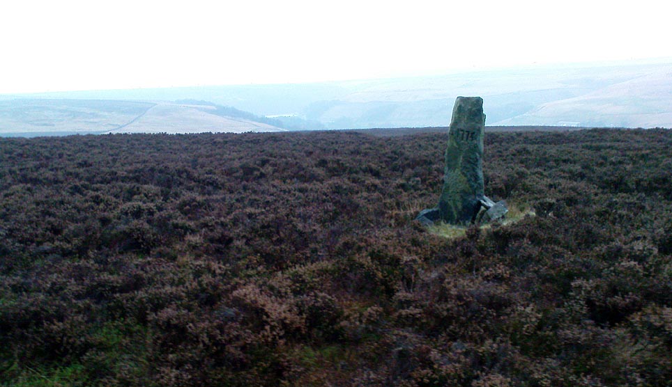
The tall upright is a boundary stone that was erected in 1775, as evidenced by the date carved on its southern face.  I must emphasize however that this was not when the stone came to acquire its name: this was defined in 1594 as evidenced by a boundary perambulation written that year where it is described as being recumbent: “thence to one lying stone, newly named Greenwood Stone.”  About 10-15 yards away is what may have been that very “lying stone,” the original Greenwood Stone, half-buried in the heather some six or seven feet long.   It is possible this may have stood upright in the distant past.

Greenwood Stone, looking south

Moving about 75 yards south we come across another small standing stone at 1360 feet (412m) above sea level. This I’ve called the ‘Greenwood B stone’.  It was marked on an old map as a boundary stone and is distinctly shaped to stand upright, marking a point separating the moors of Midgley and Wadsworth.  When stood upright it is just visible on the horizon when looking from the Miller’s Grave prehistoric tomb several hundred yards east of here and is close to being an equinox indicator.

References:

  1. Bennett, Paul, The Old Stones of Elmet, Capall Bann: Milverton 2001.

© Paul Bennett, The Northern Antiquarian 

Foulscales Stone, Newton, Lancashire

Carved Stone:  OS Grid Reference – SD 692 492

Also Known as:

  1. Bonstone
  2. Yolstone

Archaeology & History

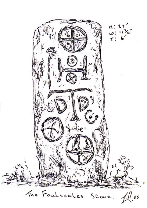
An intriguing and little-known carved stone whose existence has been brought to our attention by historian and author John Dixon.  Its precise history and nature seems unknown; but aspects of the carving possess symbols that are found on early christian remains, as well as some cup-and-ring designs.  John wrote:

Artist’s impression
Foulscales Stone

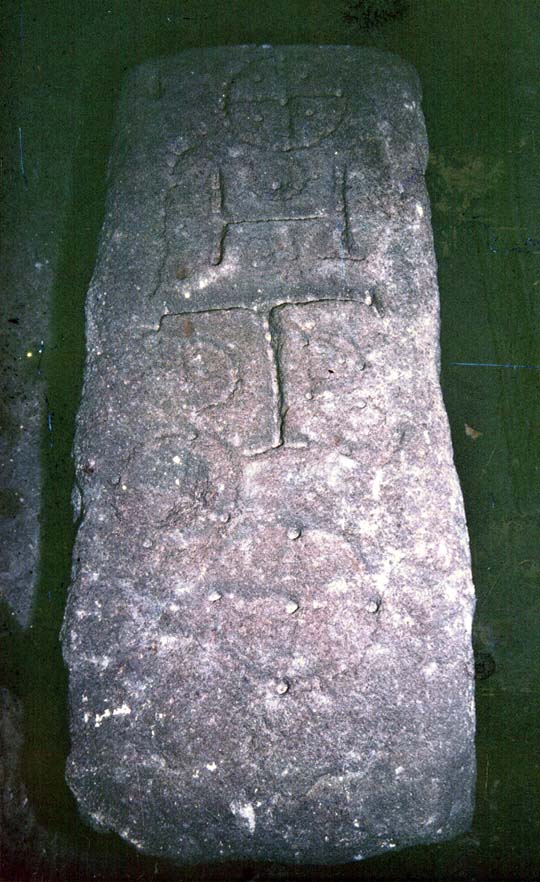
“This enigmatic stone (27 inches height, 12 inches wide, 6 inch thickness), anciently known as the Yolstone and later as the Bonstone, once stood behind Foulscales Farm, near Gibbs.  For some reason the stone was removed from this site and taken into the cellars of Knowlmere Manor under the authority of the Peel Estate.

The stone displays possible early native chi-rho symbols that may have a 6/7th century provenance. The lettering ‘HT’ look to be of 16/17th century origin and may refer to the Towneley family who held lands in Bowland.”

Was it a boundary stone?  A gravestone?  Was it an early christian stone?  A Romano-British stone?  The carved circles with ‘crosses’ inside them are typical Romano-British period designs, covered extensively in the early works of J. Romilly Allen and found to be widespread across Britain.  Any further information on this stone would be greatly appreciated.

References:

  1. Dixon, John, Slaidburn and Newton, Bowland Forest, Aussteiger Publications: Clitheroe 2003.

© John Dixon & Paul Bennett, The Northern Antiquarian

Lilla Cross, Fylingdales Moor, North Yorkshire

Cross:  OS Grid Reference – SE 88923 98686

Also Known as:

  1. Lilla’s Cross

Getting Here

Lilla Cross is situated on Fylingdales Moor, north Yorkshire, between Pickering and Whitby at the junction of two major moorland footpaths. It is located close to the Fylingdales Ballistic Missile Early Warning Station – which resemble giant golf balls on the horizon.

Archaeology & History

Woodwark’s 1930s photo of Lilla Cross

The ancient cross is 10 foot high and free-standing but it sits upon what is probably a ruined Bronze-Age bowl barrow called Lilla Howe; the recumbent stones that lie around the base of the cross may form part of that. It is a sturdy, stocky cross that has some letters carved onto it, one in particular being a large letter “C” possibly meaning Christos (Christ) and with that a small thin cross; there are a few other faint letters but these are difficult to decipher now. A plaque on a nearby stone gives information about the cross. I think Lilla Cross was used as a sort of Medieval milestone or way-marker – hence the lettering on the cross.

In 1952 the cross was moved to Sil Howe near Goathland but 10 years later in 1962 it was returned to its original site on top of Lilla Howe. In the 1920s excavations on the barrow revealed some artefacts of jewellery, but no remains of Edwin’s trusty chief minister were found; the jewellery was, in fact, said to date from the mid 9th century. Lilla Cross has been referred to by historians as the oldest christian cross on the north York Moors.

Folklore

Lilla Cross on 1854 Map

According to the legend, in AD 625 or 626 King Edwin of Northumbria was travelling with his entourage across the moors, but an assassin had been dispatched by the king of the west Saxons to kill Edwin. The assassin lunged forward with his poison tipped sword, but Lilla his chief minister at the king’s court, leapt in between his sovereign and the swordsman. Poor Lilla took the full thrust of the sword and died on the spot thus saving the king from being murdered. King Edwin, who was greatly impressed by this selfless act of devotion, ordered that Lilla being a newly converted christian be buried here in a christian way though he asked that a number of articles be placed with the body including gold and silver. The king then had a cross erected in memory at the spot where Lilla died. But it seems likely that the cross dates from the 10th century, though there may have been an earlier Saxon cross here.

References:

  1. Ogilvie, Elizabeth & Sleightholme, Audrey, An Illustrated Guide to the Crosses on the North Yorkshire Moors, Village Green Press: Thorganby 1994.
  2. White, Stanhope, Standing Stones and Earthworks on the North Yorkshire Moors, Fretwell & Cox: Keighley 1987.
  3. Woodwark, T.H., The Crosses on the North York Moors, Whitby Literary & Philosophical Society 1934.

© Ray Spencer, 2011