Holy Well, Holwell, Hertfordshire

Holy Well (lost):  OS Grid Reference – TL 16 33

Archaeology & History

The exact location of this site seems to have been lost.  One possible candidate is on the south-side of the village where remains of a large moat exists, meaning that there was a good water supply here to maintain its existence.  But this is pure guesswork on my part.  The well was mentioned briefly in R.C. Hope’s (1893) classic book where he told us:

“There was a holy well or spring in the village of Holwell, on the borders of Bedford and Hertfordshire; unfortunately both history and site have been forgotten by the villagers at Holywell.”

The site was mentioned as far back as 1086 CE in the Domesday Book as ‘Holewelle’.  The place-name authorities Gover, Mawer & Stenton (1938) tell us this derives from a “spring in the hollow” and not a holy well as subsequent writers profess.  The only thing that could perhaps fortify the ‘holy’ element is that in some instances early citations of holy wells are written as holi- wells, which this may have been.  As all historians know, early spellings of sites are far from accurate.

References:

  1. Gover, J.E.B., Mawer, Allen & Stenton, F.M., The Place-Names of Hertfordshire, Cambridge University Press 1938.
  2. Hope, Robert Charles, Legendary Lore of the Holy Wells of England, Elliott Stock: London 1893.
  3. Smith, A.H., English Place-Name Elements – volume 1, Cambridge University Press 1956.

© Paul BennettThe Northern Antiquarian


Manor Farm, Bolnhurst, Bedfordshire

Hillfort:  OS Grid Reference – TL 0849 5985

Also Known as:

  1. The Camp

Archaeology & History

Wadmore's 1920 groundplan

Wadmore’s 1920 groundplan

This much disturbed Iron Age ‘hillfort’ is effectively a large enclosure of Iron Age origin, much ruined by farming and subsequent landscape alterations through the centuries, with much of it re-fashioned as a medieval moat more than a thousand years after first being built.  Even when the site was visited and described in Mr Wadmore’s (1920) fascinating work he told of the variants in its apparent construction phases:

“This large earthwork is situated on flat level ground, a few yards off the Bedford-Kimbolton Road, at the VIIth milestone out of Bedford.  In shape it is very irregular and presents little to aid one in arriving at an estimate of its original form, except the construction of its defensive lines, which are of two totally different characters and suggest that a comparatively modern manor has been added to an older work.

“The portion which I take to be the older, lies to the south, and is contained on this and the western side, as far as and including the great sweep bending east, by a strong vallum with a parapet and external fosse.

“The modern portion appears to me to commence between the east and west faces where the lines run north, and are purely the remains of a fosse without any indication of a parapet.  The extension of these lines, so far as can be traced, would tend to prove that the work occupied both sides of the road; but such a fact should not prejudice one’s view concerning the work as a whole….”

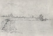
Section of the earthworks drawn by Wadmore

Section of the earthworks drawn by Wadmore

Adding with a good sense of humility that, “I am quite willing to admit that I may be mistaken, as the matter is entirely speculative.”  But modern archaeological analysis tends to prove that much of Wadmore’s words were correct and the remaining northern section of these earthworks is where the medieval moated section was built.  Roman remains and other period artifacts have also been unearthed in and around the site.

A few hundred yards southwest of the hillfort we find a place called Greenbury Farm.  This place was known in the 14th century as ‘Grymesbury’, which has been taken by some students as relating to the Norse deity, Grim.  However, Mawer & Stenton (1926) point out that in this instance,

“The Grym family had a holding in Bolnhurst in 1302 and bury is here used in the manorial sense. Hence ‘Grym’s Manor.’”

References:

  1. Mawer, A. & Stenton, F.M., The Place-Names of Bedfordshire and Huntingdonshire, Cambridge University Press 1926.
  2. Wadmore, Beauchamp, The Earthworks of Bedfordshire, Bedfordshire Standard: Bedford 1920.

© Paul BennettThe Northern Antiquarian 2016


Galley Hill, Streatley, Bedfordshire

Long Barrow (destroyed):  OS Grid Reference – TL 086 268

Archaeology & History

Aligned east-west, a large neolithic long barrow could once be seen to the west of Galley Hill, on where now we find a golf course.  It was sadly destroyed sometime around 1900 AD and its demolition was witnessed by a Mr A. Cumberland of the Dartford Antiquarian Society, who reported there being no archaeological finds of note in the tomb.  Curious…

Equally curious was the view of archaeologist James Dyer (1964) in his assessment of the site, who wrote how

“Air photographs suggest that the barrow was 300 ft long, but this is much larger than normal in the Chilterns, and 150 ft is more reasonable.”

The neolithic and Bronze Age burial specialist Paul Ashbee (1984) maintained the “300 feet” measurement.

Other tumuli can still be seen on the slopes either side of Galley Hill a few hundred yards to the east; and a henge monument has also be found in the area.

References:

  1. Ashbee, Paul, The Earthen Long Barrow in Britain, Geo: Norwich 1984.
  2. Dyer, J.F., “A Secondary Neolithic Camp at Waulud’s Bank, Leagrave,” in Bedfordshire Archaeological Journal 2, 1964.

© Paul BennettThe Northern Antiquarian 2016