St. Stephen’s Well, Banbury, Oxfordshire

Holy Well (destroyed):  OS Grid Reference – SP 4506 4055

Archaeology & History
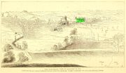
Well highlighted, in 1730

The holy well of Banbury seems to have been destroyed sometime in the second-half of the 19th century, when the industrialists built over the area.  When the historian Alfred Beesley (1841) wrote about it, the waters were still running.  He told it to be, “a chalybeate spring, well-known and still often visited, situated on the west side of the town, a little north of the footway leading to North Newington.”

The footpath is obviously long gone—as is the well.  It’s iron-bearing (chalybeate) properties would have given the waters good fortifying properties, perhaps of some renown to local people yet, according to Mr Beesley, it was a slow-flowing spring.  In his brief history of the site, he also gave us the results of a chemical examination of its healing waters, telling us:

“This is called St. Stephen’s Well in a plan of Sir John Cope’s property at Banbury made in 1764. It also appears prominently as “A Well ” in an unfinished view of Banbury made in 1730 (illustrated above)….

The water of this spring is perfectly clear and colourless, having a brisk and slightly chalybeate taste. The stone channel is coated with a light red deposit, and a scum of the same colour appears on the water in parts where stagnant. The spring discharges from half a gallon to one gallon in a minute.  In 32 oz. of the water at 60° are,

Carbonic Acid gas, 5 cubic inches
Hydrochlorate Magnesia, 0.21 grains.
Chloride Sodium or common Salt, 0.54
Sulphate Lime, 1.5
Carbonate Lime, 3.8
Protoxide Iron, 0.024
Silica a trace
Total weight of solid contents – 6.074″

Folklore

St. Stephen is an odd character.  His annual celebration or feast day in Britain is December 26. (in eastern countries it’s a day later)  Rites connected to this character are decidedly heathen in nature.  From the 10th century, in England, St Stephen’s Day has been inexorably intertwined with horses, bleeding them on his feast days, apparently for their own health.  Water blessed by priests on this day would be kept for the year and used as a medicine for horses during that time. Also on this day, young lads would “hunt the wren” and, once caught, impale it on top of a long pole and take it from house to house.  Despite this curious motif being a puzzle to folklore students, Mircea Eliade (1964) explained how this symbolism is extremely archaic and “the bird perched on a stick is a frequent symbol in shamanic circles.”

References:

  1. Beesley, Alfred, The History of Banbury, Nichols & Son: London 1841.
  2. Eliade, Mircea, Shamanism – Archaic Techniques of Ecstasy, Princeton University Press 1964.
  3. Harte, Jeremy, English Holy Wells – volume 2, Heart of Albion press: Wymeswold 2008.
  4. Johnson, William P., The History of Banbury, G. Walford: Banbury 1860.

Acknowledgements:  Huge thanks for use of the Ordnance Survey map in this site profile, reproduced with the kind permission of the National Library of Scotland

© Paul BennettThe Northern Antiquarian

Banbury Cross, Oxfordshire

Cross:  OS Grid Reference – SP 45323 40397

Also Known as:

  1. High Cross
  2. Market Cross

Archaeology & History

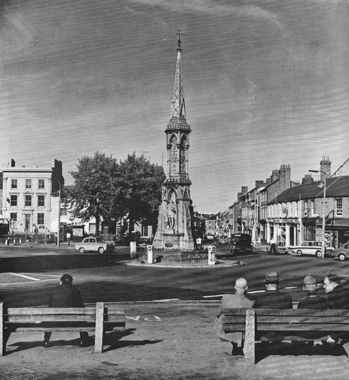
Banbury Cross (after Ronald Goodearl, 1973)

The original stone monolith that stood here has long since been destroyed (by christians arguing amongst themselves) and the ornate edifice that we see today was erected in 1859 to commemorate the marriage of Queen Victoria’s eldest daughter, Victoria Adelaide Mary Louisa, to Friedrich Wilhelm of Prussia.  Standing more than 52 feet tall, it is of a neo-Gothic design and is one of the tallest crosses in the country.  Originally there were going to be six carved statues cut into the niches of the cross, but this was later reduced to three.

First mentioned in place-name records from 1478, the original stone cross was itself very prominent, rising some 20 feet tall and sitting upon a square base of eight steps.  It was described by John Leland in his Itinerary when he visited the town sometime between 1535 and 1545, who said:

“At the west part of the street…is a large area, having a goodly cross with many degrees (steps) about it.  In this area is kept every Thursday a very celebrated market.”

The old cross was also a site where public notices and proclamations were dispensed to local people and seems to have been an old meeting place.  Whether it had a prehistoric predecessor isn’t known.

Folklore

The nursery rhyme we’ve all recited when we were kids and growing-up, has much of its origins around this ornate edifice and in the 20th century was thought to have its origins in pre-christian practices hereby, but this is questionable.  The rhyme, to those who don’t know it, goes:

Ride a cock-horse to Banbury Cross,
To see a fine lady upon a white horse,
With rings on her fingers and bells on her toes,
She shall have music wherever she goes.

As Kirsten Ayles (1973) told:

“This rhyme was first recorded in 1784, but it probably originated much earlier.  The Banbury Cross mentioned was destroyed at the turn of the 16th century by the Puritan inhabitants of Banbury.  It has been suggested that “bells on her toes” points to the fifteenth century, when a bell was worn on the long tapering shoe of each shoe.  It has (also) been thought that the “fine lady” was Queen Elizabeth I, or Lady Godiva.”

Another option identifying the “fine lady” in the rhyme is perhaps a member of the Fiennes family, ancestors of Lord Saye and Sele who owns nearby Broughton Castle.

References:

  1. Ayles, Kirsten, “A Short History of Nursery Rhymes,” in This England, 6:3, Autumn 1973.
  2. Gelling, Margaret, The Place-Names of Oxfordshire (2 volumes), Cambridge University Press 1954.
  3. Vallance, Aymer, Old Crosses and Lychgates, Batsford: London 1920.

Acknowledgements:

To Ronald Goodearl, for use of his 1973 photograph of the Banbury Cross.

© Paul Bennett, The Northern Antiquarian 


East Adderbury Cursus, Banbury, Oxfordshire

Cursus: OS Grid Reference – SP 473 372

Also known as:

  1. Bodicote Cursus

Found a few miles south of Banbury and running in a southeast to northwest alignment, Paul Devereux wrote that,

“the crop marks of this cursus fragment were first photographed by James Pickering in 1972…between the villages of East Adderbury and Bodicote…close to the River Cherwell.  The southeast end is square; the other terminus is unknown.”

References:

  1. Pennick, Nigel, & Devereux, Paul, Lines on the Landscape, Hale: London 1989.

© Paul BennettThe Northern Antiquarian 2016