Lower Lanshaw Stone (01), Askwith Moor, North Yorkshire

Cup-Marked Stone:  OS Grid Reference – SE 16033 50858 
Getting Here

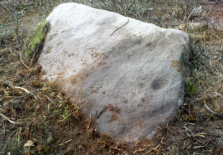
Lower Lanshaw Cup-marked Stone

Start at the Askwith Moor parking spot on Askwith Moor Road, then walk down the road (south) 300 yards till you reach the gate and track on the other side of the road, heading southeast.  Following the track onto the moor and take the footpath on your right after 75 yards. Follow this along until you hit the gate & fence.  Climb over this, then follow the same fence along (left) and down, and keep following the fence and walling all the way on until you reach the very bottom southwestern edge of Askwith Moor itself.  Now, walk up the slope to your right and, near the top of this rise 200 yards or so away are 2 or 3 rocks close to each other.  You’re here!

Archaeology & History

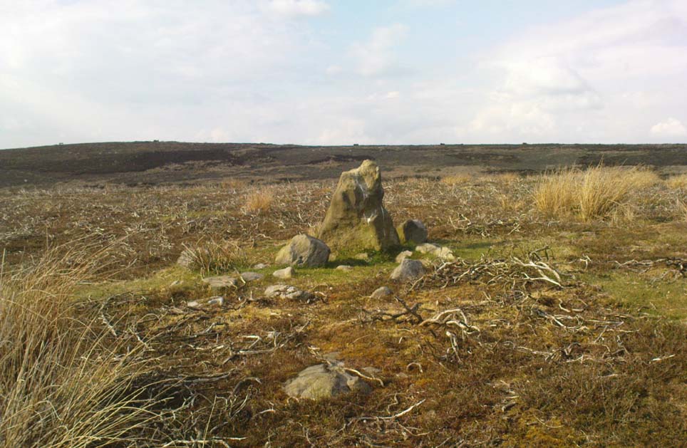
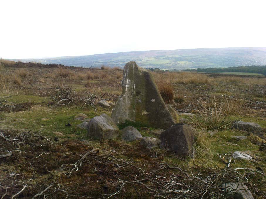
On the small, unnamed hill at the very far southwestern edge of Askwith Moor, within the unrecorded Lower Lanshaw enclosure is this previously unrecorded cup-marked stone that has been found thanks to further heather burning operations hereby.  But it’s nowt much to shout about if you’re after big colourful designs.  This is merely one of the many single cup-marked rocks scattering the Yorkshire uplands.  The large pecked cup, nearly 2 inches in diameter, is found on the lower eastern end of a long, sloping stone. Along the same ridge are also faint remains of ancient walling.

A very faint cup-and-ring stone can be found just over the brow of the hill from here, about 30 yards northeast (at SE 16059 50875) in the northeastern edge of the Bronze Age enclosure walling.

© Paul Bennett, The Northern Antiquarian

High Low Ridge, Askwith Moor, North Yorkshire

Cairns:  OS Grid Reference – SE 166 512

Getting Here

Get here before the heather grows back!  From the Askwith Moor parking spot, walk up the road (north) and turn left on the moorland track, past the triangulation pillar, then the ranger’s hut on the edge of the hill, and head WNW along and down the gradual slope.  You’ll get to a row of grouse butts after a few hundred yards and, if you’re lucky to find it, an old OS trig-marked arrow carved on one of the low-lying stones.  This stone is about 10 yards away from the cairn!

Archaeology & History

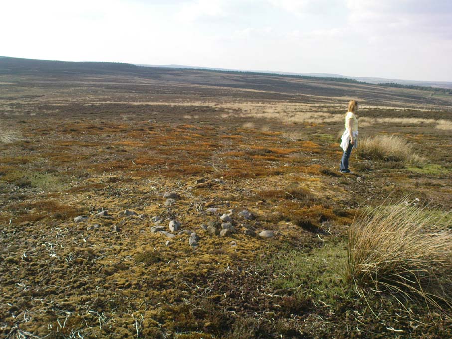
There are no previous references to this site.  It was discovered by the hardworking Keighley volunteer, Michala Potts of Bracken Bank, on May 20, 2010, and was the most visible of at least three prehistoric cairns on the sloping edge of this hill. The main one illustrated here is about 3 yards in diameter and only a foot or two high.  Typical of the many Bronze Age cairns scattering the moors north and south of here, several others are in close attendance.  It seems as if some of the stone from this cairn has been robbed to build some of the grouse-butts that stretch across the moors hereby.

Single cairn on Askwith Moor
Same cairn, looking uphill

About 50 yards away from the main cairn shown in the photos are a couple of others of the same size and nature.  And if we walk over the other side of the nearby rounded hill immediately south, a couple of other cairns are in evidence.  However, we didn’t spend too much time here getting any images, as other sites on the moor were beckoning and we were running out of good daylight!

The name of this area seems a little odd: “High Low” — and our old place-name masters say little about it in the Yorkshire directories.  The name is shown in the earliest large-scale OS-maps, but the contradiction of a high low ridge probably derives from the word originally being lowe, or “hlaw”: which as A.H. Smith (1956) said,

“In (old english) the common meaning in literary contexts is ‘an artificial mound, a burial mound,'”

Cairn to centre, with 1 more on near horizon

which is exactly what we have found here — or several of them scattered about.  This tumulus derivation is echoed by modern place-name authorities like Margaret Gelling (1988), etc.  Gelling told how the word hlaw, or low, and its variants, “was used of burial mounds over a wide area, from the south coast to the West Riding.”  Much as we’ve found on this hill at Askwith Moor!  We’ve yet more exploring to do in and around this area in the coming weeks.  God knows what else we’ll find!

References:

  1. Cowling, Eric T., Rombald’s Way: A Prehistory of Mid-Wharfedale, William Walker: Otley 1946.
  2. Gelling, Margaret, Signposts to the Past, Phillimore: Chichester 1988.
  3. Smith, A.H., English Place-Name Elements – volume 1, Cambridge University Press 1956.

© Paul Bennett, The Northern Antiquarian

Hollin Tree Hill, Askwith Moor, North Yorkshire

Settlement:  OS Grid Reference – SE 1671 5067

Getting Here

Very troublesome to locate when the heather’s deep. To get here take the Askwith Moor Road heading north and park-up at the big gritted parking spot halfway along. Cross the road (west) and walk up a little and onto the moorland track.  When you hit the triangulation pillar, walk down (left) onto the moor, heading for the small rise in the land a few hundred yards away. Once there, start walking down its sloping south-face, watching for any evidence after 100 yards. Be vigilant!

Archaeology & History

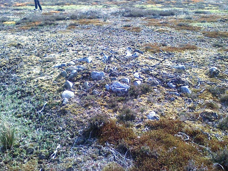
One of 4 hut circles in very good state of preservation

This small settlement was first found on 18 July, 2004, when a small group of us, in search of the troublesome Man Stone carving, were lucky to be on the moors shortly after the heather had been burnt back, amidst this archaeologically rich area of Askwith Moor, on the northern end of Hollin Tree Hill.

There were at least four hut circles found here (on the right of the track as you walk up the slope), with one in particular — the northernmost of the group — in a very good state of preservation.  This particular circle measured approximately 20 feet in diameter, with an entrance to the south side.  It is marked by a low earthfast boulder on the northeast side, visible even when the heather is deep.

Although we counted four such circles, it’s very likely that an intensive search would uncover more remains on this hillside.  In revisiting this site in October 2016, the heather had grown back over the entire complex and the circles were very difficult to see; but we were able to discern the one on the very top of the hill (the one in the photo).  The other hut circles, lower down the slopes, were notable only by zigzagging back and forth until we walked onto loose walling.

© Paul Bennett, The Northern Antiquarian


Hollin Tree Hill, Askwith Moor, North Yorkshire

Standing Stone:  OS Grid Reference – SE 16611 50818

Getting Here

Follow the directions to reach the Man Stone carving.  Walk up the sloping hillside from there until you reach the top.  From there, walk down the slope heading slightly to your left.  You’ll find it!

Archaeology & History

A small upright stone, less than three feet tall, but once a little taller as you’ll see that it’s head has been knocked off in the not-too-distant future and lies on the ground by its side.  A small scatter of what seems like possible cairn-material lies around its base, but not enough to imply that a tomb of any sort was ever here (aswell as that, the position on the slope seems wrong).

A curious little thing, without archaeological companions.  When we came here the other day, we explored the ground all round the stone as all the heather had been burnt back; but there was nothing anywhere near it to give a hint as to why it stands here, alone, at what seems like a strange spot two-thirds the way up a moorland slope. It’s been speculated that in the middle of its more north-facing side there is a cup-mark on it, but this is very dubious and, in my opinion, should be discounted as such.  The marking is a gun-shot wound – and more recent ones have just been added, as seen  in the photo.

© Paul Bennett, The Northern Antiquarian


Ellers Wood (614), Washburn Valley, North Yorkshire

Cup-and-Ring Carving:  OS Grid Reference – SE 1895 5099

Ellers Wood carving 614 (after Boughey & Vickerman)

Getting Here

Ellers Wood is at the very northern edge of the beautiful parish of Askwith and has a very particular ambience of its own. The small cluster of at least 5 cup-and-ring stones in this lovely little woodland gives you the impression that they stood out on their own, living here representing the genius loci of this luscious watery vale, all-but-hidden from all but the lucky few.  It’s very likely that there are still more carvings hidden away nearby.

The best way to check them out is simply to walk down past the haunted Dobpark Lodge, where it turns into a footpath and where it crosses the lovely old packhorse bridge at the valley bottom, walk a few hundred yards up the river-side (at the bottom of the fields) until you reach Ellers Wood. Once there, look around.  This one’s on the west side of the main stream, close by where it meets up with another small burn coming down from the western wooded slopes.


Archaeology & History

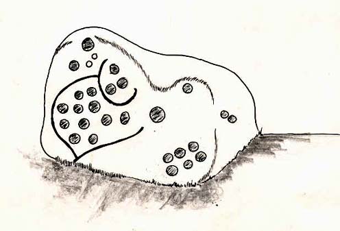
First sketch of the carving, c.1994

In the same region as the Ellers Wood 618 and other carvings and very close to the river, somehow this heavily cup-marked stone evaded the prying eyes of such notaries as Cowling, Stuart Feather and Sidney Jackson – all of whom ventured to look at the other petroglyphs in Ellers Wood.  But with good fortune, Graeme Chappell and I re-discovered this fine-looking carving in our explorations in 1993-94 and gave it back the attention it truly deserves.

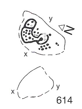
The main feature here is the clustering of cups into sections, as the drawing indicates.  It is listed as “stone 614” in Boughey & Vickerman’s (2003) survey.

References:

  1. Boughey, K.J.S. & Vickerman, E.A., Prehistoric Rock Art of the West Riding, WYAS: Exeter 2003.
  2. Cowling, E.T., ‘A Classification of West Yorkshire Cup and Ring Stones,’ in Yorks. Arch. Journal 1940.
  3. Cowling, Eric T., Rombald’s Way, William Walker: Otley 1946.
  4. Cowling, E.T. & Hartley, C.A., ‘Cup and Ring Markings to the North of Otley,’ in Yorks. Arch. Journal 33, 1937.
  5. Grainge, William, The History and Topography of the Forest of Knareborough, J.R. Smith: London 1871.
  6. Grainge, William, History and Topography of the Townships of Little Timble, Great Timble and the Hamlet of Snowden, William Walker: Otley 1895.

© Paul Bennett, The Northern Antiquarian