Snowden Carr (570a), Timble, North Yorkshire

Cup-Marked Stone:  OS Grid Reference – SE 1777 5128

Getting Here

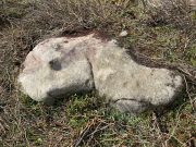
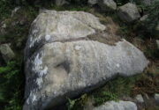
The stone in question

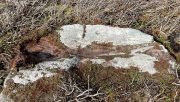
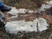
From the Askwith Moor car-park (SE 1757 5067), walk along the road north for a few hundred yards until you reach the gate on your right and head through the heather to the Death’s Head carving.  From here walk in a northwesterly direction up the gentle slope for 50-60 yards and, before reaching its crown, keep your eyes peeled for a low flat stone with a curvaceous crack running roughly halfway across it.  If the heather’s deep, you might not have a cat in hell’s chance of finding it!

Archaeology & History

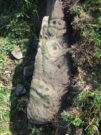
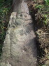
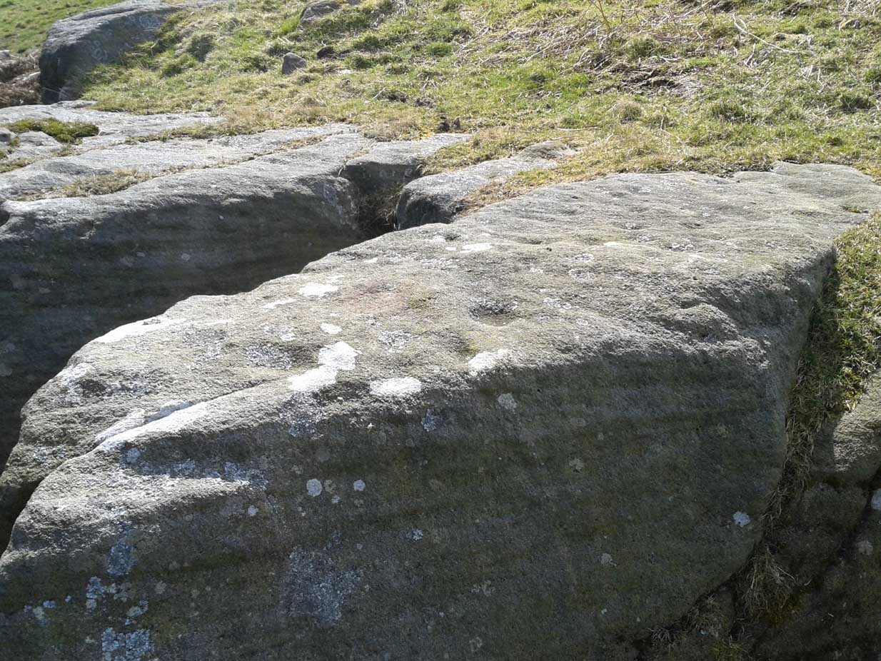
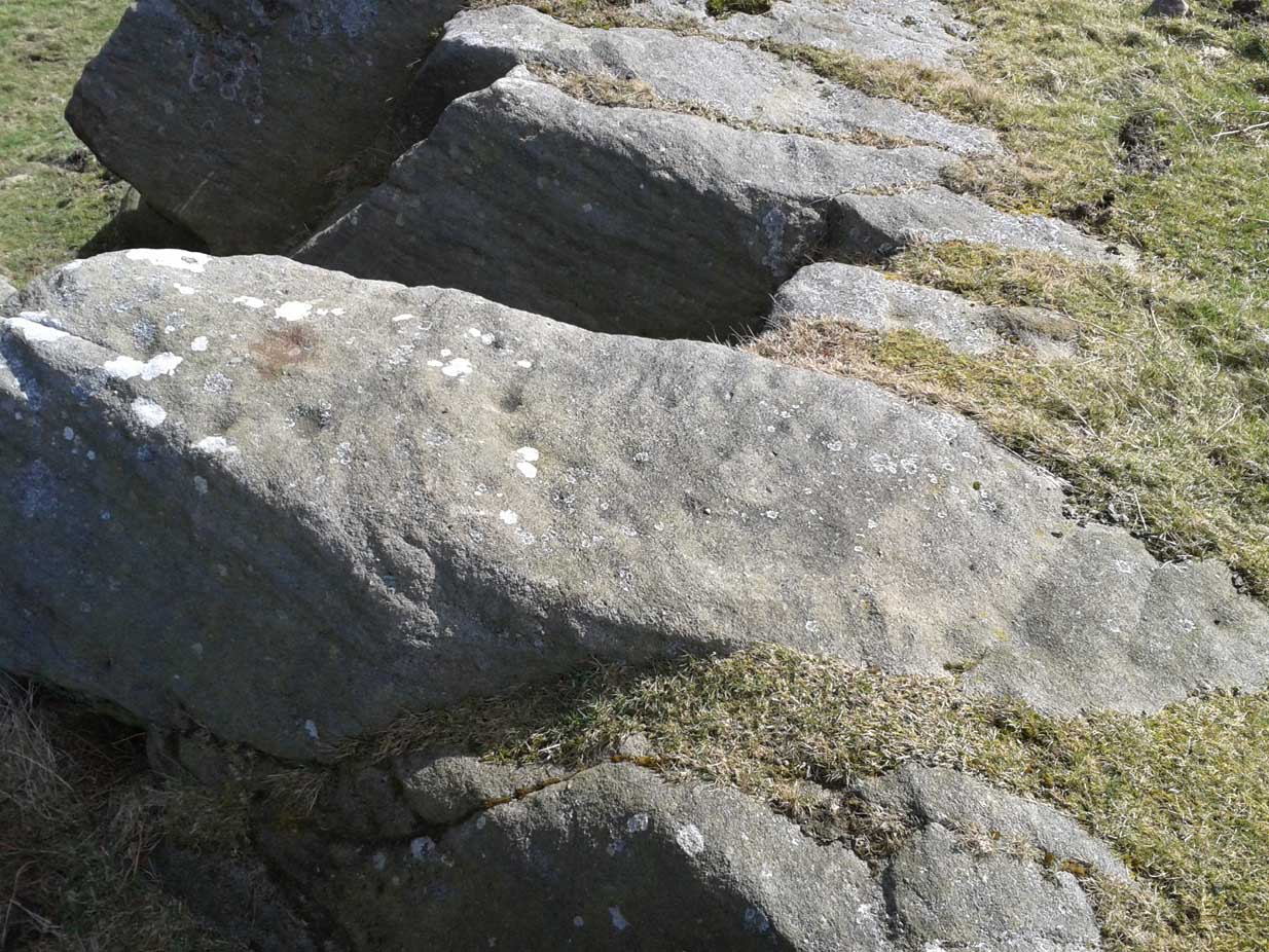
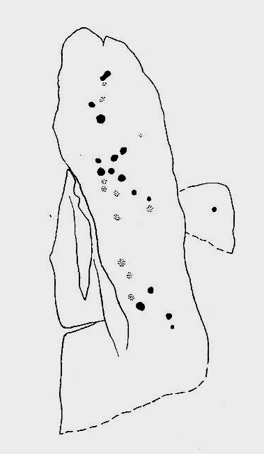
This carving isn’t much to look at on two levels: i) it’s a pretty simplistic design with no rings, and (ii) it’s very faint and almost impossible to see until the light is just right—except for one of the cups, which itself might be natural (there are a few like that amidst the Askwith complex).  It’s very much a carving for the purists among you, as I always say.  Nonetheless, for the record:

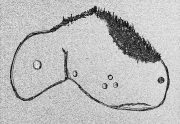
Crap sketch of design
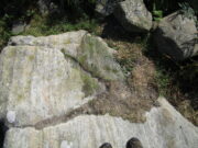
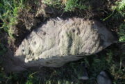
Faint cups visible

The most notable element is the single “cup mark” on the more easterly section of the stone, on one side of the natural crack.  It catches your eye and is what makes you give the stone a little more attention, although I couldn’t make up my mind whether this was Nature’s handiwork or humans.  It may be a bit of both.  On the other side the crack we can see a small group of very faint eroded cup-marks — just!  What seems to be three of them cluster in a small triangle formation, but one of these may be natural (tis hard to say for sure), with another isolated cup closer to the crack, and a final one further to the outer edge of the stone.  All are very faint but stood out when the sun was low on our recent visit here.  Give it your attention when you’re next having a look at the settlement and cairnfield close by.

© Paul BennettThe Northern Antiquarian

Snowden Carr, Askwith Moor, North Yorkshire

Ring Cairn:  OS Grid Reference – SE 1786 5129

Getting Here

Low remains of cairn mass

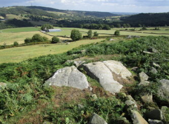
From the Askwith Moor car-park (SE 1757 5067), walk along the road north for several hundred yards and go through the gate on your right.  Head northeast through the heather to the Death’s Head carving and keep along the same direction for barely another hundred yards onto the ever-so-slight crown of a small hillock.  This is a hut circle you’re standing in/on.  A few yards away just to the southeast of where you’re standing is the very denuded remains of this ring cairn.

Archaeology & History

Low remains of rubble wall

Not visible when the heather’s in full growth, it’s nonetheless worth visiting if you’re trying to get a picture of the prehistoric landscape hereby.  Less than 10 yards southeast of the notable hut circle on the small crown of a hill, it was first noticed by Sarah Walker on a group visit here recently.  Roughly 12 yards across, the most notable section of the circle is the remains of the rubble bank on its east and southeastern sides, raised a few feet above ground level.  The majority of the monument comprises of a scatter of various rocks and small stones within and round the edges of the circle.  There’s a lot of scattering from other adjacent remains, such as the hut circle and nearby walling, that give the initial impression of it being little more than a spurious mess of stone; but the more you walk around and inside it, the more you come to recognize its structure.

It has that Bronze Age hallmark look about it, but without an excavation this is just educated guesswork.  It might actually be older.  The widespread mass of prehistoric remains all round here shows that it was once a mass of activity in prehistoric times.  It’s a brilliant area, even if you can’t find this particular site!

© Paul BennettThe Northern Antiquarian

Hornbeam Farm, Harrogate, North Yorkshire

Cup-and-Ring Stone (destroyed?):  OS Grid Reference – SE 314 537

Archaeology & History

The chances of this carving still being alive, so to speak, are pretty slim.  It was reported by a Mr. Sullivan to the old Yorkshire petroglyph researcher Stuart Feather back in 1965, in the days when English archaeologists didn’t really give a shit about rock art.  Sad but true.  The carving was found in the grounds of what used to be the ICI Fibres Research Centre, in the present landscape of Hornbeam Business Park, a hundred yards or more west of Hookstone Beck.  According to Feather’s report, the carving consisted of “a single-ringed cup and a groove” surrounding “two short pecked grooves and a meandering groove leading off,” all with clear signs of being pecked and carved in the old-school manner.  All trace of the carving has vanished and it was probably destroyed by the Industrialists. (the grid-reference to this site is an approximation)

© Paul BennettThe Northern Antiquarian

Snowden Carr (566a), Timble, North Yorkshire

Cup-Marked Stone:  OS Grid Reference – SE 17724 51258

Getting Here

The 2 cups, top-middle

Easiest way is to park up at the Askwith Moor car-park spot, turn right and walk along the road for about 350 yards until you reach the gate on the right (not the one across the road!).  You then need to head to the Death Head’s Stone carving about 450 yards across the moor to the east. It’s pretty conspicuous.  From here, walk through the heather 80-odd yards northwest.  You’ll walk past some extensive rubble walling (whose nature yet eludes us) before you get there.

Archaeology & History

Looking down at the cups

Discovered recently by Sarah Walker on a venture to see the extensive settlement and graveyard around Snowden Crags, this petroglyph is a simple basic design cut into a relatively large flat stone just above ground level.  Found less than 100 yards east of the dubious Snowden Carr (565) carving, there are two large cup-marks on this one: one of them is an inch deep and two-inches across and may originally have been geophysical in nature, but has subsequently been worked by human hands.  To its side is another much fainter and shallower cup-mark about the same width.  On some photos there’s what appears to be a very faint large ring surrounding the faint cup, but until visits are made at low sun and the stone brushed with water, we cannot be sure whether it’s real or just a trick of the light.  There may be more cups on this stone beneath the peat.  We didn’t brush it all off.

Some 30-40 yards to the east is the rubble of an extensive prehistoric man-made structure, the nature of which has yet to be discerned.  The Snowden Moor cairnfield begins immediately to the northwest, with the first tomb barely 50 yards away.

© Paul BennettThe Northern Antiquarian

Mixing Stone, Low Snowden, Askwith, North Yorkshire

Cup-and-Bowl Stone:  OS Grid Reference – SE 18074 51241

Getting Here

Follow the directions to reach the Ancestors’ Stone and the Sunrise Stone; and there, roughly halfway between them, right by the edge of the old collapsed walling, you’ll see this rise of a stone with a large ‘bowl’ on top.  That’s it!

Archaeology & History

Mixing Stone, looking E

Laid upon the same geological ridge as our Ancestors’ and Sunrise carvings, there are one, possibly two faint cup-marks visible on the low flat surface near the edge of this rock, barely visible unless the light’s right.  But the important element here, perhaps regardless of the cup-marks, is the ‘bowl’ or rock basin on top of the stone.  Internally, it’s smoothed equally on all sides and, due to being in-between the two impressive petroglyphs, may well have had a practical function to it.  Bear with me on this one…

The Mixing Stone’s bowl

Stone ‘bowls’ or cavities—natural and otherwise—have been made use of in many cultures for simple functional purposes, such as grinding flour, herbal mixes, etc.  We find such traditions in some of the bullauns of Ireland and Scotland; whereas in similar stone bowls known as cat troughs in nearby Haworth, milk was poured to appease the spirits of the land (this tradition was still being maintained in 2001!).  Folklore and traditions of such rock basins spread far and wide beyond the UK: one of the German terms for rock basins is Opferkessel, meaning ‘sacrificial basin’ and suggests ritualistic usage by early societies.  Elsewhere on Earth there are numerous accounts of the ritual use of petroglyphs in which indigenous peoples tell of their use of plant- or rock-based paints (in many cases red ochre) to decorate the carvings.  And it’s this element that I’m interested in here.

Water-painted cupmarks

The Sunrise and Ancestors’ Stones 10-15 yards either side of this Mixing Stone are ideal candidates for such petroglyphic paintings using early ochre and other stone or plant-based agents.  Such activities would always have been ritualised, either in honour of ancestors, genius loci, calendrical rites, or whatever the pertinent ingredient was at that place and time.  I’m suggesting simply that the rock basin on the Mixing Stone was used for just such purposes.  This is no spurious suggestion, but at the same time it’s important to recognise that my thoughts here represent merely an idea, nothing more—not a fact.  Whilst we know full well that these carvings were imbued fundamentally with animistic properties—a simple ‘fact’—this functional idea is just that—an idea.  Students and petroglyph-nuts need to understand this.  And the faded cup-marks at its edge are perhaps merely incidental…. though I don’t buy that misself!

© Paul BennettThe Northern Antiquarian 

Ancestors’ Stone, Low Snowden, Askwith, North Yorkshire

Cup-and-Ring Stone:  OS Grid-Reference – SE 18083 51229

Also Known as:

  1. Carving no.606 (Boughey & Vickerman)

Getting Here

The Ancestors Stone

If you’re coming up from Otley or Askwith, take the same directions as if you’re going to visit the impressive Naked Jogger Carving (stone 612), not far from the well-known Tree of Life Stone.  From the Naked Jogger carving, walk up to the small outcrop of rocks that bends above you.  There’s a small collapsed line of walling just behind the outcrop.  Walk along this up the slope as if you’re heading for the Sunrise Stone carving, but only 30 yards along, low down and right into the edge of the wall itself, you’ll see this elongated piece of stone.  That’s the spot!

Archaeology & History

If you’ve caught the petroglyph-bug, you’ll like this one!  It received its name from the curious fusion of natural cracks with the man-made pecked lines that shows, quite distinctly when the light is right and the stone is wet, the outline of two humanesque forms joined to each other.  Figurative rock engravings of ancestors in the UK are extremely rare and when we came across this example, we noticed how the design could be interpreted as two Askwith Moor ancestor figures. Figurative rock art images elsewhere in the world such as the magnificent Wandjina paintings and the extensive galleries of figures engraved at Murujuga (Burrup Peninsula) in Western Australia, might provide an initial comparison, though more specific work needs to be done to better understand this unique petroglyph.

Sketch of the carving

You can almost make out the figures in the above photo: the upper torsos of two beings on the right-hand side of the rock, almost fused together.  And the carved shapes of these “ancestral beings” are morphically similar to some elements in the Sunrise Stone just 50 yards away – which themselves remind me of a Northumbrian carving near Doddington known as West Horton 1a. (Beckensall 1991)  But we should’t get too carried away by the idea because—as we can see here in the sketch of the carving—when looked at from a different angle above, we could infer the right-hand carved elements to be representative of an animal: a deer, perhaps.  Rorscharch’s once more tickle the exploring mind….

The rock has been quarried into at same time in the past (just like the nearby Sunrise Stone), leaving us to wonder what the complete carving might have looked like.  No doubt some pieces of it will be in the collapsed walling either side of the stone.  All we have left to see are the two unfinished cup-and-rings above the natural cracks that give rise to the “ancestral being” appearance.  The faint double cup-and-ring has curious linear arcs to its side, with two well-defined cups enclosed by two of them.  It’s a nice-looking carving when the light is good.  The petroglyph was carved over a long period of time, as evidenced by the differing levels of erosion in different sections of the design.  It’s a common attribute.  The oldest section is the faint double cup-and-ring, whose mythic nature was added to / developed at a much later date, perhaps even centuries later.

In the always-expressive archaeocentric description of Boughey & Vickerman’s (2003) otherwise valuable tome, they told this carving to be,

“Long, narrow, thick rock of medium grit. Six cups, one with a double ring with a tab out and two with at least partial single rings, grooves.”

Evocative stuff!

It’s very likely that this carving had some mythic relationship with its close neighbours either side of it, probably over a very long time period and I’m inclined to think it somehow related to the rising of the sun, just like its solar companion further up the slope.  Please note how I emphasize this ingredient in the site profile of its neighbour, the Mixing Stone 10-15 yards away—roughly halfway between this and the Sunrise Stone.   A distinct place of ritual was happening in this close-knit cluster of carvings…

References:

  1. Beckensall, Stan, Prehistoric Rock Motifs of Northumberland – volume 1, 1991.
  2. Boughey, Keith & Vickerman, E.A., Prehistoric Rock Art of the West Riding, WYAS: Leeds 2003.
  3. Reeder, Phil, “Snowden Carr Rock Carvings,” in Northern Earth Mysteries, no.40, 1990.

© Paul BennettThe Northern Antiquarian

Shooting House East, Askwith Moor, North Yorkshire

Hut Circles:  OS Grid Reference – SE 17401 50967

Getting Here

Askwith Moor hut circle (1)

Along the only road that crosses Askwith Moor, park up at the single carpark on the east-side of the road.  Walk up the road for 350 yards and through the gate on the left-hand (west) side of the road onto the moorland.  Once through the gate, walk directly west into the heather immediately below the path for some 25-30 yards.  Look around!

Archaeology & History

Rediscovered by Helen Summerton in May 2022 are at least two simple hut circles on this level piece of land close to the roadside, amidst this much wider and impressive prehistoric landscape.

The small ring of stones (SE 17430 50978) closest to the road is slightly more troublesome to make out due to it being more deeply embedded in the peat than its companion about 30 yards away.  Comprising of typically small rubble walling, this first circle is only 4 yards across and would certainly have been fine for one person or, at a push, perhaps a small family.

Askwith Moor hut circle (2)

Its companion immediately west (SE 17401 50953) is somewhat larger and slightly more elongated in shape, being 10 yards along and 5-6 yards across, as well as being in a better state of preservation.  This larger hut circle has been raised on a notable artificial earth-and-rubble plinth, being one or two feet higher than the surrounding peatland.  A notable internal stretch of walling only a yard or two in length exists within the southeastern side of the construction, whose nature can only be discerned upon excavation: an issue we can say applies to the many prehistoric settlements and tombs across this small moorland.  It’s very likely that other settlement remains will be found close to these two hut circles.

The remains of another hut circle can be found closer to Shooting House Hill, several hundred yards away; whilst five hundred yards southwest we find a small but impressive cairnfield.  There are also a good number of petroglyphs close by and on much of the surrounding landscape.

Acknowledgments:  Huge thanks to Helen Summerton (not Winterton) for finding these ‘ere remains – and for the photos accompanying this site profile.

© Paul BennettThe Northern Antiquarian

Longbarrow Field, Timble, North Yorkshire

Cairn (lost):  OS Grid Reference — SE 18 53

Archaeology & History

Described in the Field Lore of Timble village by William Grainge (1895) are the names and short histories of some of the local place-names—with this in particular standing out like a veritable sore thumb!  Quite plainly, as Grainge told us,

“The name ‘Longbarrows’ is indicative of some burial mounds of a very early day.  None exist at present.  The land is under the plough, and is about the best in the township.”

But I cannot locate the position of this long-lost site and it’s not shown on any of the early OS-maps hereby.  Grainge said that the land on which it once stood was owned by a local farmer called Charles Dickinson, who leased it out to others.  He wrote:

“Dickinson had in Longbarrows 3 roods* and 23 perches*, and William Jackson’s share in Longbarrows was 1 acre, 3 roods and 21 perches.  Besides these, John Ward of Nether Timble had 1 rood and 17 perches int he same field, a long narrow slip without fence, between Dickinson’s and Jackson’s lots.”

Does anyone know where this was?  One of my suspects is the gathering place of the Fewston witches, a half-mile south of the village; but no remains of anything can be found there today and I may just be barking up the wrong tree.

The area south and west of here is rich in little-known prehistoric heritage, from the cairn-fields of Askwith Moor, the cairn circle at Snowden Crags, the settlements of Snowden Carr and the extensive petroglyphs all over the place!  Giants cairns of the early Bronze Age and neolithic period were also once more numerous upon the moors to the west and south, so the former existence of a long barrow in Timble wouldn’t necessarily be too unusual.  But where was it?!

References:

  1. Grainge, William, The History and Topography of the Townships of Little Timble, Great Timble and the Hamlet of Snowden, William Walker: Otley 1895.

*  A rood is an English unit of area, equal to a quarter of an acre or 10,890 square feet; a perch was a more variable unit of measure, being lengths of 1612, 18, 21, 24 and 25 square feet.

© Paul BennettThe Northern Antiquarian 

Sunrise Stone (605), Snowden Crags, Askwith, North Yorkshire

Cup-and-Ring Stone:  OS Grid Reference – SE 18066 51251

Also Known as:

  1. Carving 605
  2. Northern Earth Mysteries Stone

Getting Here

Sunrise Stone, Snowden Carr

Sunrise Stone, Snowden Carr

Take the same directions as if you’re going to visit the Naked Jogger Carving (stone 612), not far from the well-known Tree of Life Stone.  From the Naked Jogger carving, walk up the small outcrop of rocks that bends above you.  Barely 100 yards up when you reach the top, you’ll notice a single large sloping stone barely 50 yards ahead of you in the same field.  That’s the spot!

Archaeology & History

This is a little-known beauty of a carving just off the edge of the quiet moors that are littered with prehistoric remains.  It was only rediscovered a few years ago — by myself if you believe the writings of rock art student Keith Boughey (2010) in his essay (scattered with mistakes) on the validity of so-called “amateurs” exploring petroglyphs.  But I’d never even visited this carving until two years ago!  The stone was in fact found during a field-walk by early members of the Northern Earth Mysteries group in August 1989 (Wilson 1990) and subsequently described and illustrated for the first time by Phil Reeder (1990).
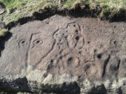
Close-up of main cluster

Close-up of main cluster

As can be seen in the photos accompanying this site profile, the rock on which the carving has been done has, at some point in the past, been cut into and its edges have been hacked away and destroyed, literally cutting into the overall design.  We have no idea what the original size of the stone was, obviously, but this petroglyph was once larger than the design that we see at present.  Such is the price of ‘progress’, as some folk call it.

Anyway – a few months after the carving was rediscovered, Phil Reeder (1990) wrote:

“After a visit to the Tree of Life stone…a cursory inspection by the NEM Group was made on nearby rock outcrops, part of which showed evidence of recent exposure due to soil erosion.

“One stone in particular stood out as five shallow cups and associated rings could be discerned.  When cleaned, it became apparent that further carvings extended beneath a thin eroding soil layer.  When this layer was cleared, a complex set of carvings were revealed.

“Only preliminary work at the site has been carried out to date, but it appears that the carvings comprise of at least 28 cups, 13 of which have associated rings; several of the cups are linked by gutters forming an intricate design, one gutter part enclosing 11 cups.  The carvings on the lower edge of the stone have weathered badly and are difficult to interpret.”

Reeder’s so-called “amateur” description is a good one. Certainly more accurate than the subsequent one by Boughey & Vickerman (2003):

“Large rock of coarse grit whose surface slopes with the hill. About forty cups, some large, many with single rings, and many curving grooves, the whole forming a remarkable, complex design.”

Phil Reeder's 1990 drawing

Phil Reeder’s 1990 drawing

Boughey & Vickerman's sketch

Boughey & Vickerman’s sketch

We can see in the respective drawings by both Reeder (left) and Boughey & Vickerman (right) that some elements which should have been included in the ‘official’ drawing were missed, yet had been accurately included in the earlier ‘preliminary’ drawing, as Mr Reeder put it.  I hope that readers will forgive me pointing out these seemingly minor elements; but I do it to illustrate the ineffectiveness of more recent rock art students who are gaining the title of ‘experts’ in this field.  It’s important to recognise that, in this field of study, “experts” are few and far between indeed… I’ve certainly yet to meet any!

Northern end of carving
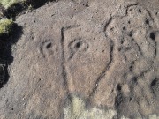
Northern end of carving

Southern side of carving

Southern side of carving

The carving is mentioned briefly in Beckensall’s (1999) introductory study, with little comment.  But of note here is not only the curious linear feature running between two cup-and-rings, but the position of the stone in the landscape.  For if you sit either upon or next to this carving, you are looking east straight across the gorgeous Fewston valley directly at the prominent wooded hill of Sword Point.  As it slopes down into the present-day greenery of fields and scattered woods, the Wharfe Valley spreads out to the distant east and, as the sun rises and scatters its rays onto the wet morning stone here, the design on the rock awakens with much greater visual lucidity than that which our daytime eyes bestow to us.  In all likelihood, sunrise was an important element in whatever mythic function underscored this curious carving, with its human-like figure rising on its southern side, emerging from the edge of the rock, personifying perhaps the rising solar disc and the living landscape as the daylight breath awoke Earth’s creatures; or maybe it signifies a symbolic group of people gathered together watching the sunrise…

Of course, I’m dreaming…

References:

  1. Barnett, T. & Sharpe, K. (eds.), Carving a Future for British Rock Art, Oxbow: Oxford 2010.
  2. Beckensall, Stan, British Prehistoric Rock Art, Tempus: Stroud 1999.
  3. Boughey, Keith, “The Role of the Amateur in the Study of UK Prehistoric Cup-and-Ring Art,” in Barnett & Sharpe, Oxford 2010.
  4. Boughey, Keith & Vickerman, E.A., Prehistoric Rock Art of the West Riding, WYAS: Leeds 2003.
  5. Chappell, Graeme, “North Yorkshire Rock Art – New Discoveries,” in Northern Earth, no.62, 1995.
  6. Michell, John, The Earth Spirit, Thames & Hudson: London 1975.
  7. Reeder, Phil, “Snowden Carr Rock Carvings,” in Northern Earth Mysteries, no.40, 1990.
  8. Wilson, Rob, “Pateley Bridge Gathering,” in Northern Earth Mysteries, 40, 1990.

© Paul Bennett, The Northern Antiquarian


Snowden Carr carving (610), Askwith, North Yorkshire

Cup-Marked Stone:  OS Grid Reference – SE 18105 51210

Getting Here

Snowden Carr carving 610

From Otley, take the road north across the River Wharfe up and up, heading towards Askwith Moor.  As the moorland opens up ahead of you, at the crossroads turn right along Snowden Carr Road and literally ¾-mile along (1.25km) where a track on your right goes to Carr Farm, on the left-side of the road is a gate.  Go through here to the Naked Jogger Stone and walk up the rocky ridge ahead of you, alongside the walling (as if you’re going to the Sunrise Stone), and about 20-30 yards up you’ll reach this carving.

Archaeology & History

Best visited on a clear day, this is one carving amidst a small cluster of cup-marked petroglyphs found along the small geological ridge between the Sunrise Stone and Naked Jogger carving (none of which are as impressive as those two!).  This particular design consists of a number of faint cup-marks— between 17 and 25 of them—reaching along the horizontal surface, with no distinct formal pattern, as usual.  The carving continues beneath the encroaching soil.

Looking down at the carving
Archaeo-sketch

It seems to have been described for the first time by Stuart Feather (1973); then subsequently in Boughey & Vickerman’s (2003) survey, in which they attach a single cup-marking on an adjacent rock into the matrix of this design—but the two rock surfaces are distinctly separate.  This apart, their description tells, briefly as always: “Large long rock which may be outcrop, with hill falling away steeply below. Seventeen worn cups.”

References:

  1. Boughey, Keith & Vickerman, E.A., Prehistoric Rock Art of the West Riding, WYAS: Leeds 2003.
  2. Feather, Stuart, “Askwith, W.Yorkshire,” in ‘Yorkshire Archaeological Register’, Yorkshire Archaeology Journal, volume 45, 1973.

© Paul BennettThe Northern Antiquarian