Skelpick Long, Strath Naver, Sutherland

Chambered Cairn: OS Grid Reference – NC 72245 56745

Also Known as:

  1. Canmore ID 6276
  2. Long Skelpick
  3. Skelpick Burn

Getting Here

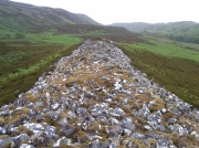
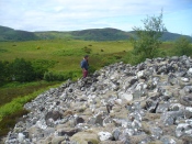
The huge cairn, looking east

The huge cairn, looking east

From the delightful village of Bettyhill, take the A836 road west. A mile out, just as the tiny road bridge crosses the sea-river, take the tiny road on your left. Go past the roadside lochan until you reach the first Skelpick house several miles down. Walk across the fields on your left (east) until you reach the wobbly wooden tidgy-widgy-bridgey that crosses the Skelpick Burn. Across on the other side – you can’t miss it!

Archaeology & History

The overgrown northern face

The overgrown northern face

As you wander down the poetic geoscapes of Strathnaver, meandering back and forth along the tributaries and Her tiny primal forest remains, on the edges of Her marshes, rivulets and rocky moorlands, tomb after tomb raise themselves to the eyes and feet of the wanderer.  They’re everywhere it seems!  But this one, above all others, hits the eyesight with an unexpected magnitude.  This is a giant–one helluva giant!–and typical of the structure and status of many of the immense prehistoric chambered tombs in this remote northern region of our entrancing heathen isles.

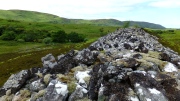
Rising out of the moorland heather to a height of sixteen feet in parts, tens of thousands of rocks make up this elongated artificial ridge, running like a spine NNW-SSE down the direction of the glen, pointing to the lowest dip in the distant southern horizon several miles away.  And although overgrown when we visited the site, at each extremity the elongated cairn has curious stretches of stones projecting out of its sides, like a pair of horns at each end.  Weird!

The long cairn, heading south

The long cairn, heading south

The giant cairn, heading north

The giant cairn, heading north

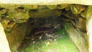
Once you get on top of the cairn, its northern end is the most impressive section. Wider than the rest of the monument, this is where, some ten feet below the top of the rock-pile, a large internal opening was covered over, hiding an impressive chamber (two birch trees mark the spot).  This is in incredibly good condition when you remember that you are looking at something that was built in the neolithic period some 6000 years ago!

Spider guards chamber of bones

Spider guards chamber of bones

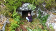
Little Lara at the entrance

Little Lara at the entrance

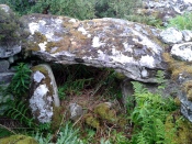
On my first visit, I sat inside the shelter of the chamber for around an hour, either inside the main ‘tomb’ section, or beneath a huge intact covering stone 12 feet outside the entrance (hiding from both rain and midges) that stretches from one side of the cairn to the other; noting, on its underside, two cup-marks: one is definitely crustacean in nature, whilst the other may be man-made (though we cannot discount it too having a crustacean origin). But we can safely say that this long stone was dragged some considerable distance from the coast to its present position and positioned into this giant cairn.  This covering stone rests precariously on a collection of many small well-placed rocks, themselves held up on two rigid solid standing stones, deeply embedded god-knows-how-deep in the solid Earth. They stand about 3 feet high in their present position above the ground.

Central stone in chamber

Central stone in chamber

Gordon gives idea of its size

Gordon gives idea of its size

The well-preserved ‘tomb’ section at the northern end of the cairn was opened sometime in the middle of the 19th century by James Horsburgh (1870)—although its description as a ‘tomb’ could be questionable here, as no funerary remains have ever been found inside it.  Horsburgh described the site as a,

“long cairn, 80 or 90 yards in length, which I opened and came upon a polygonal-shaped chamber, 11 feet in diameter, the sides consisting of large stones 6 feet high, one of them 7 feet by 4 and 1½ feet thick, placed at a distance from each other of 3 or 4 feet, the intervals being built up with long square stones.  The roof had been formed with very large flags overlaying each other.  The chamber had been opened from the top and the whole inside was filled with stones and rubbish, so that I only cleared it out.  Before I commenced operations, however, there was no appearance of it having been meddled with, and I dug it by chance where the cairn appeared to be highest.  Nothing whatever was found in it.”

This lack of funerary remains may simply be due to the collapse of stones destroying any evidences at the time Horsburgh dug into the cairn—or it may have had other functions instead.  Shortly after Horburgh’s analysis, John Stuart (1870) came to visit the site in his grand tour of the megaliths of the region, telling that,

“on the waterside is a long cairn with a chamber at its north end, of about 12 feet across, formed of six slabs, with the space between them carefully filled up with masonry.  Some of the slabs are of great size.  A passage leading to another chamber is blocked up.  The walls of the chamber begin to converge at a height of 6 feet, and were probably covered by flags.”

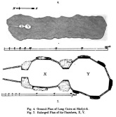
Stuart's 1874 ground plan

Stuart’s 1874 ground plan

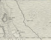
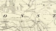
Skelpick Long on 1878 map

Long Skelpick on 1878 map

Highlighted on the first Ordnance Survey map in 1878, it was Mr Stuart (1874) who gave us our earliest ground-plan of Long Skelpick, as illustrated here.  But since then the site has been described by a number of antiquarians and archaeologists.  However, the most detailed account is given in the legendary Audrey Henshall’s (1995) updated site profile.  I make no apologies for reproducing her lengthy account of this cairn almost in its entirety, as it is an astonishing megalithic monument.  She wrote:

“…The cairn is 72m long overall, including the horns which define a forecourt at each end… The cairn is about 20m wide across the chamber, narrowing to 14m wide at a little south of centre, and expanding slightly to about 16m wide at the south end.  At the north end the forecourt is difficult to define, though the ends of the horn are clear.  Between them there is loose rubble which rises steeply to merge with the cairn material covering the passage, and which northwards merges into the downward slope of the ground.  The passage entrance is hidden beneath this stony material; presumably there is deliberate blocking immediately in front of the entrance…but this has been covered by cairn material removed from the chamber area when it was investigated. The forecourt is about 13.5m wide by about 7m deep.  The chamber is exposed in a deep hollow in the cairn, but south of it the cairn remains to a height of 3.4m (measured from the chamber floor), and from here to near the south end it continues as a ridge of bare irregular stones.  Except for a few superficial hollows, it appears to be undisturbed, neither robbed nor substantially distorted, and it retains the steep pitch of its long sides.  The cairn gradually diminishes in height southwards to about 2.8m high at about 12m north of the south forecourt.  At this point there is a transverse hollow across the cairn 2.7m wide and about 0.7m deep, which may be an original feature (though in this area a relatively recent deep hollow has been made into the cairn from the east side reaching almost to the median line).  The cairn has clearly been robbed from the south end to within 1.7m of the transverse hollow, presumably to build the square enclosure just to the south.  The southeast horn is clear and the southwest horn can just be traced though it has probably been truncated.  Between them, the edge of the forecourt is rather vague except for two laid slabs near the centre which appears to be part of an edging wall-face.  The south forecourt has been about 10m wide and probably about 3.5m deep.  The west edge of the cairn is clear though overgrown with heather, except for 20m at the north end where it is overlaid with bare stones evidently thrown down when the chamber was opened, and north of this the cairn merges into the natural slope.  All along the east side the cairn merges with the slope of the ridge and has deep heather growing almost to the crest, so that the cairn edge is difficult to trace.

“The axis of the passage and chamber is nearly NNW to SSE, skew by about 13° by the axis of the cairn.  The entrance can only be seen from the roofed passage.  A pair of transverse stones set 0.56m apart forms the portal at the outer end of the passage. They are over 0.7m and 0.4m long, 0.25m and 0.18m thick, and 0.7m and 0.65m high.  The original blocking, a neat stack of six horizontal slabs reaching to within 0.2m of the roof, is in place between them, with the south edges of the stones flush with the south faces of the portal stones.  To the north of the slabs there can just be seen loose stones, smaller than those of the cairn material.

“The passage os 1.8m long and 1.15m wide at the outer end increasing to 1.3m wide at the inner end.  A slab forms most of each wall.  The slabs are 1.36m and 1.31m long by 0.5m and 0.45m high with two or three courses of walling above them, though this is displaced inwards and in a precarious state.  Walling fills the short gaps at the ends of the stones, though missing from the NE corner.  At the inner end of the passage a pair of portal stones forms the entry into the ante-chamber.  They are 0.94m and 0.78m long by 0.26m and 0.44m thick, and 0.86m and 0.77m high, set 0.8m apart.  At the outer end of the passage a lintel rests on the east portal stone and passes a little above the west portal stone, and the north edge of the lintel projects a little north of their outer faces.  The lintel is 0.8m wide by 0.3m thick, 0.7m above the floor, tilted slightly down to the south.  The next tow lintels rise in inverted steps, each overlapping the upper surface of that to the north with the third lintel 1m above floor level.  The fourth lintel is missing and a gap of 0.5m is spanned by rubble; it is likely that a substantial stone at the top of each side wall is an end portion of this lintel, the centre part of which has broken away.  The innermost lintel is lower, 0.86m above the floor, resting directly on the east portal stone and on a corbel stone over the shorter west portal stone at the chamber entrance.  The lintel is over 2m long, 0.65m wide and 0.75m thick in the centre, and the face to the chamber is triangular.

“The chamber walls are constructed of spaced orthostats linked by panels of walling.  All the orthostats are intact.  The walling is of quite large quarried rectangular slabs, in general 0.07m to 0.02m thick, and where well-preserved can be seen to have been carefully built.  At a height of about 0.7m the walling changes to courses of large corbel stones, often 0.23m to 0.4m thick, up to 0.9m wide, and 1m or so long.  They are laid with their long axes running back into the cairn and their inner ends generally slightly oversailing; their appearance is rougher and heavier than the walling below.  There is a considerable amount of displaced stone on the chamber floor, but all vertical measurements are taken from approximately floor level.

“The ante-chamber is about 2.5m long by 2.5m wide at the south end.  The east wall consists of an orthostat 1.3m long by 0.36m thick, and 1.1m high, with a horizontal upper surface.  The spaces between it and the outer and inner east portal stones of the chamber are filled with walling about 1.15m high, and above this and the orthostat are two courses of corbel stones giving a total height of 1.7m with a considerable overhang, at the southeast corner as much as 0.5m though possibly there has been some displacement.  Only a short length at the south end of the west wall is visible.  An orthostat set close to the west outer portal stone was visible in the 19th century…but this is hidden by rubble.

“The entrance between the ante-chamber and main chamber has been spacious, 1.06m wide and probably about 1.4m high.  The portal stones are 0.85m and over 1.06m long, 0.42m and 0.25m to 0.4m wide, and 1.1m and 0.9m high, and their upper edges slope down into the cairn.  The lintel above them is somewhat displaced with its wider face tilted down from south to north.  Its east end rests on a corbel stone supported by displaced walling to the southeast of the portal stone, and its west end rests on displaced walling on the shoulder of the west portal stone and on the panel of walling to the southwest.  The lintel is about 3m long by 1m wide and 0.35m thick.

“The main chamber is 3.5m long by about 3.25m wide.  There are five orthostats in the wall.  That on the axis has a horizontal upper surface and the others are rounded and rather irregular in shape.  From the northeast, clockwise, they are 0.7m, 0.77m and 0.84m (at maximum 1.14m), over 1.3m and 0.86m long and, as far as can be seen, they vary from 0.1m to 0.4m thick.  They are all of similar height, between 1 and 1.22m; the tallest is the northwest orthostat.  Most of the linking walling remains.  Between the east portal stone and the east orthostat only the upper courses are visible; between the east and southeast orthostats there are six neat courses of walling and above them three courses of corbel stones oversailing by 0.3m at a height of 1.7m (though the lowest courses of walling at the north end have been pulled away and the upper part of the wall is in danger of collapse).  The walling between the southeast and the south orthostats has fallen away, but was intact in 1955… Between the south and southwest orthostats walling remains almost level with their tops and butts against the face of the latter, the south end of which is hidden.  The last two panels of walling on the west side of the chamber survive to half the height of the adjacent orthostats.

“Part of the chamber was evidently visible in 1800 (Cardonnel …) and subsequently it must have been filled in.  Horsburgh investigated the main chamber in 1866… His descriptions and measurements are fairly accurate except that he gave the height of the orthostats as 6ft and one as 7ft (1.8m and 2.1m); this seems to be an exaggeration as the present floor level, also extending down the passage, appears to be at approximately at the original level.  He estimated that the roof height of the main chamber had been 10ft (3m)…

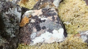
Old lichen upon the cairn-stones

Old lichen upon the cairn-stones

Of mosses and lichens hereon...

Of mosses and lichens hereon…

Much of the length of the cairn is very overgrown in a living repertoire of medicinal mosses and lichens which, of themselves, are centuries old in places.  Their profusion is a great indicator, not only of the cleanliness of the air betrayed in the cities of homo-profanus, but also a telling sign that visitors to this distant realm are few and far between.  Tis a beautiful site in a spectacular ancient arena…

…to be continued…

Folklore

There is great superstition amongst some locals even today that this immense cairn should not be tampered with and it is said to be haunted.

References:

  1. Gourley, Robert, Sutherland: An Archaeological Guide, Birlinn: Edinburgh 1996.
  2. Henshall, Audrey S., The Chambered Tombs of Scotland – volume 1, Edinburgh University Press 1963.
  3. Henshall, Audrey S., “The Distant Past,” in The Sutherland Book (edited by Donald Omand), Northern Times: Golspie 1991.
  4. Henshall, Audrey S., The Chambered Cairns of Sutherland, Edinburgh University Press 1995.
  5. Horsburgh, James, Notes of Cromlechs, Duns, Hut-circles, Chambered Cairns and other Remains, in the County of Sutherland“, in Proceedings Society of Antiquaries, Scotland, volume 7, 1870
  6. Lelong, Olivia C., “Writing People into the Landscape: Approaches to the Archaeology of Badenoch and Strathnaver,” University of Glasgow 2002.
  7. Mackie, Euan W., Scotland: An Archaeological Guide, Faber: London 1975.
  8. o’ Reilly, Kevin & Crockford, Ashley, What to See Around Bettyhill, privately printed 2009.
  9. Royal Commission on Ancient & Historical Monuments, Scotland, Second report and inventory of monuments and constructions in the county of Sutherland. HMSO: Edinburgh 1911.
  10. Stuart, John, “Report to the Committee of the Society of Antiquaries of Scotland, Appointed to Arrange for the Application of a Fund Left by the Late Mr A. Henry Rhind, for Excavating Early Remains,” in Proceedings Society of Antiquaries, Scotland, volume 7, 1870
  11. Stuart, John, “Notice of Excavations in Cairns in Strathnaver, Sutherlandshire,” in Proceedings Society of Antiquaries, Scotland, volume 10, 1874.

Acknowledgements:  Huge thanks to the beautiful Aisha Domleo for not only getting me up here, but also for the use of photos in this site profile.

© Paul BennettThe Northern Antiquarian

Mercat Cross, Clackmannan, Clackmannanshire

Cross:  OS Grid Reference – NS 91109 91890

Also Known as:

  1. Burgh Cross
  2. Canmore ID 48318
  3. Clackmannan Cross
  4. Market Cross
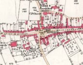
Cross on the 1886 map

Getting Here

Take the A907 road between Alloa and Kincardine, and up the B910 into Clackmannan.  To get into the village, depending on which route you’re heading in, go up the Kirk Wynd or the Cattle Market—both of which lead you to the Main Street where, right next to the huge erection known as the Stone of Mannan you’ll see the old Cross on its steps.Getting Here

Archaeology & History

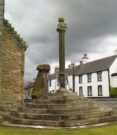
When the Royal Commission (1933) lads wrote about the site in their early survey, they called it the Burgh Cross, telling:Found in association with the village Tolbooth and the more famous Stone of Mannan, this probable 16th century cross stands at the meeting of the four lanes at the centre of the village in the heart of Clackmannanshire.  It was the focal point of an annual market fair which, said Craig Mair (1988), “could last up to eight days”.  It was the meeting place of local villagers where legal issues were called and settled, where bonds and deeds were made and, in all probability, replaced an earlier non-christian monument.

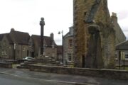
The Mercat Cross
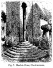
Millers 1889 sketch

“Although the stepped base has been renewed, the shaft is original.  It is 9 feet 6 inches in height and is octagonal in section, measuring 11 inches in diameter.  The capital is moulded and has on the east side a shield enclosed by swags and bearing a saltire and chief, for Bruce.  A second shield, carved on the west side, has apparently been similarly charged, but is now very weatherworn.  The ball finial on the capital was removed in 1857, but replaced in 1897.”

The reference to the chief, Bruce, is said by tradition to be that of Robert the Bruce.  This element in the cross’ history has been transposed mistakenly by early english writers onto the adjacent Stone of Mannan.

Cross & Mannan’s Stone

In recent times both the cross and the Stone of Mannan were repaired, at a staggering cost of £160,000.  How the hell it cost that much is anybody’s guess – but it certainly sounds as if someone’s pockets would have been bulging!

References:

  1. Mair, Craig, Mercat Cross and Tolbooth, John Donald: Edinburgh 1988.
  2. Royal Commission on the Ancient & Historical Monuments, Scotland, Inventory of Monuments and Constructions in the Counties of Fife, Kinross and Clackmannan, HMSO: Edinburgh 1933.
  3. Royal Commission on the Ancient & Historical Monuments, Scotland, The Archaeological Sites and Monuments of Clackmannan District and Falkirk District, Society of Antiquaries of Scotland 1978.
  4. Simpkins, John Ewart, County Folklore – volume VII: Examples of Printed Folk-Lore Concerning Fife, with some Notes on Clackmannan and Kinross-Shires, Folk-Lore Society: London 1914.
  5. Small, John W., Scottish Market Crosses, Eneas Mackay: Stirling 1900.

© Paul BennettThe Northern Antiquarian


Toad Stones, Baildon Moor, West Yorkshire

Ring Cairn:  OS Grid Reference – SE 1305 4004

Getting Here

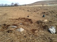
Much overgrown Toad Stones ring

Much overgrown Toad Stones ring

From the double-ring that is the Brackenhall Circle at Shipley Glen, go up the road towards the hills and seek out the cup-marked Glovershaw Quarry Stone.  Shortly before this, notice the small trees close the quarry edge.  From here, walk straight east, as if you’re going toward Baildon Hill.  Barely 10 yards into the bracken you’ll notice this small ring of stones (best looked for in winter before the bracken grows back – otherwise you’ve no chance!).

Archaeology & History

This site was explored when James Elkington, Paul Hornby and I came across it on Wednesday, 11 March 2015, after returning from a short excursion to look at some of the petroglyphs on Baildon Hill.

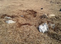
Ostensibly it is a small ring of stones comprising of at least 7 large rocks that are set deeply into the peat and bracken-mass, with a small eighth movable stone on the northern side.  It seemed likely that another, larger rock was beneath this small portable rock, but we didn’t dig into the vegetative mound to explore this.  The most curious thing about the ring of stones was that it measured barely 4 yards in diameter.  My initial thought was that this was a previously unrecorded cairn, but there seemed to be no internal mass of rocks in the centre that characterize such monuments and which you’d expect in a ring of this size – meaning that it may be, perhaps, the smallest stone circle in Britain.  It’s a pretty good contender at least! (the stone circle known as “Circle 275” at Penmaenmawr in Wales is of similar size to this one, but with less stones in that ring)

Close-up of the stones

Close-up of the stones

It would be good if the regional archaeologists could give this site their attention and clean it up to see exactly what lays beneath the boscage.  Close by are several cup-marked stones and a couple of other larger cairn circles.

The name of the site came after I almost stood on a hibernating toad, found beneath the bracken-mass right at the edge of one of the stones.  I carefully picked him up and reburied him in another spot close by, leaving him (perhaps) to ponder his venture into the bright daylight of consciousness!  Mr Hornby promptly declared – “these are the Toad Stones!” – and it stuck.

© Paul BennettThe Northern Antiquarian


Slack Bottom Stone, Heptonstall, West Yorkshire

Standing Stone:  OS Grid Reference – SD 98374 28800

Also Known as:

  1. Dawson City Field Stone

Getting Here

Go all the way up and through Heptonstall village until you reach the hamlet of Slack, by the road junction.  From here walk down the road as if you’re going back into Hebden for less than 200 yards, then take the footpath on the left downhill and walk along. After a couple of stiles, keep a keen eye on the walling where the holly trees are, above the tree-line of Hardcastle Crags.  You’ll see it soon enough!

Archaeology & History

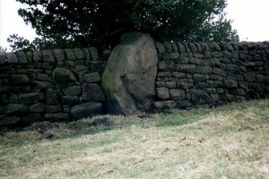
Slack Bottom stone

Arguably the best-named standing stone in Britain, it was first discovered by Absalom Voist in the late 1990s (and first described in my Old Stones of Elmet), hiding away in the more modern walling, beneath a holly tree.  But the stone itself is very nicely eroded and seems of good age, aswell as being a good near-six-foot tall specimen of a standing stone, just above the tree-line south of Hebden Dale.  The stone gets its name from the fact that it’s at the bottom end of Slack village (which is actually called ‘Slack Bottom’ – with a house-sign there above the door to prove it!).  It may be part of what was originally some original Iron Age walling instead of an authentic standing stone — tis hard to say really — but it’s a nice stone nonetheless.  David Shepherd (2003) named this stone as ‘Dawson City Field’ in his later survey of megaliths in upper Calderdale.

Not far from here, along the edge of the woodland, is the little-known remains of an old cross-base which I think has eluded all previous surveys.  Next time I’m up here, I’ll try remember to get some photos of the place!

References:

  1. Bennett, Paul, The Old Stones of Elmet, Capall Bann: Milverton 2001.
  2. Shepherd, David, ‘Prehistoric Activity in the Central South Pennines,’ in Proc. Halifax Ant. Soc., 2003.

© Paul BennettThe Northern Antiquarian


Reap’s Cross, Heptonstall Moor, West Yorkshire

Cross:  OS Grid Reference – SD 94360 30269

Also Known as:

  1. Long Stoop
  2. Ralph’s Cross

Getting Here

Reaps Cross on 1851 OS-map

Reaps Cross on 1851 OS-map

From Hebden Bridge go up the Heptonstall road, going round the village and onto and through Slack, keeping straight on the road until it goes uphill for a short distance, then levels out; then watch out for the small right-turn at Colden and the single-track road heading to a dead-end.  Go right to the end, the very end, and go through the gate and walk up the track onto the moor.  As you reach the ridge and the moorlands open up before you, note the small ‘standing stone’ on your right, about 10 yards off-path— and there, 100 yards the opposite direction to your west, the tall upright Reaps Cross is sat on the moortop.  Y’ can’t miss it!

Archaeology & History

Found in the middle of a beautiful nowhere not far from the prehistoric standing stone on Standing Stone Hill, this old tall monolith was said to have stood as a marker beside the old road which ran from Halifax over the moors to Colne, until the more recent Widdop Road became the more preferred route.  Known locally as the Long Stoop, in 1900 George Tyack said of it,

“This stone, which is composed of millstone grit, lay for a long tine broken and overthrown, but has in recent years been replaced on its original site and restored.  It is a simple Latin cross standing twelve feet high amidst the heather of the Yorkshire moors.”

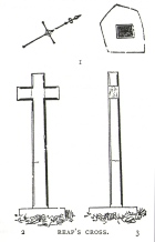
Longbottom's 1897 sketch

Longbottom’s 1897 sketch

Waddington's 1884 sketch

Waddington’s 1884 sketch

Shortly before Tyack’s description, the local historian John Longbottom (1897) wrote a series of articles on the old stone crosses of the region and gave us this old sketch of the site (right).  Even in his day the cross had been “wilfully thrown down” (probably by the screwy Puritans at that time), but a short time later it had been “repaired and restored to its original position.”  In Longbottom’s day there were short ‘arms’ extending outwards from near the top of the obelisk, defining it as a distinct ‘cross’, but these have subsequently been lost following further local demolition attempts. He told how,

“Reaps Cross is known locally to shepherds, gamekeepers and farmers at ‘T’ Long Stoop’, and…apart from its religious associations, it forms an important landmark, now as in ancient times, to many a poor weary traveller crossing the dreary and lonesome hills between Lancashire and Yorkshire.”

The cross keeps getting knocked over, by both lightning and idiots of various persuasions; but thankfully the old fella keeps getting resurrected and put back in its place. It’s history is a curious one.  When Clifford Byrne (1974) wrote about the site in his unpublished survey, he told how

“This cross appears to be of medieval origin and…in 1973 the monolith lay broken, one section lying in the grass, whilst the other section still stood in the pedestal.  It is seen to have been broken once before, for the remains of iron clamps are seen on both sections.  The arms have been broken off in some age… A local farmer insisted that the correct name was Ralphs Cross not Reaps Cross, and it should be noted that a section of moor at Widdop (the valley with the high cliffs) is named after a Ralph.”

Standing some 12 feet tall, this is the highest of all the crosses in West Yorkshire and obviously some considerable work went into its creation all those centuries ago.  Nobody is sure when it was first made, but the educated guess is 12th century.  Why it was erected here, way off from anywhere in the middle of the wild moors, is equally puzzling.  It may have had something to do with the nearby medicinal springs; it may have been as a guide-post to travellers—”to Rastric Greave”, according to Waddington (1884); it may have marked an ancient religious route; or it may have distracted people away from the prehistoric upright that gave its name to Standing Stone Hill, a short distance to the west  We simply don’t know.  It’s well worth visiting though, as the moorland landscape up here is truly expansive and civilization seems thankfully centuries away…

Folklore

Local tradition told that the cross marked an old corpse route, along which the dead were carried before being buried at Heptonstall.  Here at Reaps Cross, the bodies were rested by the weary travellers.  If this is true, it is probable that the ancient standing stone more than half-a-mile to the west once had something to do with such old rites and routes.

References:

  1. Bennett, Paul, The Old Stones of Elmet, Capall Bann: Milverton 2001.
  2. Byrne, Clifford, A Survey of the Ancient Wayside Crosses in North-East Lancashire, unpublished MS, 1974.
  3. Longbottom, John, “Ancient Crosses in Halifax Parish – Part 2,” in Halifax Naturalist, 2:8, June 1897.
  4. Taylor, Henry, The Ancient Crosses and Holy Wells of Lancashire, Sherratt & Hughes: Manchester 1906.
  5. Tyack, George, The Cross in Ritual, Architecture and Art, William Andrews: London 1900.
  6. Waddington, J. Arthur, “The Crosses in and Around Burnley,” in Transactions of the Burnley Literary & Scientific Club, volume 1, 1884.

© Paul BennettThe Northern Antiquarian


Gray Stone, Burley, Leeds, West Yorkshire

Legendary Rock:  OS Grid Reference – SE 28659 34229

Also Known as:

  1. Giant’s Stone

Getting Here

Originally located at SE 28449 34364, the site is now to be found halfway along Westfield Road, where it meets up with Hollis Place, along the footpath at the back of the school, set back against the walling.  A plaque by the rock kinda gives the game away!

Archaeology & History

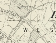
Gray Stone on 1852 map

Gray Stone on 1852 map

The large vandalised stone you see here—sprayed-painted quite eloquently it has to be said!—is apparently a replica of the old stone which could once be found about 300 yards northwest of here.  Typifying stones of this name—graygrey and variants thereof—the original Gray Stone was an old boundary marker (Smith 1956), and the last reference to it as an archaeological site was by James Wardell (1853), who even in his day said that it was “almost buried in the ground, on the Burley Road.” It is shown on the first OS-map by the roadside, close to the junction of Woodside View and Burley Road, but was said to have been removed at the beginning of the 20th century and moved to its new and present position.  However, somewhere along the line, the original stone has been destroyed and the thing that we see today has taken its place.

The original Gray Stone may have been a standing stone, but we cannot be certain about this.  The present boulder stands about four feet tall and is a rather fat-looking standing stone. You can just about squeeze round the back of it, around which is an incised line which cuts around the stone – but this obviously quite modern. A plaque stands in front of the stone, telling its brief history.  (if anyone can send us some photos of the site that would be great – I’ve gone and lost mine, somehow!)

Folklore

A creation myth of this site tells it to have been made by a giant, who threw the Gray Stone from the appropriately named Giant’s Hill (a supposed old camp, now destroyed), less than a mile southeast of here: an alignment which corresponds closely to the midsummer sunrise. In throwing it, he was said to have left the indentations of his finger-marks in the rock – thought to have been cup-markings.  Examples of other cup-and-ring stones occur a short distance west, at Kirkstall.

References:

  1. Bennett, Paul, The Old Stones of Elmet, Capall Bann: Milverton 2001.
  2. Smith, A.H., English Place-Name Elements – 2 volumes, Cambridge University Press 1956.
  3. Wardell, James, The Antiquities of the Borough of Leeds, John Russell Smith: London 1853.

© Paul BennettThe Northern Antiquarian


Gomersal Maypole, West Yorkshire

Maypole (destroyed):  OS Grid Reference – SE 2068 2672

Archaeology & History

As in countless villages and towns across the British Isles, Gomersal also once had its maypole near or at the village centre.  We don’t know when the first maypole was erected in the village and many local sites were openly destroyed by rampant christian puritans and similar idiots.  It stood not far from the Moor Lane Well and was described by the regional historian H.A. Cadman (1930), who told:

“The Maypole was at the top of Moor Lane and one can imagine the welkin echoing to the very old song:

‘Come lasses and lads take leave of your dads
And away to the maypole hie.
For every fair has a sweetheart there
And the fiddlers standing by.
For Willy shall dance with Jane
And Johnny has got his Joan.
To trip it, trip it, trip it, trip it,
Trip it up and down.’

Yet as with maypoles up and down the land, testosterone-fuelled Springtime fall-outs happened.  Mr Cadman told:

“Very often May Day gatherings ended up with fights.  Great jealousy always existed between the inhabitants of Great Gomersal, Little Gomersal and Spen.  There is a tradition which has been handed down that the last Maypole in this district stood on Liversedge Green.  This Maypole was demolished in a fight by the Gomersalians and there is a similar tradition about the Maypole on Cleckheaton Green, so as Mr Frank Peel says, “It is evident that ancient inhabitants of Gomersal were more pugnacious than their neighbours.”  I have no evidence when the Gomersal Maypole ceased to exist, but there is abundant evidence to prove that there was one in Gomersal, the proof being that the vane is now in Batley Museum.  It is in the form of a fish.”

If anyone has any further information on this important relic, or its history, please let us know.

References:

  1. Cadman, H. Ashwell, Gomersal, Past and Present, Hunters Armley: Leeds 1930.

© Paul BennettThe Northern Antiquarian


Abbey Craig, Stirling, Stirlingshire

Hillfort:  OS Grid Reference – NS 8094 9566

Also Known as:

  1. Canmore ID 47113
  2. Wallace Monument Fort

Getting Here

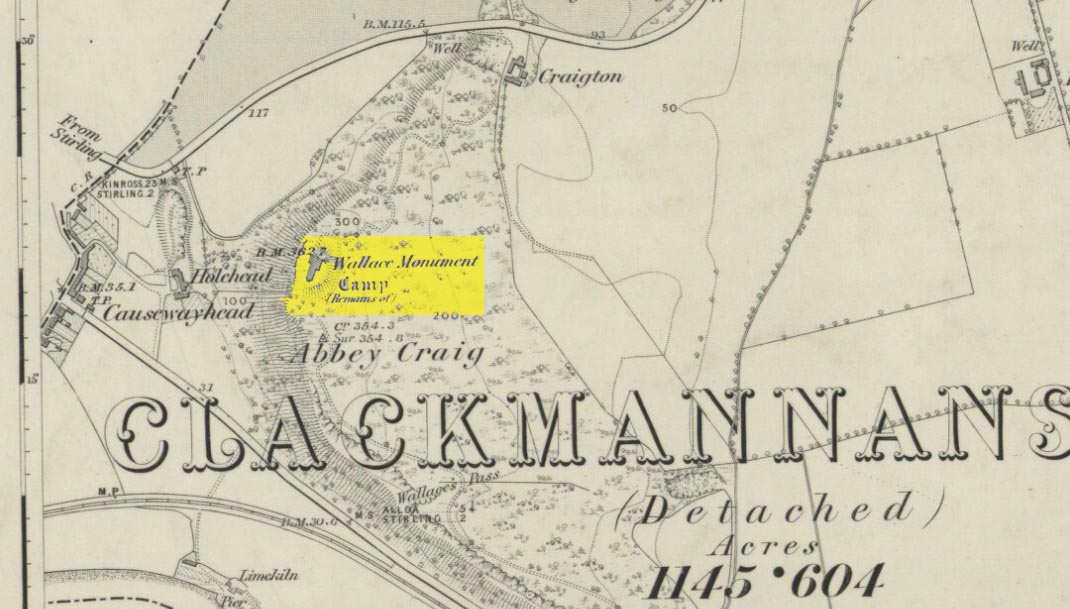
Abbey Craig on 1866 map

Most folk visiting here are coming from Stirling city.  There are various buses to get here, which head out over Stirling Bridge along Causewayhead Road (the A9) for half-a-mile where, at the roundabout and the William Wallace pub, go straight across up the minor road, zigzagging back on itself, until you reach the signs for the Wallace Monument.  Follow the well-defined footpath and, once on top of the hill, walk round the back of the mightily impressive tower.

Archaeology & History

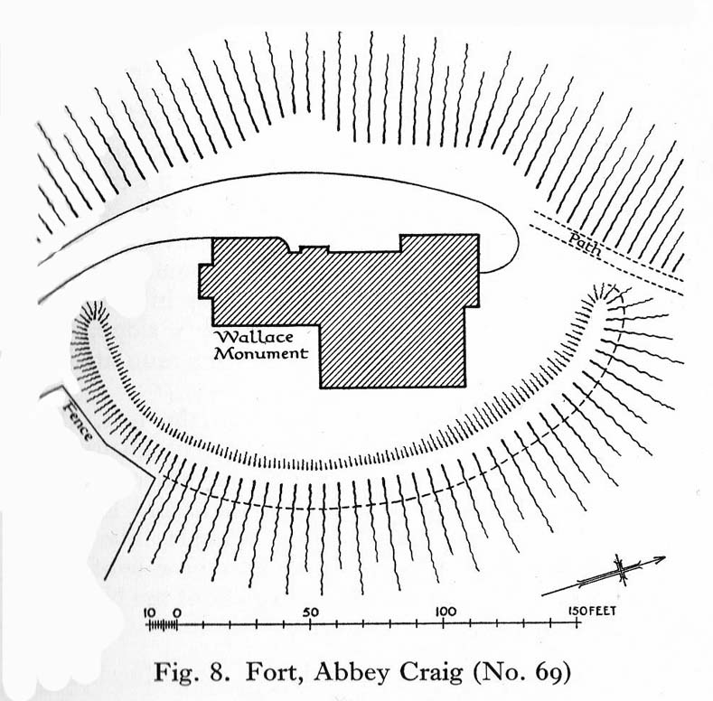
Located right where the impressive Wallace Monument proudly stands, this prehistoric precursor to Sir William Wallace’s memory was where Scotland’s legendary hero and his men cast a clear and easy view over Bannockburn, where the halfwit english came for a fight—and deservedly lost!   The structures that used to be inside the now denuded hillfort would, no doubt, have been used by Wallace’s men; but much of those prehistoric remains have now been destroyed.  The visible remains of the fort can be seen round the back of the Wallace Monument: elongated rises of overgrown walling that run almost all the way round, getting slightly higher as you approach the more northern edges, like a semi-circular enclosure.

Royal Commission plan
Abbey Craig – and the great Wallace Monument

The site was described very briefly in William Nimmo’s (1880) early survey of the area, where he told that in 1784, “eleven brazen spears were found on the Abbey Craig, by a Mr Harley”, which he thought came from the time when the earlier ‘castle’ stood here.  He was probably right.  Many years later, the prehistoric remains were included in the county survey of archaeological sites by the Royal Commission lads (1963), who told that, near the north end of the summit of Abbey Craig,

“there is a fort which has been damaged by the construction within it of the Wallace Monument.  All that remains is a substantial turf-covered bank, cresentic on plan and 260ft in length, the ends of which lie close to the brink of the precipice that forms the west face of the hill.  The bank stands to a maximum height of 5ft above the level of the interior and presumably represents a ruined timber-laced wall, since numerous pieces of vitrified stone have been found on the slopes immediately below it.

The entrance to the fort presumably lay between one end of the bank and the lip of the precipice, but both the areas concerned have been disturbed by the construction of the modern approaches.  The interior of the fort measures about 175ft from north to south, by about 125ft transversely and the interior is featureless.”

The fort was probably built sometime in the early Iron Age; so the next time you visit this fine spot, check the remains out round the back of the tower—and remember that our ancestors were living up here 2500 years ago!

References:

  1. Aitchison, N.B., “Abbey Craig Rampart’, in Discovery & Excavation, Scotland, 1981.
  2. Feacham, Richard W., Guide to Prehistoric Scotland, Batsford: London 1977.
  3. Hogg, A.H.A., British Hill-Forts: An Index, BAR: Oxford 1979.
  4. Nimmo, William, The History of Stirlingshire – volume 1 (3rd edition), T.D. Morison: London 1880.
  5. Royal Commission on the Ancient & Historical Monuments Scotland, Stirling –  volume 1, HMSO: Edinburgh 1963.
  6. Royal Commission on the Ancient & Historical Monuments of Scotland, Archaeological Sites and Monuments of Stirling District, Central Region, Society of Antiquaries of Scotland 1979.

© Paul Bennett, The Northern Antiquarian

Bury Lane (east), East Morton, West Yorkshire

Cup-Marked Stone:  OS Grid Reference – SE 09373 42410

Also Known as:

  1. Carving 51 (Hedges)
  2. Carving 91 (Boughey & Vickerman)

Getting Here

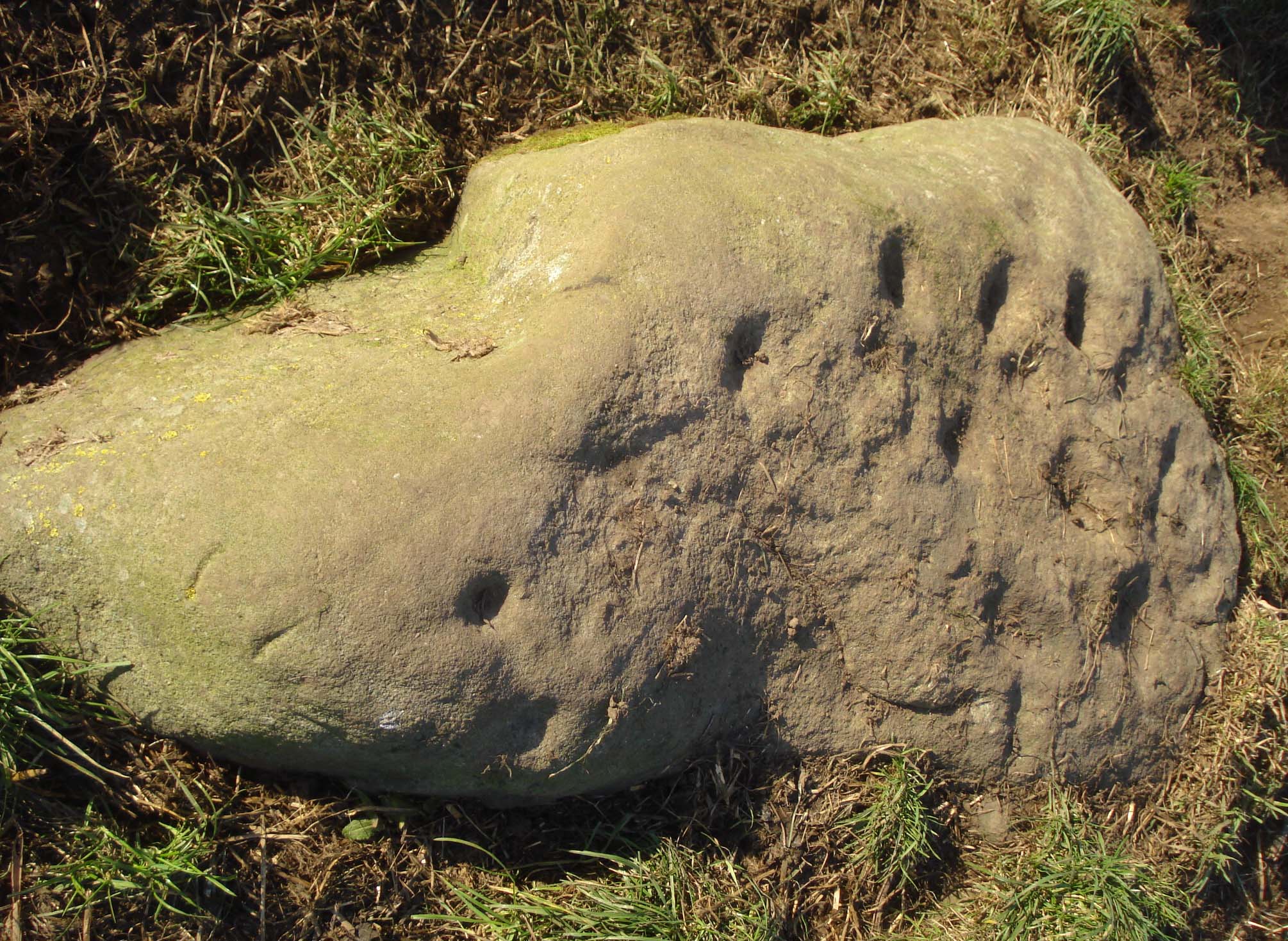
Cup-marked stone, East Morton (photo thanks, Sue Patchett)

From the expanding village of East Morton, by the school at the west-end of the village, walk up the narrow Street Lane for nearly 600 yards, past the houses, until you reach a footpath on your left that takes you across the fields.  Walk along here (following the line of walling) for 250 yards, then, take a sharp left and down the field for 55 yards (50m) until, right beneath the power lines, you’ll find the rock in question.

Archaeology & History

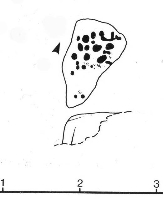
This is one in a small, little-known cluster of  petroglyphs on the western outskirts of East Morton.  It is located at the base of what are thought to be remnants of Iron Age walling.  Carved onto an elongated earthfast stone are a number of very well-preserved cup-marks, with what seems to be a faint carved pecked line running out from one of the southernmost cup-marks and curving back on itself (we could do with a good sketch artist getting us a good drawing of this).  You can see this faint line on the far-left side of the stone in Sue’s photo above.

Hedges 1986 sketch

The petroglyph was rediscovered by the northern antiquarian Stuart Feather (1959) in one of his many sojourns exploring the prehistoric remains of the area.  In John Hedges’ (1986) survey, the carving was described simply as:

“Triangular smooth grit rock with fairly flat top on which are twenty cups, not all clear, some large and oval, a few grooves.”

Boughey & Vickerman’s survey (2003) made no note of any  additional features on the petroglyph.

References:

  1. Boughey, Keith & Vickerman, E.A., Prehistoric Rock Art of the West Riding, WYAS: Wakefield 2003.
  2. Feather, Stuart, “Bronze Age Rock Carvings,” in Keighley News, March 7, 1959.
  3. Hedges, John (ed.), The Carved Rocks on Rombalds Moor, WYMCC: Wakefield 1986.
  4. Jackson, Sidney, “Massive Walling at East Morton,” in Cartwright Hall Archaeology Group Bulletin, 5:9, 1960.
  5. Jackson, Sidney, “East Morton Ancient Walls,” in Cartwright Hall Archaeology Group Bulletin, 6:9, 1961.

Acknowledgements:  Huge thanks to Sue Patchett for use of her photo.  

© Paul Bennett, The Northern Antiquarian 


Town Cross, Alloa, Clackmannanshire

Cross:  OS Grid Reference – NS 88559 92686

Also Known as:

  1. Burgh Cross
  2. Canmore ID 47169
  3. Market Cross
  4. Mercat Cross

Getting Here

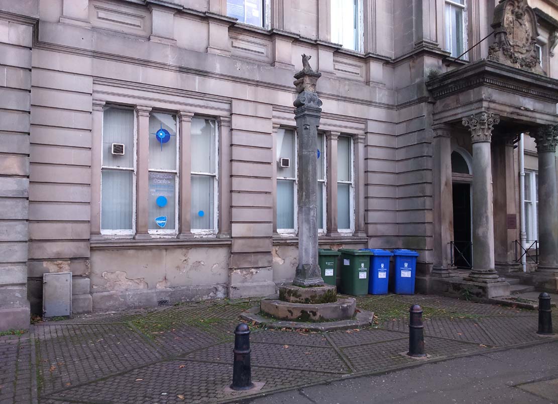
Alloa Cross, Bank Street

Get into the small town of Alloa, where the buses stand at Shillinghill.  From here walk southwest down Mill Street, which runs into Bank Street.  Keep your eyes peeled on your right-hand side, where outside one of the old municipal buildings you’ll see it standing upright.

Archaeology & History

Although now standing against the old buildings halfway down Bank Street, Alloa’s Mercat or Burgh Cross was initially set up at the crossroads 162 yards (148m) away, where Mar Street meets Mill Street and Bank Street.  It was moved to its present position sometime in the 1880s and knowledge of its early history is scant.

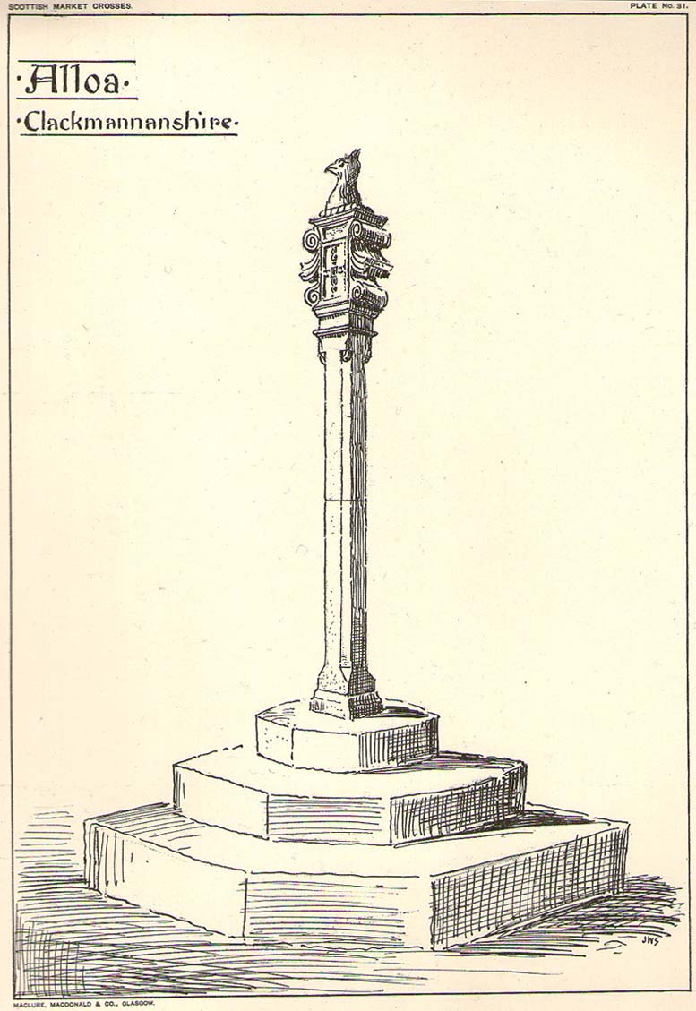
John Small’s sketch of Alloa Cross

Standing some 10 feet tall, the monument was described in John Small’s (1900) rare magnum opus, where he details the architectural features of the monument, telling:

“The shaft, which rests on a base and three steps, is of the usual square section, with splayed angles, stoped at top and bottom, the top stop being rather peculiar.  The head of the Cross is composed of an oblong stone set upright, characteristic of the late type seen in Keikleour and Kinrossie.  The oblong is ornamented at the sides with debased volutes and acanthus leaves, the whole crowned by a wreath from which rises a griffin’s head, part of the supporters of the Arms of the Lords of the Manor, Lord Mar and Kellie.”

References:

  1. Anonymous, The Alloa Illustrated Family Almanac, MacGregor & Steedman: Alloa 1887.
  2. Mair, Craig, Mercat Cross and Tolbooth, John Donald: Edinburgh 1988.
  3. Royal Commission on the Ancient & Historical Monuments, Scotland, Inventory of Monuments and Constructions in the Counties of Fife, Kinross and Clackmannan, HMSO: Edinburgh 1933.
  4. Small, John W., Scottish Market Crosses, Eneas Mackay: Stirling 1900.

© Paul BennettThe Northern Antiquarian