Giant’s Grave, Cloghfin, County Donegal

Chambered Cairn (destroyed):  OS Grid Reference – H 277 998

Archaeology & History

Included in Eamon Cody’s (2002) magnum opus, this site has long since gone.  It was highlighted on the 1845-47 OS-map of the area and the only subsequent information about it was written in the 1903 Ordnance Survey Name Book, where it was described as a “supposed Giant’s Grave” that was marked by a large spread of boulders.

Perhaps the only thing we can ascertain here is from the name Giant’s Grave.  Invariably, giants are part and parcel of creation myths in early traditional societies.  Such giants, as well as being huge mythical creatures, can also be the progenitor of tribes and communities, i.e., the person who laid the initial foundation of where the tribe came to live, usually an early queen, king or shaman figure.  So, in the case of this Giant’s Grave, it was likely to have been known as the burial place of such a figure: mythical in importance as well as size.

References:

  1. Cody, Eamon, Survey of the Megalithic Tombs of Ireland: Volume VI – County Donegal, Duchas: Dublin 2002.

© Paul BennettThe Northern Antiquarian

Cloghcorr Stones, Claggan, Dunfanaghy, County Donegal

Chambered Cairn (destroyed):  OS Grid Reference – C 003 396

Archaeology & History

In unpublished Notebooks written by one Thomas Fagan during the years 1845-48 (held by the National Archives in Dublin), he wrote how a local man had told him of the existence of “a supposed Druid’s Altar” in Claggan township, but its precise location has never subsequently been established.  In Eamon Cody’s (2002) magnum opus he told what little we know about the place, saying,

“It stood on a slight rise adjoining Claggan Upper, the name assigned to a group of houses in the townland.  It was reportedly encircled by “a wall or parapet” and consisted of several large upright stones2-4 feet high and arranged in two rows of few feet apart with a pillar at either end.”

The structure had been completely destroyed just a few years before Fagan’s visit to the place and no further information of it has yet been uncovered.

References:

  1. Cody, Eamon, Survey of the Megalithic Tombs of Ireland: Volume VI – County Donegal, Duchas: Dublin 2002.

© Paul BennettThe Northern Antiquarian

St. Alkmund’s Well, Derby, Derbyshire

Holy Well:  OS Grid Reference – SK 351 371 

Geting Here

It can be found by taking North Street off Duffield Road (A6) continuing until it joins North Parade and here a little lane, called Well Street comes off and the spring is at the junction of this and Bath Street on the left hand side.

Archaeology & History

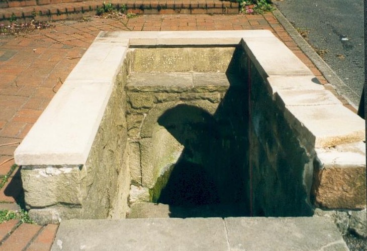
St. Alkmund's Well, Derby
St. Alkmund’s Well, Derby

First recorded in 1190 in a rental agreement but considering its association probably earlier. The well is dedicated to the Saxon saint who died 800 AD and whose tomb or shrine was located in church nearby (and is now located in the Derby Museum).  Little is recorded of its history however.

The well is below ground level with four steps to its water which flows with some force into an oval basin. A stone carving states its name. The plaque reads:

“Until the area was built up from 1814, the well was in a rural setting, part of St Helen‟s Park. The stone niche surrounding the well was built by the Rev Henry Cantrell in the early 18th century”.

It now sits rather incongruously in an area of urban landscape,  an odd juxtaposition amongst the older houses and tower blocks still exists, but is often prone to vandalism. and has suffered from it. Well dressings were discontinued due to vandalism and it was blocked off my tall metal fencing for a period recently. Now it is surrounded by a small wall and black railings which has blocked access but will protect it.

Folklore

Cox (1875–9) records that a vicar of S. Werburgh’s was cured of his low consumption, after constantly drinking its water, although the sign It has been traditionally dressed, revived in 1870 and continued infrequently until 1993, stopping because the boards were thoughtlessly vandalised. The demolishing of the St. Alkmund’s Church in the 1960s for road widening stopped the tradition of processing to the well. I was told by a local elderly lady that she still drank the water and that it was very pure…I was not sure myself!

References:

  1. Parish, R.B, (2010) Holy Wells and Healing Springs of Nottinghamshire

Copyright © Pixyled Publications


Mudbeck 2, Arkengarthdale Moor, North Yorkshire

Cup-Marked Stone:  OS Grid Reference – NY 95274 07728

Also Known as:

  1. MUD S2

Archaeology & History

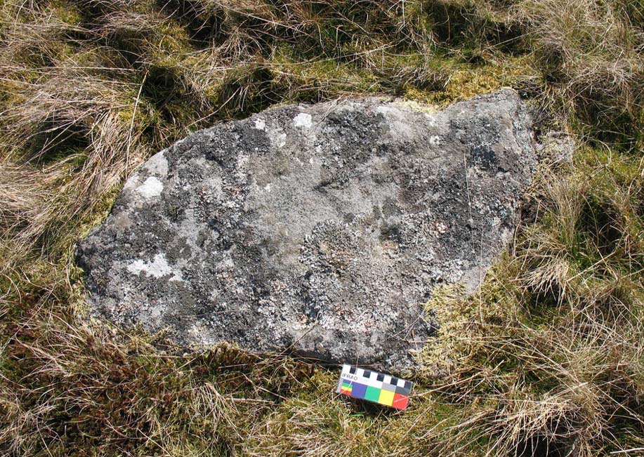
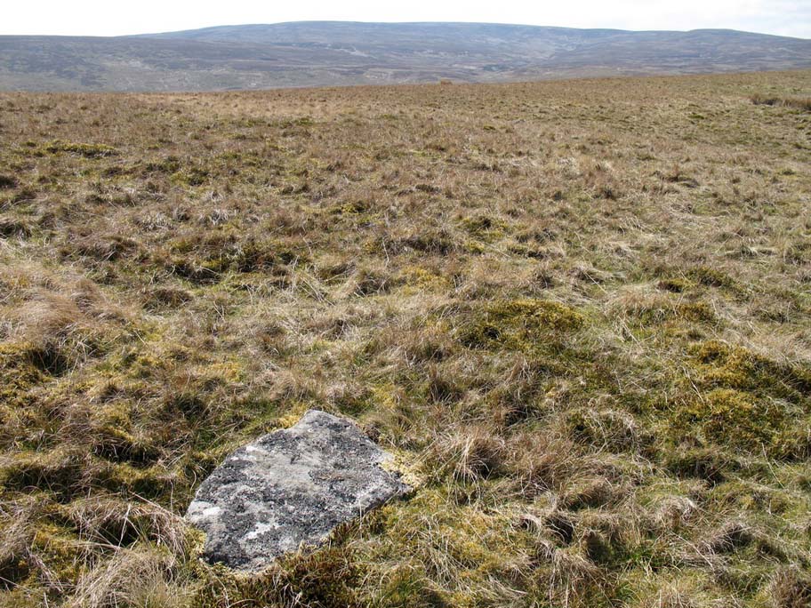
This small, simple cup-marked stone is found close to the small Mudbeck stone circle.  Consisting of just four shallow cup-marks almost running in an arc formation, the site was first discovered by Tim Laurie in the late 1990s.  I’ve not been to this place so rely on the photos kindly sent me by Richard Stroud, and the description of the place by Paul Brown (2008), where he told:

Close-up of 4 cups (courtesy Richard Stroud)
Mudbeck 2 in the landscape (courtesy Richard Stroud)

“On the crest of a ridge some 50m south-west of Mudbeck a scatter of small boulders form an indistinct ring-shape and a cup-marked boulder with four cups was discovered here by Tim Laurie.  It was suggested that the stone scatter represented the possible remains of a cairn that had at some point in its past been stripped of its stone for the construction of walling and sheepfolds in the area. ”

The only other cup-mark close by is one alleged to be on one of the small uprights in the Mudbeck circle (known as MUD S1 in Brown’s survey) – though I have to say that the “carving” is somewhat dubious to me.

References:

  1. Brown, Paul and Barbara, Prehistoric Rock Art in the Northern Dales, Tempus: Stroud 2008.

Acknowledgements:  Many thanks to Richard Stroud for use of the photos in this site profile.

© Paul Bennett, The Northern Antiquarian