Easiest way is to park up at the Askwith Moor car-park spot, turn right and walk along the road for about 350 yards until you reach the gate on the right (not the one across the road!). You then need to head to the Death Head’s Stone carving about 450 yards across the moor to the east. It’s pretty conspicuous. From here, walk through the heather 80-odd yards northwest. You’ll walk past some extensive rubble walling (whose nature yet eludes us) before you get there.
Archaeology & History
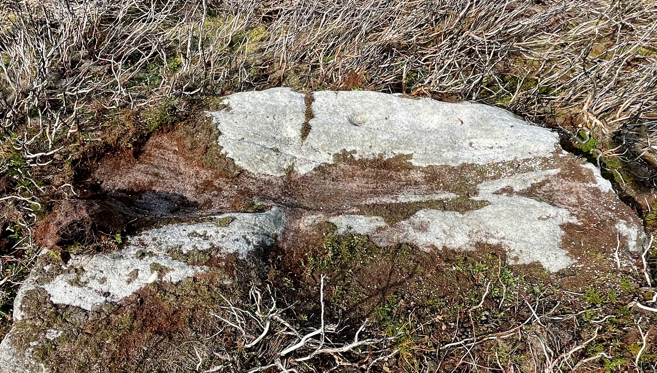
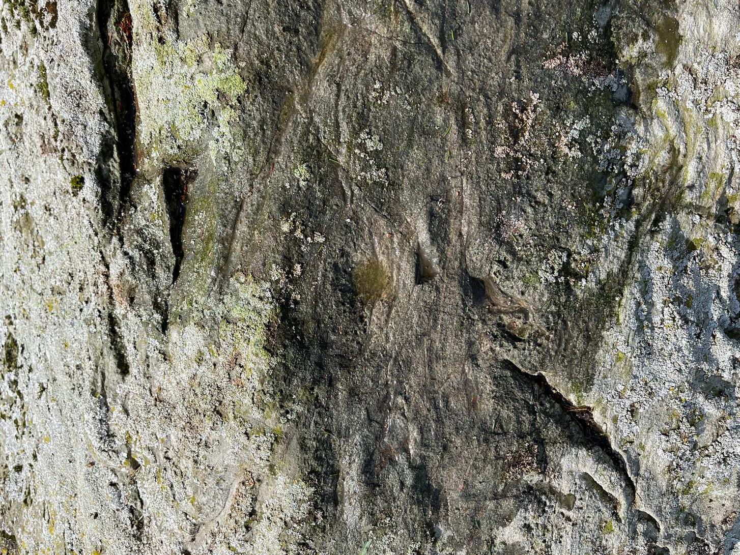
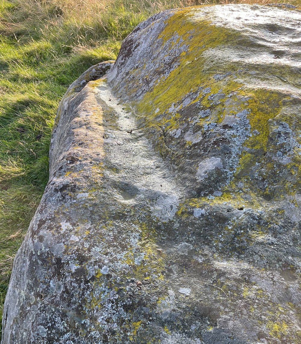
Looking down at the cups
Discovered recently by Sarah Walker on a venture to see the extensive settlement and graveyard around Snowden Crags, this petroglyph is a simple basic design cut into a relatively large flat stone just above ground level. Found less than 100 yards east of the dubious Snowden Carr (565)carving, there are two large cup-marks on this one: one of them is an inch deep and two-inches across and may originally have been geophysical in nature, but has subsequently been worked by human hands. To its side is another much fainter and shallower cup-mark about the same width. On some photos there’s what appears to be a very faint large ring surrounding the faint cup, but until visits are made at low sun and the stone brushed with water, we cannot be sure whether it’s real or just a trick of the light. There may be more cups on this stone beneath the peat. We didn’t brush it all off.
Some 30-40 yards to the east is the rubble of an extensive prehistoric man-made structure, the nature of which has yet to be discerned. The Snowden Moor cairnfield begins immediately to the northwest, with the first tomb barely 50 yards away.
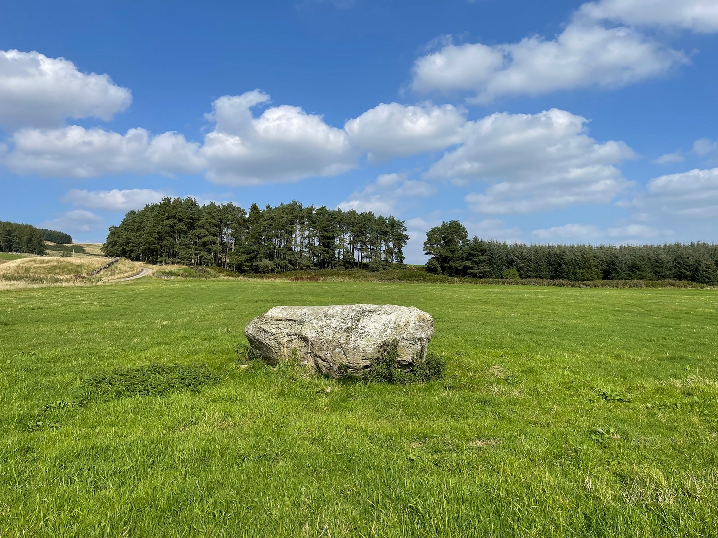
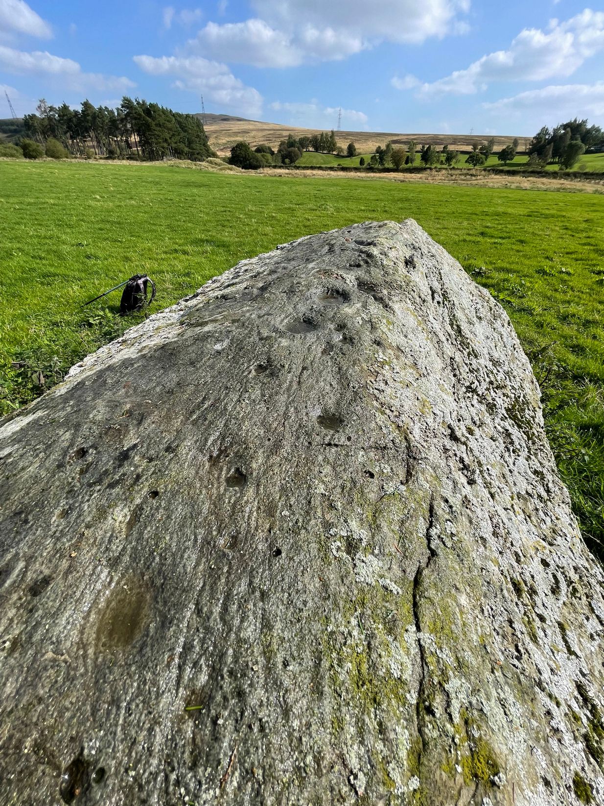
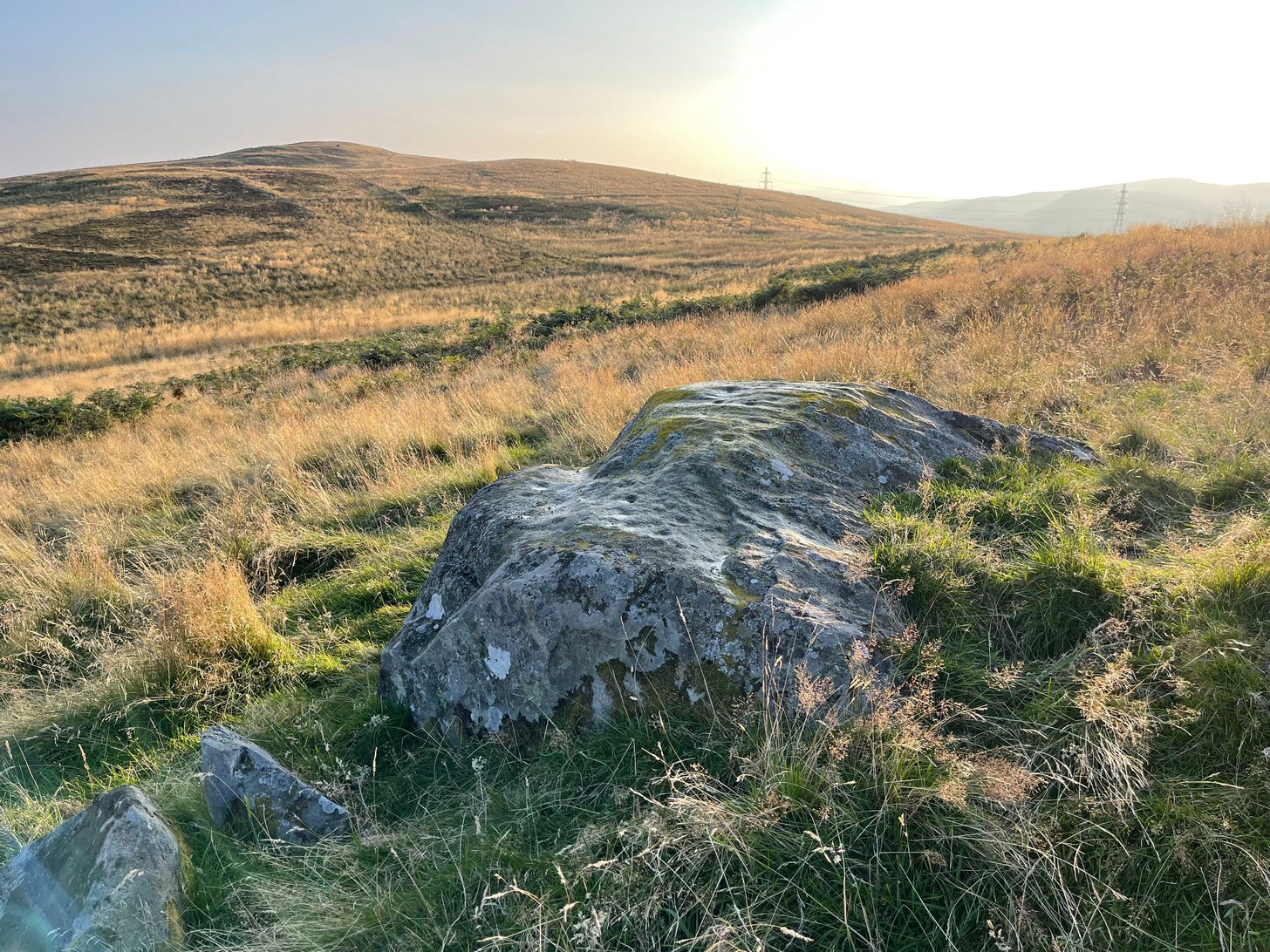
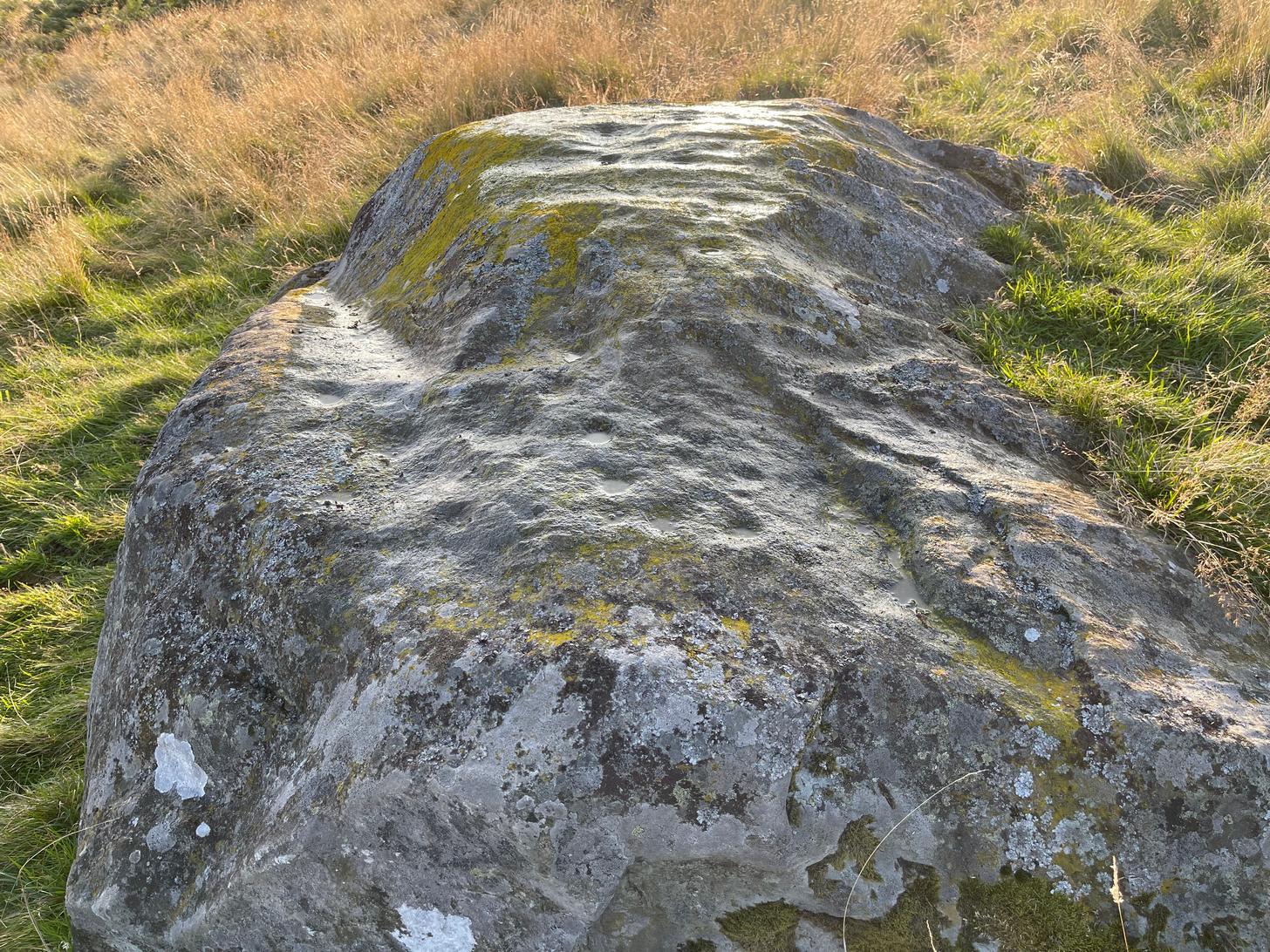
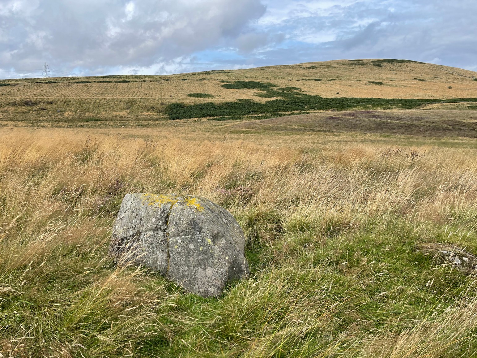
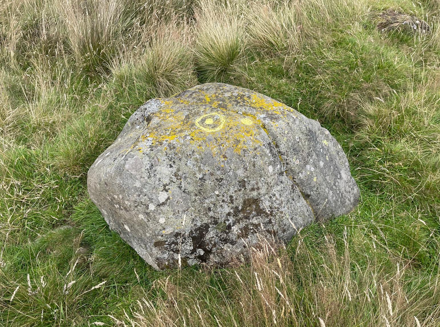
Take the A85 road east out of Crieff and after roughly 2 miles at Gilmerton, turn left up the A822 Dunkeld road. Go along here for nearly 2½ miles, where you’ll reach the Foulford golf course on the right-hand side of the road. Directly opposite the entrance into the golf course, a dirt-track leads you into the fields where, laying alone and standing out like a sore thumb about 300 yards away, you’ll see a large rounded boulder sitting there minding it’s own business. You can see it quite clearly from the roadside. Nice n’ easy.
Archaeology & History
For such a large conspicuous stone, you’d think there’d be quite a lot written about it as well as hope for a good ornate design—but alas!, both hopeful expectations are lacking. Although, as usual, there’s more to it than is described in the official records—although not much more….
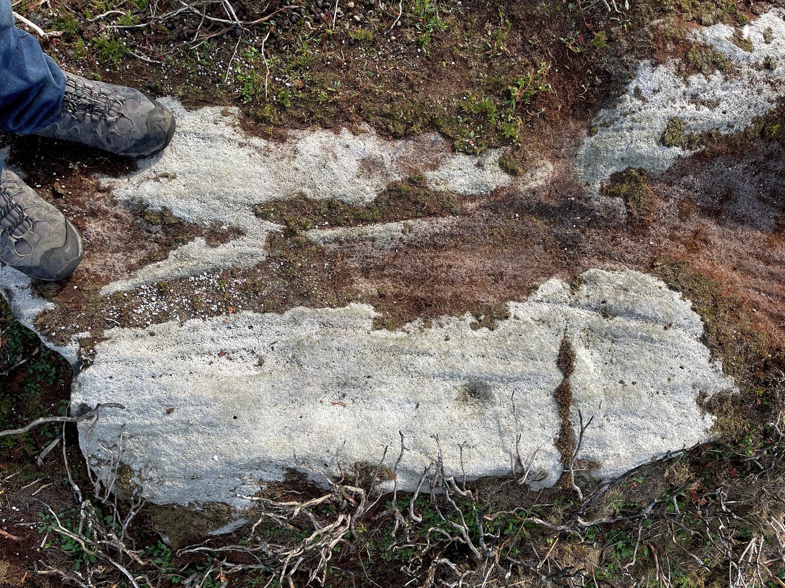
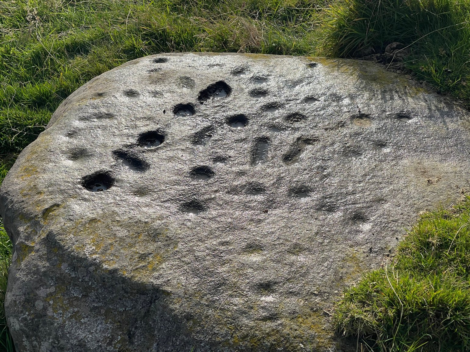
Long stone & its cupmarksCups along the spine
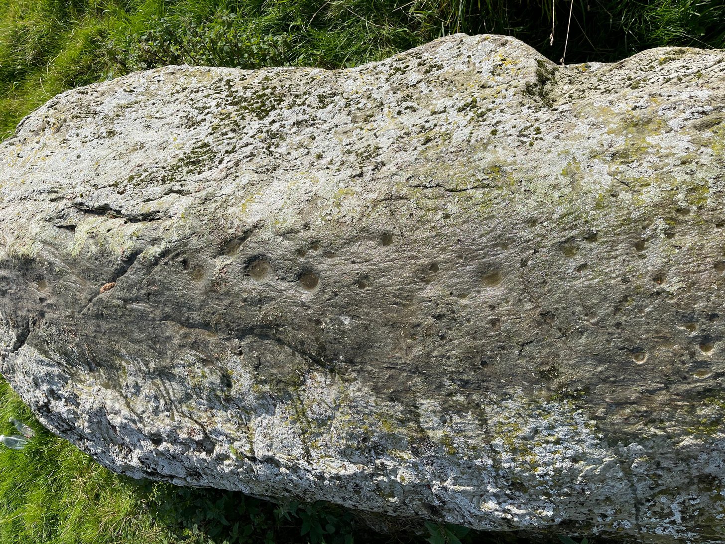
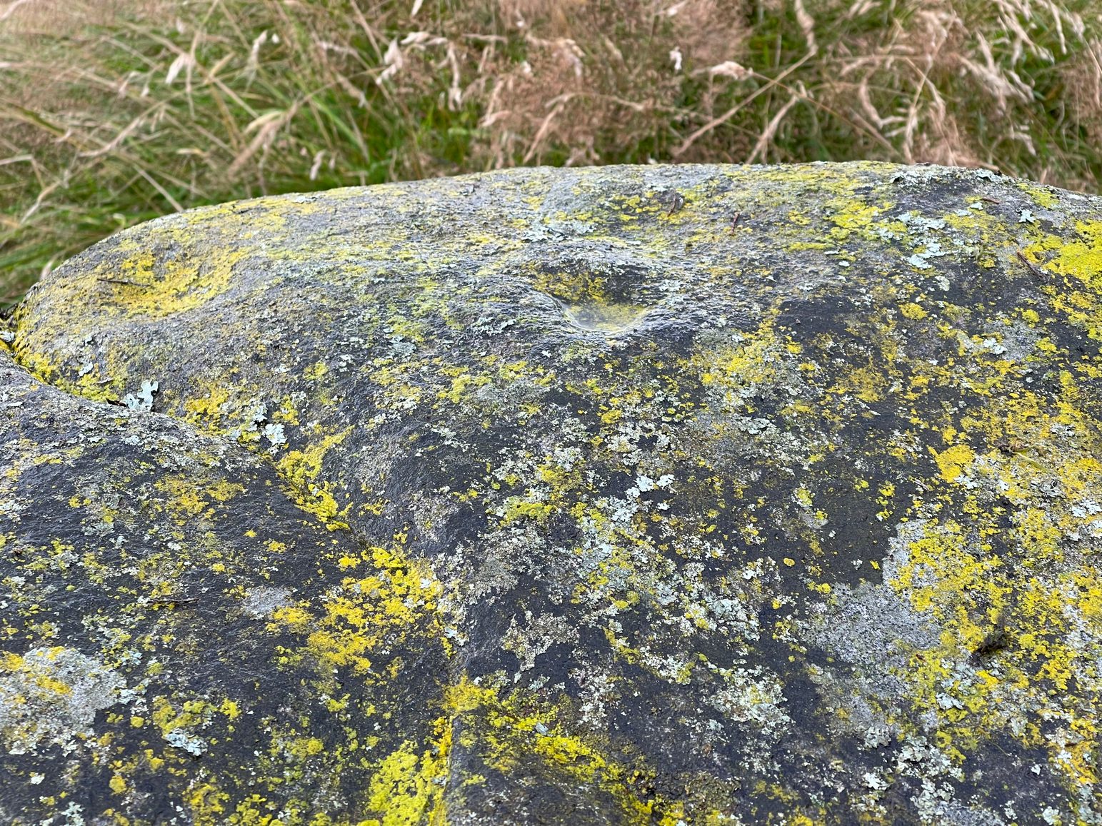
As you walk towards it, it seems as if a rounded earthfast boulder is in front of you, but once you reach it you realise that it’s nothing of the sort. Indeed, the more you looked at the stone, the more it seems as if it might have stood upright not too many centuries ago; the prevalence of other standing stones in the area being well known. But, along the spine of this long stone, a number of cup-marks speak out to you: at least seven of them, perhaps eight. There are a number of smaller “cups” roughly along the same length of stone, but these are Nature’s handiwork; but, it looks as if one or two of the man-made cups might have started their lives as Nature’s indentations and been worked into the symbols that still remain to this day.
Faint ring around a cupNose of stone, looking E
The official records tell us of the cup-marks, but says nothing of the faint but distinct rings around two or three of the cups. The most notable one, albeit faint, is near the southeastern part of the stone, where the ring seems to be an artistic partnership of Nature and man. You can make it out in the photo, albeit not too clearly. Nearer to the middle of the stone at least one of the cups has a semi-circle around it and, just to the side of it, a natural crack in the stone has been enhanced and carved into a short line. On the whole, it’s not a visually impressive carving and the design is troublesome to see if the lighting isn’t right (as usual), but is worth having a look at if you’re in the area. Very little’s been written about it apart from brief notes in the regional megalithic surveys of both Finlayson (2010) and Watson (2006).
References:
Finlayson, Andrew, The Stones of Strathearn, One Tree Island: Comrie 2010.
Watson, David, A Simple Introduction to the Stone Circles and Standing Stones of Perthshire, Photoprint 2006.
Acknowledgements:Huge thanks for use of the Ordnance Survey map in this site profile, reproduced with the kind permission of the National Library of Scotland.
Take the same direction as if you’re visiting the Ardoch (2) carving, starting from the Foulford golf course on the A822, roughly halfway between Gilmerton and the entrance to the Sma’ Glen. From here, take the track eastwards into the hills and literally ¾-mile along you reach the pylon; keep going along the same track for another 200 yards and on your left watch out for the track-cum-footpath going up the slope past Ardoch (2), onto the hilltop, then through the gate and down the path northeast for about ⅔-mile until you reach the burn. Keep going uphill for 80 yards and through the cronky gate, head 70 yards to your left to the large single rounded boulder.
Archaeology & History
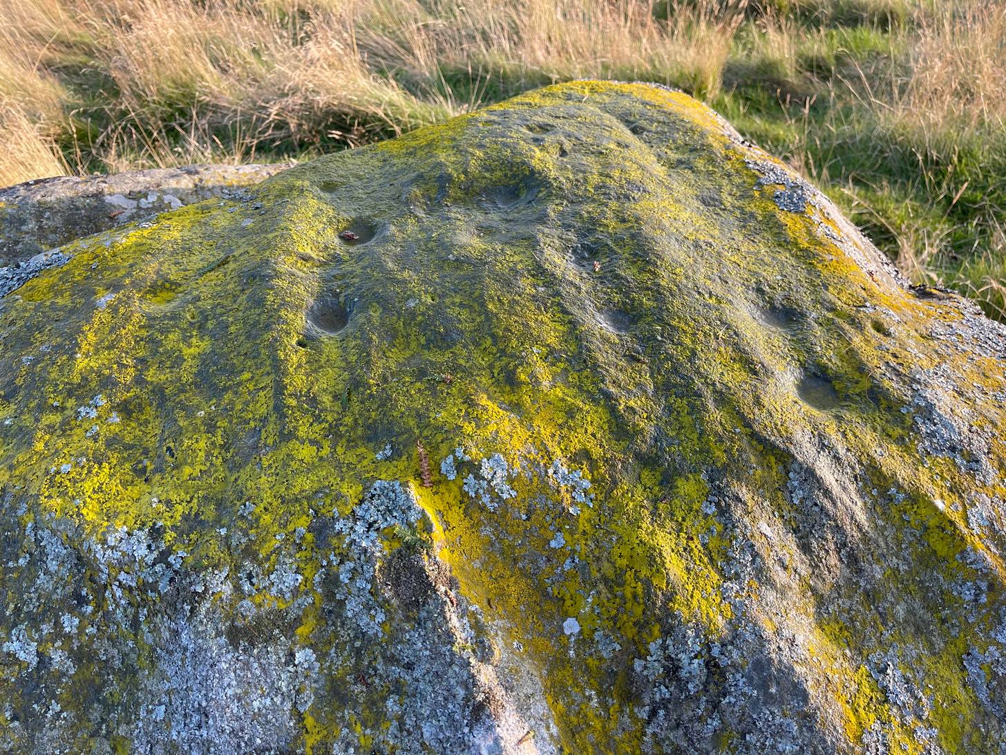
Main scatter of cups
One of several petroglyphs in the area, this is the most notable in terms of its size. It rests just below the two Stroness hut circles which sit on the small level piece of ground nearly 100 yards further up the slope. A considerable scatter of cup-marks cover much of the upper surface of the boulder, some faint, some not so faint, with a number of them painted in a slight cover of lichens at the topmost section of the rock. The carving was first described somewhat blandly by George Currie (2004), who simply wrote:
“Large boulder, 2 x 2m, just W of hut circles; 16+ cups, 40–50 x 14–20mm.”
Faint line near the edgeCups among the lichens
It’s actually south of the hut circles; and there are certainly more than sixteen cup-marks, as the photos here indicate. At the time of my visit here recently, the sun was falling and was just below the level that permitted a perfect highlighting of the cup-marks, but there seemed to be at least 25 of them, scattered in no particular order over much of its upper surface. One curiosity that seemed apparent was a long carved line running along a long slender edge along on the southern side of the stone, from a large cup-mark down to near the southwestern edge, meeting another smaller cupmark. I not 100% certain that it’s actually been carved and it may just be one of Nature’s scratches along the rock, but it does seem to have that “man-made” stamp on it. Another visit in differing light will show us one way or the other.
References:
Currie, George, ‘Buchanty Hill (Fowlis Wester parish): Cup-marked Rocks’, in Discovery & Excavation Scotland, volume 5, 2004.
If you’re coming here you’re obviously making a day out of it! You’ll be taking the shortest route to the Ardoch (2) petroglyph, via the Foulford golf course along the A822, roughly halfway between Gilmerton and the entrance to the Sma’ Glen. From here, take the track eastwards into the hills, and literally ¾-mile along you reach the pylon; keep along the same track for another 200 yards and on your left watch out for the track-cum-footpath going up the slope past the petroglyph, onto the hilltop, then through the gate and down the path for about ⅔-mile until you reach the burn. On the other side, go through the gate and 100 yards uphill through another one, walk immediately to your left alongside the fence. About 20 yards from the wall, look at the ground. Zigzag about!
Archaeology & History
Two distinct but very overgrown hut circles sit next to each other on the first ridge above the burn. When they were first built—sometime in the Bronze Age most likely—the landscape here was slightly different to what we see today. Scattered woodland of hazel, birch and Scots pine lived all across these hills and the small burn 100 yards below would have been much faster flowing, with trout and smaller fish in plentiful supply. The large cup-marked stone between the burn and these huts would have had some magico-religious meaning to the people living here. Indeed, it may have been carved by the people who built the huts, or they might have rested here due to its presence. I point out these simple ingredients to give a little more life to a site which, today, seems so isolated, lonely and unimpressive. It’s essential that we paint the history of this and all our ancient monuments with the colourful shades they lived within: of the forests and their animals, so as to give these seemingly bland lifeless remains a feeling in order to rekindle their history.
Apart from the large petroglyph less than 100 yards below, these hut circle are apparently in isolation if we go by the record books. And they’re difficult to make out when the grasses are tall—as they were when I visited recently. They are both roughly the same size—about 11 yards across—and, most likely, each housed a small family. The one closest to the wall is the slightly smaller of the two. It was first reported by Miss Comrie (1972) who initially only noticed one of the two huts—probably due to the long grasses. She told that,
“On an area known as Buchanty Hill at 1000ft is a hut circle with a diameter of 11mand wall width of 2m. Situated in a hollow, sheltered from the north and with an entrance on the downward-side facing south. The walling has no obvious inner or outer facing.”
On my visit to this place, the silence was deafening and the fading daylight painted the hills with a stunning velvet breath all across the veil of Her body. It’s a gorgeous isolated place that you might aswell sit down with after you’ve finished looking at the rock art…
References:
Comrie, J.E.M., “Fowlis Wester Parish: Hut Circle,” in Discovery & Excavation, Scotland, 1972.
From Bettyhill village, take the A836 road east (as if you’re heading towards Thurso) for literally 1½ miles (2.4km) and take the left turn to Farr (signposted). Exactly a mile along, just past the gated house above the road on your right, in the sloping field below it, you’ll notice a seemingly innocuous scatter of stones doing nothing in particular in the grassland. That’s it!
Archaeology & History
There’s not too much to look at here, apart from a very overgrown mass of loose stones seemingly piled up near the bottom of the sloping hillside. It was first noted when James Horsburgh (1870) explored the prehistoric sites of the region, but even then the site was mentioned with some brevity, telling simply:
“On the way from Farr to Borve Castle, there are the foundations of a Pictish tower at Clarkhill, the stones of which are larger than usual, being square blocks.”
Looking down on the ruins
His description regarding its precise whereabouts wasn’t very clear, but it was located some years later by the Royal Commission (1911) who subsequently added the site to their Inventory. They found that the broch was “at the extreme west end of a low rocky ridge on which are situated the buildings of a croft bearing the name of The Dun.” They reported, even then, that only a few large stones of the broch remained visible. `
The site was included in Euan Mackie’s (2007) magnum opus, where he described the only remains left of this “possible broch” to be “the basal course of the outer wall…forming an arc about 9.0m long.”
MacKie, E W., The Roundhouses, Brochs and Wheelhouses of Atlantic Scotland c.700 BC-AD 500 – volume 2, British Archaeological Report: Oxford 2007.
Royal Commission Ancient & Historical Monuments, Scotland, Second Report and Inventory of Monuments & Constructions in the County of Sutherland. HMSO: Edinburgh 1911.
Acknowledgements: With thanks to the old crew of Aisha and her little Lara for getting me up here, oh so many years ago now…..
The exact location of this site seems privy to a select few and has remained that way since its existence appeared in print in the 19th century. It was first mentioned by Arthur Mitchell (1874) following a holiday that he’d had in the area in the early 1870s. He’d visited a petroglyph at Laggan with a Mr David Ross and when he returned home received a letter from him that told how,
“he had heard from Mr M’Bain of Auchterblair of two huge granite boulders, situated on a shelving rock over an abyss on the Loch Avon side of Cairngorm, with hand-made cups on them about a foot wide and correspondingly deep.”
They were subsequently visited by Thomas Wise (1884) a few years later, who told how these huge granite boulders were,
“20 feet in height,” upon which “there are four basins, 1 foot, or 1 foot and a-half long, and 6 inches wide at the top, rounding off to 1 inch in the bottom.”
Initially Mr Mitchell (1874) was cautious in associating these carved basins with cup-marked stones—and indeed, we concur with this—but seemed to have changed his opinion when he wrote about them a few years later (Mitchell 1881). But it’s the folklore attached to this site that intrigued him – and myself…
Folklore
The traditions attached to this site will be recognised by all students of animism and folklore. Arthur Mitchell (1874) was informed how the carved bowls in the stone helped infertile women and how “sitting on (them) is said to be efficacious in cases of barrenness.” Their importance was highlighted in the fact that there had been “pilgrimages to them undertaken within the memory of people still living.”
This was affirmed by Thomas Wise (1884) who told that,
“They are supposed to be efficacious in barrenness, and people still living remember pilgrims coming to sit upon them for some time, that they might obtain what they wished. A visit to them was by no means an easy task, as the ascent was difficult, and to sit on them required a steady head, as they are on the brink of a rock overhanging a precipice. These basins are the “woman’s stone” mentioned by Tennant. They are supposed to be the resting place or throne of a certain fairy queen; but however efficacious they may have been, they have lost much of their celebrity; and as the shepherd, who acted as guide to the pilgrims, is dead, and has left no successor, they are now rarely visited.”
Does anyone know the whereabouts of this heathen magickal site? If you happen to find it, see if you can get a good photo or two and let us know on our Facebook group.
Stone Circle (destroyed): OS Grid Reference – NN 88808 19823
Archaeology & History
In 1995, an aerial survey done in this neck o’ the woods found a number of distinct shadows in the landscape showing a considerable number of unrecorded prehistoric archaeological sites. One of them indicated a previously unrecognized “four poster” stone circle. It was described briefly on Canmore as follows:
“The four-poster is visible (as) a square setting 6m across. It is situated between the cropmarks of a palisaded settlement…and a possible enclosed settlement.”
No excavation has yet been performed. A very clear ring ditch was also discovered some 50 yards to the east in the same field.
Folklore
There is no known folklore or traditions relating to this site or immediate locale.
References:
Burl, Aubrey, Four Posters: Bronze Age Stone Circles of Western Europe, BAR 195: Oxford 1988.
Ardoch (2) carving, with Milquhanzie hillfort behind
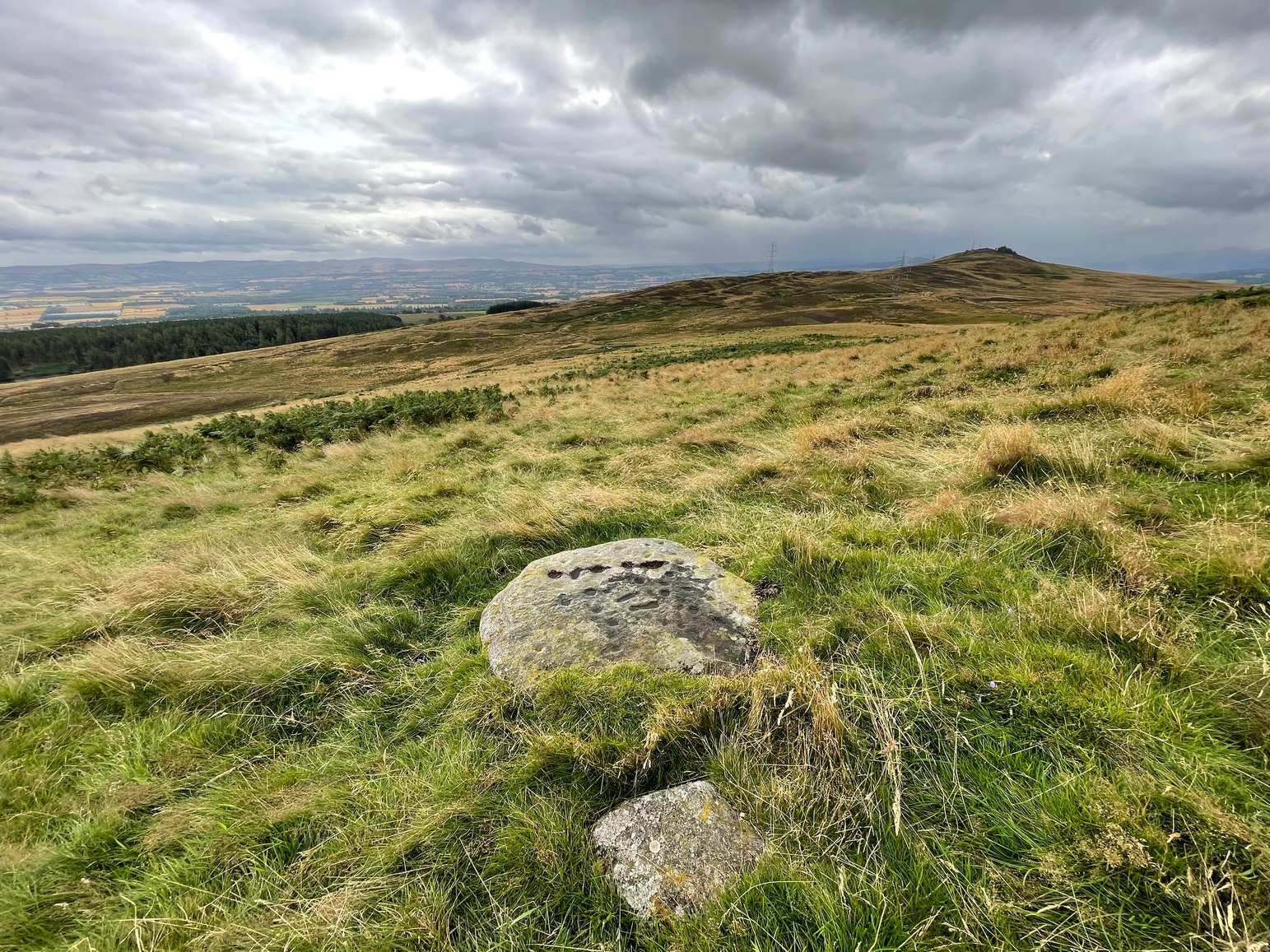
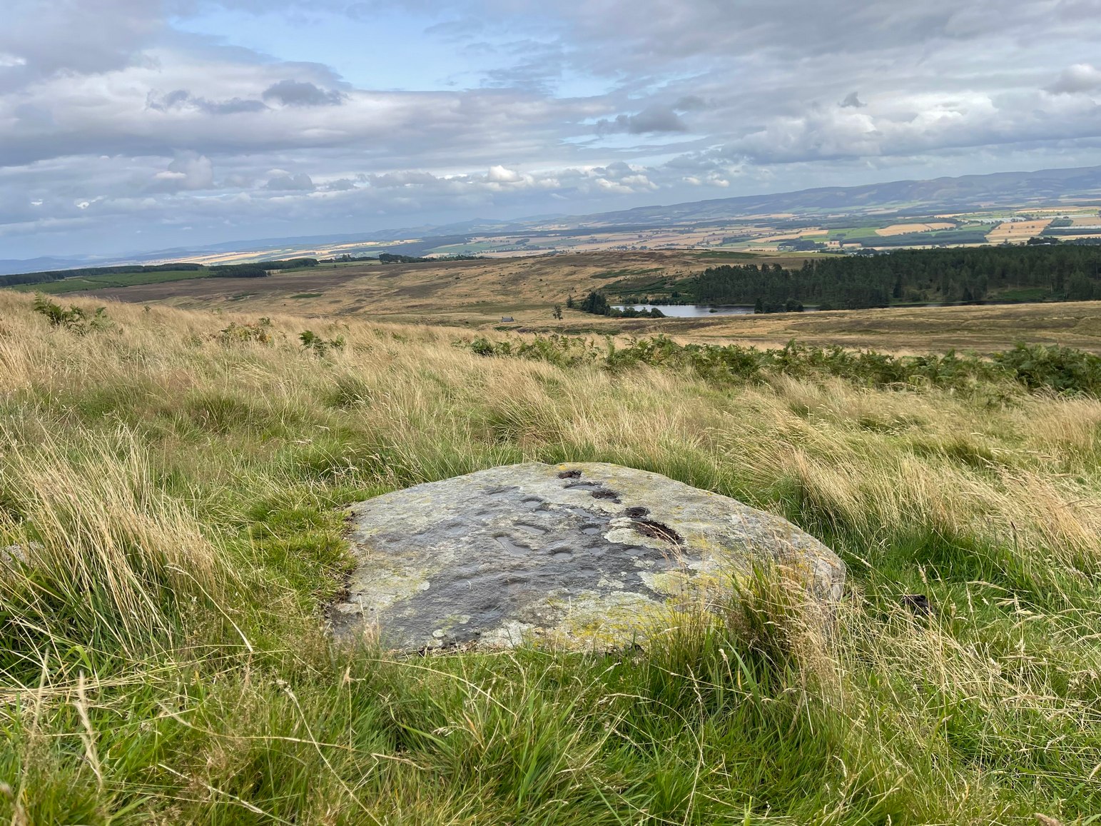
We took the long route to get here, via Fowlis Wester village, up to the car-park near the standing stones, then walk for 1¾ miles along the track: past the stones, veering right to go downhill then uphill, past the Ardoch (1) petroglyph and bearing right at the next split in the track, then right again at the next split. Then, crossing a small burn and curving round the next bend, keep your eyes peeled for the track-cum-footpath that reaches uphill on your right (NE). A shorter route is via the Foulford golf course (found along the A822 roughly halfway between Gilmerton and the entrance to the Sma’ Glen): take the track from there, eastwards into the hills, and literally ¾-mile along you reach the pylon; keep walking along the track for another 200 yards and on your left watch out for the same track-cum-footpath. Walk up there for about 400 yards and, 35 yards to the right of the fence, you’ll see a large flat stone.
Archaeology & History
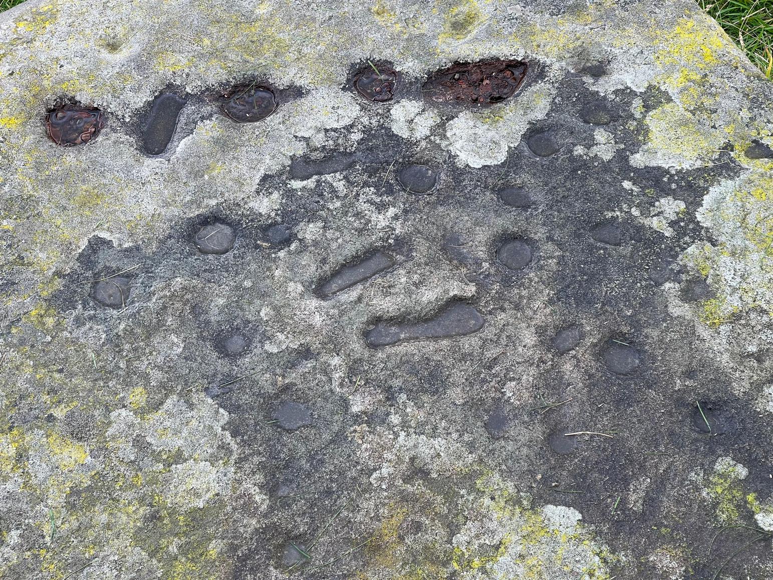
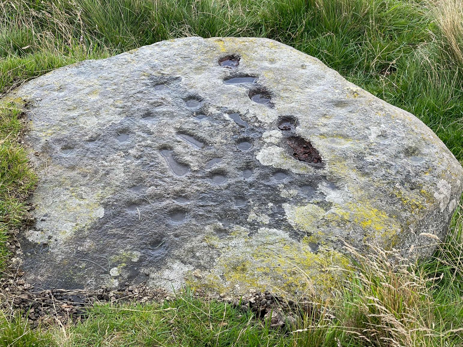
This is a most curious design, sitting way up near the top of this unnamed hill on its western face. It’s curious as there are number of odd elongated cup-marks which, to me at least, should be described as footprints. We find such designs on a few carvings (such as the one at Dunadd, and St. Columba’s Stone, etc), but they’re pretty rare. The best can be found on the Cochno Stone a few miles north of Glasgow, with additional toes on the design… but that’s for another site profile – and an essay, perhaps, should I ever get round to writing it! Anyhow…
It was first described, albeit briefly, by a Mr Comrie in 1972, who told us that,
“On a south-west facing slope of Buchanty Hill at 950ft is a boulder measuring 1.60m x 1.40m with 22 cups and 11 dumb-bells, 6 of which are distorted by a fault of quartz in the stone.”
Central “footprints”“Footprints” & cup-marks
But his description of what he saw as eleven “dumb-bells” is somewhat extravagant. Six, perhaps seven would seem the more probable. I was hoping to find that the Scottish Rock Art Project doods might have spent some of their million quid in doing a computer enhancement of this carving in order to confirm it one way or the other, but this was one of hundreds that they never looked at. Very poor… (and they only described two so-called dumb-bells here!) The only other mention I’ve found of the place is in Finlayson’s (2010) fine survey of local megaliths, but only in passing.
The dumb-bells or “footprints” on this carving are small: fairy footprints, one might say. The main ones are seen near the middle of the stone on its flat smooth surface. Another—perhaps two—occur along a curious geological cut that runs in a straight line, north-south (roughly) over the rock. This curious line has a series of deeply cut elements, mainly cup-marks, which give the impression of being enhanced or worked upon in much more recent centuries, looking almost as if they possessed some utilitarian function. They’re most odd and are certainly much younger than the very worn cup-marks that are scattered across the stone in no particular order. One of them seems to have a very faint ring around it. You can just make it out in one of the photos.
Looking southeastA nice close-up
So we’re looking at a multi-period carving done (probably) over several centuries. Some of the cup-marks are barely visible unless the light is just right. On my first visit here, the day was grey and overcast and some elements of the design were all but invisible; but on my second visit, one a beautiful evening, then wetting the rock, it shone out in all its splendour…. Well – as good as could be expected considering it may be five thousand years old! But the footprints are the stand-out features of the design.
In a lengthy essay on this motif that’s found on numerous European petroglyphs, Miroslav Verner (1973) points out several traditional and theoretical meanings ascribed to the symbol, which may be relevant to the stone here. The footprints may mark the rock as a pilgrimage site; or a representation of the location of a theophany, or genius loci. In some places it can be a signature of the so-called artist; or a symbol of victory; and even a symbol which possesses the power to cure fevers and other ailments. This latter tradition was known to have been practiced at the mightily impressive Blarnaboard (3) carving near Aberfoyle.
Another important feature of this carving its position in the landscape: more than a thousand feet above sea level, you sit here and the vista ahead of you reaches far far away into the distance from east to south to west. The skies above and around it are open and seemingly endless from here. It’s impressive and, most likely, these attributes are mythically significant to its meaning. Have a look at the place: take a day out and sit here for a while and get your own impression of the place. You’ll like it…
From Fowlis Wester village, head up the road for just over ½ a mile (veering sharp left at a junction) to the dusty car-park on the left-side of the road near the standing stones. From here walk along the track, past the standing stones, veering right to go downhill and cross the burn by the loch near the ruins of Ardoch house; then keeping uphill on the track for another half-mile or so and, just before a split in the dirt-track, you’ll see a reasonably large rounded boulder just a few yards above the track on your right. Y’ can’t really miss it!
Archaeology & History
This previously unrecorded cup-and-ring carving was rediscovered a few years ago by local lady Fiona McLaren: an absolute fount of knowledge when it comes to ancient sites in this area. It’s a pretty basic carving but is certainly worth looking at on your way up to see the much more unusual petroglyph of Ardoch (2).
The cup&ring highlightedClose-up of the cup&ring
When we visited this stone for the first time recently, the design was difficult to make out due to the grey overcast skies. The first thing you’ll notice is the single cup-marking on the left-side (west) of a natural crack near the top of the rock. It’s pretty easy to make out. But the cup-and-ring immediately left of this is much harder to see—or at least is was when we came here! But spend a bit of time with it, adjusting your sight, wetting the stone and, slowly but surely, you’ll notice the shallow ring surrounding another smaller cup-mark. You can make it out in the photo. A possible smaller cup-mark on the sloping northern face seems more likely to have Nature’s signature on it.
Acknowledgements: Huge thanks to Fiona McLaren of Abercairney for first uncovering this carving and pointing us towards it.
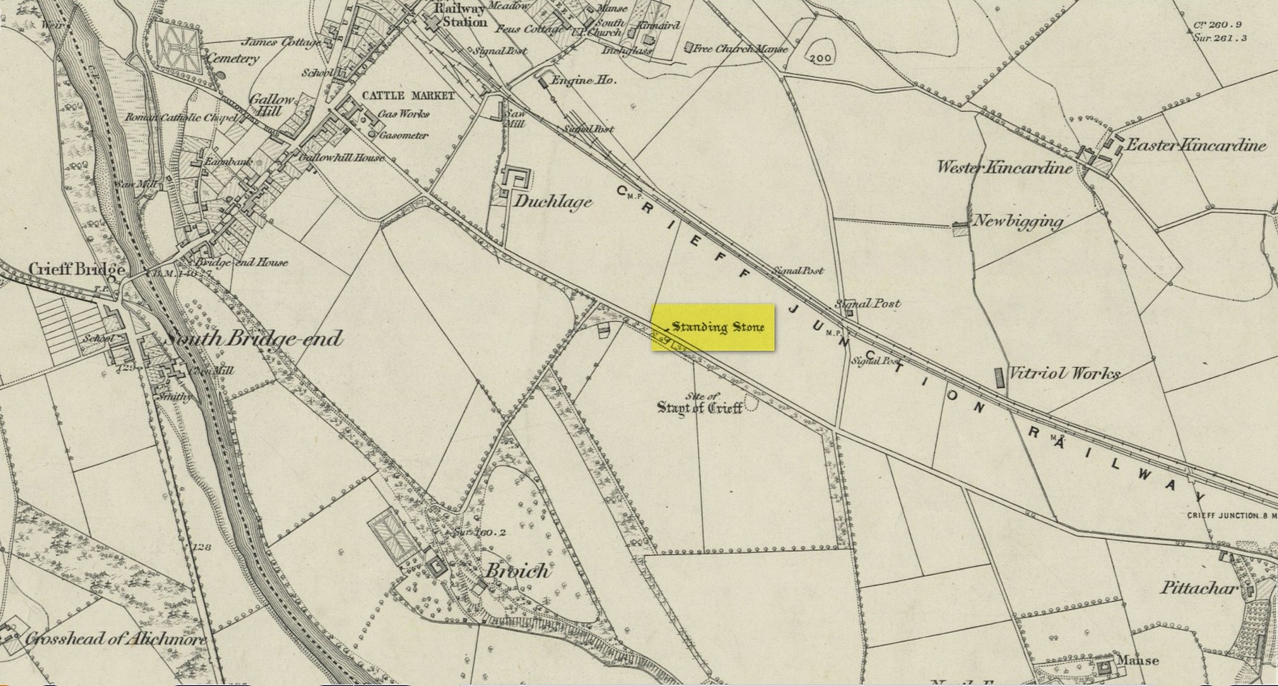
Standing Stone (destroyed): OS Grid Reference – NN 8655 2079
Archaeology & History
Site on the 1866 map
There is seemingly no trace left of this once impressive tall, slender standing stone that had lived for thousands of years on the south-side of Crieff. It was destroyed by some retard in the middle of the 20th century (anyone know their name?). Highlighted on the 1866 Ordnance Survey map of the area, it was visited and described by the late great Fred Coles (1911) when it still stood at the side of the road. He told that it was,
“In shape a narrow rhomboid at the base, this Stone rises to an acute angle at a height of 6 feet. Its longer axis is E.S.E. 52° by W.N.W. 52°, and in basal girth it measures 8 feet 11 inches.”
Coles’ 1911 sketch
Some 200 yards to the south-east there used to be the curiously-named Stayt of Crieff burial mound which had been used as a court hill for many centuries. This outlying standing stone may have been the “witness” on which oaths were sworn before the court. Sadly the history of the Stayt of Crieff mound is also somewhat sparse and it too has, appallingly, been destroyed. The destruction of these antiquities and their ancient traditions is nothing short of a fucking disgrace.
Finlayson, Andrew, The Stones of Strathearn, One Tree Island: Comrie 2010.
Acknowledgements:Huge thanks for use of the Ordnance Survey map in this site profile, reproduced with the kind permission of the National Library of Scotland.