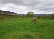
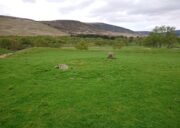
Mauns Stone, New Deer, Aberdeenshire

Legendary Rock (destroyed):  OS Grid Reference – NJ 89397 49502

Also Known as:

  1. Crawey Stone
  2. Crawford Putting Stone
  3. Crawstane
  4. Devils Putting Stone

Archaeology & History

Stone shown on 1874 map

A site whose main claim to fame is its legendary nature.  Seemingly buried or destroyed around the end of the 19th century, there have been suspicions that the stone might have had cup-marks on it (see Folklore below), but we’re not sure.  Modern lore tells that when roadworks were done here in the 1950, a large stone was uncovered.  A local man who was passing by told that he’d seen the Crawey Stone in his youth and that the stone they’d uncovered was one and the same.

Folklore

The story that used to be told amongst local people was thankfully preserved in an article by the pseudonymous “Mormond” (1889) in Scottish Notes & Queries.  He told that:

“In the parish of New Deer, and in a field near the Old Castle of Fedderat, there is a large boulder of ten or twelve tons known as the Crawey Stone.  I am unable to say if it still occupies its old site, or if it has been broken up for building purposes.  The legend connected with this stone used to be well known in the parish, and a version of it appeared in The Aberdeen Magazine some 70 or 80 years ago.  This version is substantially the same as the legend known in the district, and relates how a Crawford, the lord of the castle and lands, one day “as he looked o’er his castle wa’ ” — a phrase which often occurs in old ballads — observed a crunkled carl (old woman or witch, PB) inspecting the stone and afterwards successfully lifting up one end clear of the ground.  Not to be conquered by such a shabby looking stranger, the laird, who was famed for his athletic powers, went out and challenged the carl; but on attempting to lift the boulder, burst a blood vessel; and the carl, who stood by watching him, suddenly disappeared in a flash of fire taking the remains of the laird along with her.  The tradition is that the laird was not mourned for in the district, and the moral drawn was “He couldna hae expected ony ither en’.”  When passing the boulder going to school, the legend was often referred to, and some indentations on it pointed out as the marks of the ill man’s fingers made at the time the superhuman feat was accomplished.”

These finger marks have been taken as possible cup-markings.  They might have been, but we simply don’t know; they may just have been curious natural markings that gave rise to this animistic creation myth.  Another tale told that the markings were due to an old giant in the neighbourhood who used the rock as a putting stone and rolled it to the spot where it used to stand.  Giants are always attached to indigenous creation myths, some of which go back thousands of years.

In the OS Name Book for Aberdeenshire written in the late 1860s, they told how the Maun Stone is,

“a large Stone of a roundish shape, built on an old fence, forming a side of the Public road leading from New Deer to Brocklay.  Tradition asserts that it has been the putting Stone of a Giant in ancient times.  There are Several holes in the Stone said to be the finger marks of the Giant.”

References:

  1. Mormond, A., “Legends and Rhymes Connected with Travelled Boulders“, in Scottish Notes & Queries, volume 2, 1889.

© Paul BennettThe Northern Antiquarian

Killiesmont, Keith, Moray

Cup-Marked Stone (destroyed):  OS Grid Reference – NJ 4124 5308

Archaeology & History

Diagonally across the road from Killiesmont, about a hundred yards up the sloping field on “a piece of ground called the Helliman Rig,” could once be seen a large flat stone with cup-markings on its surface.  Walter Gregor (1881) told that,

“It lay on the top of a rising ground, and commanded a very wide view of the country, stretching for many miles over the hills of Banff and Moray.  In a part of it the rock–a kind of slate–came to the surface.  In the rock were cut out nine cups in three rows.”

The carving was earlier described in one of the Topographical Gazetteers of Scotland (1848) where its story is bound up with local tradition and folklore of the land where it lie.  There it was described as being “a flat circular stone of about 8 feet in diameter, in which there are a number of holes, but for what purpose tradition is silent.”  Subsequently the local historian J.F.S. Gordon (1880) talked of this “large flat circular Stone, of about 8 feet in diameter, in which there was a number of half-pierced holes…. It was too large for a Quern or even a Millstone; and its purpose remained an enigma.”

The stone came to light when a local farmer was digging in the field and, “at the upper end of the Rig, there was found a rude Cist among a heap of stones, which contained ashes.”  The cup-marked stone was “turned up” at the same time.  It has sadly been destroyed—along with the associated cairn that probably had some relationship with the carving.  Prehistoric tombs and rock art are frequent bedfellows and it seems likely that the equation occurred here.  But the location of the site had some fascinating local lore told of it…

Folklore

The location of this carved stone in the field called ‘Helliman Rig’, was also known as the Guidman’s Croft or the Gi’en Rig.  This was a portion of land that was never to be touched or ploughed as it was “given or appropriated…to the sole use of the devil, in order to propitiate the good services of that malign being.”  This devilish tradition superseded the earlier faith of it being a place set aside for the fairy folk and their allies—nature spirits no less.  And it’s a tradition found in many places across Scotland and elsewhere, as the account in the Scottish Gazetteer told :

“Like other crofts of this description in Scotland, the present remained long uncultivated, in spite of the spread of intelligence (pedantic bastard! PB).  The first attempt to reclaim it was made not more than 50 years since, when a farmer endeavoured to improve it; but, by an accidental circumstance, it happened that no sooner had the plough entered the ground than one of the oxen dropped down dead. Taking this as an irrefragable proof of the indignation of its supernatural proprietor, the peasant desisted, and it remained untilled till it came into the possession of the present occupant…”

This of course fortified the old folklore in the eyes of local people.  I’ve found that even up to recent times, such folklore is still held quite seriously by some of the old folk in the mountain villages and hamlets.

References:

  1. Anon, The Topographical, Statistical and Historical Gazetteer of Scotland – volume 2, A. Fullarton: Edinburgh 1848.
  2. Gregor, Walter, Notes on the Folk-lore of the Northeast of Scotland, Folklore Society: London 1881.
  3. Gordon, J.F.S.,  The Book of the Chronicles of Keith, Grange, Ruthven, Cairney and Botriphnie, Robert Forrester: Glasgow 1880.

© Paul BennettThe Northern Antiquarian

Ancestors’ Stone, Low Snowden, Askwith, North Yorkshire

Cup-and-Ring Stone:  OS Grid-Reference – SE 18083 51229

Also Known as:

  1. Carving no.606 (Boughey & Vickerman)

Getting Here

The Ancestors Stone

If you’re coming up from Otley or Askwith, take the same directions as if you’re going to visit the impressive Naked Jogger Carving (stone 612), not far from the well-known Tree of Life Stone.  From the Naked Jogger carving, walk up to the small outcrop of rocks that bends above you.  There’s a small collapsed line of walling just behind the outcrop.  Walk along this up the slope as if you’re heading for the Sunrise Stone carving, but only 30 yards along, low down and right into the edge of the wall itself, you’ll see this elongated piece of stone.  That’s the spot!

Archaeology & History

If you’ve caught the petroglyph-bug, you’ll like this one!  It received its name from the curious fusion of natural cracks with the man-made pecked lines that shows, quite distinctly when the light is right and the stone is wet, the outline of two humanesque forms joined to each other.  Figurative rock engravings of ancestors in the UK are extremely rare and when we came across this example, we noticed how the design could be interpreted as two Askwith Moor ancestor figures. Figurative rock art images elsewhere in the world such as the magnificent Wandjina paintings and the extensive galleries of figures engraved at Murujuga (Burrup Peninsula) in Western Australia, might provide an initial comparison, though more specific work needs to be done to better understand this unique petroglyph.

Sketch of the carving

You can almost make out the figures in the above photo: the upper torsos of two beings on the right-hand side of the rock, almost fused together.  And the carved shapes of these “ancestral beings” are morphically similar to some elements in the Sunrise Stone just 50 yards away – which themselves remind me of a Northumbrian carving near Doddington known as West Horton 1a. (Beckensall 1991)  But we should’t get too carried away by the idea because—as we can see here in the sketch of the carving—when looked at from a different angle above, we could infer the right-hand carved elements to be representative of an animal: a deer, perhaps.  Rorscharch’s once more tickle the exploring mind….

The rock has been quarried into at same time in the past (just like the nearby Sunrise Stone), leaving us to wonder what the complete carving might have looked like.  No doubt some pieces of it will be in the collapsed walling either side of the stone.  All we have left to see are the two unfinished cup-and-rings above the natural cracks that give rise to the “ancestral being” appearance.  The faint double cup-and-ring has curious linear arcs to its side, with two well-defined cups enclosed by two of them.  It’s a nice-looking carving when the light is good.  The petroglyph was carved over a long period of time, as evidenced by the differing levels of erosion in different sections of the design.  It’s a common attribute.  The oldest section is the faint double cup-and-ring, whose mythic nature was added to / developed at a much later date, perhaps even centuries later.

In the always-expressive archaeocentric description of Boughey & Vickerman’s (2003) otherwise valuable tome, they told this carving to be,

“Long, narrow, thick rock of medium grit. Six cups, one with a double ring with a tab out and two with at least partial single rings, grooves.”

Evocative stuff!

It’s very likely that this carving had some mythic relationship with its close neighbours either side of it, probably over a very long time period and I’m inclined to think it somehow related to the rising of the sun, just like its solar companion further up the slope.  Please note how I emphasize this ingredient in the site profile of its neighbour, the Mixing Stone 10-15 yards away—roughly halfway between this and the Sunrise Stone.   A distinct place of ritual was happening in this close-knit cluster of carvings…

References:

  1. Beckensall, Stan, Prehistoric Rock Motifs of Northumberland – volume 1, 1991.
  2. Boughey, Keith & Vickerman, E.A., Prehistoric Rock Art of the West Riding, WYAS: Leeds 2003.
  3. Reeder, Phil, “Snowden Carr Rock Carvings,” in Northern Earth Mysteries, no.40, 1990.

© Paul BennettThe Northern Antiquarian

Dud Well, Skircoat Green, Halifax, West Yorkshire

Sacred Well: OS Grid Reference – SE 0957 2281

Archaeology & History

This curiously-named old water source may have an equally curious history behind it – albeit forgotten.  Shown on the 1854 OS-map of the area and giving its s name to Dudwell Lane, we can see how an old path led from the road to the well and nowhere else.

It’s the word “dud” that holds our attention here; for if we hasten to the immensely erudite Joseph Wright (1900) in his gigantic survey of northern dialect, we find that the word relates to “a rag, piece of cloth; pl. clothes, esp. shabby, ragged, or dirty clothing.”  This is echoed in another Yorkshire dialect work by Morris (1892) who told that the word meant “clothes (or) rags.”  Several other Victorian writers tell us variations on this meaning (one adds old shoes to the list!), but in all instances it relates to dud being a rag, whereas the plural duds are rags or scruffy clothes.  Naathen (to use another old dialect word), those of us who know a thing or two abaat olde wells are very very familiar with their association to old rags that were hanged on the surrounding trees as offerings to the spirits of the water—the genius loci—to aid in the hope or desire of something, or merely as respect to the waters for their beneficient properties. (this sometimes occurred ritually at set times in the calendar)

Dud Well on 1854 OS-map

The Dud Well was obviously of considerable local repute, for just a couple of years after it was shown on the earliest OS-map, a local bailiff called Samuel Rhodes built The Dudwell house close to the waters, which he named “in honour of the magnificent and never-failing spring of pure, bright, sparkling water in the wells close by.”

There is a possible alternative meaning to the word dud, which is that some dood called ‘Duda’ left his name here!  This seems much more speculative and unlikely than the use of a local dialect term.  Hopefully a local historian amongst you might perhaps be able to find out more.

References:

  1. Morris, M.C.F., Yorkshire Folk-Talk, Henry Frowde: London 1892.
  2. Wright, Joseph, English Dialect Dictionary – volume 2, Henry Frowde: London 1900.

© Paul BennettThe Northern Antiquarian

Wishing Well, Bone Valley, Madron, Cornwall

Sacred Well (lost):  OS Grid reference – SW 4614 3259

Archaeology & History

It’s difficult to know what to make of this site: whether it was merely a healing well or whether it possessed greater esoteric functions.  In all likelihood it was the latter as many so-called “wishing wells” in earlier centuries possessed oracular attributes.  It’s also difficult to work out precisely where this well happened to be, as we know little about it apart from the singular reference of Quiller-Couch (1894), who told simply that,

“There was also a wishing-well in the Bone Valley; it is now only a small stream, and is not used for purposes of divination.”

Hidden spring on 1878 map
Line of wells on 1908 map

There were a number of wells along the Bone Valley road highlighted on the early OS-map, all of which may have been known to Quiller-Couch at the time, three of which appeared to have streams emerging from them back then: one just above Bosoljack (SW 4556 3319) and one below it (SW 4571 3292), each just off the roadside; but then a slightly more enticing one is hidden a little further down the lane and up the tinier lane to Higher Boskinning, in the trees on the right (east).  Shown on the first OS-map as a simple “spring”, a small stream runs from it and then into the larger Bone Valley Brook which runs towards Penzance.  The solace and quietude of this spot would seem much more favourable than the other two…. but my impressions may be wrong.  It would be good if someone could find this old place…

References:

  1. Quiller-Couch, M. & L., The Holy Wells of Cornwall, C.J. Clark: London 1894.
  2. Russell, Vivien, West Penwith Survey, Cornwall Archaeological Society 1971.

Acknowledgements:  Big thanks for use of the early edition OS-map in this site profile, Reproduced with the kind permission of the National Library of Scotland

© Paul BennettThe Northern Antiquarian

Chapel Well, Botrea, Sancreed, Cornwall

Holy Well (lost):  OS Grid reference – SW 4025 3062

Archaeology & History

Just over a mile northwest of the superb Sancreed Well, we find documentary evidence from 1778 recording the field-name of Chapel Well Close here, although there seems to be no remaining spring or well and nothing is shown on the early OS-maps.  Official records define it as a “medieval well” and speculate that it may have been associated with the nearby Boscence Chapel and possibly dedicated to St. Winwaloe.

References:

  1. Anon., The Church and Parish of Sancreed in the County of Cornwall, Brewer: Sancreed c.1960.

© Paul BennettThe Northern Antiquarian

Old Wives’ Well, Stape, Pickering, North Yorkshire

Sacred Well:  OS Grid-Reference – SE 7944 9406

Also Known as:

  1. Nattie Fontein

Archaeology & History

Old Wives Well, 1848 OS-map

The history of the site is scanty to say the least.  It first seems to have been recorded when the Ordnance Survey lads came here in the 1840s, although they left no record as to why the site was given such a dedication.  It’s a decidedly pre-christian title as the name “old Wife” is usually indicative in northern counties as being related to the primal Earth deity of northern England and lowland Scotland (when we reach the Highlands and Ireland, She becomes known—amongst other names—as the cailleach).  However, apart from its name we have no additional information.  Neither the holy wells writer Edna Whelan (1989; 2001), nor hydrolatry researcher Graeme Chappell were been able to find anything about the place in their own researches.  And so we must go on name alone…

The waters bubble up into a small stone-lined chamber with the words Nattie Fontein carved into the lintel.  This is something of a mystery in itself, for, as Edna Whelan (1989) told,

“it would be most unusual for the word fonten to be used for a spring in North Yorkshire: ‘keld’ is the local word.  The rather roughly inscribed word may be a corruption of Fons Natalis, the name of a Celtic water nymph.”

Graeme Chappell (2000) meanwhile, noticed in a visit to the site in June 1999,

“that the N and A in “NATTIE” are carved in such a way that the word could be read as “MATTIE FONTEIN” perhaps meaning “Mother Fountain”. This might then be another reference to the Old Wife?”

He then goes on to note how,

“the latin word ‘natalis‘ meaning ‘birth’ and its link with the roman Festival ‘Dies Natalis Sol Invictus‘ (day of the birth of the unconquered sun) which took place on the 25th December. Natalis also gave rise to the welsh word ‘Nadolig‘ – meaning Christmas.”

This Yuletide element has an intriguing relationship with the name of the well; for to the west of Yorkshire’s borders into Cumbria there was annual gathering known as Old Wives’ Saturday that took place on the first Saturday after Christmas, or first Saturday of the New Year in a person’s house or inn, where a feast was had to bring in the New Year; but there is no known written lore of such a tradition here.

Nowadays the old tradition of hanging rags on the trees surrounding the well as offerings to the spirit of the place (known as memaws in parts of Yorkshire, and clooties in Scotland) has become a regular practice of those who hold such sites as sacred in their own way.  Whelan mentioned seeing memaws here in the 1908s, but the Northern Antiquarian contributor Jon Barker told that, “The rags are a comparatively recent addition to the well, it is not a tradition there. When I used to go in the ’60s therewere no rags.”

On an even more curious note: very recently (from when this profile was written), the Northern Antiquarian contributor and photographer James Elkington visited Old Wives’ Well for the first time.  It was a grey overcast day and when he arrived here, there was a woman ahead of him at the head of the well.  I’ll let him tell the rest of it in his own words:

The Old Wives Well, Stape  (James Elkington)
Old Wives Well at Stape (James Elkington)

“In front of the well was a lady dressed in what looked like a white nighty, she had her back to me.  There was a candle lit nearby, and her hands were in the water moving slowly about like she was washing something.  She had long dark shoulder length hair.  As I was about 25 feet away I was sure she wasn’t aware of me, and I thought it would make a good photograph.  I quietly put my bag on the ground and got my camera out, and looked up and…she was gone!  I couldn’t have taken my eye off her for more than 5 or 6 seconds.  I looked all around and there was no sign of her.  Even if she had legged it through the woods I would have seen her.  I think it was then that I realized that I may have had ‘an encounter’.  I quickly took three pics of the Well and got the hell out of there!”

He rang me once he had regained his senses in a somewhat emotional state and recounted over and over what had just happened.  Whether this was a visual manifestation of the genius loci of the we can’t say.  But such encounters are not unknown at numerous sacred water sites all over the world.  We can only hazard a guess that this is what he was fortunate to encounter.

Just a few hundred yards north is the old Mauley or Malo Cross, which may or may not have had some mythic relationship with our Old Wives…

References:

  1. Chappell, Graeme, “Old Wives’ Well, Stape,” YHW 2000.
  2. Elgee, F., Early Man in Northeast Yorkshire, Frank Bellows: Gloucester 1930.
  3. Whelan, Edna, The Magic and Mystery of Holy Wells, Capall Bann: Chieveley 2001.
  4. Whelan, Edna & Taylor, Ian, Yorkshire Holy Wells and Sacred Springs, Northern Lights: Dunnington 1989.

Links:

  1. Yorkshire Holy Wells

© Paul BennettThe Northern Antiquarian

Balsamic Well, Hoxton, London

Healing Well (destroyed):  OS Grid reference – TQ 330 827

Also Known as:

  1. Balsamick Well

Archaeology & History

In that typically rambling style beloved of early writers on medicinal springs, Timothy Byfield (1687) narrated the tale of uncovering this well in an almost alchemical discourse.  It was located when digging out the cellar of a house near Charles Square in the 1680s.  Upon investigation, the waters were found to possess a good quantity of sulphur and a small amount of iron, leading Byfield to proclaim it could cure a whole army of medical disorders, from cleaning out blockages in the alimentary canal, to treating kidney stones, scurvy, ulcers, headaches, migraines and more.  If used correctly and in the right amount,

” There is,” he says, “no unwholesome glebe (concretion) or any dangerous mineral or metal (in them) that casts one unhappy ray into this healing fountain.” On the contrary, they set up ‘* such a pretty bustle or ferment in nature that makes gay a well-temper’d Healthy Body.”

In the early days when Spa Wells were in vogue, the Balsamic Well became a competitor to the nearby St Agnes le Clear Well, which is probably the reason why one doctor dissuaded the toffs of the time to avoid it!

The waters possessed a slight vinegar-esque flavour—hence the name.  In John MacPherson’s (1871) work, he described it as a “chalybeate well” and despite it having that typical “bituminous scum on it, strange to say,” it yielded “a pleasant aromatic flavour.”  The site has long since been covered over.

References:

  1. Byfield, Timothy, A Short and Plain Account of the late-found Balsamick Wells at Hoxdon, London 1687.
  2. Foord, Alfred Stanley, Springs, Streams and Spas of London: History and Association, T. Fisher Unwin: London 1910.
  3. Hembry, Phyllis, The English Spa 1560-1815, Athlone Press: London 1990.
  4. MacPherson, John, Our Baths and Wells, MacMillan: London 1871.
  5. Sunderland, Septimus, Old London Spas, Baths and Wells, John Bale: London 1915.

© Paul BennettThe Northern Antiquarian

Craig Hill cluster (4), Kenmore, Perthshire

Cup-and-Ring Stone:  OS Grid Reference – NN 81303 44419

Getting Here

Craig Hill cluster (4) stone

From Kenmore go east up the steep mountain road towards Glen Quaich, or if you’re coming from Amulree, go west along the same glen.  After 2½ miles (4km) up the Kenmore route (nearly 9 miles on the Amulree route) you’ll reach a small lochan on your left (you’ve got a very small parking spot a coupla hundred yards before the loch).  A gate and stile past the loch takes you east along a track into the moors.  More than a mile on, the track splits, but you need to keep to the left and follow the track along the wall-side for another 400 yards or so, where you’ll see a small crag of rocks 100 yards down the slope on your right. Once here, the elongated rock with a “seat” that you can sit in is the stone in question.

Archaeology & History

At first sight this stone doesn’t seem to have anything petroglyphic about it, and—as when we visited the other carvings in this Craig Hill cluster—the weather was grey and overcast, so it was difficult to discern anything at first.  But as we walked round and round inspecting the Craig Hill cluster-5 carving, a glance at this adjacent stone seemed to indicate one or two cup-marks within the curious chair-like aspect of the rock, but we couldn’t initially work out whether they were simple geophysical elements or not.

Very faint cup-&-half ring near the centre
Close-up of the C&R

So we poured water onto the stone in the hope that something might show up.  And the more we walked round and round, bending down, looking from as many angles as possible, not only did we see what looked like several cups, but one of them had a half-ring that curved round what may or may not be a natural cupmark.   You can see it pretty clearly in the attached photos.  In other photos that we took, the faint cup-and-half-ring seems to plays its part in a line of three or four other cups; although in order to ascertain whether these elements are man-made or not, we could do with the help of a good geomorphologist.

Acknowledgements:  Huge thanks to Prof Paul Hornby for use of his photos in this site profile; and to Myrna Hurley for getting us up there.  Cheers doods. 😉

© Paul BennettThe Northern Antiquarian

Meikle Whitefield, Cargill, Perthshire

Stone Circle (destroyed):  OS Grid Reference – NO 173 342 (approximation)

Archaeology & History

In an archaeological report by Alexander Hutcheson for the Scottish Society of Antiquaries in 1884, he described and illustrated an impressive cup-and-ring stone that was formerly built into the walls of a demolished house ¾-mile from its original position near Meikle Whitefield farm.  Upon destruction of that house, the farmer of West Whitefield—a half-mile from its original position—then moved the stone it into his front garden.  According to tradition, said Hutcheson, this stone

“was originally removed from a circle of stones, which had stood about half-a-mile eastward, but which have now been buried or broken up.”

Despite the local tradition, Hutcheson was some what sceptical of it, thinking that it

“seems very unlikely that such a weighty stone should have been transported for half a mile merely to serve as a foundation stone for a cottage, when the ground around was capable of supplying as many stones as would be required.”

You can see his point; but there are known circumstances where individual stones from megalithic rings have been preserved.  Hence, like John Barnatt (1989) in his magnum opus who preserved the folk memory of such sites, we include it here.  The tradition may well be valid.  Added to this is the fact that in just a few square miles hereby we once had a large cluster of stone circles, a few of which still remain.

Refeences:

  1. Barnatt, John, Stone Circles of Britain (2 volumes), BAR: Oxford 1989.
  2. Hutcheson, Alexander, “Notice of a Cup and Ring-marked Stone, and of Incised Stones Recently Discovered at Cargill, and of an Incised Boulder at Fowlis Wester,” in Proceedings Society Antiquaries Scotland, vol. 18, 1884.

© Paul BennettThe Northern Antiquarian