Deer Track Stone, Ilkley Moor, West Yorkshire

Cup-Marked Stone:  OS Grid Reference – SE 13858 45562

Also Known as:

  1. Carving no.190 (Hedges)
  2. Carving no.367 (Boughey & Vickerman)
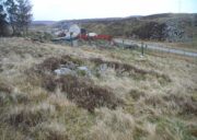
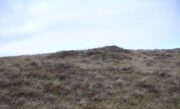
Carving with Woofa Bank enclosure to rear

Getting Here

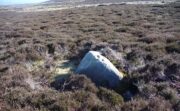
The easiest way to find this is to take the same directions to reach the Woofa Bank settlement.  Get your compass out and make sure that you’re at the northern edge of the settlement walling.  From here, walk about 60 yards northwest and keep your eyes peeled for a rock about 2 feet high, curved and elongated with its top surface above the heather.  You’ll find it.

Archaeology & History 

The name I’ve given to this stone is a conjectural one based entirely on comparative petroglyph designs elsewhere in the world.  Or to put it more simply: elsewhere in the world we find examples of prehistoric rock art showing animal tracks and rituals relating to hunting animals, and in the design of this petroglyph on Ilkley Moor I wondered if we might be looking at something similar.  Internationally respected anthropologists, archaeologists, geologists and rock art specialists such as Lawrence Loendorf (2008), Polly Schaafsma (1980), Dennis Slifer (1998) and many others show examples of animal tracks in the US and Mexico (examples exist throughout the world), and it’s not unlikely that some of the petroglyphs in the UK represent such things.  But, like I say, this particular carving may have nowt to do with such a thing and the idea is entirely conjectural on my part and is probably way off the mark.
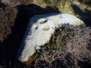
Deer-print motif & cup

Located less than 60 yards (54m) northwest of the impressive Woof Bank enclosure, it’s possible that the first literary note of this was by Stuart Feather (1968) when he made note of five cup-and-ring marked rocks (which) have been revealed by erosion in 1968,” telling us that some of the motifs on the rocks included cups with and without rings, channels and eye-shaped marks (occuli)— the latter of which may relate to this stone.

A more definite description of the stone was made in John Hedges (1986) survey where he described it in that usual simplistic form, telling us: “Long rock, its surface on two levels, sloping N to S in heather.  Two large oval cups and one cup at N end.  One clear cup at S end.”

Hedges’ 1986 sketch

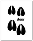
It is these two elongated cups that have the distinct appearance of deer tracks. (another animal with a similar footprint is the goat)  The cup-mark in front of them and the one at the back of the rock may be something relative to the animal.  But more important than this is to recognise that, in lots of cultures, animal tracks are represented in some petroglyphs.  That’s more important to think about when you look at British rock art, than the improbability of this design being such a thing…

References:

  1. Boughey, Keith & Vickerman, E.A., Prehistoric Rock Art of the West Riding, WYAS: Wakefield 2003.
  2. Feather, Stuart, “West Yorkshire Archaeological Register – Ilkley (WR) Green Crag Slack,” in Yorkshire Archaeology Journal, volume 42, 1968.
  3. Hedges, John, The Carved Rocks on Rombalds Moor, WYMCC: Wakefield 1986.
  4. Loendorf, Lawrence L., Thunder and Herds – Rock Art of the High Plains, Left Coast: Walnut Creek 2008.
  5. Schaafsma, Polly, Indian Rock Art of the Southwest, University of New Mexico Press 1980.
  6. Slifer, Dennis, Signs of Life – Rock Art of the Upper Rio Grande, Ancient City: New Mexico 1998.

© Paul BennettThe Northern Antiquarian
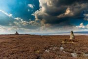
Fiscary Cairnfield, Bettyhill, Sutherland

Cairnfield:  OS Grid Reference – NC 7279 6232

Getting Here

Tumuli on 1878 map

From Bettyhill, go out of the village along the A836 Thurso road for just over a mile.  You go uphill for a few hundred yards and just as the road levels-out, there’s the small Farr Road on your left and the cattle-grid in front of you.  Just before here is a small cottage on your left.  In the scrubland on the sloping hillside just below the cottage, a number of small mounds and undulations can be seen.  That’s it!

Archaeology & History

Although this place was highlighted on the first OS-map of the area in 1878, I can only find one modern reference describing this somewhat anomalous cluster of sites.  It’s anomalous, inasmuch as it doesn’t have the general hallmark of being a standard cairnfield or cluster of tumuli.  For one, it’s on a slightly steep slope; and another is that amidst what seems to be cairns there are other, more structured remains.  As I wandered back and forth here with Aisha, I kept shaking my head as it seemed somewhat of a puzzling site.  As it turns out, thankfully, I wasn’t the only one who thought this…

One of the ‘cairns’ from above
Profile of a typical cairn

In R.J. Mercer’s (1981) huge work on the prehistory of the region, he described the site as a whole as a field system comprising “enclosures, structures, cairns and field walls” and is part of a continual archaeological landscape that exists immediately east, of which the impressive Fiscary cairns are attached.  In all, this ‘cairnfield’ or field system is made up of at least 23 small man-made structures, with each one surviving “to a height of c.0.5m and are associated with 11 cairns from 2-6m is diameter.”

In truth, this site is probably of little interest visually unless you’re a hardcore archaeologist or explorer.

References:

  1. Mercer, R.J., Archaeological Field Survey in Northern Scotland – volume 2: 1980-1981, University of Edinburgh 1981.

Acknowledgments:  To the awesome Aisha Domleo, for her images, bounce, spirit and madness – as well as getting me up here to see this cluster of sites.

© Paul BennettThe Northern Antiquarian

Devil’s Stone, Winceby, Lincolnshire

Legendary Rock (destroyed):  OS Grid Reference – TF 3127 6901

Also Known as:

  1. Big Stone of Slash Lane

Archaeology & History

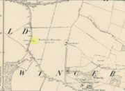
Stone shown on 1887 map

There is no specific archaeological information about this stone.  However, we must take note of the so-called “devil’s footprint” that was on the boulder.  In some parts of the UK, some devilish and other mythic footprints on stone are prehistoric cup-markings; but we have no idea whether this impression was such a carving or—more probably in this case—Nature’s handiwork.  The field in which the stone existed was said to be the place where the so-called Battle of Winceby occurred.

Folklore

The stone was mentioned in several old tomes, with each one generally repeating the same familiar story, and with motifs that will be familiar to antiquarians and folklorists alike.  In an early edition of Notes & Queries we were told of,

“the large stone in Winceby field, where soldiers had sharpened their swords before the battle. This was a stone of fearful interest, for much treasure was supposed to have been buried under it. Numerous attempts have been made to get at this treasure, but they were always defeated by some accident or piece of bad luck. On the last occasion, by ‘yokkin’ several horses to chains fastened round the stone, they nearly succeeded in pulling it over, when, in his excitement, one of the men uttered an oath, and the devil instantly appeared, and stamped on it with his foot.  “Tha cheans all brok, tha osses fell, an’ tha stoan went back t’ its owd place solidder nur ivver; an’ if ya doan’t believe ya ma goa an’ look fur yer sen, an’ ya’ll see tha divvill’s fut mark like three kraws’ claws, a-top o’ tha stoan.’  It was firmly believed the lane was haunted, and that loud groans were often heard there.”

The tale was retold in Grange & Hudson’s (1891) essay on regional folklore.  In Mr Walter’s (1904) excellent local history survey, there was an additional shape-shifting element to the story which, in more northern climes, is usually attributed to hare; but this was slightly different.  The stone, as we’ve heard,

“was supposed to cover hidden treasure, and various attempts were made at different times to remove it, sometimes with six or even eight horses. At one of these attempts, his Satanic Majesty, having been invoked by the local title of ‘Old Lad’ appeared, it is said, in person, where upon the stone fell back, upsetting the horses.  On another occasion a black mouse, probably the same Being incarnate in another form…ran over the gearing of the horses, with a similar result.  Eventually, as a last resort, to break the spell, the boulder was buried, and now no trace of the boulder, black mouse, or Satan’s foot-print remains.”

Sadly we have no sketches of the devil’s ‘footprint’; and if local lore is right, we’ll never know.  For tis said that a local farmer in the 1970s dug down and removed the stone completely.  All that he found were numerous broken ploughshares around the rock, indicating that many tools had been used to shift the stone.

References:

  1. Grange, Ernest L. & Hudson, J.C. (eds.), Lincolnshire Notes and Queries – volume 2, W.K. Morton: Horncastle 1891.
  2. Gutch, Mrs & Peacock, Mabel, Examples of Printed Folklore Concerning Lincolnshire, David Nutt: London 1908.
  3. Walter, J. Conway, Records, Historical and Antiquarian of Parishes around Horncastle, W.K. Morton: Horncastle 1904.

© Paul BennettThe Northern Antiquarian


Portmore Loch, Eddleston, Peeblesshire

Cist (destroyed):  OS Grid Reference – NT 2601 5074

Archaeology & History

Cist site on 1906 OS map

It seems that very little is known about this site, long since gone when quarrying operations did what quarrying operations do.  The site was recorded by the Ordnance Survey lads on their 1908 map of the region, on which they noted: “Stone coffin containing human remains found AD 1905.”  The Royal Commission boys visited the site in April 1962 and reported that “nothing now survives.”  They listed it in their inventory as a prehistoric cist, or small stone-lined burial chest.  Such remains tend to be either neolithic or Bronze Age in nature.

References:

  1. Royal Commission Ancient & Historical Monuments, Scotland, Peeblesshire – volume 1, HMSO: Edinburgh 1967.

© Paul BennettThe Northern Antiquarian
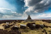

West Dron Hill, Bridge of Earn, Perthshire

Cup-and-Ring Stone:  OS Grid Reference – NO 11845 15169

Getting Here

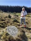
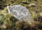
West Dron’s petroglyph

In the middle of Bridge of Earn village, take the Heughfield Road until, ⅓-mile on you hit the T-junction.  Turn left along Forgandenny Road and go along the curvaceous road for just over a mile where you need to keep your eyes peeled for the small left turn that takes you up the dead straight road.  At the top, turn left at the junction and go ⅔-mile, turning right at the next junction until after 400 yards you reach the houses on your right.  Go up the footpath opposite the houses (south) until, after nearly 400 yards, it splits.  Bear right and zigzag up the track for nearly a mile till you reach a large opening in the forest.  40 yards up the slope to your left is the stone—at last!

Archaeology & History

After the trail to get here, you might not be overly impressed by what you see – and it’s nothing special to look at to be honest.  But its location is a good one: reasonably high up on a sloping plateau which would have given good views were it not for the surrounding forestry plantations.  The only literary description of the site was the brief one in Discovery & Excavation Scotland, shortly after being rediscovered.  Mrs Johnson (1960) wrote:

Close-up of the carving

“A cup-marked stone was found by Mr. J. R. Morrison on the N side of West Dron hill.  The stone measures approx. 4ft long by 1ft 9in broad.

There are 17 cup-marks: five of which have channels, and two of which are joined in the form of a dumb-bell.  The stone lies with its longer axis NE-SW, and its broad face uppermost.”

Its seeming isolation is a peculiarity that I don’t buy.  Other carvings are going to be in the locale, probably on the same north- or north-east facing ridges – but due to the dense forestry, any other petroglyphs will remain hidden for quite some time…

References:

  1. Johnson, M., “Dron, Perthshire,” in Discovery & Excavation Scotland, SRG 1960.

Acknowledgements:  Huge thanks to Theresa Hughes for the use of her photos of this carving.

© Paul BennettThe Northern Antiquarian


Loch of Blairs, Forres, Morayshire

Cist:  SO Grid Reference – NJ 0194 5540

Also Known as:

  1. Canmore ID 15792

Archaeology & History 

This is another of the many sites in the country that was uncovered fortuitously, as a result of widening the road just west of the Loch of Blairs.  It’s in relative isolation from other prehistoric sites.  The best description of it was by local antiquarian and folklorist James Ritchie (1932), to whom we owe our gratitude for the old photo.  “This cist,” he wrote, 

“as such tombs are called, had been discovered by workmen who were digging sand from a mound just by the main road to Grantown.  Flat, rectangular stones formed its ends and sides; its top was a single slab of massive proportions.  All around were packed smooth. water-worn boulders, that had once lain in the bed of the Findhorn.  The opening of the cist revealed the ashes of some long-departed dweller in Moray, together with pieces of what had been beautifully moulded pot of clay. On examination of the remains by antiquarian experts, the date of the burial was estimated to be at least a thousand years BC.”

The attached photo makes the site look larger than it is; as the length of the chamber is just 2ft 7in long, by 1ft 8in across, with the covering stone being nearly twice as large as the cist itself.  The urn found inside the cist now resides in the Scottish National Museum of Antiquities. 

References:

  1. Ritchie, James B., The Pageant of Morayland, Elgin Courant 1932.

© Paul BennettThe Northern Antiquarian

Scotland Well, Scotlandwell, Kinross

Healing Well:  OS Grid Reference – NO 18474 01656

Also Known as:

  1. Scotlandwell

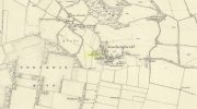
Scotland well on 1856 map

Getting Here

Whichever way you come into the hamlet—be it along the A911 from either Milnathort or Glenrothes, or up the B920 from Ballingry side—the only little carpark to use is about 20 yards from the main road junction, on the west-side of the road, appropriately named Well Road.  The site is unmissable beneath the small well-house at the end of this short cul-de-sac.

Archaeology & History

When a village is named after a well, you know that its waters held some considerable importance!  Mentioned as early as 1218 as “de fonte Scotie” and subsequently many variations thereof in centuries thereafter, the place-names authority Simon Taylor (2017) thinks it may have been mentioned as early as 1090 CE.

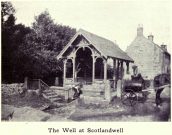
Scotland Well in 1915

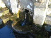
The clear cold waters

Although there has never been a direction dedication of the Scotland Well to any saint, as J.M. MacKinlay (1904) and others have pointed out, in the village itself was an ancient medieval hospital that belonged to “the Trinity or Red Friars” that was built for the benefit of the poor by the Bishop of St. Andrews, some 22 miles to the east.  The hospital was at first dedicated to St. Thomas and subsequently to the Virgin, or St Mary.  Holy wells dedicated to both saints are renowned the world over as having great medicinal properties, but no extant written document relates either saint to the well.

Folklore

The main reason for this site maintaining such an honourable place in Scottish history is its association with the two great Scottish heroes, Sir William Wallace and King Robert the Bruce.  In the pseudonymous Historica’s (1934) literary rambles, he told that, after coming down out of the Lomond Hills,

“We descend the narrow defile—the Howgate—into Scotlandwell—Fons Scotia—famous for its medicinal springs, where tradition says King Robert the Bruce came to take the waters for scrofula and leprosy in 1295.  The great Sir William Wallace—according to ‘Blind Harry’—also has associations here.  His famous swim to the Castle Island, for a boat to take over some of his men to capture the english on St. Serf’s, took place from below Scotlandwell.”

In Ruth & Franks Morris’ (1982) fine survey of Scottish wells, they told that upon their visit to the Scotland Well, three people they met still thought highly of its curative properties.  “Of these three people,” they said,

“one was a sufferer from cancer which was the cause of a painful skin rash.  He had been persuaded to try the water and found that it did him so much good that he was driven from Edinburgh to the well, a round trip of some 80 miles, at at regular intervals to drink the water and take back with him two demi-johns of it.”

According to the man concerned, it did him the world of good and cleared the stubborn body rash he’d been suffering!

References:

  1. Day, J.P., Clackmannan and Kinross, Cambridge University Press 1915.
  2. Historicus, Historic Scenes within our Limits, Kinross-shire Advertiser: Kinross 1934.
  3. MacKinlay, James M., Influence of the Pre-Reformation Church on Scottish Place-Names, William Blackwood: Edinburgh 1904.
  4. Morris, Frank & Ruth, Scottish Healing Wells, Alethea: Sandy 1982.
  5. Taylor, Simon, The Place-Names of Kinross-shire, Shaun Tyas: Donington 2017.

Acknowledgements:  Big thanks for being able to use the 1st edition OS-map for this site profile, Reproduced with the kind permission of the National Library of Scotland

© Paul BennettThe Northern Antiquarian


Simon Howe Stone Row, Goathland, North Yorkshire

Stone Row:  OS Grid Reference – SE 83016 98119 (SSW) to SE 83031 98142 (NNE)

Getting Here

Simon Howe stone row (photo by James Elkington)

From Pickering take the moor road towards Whitby (A169) for approx. 12 miles.  After passing the Fylingdales Early Warning radar on the right (you can’t miss it), the road dips down to cross Eller Beck as a dog leg. After a half mile turn off left (west) towards Goathland (signposted). Follow the road under the North Yorks Moor railway bridge and after a third-of-a-mile the road turns slightly left.  Park in the little layby and follow the track onto the moors. Cross the small stream and walk along the narrow track through gorgeous heather for a mile and a half. Ahead you will see Simon Howe prominent on a ridge, with a stone row leading to it.

Archaeology & History

Not included in either of the giant megalithic alignments surveys of Burl or Thom, it seems that the first archaeological reference to this site was made by Raymond Hayes (1988).   He visited the site in 1947, shortly after a moorland fire had cleared away all the vegetation, allowing for a clearer view of the stones and, after his brief description of the adjacent Simon Howe tomb, he told that,

“The ridge is also the site of what is an unusual feature for the moors: a stone alignment consisting of three, formerly five upright stones that lead to a low eroded cairn c.65m to the south(west).  A moor fire in 1947 revealed the fourth, fallen stone, and I was able to locate the socket of a fifth.”

Raymond Hayes 1947 photo

Stone row on GoogleEarth

From hereon, Hayes seemed to more interested in seeking out and describing a large number of flints that he found scattered on the ground around Simon Howe and its associated monoliths than the stones themselves.  Very sad…  The exact position of the missing fifth stone seems to be shown on Hayes’ plan as being closest to the cairn, about 10-15 yards away, but no trace of this remains.  However, of the remaining monoliths, they are all clearly visible from the air on Google Earth!

Looking SW (Photo by James Elkington)

Looking NE (photo by James Elkington)

The most southerly of the four stones (SE 83016 98119) stands just over 3 feet tall and the second upright, leaning at an angle, is just slightly taller, with the tallest of the three uprights at the northeastern end, being some 6 feet tall.   The fourth fallen stone (SE 83031 98142) lies just beyond this in the heather and which, if resurrected, would stand some 4 feet in height.  The length of the row, stone-to-stone, is just over 29 yards (26.6m).  I’m not aware if this site has ever been assessed as having an astronomical function, but its angle to the northeast might suggest a lunar rising.  Perhaps more pertinent would be another prehistoric cairn that can be seen less than 100 yards away past the northern end of the stone row: as North is the cardinal direction symbolizing Death in traditional lore…

References:

  1. Hayes, Raymond H., North-East Yorkshire Studies: Archaeological Papers, YAS: Leeds 1988.
  2. White, Stanhope, Standing Stones and Earthworks on the North Yorkshire Moors, privately printed: Scarborough 1987.
  3. Windle, Bertram C.A., Remains of the Prehistoric Age in England, Methuen: London 1909.

Links: 

  1. Simon Howe Stone Row on Stone Rows of Great Britain

Acknowledgements:  A huge thanks to James Elkington for use of his excellent photos in this site profile, as well as telling us about Getting Here. 🙂

© Paul BennettThe Northern Antiquarian

Simon Howe, Goathland, North Yorkshire

Cairn:  OS Grid Reference – SE 83007 98096

Getting Here

Simon Howe on 1854 map

From Pickering take the moor road towards Whitby (A169) for approx. 12 miles.  After passing the huge Fylingdales Early Warning radar on the right (you can’t miss it), the road dips down to cross Eller Beck as a dog leg. After a half mile turn off left (west) towards Goathland (signposted). There’s a free car park on the left where you can sit for awhile and enjoy the views.  Follow the road under the North Yorks Moor railway bridge, and after a third-of-a-mile the road turns slightly left.  Park in the little layby and follow the track onto the moors. Cross the small stream and walk along the narrow track through gorgeous heather for a mile and a half. Ahead you will see Simon Howe prominent on a ridge, with a stone row leading to it.

Archaeology & History

This impressive prehistoric tomb was first described in deeds as early as 1335 as Simondshou, which A.H. Smith (1928) translates to mean ‘Sigemund’s mound’ – alluding it to have been either the burial of someone with that name, or a name given to it by the incoming Vikings, oh so many centuries ago.  The latter is the more probable of the two…

Simon Howe (photo by James Elkington)

Hayes’ 1947 photo of Simon Howe

With excellent views in all directions, this monument is found high up in the landscape at the meeting of four paths that are closely aligned to the cardinal directions.  It was highlighted as a tumulus on the 1854 OS-map of the region and subsequently included in Windle’s (1909) listings as a “round barrow”, found in association with “three upright stones” running to the northeast. There are in fact four stones.

Not much has been written about it in archaeological circles.  Thankfully a brief survey of it was undertaken in 1947 by Raymond Hayes (1988) after a moorland blaze had cleared the heather, enabling good conditions to see the site more clearly.  He told that,

“Simon Howe…is very mutilated, what survives indicates that it was 11.50m in diameter and it is clear that it incorporated a stone kerb.”

This “stone kerb”, or surrounding ring of stones, is a feature found at other tombs on these hills—Flat Howe (1) being just one example.  However, in contrast to Flat Howe (1), Simon Howe has had most of its central mound totally stripped by peoples unknown a few centuries ago.  The remains we see today look more like a small ruined stone circle with internal rubble and a new walker’s cairn growing slowly from its centre.  Outside the cairn, just a few yards northeast, a fascinating megalithic stone row emerges.  Whether these were erected at the same time (in the early to mid-Bronze age, in my opinion) only an excavation would tell.

References:

  1. Hayes, Raymond H., North-East Yorkshire Studies: Archaeological Papers, YAS: Leeds 1988.
  2. Smith, A.H., The Place-Names of the North Riding of Yorkshire, Cambridge University Press 1928.
  3. White, Stanhope, Standing Stones and Earthworks on the North Yorkshire Moors, privately printed: Scarborough 1987.
  4. Windle, Bertram C.A., Remains of the Prehistoric Age in England, Methuen: London 1909.

Links

  1. Simon Howe on The Megalithic Portal
  2. Simon Howe on Stone Rows of Great Britain

Acknowledgements:  A huge thanks to James Elkington for use of the photograph in this site profile, as well as telling us about Getting Here.  And the map accompanying this site profile is Reproduced with the kind permission of the National Library of Scotland

© Paul BennettThe Northern Antiquarian


Ellen’s Well, Angle, Pembrokeshire

Holy Well (lost):  OS Grid Reference – SM 86913 03483

Archaeology & History

Ellen’s Well on 1869 map

Very little seems to be known about this apparently lost site, deemed to be an authentic holy well in Francis Jones’ (1954) fine survey: the ‘Ellen’ in question here being the legendary St Helen.  It was highlighted on the first OS-map of the area in 1869 and subsequently included in the Royal Commission’s huge Pembrokeshire (1925) tome, but when they came to visit the site they reported that “it could not be traced, nor any information obtained about it.”  Has it truly fallen back to Earth, or do any local historians and antiquarians know where it is…?

References:

  1. Jones, Francis, The Holy Wells of Wales, University of Wales 1954.
  2. Royal Commission Ancient & Historical Monuments, Wales, An Inventory of the Ancient Monuments in Wales & Monmouthshire: VII – County of Pembroke, HMSO: London 1925.

© Paul BennettThe Northern Antiquarian