Castleton (5f), Airth, Stirlingshire

Cup-Marked Stone:  OS Grid Reference – NS 85584 88087

Archaeology & History

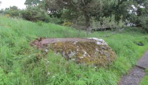
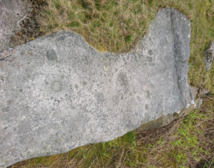
As with other carvings in this locale, the name of the stone is based on a survey done by Maarten van Hoek. (1996)  It’s a pretty simplistic design within the impressive Castleton complex, found at the southeastern end of the gorse-covered rocky ridge, about 70-80 yards west of the farmhouse.  It was uncovered on a visit here by Nina Harris, Paul Hornby, Frank Mercer and Lisa Samson on Sunday 19 November, 2018.
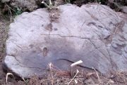
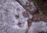
The cup-marked stone
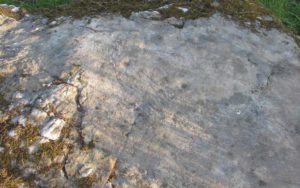
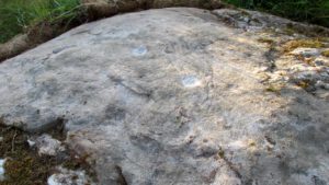
Large cup & arc of 3

Unlike the others in the Castleton complex, this carving is probably of interest only to the hardcore petroglyph hunters.  The design consists of at least ten cup-marks on the uncovered section of the rock, one of which appears to have a broken circle with two ‘entrances’ either side of it, so to speak.  The most notable element in the design is close to the edge, where an arc of three cups almost corners a larger cup right at the edge.   There may be more carved elements to be found on the westerly side of the stone, which was covered in deep vegetation when we came here.

References:

  1. van Hoek, Martin A.M., “Prehistoric Rock Art around Castleton Farm, Airth, Central Scotland,” in Forth Naturalist & Historian, volume 19, 1996.

© Paul BennettThe Northern Antiquarian


Brae of Cultullich (6), Aberfeldy, Perthshire

Cup-and-Ring Stone:  OS Grid Reference – NN 8818 4906

Getting Here

X supposedly marks the spot

Out of Aberfeldy, take the A826 road as if you’re going up Glen Cochill.  Not far up, just where the housing of Aberfeldy itself ends and the green fields open up either side of you, keep on the road for a half-mile where you meet a small copse of trees on your left, with a dirt-track that runs down the slope.  Go along the track for 0.8 miles (1.3km), past the Ursa Major Stone and where the track splits, go left past the Quartz Stone and follow the track through the farmyard.  It’s somewhere there – or is supposed to be!

Archaeology & History

On our visit here, we couldn’t locate the cup-and-ring stone that’s described in Sonia Yellowlee’s (2004) regional rock art survey.  She described it, as archaeologists always do, in the briefest manner, telling us simply:

“Leaning against a pile of rubble in the farmyard there is a split boulder bearing eighteen cupmarks, one of which is ringed.”

It may have been destroyed, as we were told by a couple of locals that there used to be “a real miserable sod” living there.  When we visited the place and tried to ask the present farm owner, sadly he wasn’t to be found.  If any rock art explorer manages to locate this seemingly lost cup-and-ring, please let us know – and mebbe send us some photos so that we can add them to this site profile. 😉

References:

  1. Yellowlees, Sonia, Cupmarked Stones in Strathtay, RCHAMS 2004.

Acknowledgements:  Big thanks to the crew – this time being Neens Harris, Paul Hornby & Frank Mercer.  And the stunning resource of Scotland’s 1st edition OS-maps is Reproduced with the kind permission of the National Library of Scotland

© Paul BennettThe Northern Antiquarian


Quartz Stone, Brae of Cultullich, Aberfeldy, Perthshire

Cup-Marked Stone:  OS Grid Reference – NN 88104 49001

Also Known as:

  1. Brae of Cultullich (4)

Getting Here

The cupmarked Quartz Stone

Out of Aberfeldy, take the A826 road as if you’re going up Glen Cochill.  Not far up, just where the housing of Aberfeldy itself ends and the green fields open up either side of you, keep on the road for a half-mile where you meet a small copse of trees on your left, with a dirt-track that runs down the slope.  Go down here and follow the slightly meandering track for 0.8 miles (1.3km), a short distance past the Ursa Major Stone where the track splits.  Take the track to the left and there, less than 100 yards on you’ll hit a large boulder on your left.  That’s it!

Archaeology & History

Not previously recorded, this simple cup-marked stone will probably only be of interest to petroglyph aficionados, or those folk who are into  ‘energies’ at sites.  This latter aspect is due entirely to the carving being etched onto a huge rock, much of which is composed of quartz—which isn’t too unusual in this part of the world.  But that aside…

Looking down at the cups
The cupmarks highlighted

It is one in a group of carvings within a few hundred yards of each other, with its nearest neighbour 20 yards to the north.  That one’s covered in cups—but on this large Quartz Stone, only two of them exist, on the top near the centre.  Just a couple of inches across and half-an-inch deep, they’re pretty clear once you see them.  The raised piece of ground behind the stone is artificial and has variously been described by antiquarians and archaeologist alike, as either a prehistoric dun, or a stone circle.  Whatever it may be, some of it is certainly man-made.  Check it out – and mebbe ask the friendly fat fella who lives nearby what he thinks.

© Paul BennettThe Northern Antiquarian


Wood Well, Shipley Glen, Gilstead, West Yorkshire

Healing Well:  OS Grid Reference – SE 12797 39277

Getting Here

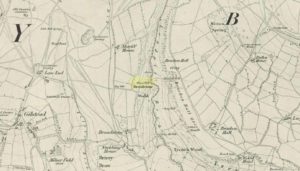
Wood Well on 1852 map

Best reached by going up Shipley Glen, to the Brackenhall Circle enclosure; keep going for a couple of hundred yards and then drop down into the trees, taking the directions directly to the Cloven Hoof Well.  Just past the well, a small footpath leads you downhill towards the large stream at the bottom, where there’s a rocky crossing (an old ford).  Go over here and, barely 50 yards upstream to your right, a large singular moss-covered boulder is set back, just a few yards above the stream with a small pool in front of it.  That’s it!

Archaeology & History

The ‘directions’ to find this might seem a little confusing to locals at first.  This is because the whereabouts of the Wood Well is on the eastern boundary edge of Gilstead – which is down at the bottom of Shipley Glen.  The steep muddy hill above it is almost always slippy and wet through, so it’s easiest to approach from the Baildon side.

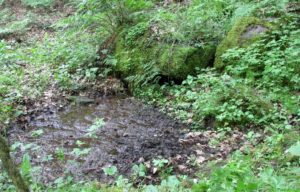
The shallow muddy waters in a hot summer

The site is shown on the 1852 map of the area, but I can find no written material telling of its qualities.  If it ever had any medicinal virtues, they have long since been forgotten.  Whilst the water here is fresh and drinkable, in times of drought and low rainfall the water subsides and leaves only a muddy pool – just as it was when I last visited, making it quite undrinkable.  But to me, the main aspect of this site is its natural spirit, its locale, as it’s surrounded by unerring hues of rich greens, cast out by the landscape of mosses prevalent in a region almost bereft of such voices.  If you like y’ wells – check it out!

© Paul Bennett, The Northern Antiquarian
Lady Well, Aldborough, North Yorkshire

Holy Well:  OS Grid Reference – SE 400 662

Archaeology & History

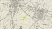
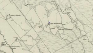
Ladywell Lane is shown on the 1855 OS-map (right).

At present we have no information or images about this site. Be the first person to contribute material by emailing us with info or images to the usual address – megalithix@yandex.com


Robin Hood’s Well, Allerston High Moor, North Yorkshire

Site shown on 1854 map

Sacred Well:  OS Grid Reference – SE 8831 9559

Also Known as: 

  1. Robin Hood’s Spring

Archaeology & History

At present we have no information or images about this site. Be the first person to contribute material by emailing us with info or images to the usual address – megalithix@yandex.com


Petrifying Well, Guilsborough, Northamptonshire

Sacred Well (lost):  OS Grid Reference – SP 664 733

Archaeology & History

It’s difficult to know precisely which category this site should come under: sacred well or just a healing well.  I’ve opted for ‘sacred’, due to its peculiar and rare properties, i.e., turning things into stone.  For a spring to do such a thing would have been seen by our ancestors as it having some sort of magickal or supernatural ability.  Sadly however, it seems that all trace of this well has long since gone.

It was described only in passing in Peter Hill’s (2005) folklore survey of Northamptonshire, to which he gave no reference. He told us simply,

“Guilsborough had a petrifyiong spring near the Grange, which was ‘good for several diseases.”

None of the early OS-maps of the area show any such ‘well’ immediately in or around Guilsborough’s Grange and so I surmise (perhaps in error) that one of the two ponds to the south of the Grange is fed by the spring in question.  It would be good to know for certain!

References:

  1. Hill, Peter, Folklore of Northamptonshire, Tempus: Stroud 2005.

© Paul BennettThe Northern Antiquarian


Nor Hill, Skipton Moor, North Yorkshire

Cup-Marked Stone:  OS Grid Reference – SE 02181 51125

Getting Here

Along the A65 near Draughton, go (south) uphill at Height Lane until it levels out.  ¾-mile (1.2km) up, a modernized stone milepost is where the road crosses the ancient Roman Road. From here, walk west for just over a mile (1.8km), past the trees on yer right, until you approach a small copse on yer right. In the field just before the copse, walk uphill until you reach the highest of the two rises and walk about. You’re damn close!

Archaeology & History

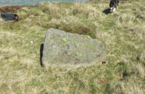
Nor Hill cup-marked stone
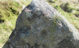
Cupmarks, top & side

This small cup-marked rock was rediscovered by Chris Swales in April 2018.  It’s probably only for the purist petroglyph fanatics amongst you, consisting of just a single cup-mark on its vertical west-face, and another near its top western edge.  Official records show no other carvings in the immediate vicinity, but local antiquarians may find it profitable in surveying the area.

© Paul BennettThe Northern Antiquarian


Rough Haw Carvings, Flasby, North Yorkshire

Cup-Marked Stone: OS Grid Reference – SD 96396 55834

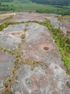
Rough Haw cupmarks

Getting Here

The quickest way to get here is to follow the directions to the Sharp Haw Trig Stone. From the Trig Stone keep heading down the footpath until you see the gate at the bottom. Go through the gate and Rough Haw is straight in front of you.  Head towards Rough Haw and you will see a track going straight up the middle. Go right up that track and over the top till your on the summit, keep walking forward about 50-60 yards and you will see it.

Archaeology & History

Second lot of cups

Some petroglyphs have been found near the top of the prehistoric Iron Age settlement called Rough Haw, a few miles north of Skipton. Not previously recorded, this long flat stone and its companion are littered in cup markings (perhaps a couple of dozen).  There could be more cups and other markings than we saw today, but by the time we reached here the sun had disappeared, so poor daylight made it difficult to see if there were any more.  Another venture up onto this hillfort might be worthwhile to see if anymore can be found.

© Chris Swales, The Northern Antiquarian


Southdown Cottage, Cotmandene, Dorking, Surrey

Tumulus (destroyed):  OS Grid Reference – TQ 1686 4958

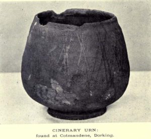
The Cotmandene urn

Archaeology & History

Highlighted on the 1914 OS-map (as ‘Site of’), nothing now remains of the prehistoric structure that either covered or surrounded the ancient burial urn, found fortuitously by a Mr Turner in the garden of Southdown Cottage at the beginning of the 20th century.  Believed to be either Iron Age or Romano-British in origin, the find was noted by Mr Malden (1913) in his brief in the Surrey ArchaeologicalCollections, who wrote:   

“Early in 1913 it came to my knowledge that some years ago some discoveries had been made in the garden of a house on Cotmandene, Dorking.  Mr Turner…was digging for sand in his garden when he found a small cinerary urn (see illustration), with ashes in it.  The height is only 5 inches, the diameter across the top about 4 inches, but at the widest part 5⅜.  The urn is so small that it probably contained the ashes of a child: it is wheel-made, but badly; the diameter is not precisely the same across the top from every direction: Mr Reginald Smith attributes it to the first century BC.  Some fragments of other urns were found.  Mr Turner has kindly presented the whole specimen to the Society’s Museum.  At a lower depth in the same garden were numerous flints, some implements, many flakes, and traces of a hearth with several burnt stones. These clearly belonged to an earlier date, considerably, than the interments, but as the finds were made about 1906-7, and not investigated till this year, it is impossible to be precise about the depth at which they occurred.”

References:

  1. Malden, H.E., “A Cinerary Urn and other Matters found at Dorking and Betchforth,” in Surrey Archaeological Collections, volume 26, 1913.

© Paul BennettThe Northern Antiquarian