Mullach-Geal Stone, St Kilda, Outer Hebrides

Legendary Rock:  OS Grid Reference – NF 092 996

Archaeology & History

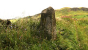
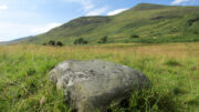
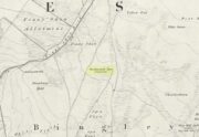
This is a most intriguing site, whose exact location seems to have been forgotten.  It was first mentioned in Macaulay’s History of St Kilda (1764) as being one of four stone altars that the islanders used for worship.  Three of them were related to the early christian figure of St. Brendan, whose well and chapel remains are on the south-side of the island.  However, this fourth stone altar possessed a purely magickal and heathen function.  Macaulay initially gives the location as being “on top of a hill to the southwest” of St. Brendan’s chapel; but subsequently tells us it was upon “Mulach-geall” which is a mile NNW.  It was an important place to the people of Hirta and its exact position needs to be found and, hopefully, the altar still exists.

Folklore

Despite Macaulay’s conflicting directions of how to get here (a common feature of early writers), he wrote:

“I have already made mention of one St. Kilda altar, that in Brendans Chapel.  There are no less than four more in the island, of which three lie at considerable distances from the holy places.  There is one particularly on the top of a hill to the south-weft (sic), dedicated according to tradition to the God who presides over Seasons; The God of thunder, lightning, tempests and fair weather.  To avert the terrible judgments inflicted by this mighty Divinity, the ancient St. Kildians offered propitiatory sacrifices on this altar, sacrifices of different forts, much like the old Pagans, who offered a black sheep to Winter, or the Tempest, and a white one to the Spring…  The place where the people of this island, offered their victims to Taranis, is called Mulach-geall, that is to say, the White eminence or hill…”

More than a hundred years later, Seton (1878) made mention of it, but added no further details.

The invocation to Nature’s elements is something we find echoed at some sites further east, such as the Well of the North Wind on Iona and its compatriot Well of the South Wind.  At both these places, so-called ‘pagan’ rituals were used to both placate and invoke the gods and spirits of the wind.  This one on St Kilda possessed additional magickal prowess.  But where is it?  Have we lost it, or is it sleeping somewhere on the edge of Mullach-Geal…?

References:

  1. Macaulay, Kenneth, The History of St. Kilda; Containing a Description of This Remarkable Island; the Manners and Customs of the Inhabitants; the Religious and Pagan Antiquities There Found, T. Becket: London 1764.
  2. Seton, Gordon, St. Kilda – Past and Present, William Blackwood: Edinburgh 1878.

© Paul BennettThe Northern Antiquarian

Giant’s Stones, Arnbathie, Perthshire.

Legendary Stones: OS Reference – NO 16695 26086

Getting Here

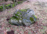
The two stones in relation to each other

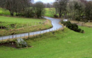
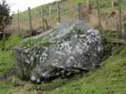
Travelling north from Perth on the A94, take the right turning for Murrayshall just before entering Scone, then take the first right and continue up to the road junction, and park up at the trackway opposite.  You’ll see the big stone in the field to the right, up against the road embankment; and the small stone is in the paddock to the left of the trackway at the edge of the trees.

Archaeology & History

Two large glacial erratics which have acquired mythic status and picked up a Christian triumphalist message on the way.

Folklore

In Lawrence Melville’s (1939) excellent local history work, he thankfully put to pen an all-but-forgotten tale of oral tradition:

“Where the road from the Muir of Durdie leaves Kilspindie parish, a grass grown road leads north to Boglebee….. A few yards from the highway lie two large stones, said to have been flung from the Giant’s Hill in Collace parish – the flat topped eminence lying due north from the stones, about two or three miles away, better known as “Macbeth’s Hill”, or “Dunsinane Hill”.

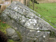
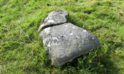
The ‘string’ marks of legend
The smaller stone with its ‘string’ marks

“When the church dedicated to St John in Perth was being built and its tower began to appear, a witch living in Collace was enraged to see this proof of the approach of Christianity and determined to destroy it. She had a son, a giant (after whom the hill receives one of its names), whom she sent to the top of the hill, giving him two huge stones with which to destroy the rising church.

“By her incantations she had supernatural power and knew that when Christianity came her power would be destroyed. She gave him her mutch from her head to be used as sling and in it the giant put the two huge stones. Whirling it around his head, he aimed them in a line with the tower, but, just as he let them fly, the string of his mother’s cap broke and the stones only went the length of Boglebee. The marks on the stones are said to be the marks of the witch’s mutch strings.”

Another view of the larger stone

A familiar folkloric message is remembered the length of Britain:  a giant, a devil or other supernatural being throwing stones that either spill out of an apron or otherwise miss their mark.  And in this case an unsubtle message to anyone trying to take on the might of the church.  But what was the original story of these stones as told by the old time oral storytellers before Christian missionaries stalked the land?

If the string hadn’t broken and the stones had followed their original trajectory they would have fallen south of St John’s Kirk, but it was the thought that counted….

Reference:

  1. Melville, Lawrence, The Fair Land of Gowrie, William Culross: Coupar Angus, 1939.

©Paul T. Hornby 2020, The Northern Antiquarian


Wester Nether Urquhart Stane, Gateside, Fife

Standing Stone:  OS Grid Reference – NO 1862 0799

Getting Here

Wester Nether Urquhart Stane

To find this stone take the A91 to Gateside and turn into Station Road.  Follow to the end, then turn right.  200 yards on there is a parking spot for the Bunnet Stane, and a track to follow.  As you go up this track towards the Bunnet, approximately 280 yards on is this beauty.

Archaeology & History

At over 6ft high, this previously unrecorded standing stone has quite a presence on this slight incline.  It’s hard to tell the true height as he is set in a grassy bank with a drystane wall behind.  It has obviously been used as a gatepost at some time in the past, but there’s no hint of being moved for that purpose.  There are many ancient relics in this area and there used to be a stone circle across the road and behind Nether Urquhart Farm, along with several burial cairns.  I reckon there is a lot more to be found, and we fully intend to go back there.

© Maggie Overett, The Northern Antiquarian
Tombreck (15), Kenmore, Perthshire

Cup-Marked Stone:  OS Grid Reference – NN 64894 38308

Getting Here

Tombreck (15) carving

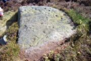
Along the A827 Loch Tay road between Morenish and Lawers, take the track uphill where Carie farmhouse and Tombreck are either side of the road. Walk up this track 2-300 yards till you go through the gate just past the sheep-folds on your left.  Ahead of you is a small grassy hillock on your right upon which you’ll find the unimpressive Tombreck-1 carving.  Walk down the grassy-slope to the boggy stream and then up the rounded knoll on the other side, where you’ll find a stone that’s been split in two.  You’re here!

Archaeology & History

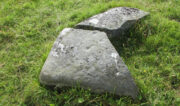
This is another unrecorded carving, found amidst this already large petroglyphic cluster on August 9, 2020.  Carved on a stone that’s been spilt in half, three simple cup-marks can be seen on the larger easternmost section, with the lowest of them having a possible short line running towards the cup on the right.  It seems that the right-hand (north) side of the stone has also been cut, but there is no trace of this part of the stone on the ground.  Additionally, there is the possibility that this stone once stood upright, as evidenced by its very worn rounded top and the larger bottom end of the stone being distinctly lower compared to the ground all round it. But this is speculative.

The 3 cups, highlighted
3 cups on the lower stone

Although the rock is close to being on the top of a rounded knoll, giving good visibility both east and west for a few miles along the extensive grassy ridge (where many other petroglyphs exist), the grandeur of Loch Tay  in the glen below is not and could never have been visible from this, or indeed many other carvings on this ridge.  I mention this due to the fact that some students are positing that the existence of so many carvings along here may relate to some sort of deification of Loch Tay.  But here and at many others along this ridge, the idea simply aint valid, unfortunately.

© Paul BennettThe Northern Antiquarian

Redman’s Spa, Bingley Moor, West Yorkshire

Healing Well:  OS Grid Reference – SE 1159 4343

Also Known as:

  1. Redmire Spa
  2. Redmond’s Spa
  3. Richmond’s Spa

Getting Here

Redman’s Spa on 1851 map

From East Morton village, take the moorland road, east, and up the steep hill.  Where the road just about levels out there’s a right turn, plus (more importantly!) a trackway on your left which leads onto the moor.  Walk up this track for ⅔-mile until you get to the point where the moorland footpath splits, with one bending downhill to an old building, whilst the other smaller footpath continues on the flat to the north.  Go up here for 400 yards then walk off-path, right, for about about 150 yards.  But beware – it’s boggy as fuck!

Archaeology & History

On this featureless southern-side of Rombalds Moor, all but lost and hidden in the scraggle of rashies, a very boggy spring emerges somewhere hereabouts.  I say hereabouts, as the ground beneath you (if you can call it that!) is but a shallow swamp and its actual source is almost impossible to locate.  If you want to find the exact spot yourself, be prepared to put up with that familiar stench of bog-water that assaults our senses when we walk through this sort of terrain.  Few are those who do, I have found… But somewhere here, amidst this bog—and still shown on the OS-maps—is the opening of what is alternatively called Redman’s or Richmond’s Spa.  We don’t know exactly when it acquired its status as a spa-well, but the 18th century Halifax doctor, Thomas Garnett—who wrote the early work on the Horley Green Spa—appears to be the first person to describe it.  Garnett (1790) said how the place:

“was first mentioned to me by Mr W. Maud, surgeon, in Bradford, who went with me to see it.  It is situated on Romalds-moor, about two or three miles from Bingley, and goes by the name of Redmire-spaw.  The access to it is by no means good; the ground about it being very spongy and soft.  On the bottom and sides of the channel is deposited an ochrey matter, of a very fine, bright, yellow colour; and which I believe is used, by the country people in the neighbourhood, to paint their houses.  It sparkles when poured into a glass and has a taste very like the Tewit-well at High-Harrogate; which water it very much resembles in all its properties, and seems to be about the same strength… This water seems to hold a quantity of iron dissolved by means of fixed air.  Its taste is very pleasant; it is said to act very powerfully as a diuretic, when drank in considerable quantity, and may prove a useful remedy, in cases where good effects may be expected from chalybeates in very small doses; the fixed air, and even the pure water itself may be useful in some cases.  It is, however, necessary to drink it at the well, for it seems to lose its iron and fixed air very soon.”

I’ve drank this water, and believe me!—it doesn’t quite taste as pleasant as Mr Garnett espouses!  Its alright I s’ppose—but drinking water from a bog isn’t necessarily a good idea.  That aside, I find it intriguing to hear so much lore about such a little-known spring; and it is obvious that the reputation Garnett describes about this spa came almost entirely from the local people, who would have been visiting this site for countless centuries and who would know well its repute. Below the source of the well the land is known as Spa Flat, and slightly further away Spa Foot, where annual gatherings were once held at certain times of the year to celebrate the flowing of the waters.  Such social annual gatherings suggests that the waters here were known about before it acquired its status as a spa—which would make sense.  The remoteness of this water source to attract wealthy visitors (a prime function of Spa Wells) wouldn’t succeed and even when Garnett visited the place, he said how he had to travel a long distance to get here.

The origin of its name was pondered by the great Harry Speight (1898) who wondered if it derived from the ancient and knightly Redman family of Harewood, whose lands reached over here.  But he was unsure and it was merely a thought.  As an iron-bearing spring (a chalybeate) you’d think it might derive from being simply a red mire or bog (much like the Red Mire Well at Hebden Bridge), but its variant titles of apparent surnames casts doubt on this simple solution.

No one visits the place anymore.  Of the countless times I’ve wandered the moors, rare have been the times when I’ve seen folk anywhere near this old spring.  It is still coloured with the same virtues that Garnett described in the 18th century: the yellowish deposits, the boggy ground, much of which reaches to the truly dodgy Yellow Bog a short distance north and which should be completed avoided by ramblers after heavy rains (try it if y’ don’t believe me—but you’ve been warned!).

References:

  1. Garnett, Thomas, Experiments and Observations on the Horley-Green Spaw, near Halifax, George Nicholson: Bradford 1790.
  2. Short, Thomas, The Natural, Experimental and Medicinal History of the Mineral Waters of Derbyshire, Lincolnshire and Yorkshire, privately printed: London 1724.
  3. Speight, Harry, Chronicles and Stories of Old Bingley, Elliott Stock: London 1898.

© Paul BennettThe Northern Antiquarian


Robin Hood’s Oak, Great Horkesley, Essex

Legendary Tree (lost):  OS Grid Reference –TL 96 28

Archaeology & History

In more than twenty volumes about Robin Hood in the Northern Antiquarian library, no mention can be found of this all-but-forgotten site, first recorded (I think) in September 1637, in the boundary perambulation account of northern Colchester.  In days of olde, folk walked the boundaries annually and so the description given here follows their very footsteps – although the landscape has obviously been altered in places since then.  Because of the length of the entire perambulation their account is rather long, so I’ve cut to the piece relating to our legendary oak tree, which gives a good idea of its location.  We meet up with them at a place called Motts-Bridge, just above a place that is today called Seven Arches Farm (TL 9630 2595):

“…and so over Mott’s-bridge, and so cross the river by Nicholas Ayleward’s howse into the meadowe crossinge over to the lower ende of West-fielde, and from thence to Buttolph’s brooke leavinge the Brooke alwais upon the left-hand, and so along to Thomas Abrige (which is righte against Robin Hood’s oake). And from thence to Black-brooke under Chesterwelle and so along the Rampiers by Horkesley Heathe to the brooke that is under Langham-park-corner…”

P.H. Reaney (1935) proposes that the ‘Rampiers’ in this account is the Iron Age hillfort of Pitchbury Ramparts.

The description of its whereabouts isn’t too clear, but in a subsequent and much longer perambulation account from August 1671, some extra topographical features are mentioned.  Starting not far from Mott’s Bridge, down Shett’s Hill to Newbridge,

“and then into the Fields in the occupation of Matth. Ayleward…through a gate a little above the Bridg: and soe along to Matth. Ayleward’s Yard, crosse the River into Matth. Ayleward’s Meadowe, and crosse that Meadowe into the lower part of Westfields, neare to which is a Foote-bridge cross the river, which is called Mott’s-bridge.  And soe along through West-fields to a Gate in a lane at or neere the north ende of a Meadow of one Mrs —, now in Samuel Duglet’s occupation, which lane parts West-fields from Bergholt, as the Parsons of each Parish, whoe were both present, affirmed; and, upon a Tree standing neere to which Gate is set a crosse.  And from thence to Butolph’s brooke, leaveing the brooke allwaies  upon the left-hand; and soe along through Mr Leming’s Meadows and Woods at the ende of them to a Bridge called Thomas Abridge, leading on to Horkesley Heath, which bridge is right against Robin Hood’s Oake, that stood on the pitch of the hill. And from thence along the Naylande Roade over Horkesley-heathe to Blackbrooke under Chesterwell, which Brooke runnes crosse the way at the foote of Horkesly cawsy…”

This second account seems to speak of the tree in the past tense, telling us that “Robin Hood’s Oake, that stood on the pitch of the hill”, but we can’t be completely sure.  I presume that there’s no longer any trace of this legendary oak tree; however, considering the fact that oaks can live to an incredible age, it may be worthwhile for a local antiquarian to follow this ancient boundary and see if, perchance, any remaining tree stump might still be there.  Y’ just never know…..

There are several other place-names in Essex relating to our mythical outlaw, including Robinhood End at Finchingfield described in 1699, and a farm of the same name nearby; plus a Robin Hood’s Inn near Loughton. (Reaney 1935)  There are probably a few more hiding away in field-name records…

NB:  The grid-reference map linked to this site is an approximation.  If someone can find the exact spot where the tree stood, we’ll update its position.   

References:

  1. Morant, Philip, The History and Antiquities of the Most Ancient Town and Borough of Colchester, W. Bowyer: London 1748.
  2. Reaney, P.H., The Place-Names of Essex, Cambridge University Press 1935.

© Paul BennettThe Northern Antiquarian

Temple Tree, Templeton, Newtyle, Angus

Sacred Tree: OS Grid Reference – NO 31339 42894

Getting Here

The tree is at Templeton on the west hand side of the Newtyle to Balkeerie Road travelling north, just before the bend in the road at Templeton Farm.

Archaeology & History

The only written record of the tree is in Strathmore Past and Present by the Reverend J.G. M’Pherson (1885): 

Standing Proud

“After driving two miles eastward from the village of Newtyle along a most excellent level road, we enter the united parishes of Eassie and Nevay.  The time-honoured boundary-mark is a conspicuous old ash, which popularly goes by the name of the Temple-tree. Tradition cannot guess its age. It is of considerable diameter, but quite hollow from the ground upwards for twenty feet. The bark is stripped off in several parts, and the thin shell of wood exposed is quite worm eaten; here and there being quite worn through, forming a rude door and rugged windows for the weird like interior.

“Large branches spread out, half dead-and-alive, with some foliage, scantily furnished with the life-giving root-sap. Could it speak it would tell of many a strange incident in its vicinity or underneath its arms. Its appearance might almost take one back to the time when the Templars left the neighbourhood; thus fixing its curious appellation”.

Sadly the tree described in the above quotation from 1885 has perished, but, just as it was not growing at the time of the Knights Templars’ local involvement, it is not unreasonable to speculate that it was a daughter of an ash tree that had formed a parish boundary marker of the original estate at the time of the Templars or even before.  And now a daughter tree of that venerable 1885 tree grows in its place, the Temple-tree of the present day.

Various writers have attested to the Templar presence in Meigle, indeed M’Pherson writes:

“When the Knight Templars were in pomp…they had considerable interest in Meigle, several lands in the parish still being known as the Temple Lands. We prefer this derivation to the common one of templum, any religious house”.

In describing the now famous Meigle Pictish stones in the New Statistical Account, the Reverend William Ramsay (1845) writes;

“…A more satisfactory account of them has been suggested by Captain T.P. Mitchell, …He considers them as neither more nor less than the monuments of the Knights Templars, who unquestionably had a burying-ground at Meigle”.

While Mitchell was wrong in his attribution of the carved stones, he was clearly aware of the continuing memory of the Templars.

Modern research has shown that many of the Templar estates and lands in Scotland remained as separate fiscal entities within the Hospitaller lands up until at least the Reformation, which may explain the enduring Templar nomination of our tree.

Note: The tree formed the 19th century boundary of the parishes of Eassie and Nevay to the north, and Newtyle, both in Angus.  We must assume the Templar lands boundary has been incorporated into the later parish system.

Note: This is not a clooty tree – please treat her with respect.

References:

  1. Rev William Ramsay, Parish of Alyth, The New Statistical Account of Scotland, 1845. 
  2. Rev J.G. M’Pherson, Strathmore Past and Present, S. Cowan & Co: Perth, 1885. 
  3. Robert Ferguson, The Knights Templar And Scotland, The History Press: Stroud 2010

© Paul T Hornby 2020, The Northern Antiquarian
Holy Well, Holwell, Hertfordshire

Holy Well (lost):  OS Grid Reference – TL 16 33

Archaeology & History

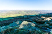
The exact location of this site seems to have been lost.  One possible candidate is on the south-side of the village where remains of a large moat exists, meaning that there was a good water supply here to maintain its existence.  But this is pure guesswork on my part.  The well was mentioned briefly in R.C. Hope’s (1893) classic book where he told us:

“There was a holy well or spring in the village of Holwell, on the borders of Bedford and Hertfordshire; unfortunately both history and site have been forgotten by the villagers at Holywell.”

The site was mentioned as far back as 1086 CE in the Domesday Book as ‘Holewelle’.  The place-name authorities Gover, Mawer & Stenton (1938) tell us this derives from a “spring in the hollow” and not a holy well as subsequent writers profess.  The only thing that could perhaps fortify the ‘holy’ element is that in some instances early citations of holy wells are written as holi- wells, which this may have been.  As all historians know, early spellings of sites are far from accurate.

References:

  1. Gover, J.E.B., Mawer, Allen & Stenton, F.M., The Place-Names of Hertfordshire, Cambridge University Press 1938.
  2. Hope, Robert Charles, Legendary Lore of the Holy Wells of England, Elliott Stock: London 1893.
  3. Smith, A.H., English Place-Name Elements – volume 1, Cambridge University Press 1956.

© Paul BennettThe Northern Antiquarian

Backstone Beck West (282), Ilkley Moor, West Yorkshire

Cup-and-Ring Stone:  OS Grid Reference – SE 12719 46272

Also Known as:

  1. Carving no.124 (Hedges)
  2. Carving no.282 (Boughey & Vickerman)

Getting Here

Cup-and-Ring Stone 282

Various ways to get here, but probably the easiest is to start from Cow & Calf Rocks, walking up the steep slope onto the moor-edge. Paths veer left and right once you’re on the level, but you wanna head straight forward, west(-ish), for about 350 yards till you reach the stream. Cross over and then take the path that runs parallel with the stream, uphill.  Nearly 200 yards up, where the moor begins to level out, you cross a path running east-west; keep going past this for about another 50 yards (as if you’re heading to the Backstone Circle) and you’ll notice some small sheep-paths leading you into the heather to your right and, some  40-50 yards into the heath you’ll see this large flat stone!

Archaeology & History

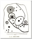
This carving seems to have been rediscovered in the 1950s by Michael Walker and Stuart Feather.  They were amongst a small group of people who visited this and some other carvings in June 1956, when the first (known) sketch of the carving was done by Mr Walker.  His sketch of the stone is somewhat more elaborate than the one in John Hedges’ (1986) later archaeological survey.  Indeed, in some ways the two drawings seem to show little resemblance to each other. (not uncommon with these things!)

Walker’s 1956 sketch

Hedges’ 1986 sketch

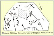
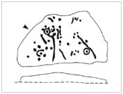
Walker shows nine cup-and-rings in various states of completion, with several clusters of singular cups at different places on the rock—more than forty in all, some of which are connected to each other by short lines.  This is in contrast with the later archaeological description, which saw far fewer of the primary symbols.  When John Hedges (1986) described the carving in his inventory, he informed the reader:

“Fairly smooth, medium sized grit rock standing up in heather, crowberry and grass, sloping SW to NE with the hill, its almost triangular flat top covered with carvings, some very clear, interesting patterns.  About thirty-five cups, seven surrounding a small ring with cups on the circumference and at centre.  Two long grooves with a cup at one end, running down to the edge of the rock. ‘Peck’ marks noticeable in one groove and in one ring round a cup.  Three other grooves going half round cups, or leading from a cup.  Slice of rock apparently removed.”

Boughey & Vickerman (2003) added nothing new in their later survey.

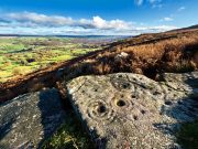
Although we have an uninterrupted open view of the landscape to the north and west from here, it might not have been like this when the carving was done 4-5000 years ago.  The scattered woodland covering these heaths may have impeded the views.  However, immediately west of this carving are the broken remains of a small Bronze Age settlement, some of whose walling is traceable some 100-150 yards away and any tree cover that may have been here may have been cut back.  We may never know for sure…

References:

  1. Boughey, K.J.S. & Vickerman, E.A., Prehistoric Rock Art of the West Riding, WYAS: Leeds 2003.
  2. Hedges, John (ed.), The Carved Rocks of Rombald’s Moor, WYMCC: Wakefield 1986.
  3. Jackson, S. & Walker, Michael J., “Ilkley Boulders Tour,” in Cartwright Hall Archaeology Group Bulletin, 2:1, 1956.

© Paul BennettThe Northern Antiquarian 


Piper’s Crag Stone, Addingham Moorside, West Yorkshire

Cup-and-Ring Stone:  OS Grid Reference – SE 08497 47097

Also Known as:

  1. Carving no.44 (Hedges)
  2. Carving no.212 (Boughey & Vickerman)
  3. Piper’s Stone

Getting Here

Piper Stone (photo by James Elkington)

Follow the directions to reach our superb Swastika Stone from Ilkley, visible due to the iron railing that surround and protect the carving on the cliff edge.  From here, keep walking west along the Millenium Way footpath, over the stile of the first wall, then the second wall—six in all—for ⅔-mile (1km), where you’ll see another small crag of rocks on your right, just yards from the footpath.  You’re damn close!

Archaeology & History

When the great J. Romilly Allen (1882) visited the Ilkley petroglyphs in 1878, the Piper Stone was one that he wandered over to see—and he had this to say of it:

“At the edge of Piper’s Crag is a horizontal rock-surface, and on a portion of it, measuring 5ft by 7ft, are carved a series of fifteen cups varying in diameter from 2 to 3 ins.  Of these, one is surrounded by a single ring, four by a double ring, and one by a triple ring.”

Hedges 1986 sketch

Cowling’s 1940 sketch

This type of description, whilst accurate on the whole, rarely does justice to the carving.  It was echoed more than 100 years later in John Hedges’ (1986) survey, when he described the large rock jutting out to possess merely, “a complicated design of cups, rings and grooves.”  When Boughey & Vickerman (2003) did their follow-up survey, they added nothing more.

In an attempt to give some sort of meaning to the carving (and many others), the late great Eric Cowling (1940; 1946) placed it within Henri Breuil’s (1934) classification system, which assigns all carvings different degrees of complexity and form, from Classes 1-4.  The Piper Stone entered Breuil’s Class 3A, being one “with deeply cut and smoothed down grooves.” Whilst this may sound good on the surface, in truth such classifications are utterly meaningless outside of the tables and graphs of statisticians and the boring.  They give the appearance of quantitative research, but they have as much bearing on the nature of the carvings as an energy dowser healing the place with crystals.

Piper Stone (photo by Josh Millgate)

Close-up of design (photo by James Elkington)

In the flesh, in the real world—so to speak—from the Piper Stone we are looking, not just at the carving, but its place in the landscape: an ingredient that more and more emerging archaeologists are recognizing has a synergistic relationship with some petroglyphs.  And here we have an impressive landscape that reaches out ahead of us for many miles.  We look primarily to the north: the Land of the Dead in many traditional northern cultures.  But our panorama here is 180º, with east and west horizons having the potential for measuring equinoctial periods in the cycle of the year.  But in truth this is sheer speculation.

It’s a worthwhile carving to see, both for its views and its excess of non-linearity.  In its form, Rorscharch impressions of early humans emerge; the usual solar and lunar symbols can be seen; star systems seem apparent; maps or settlement ground-plans could be there.  We know that somewhere within it is the animistic ‘spirit’ of the rock itself, but the forms it exalts are, once again, all but lost on us modern folk…

References:

  1. Allen, J. Romilly, “Notice of Sculptured Rocks near Ilkley,” in Journal of the British Archaeological Association, volume 38, 1882.
  2. Allen, J. Romilly, “Cup and Ring Sculptures on Ilkley Moor,” in The Reliquary and Illustrated Archaeologist, volume 2, 1896.
  3. Anonymous, Walks around Cup and Ring Stones, TIC: Ilkley n.d. (c.1990).
  4. Baildon, W. Paley, “Cup and Ring Carvings: Some Remarks on their Classification and a New Suggestion as to their Origin and Meaning,” in Archaeologia, volume 61, 1909.
  5. Bennett, Paul, “Cup-and-Ring Art”, in Towards 2012, volume 4, 1998.
  6. Bennett, Paul, The Old Stones of Elmet, Capall Bann: Milverton 2001.
  7. Boughey, Keith & Vickerman, E.A., Prehistoric Rock Art of the West Riding, WYAS: Wakefield 2003.
  8. Breuil, Henri, “Presidential Address for 1934,” in Proceedings Prehistoric Society East Anglia, 7:3, 1934.
  9. Collyer, Robert & Turner, J.H., Ilkley: Ancient and Modern, William Walker: Otley 1885.
  10. Cowling, E.T., ‘A Classification of West Yorkshire Cup and Ring Stones,’ in Yorkshire Archaeological Journal 1940.
  11. Cowling, E.T., Rombald’s Way: A Prehistory of Mid-Wharfedale, William Walker: Otley 1946.
  12. Hedges, John (ed.), The Carved Rocks on Rombalds Moor, WYMCC: Wakefield 1986.

Acknowledgements:  Huge thanks to Josh Millgate and James Elkington for use of their photos in this site profile.  Cheers guys. 🙂

© Paul BennettThe Northern Antiquarian