Stone of Mannan, Clackmannan, Clackmannanshire

Legendary Stone:  OD Grid Reference – NS 91114 91891

Also Known as:

  1. Canmore ID 48321
  2. Clackmannan Stone
  3. King Robert’s Stone

Getting Here

The Stone of Mannan

The Stone of Mannan

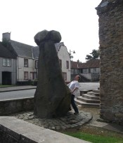
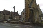
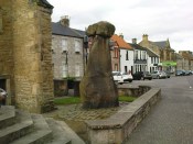
Take the A907 road between Alloa and Kincardine, and up the B910 into Clackmannan.  To get into the village, depending on which route you’re coming in, go up the Kirk Wynd or the Cattle Market—both of which lead you to the Main Street where, beneath the old clock tower, you’ll see the Market Cross and its companion erection just to the side. You can’t really miss it!

Archaeology & History

The phallic upright!

The phallic upright!

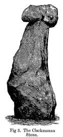
The history of this curious-looking giant phallic stone, sat quietly on the Main Street of sleepy Clackmannan village, isn’t as heathen as you’d expect when first seeing the huge upright—but there are mysteries and myths gathered about it.  The county of Clackmannan itself takes its name from this stone—but not the entire stone that we see today; merely the rounded, smaller element on top.  For it’s this that’s the real Mannan Stone. The rest of it, the tall upright pillar, was only attached to the smaller rounded stone—the Stone of Mannan— in the first-half of the 19th century.

First mentioned as a place-name in 12th century writings, the story of the stone was best told by Peter Miller (1889), who wrote:

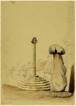
“The old ‘clack’ or stone that forms the prefix to the name-word Clackmananmust be of considerable antiquity.  Its form and appearance have nothing to excite remark. The two larger portions of the stone are battened together with iron, and the portion forming the cleft appears to be detached from the larger one.  It is only the legend or tradition respecting its history and its association with the name-word Clackmanan that makes it interesting to the antiquary. Its dimensions are as follows: —It is over 3 feet in length, 2 in breadth, and about the same in thickness.  Its form is oval, and it has a deep cleft on its upper side.  The stone has nothing peculiar about it to indicate what it may have been originally, or the uses it was made to serve in early times.  There is no appearance of its ever having had an inscription or any ornamentation upon it.  It is simply a boulder-stone stone of whinstone, such as are found in abundance at the Abbey Craig near Cambuskenneth.  It was placed on the tall boulder slab on which it now stands, brought from the Abbey Craig in the year 1833 by the late Robert Bruce of Kennet, and the late Professor Fleming, who was then minister of the parish.  Previous to that time it lay on the ground alongside of the old jail and court-house of Clackmannan, close by the old cross of the town…”

Clackmannan Stone (after Miller)

Clackmannan Stone (after Miller)

The old stone & its upright

The old stone & its upright

Mr Miller then went on at some length to show the derivation of ‘Clackmannan’ to be from the old Irish, meaning “the stone of the monks.”  It seems a plausible theory too.  Despite this, Watson (1926) deemed it to be the ‘Stone of Manau’, being deemed vaguely as the people of the land north of the Forth.  The great Celtic scholar John Rhys (1888) declared Clackmannan to derive from the Irish deity or hero-figure, Manannan, as have other academic authorities since then.  But it’s all just a bit vague if we’re wanting ‘certainty’…

When T.C. Crouther (1936) wrote about this, he said how the Stone of Mannan had originally come from a position only a few hundred yards south of its present spot, at a place known as Lookabootye Brae  (NS 912 911), just above where the land begins to drop down closer to sea level.  This doesn’t seems too improbable.  Close to this spot could once be seen the sacred site of the Lady Well.

At the turn of the 21st century the stone was caged by the local council as it was beginning to crumble and was in danger of collapse; and so, the local council repaired the great upright and its sacred top-stone—albeit at the staggering cost of £160,000!!!  As the local people and other masons know to this day, the job could have been done for a fraction of that cost with equal efficiency.

Folklore

Said by T.C. Crouther (1936), the local council, and others to have got its name from the sea god Mannan, other legends have grown around this fascinating old rock.  When Edwin Adams (1863) wrote about it, these were the tales that local people gave him:

“Its legendary history is curious. When King Robert Bruce was residing in Clackmannan tower, and before there was a town attached to that regal mansion, he happened, in passing one day near this way on a journey, to stop awhile at the stone and, on going away, left his glove upon it.  Not discovering his loss till he had proceeded about half-a-mile towards the south, he desired his servant to go back to the clack (for King Robert seems to have usually spoken his native Carrick Gaelic), and bring his mannan, or glove. The servant said, ‘If ye’ll just look about ye here, I’ll be back wi’t directly,’ and accordingly soon returned with the missing article.

£From this trivial circumstance arose the name of the town which was subsequently reared about the stone, as also that of a farm at which the King stopped, about half-a-mile from the south, on the way to Kincardine, which took its name from what the servant said, namely, ‘Look about ye,’ and is so called to this day.”

But as the various dates in this tale simply don’t add up, it seems that the writer had been easily fooled.

References:

  1. Adams, Edwin, Geography Classified, Chapman Hall: London 1863.
  2. Drummond, James, Scottish Market-Crosses, Neill & Co.: Edinburgh 1861.
  3. Drummond, James,”Notice of Some Stone Crosses, with Especial Reference to the Market Crosses of Scotland,” in Proceedings Society of Antiquaries, Scotland, volume 4, 1862.
  4. Gordon, T Crouther, The History of Clackmannan, Civic Press: Glasgow 1936.
  5. Miller, Peter, “Notices of the Standing Stones of Alloa and Clackmannan,” in Proceedings of the Society of Antiquaries, Scotland, volume 23, 1889.
  6. Rhys, John, Lectures on the Origin and Growth of Religion as Illustrated by Celtic Heathendom, Williams & Norgate London 1888.
  7. Royal Commission on the Ancient & Historical Monuments, Scotland, Inventory of Monuments and Constructions in the Counties of Fife, Kinross and Clackmannan, HMSO: Edinburgh 1933.
  8. Royal Commission on the Ancient & Historical Monuments, Scotland, The Archaeological Sites and Monuments of Clackmannan District and Falkirk District, Society of Antiquaries of Scotland 1978.
  9. Simpkins, John Ewart, County Folklore – volume VII: Examples of Printed Folk-Lore Concerning Fife, with some Notes on Clackmannan and Kinross-Shires, Folk-Lore Society: London 1914.
  10. Small, John W., Scottish Market Crosses, Eneas Mackay: Stirling 1900.
  11. Watson, W.J., The History of the Celtic Place-names of Scotland, Edinburgh 1926.

Links:

  1. Nataraja’s Foot – Skullduggery

Acknowledgements:  Big thanks to author Marion Grace Woolley for use of her photo in this site profile. 🙂

© Paul BennettThe Northern Antiquarian

The map could not be loaded. Please contact the site owner.


Castle Craig, Tillicoultry, Clackmannanshire

‘Fort’ (destroyed):  OS Grid Reference – NS 9116 9769

Also Known as:

  1. Canmore ID 48294

Archaeology & History

This ancient fort could once be seen in the ancient woodlands on the western side of the Mill Glen, above the village, going into the Ochils—but it was completely destroyed, as usual, by the Industrialists when they quarried the entire structure out of existence.  It was a big thing too, by all accounts.  When Stewart Cruden (1964) saw it, shortly before its final demise, it was still impressive to look at.  He told that the fort consisted of a deep rock-cut ditch with a stone wall on the inside and the remains of a stony rampart on the outside.  Although damaged it still measured 300 feet across.  Its interior contained an almost precise circular enclosure, more than eighty feet across inside the remains of a large stone wall some twelve feet thick.

Nearly a hundred years earlier, Miss Christian MacLagan (1875) told it to be much bigger!  Not only did she report how locals remembered a stone roof on top, but it possessed three concentric circular walls, thirty-five apart, with the central area eighty feet in diameter—much as Cruden later reported.  However, even in MacLagan’s day, she told how many of the stones from the fort were being used to construct sheepfolds.  This destruction was being lamented by the local historian William Gibson (1883), who wrote:

“On the west side of the burn, and overtopping the village, stands the beautiful Castle Craig, wooded to the top, and on which stood, in ancient times, a round Pictish fortress, the traces of which can still be distinctly seen. This craig is, I think, one of the most picturesque objects on the Alva estate, and it is a very great pity that it should be so disfigured by the extensive quarrying operations that are being at present carried on at it.”

On the top of the quarry edges can still be found old walled remains crumbling at the edge of the huge cliffs, but these are unlikely to have been attached to the ancient fortress, and may just be the fragmentary memories of the sheepfolds built from the old fort.

Folklore

Tradition told that this was one of the old forts of the Picts who lived in the Ochils.  If it was a fort, then the Pictish tradition is probably true.  Old lore also told that some of the stones from the fort were used in the construction of Stirling Castle, 7.8 miles (12.6km) to the west.

References:

  1. Corbett, L., et al., The Ochil Hills, Forth Naturalist & Historian 1994.
  2. Cruden, Stewart H., “Castle Craig, Tillicoultry,” in Discovery & Excavation Scotland, 1964.
  3. Feacham, Richard, Guide to Prehistoric Scotland, Batsford: London 1977.
  4. Gibson, William, Reminiscences of Dollar, Tillicoultry and other Districts Adjoining the Ochils, Andrew Elliot 1883.
  5. Maclagan, Christian, The Hill Forts, Stone Circles and other Structural Remains of Ancient Scotland, Edinburgh 1875.
  6. Royal Commission on the Ancient & Historical Monuments, Scotland, Inventory of Monuments and Constructions in the Counties of Fife, Kinross and Clackmannan, HMSO: Edinburgh 1933.
  7. Royal Commission on the Ancient & Historical Monuments, Scotland, The Archaeological Sites and Monuments of Clackmannan District and Falkirk District, Society of Antiquaries of Scotland 1978.
  8. Watson, Angus, The Ochils: Placenames, History, Tradition, PKDC: Perth 1995.

© Paul BennettThe Northern Antiquarian

The map could not be loaded. Please contact the site owner.


Mercat Cross, Clackmannan, Clackmannanshire

Cross:  OS Grid Reference – NS 91109 91890

Also Known as:

  1. Burgh Cross
  2. Canmore ID 48318
  3. Clackmannan Cross
  4. Market Cross
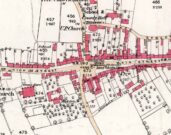
Cross on the 1886 map

Getting Here

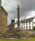
Take the A907 road between Alloa and Kincardine, and up the B910 into Clackmannan.  To get into the village, depending on which route you’re heading in, go up the Kirk Wynd or the Cattle Market—both of which lead you to the Main Street where, right next to the huge erection known as the Stone of Mannan you’ll see the old Cross on its steps.Getting Here

Archaeology & History

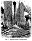
When the Royal Commission (1933) lads wrote about the site in their early survey, they called it the Burgh Cross, telling:Found in association with the village Tolbooth and the more famous Stone of Mannan, this probable 16th century cross stands at the meeting of the four lanes at the centre of the village in the heart of Clackmannanshire.  It was the focal point of an annual market fair which, said Craig Mair (1988), “could last up to eight days”.  It was the meeting place of local villagers where legal issues were called and settled, where bonds and deeds were made and, in all probability, replaced an earlier non-christian monument.

The Mercat Cross
Millers 1889 sketch

“Although the stepped base has been renewed, the shaft is original.  It is 9 feet 6 inches in height and is octagonal in section, measuring 11 inches in diameter.  The capital is moulded and has on the east side a shield enclosed by swags and bearing a saltire and chief, for Bruce.  A second shield, carved on the west side, has apparently been similarly charged, but is now very weatherworn.  The ball finial on the capital was removed in 1857, but replaced in 1897.”

The reference to the chief, Bruce, is said by tradition to be that of Robert the Bruce.  This element in the cross’ history has been transposed mistakenly by early english writers onto the adjacent Stone of Mannan.

Cross & Mannan’s Stone

In recent times both the cross and the Stone of Mannan were repaired, at a staggering cost of £160,000.  How the hell it cost that much is anybody’s guess – but it certainly sounds as if someone’s pockets would have been bulging!

References:

  1. Mair, Craig, Mercat Cross and Tolbooth, John Donald: Edinburgh 1988.
  2. Royal Commission on the Ancient & Historical Monuments, Scotland, Inventory of Monuments and Constructions in the Counties of Fife, Kinross and Clackmannan, HMSO: Edinburgh 1933.
  3. Royal Commission on the Ancient & Historical Monuments, Scotland, The Archaeological Sites and Monuments of Clackmannan District and Falkirk District, Society of Antiquaries of Scotland 1978.
  4. Simpkins, John Ewart, County Folklore – volume VII: Examples of Printed Folk-Lore Concerning Fife, with some Notes on Clackmannan and Kinross-Shires, Folk-Lore Society: London 1914.
  5. Small, John W., Scottish Market Crosses, Eneas Mackay: Stirling 1900.

© Paul BennettThe Northern Antiquarian

The map could not be loaded. Please contact the site owner.


Culhawk Hill, Kirriemuir, Angus

Stone Circle:  OS Grid Reference – NO 3530 5620

Also Known as:

  1. Canmore ID 32209

Getting Here

The largest stone in the ring

From Kirriemuir central, head up the Kinnordy road, going straight across the main road and continuing past the Kinnordy turn-off for just over a mile towards Mearns, stopping where a small copse of trees appears on your left.  From here, walk along the track to the west. It goes gradually uphill, cutting through a small cleft with a hillfort on the north and a cairn circle on the south until, ⅔-mile along, you reach the moorland.  Keep going on the same path for another ½-mile west where the grasslands level out.  Here, on the flat bit between the two hills, a small incomplete ring of stones lives, with one stone sticking out.  You’ll find it!

Archaeology & History

This is a curious site on several levels—not least, that its definition as a ‘stone circle’ is a fragile one; although to be honest, we do find here a large unfinished arc of stones in what looks like either an unfinished ring, or a deliberately constructed large arc.  But you won’t find it in the standard megalithic gazetteers of Burl, Barnatt or Thom as it was only relocated in the 1980s by local researchers Sherriff and MacKnight. (1985)  They didn’t have much to say about it either, simply telling that they’d found,

“A stone setting representing the remains of either a denuded cairn or a stone circle lies in the saddle between Culhawk Hill and Castle Hill. One erect and 4 prone boulders describe a portion of a roughly circular site some 10m in diameter.”

Arc of fallen stones, looking NE

Faint low ring, looking W

This is roughly the gist of it, with the largest and most prominent of the stones—barely three feet tall—standing on the western side (this is the stone which draws your attention – otherwise you’d never even notice it).  The rest of the stones seem to have been knocked down some time ago.  A barely discernible embankment constructed around the edge of the ring can be seen around the northern side.  It seems unlikely that it was a cairn, as no inner piles of stones were in evidence when we visited the site.  It may be a large hut circle.  But in truth it could do with an excavation so that we can suss out its exact nature.  Beneath the grasses we found an additional stone to those counted by Sherriff & MacKnight; but more intriguing is what Frank Mercer and I found before we even reached the small circle….

Trackway leading to the circle

More visibly distinct than the ring itself were two artificial raised embankments, running parallel with each other 3-4 yards apart.  The raised edges of these embankments were about a yard across, on both sides, with the inner area slightly lower than the outlying natural background.  These distinct linear earthworks are, quite simply, an early medieval or prehistoric trackway—and it leads directly into the circle!  It’s quite unmistakable and is clearly visible as it drops down the slope to the south and away into the fields below.  Sadly when we found it last week, darkness was falling and so we didn’t trace the trackway any further.  But the most notable thing was that it stopped at the circle and did not continue on its northern side, implying that it was constructed with the circle as its deliberate focal point.  The trackway and its embankments are roughly the same size as other recognized prehistoric routes, such as Elkington’s Track on Ilkley Moor and the other ancient causeway that runs past the prehistoric ring known as Roms Law.

Regarding the ring of stones: unless you’re a real megalith fanatic, you’ll probably be disappointed by what you see here.  It’s a bittova long wander to something that may once have been just a hut circle, but the avenue leading up to it is something else – and much more intriguing!

References:

  1. Sherriff, John R. & MacKnight, O., “Culhawk Hill (Kirriemuir p): Stone Setting,” in Discovery & Excavation Scotland, 1985.

Acknowledgements:  Thanks as always to Nina Harris and Frank Mercer; and to Paul Hornby for use of his photos.

© Paul BennettThe Northern Antiquarian

The map could not be loaded. Please contact the site owner.


Tods Stone, Monifieth, Angus

Standing Stone (destroyed):  OS Grid Reference – NO 486 339?

Archaeology & History

The only reference I can find about this site is in A.J. Warden’s (1880) massive survey of the county of Angus—previously called ‘Forfarshire’—where, in his discussion of the hillforts of the area, he told us that,

“About a quarter of a mile distant from The Laws is the Gallow Hill of Ethiebeaton.  In a field, a little to the south, there formerly stood a large upright stone called Tods Stone.”

All trace of it disappeared when quarrying operations were undertaken there, also destroying a number of prehistoric tombs close by.  The monolith may have had some association with the tombs, but we cannot be certain.

The name of the stone, tods, probably derives from the word ‘foxes’, although we cannot be certain of this either, as there are a variety of other Scottish dialect words relating to ‘tod’that may have had bearing on the name.

If anyone has any further information about this long lost site, we would gladly welcome it.

References:

  1. Grant, William (ed.), The Scottish National Dictionary – volume 9, SNDA: Edinburgh 1973.
  2. Warden, Alex J., Angus or Forfarshire – volume 1, Charles Alexander: Dundee 1880.

© Paul BennettThe Northern Antiquarian

The map could not be loaded. Please contact the site owner.


Balkello, Tealing, Angus

Standing Stone:  OS Grid Reference – NO 36332 38305

Also Known as:

  1. Canmore ID 31871
  2. The Standing Stone of Balkello

Getting Here

Balkello Stone, W of Tealing

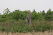
From the little village of Kirkton of Auchterhouse, take the winding road uphill east as if you’re heading to Tealing.  About 1⅓ mile along, where the road has straightened out, keep your eyes peeled on your right (to the south) where—if the vegetation isn’t too high—you’ll see a tall upright stone in the field.  You’ll have to walk along the roadside until you find a gate into the overgrown field.  Good luck!

Archaeology & History

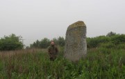
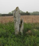
Not to be confused with the legendary Martin’s Stone of Balkello ⅘-mile to the southeast, this is a little-known standing stone hiding above a mass of boscage ‘pon a quiet ridge that fades focus away from the world.  It’s a bittova giant, all but forgotten it seems, and with little history to speak of in literary terms at least.  When we visited the place a short while ago, summer nettles and willowherbs obstructed our initial contact—but we got to the fella eventually.

This dood lives & sleeps at the stone!

Looking east

Standing more than nine feet high and about five feet across, it’s quite a slender monolith that has seen better days.  Its southern face is crumbling away and a large section of it is close to splitting off completely (surely a case for Historic Scotland to fix?).  As you can see in the photos, upper portions of the stone have fallen into the widening crack that promises to fell the stone at some time in the not-too-distant future.  Let’s get it sorted —before it collapses!

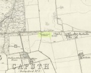
Balkello Stone on 1865 map

It was highlighted on the first OS-map in 1865 as the Standing Stone of Balkello, although without antiquated lettering.  But unless there is excellent reason to suggest this was erected in recent times (it wasn’t), its ‘prehistoric’ status needs activating—cos it’s surely prehistoric!  We all thought so anyhoo…  It’s well worth checking out when you’re in the area!

Folklore

When the Ordnance Survey lads first visited the site in 1861, local people informed them that the stone was said to be,

“in Connection with some others in the Parish (and) are supposed to have (been) used to point out the Roads as they were then, merely beaten paths.”

Alfred Watkins students take note!

Acknowledgements:  Huge thanks as always to Paul Hornby, Nina Harris & Frank Mercer for their assistance in our visit here.

© Paul BennettThe Northern Antiquarian

The map could not be loaded. Please contact the site owner.


Hillhead, Forgue, Aberdeenshire

Stone Circle (destroyed):  OS Grid Reference – NJ 638 367

Also Known as:

  1. Canmore ID 18237 
  2. Hillhead of Bogfouton
  3. Wether Hill

Archaeology & History

Described by the early 20th century antiquarian and megalithomaniac Fred Coles (1903) as being situated “about 1¼ mile SE from the church at Ythan Wells,” all trace of this stone circle has long gone, and had already disappeared when Coles was surveying the region, telling merely that it had been here “in open fields.”  All subsequent explorations looking for remains of the site has proven fruitless.

References:

  1. Barnatt, John, Stone Circles of Britain – volume 2, British Archaeological Report: Oxford 1989.
  2. Cole, Fred, “Report on the stone circles of North-Eastern Scotland, chiefly in Auchterless and Forgue,” in Proceedings of the Society of Antiquaries, Scotland, volume 37, 1903.

© Paul BennettThe Northern Antiquarian

The map could not be loaded. Please contact the site owner.


The Crofts, Doune, Perthshire

Cists (destroyed):  OS Grid Reference – NN 7247 0188

Also Known as:

  1. Canmore ID 24760

Archaeology & History

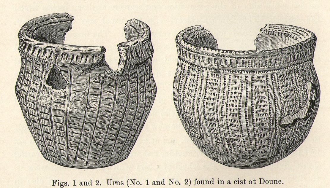
Urns in The Croft cist, Doune

Somewhere in the woodland park, before the area was “ruined”, as Moray Mackay (1984) put it, by “sand and gravel workings”, and within 100 yards of the re-positioned Trysting Stone, there once remained the ruins of ancient tombs—probably neolithic or Bronze Age in nature.  The ‘cists’ as they’re known (stone-lined graves), were described in several short articles at the beginning of the 20th century, shortly after their rediscovery.  Drawing upon the initial article by Joseph Anderson (1902) in the Scottish Antiquaries journal, W.B. Cook (1904) wrote:

“The doubling of the (railway) line from Dunblane to Callander has necessitated the altering of a road at the Crofts, Doune, and on Tuesday, 8 May, while digging, the navvies came across two stone cists containing bones.  The cists were made of stone slabs.  On Thursday, the men came on another cist about five feet from the surface. It was 3 feet long and 2½ feet broad, composed of round stones, and a quantity of bones were found in it, and also an urn. Unfortunately a cart-wheel passed over the urn, smashing it.  The pieces were, however, carefully collected and cemented and they are now in the possession of Mr Smith, Clerk of Works to the Caledonian Railway Company, Doune.  One of the cists first found was quite empty, but the other contained a large number of human bones, the largest about 1½ inches long.  The coffins were about 15 inches from the surface, and lay from east to west.  They measured 2 feet 9 inches in length, and in breadth and depth about 18 inches. They are constructed of local stone, and near the spot there has been a dyke running from the burgh to the sand holes, as the foundation was visible when the soil was being removed.  Some of the stones indicate that a house might have stood near the spot, but there had been no public burying-place nearer than at Kilmadock and at the little chapel of Inverardoch previous to 1784.”

In Mr Joseph’s (1902) article, he told us there wasn’t one, but two urns which, after some considerable effort, were reconstructed.  I’m not a great lover of urns misself, although when found in conjunction with the dead, we must ask, what was in them (if anything) when they were placed with the deceased?  Food? Herbal beverages? Shamanic potions?  In this case, we don’t know; and so all we are left with is Mr Anderson’s description of them:

“Urn No.1 is of the usual type of the so-called ‘food-vessel’, 4¾ inches in height by 5 inches in diameter at the mouth, the lip slightly bevelled inward, and the whole exterior surface ornamented. The ornamentation consists entirely of lines impressed into the soft clay with what seems to have been the roughly broken end of a small twig about ⅛-inch in diameter.  On the level of the lip there are two parallel lines of short scorings going completely round the upper surface. On the exterior surface there is a kind of slightly concave collar half an inch in width immediately under the brim, which is ornamented with short perpendicular indentations about a quarter of an inch apart. Underneath the collar the vessel expands slightly to the shoulder and then contracts to a flattened base of three inches in diameter. The part above the shoulder is slightly concave externally, but the scheme of decoration above and below the shoulder is the same, consisting of a series of short impressed lines scarcely half an inch in length ranged round the circumference in horizontal rows about a quarter of an inch apart, and crossed perpendicularly by lines about half an inch apart, not impressed, but scored into the clay. The perpendicular lines above the shoulder are more divergent than those below the shoulder, which converge towards the bottom in consequence of the tapering form of the lower part of the vessel. The paste is coarse, and mixed with small stones; the wall of the vessel is about a quarter of an inch thick, and the colour a reddish brown on both the exterior and interior surfaces, but quite black in the fractures exposing a section of its thickness.

“Urn No.2 is of the same wide-mouthed, thick-lipped form of the so-called food vessel type, 5 inches high and 5½- inches in diameter at the mouth. The lip is bevelled inwards, and the general shape of the vessel somewhat resembles that of No. 1, except in the lower part, which, instead of tapering to a flat bottom, narrows from the shoulder in a much more gradual curvature to the bottom. The ornamentation also is much more elaborate, though partaking of the same general character, inasmuch as it is a scheme of impressed markings, in bands arranged alternately in vertical and horizontal directions and covering the whole exterior surface of the vessel. On the bevel of the rim is a horizontal band of three lines of impressed markings, surmounted on the upper verge of the rim by a row of shallow oval impressions less than ⅛ of an inch apart. Under this there is a horizontal band of impressed markings as with the teeth of a comb, and below that the general scheme of ornament is carried out in alternate bands of about half an inch in width, running vertically from collar to base. The one set of these bands consists of three parallel rows of impressions of about ⅛ of an inch in width, and ⅛ of an inch apart, which seem to have been produced in the surface of the soft clay by a comb-like instrument, while the other set of bands has been produced by marking the spaces between the triple bands in the same way with a similar instrument, but placing the lines horizontally and closer together.”

A short distance from here, more cists were found. It’s possible that a prehistoric graveyard this way lay, countless centuries ago…

Folklore

Moray Mackay (1984) reports that the Doune fairs used to be held here.

References:

  1. Anderson, Joseph, “Notices of Cists Discovered in a Cairn at Cairnhill, Parish of Monquhitter, Aberdeenshire; and at Doune, Perthshire,” in Proceedings Society of Antiquaries, Scotland, volume 36, 1902.
  2. Cook, W.B. (ed.), “Antiquarian Find at Doune,” in Stirling Antiquary, volume 3, 1904.
  3. Mackay, Moray S., Doune Historical Notes, Forth Naturalist & Historian: Stirling 1984.
  4. Royal Commission Ancient & Historical Monuments, Scotland, Archaeological Sites and Monuments of Stirling District, Central Region, Edinburgh 1979.

© Paul Bennett, The Northern Antiquarian 

The map could not be loaded. Please contact the site owner.

Cooper’s Well, Partick, Glasgow, Lanarkshire

Healing Well (destroyed):  OS Grid Reference – NS 5619 6654

Archaeology & History

Along the B808, between Beith Street and Byres Road, where it meets the main Dumbarton Road, the memory of Cooper’s Well is preserved in the street-name.  It was one of more than a dozen springs in the area, but was one of the most renowned by local people.

Although not shown on the early OS-maps, thankfully the local historian and folklorist—and early environmentalist, it must be said!—James Napier (1873), gave a good account of it in his excellent work on the traditions of the area:

“Cooper’s Well was situated on the side of the road at the north-west end of Well Street, at the corner of where the Gas-work wall now is.  It was about three feet deep, and had two steps leading down to the water from the road.  Two sides and back were walled up higher than the road, and covered with a stone slab.  It was celebrated in the neighbourhood as a drinking water, being strongly chalybeate, and therefore could not be used for cooking purposes.  Although shallow, it was never frozen during winter (so that it must have come from a considerable depth), and it was cold in summer.  On a warm summer Sunday evening we have seen people, not only from all parts of the village, but from the gentle houses in the neighbourhood, carrying water from the Cooper’s Well to drink.  It is from this well the street has its name.  The Gas-work dried up the well.  There was a story current of some Glasgow people who were visiting at Mr. Sharp’s of Horslethill.  Mrs. Sharp had been baking some oatcakes with butter or dripping in them, which caused them to be very fine and short.  The Glasgow gentlemen were anxious to know how they were baked, and were told that they were baked with the Cooper’s Well water, some of which they had got a drink of.  Shortly after some of the gentlemen sent out their servants to Partick for a supply of the water, but the servants could not succeed in making the cakes so nice as those got from Mrs Sharp.  For long after this, butter-cakes were known in and around Partick as Cooper’s Well bread.”

I have to admit I’ve not visited this site, but presume that all trace of the site has disappeared.

References:

  1. Bennett, Paul, Ancient and Holy Wells of Glasgow, TNA 2017.
  2. Napier, James, Notes and Reminiscences Relating to Partick, Hugh Hopkins: Glasgow 1873.

© Paul BennettThe Northern Antiquarian

The map could not be loaded. Please contact the site owner.

Dunmoid, Dalginross, Comrie, Perthshire

Stone Circle:  OS Grid Reference – NN 78030 21266

Dunmoid Circle, Comrie

Also Known as:

  1. Canmore ID 24857
  2. The Court Knoll
  3. Dalginross
  4. Dunmhoid
  5. Judgement Mound
  6. Muirend
  7. Roundel

Getting Here

From the main road running through lovely Comrie, take the south B827 road over the old river bridge.  Go dead straight for several hundred yards until the road bends right; but take the left turn here.  100 yards or so along note the trees on your right, and the road begins to swerve round here. Just round the corner in the trees, the stones are in the clearing right by the roadside. You can’t miss them! (if you hit the graveyard, you’ve gone past them)

Archaeology & History

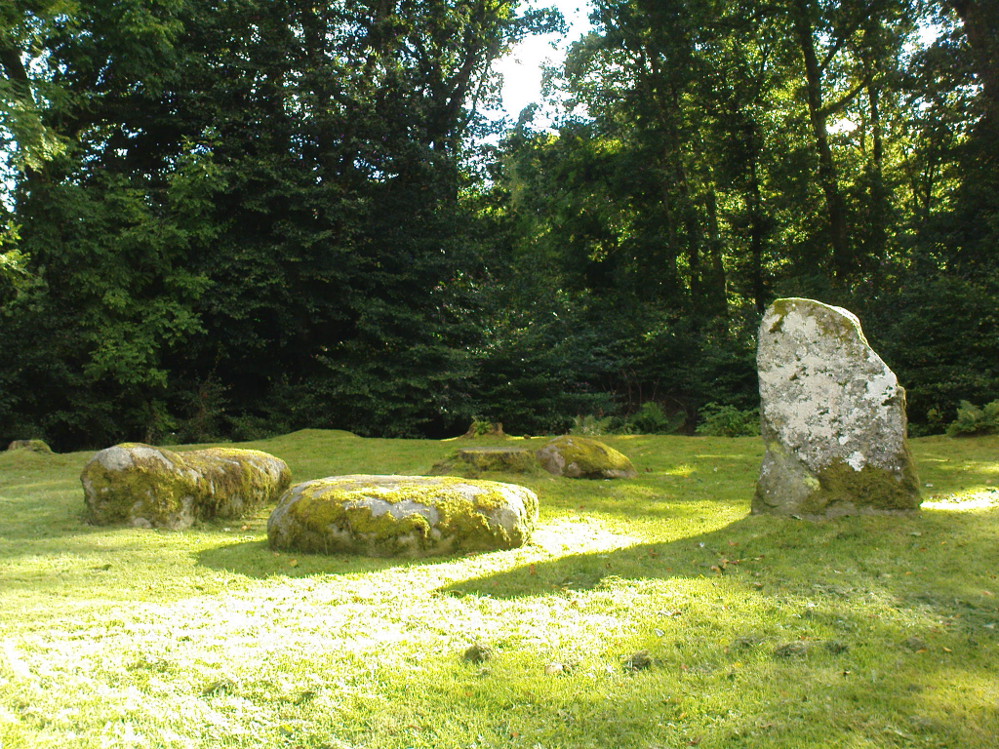
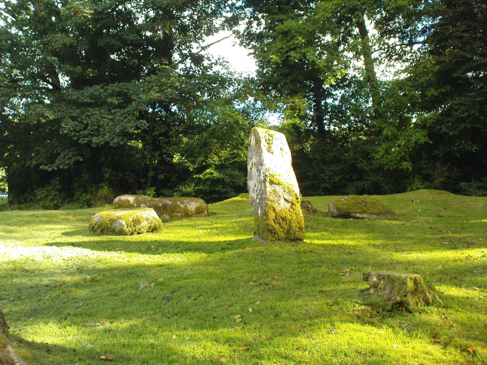
This is a truly lovely, almost warming enclosed megalithic site—albeit damaged by the ruin of centuries; but on the occasions I’ve been here it feels quite nurturing and elicits a quite natural meditative state.  Whether or not this is due to the surround of trees, or the natural electromagnetic field, or just me, I dunno….

Dunmoid Circle, looking SE
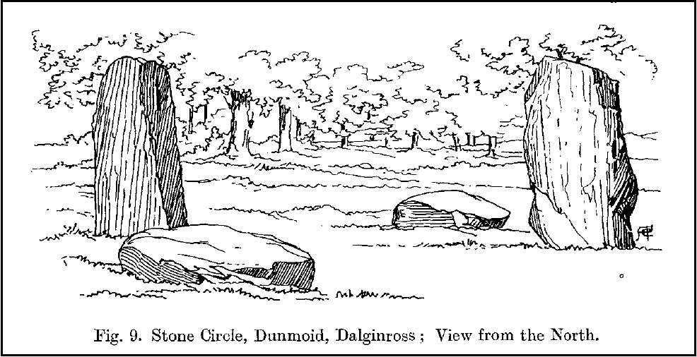
Dunmoid from the North (Coles 1911)

The ‘circle’ is constructed upon a flat rounded section of ground, surrounded by a ditch on two-thirds of its edges, very reminiscent of a typical henge monument—but there is no mention of this in modern surveys.  One of the earliest accounts of Dunmoid was written by John MacPherson (1896) who gave us as much of the known history of the site as is still known by any modern academic.  He wrote:

“At the west side of the new cemetery, close to the public road, there is a curious round knoll, which at one time must have been used as a place for the burial of the dead.  The attention of the writer of this was drawn to it about twenty years ago.  There were three large slabs of stone lying upon the ground, which apparently had been at some former period placed erect by some loving hands to mark the last resting-place of some departed friend or hero.  By the aid of some of the Comrie masons the stones were placed in a standing position.  Curious to know what lay beneath the surface, we dug up the earth in front of the largest slab, and came upon a stone cist placed north and south, 7 inches long, 1 foot 8 inches broad, and 1 foot 3 inches deep.  The only remains discovered was a thigh-bone, but whether it at one time formed a part of the leg of a Celt, a Roman, or a Saxon we could not tell. An old man who then lived in the village of Comrie told us that in his young days the same mound was dug up, when an urn filled with ashes was discovered.  This, perhaps, would indicate that it formed a place of burial for Romans rather than for Caledonians.  The spot is called Dunmoid, or ‘hill of judgment.'”

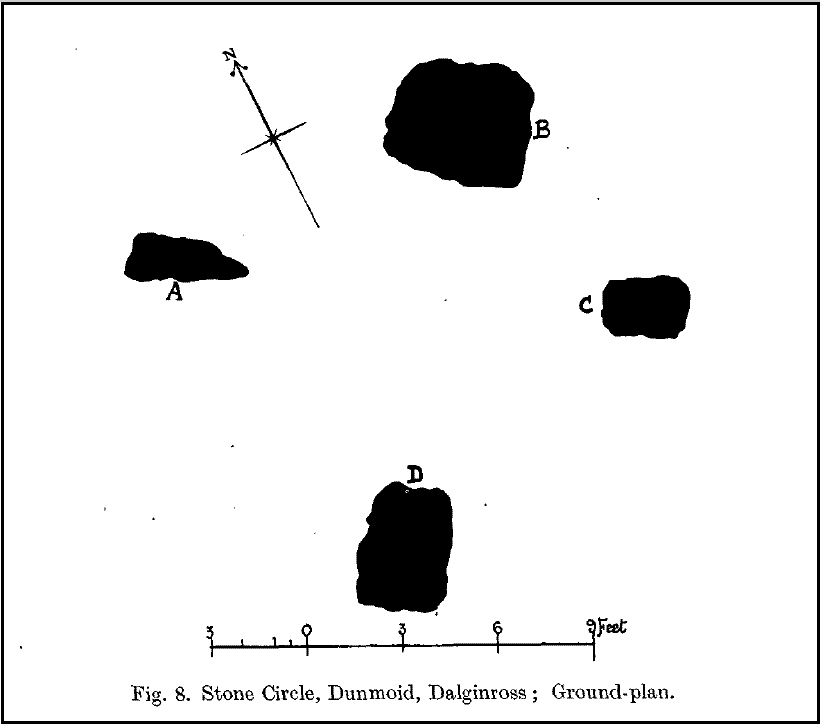
Fred Coles 1991 plan
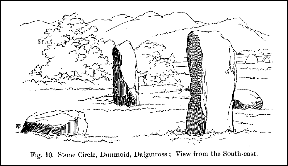
Dunmoid from SE (Coles 1911)

The circle gained the attention of the prolific Fred Coles (1911) in his Perthshire surveys, whose drawings and measurements are still repeated in the modern textbooks more than a century later.  When he visited the site, two of the stones were still upright, but today only one still stands.  In Aubrey Burl’s (1988) survey on ‘four-poster’ stone circles, he reiterated Coles’ words, telling:

“Originally four stone stood at the corners of a rectangle on a mound some 75ft (23m) across and 2ft (60cm) high.  Coles’ plan showed the NW stone standing 5ft 4ins (1.6m) high and the SE, opposite, 5ft 2ins (1.6m), with the thick NW stone prostrate, 4ft 6ins (1.4m) long, with the more slender SW pillar also supine and 4ft (1.2m) long.  The longer SE and NW sides of the oblong were roughly 9ft 6ins (2.9m) long and the others 9ft (2.7m) in length.  The circle on which the stones had been placed had a diameter 13ft 2ins (4m), of which the Megalithic Yard is not an integer.”

The circle is included in Andrew Finlayson’s (2010) modern survey of the region.

References:

  1. Burl, Aubrey, Four Posters: Bronze Age Stone Circles of Western Europe, BAR 195: Oxford 1988.
  2. Finlayson, Andrew, The Stones of Strathearn, One Tree Island: Comrie 2010.
  3. Hunter, John (Ed.), Chronicles of Strathearn, David Philips: Crieff 1896.
  4. Hutchison, A.F., “The Standing Stones of Stirling District,” in The Stirling Antiquary, volume 1, 1893.
  5. MacPherson, John, “At the Head of Strathearn,” in Chronicles of Strathearn, Crieff 1896.

© Paul Bennett, The Northern Antiquarian

The map could not be loaded. Please contact the site owner.